| Previous :: Next Topic |
| Author |
Message |
Hulksmash
Cleaning up.


Joined: 20 Apr 2008
Posts: 7113 | TRs | Pics
Location: Arlington |
|
Hulksmash
Cleaning up.
|
 Tue Sep 16, 2008 10:26 pm |
|
|
After yesteday's trip https://www.nwhikers.net/forums/viewtopic.php?t=7970305 I was kind of tired, but i wanted to get out and do a hike. I decided to ge Eagle lake a shot. Rather than go than going through Barclay lake, and climbing the hill, i chose the back route via Beckler river road. I have never been to eagle lake, but i know there's no "offical" trail. I parked next to the bridge that goes over Eagle creek.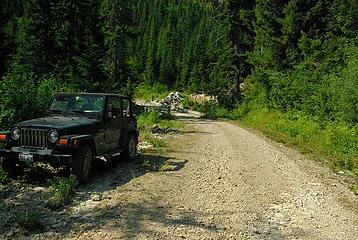 parking spot 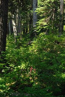 route 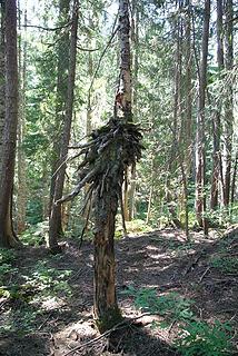 odd tree 3 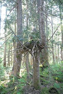 odd tree2 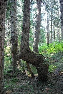 odd tree  There appeared to be some mature forest beyond the slide alder, so i tried to bash through it. I had to put all my weight into forcing my way though the stuff. With much resistance, it gave in..just to transition to dense devils club and nettles. There appeared to be some mature forest beyond the slide alder, so i tried to bash through it. I had to put all my weight into forcing my way though the stuff. With much resistance, it gave in..just to transition to dense devils club and nettles.  Wearing shorts it was quite painfull. I back tracked a bit. This is where i should have truned around give up. Stubbornly i pressed on. Instead of fighting the slide alder I chose the creek bed. Spashing in the cool water soothed my scratched up legs. Wearing shorts it was quite painfull. I back tracked a bit. This is where i should have truned around give up. Stubbornly i pressed on. Instead of fighting the slide alder I chose the creek bed. Spashing in the cool water soothed my scratched up legs.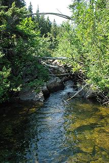 route 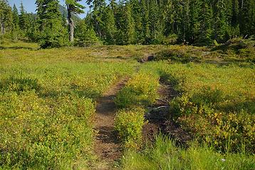 trail 1  After a few more minutes of conversation about the route. I discovered that there was a trail on the south side of Eagle Creek. I just traveled the north side, through the meadow. Ooops. Who ever named the meadow's Paradise meadows either they had a sarcastic sense of humor, or has never travled though them. After a few more minutes of conversation about the route. I discovered that there was a trail on the south side of Eagle Creek. I just traveled the north side, through the meadow. Ooops. Who ever named the meadow's Paradise meadows either they had a sarcastic sense of humor, or has never travled though them.  On the way out i took the trail On the way out i took the trail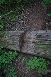 trail 2 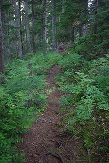 trail  A sign at the trail head would be nice though
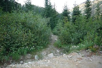 the real trail head
"Bears couldn't care less about us....we smell bad and don't taste too good. Bugs on the other hand see us as vending machines." - WetDog
Albuterol! it's the 11th essential
"Bears couldn't care less about us....we smell bad and don't taste too good. Bugs on the other hand see us as vending machines." - WetDog
Albuterol! it's the 11th essential
|
| Back to top |
  
|
|
Sabahsboy
Member

Joined: 18 Jul 2006
Posts: 2484 | TRs | Pics
Location: SW Sno County |
|
Sabahsboy
Member
|
Fri Sep 19, 2008 6:31 pm Eagle Lake access from Beckler River Road
|
|
|
Hulksmash, I missed this TR. Darned! The entry into the Meadow is unusual...I am uncertain of the plants you show in photo...perhaps a bistort or knotweed...but unlike any I know of! I have not ever seen this before! Remarkable! Thank you for the shot showing the unusual plantlife at Paradise Meadow's lower regions.
Soon, once I have more time, I will download shots of my hike to Eagle Lake, Saturday, Sept. 20, via the usual fishermen's trail (the one you returned on). This walk took me about 2 hours or more round trip than it did in Sept/Oct. 2006. So, my body is still in recovery and the feet remain slow. At the lakeside cabin was a group of 4 (one was floating around on the lake, attempting fishing but just catching mosquito bites). They told me they come to the cabin and keep it clean and repaired. Showed me recent work to prolong the cabin's life, esp. that of the roof that carries heavy snow loads plus endless, rain forest - like rains. This conversation set me back a bit and I had to "hustle" my return to TH. Nevertheless, the upper meadow was still a feast for the eyes, full of flowers (the spectacular bog orchid being the primary flora a plantsman might be willing to trek and see). Learned a bit more of "how to access Mount Townsend" for a yet to try ascent...fellows at cabin have done it and said to avoid the 8' and very heavy growth that looks like moss from the lake. Head for the saddle and mush your way to the obvious exit on the slope. They described this as the only place where there is necessity to catch a grip on rocks and protect self from teetering off the slope. They described the knife edge of the summit ridge line, so often shown in TRs by adventurous NWHikers reaching the summit block, both summer (with dogs) and winter (I think those are amazing).
Glad you afforded shots of Merchant Peak from down valley/meadow. Close up, Merchant is diminished by perspective and appears small in stature at Eagle Lake -side. Sorry about the lost phone....perhaps a bear will find it and give you a call? LOL!
BTW, isn't the road to this TH spectacular? Exiting last Saturday delivered a near full moon rising over the ridge. The descent drive along the road afforded the great sweep of view including Daniel and Hinman. Knock-you-socks-off, even after dusk!!
|
| Back to top |
|
|
Scrooge
Famous Grouse

Joined: 16 Dec 2001
Posts: 6966 | TRs | Pics
Location: wishful thinking |
|
Scrooge
Famous Grouse
|
Fri Sep 19, 2008 9:49 pm |
|
|
Hee Hee Hee  Way to go, Hulk. Larch and I did that route with our dog, 10 or 12 years ago. What a nightmare. Way to go, Hulk. Larch and I did that route with our dog, 10 or 12 years ago. What a nightmare.  It's Harvey Manning's fault. He wrote up the trip to Eagle via Barclay, then mentioned that he met a fisherman there who'd gotten there in about half an hour by coming up Eagle Creek. He implied that was "cheating" and didn't give details. ........ Ha! That sounded right down my alley, to me.
  I found it on the map, found the road and the creek, and even found the start of a trail ....... which quickly disappeared.
  I kept thinking that we must be almost at the meadow (that's what it looked like on the map), not knowing that the map was long out of date and large sections of the meadow buried in second growth. I kept thinking that we must be almost at the meadow (that's what it looked like on the map), not knowing that the map was long out of date and large sections of the meadow buried in second growth.  Oh well, like you, we kept going, and we did get to the lake, eventually. We did not, however, take to the creek. I looked at it several times, but each time it looked to be about as much blowdown as water, so we just slogged it out up on the bank..
Going back, I hadn't found anyone to talk to, but I did find the fisherman's trail, anyway. In my case, it was just because I decided that side-hilling it would probably be easier than fighting the brush in the valley ....... and the side of the hill is where the trail turned out to be.
Oh well, like you, we kept going, and we did get to the lake, eventually. We did not, however, take to the creek. I looked at it several times, but each time it looked to be about as much blowdown as water, so we just slogged it out up on the bank..
Going back, I hadn't found anyone to talk to, but I did find the fisherman's trail, anyway. In my case, it was just because I decided that side-hilling it would probably be easier than fighting the brush in the valley ....... and the side of the hill is where the trail turned out to be. 
Something lost behind the ranges. Lost and waiting for you....... Go and find it. Go!
Something lost behind the ranges. Lost and waiting for you....... Go and find it. Go!
|
| Back to top |
|
|
Bryan K
Shameless Peakbagger

Joined: 29 Sep 2005
Posts: 5129 | TRs | Pics
Location: Alaska |
|
Bryan K
Shameless Peakbagger
|
Fri Sep 19, 2008 10:28 pm |
|
|
I'm glad there is still some flagging on the route that you took, I know somebody that removed the flagging on the route from Barclay Lake (wasn't me either)...................
|
| Back to top |
|
|
Layback
Cascades Expatriate

Joined: 16 Mar 2007
Posts: 5712 | TRs | Pics
Location: Back East |
|
Layback
Cascades Expatriate
|
Fri Sep 19, 2008 10:50 pm |
|
|
Nice work. I'd like to make it there one of these days.
Does your route to Eagle Lake basically follow the drainage?
|
| Back to top |
|
|
Scrooge
Famous Grouse

Joined: 16 Dec 2001
Posts: 6966 | TRs | Pics
Location: wishful thinking |
|
Scrooge
Famous Grouse
|
Fri Sep 19, 2008 11:11 pm |
|
|
Here's a map I did years ago.
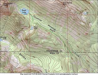 Eagle Lake
Something lost behind the ranges. Lost and waiting for you....... Go and find it. Go!
Something lost behind the ranges. Lost and waiting for you....... Go and find it. Go!
|
| Back to top |
|
|
Snowbrushy
Member

Joined: 23 Jul 2003
Posts: 6670 | TRs | Pics
Location: South Sound |
Yes. It is straight foward. When I went there I suspected that it was the backdoor trail and parked the vehicle at the logical place and hunted for the trailhead and found it. Easy. There are no signs. BTW, you can look down to Barclay from the area (up) at Eagle and it's a loonngg way down, down... The backdoor trail to Eagle Lake is an easy almost flat hike.
Oh Pilot of the storm who leaves no trace Like thoughts inside a dream Heed the path that led me to that place Yellow desert stream.
Oh Pilot of the storm who leaves no trace Like thoughts inside a dream Heed the path that led me to that place Yellow desert stream.
|
| Back to top |
|
|
Jim Welch
Member
Joined: 24 Aug 2008
Posts: 82 | TRs | Pics
Location: Bringing up the rear |
So I have been to Eagle 4 times, 2 via Barclay, 2 via the Meadows. The meadows rock (I dont mind "cheating" at all). The second time my friend and I climbed Townsend. There are a few lakes you can see to the north of Townsend.
Has anyone gone to them and were they good fishing?
The top of a mountain is just the place you turn around and head back down.
The top of a mountain is just the place you turn around and head back down.
|
| Back to top |
|
|
Hulksmash
Cleaning up.
Joined: 20 Apr 2008
Posts: 7113 | TRs | Pics
Location: Arlington |
|
Hulksmash
Cleaning up.
|
Sat Sep 20, 2008 6:58 am |
|
|
"Bears couldn't care less about us....we smell bad and don't taste too good. Bugs on the other hand see us as vending machines." - WetDog
Albuterol! it's the 11th essential
|
| Back to top |
|
|
Jim Welch
Member
Joined: 24 Aug 2008
Posts: 82 | TRs | Pics
Location: Bringing up the rear |
| Hulksmash wrote: | Bryan
| Quote: | | I'm glad there is still some flagging on the route that you took, I know somebody that removed the flagging on the route from Barclay Lake (wasn't me either) |
DONT FOLLOW THE FLAGS FROM THE BACK DOOR ROUTE!!
The flags are on the north side of eagle creek. They dissapear in the forest but there are more just before the meadow. I think some one removed some of them they all need to be removed. They just lead to pain and agony
There is a well brushed out, was well logged out trail on the south side of the creek. There is a Y in the forest service road just before eagle creek. Go left! Park at the first "hair pin" corner, there's a there is a hole in the brush on the side of the road this is the trail. If you went right, and parked anywhere near the bridge over Eagle Creek your in for a horrible bushwack. Back up, find the trail, it's easy walking Print out the map Scrooge posted
Scrooge, i think Maning deserves some blame. Looking at a topo map I would have thaken that route before i would have attempted the trail from Barclay. His wrighting simply alerted me to a possiblilty of a flagged route. I didn't expect a maintained trail!
Javajim wrote:
| Quote: | | Has anyone gone to them and were they good fishing? |
I have not fished either lake. But i doubt there would be a fishemens trail to Eagle lake if the fishing sucked. How ever, the lake is quite warm right now, at least at the surface. You would probably need to raft out to a deeper part to catch anything. |
OOPS, sorry, I wasn't talking about Eagle Lake, I was talking about the lakes to the north of Townsend. I believe their names are Simms and Sunset.
I was looking a the topo and looking at MSVE and it looked like there was(is) a logging road to the north of the one that takes you to the paradise meadows route to Eagle. The road ends in a log collecting spot (where they set the spar poles) and then there is a bushwhack overland route flanking Burley Mtn.
So I was wondering if anybody has been to those lakes, what route they took and how the route was AND if the fishing was any good.
Now if you are going to pin me down on what the definition of good fishing is, I would have a hard time articulating it. Maybe that would be a good thread topic.
The top of a mountain is just the place you turn around and head back down.
The top of a mountain is just the place you turn around and head back down.
|
| Back to top |
|
|
Snowbrushy
Member
Joined: 23 Jul 2003
Posts: 6670 | TRs | Pics
Location: South Sound |
Finding the drainage on the road isn't very difficult if you are attentive to your road map and the country. Looking up the drainage the trail is on the left side of the creek. Left. The unmarked trailhead is off in some brush/grass.
Maybe the locals themselves stock the lake with fish. Its an easy hike.
Oh Pilot of the storm who leaves no trace Like thoughts inside a dream Heed the path that led me to that place Yellow desert stream.
Oh Pilot of the storm who leaves no trace Like thoughts inside a dream Heed the path that led me to that place Yellow desert stream.
|
| Back to top |
|
|
Hulksmash
Cleaning up.
Joined: 20 Apr 2008
Posts: 7113 | TRs | Pics
Location: Arlington |
|
Hulksmash
Cleaning up.
|
Thu Oct 02, 2008 7:13 am |
|
|
It appears that i'm not the only one who has been fooled by those flags thinking it was the route to Eagle Lake.
Check out this WTA trip report
http://www.wta.org/go-hiking/trip-reports/trip_report.2008-09-30.7484577687
I think it's time to remove those flags.
"Bears couldn't care less about us....we smell bad and don't taste too good. Bugs on the other hand see us as vending machines." - WetDog
Albuterol! it's the 11th essential
"Bears couldn't care less about us....we smell bad and don't taste too good. Bugs on the other hand see us as vending machines." - WetDog
Albuterol! it's the 11th essential
|
| Back to top |
|
|
Steve Erickson
Member
Joined: 13 Jun 2005
Posts: 210 | TRs | Pics
Location: Next door to my neighbors |
I have been to both Sims and Sunset on a number of occasions. The easiest route in has changed due to road clsoures. PM me and I will give you my thoughts on the best way to get there now. By the way, the first two times I went into Sunset was up the Trout Creek road. You don't want to go that way.
|
| Back to top |
|
|
Sabahsboy
Member
Joined: 18 Jul 2006
Posts: 2484 | TRs | Pics
Location: SW Sno County |
Last I read, the route to Simms was over the saddle above Eagle Lake and down to Simms. Route finding skills would be helpful. When activists were promoting Wild Sky, they had info and photos on line, including a photo of and one from Simms. Nice views. Obvious access is to Eagle via the fishermens' trail from brushed out parking spot (short, side road, just before descent to bridge over Eagle Cr. and infamous, flagged non-route to Eagle Lk.). I think that road beyond Eagle Cr. crossing contours and heads east and around the large hill that has an unusual name (and, snowpatch remaining at base of east face); I doubt there is a good route from that road nor do I think the road is now passible....but might make an interesting "hike", albeit, mostly in clearcut.
|
| Back to top |
|
|
Hulksmash
Cleaning up.
Joined: 20 Apr 2008
Posts: 7113 | TRs | Pics
Location: Arlington |
|
Hulksmash
Cleaning up.
|
Fri Oct 10, 2008 8:19 pm |
|
|
Todays goal was to be that saddle above eagle lake, between Merchant, and Townsend peaks. And maybe about a mile north-ish. However the migraine monster was rattling it's cage. This zapped any ambition i had. It was a nice stroll through the woods. Townsend and Merchant had a fresh dusting of snow, and in places there was a dusting at Paradise meadow.
One thing i did notice is after some rain, the short section of trail that ends up in the meadow, needs some puncheon. I snapped some photos, before returning home to hide from all light and sound. I also managed to resist the temptation to pick up a rock and slay the migraine  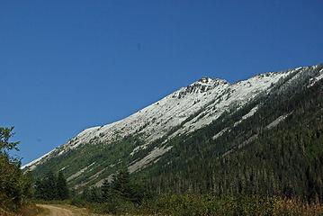 townsend 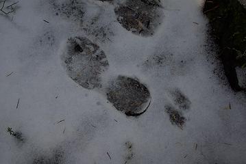 foot prints 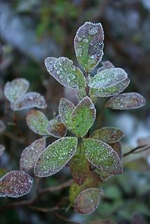 frost 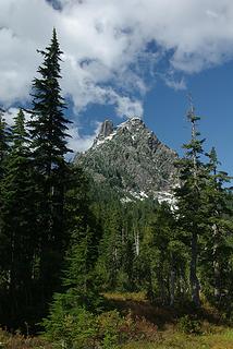 merchant 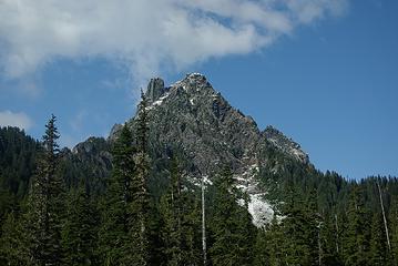 merchant  merchant  So thats where jelly beans come from!  merchant  townsend 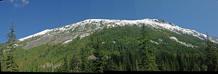 townsend
"Bears couldn't care less about us....we smell bad and don't taste too good. Bugs on the other hand see us as vending machines." - WetDog
Albuterol! it's the 11th essential
"Bears couldn't care less about us....we smell bad and don't taste too good. Bugs on the other hand see us as vending machines." - WetDog
Albuterol! it's the 11th essential
|
| Back to top |
|
|
|
|
You cannot post new topics in this forum
You cannot reply to topics in this forum
You cannot edit your posts in this forum
You cannot delete your posts in this forum
You cannot vote in polls in this forum
|
Disclosure: As an Amazon Associate NWHikers.net earns from qualifying purchases when you use our link(s). |


