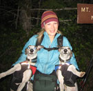
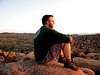
Dates:Saturday and Sunday, September 27-28Crew:yukon222, Schmidt Alti-Babe, Schmidt Alti-DudeSummits (in the order we climbed them): Fortune Peak 7382' (#2 Teanaway 20), South Ingalls Peak 7640' (#1 Teanaway 20), Mount Stuart 9415' (second highest non-volcano in Washington, #7 Bulger List, #10 Prominance List, #1 Back Court List)
Lakes (in the order we visited them):Lake Ingalls (we "view-bagged" Lake Campfire Girls and Lake Ann after determining they were not worth the elevation loss down to their shores)
Total Miles: Estimated 16Total Elevation:11,269 feet gained
Mount Stuart. While Dude was a student at Central Washington University the two of us have stared at this impressive peak from both afar and up close during various hikes. We thought we'd never be crazy enough to actually try to climb it. No, lakebagging was our passion. In 2007, we joined NWHikers.net and then started attending a little thing called TNAB shortly thereafter. We conducted a new activity called peak scrambling and discovered we liked it. The more we climbed, the higher we wanted to go and finally it was time to visit that summit we thought we'd never be crazy enough to do. Thank you NWHikers and TNAB for helping us lose our minds but find the peakbaggers inside of us!
Day 1: Esmeralda Basin Trailhead - Ingalls Way Trail - Ingalls Pass - Fortune Peak - South Ingalls Peak - Ingalls Lake - Ingalls Creek Trail - Cascadian Coulier Horse Camp
A simple hike and camp to the base of Stuart and then a summit the next day seemed too tame for us, so we decided to spend Saturday exploring around Ingalls Lake. It was 2001 the last time we were in the area so another visit was long overdue. At the trailhead, we visited briefly with another party trying for a dayhike of Stuart and then headed up the trail. Since we knew we had a ton of elevation to climb tomorrow we purposely kept it at a slower pace but still made Ingalls Pass in good time.
We hiked the trail down into the Headlight Basin a couple hundred feet and then made an ascending traverse up towards the ridge that leads to Fortune. We crossed over the ridge and then traveled cross country to a ledge where we could look at Lake Campfire Girls below us. Except there was no lake below us ! We checked our map, looked at the surrounding terrain and looked down again. The lake should be right below us. We eventually determined that the dry mud pan 200' below us was where the lake should be, but the lake must be all dried up. Since it was such a big snow year we fear the lake may be gone forever .
We swallowed our disappointment and continued west towards Fortune. We stayed as close to the ridge crest as the rough, broken terrain would allow, eventually climbing up some loose scree that was two steps up - slide one step back. About 400' below the summit we found a faint boot path just on the north side of the crest and followed it up to the 7382' summit.
Fortune, South Ingalls, Ingalls, and Stuart surrounding Ingalls Lake
Cross-country to Fortune Peak
Two steps up - slide one step back
The summit had an impressive cairn but no register . We clicked away at the views in all directions. We really liked the views of all the peaks of the Home Court off to the west. We were surprised how cold the wind was on the summit. The sun was shining but the heat was soo weak it didn't seem to matter at all.
From Fortune we descended NE (right) a couple hundred feet into the Headlight Basin and then traversed under some small cliffy sections north towards S. Ingalls. Halfway to the other peak we came across a boot path leading up the hillside to a notch in the ridge between the two peaks. We had asked for some beta about this traverse from wamtngal & Just Todd (thanks) who had been in the area a week before. Of course, we didn't print that beta off and when we came to this section Dude stated "I think they said to stay on the Headlight Basin side." So we ignored the obvious boot path (we figured it was a cross country trail to Lake Ann on the other side of the ridge) and came to the base of the South Ingalls summit on the east side. After poking around looking for a way up we determined that a class 2 scramble couldn't be this hard and that the trail we didn't follow must lead to the correct path on the west side of the ridge . Of course, we found the path as soon as we crested the ridge. The path traversed below the summit on the west side until it crested the ridge again north of the summit. From there, it was an easy walk up to the top, 7640'. (Once again the correct path is east side of the ridge from Fortune, cross over half way, and west side of the ridge to South Ingalls).
On the route from Fortune to South Ingalls
The views from the summit were very similiar to the ones from Fortune Peak except for the main Ingalls summit looming over to the north. This summit did have a register. The current one had been placed only a few years before and a quick scan revealed Yana's entry as well and wamtngal & Todd's.
The Home Court from South Ingalls
Mount Stuart & Ingalls Lake
On the South Ingalls summit
360 degree summit pano
South Ingalls Lunies
We headed north off the summit and descended towards the Ingalls Col. The Beckey Guide made it seem like it's an easy walk from the col to the peak, but we found that wasn't the case. The direct route had a little more class three than we wanted with a full pack and we eventually found an easier path that descended down west of the ridge and then back up to the col. Along the way we were entertained by a couple rope climbing the main Ingalls summit. The woman kept yelling at her partner and it didn't sound like she was having a good time .
Views from the Ingalls col
Babe's just sitting around while we have miles to cover!
We descended a boot path to the boulders below the col and then rock hopped our way to the shore of the lake. At the lake we enjoyed the sunshine without the wind blowing and Dude took the time to check out the health of the resident trout . We spent quite a while at the lake shore relaxing before moving on. As we made our way towards the outlet on the NE side of the lake, Dude stopped to chat with a couple that were also enjoying the fishing. They asked Dude if we were members of NWHikers.net since they thought they had recognized us from our trip reports. The couple was emeraldcitydreamz and Michelle:D. After trading some fishing tips we made our way to the outlet area where we took a few more casts and a lot more pictures.
Ingalls Lake
We found the start of the Ingalls Creek trail and followed its course. At first it traversed towards Stuart Pass and then descended into a pretty meadow area. The trail is faint and thus hard to follow at times. We lost the trail once but we just headed in the general direction we thought it should go and picked it up again a few minutes later. After the meadows, the trail entered the trees again, became more distinct, and started dropping elevation. We passed a couple of very tired looking climbers that were returning to their camp in the Headlight Basin after climbing Stuart via the west ridge (technical rope route) and descending the Cascadian Coulier. We asked them about the Coulier and they stated that it sucked and wouldn't recommend it. Before we parted ways, they asked us how much farther to the lake and looked disappointed with the answer . We made our way quickly down to the Longs Pass junction and started looking for places to camp as we continued on the Ingalls Creek trail. After a small creek crossing, we saw a climber descending a boot path that connected to the trail and it turned out to be one of the climbers we chatted with in the parking lot. Their summit attempt had been successful and they were on their way back out. As we were talking to them, GeoTom, kyled, and wildernessed emerged from their camp hidden in the trees not far down the trail. We asked if there was any more spots left since we were unsure if there would be more camping farther down the trail. There was plenty of room, so we turned the evening into a mini NWHikers social.
Ingalls Meadows and Ingalls Peak
Trail Stats Day 1: 9 miles (est.), 4573', 9:47
Day 2: Cascadian Coulier Horse Camp - Sherpa Way Trail - Sherpa Basin - Upper Cascadian Coulier - Mount Stuart Summit - Back to Camp - Longs Pass - Trailhead
We awoke after a very cold nights sleep a little after 6:00. The thermometer on Dude's pack was reading right at 32 degrees. The other group was already gone and we ate breakfast, prepared our summit packs, and headed down the trail well over an hour behind them. Instead of enduring the Crapcadian Coulier as some have named it, we took the recommendation of dicey, Yana, and others and decided to use the Sherpa way trail route. We headed down the Ingalls Creek trail another 15 minutes and found the Sherpa trail just before the main trail junctions with the Beverly Turnpike trail (about 50' NW of the junction). There was a perfect camp spot next to a stream at the intersection as well but if we had camped here, we would have missed the social .
Finding the Sherpa way trail
The trail was well defined and switchbacked steeply up (we were feeling the 4500' gain from yesterday ) through meadows and then light forest. The trail ended in the middle of a rocky dry streambed (dry for us, others have reported a small stream running down the rocks). We traveled up the streambed a few hundred feet and then exited up a cement-hard dirt slope to our right (east). We scrambled up the slope to where the terrain leveled out then paralleled the gully up a few hundred feet more before finding a faint climbers path that took us past a beautiful bivy site and finally to a ridge crest where we had in-your-face views of Sherpa Peak. (This route is referenced as Variation No. 1 in the Beckey Guide but the route is drawn slightly wrong on the picture)
From this spot, the cairned route leads up the ridge and back towards the Cascadian Coulier but we did not go that route. Instead we descended about 150' into the basin below Sherpa and ascended up first heather slopes and then large boulders until we arrived at a large open bowl right underneath the peak. We then climbed up a class 3 gully beneath cliffs along the far left (west) edge of the bowl. We achieved a pass about 8200' right at the upper boulder field of the Cascadian Coulier below the false summit. (This section is drawn in as Variation No. 2 on the picture in the Beckey Guide but the route is not described)
Dude leads up the class 3 slabs
We saw two climbers below us without helmets but decided that they were responsible for their own safety and started up the boot path in the middle of the boulder field. The path was full of loose dirt and scree with just enough slabs to make it interesting. We made it to the base of the false summit and spotted a cairn off to our left (west). We climbed up to the cairn and spotted another and so forth around the mountain under the false summit. There was one interesting section when we finally turned the corner and could see the true summit. The last cairn seemed to lead over a ledge with about a 20' drop. After looking around, we figured out the route was to tunnel through a small gap in the boulders that required us to take our packs off to squeeze through On the other side of the gap we ran into kyled, wildernessed, and GeoTom coming down off the summit. We asked them when they had achieved the top, and it was at least two hours before we would, so we knew that our route hadn't saved us any time.
Up the Cascadian Coulier
Shutter delay
First views of the Stuart summit
We caught up to and passed a group of three climbers (also without helmets ) at the base of the final summit block. The cairns became scarce here so it was just make your own way up as best you can. Dude did a class 3 scramble (with one overhanging class 4 move) to the summit crest and then walked over to the summit while Yukon and Babe took the more well traveled way along a dirty path through broken slabs. Our longer adventure meant we had to share the summit with the two other parties but we were just glad to finally cross a big one off our lists.
Climbing the last little bit
Babe at the tippy top
Of course, the views were spectacular! We spent quite a while on the summit taking pictures. The wind was howling pretty good so we did have to duck behind some rocks to keep from freezing. We had a celebratory toast of Yukon Jack and signed the summit register (which is just a bunch of loose papers and needs to be replaced). All the other parties headed off the summit before we did.
We retraced our steps, passed the other party of three, and then started heading down the coulier. We found the going easy if a little loose but loose is always easier heading down. The only complaint was that is was a much hotter day than we expected with Dude's pack thermometer reaching 80 degrees at one point . We decided not to descend back into the Sherpa basin and instead kept heading down through the boulders and scree. We eventually came to a spot where the trail split. There was a big cairn next to the right (west) fork but the left (east) fork was better established and had fresh footprints. We descended on the path about 500' more until it faded at the top of some cliffs looking down into a creek gully at about 6800' . We looked around and found cairns to our left (east) that eventually led us to the ridge with great views of Sherpa we had been on in the morning .
Babe takes the "under" route
Underneath the Stuart summit
From here on out it was a boring retracing of our steps back to camp. We were surprised to find that temperatures down in the creek basin had dropped to almost 40 degrees and we went from being too hot to too cold quickly. As we were packing up our gear, the other group of three walked past us on the trail. Dude went out to talk to them and it turned out they had descended the same route that we had. The most experienced climber among them opinioned that the Cascadian route wasn't as bad as everyone made it out to be and he'd prefer it to the one we did .
Finally back to the horse camp
After we were packed up and fully rehydrated we headed up the trail and started on the Longs Pass way trail. We didn't know what to expect since we didn't come in this way but wildernessed et al. stated it wasn't going to be fun. Well, it wasn't and it is certainly longer from the junction to the pass than the 1.1 miles the Green Trails Map shows ! We shot some sunset pictures from the pass and headed down to the car with the use of headlamps. It was a great weekend and we'll sign off with this - DON'T BE AN @SSHAT, WEAR A HELMET!
"Dangerous" log crossing!!!
What was our route again?
Fading light on Stuart
Almost time for headlamps
The last colors of a great day
Another lucky trailhead shot!
Trail Stats Day 2: 7 miles (est.), 6696', 11:53
"Forest 101: These big wood stick things are called trees. The big rocks are called mountains, and the little rocks are their babies." Elliott from Open Season
0
"Forest 101: These big wood stick things are called trees. The big rocks are called mountains, and the little rocks are their babies." Elliott from Open Season
In light of GeoTom's interesting discoveries this weekend, I found that there were a few of my own:
A few things I learned this past weekend:
When passing on a greeting from a friend of "hey freak!" make sure you have the right freak. (Sorry, Kyle)
Saying "hey freak" is probably not the best way to introduce yourself to someone you haven't met before. (Sorry, Wildernessed)
Yukon's lucky yellow shirt only works if it's the RIGHT lucky yellow shirt.
If a friend asks you to pour boiling water into their Mountain House, do the right thing and DON'T have them hold it. Unless you are seeking revenge.
Take others' recommendations about "alternate better routes" with a grain of salt. Especially if there isn't much beta on said route.
Stuart has many variations and routes. I think we started with Sherpa, topped out in Cascadian, but threw in a variation 1 and 2 in there. Or was that 3? We'll just call it variation XS for Team Extreme S!!!
The best way to prepare for a 6500' day is to probably not do 4500' the day before.
Do NOT sleep next to Dude when he is extremely tired. You will not get any sleep. Zunes can't block out the decibel range he emits.
Day 1
First view of Fortune Peak
Fall colors in the undergrowth
Electric Larches
Dude searches for Lake Campfire Girls
Staying close to the ridge crest
Dude arrives on Fortune Peak
Mount Stuart and Ingalls Lake from Fortune
Mountain Men on Fortune Peak
Looking over to South Ingalls
Summit Chief, Bears Breast, Citadel, Hinman, Daniel
On the correct route on the west side of the ridge
With limited time for the weekend, we decided to extend the sightseeing on the Saturday approach day by veering over to Fortune Mtn and South Ingalls Peak instead of the direct Longs Pass route. Well worth the detour, especially the different perspectives of Lake Ingalls and Mt Stuart. Really liked how Stuart reared up out of the valley floor, with mammoth sweeping lines. Only disappointment was we were about 1 week early for the turning of the larches.
Something about those photos looks vaguely familiar
Nice to have run into you guys. Now I know how to beat you to a summit: Start out an hour and a half beforehand
I've been waiting for this TR for days! I'm speechless... Beautiful photos, amazing panos like usual, great route info. What more could we ask for from you three? Oh yeah...where's Babe's video!?
Great job, guys!
Cheers,
-->Justin
We are very sad to report that Babe's computer had an error and as a result she lost all of her video files. Both the ones she had finished and the 20 or so she had partially done. It is best not bring the subject up for a few more days, especially since I'm the one who had to put up with the wailing and gnashing of teeth .
-Dude-
"Forest 101: These big wood stick things are called trees. The big rocks are called mountains, and the little rocks are their babies." Elliott from Open Season
0
"Forest 101: These big wood stick things are called trees. The big rocks are called mountains, and the little rocks are their babies." Elliott from Open Season
Mount Stuart 9415' (second highest non-volcano in Washington, #7 Bulger List, #10 Prominance List,
Don't short change yourself, Stuart is actually #6 in prominence in WA. And #45 in the lower 48 states. The number 10 is its rank on the true 100 highest list-- versus #7 on the Bulger variation.
We are very sad to report that Babe's computer had an error and as a result she lost all of her video files. Both the ones she had finished and the 20 or so she had partially done. It is best not bring the subject up for a few more days, especially since I'm the one who had to put up with the wailing and gnashing of teeth .
-Dude-
Congrats guys on what is one hell of an impressive climbing season! I am now looking forward to see what you do in the winter. Perhaps you should check out this guy.
This trip report is almost as amazing as the accomplishment, congrats to the three of you in making your summit. I enjoy the talent with which you all manage to capture the steeps, I have yet to learn how to show the true angles of the terrain. It must help that you are always going up, up, up, giving you lots of practice at shooting right angles. I'm too to climb with camera in hand yet. One last note of praise, the panos in this report are fantastic, beyond being clean they are beautifully framed and give an excellent sense of depth.
Ok, gush~fest complete.
another great trip! what a great way to cap off your season,thank's for the extra pic's of the variation's. talk about being in shape(4500') the day before ,hey let me poke you so we can see if your human. one more thought, i think we should vote you guy's for president and v.p. just so we can watch the secret service floundering around the wilderness keeping up with you two.
Alti-Babe-
Sorry about your computer.
I would ask if you had the files backed up on an external device, but you might pour boiling water on me, so I won't ask.
Great trip you guys - been waiting for this TR!
Dude: I guess I could have been more descriptive on the Ingalls-Fortune traverse. I went back and read my PM to you and it made sense coming from S. Ingalls heading to Fortune like we did (plus you can actually see the bootpath while up on Ingalls), but not so much if coming from Fortune to Ingalls...sorry 'bout that. But you got 'er dun anyway!
You cannot post new topics in this forum You cannot reply to topics in this forum You cannot edit your posts in this forum You cannot delete your posts in this forum You cannot vote in polls in this forum
Disclosure: As an Amazon Associate NWHikers.net earns from qualifying purchases when you use our link(s).


 ! We checked our map, looked at the surrounding terrain and looked down again. The lake should be right below us. We eventually determined that the dry mud pan 200' below us was where the lake should be, but the lake must be all dried up. Since it was such a big snow year we fear the lake may be gone forever
  .
.


 . We clicked away at the views in all directions. We really liked the views of all the peaks of the Home Court off to the west. We were surprised how cold the wind was on the summit. The sun was shining but the heat was soo weak it didn't seem to matter at all.


 and when we came to this section Dude stated "I think they said to stay on the Headlight Basin side." So we ignored the obvious boot path (we figured it was a cross country trail to Lake Ann on the other side of the ridge) and came to the base of the South Ingalls summit on the east side. After poking around looking for a way up we determined that a class 2 scramble couldn't be this hard and that the trail we didn't follow must lead to the correct path on the west side of the ridge
  . Of course, we found the path as soon as we crested the ridge. The path traversed below the summit on the west side until it crested the ridge again north of the summit. From there, it was an easy walk up to the top, 7640'. (Once again the correct path is east side of the ridge from Fortune, cross over half way, and west side of the ridge to South Ingalls).


 .
.


 . We spent quite a while at the lake shore relaxing before moving on. As we made our way towards the outlet on the NE side of the lake, Dude stopped to chat with a couple that were also enjoying the fishing. They asked Dude if we were members of NWHikers.net since they thought they had recognized us from our trip reports. The couple was
 . We made our way quickly down to the Longs Pass junction and started looking for places to camp as we continued on the Ingalls Creek trail. After a small creek crossing, we saw a climber descending a boot path that connected to the trail and it turned out to be one of the climbers we chatted with in the parking lot. Their summit attempt had been successful and they were on their way back out. As we were talking to them, GeoTom, kyled, and wildernessed emerged from their camp hidden in the trees not far down the trail. We asked if there was any more spots left since we were unsure if there would be more camping farther down the trail. There was plenty of room, so we turned the evening into a mini NWHikers social.

 .
.

 ) through meadows and then light forest. The trail ended in the middle of a rocky dry streambed (dry for us, others have reported a small stream running down the rocks). We traveled up the streambed a few hundred feet and then exited up a cement-hard dirt slope to our right (east). We scrambled up the slope to where the terrain leveled out then paralleled the gully up a few hundred feet more before finding a faint climbers path that took us past a beautiful bivy site and finally to a ridge crest where we had in-your-face views of Sherpa Peak. (This route is referenced as Variation No. 1 in the Beckey Guide but the route is drawn slightly wrong on the picture)


 but decided that they were responsible for their own safety and started up the boot path in the middle of the boulder field. The path was full of loose dirt and scree with just enough slabs to make it interesting. We made it to the base of the false summit and spotted a cairn off to our left (west). We climbed up to the cairn and spotted another and so forth around the mountain under the false summit. There was one interesting section when we finally turned the corner and could see the true summit. The last cairn seemed to lead over a ledge with about a 20' drop. After looking around, we figured out the route was to tunnel through a small gap in the boulders that required us to take our packs off to squeeze through


 . We decided not to descend back into the Sherpa basin and instead kept heading down through the boulders and scree. We eventually came to a spot where the trail split. There was a big cairn next to the right (west) fork but the left (east) fork was better established and had fresh footprints. We descended on the path about 500' more until it faded at the top of some cliffs looking down into a creek gully at about 6800'
  . We looked around and found cairns to our left (east) that eventually led us to the ridge with great views of Sherpa we had been on in the morning

 .
.


 Oh yeah...where's Babe's video!?
  Great job, guys!
Cheers,
-->Justin
Great job, guys!
Cheers,
-->Justin

 to climb with camera in hand yet. One last note of praise, the panos in this report are fantastic, beyond being clean they are beautifully framed and give an excellent sense of depth.


 so we can see if your human. one more thought, i think we should vote you guy's for president and v.p. just so we can watch the secret service floundering around the wilderness keeping up with you two.


