| Previous :: Next Topic |
| Author |
Message |
Sadie's Driver
Sadie's Driver


Joined: 24 Apr 2006
Posts: 1763 | TRs | Pics
Location: Welcome Pass |
(Note trip title courtesy of Middle E  )
30 - 40% chance of HEAVY RAIN, hail and thunder/lightening by the magic hour of (you guessed it) 11:00 a.m. predicted the National Weather Service for the Teanaway area. )
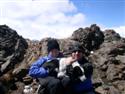
30 - 40% chance of HEAVY RAIN, hail and thunder/lightening by the magic hour of (you guessed it) 11:00 a.m. predicted the National Weather Service for the Teanaway area.  However, Jim K, the champion of advance trip planning, had suggested on Tuesday(!) a possible return to an old favorite Koppen Mountain via Medra Pass. He hadn't been there since 2002. On Tuesday, it looked like Saturday would be the best weather day of the weekend. That would change by Friday! But, fool-hardy souls such as Brewmaster (David), Snow Dog (Elle), Middle E (Barry), Gus and I decided to join Jim on this little folly. Happy Marmot (Kelly) decided sanity would guide her - so she opted out! However, Jim K, the champion of advance trip planning, had suggested on Tuesday(!) a possible return to an old favorite Koppen Mountain via Medra Pass. He hadn't been there since 2002. On Tuesday, it looked like Saturday would be the best weather day of the weekend. That would change by Friday! But, fool-hardy souls such as Brewmaster (David), Snow Dog (Elle), Middle E (Barry), Gus and I decided to join Jim on this little folly. Happy Marmot (Kelly) decided sanity would guide her - so she opted out!  So, the five of us and Gus packed into the ol' Highlander at the High Point exit at 7:30 a.m. (already several folks heading up Tiger) and off we headed to points east. Wasn't looking too promising until we got to Easton - and it started to look encouraging. We were struck by how little snow there was on Earl - we had been to Navaho just two weeks ago and there was A LOT more snow evident. The roads are clear in the Teanaway - not a problem getting to most trailheads. And, there were lots and lots of people camped all along the road as we headed past Beverly Creek Campground. We arrived at the Johnson Creek trailhead and there was one other car. Jim mentioned that this was a little-used trail, but why was a mystery to us - it's a lovely trail! So, as we prepared to head out, all of us but one were in summer attire (including Gus' new haircut) - but Elle wasn't taking any chances! So, the five of us and Gus packed into the ol' Highlander at the High Point exit at 7:30 a.m. (already several folks heading up Tiger) and off we headed to points east. Wasn't looking too promising until we got to Easton - and it started to look encouraging. We were struck by how little snow there was on Earl - we had been to Navaho just two weeks ago and there was A LOT more snow evident. The roads are clear in the Teanaway - not a problem getting to most trailheads. And, there were lots and lots of people camped all along the road as we headed past Beverly Creek Campground. We arrived at the Johnson Creek trailhead and there was one other car. Jim mentioned that this was a little-used trail, but why was a mystery to us - it's a lovely trail! So, as we prepared to head out, all of us but one were in summer attire (including Gus' new haircut) - but Elle wasn't taking any chances!  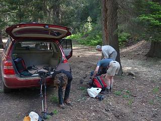 Elle making sure she gets those gaiters on!!! 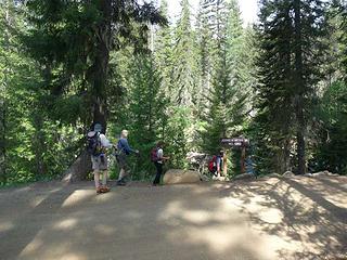 Troops head to the trail - sun shining 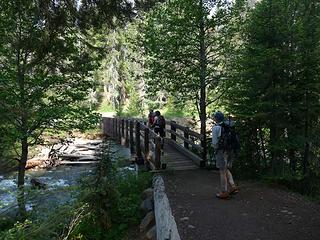 Crossing the Teanaway 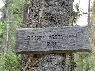 On our way 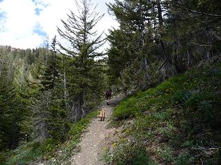 Brown hikes are back!!!! Yaaaaaa!!!!  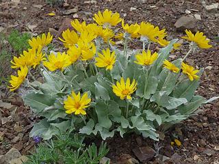 Pretty 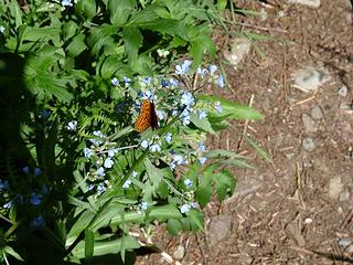 Flowers and Butterfiles 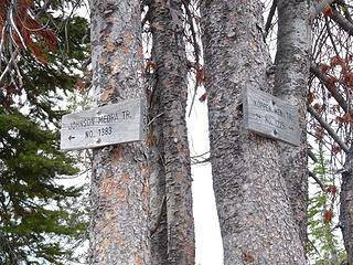 Taking the route less traveled . . . 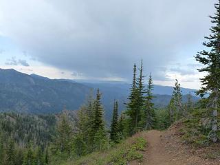 Storm clouds to the east 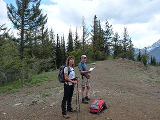 At Medra Pass  However, a quick course correction - (Elle was questioning our directional dysfunction the entire time) - we were back on trail and headed to Koppen (note to the intrepid - after you leave Medra Pass and come upon a fork in the trail - take the high road - even though it initially looks less traveled. Stick to the ridge - you can't go wrong!) There are a few bumps to go up and down on your way to Koppen However, a quick course correction - (Elle was questioning our directional dysfunction the entire time) - we were back on trail and headed to Koppen (note to the intrepid - after you leave Medra Pass and come upon a fork in the trail - take the high road - even though it initially looks less traveled. Stick to the ridge - you can't go wrong!) There are a few bumps to go up and down on your way to Koppen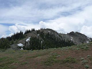 Ridge to Koppen 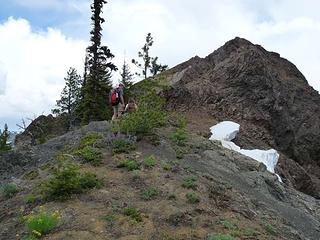 Just another bump along the ridge 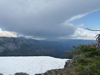 A storm a' brewin' 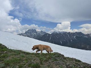 Hot dog 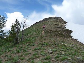 Heading to the summit of Koppen 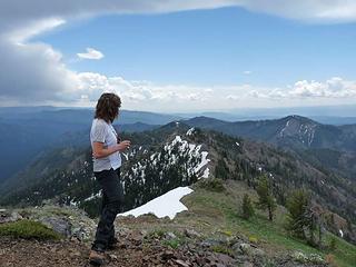 Cool clouds all around - Elle on the summit 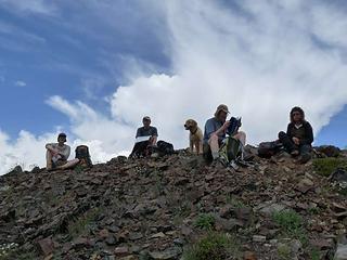 Team Koppen enjoying the views 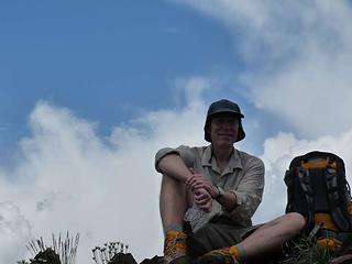 Brewmaster thinking about being struck by lightening 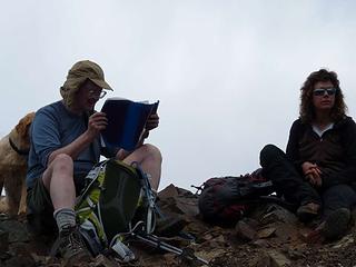 Jim K studying the summit register - Elle contemplating ???? 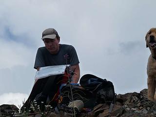 Map student and faithful companion 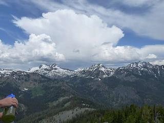 Cool clouds looking towards Hawkins and Esmerelda  so down we started - the weather was still pleasantly mild - around 70 degrees and a slight breeze. so down we started - the weather was still pleasantly mild - around 70 degrees and a slight breeze.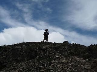 Man and the sky 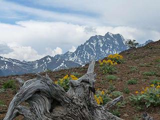 Flowers and Stuart   We won't mention any names here . . . . We won't mention any names here . . . .  The humidity seemed a little less intense on our way down the switchbacks, but as soon as we got close to Johnson Creek again, someone took advantage . . . The humidity seemed a little less intense on our way down the switchbacks, but as soon as we got close to Johnson Creek again, someone took advantage . . .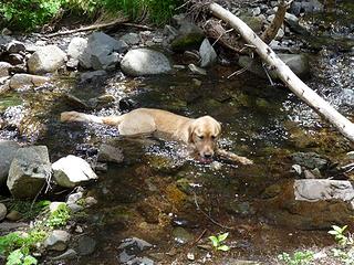 Chillin' - He is so good at that. 06-13-09 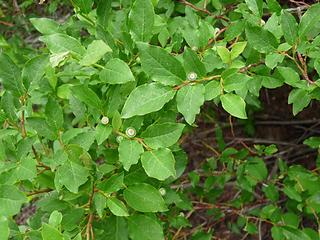 The bears will be happy this year!  fun fun  a BROWN HIKE a BROWN HIKE  and great company! and great company! 
Four-paw buddy lets me tag along!
Four-paw buddy lets me tag along!
|
| Back to top |
  
|
|
GeoTom
Member
Joined: 19 May 2005
Posts: 3215 | TRs | Pics
Location: Earth |
|
GeoTom
Member
|
 Sat Jun 13, 2009 10:52 pm |
|
|
I thought I saw you guys from our vantage point above Longs Pass. 
|
| Back to top |
|
|
Brewmaster
Member
Joined: 19 Feb 2008
Posts: 30 | TRs | Pics
Location: Issaquah, WA |
Another great trip suggested by Jim. Not so sure about the weather and I do admit that I was keeping an eye on the weather. The loud thunder at about 10 am with few clouds in the sky was interesting to say the least. (At least Jim is 2 inches taller than I am...)
Here are the stats- including our little side trip down the ridge to nowhere about 11.5 miles and 3500 feet elevation gain. Some ups and downs over the false summits. Overall a very nice ridge walk, one I will repeat!
Lots of birds singing in the first part of the trip, and for the adventuresome quite a few mushrooms.
And yes, the cold brew (latest batch of American Pale Ale) tasted great.
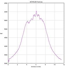 Koppen elevation 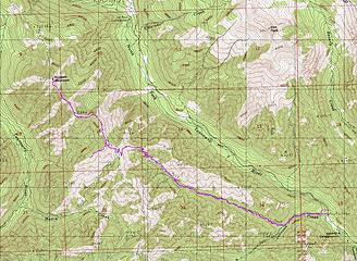 Koppen track
|
| Back to top |
|
|
Joey
verrry senior member

Joined: 05 Jun 2005
Posts: 2797 | TRs | Pics
Location: Redmond |
|
Joey
verrry senior member
|
Sun Jun 14, 2009 7:18 am |
|
|
Hey Jim - Did you recognize that car at the TH? I heard voices just before arriving in the Medra Pass area (coming from the south). Maybe that was the Malcolm Mtn debate. I took a break at the pass and never even saw the dust you trail runners must have been raising.
|
| Back to top |
|
|
Snowdog
Member

Joined: 21 Jul 2006
Posts: 1028 | TRs | Pics
Location: on (& off) the beaten path |
|
Snowdog
Member
|
Sun Jun 14, 2009 2:48 pm |
|
|
So glad I had my gaiters on! The stream crossings alone called for them, not to mention the inches & inches of snow.
Laugh if you will, but here is my inaugural attempt at adding pics.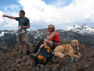 IMG_0511.JPG 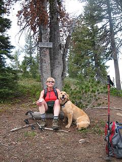 IMG_0510.JPG
'we don't have time for a shortcut'
'we don't have time for a shortcut'
|
| Back to top |
|
|
TrailPair
Member

Joined: 17 Apr 2005
Posts: 1699 | TRs | Pics
|
Looks like you had an excellent trip....better weather than expected....less nsow than expected....and no trailpair summit curse.
Jim K was pointing out the peaks and Elle was contemplating
This thing called work is interfering with my play
This thing called work is interfering with my play
|
| Back to top |
|
|
Middle E
no more moustache

Joined: 10 Feb 2008
Posts: 432 | TRs | Pics
Location: Seattle, WA |
|
Middle E
no more moustache
|
Sun Jun 14, 2009 6:45 pm |
|
|
| Snowdog wrote: | | Laugh if you will, but here is my inaugural attempt at adding pics.
|
Good try, but the pictures of someone pointing MUST involve JimK. You'll get the hang of it soon enough.
Here are a couple more that I took....
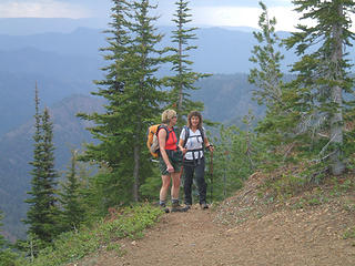 Suzanne and Elle almost to the pass 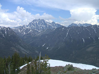 Stuart from Koppen 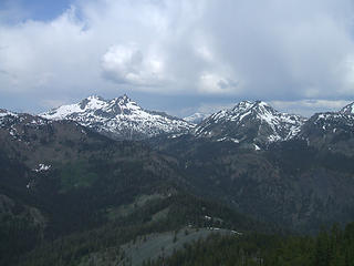 Hawkins and Esmerelda from Koppen 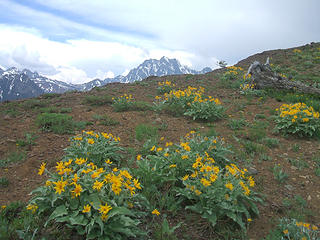 Mt. Stuart behind balsamroot
pithy yet insightful signature
pithy yet insightful signature
|
| Back to top |
|
|
JimK
Member

Joined: 07 Feb 2002
Posts: 5606 | TRs | Pics
Location: Ballard |
|
JimK
Member
|
Sun Jun 14, 2009 8:04 pm |
|
|
Joey, we saw a couple near Medra Pass heading towards Koppen. That was it until a couple mushroom pickers near the bottom. That must have been us you heard. Just missed a surprise meeting at the pass.
|
| Back to top |
|
|
Sadie's Driver
Sadie's Driver
Joined: 24 Apr 2006
Posts: 1763 | TRs | Pics
Location: Welcome Pass |
Four-paw buddy lets me tag along!
|
| Back to top |
|
|
Jasper
Cascade Snow Pig

Joined: 13 Apr 2008
Posts: 350 | TRs | Pics
Location: Burrowing in the snow |
|
Jasper
Cascade Snow Pig
|
Mon Jun 15, 2009 10:08 pm |
|
|
Gus-
It's ok. I was at the cabin with my mom. It's better without him anyway as he kicks me off the bed.
|
| Back to top |
|
|
JimK
Member
Joined: 07 Feb 2002
Posts: 5606 | TRs | Pics
Location: Ballard |
|
JimK
Member
|
Mon Jun 15, 2009 10:26 pm |
|
|
I'm often mistaken for Middle E. 
|
| Back to top |
|
|
JimK
Member
Joined: 07 Feb 2002
Posts: 5606 | TRs | Pics
Location: Ballard |
|
JimK
Member
|
Tue Jun 16, 2009 11:47 am |
|
|
My turn to add a report and photos.
I had hiked up Koppen Mountain twice before via Medra Pass. The old sheep highway has not been maintained in many decades but some tread remains all the way to Koppen and beyond. Suzanne, Barry, Brewmaster, and Elle completed the group. All of us and Suzanne's dog Gus squeezed into one vehicle for the drive over. This weekend provided an unusual forecast as unsettled weather presented the chance of thundershowers in the mountains. The best weather was in Seattle. Still, flowers are great now on the east side of the crest and rapidly melting snow provides the chance to hike on dirt once again.
We arrived at the Johnson Creek Trailhead, just beyond Beverly Creek Campgrounds on the NF Teanaway River, at about 9:00 am. There was one other car there. The trail crosses the Teanaway River on a bridge and begins a gentle climb up the valley. In less than a mile the junction with the Jungle Creek Trail is reached. The valley is really green right now. A few trillium remain though far past their prime. Vanilla leaf lines much of the trail. We also saw columbine, violets, and numerous other flowers. Ell noticed a small snake in the trail. It was brownish in color and yellow on its belly. It was not moving but not dead either. We moved it out of the way. I don't know what type of snake it was.
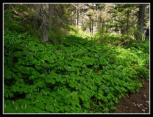 Lots Of Vanilla Leaf 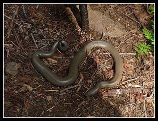 Small Snake 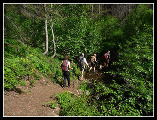 Into The Jungle 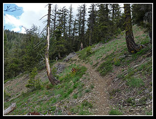 Open Slopes 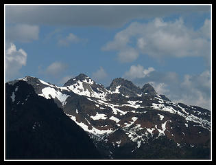 Fortune & Ingalls 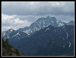 Mt. Stuart 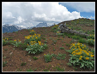 Balsamroot & Stuart 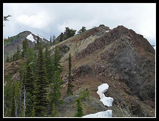 Summit In Sight 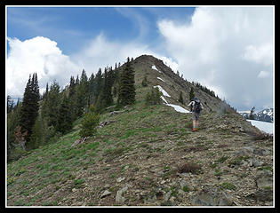 Summit Above 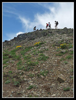 Almost There 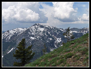 Tall White Clouds 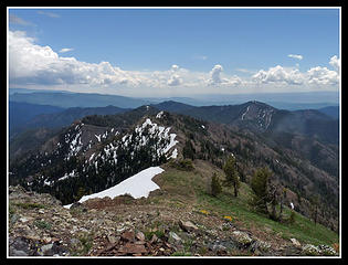 Looking Back Along Ridge 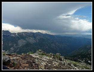 Raining Hard 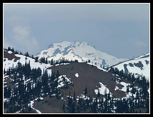 Mt. Daniel  Jolly Mountain 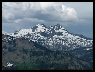 Hawkins Mountain 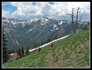 Heading Down 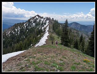 Ridge Back To Pass 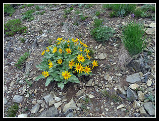 Balsamroot On Ridge 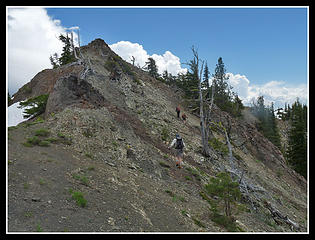 Rocky Slope 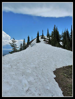 Biggest Snow Patch 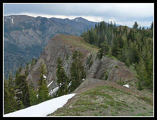 Drop Off On Left Side 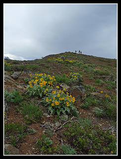 Hikers & Balsamroot 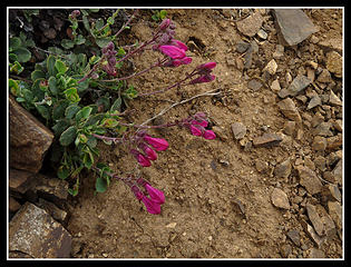 Penstemon? 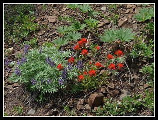 Paintbrush & Lupine 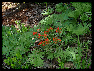 Orange Panitbrush 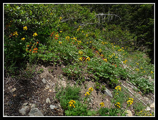 Yellow & Orange 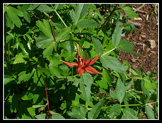 Columbine 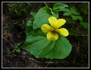 Violet 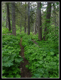 Lush Green Valley
|
| Back to top |
|
|
|
|
You cannot post new topics in this forum
You cannot reply to topics in this forum
You cannot edit your posts in this forum
You cannot delete your posts in this forum
You cannot vote in polls in this forum
|
Disclosure: As an Amazon Associate NWHikers.net earns from qualifying purchases when you use our link(s). |


 He could have stopped a few miles earlier and you could have hung out with me for the day!!!
  P.S. Ahhh, that wouldn't be Jim K and Elle.


