| Previous :: Next Topic |
| Author |
Message |
Sadie's Driver
Sadie's Driver


Joined: 24 Apr 2006
Posts: 1763 | TRs | Pics
Location: Welcome Pass |
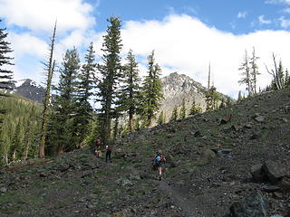
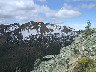
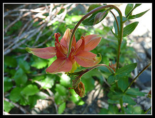
OK - so say that five times really fast! This is a story of a Trailpair summit WITH views! The curse was lifted!   Well, at least for today. Team today consisted of: Bob, Kolleen, Elle, Jim K, Barry, the Driver, Gus, Luis and the new addition, Lupe! The thought was maybe do a one-way from the DeRoux side over the saddle between Iron and Teanaway, up Bill, up Mary and then out Bean Creek. Well, we decided to eliminate all of the driving and two-car thing and just head up Beverly Creek Basin. Start time: 9:30 a.m. Not a lot of cars in the parking lot, but a few - probably some overnighters. Well, at least for today. Team today consisted of: Bob, Kolleen, Elle, Jim K, Barry, the Driver, Gus, Luis and the new addition, Lupe! The thought was maybe do a one-way from the DeRoux side over the saddle between Iron and Teanaway, up Bill, up Mary and then out Bean Creek. Well, we decided to eliminate all of the driving and two-car thing and just head up Beverly Creek Basin. Start time: 9:30 a.m. Not a lot of cars in the parking lot, but a few - probably some overnighters.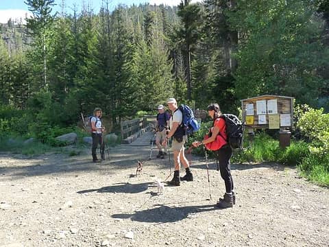 Heading out 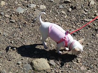 Pretty in Pink 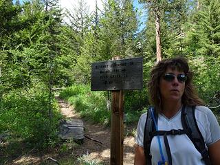 Heading up the Basin 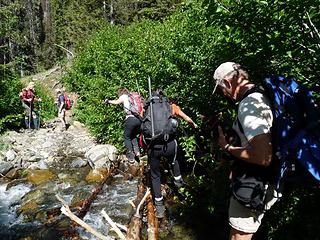 Crossing Bean Creek at the start 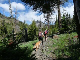 Heading up the Basin  ). Take note, the snow is pretty much gone. Oh sure, there are spots here and there - but they won't last long. However, we did use our ice axes on the decent of Bill. We were clipping along at great time, and before long were at Four Creek Pass for a quick snack. ). Take note, the snow is pretty much gone. Oh sure, there are spots here and there - but they won't last long. However, we did use our ice axes on the decent of Bill. We were clipping along at great time, and before long were at Four Creek Pass for a quick snack.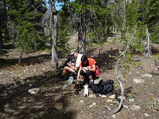 Snack time at Four Creek Pass 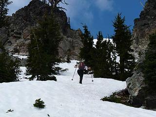 Elle heading up to Bill 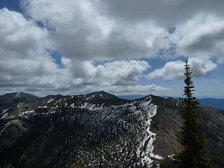 Mary Peak from Bill 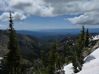 Looking south down the Basin 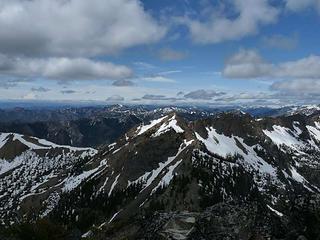 Teanaway and Iron from Bill 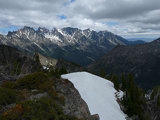 Enchantments from Bill 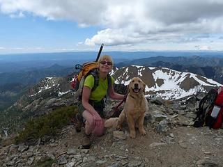 Driver and Gus on summit of Bill with Iron as a backdrop 06-20-09 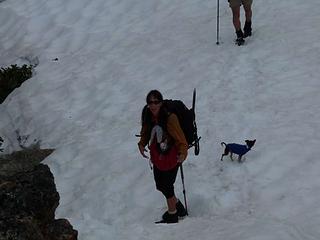 Kolleen and Luis heading to the summit of Bill 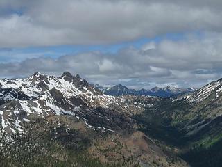 Gorgeous views today 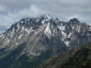 Stuart in and out of the clouds 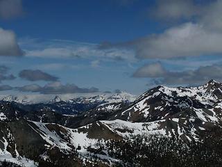 Daniel and friends 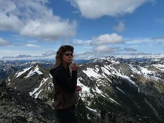 Queen of the Teanaways 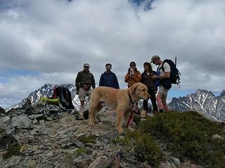 Motley crew on Bill (- the Driver) 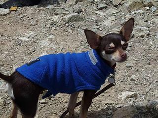 Studly Luis 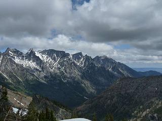 The Enchantments 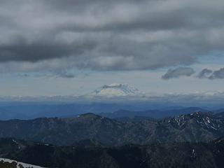 The Big R from Bill 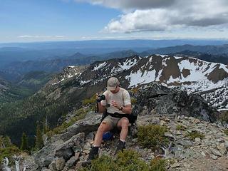 Bob deep in concentration on Bill 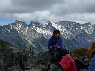 Elle on Bill with Enchantments as a backdrop 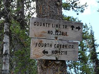 We part ways here    and met up with a group of scouts and their leaders out for an overnighter; we chit-chatted while we waited for Trailpair and Jim K to join us. At the Pass it was decided that we would split up - Barry, Elle, driver and Gus would head up Mary and down Bean Creek Basin back to the cars. Meanwhile, Bob, Kolleen, Luis, Lupe and Jim K would head back down the Beverly Creek Basin and skip the trifecta today. The rest of this report will be about the next two peaks achieved by the intrepid trio and buddy Gus. Jim K had said that it was a 600' gain to the peak of Mary - ahhh Jim, we need to talk! and met up with a group of scouts and their leaders out for an overnighter; we chit-chatted while we waited for Trailpair and Jim K to join us. At the Pass it was decided that we would split up - Barry, Elle, driver and Gus would head up Mary and down Bean Creek Basin back to the cars. Meanwhile, Bob, Kolleen, Luis, Lupe and Jim K would head back down the Beverly Creek Basin and skip the trifecta today. The rest of this report will be about the next two peaks achieved by the intrepid trio and buddy Gus. Jim K had said that it was a 600' gain to the peak of Mary - ahhh Jim, we need to talk!   Try 1100' of gain to reach the peak of Mary. Now, this is after a "little" 1300' gain to the summit of bill in about 3/4mile! Try 1100' of gain to reach the peak of Mary. Now, this is after a "little" 1300' gain to the summit of bill in about 3/4mile!   Oh well, it was worth it! There are a couple of "false summits" on the way to Mary, but the route was easy enough to find - Elle chose the snow to ascend, Barry, the driver and Gus chose the dirt/rocks. Some pretty flowers along the way. Oh well, it was worth it! There are a couple of "false summits" on the way to Mary, but the route was easy enough to find - Elle chose the snow to ascend, Barry, the driver and Gus chose the dirt/rocks. Some pretty flowers along the way.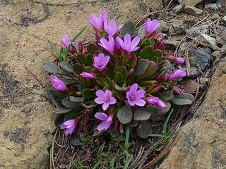 Tweedy's Lewisia(?) If not, what? 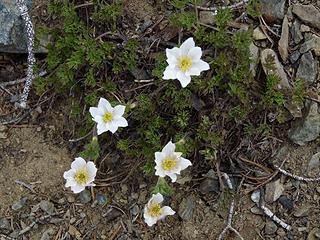 Anemone 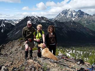 Mary and the Trio + Gus 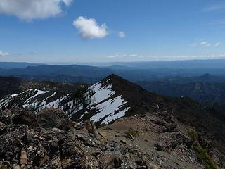 Mary from Bill 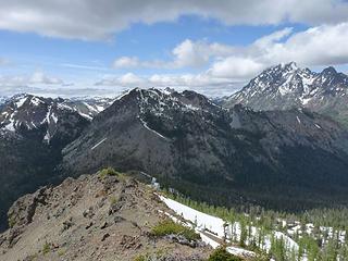 Bill from Mary 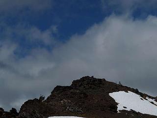 New friends up on Mary 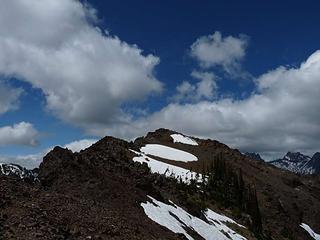 Looking north to the Judy/Mary ridge 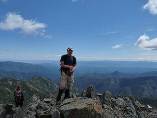 Barry on Judy (oh my!)  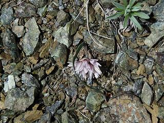 Hooker's Onion 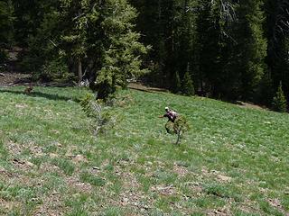 Barry on his own path 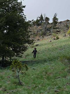 Elle coming down the "gentle" slope 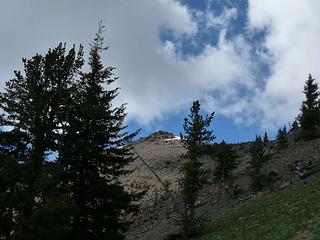 Looking back to Judy 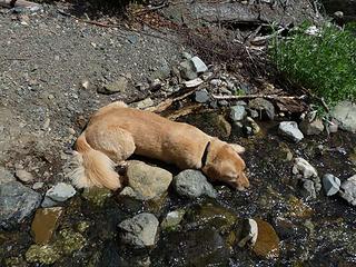 Hot dog   This one is for Angry Hiker - fresh from the Teanaways!
Four-paw buddy lets me tag along!
Four-paw buddy lets me tag along!
|
| Back to top |
  
|
|
puzzlr
Mid Fork Rocks

Joined: 13 Feb 2007
Posts: 7220 | TRs | Pics
Location: Stuck in the middle |
|
puzzlr
Mid Fork Rocks
|
 Sat Jun 20, 2009 11:39 pm |
|
|
Cartman, my friend Luke, and I did Earl today. When we got down we ran into Jimk and Trail Pair at the trailhead while they were waiting for Judy crew to show. Nice spring day in the Teanaway!
|
| Back to top |
|
|
TrailPair
Member

Joined: 17 Apr 2005
Posts: 1699 | TRs | Pics
|
Bill is a steep sucker, but probably is the best vantage point in the Teanaways. We should have continued on to Mary with you so we could show you the correct route down through Bean Creek Basin!
 Bill Peak highlighted in the sunshine 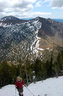 Jim K with Mary beyond 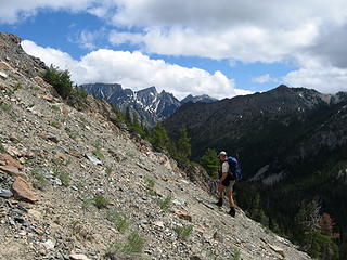 Bob on Bill Peak 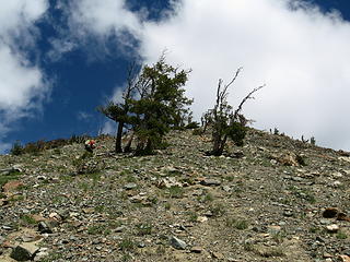 Steep climb 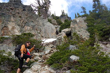 Scramble near the summit 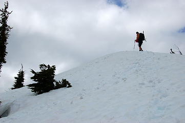 Near the summit 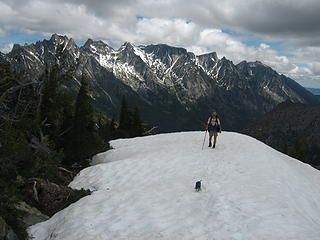 Luis racing to the summit 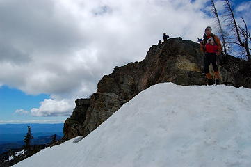 Summit on Bill 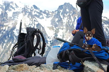 Luis' summit shot. 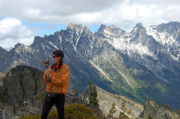 K and Luis, Enchantment Peaks beyond
This thing called work is interfering with my play
This thing called work is interfering with my play
|
| Back to top |
|
|
wildernessed
viewbagger

Joined: 31 Oct 2004
Posts: 9275 | TRs | Pics
Location: Wenatchee |
The area is cleaning up pretty good, how is the Bean Creek Basin, snowfree yet ?.
Living in the Anthropocene
Living in the Anthropocene
|
| Back to top |
|
|
Middle E
no more moustache

Joined: 10 Feb 2008
Posts: 432 | TRs | Pics
Location: Seattle, WA |
|
Middle E
no more moustache
|
Sun Jun 21, 2009 8:28 am |
|
|
| wildernessed wrote: | | The area is cleaning up pretty good, how is the Bean Creek Basin, snowfree yet ?. |
There's some snow on the slopes below Mary, but the basin is more or less free of snow.
We didn't drop down to the basin, but followed the ridge over Judy and then down the ridge spine to the trail, just above the first crossing of Bean Cr (which wasn't bad). There was a short stretch of moderate talus/scree but otherwise it made a nice loop route.
A few of my pics...
 Iron Pk comes into view  Route to Mary 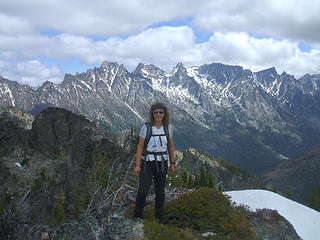 Enchantments behind Elle, from Bill 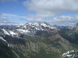 Fortune and Ingalls from Bill 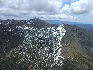 Mary from Bill 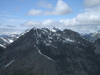 Bill from Mary 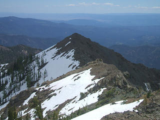 Judy from Mary 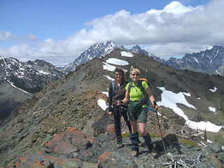 Mary from Judy
pithy yet insightful signature
pithy yet insightful signature
|
| Back to top |
|
|
GeoTom
Member
Joined: 19 May 2005
Posts: 3215 | TRs | Pics
Location: Earth |
|
GeoTom
Member
|
Sun Jun 21, 2009 8:30 am |
|
|
Good to see you finally getting out to the Teanaway Sadie's Driver. 
|
| Back to top |
|
|
Sadie's Driver
Sadie's Driver
Joined: 24 Apr 2006
Posts: 1763 | TRs | Pics
Location: Welcome Pass |
Four-paw buddy lets me tag along!
|
| Back to top |
|
|
TrailPair
Member
Joined: 17 Apr 2005
Posts: 1699 | TRs | Pics
|
This thing called work is interfering with my play
|
| Back to top |
|
|
Jasper
Cascade Snow Pig

Joined: 13 Apr 2008
Posts: 350 | TRs | Pics
Location: Burrowing in the snow |
|
Jasper
Cascade Snow Pig
|
Sun Jun 21, 2009 6:33 pm Re: Teanaway Trifecta
|
|
|
|
| Back to top |
|
|
JimK
Member

Joined: 07 Feb 2002
Posts: 5606 | TRs | Pics
Location: Ballard |
|
JimK
Member
|
Mon Jun 22, 2009 9:25 pm |
|
|
My turn:
All 35 photos can be seen here: Bill's Peak Photos
The good weather was to the east so back we went to the Teanaway area. Bill Peak is one of the few Teanaway area summits nobody else had climbed. I had been up twice on dirt and once on snow. Our crew included Bob, Kolleen, Elle, Suzanne, and Barry. After a debate on the route we chose Beverly Creek to Bill's Peak then Mary Peak and out via Bean Creek Basin. There were already half a dozen cars in the lot when we arrived at 9:15 am.
 Columbine 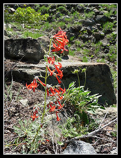 Scarlet Gilia 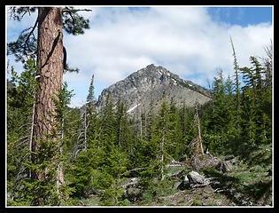 First View Of Bill's Peak 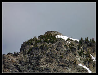 Zoomed Bill's Summit 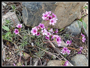 Colorful Flower 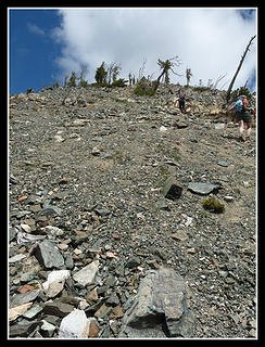 Climbing Steep Slope 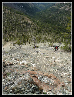 Looking Down 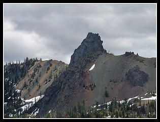 Volcanic Neck 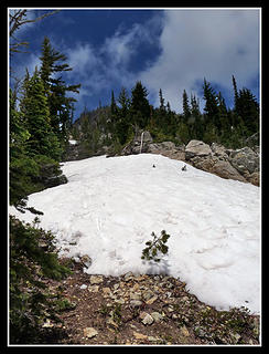 Snow Patch 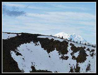 Mt. Rainier Over Iron 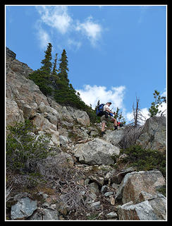 Scrambling Up 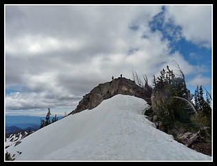 Bill's Summit 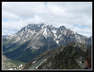 Mt. Stuart In Clouds 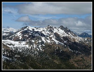 Fortune & Ingalls 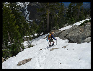 Suzanne Descending 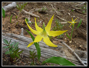 Glacier Lily 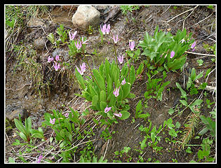 Shooting Stars 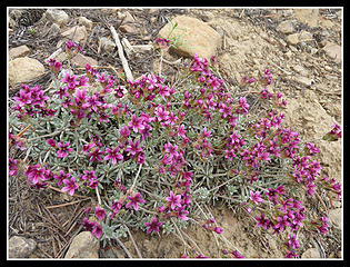 More Color
|
| Back to top |
|
|
the Zachster
Member

Joined: 17 Jan 2007
Posts: 4776 | TRs | Pics
Location: dog training |
Fun stuff, y'all!
"May I always be the kind of person my dog thinks I am"
"May I always be the kind of person my dog thinks I am"
|
| Back to top |
|
|
Sadie's Driver
Sadie's Driver
Joined: 24 Apr 2006
Posts: 1763 | TRs | Pics
Location: Welcome Pass |
|
Sadie's Driver
Sadie's Driver
|
Mon Jun 22, 2009 10:19 pm Bill/Mary/Judy
|
|
|
Four-paw buddy lets me tag along!
|
| Back to top |
|
|
joker
seeker

Joined: 12 Aug 2006
Posts: 7953 | TRs | Pics
Location: state of confusion |
|
joker
seeker
|
Mon Jun 22, 2009 11:12 pm |
|
|
Nice route and nice reporting from all. Thanks for sharing.
I've done Iron/Bill/Earl as a ski trifecta - I'm guessing that despite our extra elevation gain, it was a bit easier due to ease of ski descent (and the long descending traverse across Bean Creek basin on the way from Bill to Earl), and we were pretty beat at the end of that day.
|
| Back to top |
|
|
twodogdad
Member

Joined: 21 Nov 2006
Posts: 846 | TRs | Pics
Location: seattle |
| Sadie's Driver wrote: | Snack time at Four Creek Pass |
Pretty in pink
and macho in blue:
but can they steal
a sandwich from you?
td
|
| Back to top |
|
|
Sadie's Driver
Sadie's Driver
Joined: 24 Apr 2006
Posts: 1763 | TRs | Pics
Location: Welcome Pass |
| twodogdad wrote: | | Sadie's Driver wrote: | Snack time at Four Creek Pass |
Pretty in pink
and macho in blue:
but can they steal
a sandwich from you?
td |
Actually, Macho in Blue (aka Luis) attempted to grab Bob's sandwich on the top of Bill - Gus was soooo proud of him! Gus is helping him with his technique!!!
Four-paw buddy lets me tag along!
Four-paw buddy lets me tag along!
|
| Back to top |
|
|
|
|
You cannot post new topics in this forum
You cannot reply to topics in this forum
You cannot edit your posts in this forum
You cannot delete your posts in this forum
You cannot vote in polls in this forum
|
Disclosure: As an Amazon Associate NWHikers.net earns from qualifying purchases when you use our link(s). |


