| Previous :: Next Topic |
| Author |
Message |
Schroder
Member


Joined: 26 Oct 2007
Posts: 6720 | TRs | Pics
Location: on the beach |
|
Schroder
Member
|
 Fri Jul 03, 2009 9:27 am |
|
|
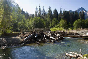
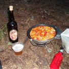
After going up the abandoned Green Mountain trail last weekend with Quark and JimK, I decided I was sufficiently beat up to step up the punishment by going up the Gothic Basin trail. For those of you that have never been up this trail, it starts off by following the Monte Cristo Road to the washed-out Twin Bridges and then following a trail built in the 80's that meanders up and down on the bank of the Sauk River before connecting with the old miners trail. Then it's serious switchbacks to timberline where the trail turns into a succession of creekbeds. I persuaded Larry, Neil and Chris into going along with me.
The trail along the river is cleared out and has one easy stream crossing. There are a couple of small walkaround blowdowns on the switchbacks and then you get into the fun part. There are several trees down once you start traversing and, of course, they are too low to crawl under and too high to step over. The gullys all have some snow in them that are easy to get around and the waterfall crossing is snow free.
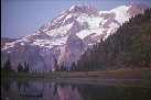
 Twin Bridges 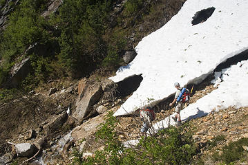 skirting a snow patch 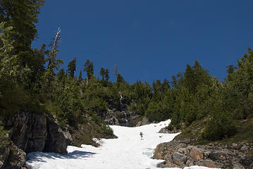 heading up the spring route 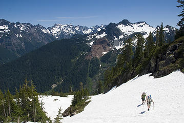 approaching the lake 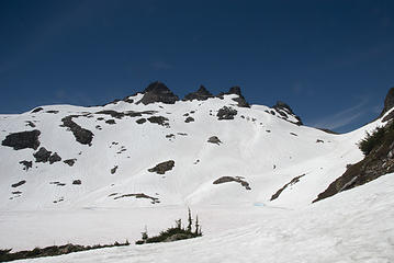 Gothic on the left 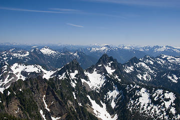 Looking over Sheep Gap toward Spire Mountain with Daniel and Hinman on the horizon 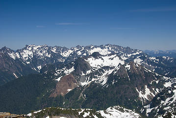 The Monte Cristo Group 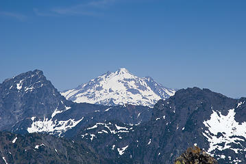 Sloan and Glacier Peak 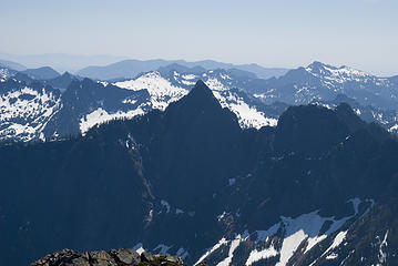 The now almost unreachable Red Mountain in Sultan Basin. Mt Stickney in the distant right. 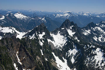 Sheep Gap and the Crested Buttes 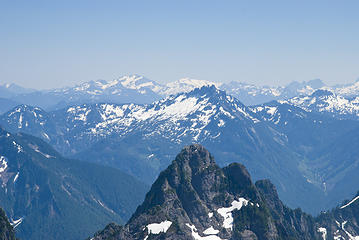 Spire Mountain, Daniel & Hinman in the distance 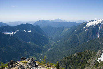 The forbidden upper Sultan River, Mt Pilchuck in the background 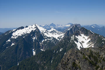 Left to right, most prominent - Vesper, 3 Fingers, Whitehorse, Big 4, Sperry, Morning Star, Jumbo 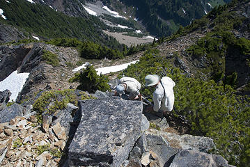 Starting back down 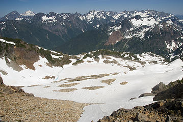 looking to Monte Cristo & Foggy (Crater) Lake 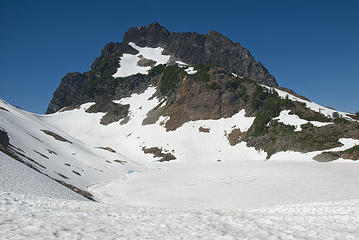 Looking back at Del Campo
|
| Back to top |
  
|
|
Magellan
Brutally Handsome

Joined: 26 Jul 2006
Posts: 13116 | TRs | Pics
Location: Inexorable descent |
|
Magellan
Brutally Handsome
|
Fri Jul 03, 2009 9:44 am |
|
|
Love it! 
|
| Back to top |
|
|
seattlehikertoo
Member

Joined: 26 Jun 2008
Posts: 582 | TRs | Pics
Location: Finding an alternative to Mailbox Pk |
Jeeezus Schroder...Going to have to get this one in. My brother and I tried to go up to the summit a couple of times, but couldn't find the a good way up. So, it looks like you head toward the notch from the Del Campo side...We too may have to stash some beer on a trip like this...
|
| Back to top |
|
|
Schroder
Member
Joined: 26 Oct 2007
Posts: 6720 | TRs | Pics
Location: on the beach |
|
Schroder
Member
|
Fri Jul 03, 2009 11:44 am |
|
|
If you come into the basin on the snow route you end up at a small tarn on the shoulder of Del Campo. From here the most direct route is to drop down on talus to the lake shore and traverse to the right onto the snow and then just head directly for the east (left) side of the summit rock. If you come up the trail into the lake basin it's shortest just to head from the lake outlet to the summit block.
Here's another photo - a small pano of Vesper to Del Campo
|
| Back to top |
|
|
11th Essential
Member
Joined: 09 Jun 2007
Posts: 203 | TRs | Pics
Location: Shoreline, WA |
Thanks for the excellent trip report. What a great, clear day.
Looks like a quite a bit of snow still up there in the basin. Looks tempting to maybe get up there next weekend for an overnight, popping up to Gothic and Del Campo plus some other wanderings in the basin. Hmm, wish I was there today....
|
| Back to top |
|
|
Popcorn
Member
Joined: 20 Aug 2008
Posts: 151 | TRs | Pics
Location: Another Place |
|
Popcorn
Member
|
Fri Jul 03, 2009 4:42 pm |
|
|
|
| Back to top |
|
|
EastKing
Surfing and Hiking

Joined: 28 Mar 2007
Posts: 2082 | TRs | Pics
Location: 77 miles from Seattle! |
|
EastKing
Surfing and Hiking
|
Fri Jul 03, 2009 5:41 pm |
|
|
This is the first time I have seen a trip report of the area. now that I know it is doable I might alter my plans. Good TR and photos!
YouTube | SummitPost
Saw the depths of despair. Now I am salvaging what time I have left on Earth.
YouTube | SummitPost
Saw the depths of despair. Now I am salvaging what time I have left on Earth.
|
| Back to top |
|
|
|
|


