| Previous :: Next Topic |
| Author |
Message |
huron
Member


Joined: 13 Sep 2004
Posts: 1035 | TRs | Pics
|
|
huron
Member
|
 Fri Jul 17, 2009 4:57 pm |
|
|
McClellan Butte is the pointy spire found on the South side of I-90 several miles East of the last North Bend exit. From the highway, its 5162 foot summit pyramid appears too steep for an unroped climb, but the trail goes around to the secret back door entrance where grades are much less demanding.
Since the last TNAB on McClellan, the trail has been improved, or rather, some might say restructured, significantly. It no longer down climbs into a delicate tarn and the approach to the summit block now includes several switchbacks.
*** WARNING - EXAGGERATION & POETIC LICENSE AHEAD ***
Without getting too wordy, I can say with certainty that this trip packed more adventure into a single evening than any TNAB since Poohbear got lost in the fire training center two years ago. There were men in dresses, a birthday celebration with popping corks, a forest road that required cars to jump Evel Kneivel style over two chasms, secret trips to seldom climbed peaks, canine carnage, dangerous leaps over crumbling snow bridges, mosquitoes the size of whippets and the expected, but never quite comfortable last hundred feet of scrambling which was enhanced this time by an obstacle course thru hesitant mounties. We had a wild time and made great friends with the water district officer who joined us on the summit. We promised not to say anything about the jeep rides or refreshing dip in Chester Morse as long as he would join us next Thursday.   *** END ***
Thursday's fractured group introduced many new faces to some TNAB regulars. There were at least two other groups joining us at the summit, so it was difficult to figure out who was TNAB and who wasn't. Tagged in our summit photo were: Alti-Dude & Babe, Magnum, Yukon, Damon, Craig, Seattlehikertoo, GeoTom, Magellan, Moosefish, Malachai Constant, Stefan, Braveheart, NatureMan, Recon, ZeusDaddy, Larry. Not pictured - Ewb, Andrew, Jeff and maybe a few more.
*** END ***
Thursday's fractured group introduced many new faces to some TNAB regulars. There were at least two other groups joining us at the summit, so it was difficult to figure out who was TNAB and who wasn't. Tagged in our summit photo were: Alti-Dude & Babe, Magnum, Yukon, Damon, Craig, Seattlehikertoo, GeoTom, Magellan, Moosefish, Malachai Constant, Stefan, Braveheart, NatureMan, Recon, ZeusDaddy, Larry. Not pictured - Ewb, Andrew, Jeff and maybe a few more.
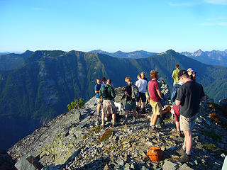 McClellan's Butte Summit 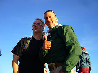 Magellan & Braveheart 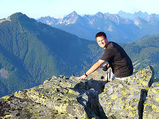 Moosefish 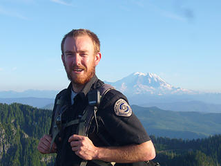 Our new bud 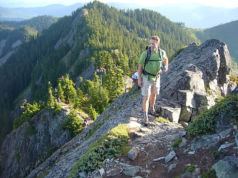 Seattlehikertoo 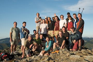 Kendall Peak 5,784'
|
| Back to top |
  
|
|
Malachai Constant
Member

Joined: 13 Jan 2002
Posts: 16092 | TRs | Pics
Location: Back Again Like A Bad Penny |
Summit Scenery
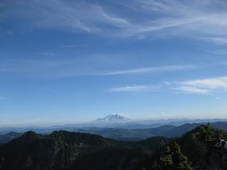 Rainier Clouds 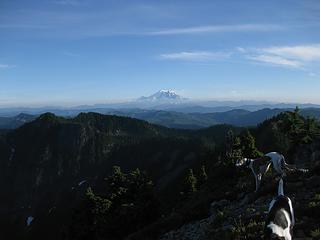 Rainier with clearing 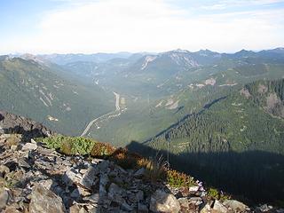 Down Valley View 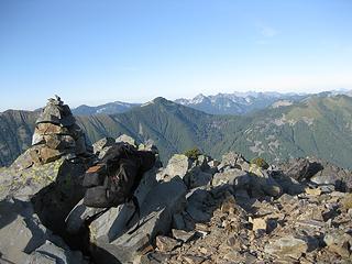 One Cairn of many 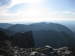 Flair over Seattle 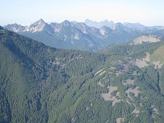 Roosevelt, Kaleetan, Chair, Bryant 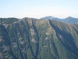 PPP Web 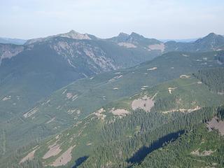 Silver Abel Tinkham 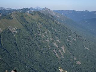 Bandarra Granite 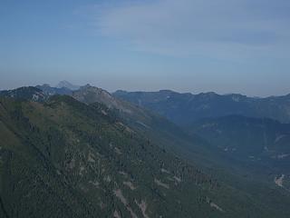 Stewie in Distance 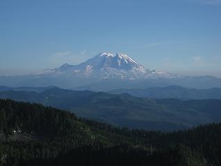 Rainier on Arrival 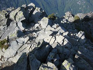 Summit Butterfly
"You do not laugh when you look at the mountains, or when you look at the sea." Lafcadio Hearn
"You do not laugh when you look at the mountains, or when you look at the sea." Lafcadio Hearn
|
| Back to top |
|
|
gone
Member

Joined: 08 Feb 2008
Posts: 1051 | TRs | Pics
|
|
gone
Member
|
Fri Jul 17, 2009 5:59 pm |
|
|
Great report, Magnum - poetic, perhaps, but no exaggeration! And your title is perfection!  I've been looking forward to climbing McClellan since missing last year's TNAB, and it sure didn't disappoint. After clearing the 9020's Snake River Canyons in my rental, I got on trail a bit behind Recon and proceeded up, and continued thusly, eventually being passed by MC, risking life and limb on the snow bridges of doom (both the barely intact one and the later step-for-your-life one), and ascending into ever thicker hordes of recently hatched alpine vampires. By the time the trail U-turned around back of the ridge, the blood-suckers had formed a thick gauntlet of doom through which hikers were forced to run for their lives to the trail's terminus just below the summit block of doom! Doom! DOOM!
After exhausting my DEET supplies, I snapped a bunch of pics, including an unfortunate up-skirt of Braveheart ("Freedom!", hee hee), talked up the Indiana-raised watershed officer (whose job I covet so badly I considered beating him up and stealing his uniform), then high-tailed it back down, eating on the run. Luckily, just before the broken step-for-your-(now backwards)-life snow bridge, I was caught by Larry who slowed to provide me a most helpful life-saving spot - thank you Larry!
I've been looking forward to climbing McClellan since missing last year's TNAB, and it sure didn't disappoint. After clearing the 9020's Snake River Canyons in my rental, I got on trail a bit behind Recon and proceeded up, and continued thusly, eventually being passed by MC, risking life and limb on the snow bridges of doom (both the barely intact one and the later step-for-your-life one), and ascending into ever thicker hordes of recently hatched alpine vampires. By the time the trail U-turned around back of the ridge, the blood-suckers had formed a thick gauntlet of doom through which hikers were forced to run for their lives to the trail's terminus just below the summit block of doom! Doom! DOOM!
After exhausting my DEET supplies, I snapped a bunch of pics, including an unfortunate up-skirt of Braveheart ("Freedom!", hee hee), talked up the Indiana-raised watershed officer (whose job I covet so badly I considered beating him up and stealing his uniform), then high-tailed it back down, eating on the run. Luckily, just before the broken step-for-your-(now backwards)-life snow bridge, I was caught by Larry who slowed to provide me a most helpful life-saving spot - thank you Larry!  Continuing down, I was passed by and kept company with various other friendly TNABers until finally back to the road, where more oil-pan-busting basement-jumping fun ensued in my rental back to the pavement, then on to the Pour House for more birthday fun and great company. Perfect!
 Beargrass and Kent Wispy Clouds TNAB Exposed Rainier View Snow Bridge of Doom
|
| Back to top |
|
|
yukon222
Member

Joined: 12 Mar 2007
Posts: 1893 | TRs | Pics
|
|
yukon222
Member
|
Fri Jul 17, 2009 9:11 pm |
|
|
Very pleasant hiking temperature (well, OK, a bit too warm at the TH  ) and the mozzies stayed away until the high sweeping turn near the Watershed Boundary. Just enough breeze on the summit to keep them at bay. No sunset shots due to the clear skies. ) and the mozzies stayed away until the high sweeping turn near the Watershed Boundary. Just enough breeze on the summit to keep them at bay. No sunset shots due to the clear skies.
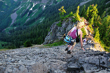 DSD_2668 Alti-Babe finishing the exposed scramble section 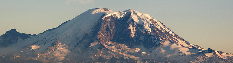 Last light on Rainier - goodnight, TNAB
|
| Back to top |
|
|
Yana
Hater

Joined: 04 Jun 2004
Posts: 4212 | TRs | Pics
Location: Out Hating |
|
Yana
Hater
|
Fri Jul 17, 2009 9:12 pm |
|
|
I like the doom motif. 
PLAY SAFE! SKI ONLY IN CLOCKWISE DIRECTION! LET'S ALL HAVE FUN TOGETHER!
PLAY SAFE! SKI ONLY IN CLOCKWISE DIRECTION! LET'S ALL HAVE FUN TOGETHER!
|
| Back to top |
|
|
seattlehikertoo
Member

Joined: 26 Jun 2008
Posts: 582 | TRs | Pics
Location: Finding an alternative to Mailbox Pk |
I started at the very bottom off exit 42 by the maintenance facility, which got me nearly 3800 feet of gain and a nice view of the waterfall going through the culvert.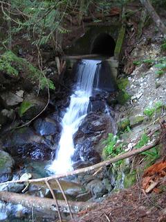 Man-made waterfall pouring out from beneath the old roadbed at 1750 ft 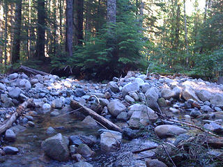 Alice creek where the trail crosses near the very bottom of the old trail 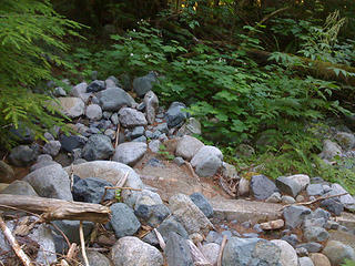 Alice creek bed along the lower portion of the old trail 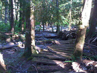 Footbridge along the lower portion of the old trail 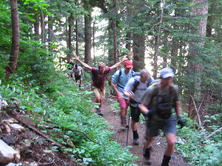 TNABers moving too fast for the camera. 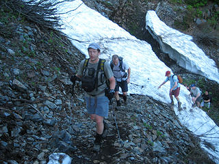 Yukon hasn't broken a sweat yet 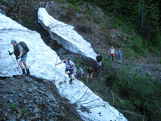 Two hikers marveling at some tricky TNABing 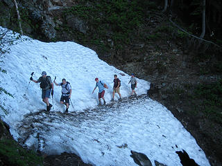 Expert gully crossing skills 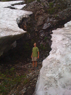 Me between remnants of a massive snow bank at a gully crossing around 3750 ft 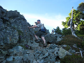 Magnum on the final steps 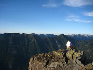 Braveheart getting some solitude 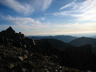 Yukon lining up the group photo 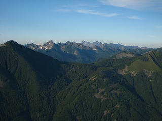 Looking across I90 between Defiance (left) and Bandera (right) 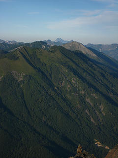 Stuart sitting atop Bandera 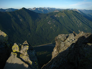 Looking N across I90 with Defiance on the left and Bandera to the right. Lonely summit cairn on the right. 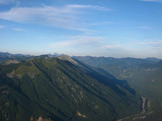 McClellan-090716 032 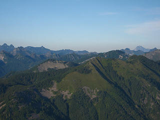 McClellan-090716 027 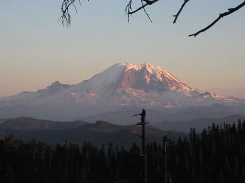 McClellan-090716 048
|
| Back to top |
|
|
Recon
Guest
|
|
Recon
Guest
|
Sat Jul 18, 2009 11:32 am TNAB McClellan Butte 09
|
|
|
Some more pics and me talking about my scramble up last year.
15 JUN 08 a friend and I snow climbed and scrambled McClellan Butte via a non standard route. There was still much snow on the trail at the time and when we reached the first stream crossing with a snowfield we went up it with ice ax's. We ended up on a rock band and continued climbing. After 5 pitches or so of Class 4 scrambling we reached some trees, but only after a large wheel barrel sized piece of snow came crashing by just after I tied off to one of the trees. There was much screaming of ice falling to my partner John who was still below the lip there. The block of snow had burst into pieces going over the edge. It would have wiped us both off had it come down minutes before. Class three scrambling brought us to the summit.
For the life of me I can't follow the line looking up from I-90. It isn't the standard North Gully, I don't think anyway. Looking down at the trees I can see the bottom of the valley where Alice Creek drains.
And oh yes, this ended up with a RON about 150 yards from the road - embarrassing yes - laughs at the realization - priceless. Coming out there was a ton of snow and we ended up crossing over the ridge by the logging road below point 4084, then flowing another logging road below the main trail. The RON was in the rocky bottom by the sharp bend FS9020 over Alice Creek. All my fault, but there is a avy debris and slide alder hell in there!
Gear used last year
Ice Ax's
One Harness
One 8mm x 30 m rope
One ATC
Anybody know this route?
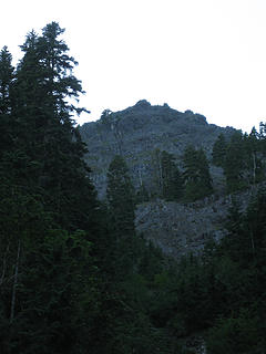 This might be the minor bump north north east of the true summit? 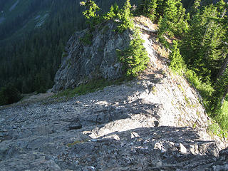 McClellan Butte Standard Scramble 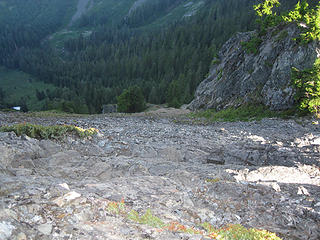 Nervous Yes! 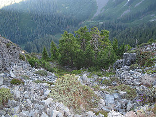 Topped out last years scramble here. 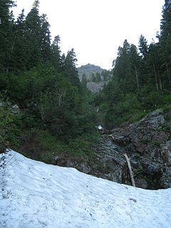 Started last years snow climb here. 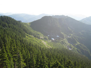 Minor point 4084 feet? 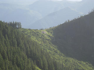 Last year we traversed over to this small saddle to descend. 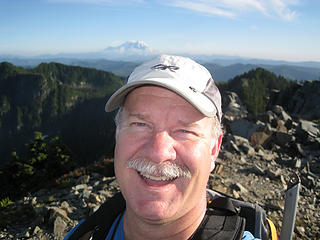 Your Hero 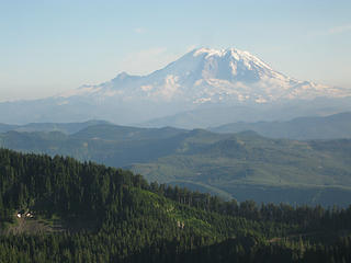 Mt. Rainier 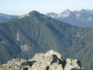 Mt. Defiance 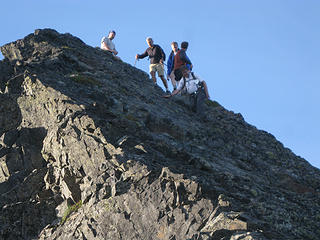 TNAB Descending 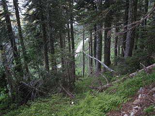 Looking down on a logging road below the trail on the southeast side of McClellan Butte.
|
| Back to top |

|
|
Magellan
Brutally Handsome

Joined: 26 Jul 2006
Posts: 13116 | TRs | Pics
Location: Inexorable descent |
|
Magellan
Brutally Handsome
|
Wed Jul 22, 2009 12:08 am |
|
|
There are so many trip reports that I totally missed this one.
Embarassing to admit that this was my first TNAB this year. Work  !!
Anywho, it was comfy warm on top. We sang for Tisha's birthday, and welcomed a lot of newcomers, including Braveheart. In a Scottish accent he proclaimed it perfect kilt weather. Tuna wraps, Kettle chips, and cookies made a perfect feast. That did not keep us from gathering at the Pour House for Cheesy Tots, and ping pong. !!
Anywho, it was comfy warm on top. We sang for Tisha's birthday, and welcomed a lot of newcomers, including Braveheart. In a Scottish accent he proclaimed it perfect kilt weather. Tuna wraps, Kettle chips, and cookies made a perfect feast. That did not keep us from gathering at the Pour House for Cheesy Tots, and ping pong. 
|
| Back to top |
|
|
|
|
You cannot post new topics in this forum
You cannot reply to topics in this forum
You cannot edit your posts in this forum
You cannot delete your posts in this forum
You cannot vote in polls in this forum
|
Disclosure: As an Amazon Associate NWHikers.net earns from qualifying purchases when you use our link(s). |


