| Previous :: Next Topic |
| Author |
Message |
Elvis
Shuffl'n

Joined: 09 Jun 2004
Posts: 1804 | TRs | Pics
Location: del Boca Vista |
|
Elvis
Shuffl'n
|
 Sat Aug 08, 2009 11:58 pm |
|
|
Left the house this morning (solo) with about six different destinations in mind.
Ended up doing 1.5 of them.
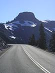
First trail of the day was the Iron Goat Trail from Wellington to the Windy Point Tunnel. This section was about 8 miles, round trip, with very little elevation gain/loss.
Warning: Too Many Photos (yes, really, too many, I'm sure of it).
Somewhere along the line a couple years ago, Marylou recommended the book The White Cascade by Gary Krist. It was a great book and was the reason I had to come visit Wellington.
To reach Wellington, as you head west on Hwy 2 from Stevens Pass, take the first right. Follow the road and then the sign to Wellington. It's about 3 miles from Hwy 2 and the road is 'decent' for any vehicle (except a skateboard).
For those that don't know, Wellington used to be a railroad town that supported trains crossing over the pass and is also the location of a notorious avalanche (the nations deadliest, according to the book) that wiped out numerous buildings as well as two trains. One of the trains was a passenger train, loaded with passengers, that had been stranded at Wellington for days due to weather.
This trail has an abundance of informative signs along the way, which are provided at the bottom of the photos in case you want to try and read them online.
Despite the grim history and the ominous snowshed, the greenery was beautiful and it was really very interesting to 'hike' in this Land Of the Lost type of environment. Fascinating to watch Nature take back what former generations have left.
At the beginning of the trail you enter a very long snowshed.
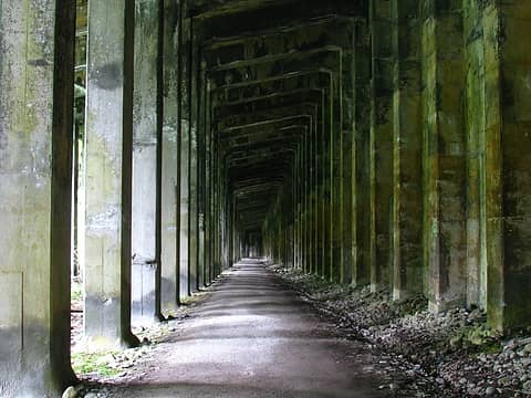 More Snowshed 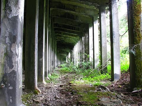 Outer lane of snowshed 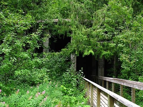 Snowshed Entrance from Wellington Toward Windy Point 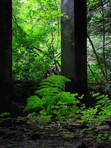 Fern inside snowshed 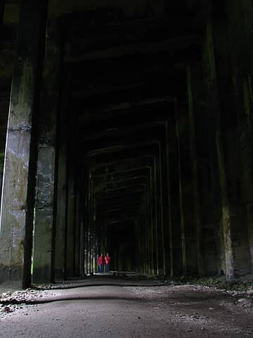 Hikers in snowshed help to show scale 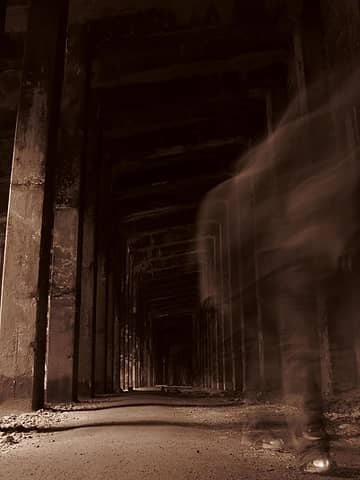 Snowshed ghost ;~) 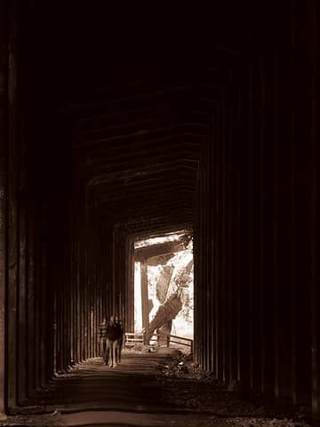 Hikers in snowshed for scale in front of collapse 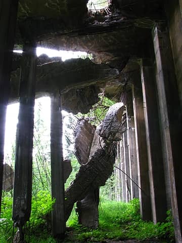 Collapsing Snow Shed 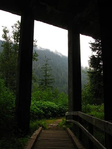 Exiting Snowshed on way to Windy Point Tunnel 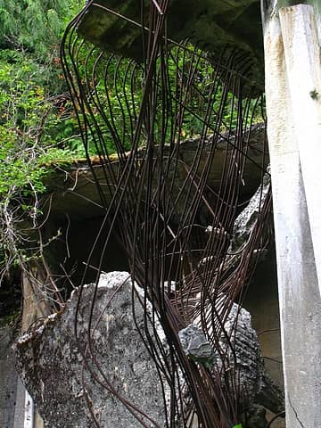 Rebar & Concrete dangling from snowshed roof 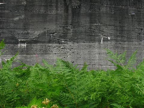 Snowshed back wall with greenery 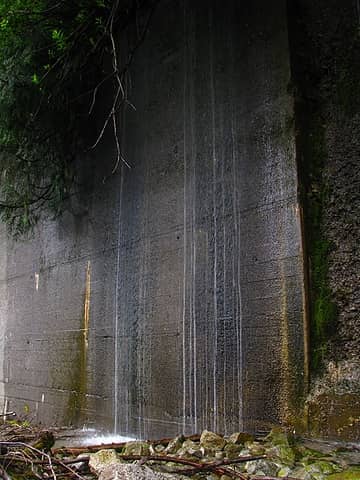 Waterfall Wall 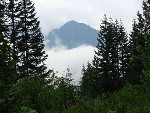 Trail View 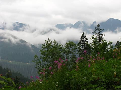 More View 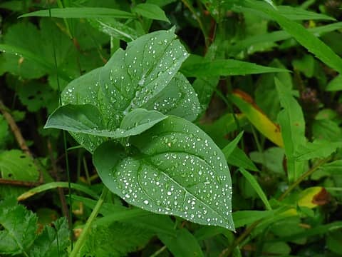 Water on Leaf 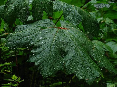 Water on Club 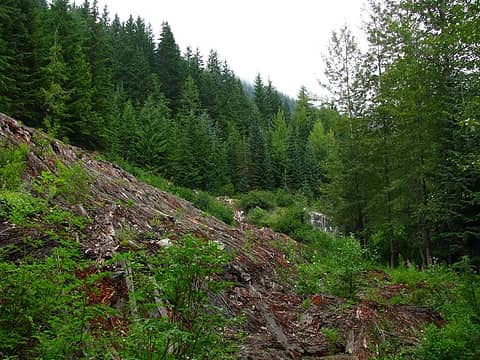 Collapsed Wooden Snow Shed 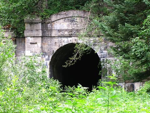 Closed Tunnel (flash flood danger) 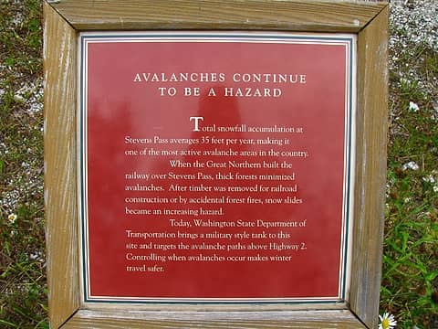 Trail Signage 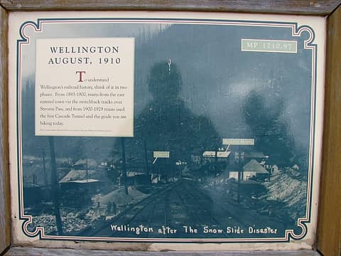 Trail Signage 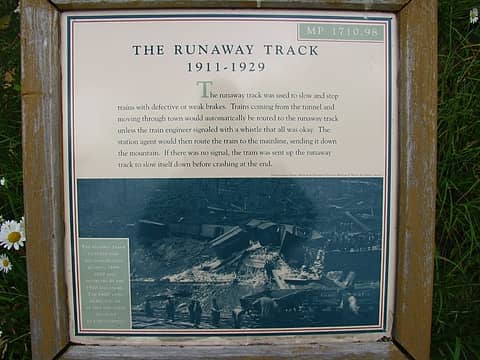 Trail Signage 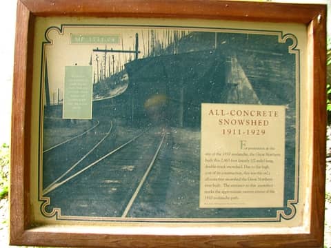 Trail Signage  Trail Signage 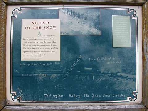 Trail Signage 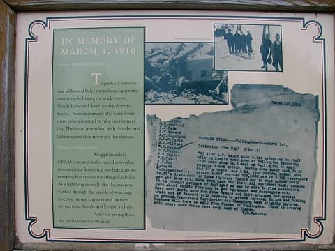 Trail Signage 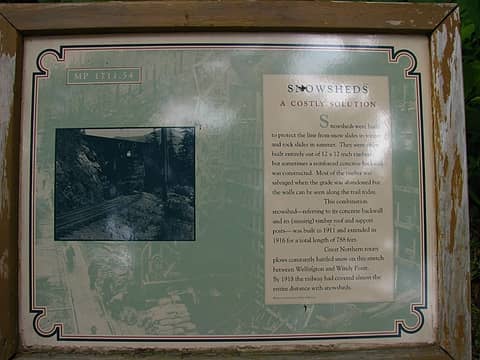 Trail Signage  Trail Signage 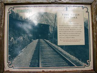 Trail Signage 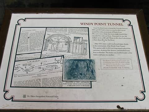 Trail Signage 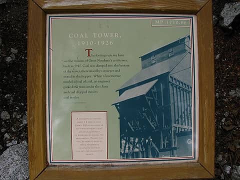 Trail Signage 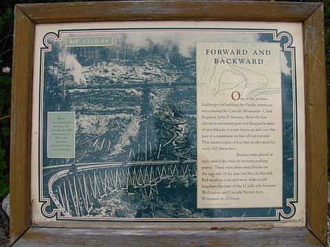 Trail Signage 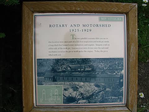 Trail Signage 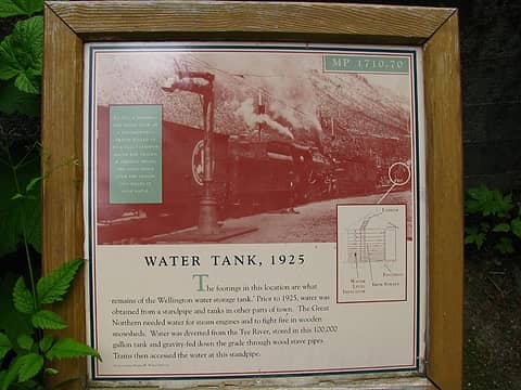 Trail Signage 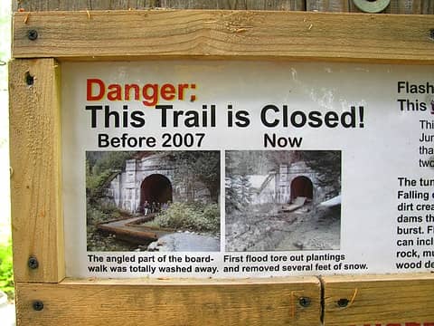 Trail Warning 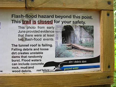 Trail Warning 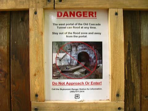 Trail Signage 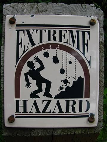 Trail Warning
"Ill habits gather unseen degrees, as brooks make rivers, rivers run to seas." ~John Dryden
My Trip List
"Ill habits gather unseen degrees, as brooks make rivers, rivers run to seas." ~John Dryden
My Trip List
|
| Back to top |
  
|
|
Kim Brown
Member

Joined: 13 Jul 2009
Posts: 6899 | TRs | Pics
|
Hey, Elv, I've always wondered what Wellington was like. I wanted to go last fall, but I wanted to read the book first. I never got around to checking the book out at the library, so put it off.
There's still time for me to get to the book this summer and to Wellington this fall. So you say that's a pretty good book, hey? I've heard from several people that it is.
"..living on the east side of the Sierra world be ideal - except for harsher winters and the chance of apocalyptic fires burning the whole area."
Bosterson, NWHiker's marketing expert
"..living on the east side of the Sierra world be ideal - except for harsher winters and the chance of apocalyptic fires burning the whole area."
Bosterson, NWHiker's marketing expert
|
| Back to top |
|
|
Elvis
Shuffl'n
Joined: 09 Jun 2004
Posts: 1804 | TRs | Pics
Location: del Boca Vista |
|
Elvis
Shuffl'n
|
Sun Aug 09, 2009 10:34 pm |
|
|
Kim_B, it is a fantastic book.
Thumbs up from start to finish.
If you want to make a day of it I would suggest starting down at the bottom, using the crossover trail to Windy Point then go to Wellington & back. That way you have the ~700 foot gain up front then an easy, barely noticable incline for 4 miles before turning around.
But... I've heard there is cool stuff to see west of Windy Point tunnel also that I haven't been to yet.
A moist, but not wet, fall day would be perfect.
~E
"Ill habits gather unseen degrees, as brooks make rivers, rivers run to seas." ~John Dryden
My Trip List
"Ill habits gather unseen degrees, as brooks make rivers, rivers run to seas." ~John Dryden
My Trip List
|
| Back to top |
|
|
puzzlr
Mid Fork Rocks

Joined: 13 Feb 2007
Posts: 7220 | TRs | Pics
Location: Stuck in the middle |
|
puzzlr
Mid Fork Rocks
|
Mon Aug 10, 2009 1:43 am |
|
|
Thanks for the sign pictures -- interesting reading. I'd like to go sometime.
|
| Back to top |
|
|
|
|
You cannot post new topics in this forum
You cannot reply to topics in this forum
You cannot edit your posts in this forum
You cannot delete your posts in this forum
You cannot vote in polls in this forum
|
Disclosure: As an Amazon Associate NWHikers.net earns from qualifying purchases when you use our link(s). |


