| Previous :: Next Topic |
| Author |
Message |
Dayhike Mike
Bad MFKer

Joined: 02 Mar 2003
Posts: 10958 | TRs | Pics
Location: Going to Tukwila |
Preamble:
Lime Ridge is a place I've been looking at on the map for almost a decade now. A string of lakes nestled high on a ridgeline, just a stone's throw away from Glacier Peak. How could you go wrong with a location like that? It had to be nice.
Unfortunately, access was diminished when the flooding back in 2003 wiped out bridges over Milk Creek and the Suiattle River. And additional flooding in 2004 and 2006 wiped out enough of the road to make even getting to a trailhead a 12 mile one-way trip.
After the initial flooding, I figured that I'd wait until the Forest Service replaced the bridges...why ford a swiftly flowing river if you don't have to, right? After many many years of delays and foot dragging by the Forest Service, I finally realized that government bureacracy was working on geologic time and I might be dead before they get around to making their intended repairs. Better off doing it sooner, rather than later.
Getting There:
So Tom and I headed out early Tuesday morning, ready to conquer the high route along Lime Ridge.
We finally arrived at the end of the road around 10:45. Unloaded the bikes, pulled on the boots, and finished loading our packs. The ride up the valley went relatively quickly. Roughly 2 hours after leaving the cars, we arrived at the Suiattle River Trailhead.
The next step involved finding a way across the Suiattle. This took a bit more time than anticipated. Nothing looked good near the old bridge site...everything was too swift, too deep. We found a place a little farther down the river where the river fanned out and split into three separate channels. A few hesitations, a few false starts, and we ended up making it across to the sandy shores on the far side.
From there, we continued on up the valley, bushwhacking our way to the old Milk Creek trail and then following the overgrown trail to the first creek crossing and the old Pipeline trail. After filtering some water, we headed on up. The trailbed was in pretty decent shape...faint in places, but well defined where it mattered. It doesn't mess around, heading steeply straight up the hillside.
Unfortunately, a few hundred feet up the hillside, there were a few sections of blowdown and we completely lost the trail. Tom searched right, I searched left, but there was just nothing. We probably should have spent more time looking for it, but we were in a hurry. The extra time spent figuring out the river crossing had put us way behind schedule and we were racing the daylight and trying to get up the hillside as quickly as possible.
In spite of this setback, we continued on up the steep duffy hillsides. Incredibly steep, but we made good time. We dodged right, then back to the left, and then as luck would have it we hit upon a bit of a bench at 3500 feet and...
"Trail!"
Light was fading fast and we really didn't want to risk losing the faint track again, so we decided to call it a day.
The Traverse:
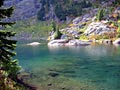
The next morning, we made short work of the trail on up and quickly reached the meadows and creek at 4700'. Twenty minutes (and many berries) later we were basking in the sun and enjoying the largest of the Box Mountain Lakes. The most striking thing to me was the number of social trails around the lakes...this place had been pretty well loved to death...and the fact that pretty much all of those trails were now covered in moss, delicate tendrils of heather, and/or lush ground cover.
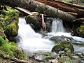
From here we worked our way around the left side of the lake, and up the waterfall coming out of the upper lake. Swam and enjoyed a few backcountry pizzas in the scenic company of the upper lake, and then continued on up a steep creek / gully to reach the large unnamed lake underneath Lime Mountain, then Rivord, and finally on to camp at Upper Twin Lake.
The next morning, we headed on down the trail, working up and over the ridgeline to get a few good views of Glacier and reach Milk Lakes. Enjoyed the beautiful color on the lower lake before continuing on the picturesque trail to a tarn for lunch again. Worked our way over the ridgeline and descended the blueberry filled hillsides to Lime Lake. Swam, fished, and took more pictures before heading on up the ridgeline and continuing on toward Mica Lake.
From this point, the nature of the route takes on a very different tack. Up to this point, our route had been relatively well defined -- steep and overgrown in places, but a nice trail for the most part. From the ridgeline above Lime Lake to Mica Lake, there is only the occasional cairn, infrequent boot wear, and natural benches to guide the way. Steep talus, loose rocks, a little exposed sidehilling, and one hard snowfield later, we were looking down at Mica Lake.
Looking down at the lake, already in the shadows, we decided it might be nicer to camp high on Fire Creek Pass. So we filled up our water bottles at a tarn and then traversed across steep, exposed mud, heather, and cliffbands to reach the PCT and rise on up to the pass. From there, we enjoyed a glorious sunset and great views of the surrounding peaks as clouds moved in and enshrouded the hillsides beneath us.
Getting Home Again:
The next morning, we headed up point 6914' to get great views of Glacier Peak and the melted out lake underneath the Milk Lake Glacier. Enjoyed the sunny views and descended back to camp to pack up and head out for the long walk home. Dropped to Mica Lake and were amazed by the absolutely beautiful blues there before beginning our final descent down the million switchbacks on the f-ing stupid PCT.
Near the bottom, we found the trail work that Iron had mentioned in his trip report and were kinda overwhelmed by some of the horrible decisions made in the trail routing. Amazing numbers of trees were completely undercut, massive supporting root structures completely slashed and discarded. This trail building may have been in response to a washed out trail elsewhere, but the new one doesn't look much more secure in the wet, muddy hillside, and I don't imagine it'll be long before the trees they mangled either die and/or are blown over and lie across the new trail.
Once we reached the bottom of the valley, we crossed the Milk Creek on the new bridge, and headed down the valley. The Milk Creek trail has been unmaintained for the last six years. To say that it was overgrown is a vast understatement. Sections of it are sheltered by deep forest, and in those sections the worst one needs to deal with are the multitude of blowdowns, but the head-high brush, thorny vines, nettles, and devil's club were beyond anything I'd ever expected to encounter. In a few sections, we needed to retrace our steps to make sure we were still on trailbed and try to figure out where it'd gone and why it'd gone there.
In any case, we made relatively good time, racing through the 6 miles of valley trail in roughly 4 hours, and made it back to the crossing of the Suiattle River at 7pm. We were thankful to be across the river as the sun's light faded away and pulled on our headlamps for the last mile of hiking and then the 12 mile bikeride out.
All in all a great adventure. The only real "tragedy" was that I forgot my camera at home. (Suffice it to say that I'm looking forward to seeing Tom's pictures almost as much as you are.)
"There is only one basic human right, the right to do as you damn well please. And with it comes the only basic human duty, the duty to take the consequences." -P.J. O'Rourke
"Ignorance is natural. Stupidity takes commitment." -Solomon Short
"There is only one basic human right, the right to do as you damn well please. And with it comes the only basic human duty, the duty to take the consequences." -P.J. O'Rourke
"Ignorance is natural. Stupidity takes commitment." -Solomon Short
|
| Back to top |
  
|
|
Tom
Admin
Joined: 15 Dec 2001
Posts: 17851 | TRs | Pics
|
|
Tom
Admin
|
 Mon Sep 28, 2009 8:50 pm |
|
|
Day 1:
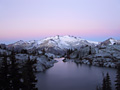
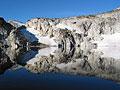
 Taking a picture break along the 12 mile bike ride 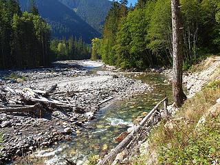 Suiattle River From Road 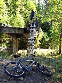 Mike Above Ladder at Downey Bridge Washout 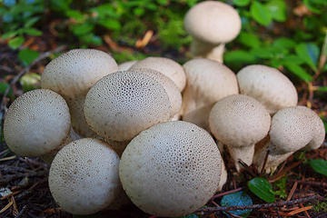 Trail Mushrooms 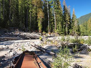 Remnants of Former Bridge over Suiattle 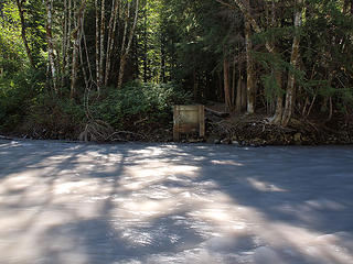 Former Bridge Crossing Over Suiattle 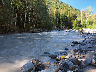 Swift and Deep - I Don't Think We'll Be Crossing Here! 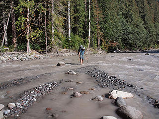 Mike Crossing Suiattle on Relatively Calm and Shallow Side of Isthmus 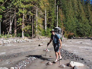 Flip Flop Mike  Morning Sun - Did We Get Nuked Last Night?  ???  Arriving at Meadows Below Box Lakes  Outlet Tarn Below Lower Box Lake  Lower Box Lake Outlet 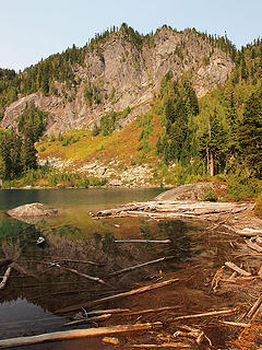 Lower Box Lake Outlet Area 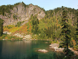 Lower Box Lake 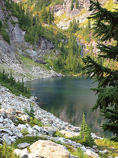 Outlet Waterfall from Upper Box Lake into Lower Box Lake 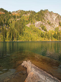 Lower Box Lake from SE Shoreline 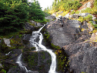 Mike Free Climbing Waterfall Slabs to Upper Box Lake 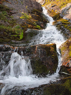 Waterfall Outlet from Upper Box Lake 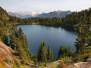 Lower Box Lake from Top of Waterfall 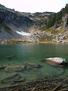 Arriving at Upper Box Lake 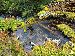 Upper Box Lake Outlet 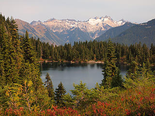 Lower Box Lake and Dome Peak 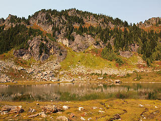 Fall Colors at Upper Box Lake 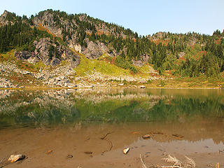 Shallow Upper Box Lake 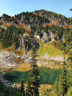 Rising Above Upper Box Lake 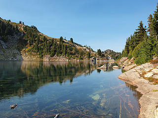 Upper Rivord from Outlet Area 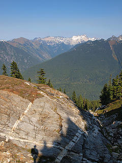 Shadows Falling on Upper Rivord Outfall 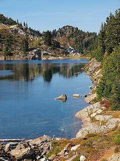 Leaving Upper Rivord Lake 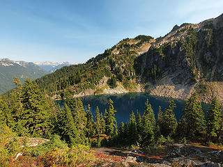 First Views of Lower Rivord Lake 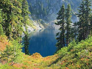 Descending to Lower Rivord Lake 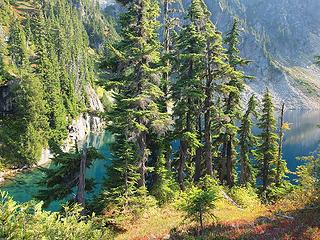 Lower Rivord Lake  Fall Colors at Lower Rivord Lake 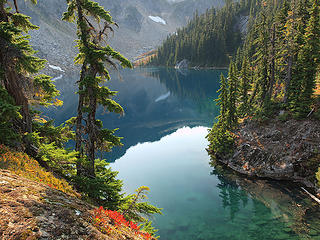 Lower Rivord Lake from Outlet Area 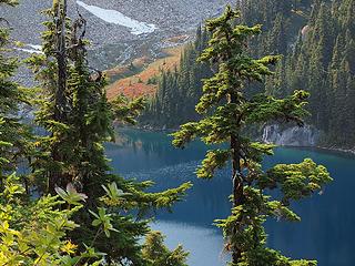 Rising Above Lower Rivord Lake 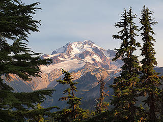 First Views of Glacier Peak 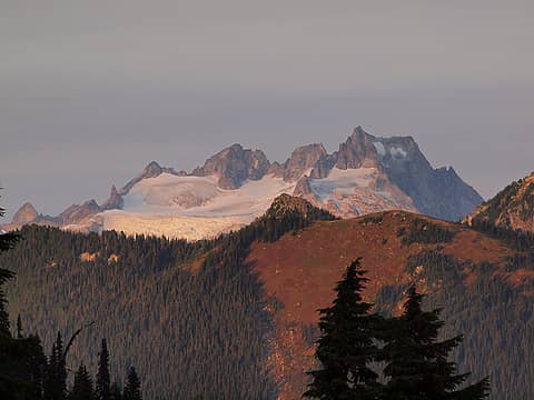 Dome from Upper Twin Lake 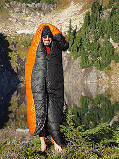 Dayhike Smurf at Upper Twin 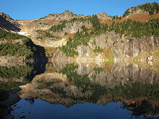 Morning at Upper Twin 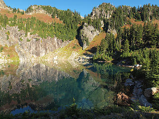 Beautiful Upper Twin Lake 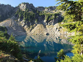 Southern End Of Upper Twin Lake 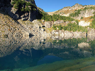 Upper Twin Lake from South 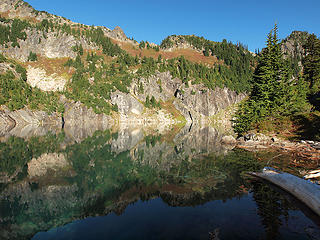 Upper Twin Lake from Outlet Area 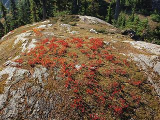 Fall Color at Upper Twin Lake 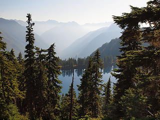 Lower Twin from Upper Twin 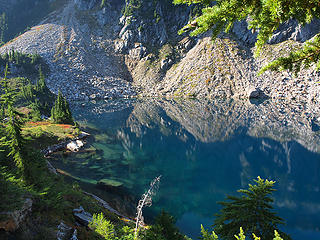 South End of Upper Twin Lake 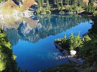 Reflections in Upper Twin 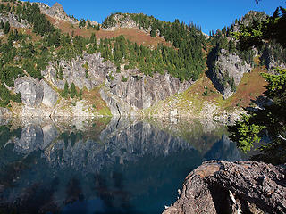 Morning Shadows on Upper Twin 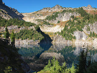 Upper Twin Lake 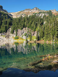 Lower Twin Lake 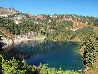 Rising Above Lower Twin Lake 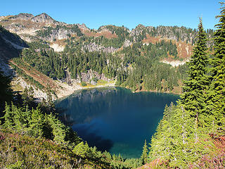 Lower Twin Lake from Ridge 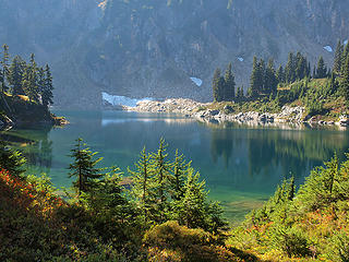 Arriving at Lower Milk Lake 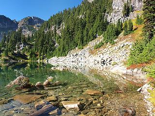 Northern End of Lower Milk 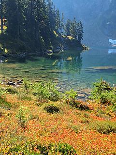 Fall Color at Lower Milk Lake 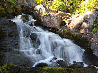 Lower Milk Lake Outlet 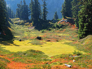 Milk Meadows 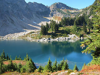 Lower Milk Lake from NE 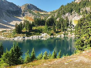 Lower Milk Lake 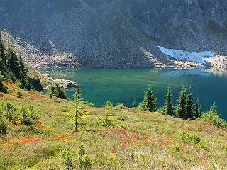 Shallow Southern End of Lower Milk Lake 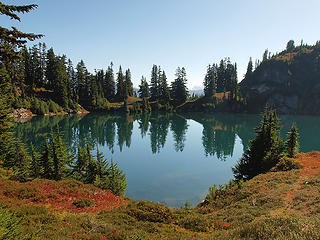 Upper Milk Lake 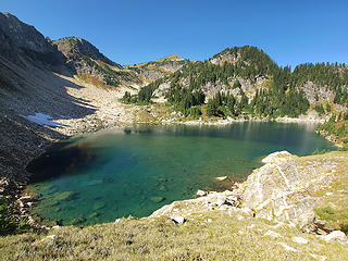 Rising Above Lower Milk Lake 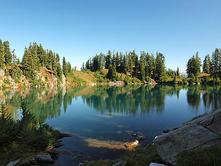 Upper Milk Lake from Outlet 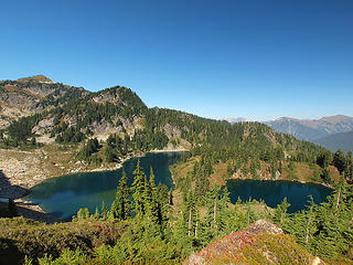 Looking Back to Milk Lakes 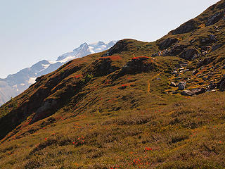 Glacier Peak from Lime Ridge 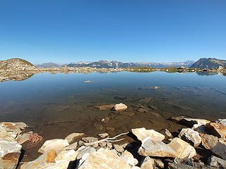 Tarn North of Lime Lake 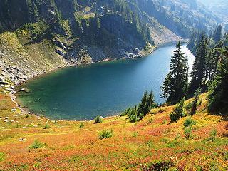 Descending to Lime Lake 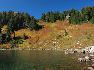 Mike Preparing to Swim at Lime Lake 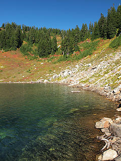 Lime Lake Shoreline 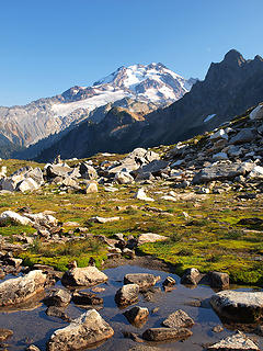 Glacier Peak from Lime Traverse to Mica 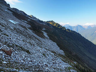 Looking Back to Traverse from Lime to Mica 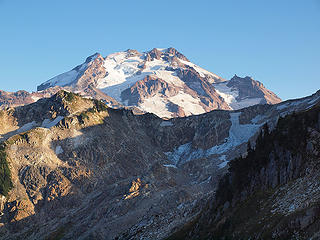 Glacier Peak Rising Above Point 6698' 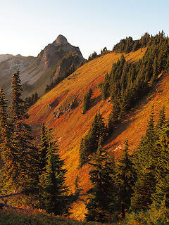 Looking North from Fire Creek Pass 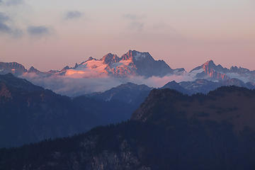 Dome from Camp Above Fire Creek Pass 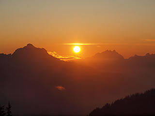 Sun Setting Between Pugh and Three Fingers from Camp 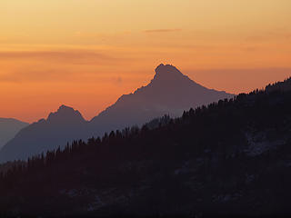 White Chuck at Sunset from Camp 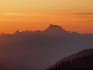 Whitehorse at Sunset from Camp 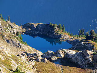 Mica Lake from Camp Above Fire Creek Pass 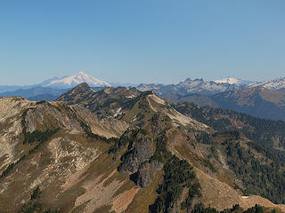 Baker, Chaval, and Shuksan from Point 6914' (Fire Mountain and Lime Ridge In Foreground) 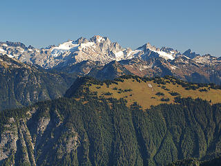 Dome, Sinister, Gunsight, Agnes, and Grassy Point from Point 6914' 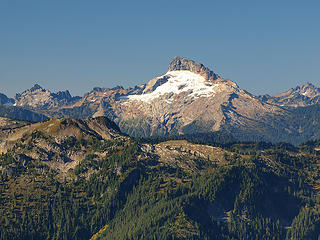 Cadet, Sloan, and Bedal from Point 6914' 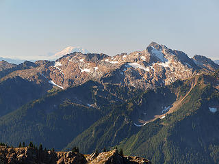 Ranier and Black Mountain from Point 6914' 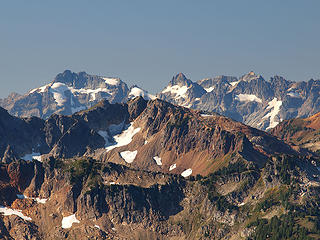 Kyes, Monte Cristo, Columbia, and Cadet from Point 6914' 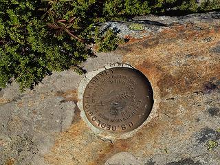 Marker on Point 6914' 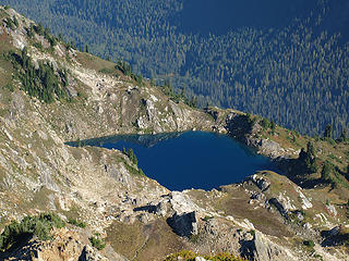 Mica Lake from Point 6914' 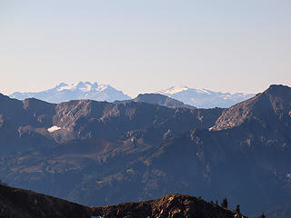 Daniel and Hinman from Point 6914' 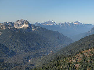 Pugh, Three Fingers, and Whitehorse from Point 6914' 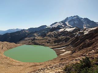 Former Milk Lake Glacier and Glacier Peak 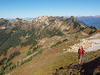 Descending Back to Camp (Fire Creek Pass and Fire Mountain in Background) 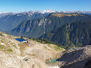 Mica Lake, Glacial Tarn, and Views East from Camp Above Fire Creek Pass 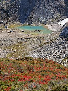 Fall Color and Glacial Tarn Below Fire Creek Pass 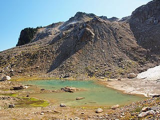 Arriving at Glacial Tarn 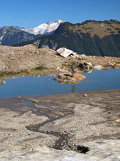 Dayhike Mike at Glacial Tarn 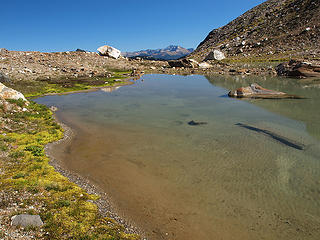 Leaving Glacial Tarn 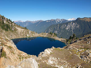 Descending to Mica Lake 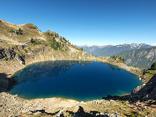 Approaching Mica Lake 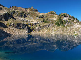 Mica Blue 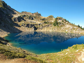 Mica Lake from PCT  East Shoreline of Mica Lake 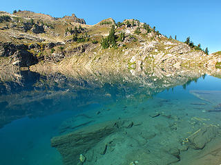 Mica Lake 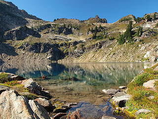 Mica Lake from Outlet 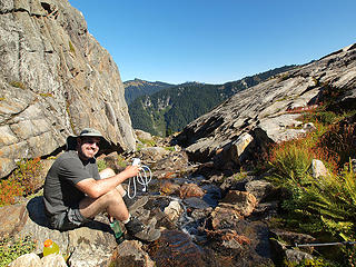 Dayhike-a-Mica Filtering 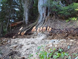 The new and improved PCT - built to last! 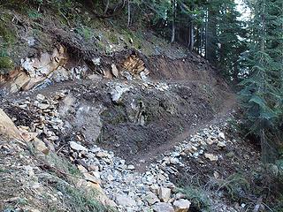 A thru hiker suffering from Stockholm Syndrome let us know the 5% grade switchbacks of the PCT were needed to "reduce erosion" 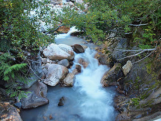 Milk Creek from New PCT Bridge 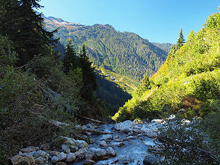 Looking Back To Southern End of Lime Ridge (from PCT Milk Creek Bridge) 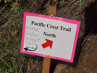 Roman Soldier Helmet Trail? 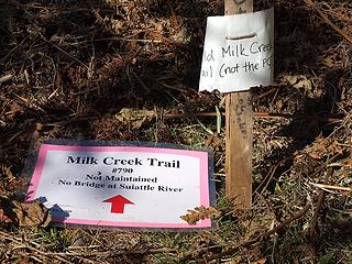 Not the PCT? Thank Heavens! 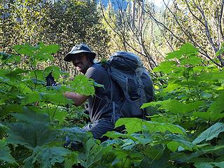 Into the Void 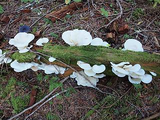 White Fungus Along Milk Creek Trail 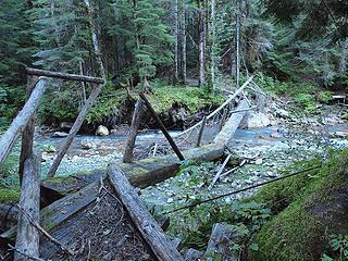 Bridge Over Milk Creek 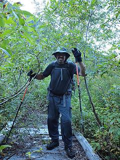 I Think We're On Trail Again! 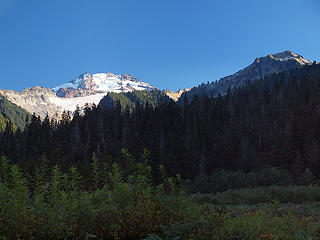 Glacier Peak from Roman Soldier Helmet Trail 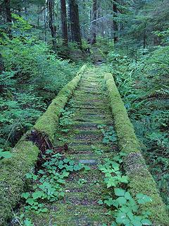 Milk Creek Trail Puncheon 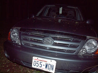 I guess some special folks get to drive the 12 miles of closed road - WTF?!? 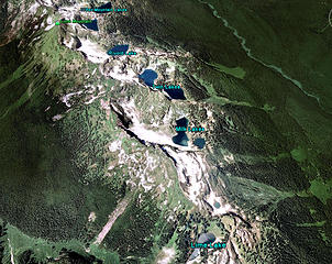 Lime Ridge per Google Earth 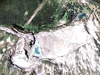 Next time check Google Earth for unmapped lakes before leaving, doh!!!
 zimmertr zimmertr
zimmertr |
| Back to top |
|
|
JimK
Member

Joined: 07 Feb 2002
Posts: 5606 | TRs | Pics
Location: Ballard |
|
JimK
Member
|
Mon Sep 28, 2009 9:04 pm |
|
|
Kim is going to hate you. That's a trip I very much want to do.
|
| Back to top |
|
|
Magellan
Brutally Handsome

Joined: 26 Jul 2006
Posts: 13116 | TRs | Pics
Location: Inexorable descent |
|
Magellan
Brutally Handsome
|
Mon Sep 28, 2009 9:19 pm |
|
|
I have seen a few awesome reports from you guys, but I will say it right now. This is the best one ever. Gorgeous lakes, incredible weather, and just enough bushwacking to be fun, what more could a fella want?
I was introduced to the concept of unmapped lakes from Fire Mt, right in your neighborhood.
A couple of questions: Since I thought it was impossible to drive down the closed portion, how did it happen? Was the car parked at Downey Bridge? Are people going to hunt down this 'law-breaker' of a person via license plate?
|
| Back to top |
|
|
naturealbeing
Member

Joined: 05 Dec 2004
Posts: 1565 | TRs | Pics
Location: Great Mystery |
Way to exploit an area that's seldom visited. Tom's pictures are way more beautiful than I ever imagined that area to be. Nicely done guys!
Before the bridges were discombooberated I was planning a trip in there, but needless to say Mother Nature rearranged the furniture before I could get it done. Now you two have rekindled the fire big time!
Thanks for lifting the veil of mystery and sharing the wealth of visionary dreams.
|
| Back to top |
|
|
Tom
Admin
Joined: 15 Dec 2001
Posts: 17851 | TRs | Pics
|
|
Tom
Admin
|
Mon Sep 28, 2009 9:30 pm |
|
|
The road is perfectly drivable to Downey (10 miles from the road closed sign) if you have a vehicle with any sort of clearance. On the way back I noticed the "road closed" sign does indicate in small print an exception for vehicles with a permit. Personally I think this is bullsh##. I did call in the license plate to the Darrington Ranger Station but nobody returned my call. Official vehicle or not, I was tempted to let the air out of their tires. That way they'd have to walk the extra miles like everyone else. 
|
| Back to top |
|
|
Malachai Constant
Member

Joined: 13 Jan 2002
Posts: 16092 | TRs | Pics
Location: Back Again Like A Bad Penny |
"You do not laugh when you look at the mountains, or when you look at the sea." Lafcadio Hearn
|
| Back to top |
|
|
chiwakum
not credible

Joined: 29 Jun 2009
Posts: 980 | TRs | Pics
Location: Ballard |
|
chiwakum
not credible
|
Mon Sep 28, 2009 10:05 pm |
|
|
| Tom wrote: | | The road is perfectly drivable to Downey (10 miles from the road closed sign) if you have a vehicle with any sort of clearance. On the way back I noticed the "road closed" sign does indicate in small print an exception for vehicles with a permit. Personally I think this is bullsh##. I did call in the license plate to the Darrington Ranger Station but nobody returned my call. Official vehicle or not, I was tempted to let the air out of their tires. That way they'd have to walk the extra miles like everyone else. |
I'm confident more washouts will occur in the near future to eliminate the annoyance of vehicles making it up that road.
Great TR and pics.
I think I'll try to work this one in next year as a hike/bike. The trips you have to work a little harder for always seem more satisfying in the end.
|
| Back to top |
|
|
Sadie's Driver
Sadie's Driver

Joined: 24 Apr 2006
Posts: 1763 | TRs | Pics
Location: Welcome Pass |
Tom/DHM -
Absolutely gorgeous! Thank you, thank you. s.d.
Four-paw buddy lets me tag along!
Four-paw buddy lets me tag along!
|
| Back to top |
|
|
Matt
Tea, Earl Grey, Hot

Joined: 30 Jan 2007
Posts: 4307 | TRs | Pics
Location: Shoreline |
|
Matt
Tea, Earl Grey, Hot
|
Mon Sep 28, 2009 10:32 pm |
|
|
I hate you also, but only in the most positive kind of way.
I've been wanting to do that trip for years.
Of course, lots of people have been saying they want to go to Lime Ridge, but you guys went ahead and got it done.
Nice job on the route-finding.
Beautiful photos also. The lakes look wonderful.
As beacons mountains burned at evening. J.R.R. Tolkien
As beacons mountains burned at evening. J.R.R. Tolkien
|
| Back to top |
|
|
iron
Member

Joined: 10 Aug 2008
Posts: 6392 | TRs | Pics
Location: southeast kootenays |
|
iron
Member
|
Mon Sep 28, 2009 10:34 pm |
|
|
holy sh*t!
DHM: i agree with your assessment on the trail work. they really butchered the roots of a ton of trees and the slope stability is questionable at best. maintaining the PCT standard grade... sure, but what's the point if it washes out all the time and looks like the ugly switchbacks on the north side of the suiattle???
|
| Back to top |
|
|
jenjen
Moderatrix

Joined: 30 Jun 2003
Posts: 7617 | TRs | Pics
Location: Sierra stylin |
|
jenjen
Moderatrix
|
Mon Sep 28, 2009 10:39 pm |
|
|
 Someone described the Pipeline as a mudslick created by falling hikers. Sounds like that's still a good description.
If life gives you melons - you might be dyslexic
If life gives you melons - you might be dyslexic
|
| Back to top |
|
|
hikapath
Member
Joined: 13 Apr 2009
Posts: 44 | TRs | Pics
Location: Lochsloy |
|
hikapath
Member
|
Mon Sep 28, 2009 11:05 pm |
|
|
The upper lake below Lime Mountain is Upper Rivord lake--there are two Rivord lakes--Upper and lower
|
| Back to top |
|
|
Tom
Admin
Joined: 15 Dec 2001
Posts: 17851 | TRs | Pics
|
|
Tom
Admin
|
Tue Sep 29, 2009 12:10 am |
|
|
Without exception, the trails I'm happy to hike on to get to the high country were flagged by competent navigators. 
|
| Back to top |
|
|
DIYSteve
seeking hygge

Joined: 06 Mar 2007
Posts: 12655 | TRs | Pics
Location: here now |
|
DIYSteve
seeking hygge
|
Tue Sep 29, 2009 7:47 am |
|
|
Excellent
|
| Back to top |
|
|
|
|
You cannot post new topics in this forum
You cannot reply to topics in this forum
You cannot edit your posts in this forum
You cannot delete your posts in this forum
You cannot vote in polls in this forum
|
Disclosure: As an Amazon Associate NWHikers.net earns from qualifying purchases when you use our link(s). |


 . It looks like it has pretty much reverted to the way it was when we first went there. I guess you cannot get there to sleep on Friday night when leaving after work
  Are there still remnants of tread between the lakes? I remember not being able to sleep next to Twin Lakes for the fish jumping.