| Previous :: Next Topic |
| Author |
Message |
Matt
Tea, Earl Grey, Hot


Joined: 30 Jan 2007
Posts: 4307 | TRs | Pics
Location: Shoreline |
|
Matt
Tea, Earl Grey, Hot
|
 Fri Feb 26, 2010 2:07 am |
|
|
Date: February 20-21
Destination: Stetattle Ridge, Sourdough Mtn (NCNP)
Party: Matt, GeoTom, Schmidt AltiBabe, Yukon222, Yana
Five of us decided to camp overnight high up on Stetattle Ridge.
The results confirmed that Stetattle Ridge is perhaps the premier view ridge for the North Cascades, with its broad crest providing panoramic views that just keep getting higher and better the farther you go.
And when you can camp high on such a ridge on a clear windless night and spend hours watching the sunset and sunrise light up the surrounding peaks, its difficult to get any better.
Background on Stetattle Ridge
Feel free to bypass this section if you just want to skip ahead to the pretty pictures.
First lets clarify some nomenclature.
To get Stetattle Ridge, you start out on the Sourdough Mountain Lookout trail. But the trail is NOT on Sourdough Mountain, and it does NOT go to Sourdoughs summit. The trail begins on Stetattle Ridge, and only later traverses over to Sourdoughs lookout, which is not on the summit. So theres no reason to go to Sourdough. Instead, continue up Stetattle Ridge, which runs much further and higher than Sourdough anyway.
Now lets look at some topography, and a daunting lesson in cumulative elevation gain.
The trailhead is at 890 feet. Circa 1150 feet, youll pass a sign that says youll be safe from flooding if Ross Dam collapses. Circa 4100 feet, near the Park Boundary marker, the trail turns to head for Sourdough, but going off trail uphill a steep couple hundred feet puts one on the crest of Stetattle Ridge. From there its an easy ridge run to the only challenging spot, a narrow dip in the ridge at 5700. Then its more easy ridge walking to Lake 5916, which is also the junction between Stetattle & Sourdough peaks. (If you want Sourdoughs summit (6107), its only half a mile away and 200 feet higher from here.)
From here, Stetattle ridge continues another 4.5 miles onward, with no less than ten marked elevation points on the map. Was it some surveyors graduation project, or what?
In between every high point are multiple lower points, so the cumulative elevation gain adds up rapidly. But its such a seductive easy rolling crest, that each point just tempts one onward to the next, with views getting better at every step.
The most noteworthy points along the way are:
- Lake 5916 (junction between Stetattle & Sourdough), 5000 gain, 100 loss, 3.7 miles.
- Point 6010 (the first 360 degree viewpoint), gain 200, cumulative gain 5200. 4.0 miles.
- Point 6308 (best viewpoint for day hikes), gain 300, cumulative total 5500, 4.7 miles.
- Point 6495 (Stetattles south summit), lose 200, gain 400, cumulative total 5900, 5.5 miles.
- Point 6728 (Stetattles main summit), lose 660, gain 900, cumulative total 6800, 6.9 miles.
- Point 6154 (north end of the ridge), lose 800, gain 200, cumulative total 7000, 8.2 miles.
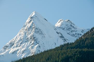
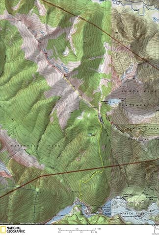 Stetattle Ridge Map  fencing dumped precisely on trailhead 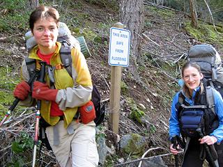 Safe From Flooding 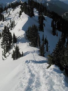 Tracks just before the narrow cut 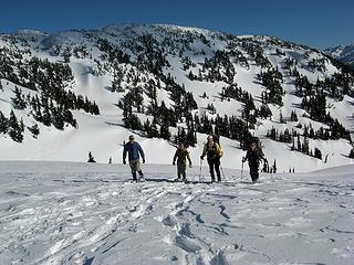 At the ridge junction, with Sourdough Mtn behind 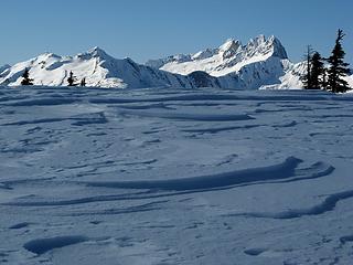 Shadow for break on Point 6010 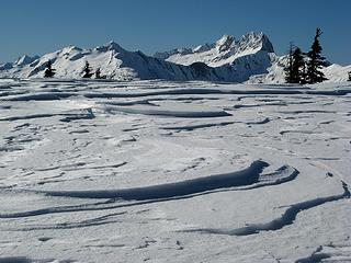 Sunlight for break on Point 6010 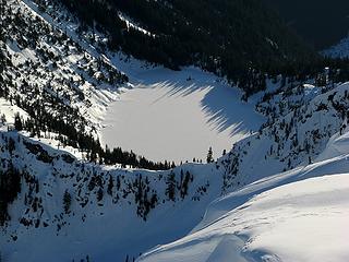 Sourdough Lake 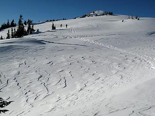 Ascending toward Point 6308 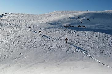 Ascending the side of one of the bumps 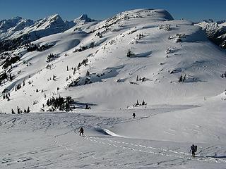 Near the 6308/6495 low point. 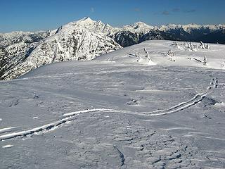 Looking east at Jack along the way 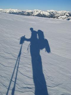 My shadow backpacking 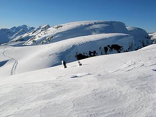 The last few rises (& cornices) 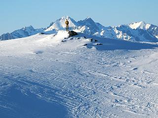 Yana conquers the summit 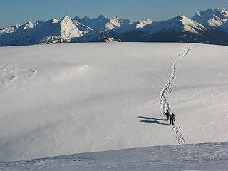 More of the party approaching Point 6495 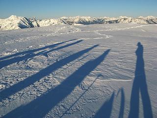 Everyones here now 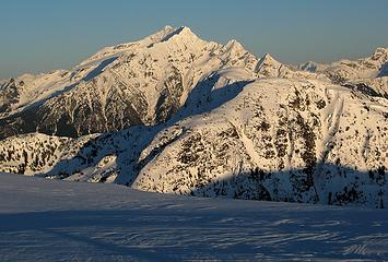 Late light on Jack & Crater 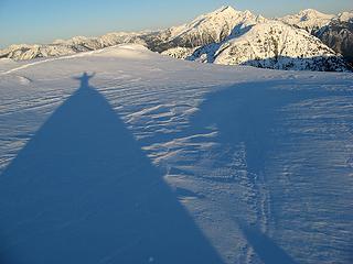 Does this shadow make my butt look too big? (Actually its my tents shadow) 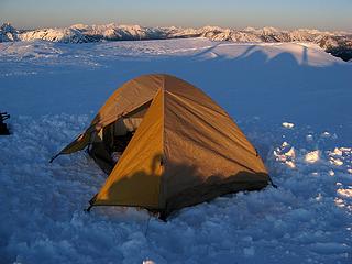 Shadows moving toward the edge 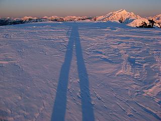 Long-legged sunset shadow 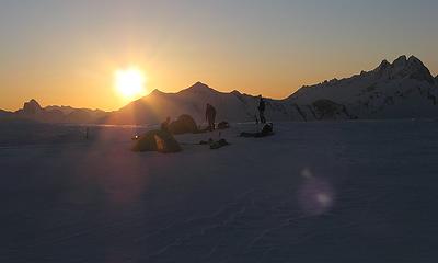 Looking west at our camp as sunset nears (with Triumph, Glee, & Pickets) 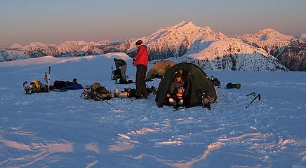 Looking east at our camp as sunset nears (with Jack & Crater) 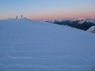 Watching the alpenglow develop 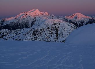 Alpenglow on Jack & Crater 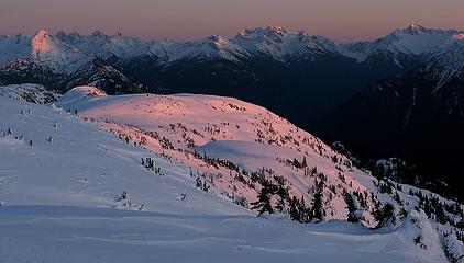 5 labels Alpenglow on our ridge, Ruby, Logan & Buckner 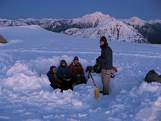 Evening in Fortress Radenska 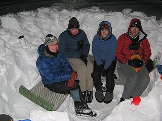 Night in Fortress Radenska  Sunrise band above the horizon 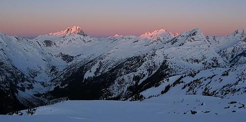 Sunrise touches the summits 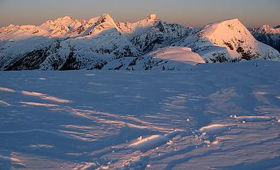 Sunrise descending down the peaks 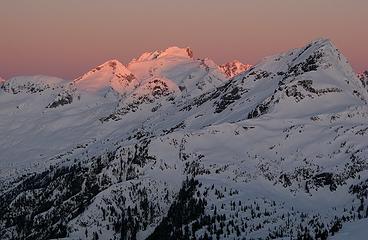 Fury glowing, Elephant Butte in shadow 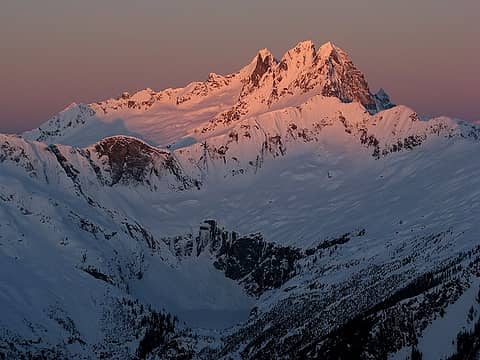 Pickets glowing, Azure Lake in shadow  Everyone out photographing the sunrise 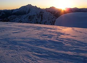 Sastrugi, Jack, Crater & Sol 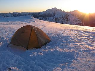 Sunrise hits our camp 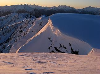 Alpenglow on the cornices below our camp 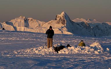 Fortress Radenska with Thornton & Triumph 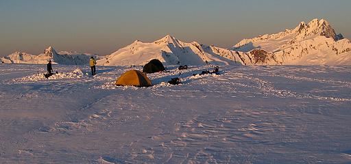 Camp, Triumph, Glee, & Pickets 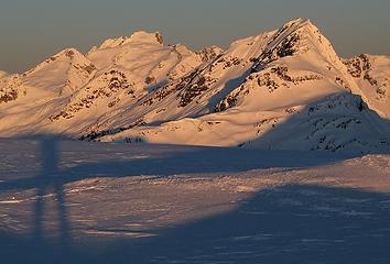 Full alpenglow on SE Fury, Fury, & Elephant 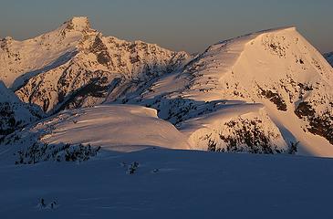 Full alpenglow on Luna & Stetattle Summit 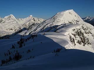 Elephant on the left and Stetattle summit on the right 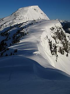 The path up to Point 6728 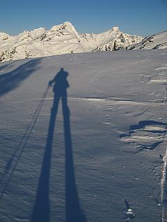 My shadow pointing toward my goal for the day 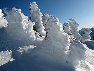 Rime near the top of Point 6728 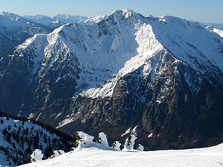 East Face of Davis Peak 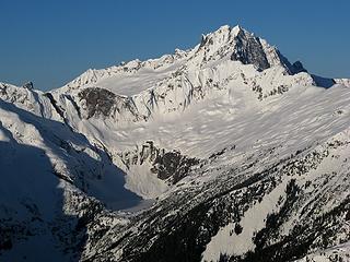 Azure Lake & Southern Pickets 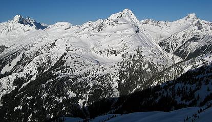 Southern Pickets, Elephant, & Luna 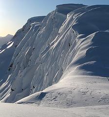 Fluting on the east face of Stetattle Ridge
As beacons mountains burned at evening. J.R.R. Tolkien
As beacons mountains burned at evening. J.R.R. Tolkien
|
| Back to top |
  
|
|
puzzlr
Mid Fork Rocks

Joined: 13 Feb 2007
Posts: 7220 | TRs | Pics
Location: Stuck in the middle |
|
puzzlr
Mid Fork Rocks
|
Fri Feb 26, 2010 2:34 am |
|
|
Over the top trip and TR as usual Matt! The return of AltiBabe!
|
| Back to top |
|
|
Tigerotor77W
Member

Joined: 16 May 2009
Posts: 776 | TRs | Pics
Location: Charleston, SC |
|
| Back to top |
|
|
DIYSteve
seeking hygge

Joined: 06 Mar 2007
Posts: 12655 | TRs | Pics
Location: here now |
|
DIYSteve
seeking hygge
|
Fri Feb 26, 2010 9:36 am |
|
|
Great TR and pics, Matt.  Looks like a fun party. Stetattle Ridge is indeed a special place, one of the few overnight trips that feels like being wayyyyyy back in there.
ETA: in late season, one can take the trail all the way to Sourdough Camp (just short of SD Creek) and ascend up vegetated class 1-2 terrain (one short step of class 3) to hit lower Steattle Ridge ENE of Jeanita Lake, then follow Matt's route N-ward from there. Looks like a fun party. Stetattle Ridge is indeed a special place, one of the few overnight trips that feels like being wayyyyyy back in there.
ETA: in late season, one can take the trail all the way to Sourdough Camp (just short of SD Creek) and ascend up vegetated class 1-2 terrain (one short step of class 3) to hit lower Steattle Ridge ENE of Jeanita Lake, then follow Matt's route N-ward from there.
|
| Back to top |
|
|
RokIzGud
Cozza Frenzy

Joined: 08 Feb 2010
Posts: 1049 | TRs | Pics
|
|
RokIzGud
Cozza Frenzy
|
Fri Feb 26, 2010 9:43 am |
|
|
Right on! Awesome pictures. Rime ice is the best!
|
| Back to top |
|
|
silence
Member

Joined: 25 Apr 2005
Posts: 4420 | TRs | Pics
|
|
silence
Member
|
Fri Feb 26, 2010 10:01 am |
|
|
nice photos matt .. love the b&w -- great job
PHOTOS
FILMS
Keep a good head and always carry a light bulb. Bob Dylan
PHOTOS
FILMS
Keep a good head and always carry a light bulb. Bob Dylan
|
| Back to top |
|
|
yukon222
Member

Joined: 12 Mar 2007
Posts: 1893 | TRs | Pics
|
|
yukon222
Member
|
Fri Feb 26, 2010 10:25 am |
|
|
A very, very enjoyable trip. Nice to see the few peaks I've climbed in the area from this excellent vantage point.
 DSD_7710 - Pointy Pyramid Peak 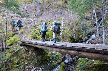 DSD_7713 - Moving quickly (still early morning and packs feel somewhat light) 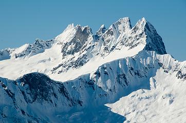 DSD_7742 - Magical McMillian Spires 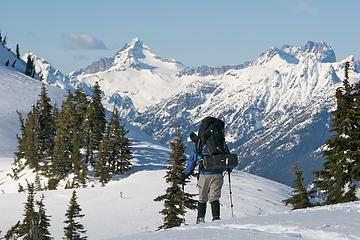 2 labels DSD_7767 - Many pauses to gaze at the views 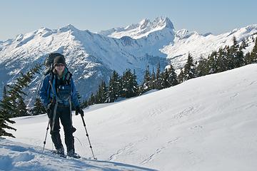 DSD_7770 - Easy to smile with warm sunshine and commanding views in all directions 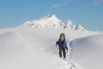 DSD_7774 - AltiBabe turns her back on Jack Mtn. For now. :-) 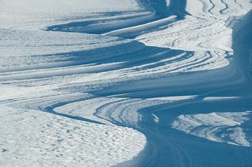 DSD_7784 - Sastrugi swirls 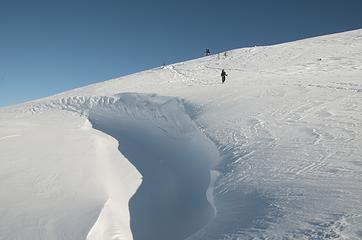 DSD_7786 - Tiny people approach giant wind carved snow channel 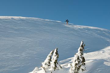 DSD_7801 - Climb and climb some more... 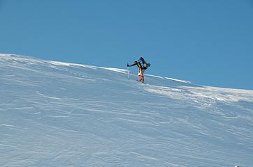 DSD_7803 - ... just a little bit further to camp and see... 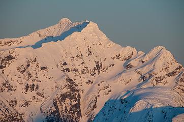 DSD_7806 - ... ah, alpenglow on Jack Mountain 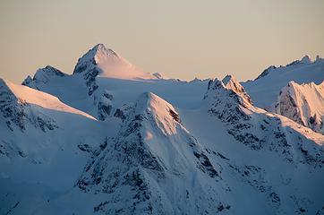 DSD_7807 - the Snowfield group beds down for the night 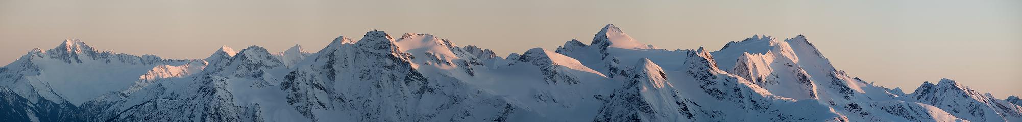 Pano_DSD_7815 - Snowfield and friends 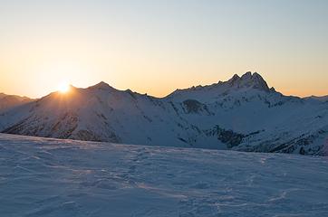 DSD_7816 - Last of the direct sunlight 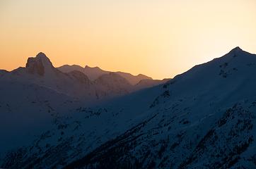 DSD_7820 - Reward in views for the long ascent with winter packs 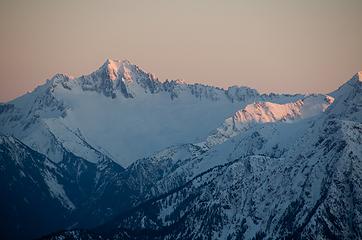 DSD_7824 - Ripsaw Ridge 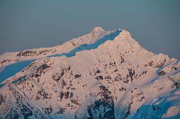 DSD_7827 - Jack Mountain fading from view 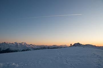 DSD_7829 - "I'd rather be winter camping at 6500' than in the plane overhead." 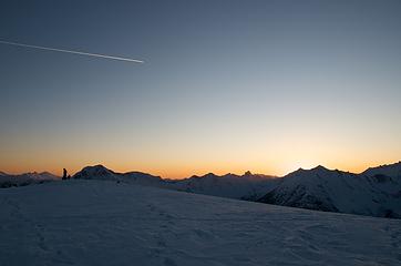 DSD_7830 - Plane races to catch the setting sun 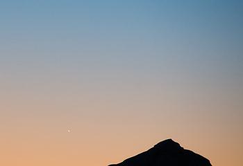 1 label DSD_7833 - Fleeting view of Mercury 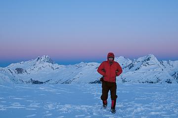 DSD_7836 - Matt is pleased with Nature's show 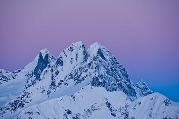 DSD_7837 - pre dawn colors and McMillian Spires 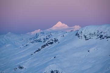 DSD_7843 - tip touching the light 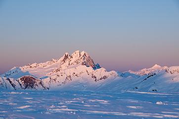 DSD_7850 - worth every frozen finger tip 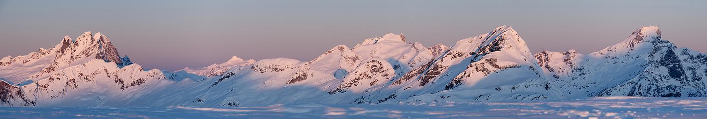 5 labels Pano_DSD_7851 - McMillian to Luna 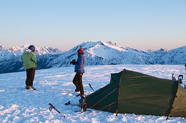 DSD_7858 - camping at the top of the world (well, not quite!) 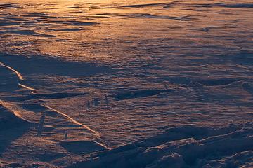 DSD_7862 - By dawn's early light 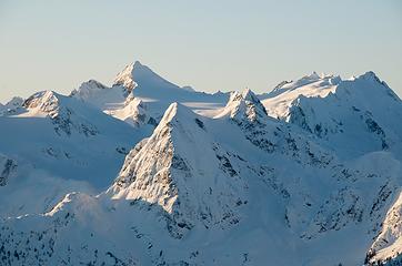 DSD_7874 - Snowfield, Pyramid and Pinnacle 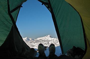 Stetattle Ridge 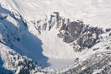 DSD_7892 - Azure Lake hidden until late summer 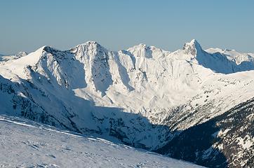 DSD_7894 - so many places to go, so little time 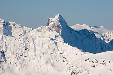 DSD_7895 - Tasty Triumph (and Bacon Peak behind) 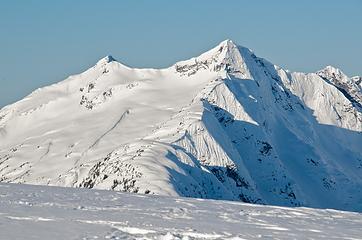 DSD_7897 - Glee(fully) enjoying the dawn 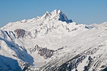 DSD_7903 - Azure Lake basin beneath McMillian Spires 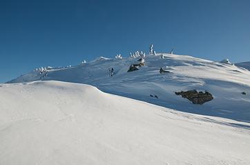 DSD_7905 - untouched beauty 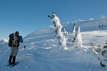 DSD_7909 - So much scenery creates endless photo ops 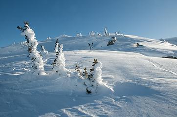 DSD_7911 - tempting to just sit down and soak in the snowscape 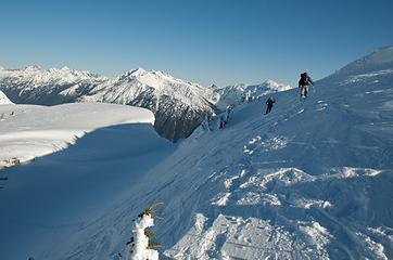 DSD_7913 - edging our way across the face 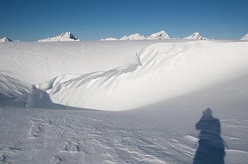 DSD_7914 - wind carving its' way thru the ridge 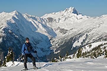 DSD_7922 - AltiBabe and McMillian Spires 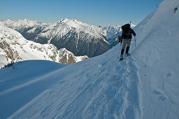 DSD_7928 - Traversing beneath another steep ridgeline 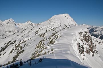 DSD_7938 - Always nice to see the route to your summit 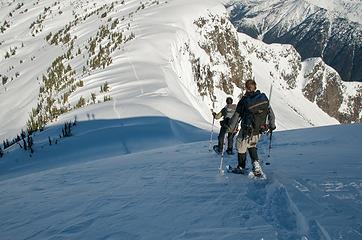 DSD_7940 - Lots of rollercoaster ups and downs as we roamed the ridgeline 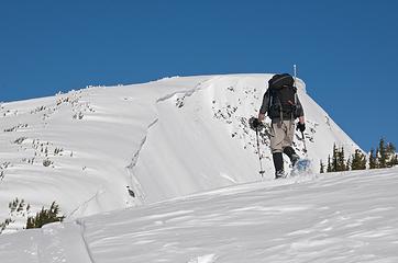 DSD_7943 - Heading for North Stetattle 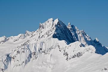 DSD_7948 - Darkness comes early to part of the McMillian Spires 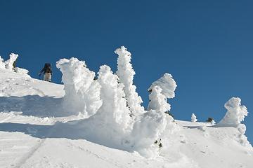 DSD_7954 - Heavy winter coating 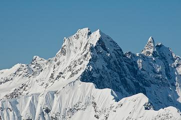 DSD_7960 - Not many ways thru these mountains 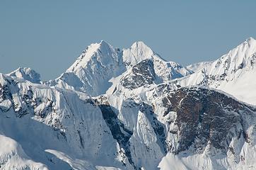 DSD_7961 - Despair but certainly none today 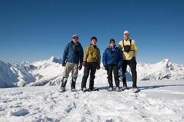 DSD_7978 - North Stetattle Ridge summit 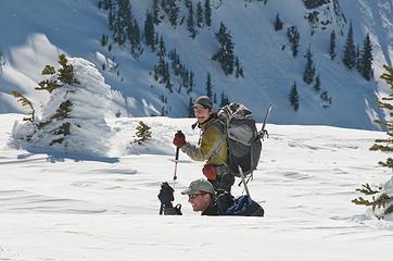 DSD_7986 - Yana enjoys GeoTom's sudden descent 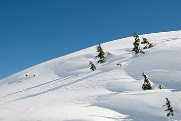 DSD_7998 - Moon peeks over Stetattle Ridge 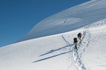 DSD_8008 - Fortunately, a way around the barrier by going hard right  Pano_DSD_8011 - Mammoth ridge and Tiny Tom 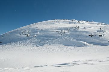 DSD_8014 - another bump in the ridge 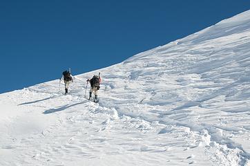 DSD_8017 - Climb back to camp 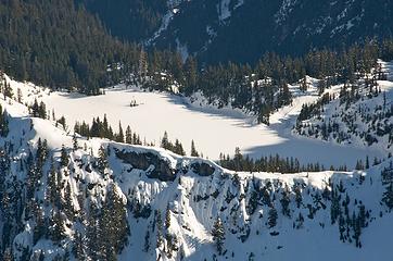 DSD_8024 - Sleeping Sourdough Lake 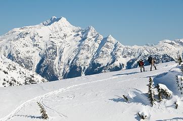 DSD_8028 - Jogging past Jack Mtn 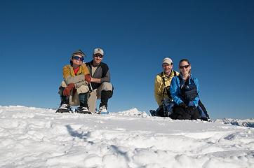 DSD_8032 - Sourdough Mountain summiteers
|
| Back to top |
|
|
RichP
Member

Joined: 13 Jul 2006
Posts: 5633 | TRs | Pics
Location: here |
|
RichP
Member
|
Fri Feb 26, 2010 11:08 am |
|
|
This must be the best winter ever for spectacular trips. Too bad I chose to be away this year  . .
|
| Back to top |
|
|
BarbE
Member

Joined: 28 Jul 2006
Posts: 1153 | TRs | Pics
|
|
BarbE
Member
|
Fri Feb 26, 2010 12:41 pm |
|
|
Awesome scenery and pictures!
Impressive elevation gain.
|
| Back to top |
|
|
Obi Tony Kenobi
Waterfall Crazy!

Joined: 25 Jun 2007
Posts: 1899 | TRs | Pics
Location: Marysville, WA |
Wow that is beautiful. I may need to get myself to try this winter backpacking stuff! Great job you guys!
|
| Back to top |
|
|
Hikingqueen
Member

Joined: 12 Nov 2007
Posts: 2946 | TRs | Pics
|
Looks pretty Epic! 
|
| Back to top |
|
|
Jim Dockery
Member

Joined: 12 Sep 2007
Posts: 3092 | TRs | Pics
Location: Lake Stevens |
Great shots, after Josh's TR I was thinking I had to get up there, now it's confirmed. I just wish the pics were bigger to see detail on those incredible mountains!
|
| Back to top |
|
|
DIYSteve
seeking hygge
Joined: 06 Mar 2007
Posts: 12655 | TRs | Pics
Location: here now |
|
DIYSteve
seeking hygge
|
Fri Feb 26, 2010 5:11 pm |
|
|
Jim, I've been up there late season -- it's one of my favorite overnights in the NC's* -- and I've long intended to do an early spring tour up there. The access route is pretty much deadass S aspect, but pretty densely treed. A couple weeks of warm spring weather should bring it into ski shape, though one should be prepared for some tree bomb action and grunt ski carry up the trail to 4000' or higher. Once on the ridge, there are oodles of ski run opportunities. The camping opportunities up there are endless.
*I forebore from posting a TR, lest I might popularize the place. But now the word is out.  ETA: Jason Hummel just demonstrated that one need not wait until spring for a ski tour up there.
|
| Back to top |
|
|
yukon222
Member
Joined: 12 Mar 2007
Posts: 1893 | TRs | Pics
|
|
yukon222
Member
|
Fri Feb 26, 2010 5:25 pm |
|
|
| Jim Dockery wrote: | | Great shots, after Josh's TR I was thinking I had to get up there, now it's confirmed. I just wish the pics were bigger to see detail on those incredible mountains! |
Jim - Sorry about that. I had been in my Flickr settings a few days ago and adjusted the wrong thing. Should be able to see the larger size versions now.
|
| Back to top |
|
|
GeoTom
Member

Joined: 19 May 2005
Posts: 3215 | TRs | Pics
Location: Earth |
|
GeoTom
Member
|
Fri Feb 26, 2010 7:10 pm |
|
|
Thanks for organizing a good trip Matt. I even got to use sunscreen over the weekend.
My full flickr photo set
Here are a few:
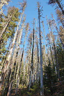 Tall trees along the Sourdough trail 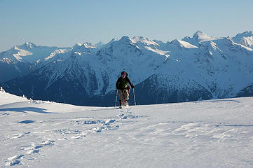 Matt arrives in camp 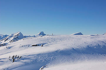 Yana looks for tent sites 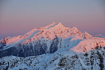 Alpenglow Jack 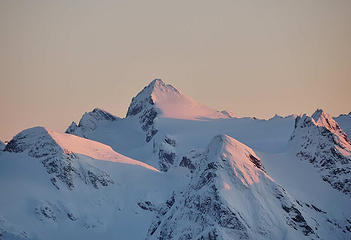 Snowfield Peak above the Neve Glacier 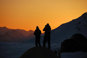 Tisha and Steve capturing the moment 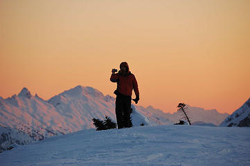 Matt takes another photo 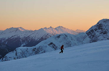 Matt hurries to take photos 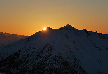 Goodbye Sun! 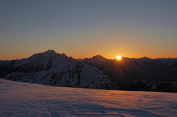 Welcome back Sun 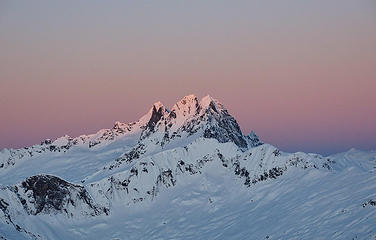 McMillan morning 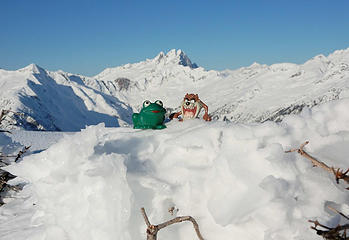 Soapy & Tazz bag Pt. 6,495 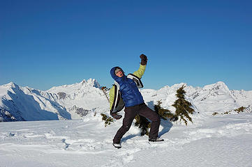 YanaKing on Point 6,495 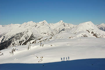 Shadowy figures in the foreground 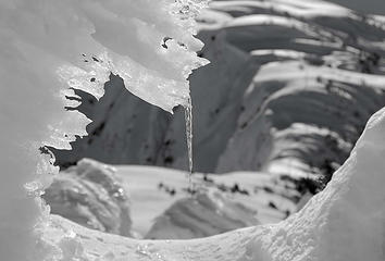 Icicle 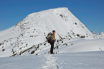 Yana pauses below Point 6,728 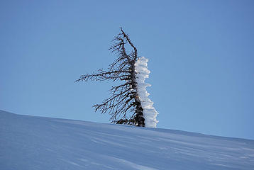 Small tree and ice 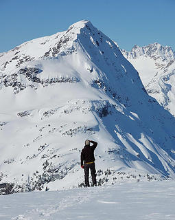 Yana looks for Matt 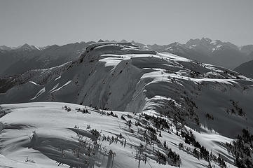 Stetattle in Black & White 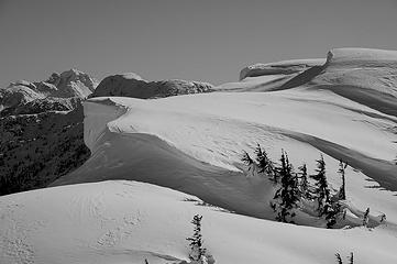 Snow shapes 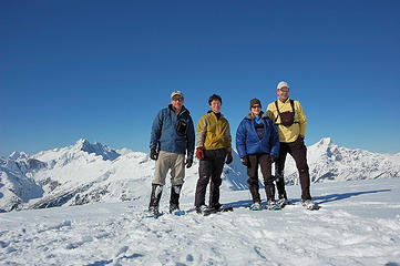 The Stetattle Four 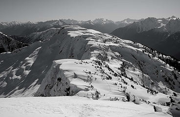 Stetattle Ridge in Black and White (again) 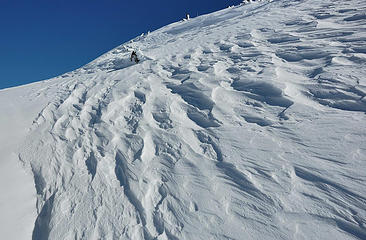 More sastrugi on Stetattle 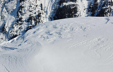 Contour lines 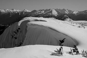 A little fluting 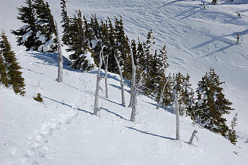 A flock of snags 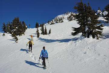 Heading up Sourdough Mountain 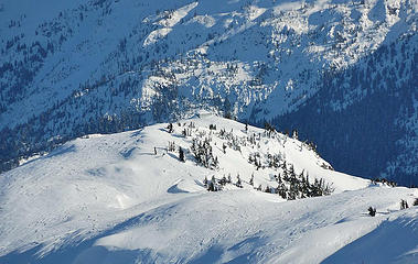 The Sourdough Mountain Lookout 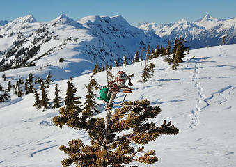 Soapy and Tazz bag a summit tree on Sourdough Mountain  Tisha on Sourdough with Stetattle Ridge behind 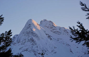 Pyramid and Pinnacle Mountains in early evening light
|
| Back to top |
|
|
|
|
You cannot post new topics in this forum
You cannot reply to topics in this forum
You cannot edit your posts in this forum
You cannot delete your posts in this forum
You cannot vote in polls in this forum
|
Disclosure: As an Amazon Associate NWHikers.net earns from qualifying purchases when you use our link(s). |


