| Previous :: Next Topic |
| Author |
Message |
Flora
Enjoying the Sun!


Joined: 25 Mar 2007
Posts: 1035 | TRs | Pics
Location: Land of many waters |
|
Flora
Enjoying the Sun!
|
 Sun May 16, 2010 3:56 pm |
|
|
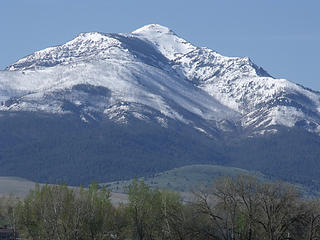 Strawberry Mountain - This 9,000 foot peak looms up above the headwaters of the John Day River, near Prairie City, OR 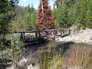 Bridge on the beginning of the North Fork John Day River Trail that penetrates into the wilderness area for 23 miles. 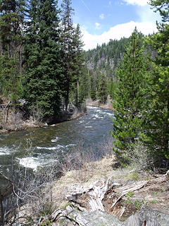 North Fork John Day River Trail follows the river for 23 miles through a wilderness area. 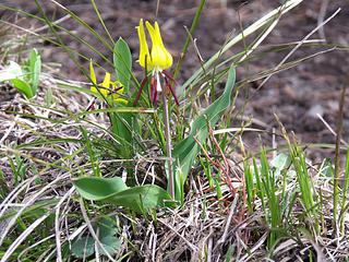 Glacier Lilies on the N. Fork John Day River Trail 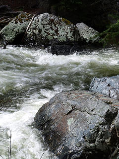 The chilly waters of the North Fork start in the mountains above Granite, OR and join the John Day River near Dayville, OR 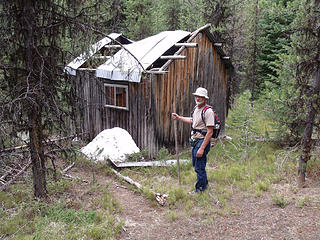 The North Fork John Day River country was an active mining area in the 1800's. There are still mining claims in the Umatilla National Forest that are still being worked. 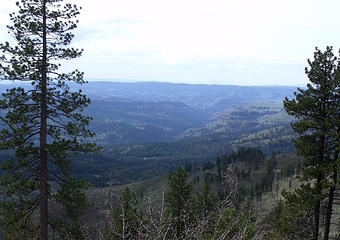 Deep drainage canyons and rugged country of the North Fork John Day River 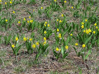 Glacier Lilies blooming in May, the Southern Blue Mountains, near Ukiah, OR, off the Blue Mountain Scenic Byway, Road 52, Umatilla National Forest. 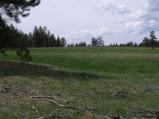 Meadow filled with Blue-Eyed Grass on the Blue Mountain Scenic Byway, Road 52, above Ukiah, OR 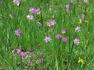 One of the first spring wildflowers to bloom after snow melt, Blue-Eyed Grass favors damp meadows. 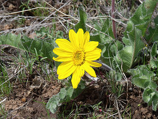 Carey's Balsamroot brightens the stony meadows of the Blue Mountains near Ukiah, OR
|
| Back to top |
  
|
|
Quark
Niece of Alvy Moore

Joined: 15 May 2003
Posts: 14152 | TRs | Pics
|
|
Quark
Niece of Alvy Moore
|
Mon May 17, 2010 8:19 pm |
|
|
Flora -
What a great report and pictures. Thanks, lady...
Love the field of blue flowers at Ukiah...
"...Other than that, the post was more or less accurate."
Bernardo, NW Hikers' Bureau Chief of Reporting
"...Other than that, the post was more or less accurate."
Bernardo, NW Hikers' Bureau Chief of Reporting
|
| Back to top |
|
|
Flora
Enjoying the Sun!
Joined: 25 Mar 2007
Posts: 1035 | TRs | Pics
Location: Land of many waters |
|
Flora
Enjoying the Sun!
|
Mon May 17, 2010 8:28 pm |
|
|
Thanks, Quark,
The best flower fields I saw were the huge meadows above Ukiah, near Drift Fence Campground, a primitive Forest Service CG on Road 52. As you can see, the Blue-eyed Grass was blooming vigorously in the damp meadow. And nearby, Desert Parsley and Carey's Balsamroot were decorating more rocky fields. Such sights are a little hard to capture on camera so I just took it in.
BTW, I think I saw a Mountain Peony just coming into bud above the trail on the North Fork. It sure looked like a small peony, with cut leaves. Very pretty plant. Here's a link for the fully developed plant:
http://www.siskiyous.edu/Shasta/env/flora/fp.htm
Great area to explore.
|
| Back to top |
|
|
Quark
Niece of Alvy Moore
Joined: 15 May 2003
Posts: 14152 | TRs | Pics
|
|
Quark
Niece of Alvy Moore
|
Mon May 17, 2010 8:34 pm |
|
|
I would like to take a long, long road trip next spring and visit this area. I've only driven around there once or twice, and didn't have much time to explore.
Seeing reports like this are the only time(s) I wish I were fairly wealthy or was able to endure an excrutiatingly boring job like at Boeing and had lots of vacation time on my hands to explore.
In short, Flora - you've ruined my evening and all my regrets are looming in front of me.
Thanks.
"...Other than that, the post was more or less accurate."
Bernardo, NW Hikers' Bureau Chief of Reporting
"...Other than that, the post was more or less accurate."
Bernardo, NW Hikers' Bureau Chief of Reporting
|
| Back to top |
|
|
Flora
Enjoying the Sun!
Joined: 25 Mar 2007
Posts: 1035 | TRs | Pics
Location: Land of many waters |
|
Flora
Enjoying the Sun!
|
Mon May 17, 2010 8:36 pm |
|
|
 Urr...I would rather be in John Day than working at my job!
|
| Back to top |
|
|
mike
Member
Joined: 09 Jul 2004
Posts: 6397 | TRs | Pics
Location: SJIsl |
|
mike
Member
|
Mon May 17, 2010 9:19 pm |
|
|
Check out the South Fk JDR sometime.
|
| Back to top |
|
|
Flora
Enjoying the Sun!
Joined: 25 Mar 2007
Posts: 1035 | TRs | Pics
Location: Land of many waters |
|
Flora
Enjoying the Sun!
|
Tue May 18, 2010 6:44 am |
|
|
Thanks, Mike.
I did look longingly up that valley leading away from Dayville and glanced at the map a time or two, but, alas, there wasn't enough time to explore this fork, too. Maybe later!
|
| Back to top |
|
|
|
|
You cannot post new topics in this forum
You cannot reply to topics in this forum
You cannot edit your posts in this forum
You cannot delete your posts in this forum
You cannot vote in polls in this forum
|
Disclosure: As an Amazon Associate NWHikers.net earns from qualifying purchases when you use our link(s). |


