| Previous :: Next Topic |
| Author |
Message |
daffish
Member


Joined: 16 Sep 2009
Posts: 282 | TRs | Pics
Location: Dreamtime |
|
daffish
Member
|
 Mon May 24, 2010 9:31 pm |
|
|
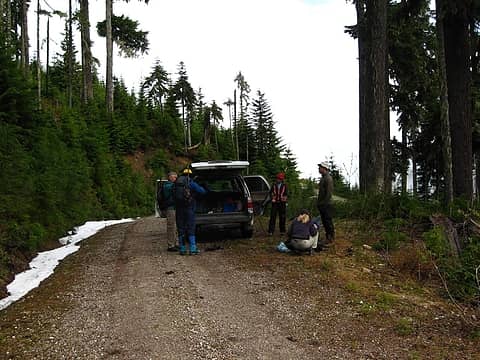
Hulksmash's recent reports of the new bridge over the Suiattle River and access to a newly built trail, piqued our interest into going up Road 2703 towards Circle Peak. The Forest Service was actually brushing out the roads in this whole area; a region that has been inaccessible since the major floods of 2003 took out the only bridge into the area. The road was in very good shape, but the last several miles were definitely 4 wheel drive territory. The roadbed itself has survived in wonderful condition, but the encroaching brush, lingering snowbanks, and one fairly rough stream crossing would not be friendly for a regular passenger car. We managed to drive just past the second switchback before solid snow forced us to park.
 It looks like we parked in the road, but we were very assured no other car would get this far. 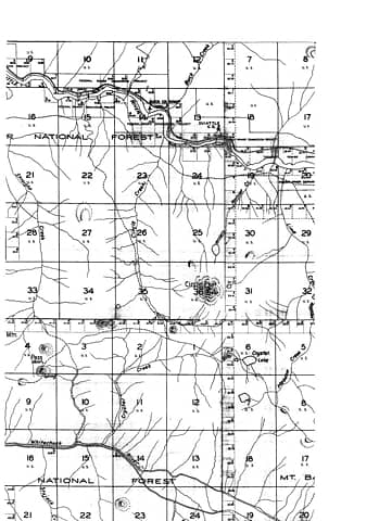 While not a Forest Service map, this does indicate that an old trail existed from the Circle Peak trail to Crystal Lake. 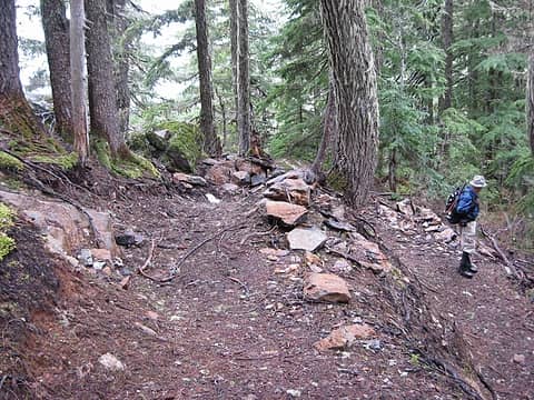 new trail switchbacking up the ridge 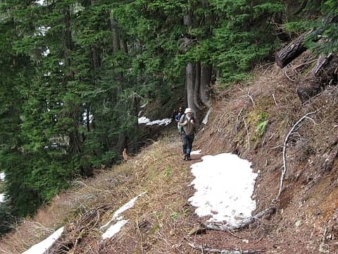 new trail 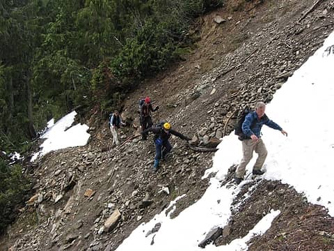 gully washout on new trail 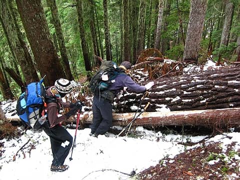 some trees are across the trail 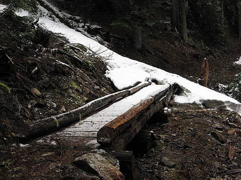 bridgeway 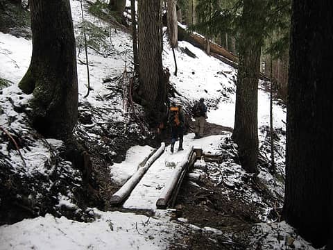 getting snowier as we approach the lake 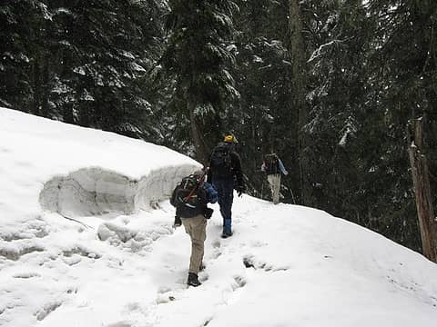 solid snow as we near the lake 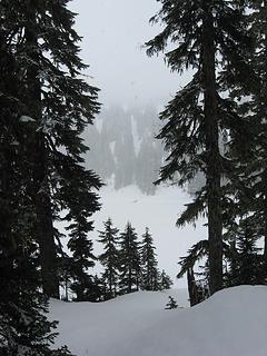 first glimpse of the lake 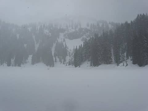 snowing at Crystal Lake 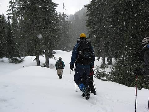 leaving with snowfall 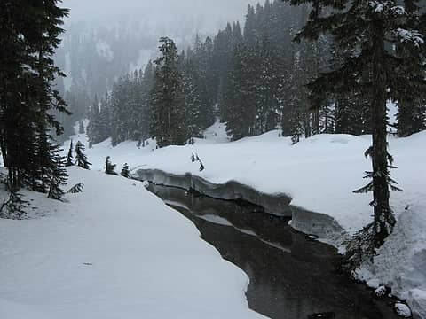 outlet stream 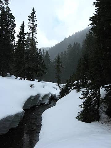 A brief sucker hole of sunshine was heading our way. 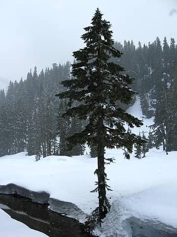 along the outlet stream 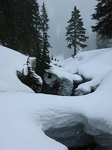 stream bank labyrinth 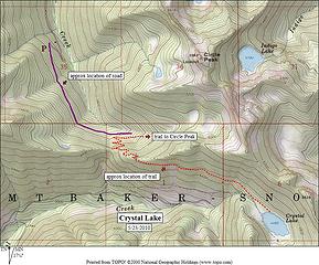 Crystal Lake Map
"Be moderate in everything, including moderation" Horace Porter
"Be moderate in everything, including moderation" Horace Porter
|
| Back to top |
  
|
|
Quark
Niece of Alvy Moore

Joined: 15 May 2003
Posts: 14152 | TRs | Pics
|
|
Quark
Niece of Alvy Moore
|
Mon May 24, 2010 9:47 pm |
|
|
daffish, this just about brings tears to my eyes!
After all this time, the uncertainly, the money, the waiting, waiting, waiting....and as soon as this area became accessible once again - people wrestle their way in - 'cause they love it!
Thanks for the pics and report.
We learned from Malachai Constant that there was an old, old trail from around Rat Trap Pass and over Skar Pass to Circle/Crystal Lake, but I hadn't seen any old maps of the area til you posted this one; thanks, dude.  Andy Holland's book, Switchbacks, mentions that Bedal had a cabin at Crystal Lake at one time, and that Nels Bruseth & crew built the Meadow Mtn trail (and had a run-in with a grizzly that treed the whole crew!). I didn't read Hollands book til after we went to Crystal Lake, so I'm anxious to get back & see if there are any remains (of the cabin, not Bruseth's crew). I suspect it's location; doubt any remains remain - it was likely just an old hunting shack.
"...Other than that, the post was more or less accurate."
Bernardo, NW Hikers' Bureau Chief of Reporting
"...Other than that, the post was more or less accurate."
Bernardo, NW Hikers' Bureau Chief of Reporting
|
| Back to top |
|
|
Malachai Constant
Member

Joined: 13 Jan 2002
Posts: 16093 | TRs | Pics
Location: Back Again Like A Bad Penny |
When I was last there before the floods there were remnants of a cabin (mostly just some trimmed logs) near a small point on the south side.
"You do not laugh when you look at the mountains, or when you look at the sea." Lafcadio Hearn
"You do not laugh when you look at the mountains, or when you look at the sea." Lafcadio Hearn
|
| Back to top |
|
|
Magellan
Brutally Handsome

Joined: 26 Jul 2006
Posts: 13116 | TRs | Pics
Location: Inexorable descent |
|
Magellan
Brutally Handsome
|
Mon May 24, 2010 11:05 pm |
|
|
That is a great map! Thanks for posting it.
That old trail from the Rattrap area has been singled out for rebuild to get people over to the Circle Peak/Crystal Lake area if/after they close FR 2703. It makes sense since there is plenty of parking near the pass. Since they are working on 2703 perhaps that plan has been changed or postponed.
|
| Back to top |
|
|
lopper
off-route

Joined: 22 Jan 2002
Posts: 845 | TRs | Pics
|
|
lopper
off-route
|
Mon May 24, 2010 11:20 pm |
|
|
daffish:
Great report. Here is a scan of a portion of the 1932 Mt Baker NF map.
Nothing quite like finding those 80-year-old blazes.....following the little dotted lines!
|
| Back to top |
|
|
puzzlr
Mid Fork Rocks

Joined: 13 Feb 2007
Posts: 7220 | TRs | Pics
Location: Stuck in the middle |
|
puzzlr
Mid Fork Rocks
|
Mon May 24, 2010 11:37 pm |
|
|
Nice work getting in there. We (NWers) are so lucky to have all the areas that are accessible, and then these get added back in to the pool, not to mention all the off-trail routes. I'm never leaving WA.
|
| Back to top |
|
|
Hulksmash
Cleaning up.

Joined: 20 Apr 2008
Posts: 7113 | TRs | Pics
Location: Arlington |
|
Hulksmash
Cleaning up.
|
Tue May 25, 2010 12:38 am |
|
|
| Magellan wrote: | | That is a great map! Thanks for posting it.
That old trail from the Rattrap area has been singled out for rebuild to get people over to the Circle Peak/Crystal Lake area if/after they close FR 2703. It makes sense since there is plenty of parking near the pass. Since they are working on 2703 perhaps that plan has been changed or postponed. |
They are also working on 2510 Conrad creek road. It's on the chopping block as well. Sadly, just cause they are working on it does not mean it's off the chopping block. In order to get trucks and equipment it needs to be good enough condition to do so. That means the insanity of fixing it just to destroy it. 
"Bears couldn't care less about us....we smell bad and don't taste too good. Bugs on the other hand see us as vending machines." - WetDog
Albuterol! it's the 11th essential
"Bears couldn't care less about us....we smell bad and don't taste too good. Bugs on the other hand see us as vending machines." - WetDog
Albuterol! it's the 11th essential
|
| Back to top |
|
|
GeoHiker
Rocky Walker

Joined: 26 Feb 2005
Posts: 6033 | TRs | Pics
Location: Off the Deep End |
|
GeoHiker
Rocky Walker
|
Tue May 25, 2010 6:11 pm |
|
|
Thanks for the report and pics. I'll have to take a wander back up that way now that it's finally opening up. I can hear the beat of hiking boots in the distance!.... Did you move your vehicle over after the pic? Not sure why you wouldn't have pulled off the road, looks like you had more than enough room. You may have thought nobody would be up there, but why force a large vehicle onto the far shoulder and tear up the road if you don't have to.
  Or worse have your vehicle side swiped or trashed because you aren't off the road. Or worse have your vehicle side swiped or trashed because you aren't off the road.
You call some place paradise, kiss it goodbye......Eagles
You call some place paradise, kiss it goodbye......Eagles
|
| Back to top |
|
|
daffish
Member
Joined: 16 Sep 2009
Posts: 282 | TRs | Pics
Location: Dreamtime |
|
daffish
Member
|
Tue May 25, 2010 6:30 pm |
|
|
| GeoHiker wrote: | | Not sure why you wouldn't have pulled off the road, looks like you had more than enough room. |
Yes, I agree with everything you say and normally I make sure the car is well clear of the road. However, pictures don't always show the full story. As so often happens this time of year, the road can be totally clear and then suddenly change to one foot of snow. When I took the picture, I was standing at the beginning of the snowbank that covered the entire road. So it is a very deceiving picture. Nobody could drive any farther. And there was plenty of room to turn around both in front of us and behind us.
"Be moderate in everything, including moderation" Horace Porter
"Be moderate in everything, including moderation" Horace Porter
|
| Back to top |
|
|
Sabahsboy
Member

Joined: 18 Jul 2006
Posts: 2484 | TRs | Pics
Location: SW Sno County |
Thanks to all for information; this whets my appetite for a new trail. I enjoy Darrington District a great deal!
|
| Back to top |
|
|
deerhunter
Member

Joined: 24 Jun 2009
Posts: 61 | TRs | Pics
|
Good report. When I was 14 years old, Crystal lake was my first overnighter without adult supervision. Dad dropped a few of us kids off at the traihead and we were on our own. Great memories of that place. Hopefully the newness wears off after a year or so and meadow mountain doesn't get trampled.
|
| Back to top |
|
|
|
|


