| Previous :: Next Topic |
| Author |
Message |
bonobo
Owl Juggler for rent

Joined: 23 Jun 2004
Posts: 818 | TRs | Pics
|
|
bonobo
Owl Juggler for rent
|
 Mon Jul 26, 2010 1:09 pm |
|
|
BLTN! (Better Late Than Never)
My intrepid hiking buddy Aimee and I camped the night of the 11th at Soda Springs near Little Wenatchee, nice spot. We were the only party there. Skeeters were definitely out in force.
In the morning, we headed west to the Snowy Creek TH, only one other car there. Neither of us had hiked this trail before.
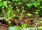
The low meadows are beautiful, but really tall and bushy. Lovely berry bushes along the way - we saw thimbleberry, salmonberry, huckle and blueberries. This trail will be delicious in a few weeks, and I'd imagine there will be a ton of bears getting in on that action. We saw lots of bear poop on the drive in.
We were surprised to find the old Nason Ridge connector trail, since it was not on my map. After a moment of confusion, we continued up the trail. Before long we arrived at the big meadow:
Incredibly wet. Very buggy. We took a break, had a snack, and looked at the trail heading up to the saddle. before long the bugs pushed us on, and we continued up. Lots and lots of log-walking was needed to attain the trail on the west side of the basin. But soon we were headed into the trees and up the trail. We soon met the owners of the other car on their way down.
When we broke out of the trees and began the climb up to the Nason Ridge junction, the wind started gusting up a bit.
Between the wind and the exposure on the mountainside, I was nervous. But we pushed on and soon were hunkered down just east of the Nason Ridge trail junction and looking at the view off the other side. The peaks! The majesty of it all! It was....
...not there.
We were in the clouds at this point. So was some awesome sleet. Ouch. Due to the low visibility, gusty winds, painful sleet, and lack of familiarity with the trail, we somewhat mournfully made the decision to head back down.
A really great trail, one of my fave hikes this year. I'll definitely go back to get the views I worked for and a shot at Rock Mountain.
|
| Back to top |
  
|
|
Yana
Hater

Joined: 04 Jun 2004
Posts: 4212 | TRs | Pics
Location: Out Hating |
|
Yana
Hater
|
Mon Jul 26, 2010 1:51 pm |
|
|
| bonobo wrote: | | We were in the clouds at this point. So was some awesome sleet. |
 Thanks for the TR. I loved this hike when I did it on my birthday many years ago. Of course, it was warm and sunny and sleetless at the time.
  Hm. that's weird about the Nason Ridge connector trail - I totally don't remember that. Of course, it's been a while and my memory is not what it used to be.
PLAY SAFE! SKI ONLY IN CLOCKWISE DIRECTION! LET'S ALL HAVE FUN TOGETHER!
PLAY SAFE! SKI ONLY IN CLOCKWISE DIRECTION! LET'S ALL HAVE FUN TOGETHER!
|
| Back to top |
|
|
bonobo
Owl Juggler for rent
Joined: 23 Jun 2004
Posts: 818 | TRs | Pics
|
|
bonobo
Owl Juggler for rent
|
Mon Jul 26, 2010 3:19 pm |
|
|
The trail surprised me. It has a sign and everything, it was strange. After getting on NWH and doing a little digging, it appears the trail was supposed to be a connecter from Snowy Creek to some point on the Nason Ridge trail. It was never finished, or stopped being maintained, or something like that.
|
| Back to top |
|
|
Highwalker's Daughter
Member
Joined: 12 Aug 2006
Posts: 1575 | TRs | Pics
Location: Bothell, WA |
We had heavy mist and freezing conditions when we were up there, but we could make it to the old lookout site. I'd love to see it on a sunny day! Guess we'll all just have to go back to see it when it's clear.
|
| Back to top |
|
|
Flora
Enjoying the Sun!

Joined: 25 Mar 2007
Posts: 1035 | TRs | Pics
Location: Land of many waters |
|
Flora
Enjoying the Sun!
|
Mon Jul 26, 2010 3:56 pm |
|
|
If you do get up there again, there are non-stop views. The flowers going up should also be great this week or next, depending on the weather. I've been up there in a total fog/wind and on a day when we were above the clouds, surrounded by floating mountains. Cool!
|
| Back to top |
|
|
tigermn
Member

Joined: 10 Jul 2007
Posts: 9242 | TRs | Pics
Location: There... |
|
tigermn
Member
|
Mon Jul 26, 2010 4:30 pm |
|
|
This is definitely one to repeat for the views. I need to get up there again this year but will probably go up via Rock Creek having done the other approach. Don't want to deal with fog and bad snow though and a flower show would be nice!
|
| Back to top |
|
|
bonobo
Owl Juggler for rent
Joined: 23 Jun 2004
Posts: 818 | TRs | Pics
|
|
bonobo
Owl Juggler for rent
|
Mon Jul 26, 2010 4:52 pm |
|
|
The flower show has begun. I was too focused on not falling off the side of the mountain during the gusts to take much in the way of pictures. This was also two weeks ago, so the show is probably in full swing by now...
|
| Back to top |
|
|
Quark
Niece of Alvy Moore

Joined: 15 May 2003
Posts: 14152 | TRs | Pics
|
|
Quark
Niece of Alvy Moore
|
Mon Jul 26, 2010 4:56 pm |
|
|
I recall millions of purple aster carcasses (I was up there in the fall, too late for the flowers), so I imagine it to be a purple haze up there.
Odd they haven't cleared the avy debris, or re-routed the trail from the meadow up. Can you tell how much of the trail was taken out by the debris? That's a very old trail and you can see blazes cut into some of the trees at switchbacks, though many blaze trees are dead & gone.
"...Other than that, the post was more or less accurate."
Bernardo, NW Hikers' Bureau Chief of Reporting
"...Other than that, the post was more or less accurate."
Bernardo, NW Hikers' Bureau Chief of Reporting
|
| Back to top |
|
|
bonobo
Owl Juggler for rent
Joined: 23 Jun 2004
Posts: 818 | TRs | Pics
|
|
bonobo
Owl Juggler for rent
|
Mon Jul 26, 2010 5:02 pm |
|
|
Funny you should mention that, Quark. When we were looking for the trail, you could see trail work had been done since the avalanche. I don't know if the trail is obvious when the meadow is drier, but we were negotiating a ton of meltwater streams and rivers, and the trail was one of them - the question was which one?. Because of the amount of downed trees (a newer avi/slide? leftovers from the old one? Who knows?) between the meadow campsite and the trail to the forest, it looked like we would do the least damage log walking.
If the trail is actually gone in that section, I'd guess it's about a 200 foot stretch. But that's a pretty loose guess.
|
| Back to top |
|
|
|
|


