| Previous :: Next Topic |
| Author |
Message |
daffish
Member


Joined: 16 Sep 2009
Posts: 282 | TRs | Pics
Location: Dreamtime |
|
daffish
Member
|
 Thu Jul 29, 2010 3:20 pm |
|
|
Every year, I plan an ambitious backpack in July and then the realities of my not-quite-in-shape body protest and scream at me, What were you thinking? It seems that everything took longer and was harder on this trip than I originally thought. But it was still a success and gave me a chance to spend some time up on the alpine ridges.
I headed out late Sunday on the North Fork Sauk trail, only expecting to get partway in as I knew that the next day would involve a major elevation rise and some decent trail mileage. At the Mackinaw Shelter, the approaching evening and my sore feet told me to stop and not press on uphill to my sekrit camp spot. And it took longer than usual to hike those 5 trail miles.
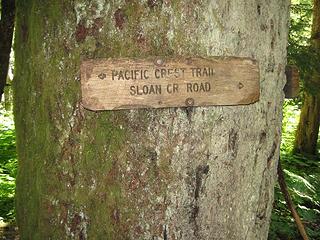 trail signage 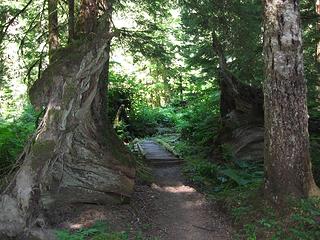 trail scene 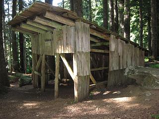 Mackinaw Shelter 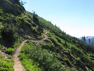 the trail wends upwards 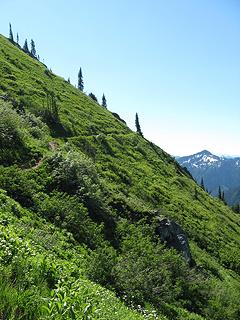 and upwards 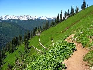 the Monte Cristo Mtns above Pilot Ridge 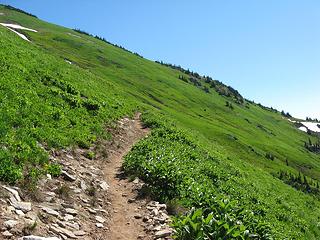 steep meadows of White Mtn 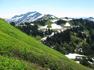 White Pass 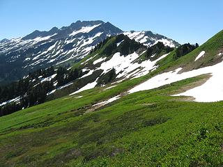 Indian Head Peak from the PCT 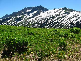 Indian Head Peak 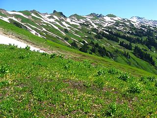 trail to Foam Basin 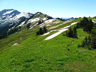 south along the PCT 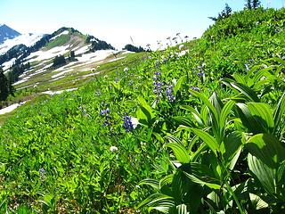 early season meadow plants 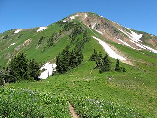 White Mtn from the PCT 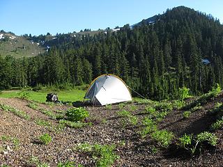 a Moment at Indian Pass 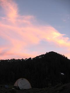 evening 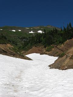 snow filled pumice gully 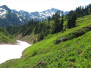 the gully ascended 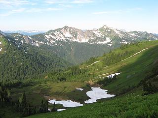 climbing in the morning 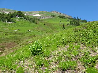 meadowed slopes towards the summit 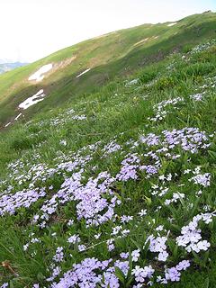 Phlox gardens high on the mountain 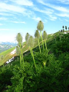 Anenome in seed phase 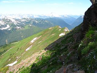 last shade 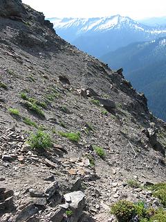 animal trail traversing at 7200' 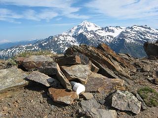 summit cairn 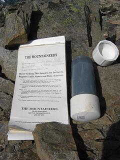 summit register 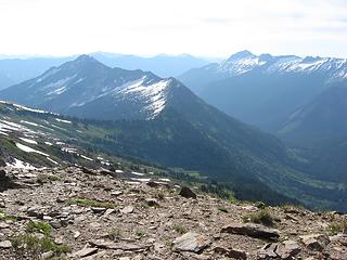 Mt Saul down the ridgeline to the east 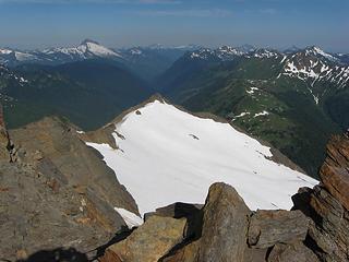 west past the glacier and Sauk valley 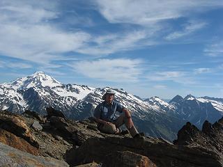 on the summit of Indian Head Peak 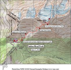 Indian Head Peak 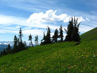 White Pass 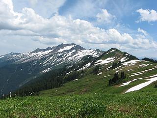 south from White Pass 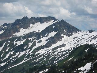 the north face of Indian Head Peak 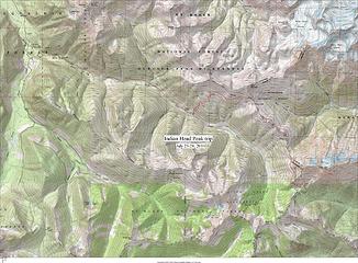 Indian Head trip
"Be moderate in everything, including moderation" Horace Porter
"Be moderate in everything, including moderation" Horace Porter
|
| Back to top |
  
|
|
Dayhike Mike
Bad MFKer

Joined: 02 Mar 2003
Posts: 10958 | TRs | Pics
Location: Going to Tukwila |
Looks like a fun trip in a nice area. Thanks for the trip report and pictures! 
"There is only one basic human right, the right to do as you damn well please. And with it comes the only basic human duty, the duty to take the consequences." -P.J. O'Rourke
"Ignorance is natural. Stupidity takes commitment." -Solomon Short
"There is only one basic human right, the right to do as you damn well please. And with it comes the only basic human duty, the duty to take the consequences." -P.J. O'Rourke
"Ignorance is natural. Stupidity takes commitment." -Solomon Short
|
| Back to top |
|
|
Quark
Niece of Alvy Moore

Joined: 15 May 2003
Posts: 14152 | TRs | Pics
|
|
Quark
Niece of Alvy Moore
|
Thu Jul 29, 2010 3:33 pm |
|
|
In the heat of last weekend - that would have killed in about 4 minutes flat. It would have killed me anyway, but it would have been sooner in the heat. Wonderful photos!!!!!
Indian Head is why my knees aren't so great. Coming down is a pounder.
"...Other than that, the post was more or less accurate."
Bernardo, NW Hikers' Bureau Chief of Reporting
"...Other than that, the post was more or less accurate."
Bernardo, NW Hikers' Bureau Chief of Reporting
|
| Back to top |
|
|
DIYSteve
seeking hygge

Joined: 06 Mar 2007
Posts: 12655 | TRs | Pics
Location: here now |
|
DIYSteve
seeking hygge
|
Thu Jul 29, 2010 4:24 pm |
|
|
Cool. Great pics.  It's a lovely area. Oh yeah, there's some steep heather/rock slopes on that route. Your TR brings back some good memories of when Anita and did the traverse from Saul to IH a few years ago.
Good look at much of the Lightning Creek HR in this pic: It's a lovely area. Oh yeah, there's some steep heather/rock slopes on that route. Your TR brings back some good memories of when Anita and did the traverse from Saul to IH a few years ago.
Good look at much of the Lightning Creek HR in this pic:| daffish wrote: | on the summit of Indian Head Peak |
|
| Back to top |
|
|
raising3hikers
Member

Joined: 21 Sep 2007
Posts: 2344 | TRs | Pics
Location: Edmonds, Wa |
Awesome! Thanks for the TR, I want to climb that peak next time I'm in that area
|
| Back to top |
|
|
iron
Member

Joined: 10 Aug 2008
Posts: 6392 | TRs | Pics
Location: southeast kootenays |
|
iron
Member
|
Thu Jul 29, 2010 7:04 pm |
|
|
thanks for the update dave. looks mostly melted out there. tempted to take a friend to that neighborhood next week for some backpacking...
|
| Back to top |
|
|
Magellan
Brutally Handsome

Joined: 26 Jul 2006
Posts: 13116 | TRs | Pics
Location: Inexorable descent |
|
Magellan
Brutally Handsome
|
Thu Jul 29, 2010 11:14 pm |
|
|
Gorgeous pictures!
You look familiar to me too. 
|
| Back to top |
|
|
daffish
Member
Joined: 16 Sep 2009
Posts: 282 | TRs | Pics
Location: Dreamtime |
|
daffish
Member
|
Fri Jul 30, 2010 8:06 am |
|
|
Yeah, I guess the mountaineering community is relatively small. I was surprised at how many names in the summit register I recognized.  Of course, when NWHikers use their online names to sign the summit roll, it makes it easier to make a connection. Of course, when NWHikers use their online names to sign the summit roll, it makes it easier to make a connection. 
"Be moderate in everything, including moderation" Horace Porter
"Be moderate in everything, including moderation" Horace Porter
|
| Back to top |
|
|
Quark
Niece of Alvy Moore
Joined: 15 May 2003
Posts: 14152 | TRs | Pics
|
|
Quark
Niece of Alvy Moore
|
Fri Jul 30, 2010 8:08 am |
|
|
 I didn't even see the summit register (at least I don't remember signing it); though I may not have done the true summit. There are 2 bumps, and I was too fagged to go over to the other bump and tag it, to be sure..... I didn't even see the summit register (at least I don't remember signing it); though I may not have done the true summit. There are 2 bumps, and I was too fagged to go over to the other bump and tag it, to be sure.....
"...Other than that, the post was more or less accurate."
Bernardo, NW Hikers' Bureau Chief of Reporting
"...Other than that, the post was more or less accurate."
Bernardo, NW Hikers' Bureau Chief of Reporting
|
| Back to top |
|
|
Eric
Peak Geek

Joined: 21 Oct 2002
Posts: 2062 | TRs | Pics
Location: In Travel Status |
|
Eric
Peak Geek
|
Fri Jul 30, 2010 9:15 am |
|
|
The SW bump is definitely the higher of the two. We went and tagged the other one just to be sure but from both points the SW looked higher. I believe that that is where the register was as well.
Indian Head is a great hike and one I may have to repeat someday after visiting Saul. Unless I come in from that N Fork Sauk or via West Cady Ridge and then turn N might be nice too. Lots of scenic ways to get to this area.
|
| Back to top |
|
|
Pass-n-Thru
Member
Joined: 07 Jul 2010
Posts: 35 | TRs | Pics
|
Great shots!. A lot of the snow has melted out since the report on th GP hike. Lots of hot weather helped.
|
| Back to top |
|
|
Mike Collins
Member
Joined: 18 Dec 2001
Posts: 3097 | TRs | Pics
|
You might have gone through Indian Pass on your way to the summit. Last week I was at the UW library attempting to find information about Surprise Creek/Gap/Mountain to see what the "Surprise" was to the early surveyor. John Stevens who is immortalized by Stevens Pass wrote in his reminiscences about Indian Pass. His boss, James Hill, gaved him the responsibility to find a route through the mtns between Stampede Pass used by the Northern Pacific RR and the Canadian border. Stevens writes "From Indian Pass I followed the crest of the Cascade mountains clear through to Snoqualmie Pass. I personally examined every nook and corner of that area which seemed to offer any prospect that might be worth consideration. C.B. Haskell...was my only assistant that summer. He [Haskell] blazed a name on a cedar tree 'Stevens Pass' and continued through the pass down the Skykomish." He writes further that "Indians & Whites crossing the mountains used either Snoqualmie on the south or Indian Pass on the north for the route of transit."
|
| Back to top |
|
|
Lakes&Summits
Member

Joined: 14 Jul 2010
Posts: 90 | TRs | Pics
Location: N. Seattle |
Thanks for the great map and detailed description of the ascent. I am planning to go up there this weekend. Did you indeed use/need an ice axe? I'm debating on whether to take it or not.
|
| Back to top |
|
|
|
|


