| Previous :: Next Topic |
| Author |
Message |
Schroder
Member


Joined: 26 Oct 2007
Posts: 6722 | TRs | Pics
Location: on the beach |
|
Schroder
Member
|
 Fri Aug 20, 2010 11:07 am |
|
|
Hanzsek & I headed up the Gold Run Pass trail on Wednesday morning with the intention of going up Tomyhoi & wandering around the area as far as we could in a couple of days. We got a liesurely start at about 10:30 in 83 degree heat with no wind. In the first 100 feet from the car I got bit by half a dozen flys - not a good sign.
For those who haven't done this trail, most of the elevation gain is in the first mile and a half, but the views come quickly.
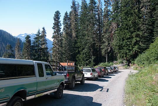 parking on twin lakes road 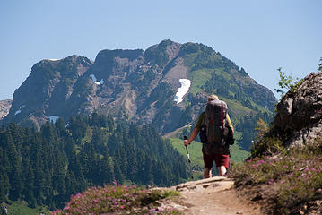 view of Winchester Mountain 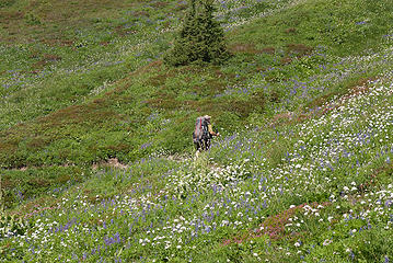 lots of flowers 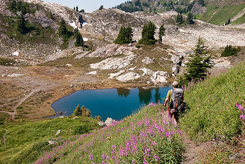 descending to tarns 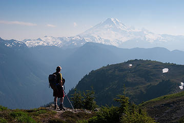 Baker from Point 5933 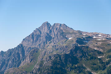 Tomyhoi from 5933 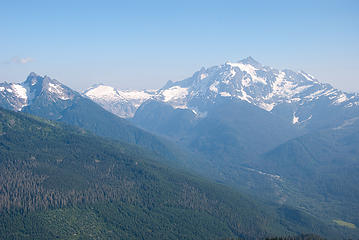 Shuksan from 5933 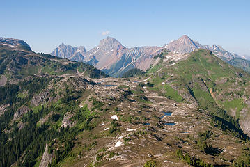 Border Peaks, Larrabee, Yellow Aster Butte 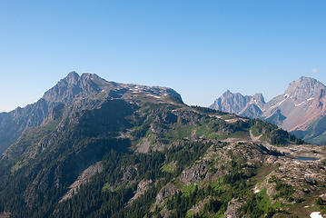 Tomyhoi & Border Peaks 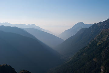 Looking to Canada 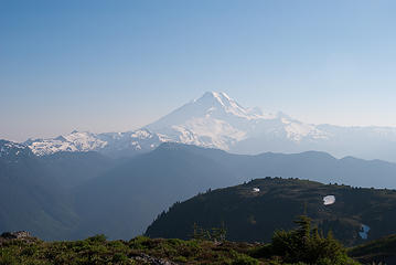 hazy Mt Baker 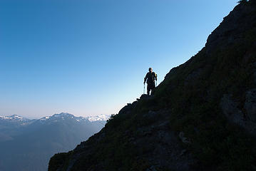 Descending from 5933 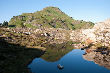 Yellow Aster Butte reflection 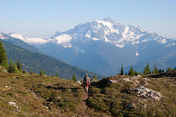 Heading to camp for dinner 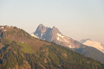 Mt Sefrit 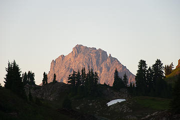 American Border Peak 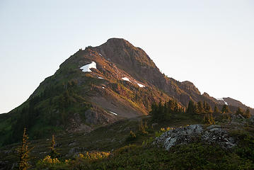 Point 5933 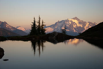 Shuksan 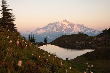 Shuksan 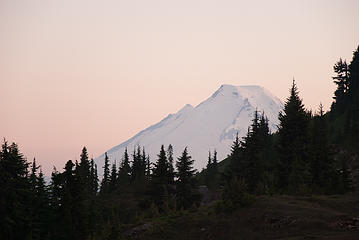 Mt Baker 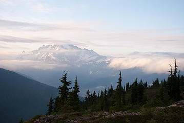 morning fog rolling in 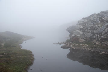 whiteout 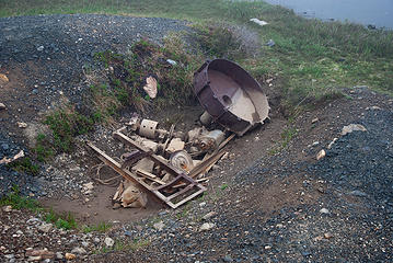 mining equipment near tarns 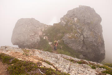 Tomyhoi ridge 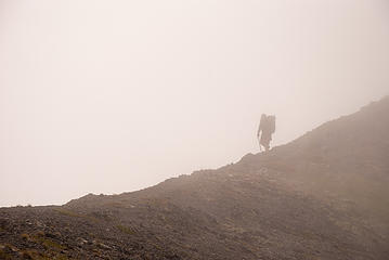 Tomyhoi ridge 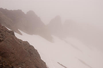 summit ridge 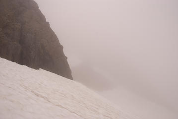 dropping down Tomyhoi glacier 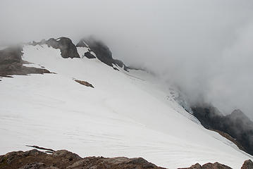 Tomyhoi from the east 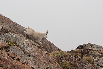 goat 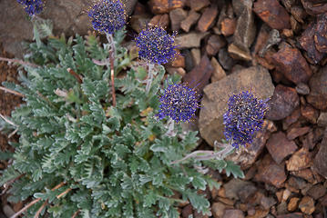 ? flower in talus 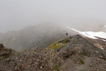 starting down 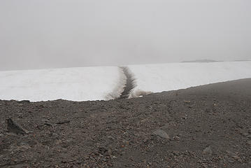 snow runnel 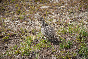 ptarmigan 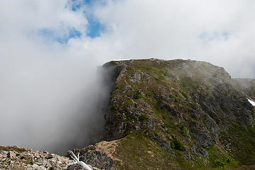 up & down 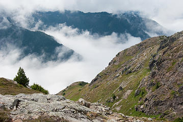 looking west 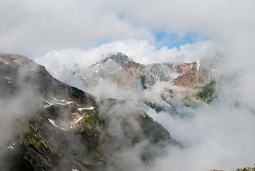 American Border Peak 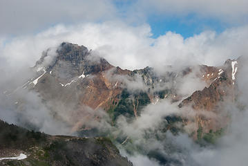 American Border Peak 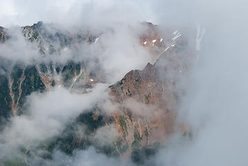 shoulder of Larrabee 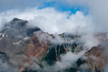 American Border Peak 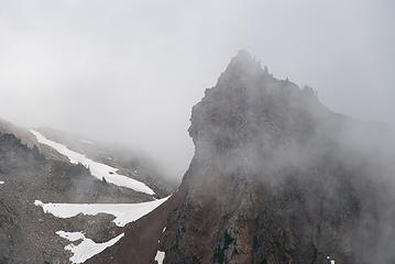 face on Yellow Aster Butte 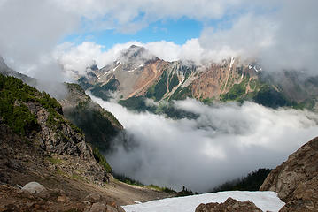 American Border Peak 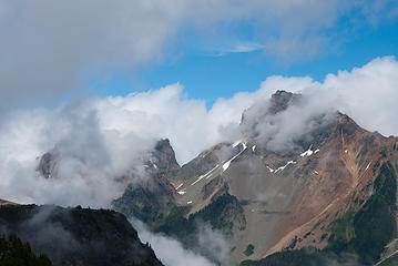 Border Peaks 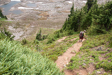 last bit of trail to tarns 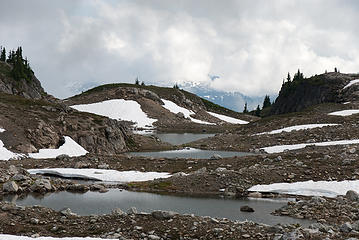 tarns  cabin 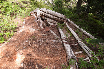 cabin 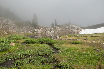 tarn 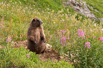 marmot 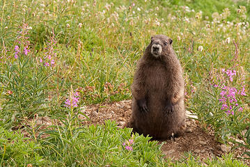 marmot 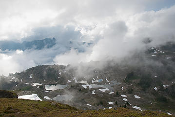 tarns from Yellow Aster Butte 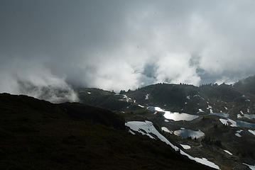 tarns from Yellow Aster Butte 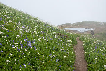 heading out
|
| Back to top |
  
|
|
Schroder
Member
Joined: 26 Oct 2007
Posts: 6722 | TRs | Pics
Location: on the beach |
|
Schroder
Member
|
Fri Aug 20, 2010 10:15 pm |
|
|
|
| Back to top |
|
|
Backpacker Joe
Blind Hiker

Joined: 16 Dec 2001
Posts: 23956 | TRs | Pics
Location: Cle Elum |
Great pics Schrod. I bet this place is nice in October.....
"If destruction be our lot we must ourselves be its author and finisher. As a nation of freemen we must live through all time or die by suicide."
Abraham Lincoln
"If destruction be our lot we must ourselves be its author and finisher. As a nation of freemen we must live through all time or die by suicide."
Abraham Lincoln
|
| Back to top |
|
|
Zukismom
Member

Joined: 19 Jul 2010
Posts: 122 | TRs | Pics
|
|
Zukismom
Member
|
Sat Aug 21, 2010 10:17 am |
|
|
Photo ops is an UNDERSTATEMENT! JumpinJeHosafat...awesome pictures...esp. the cloud pics. PHEW!! Thanks for sharing.
|
| Back to top |
|
|
Flora
Enjoying the Sun!

Joined: 25 Mar 2007
Posts: 1035 | TRs | Pics
Location: Land of many waters |
|
Flora
Enjoying the Sun!
|
Sat Aug 21, 2010 12:47 pm |
|
|
|
| Back to top |
|
|
Schroder
Member
Joined: 26 Oct 2007
Posts: 6722 | TRs | Pics
Location: on the beach |
|
Schroder
Member
|
Sat Aug 21, 2010 1:35 pm |
|
|
| Flora wrote: | | The blue-flowered plant is Silky Phacelia |
Thanks for the plant id.
No berries ripe yet but there will be lots of them up there this year.
|
| Back to top |
|
|
aywolfpac
Member

Joined: 27 Jan 2008
Posts: 1286 | TRs | Pics
Location: Burlington, WA |
|
| Back to top |
|
|
jenjen
Moderatrix
Joined: 30 Jun 2003
Posts: 7617 | TRs | Pics
Location: Sierra stylin |
|
jenjen
Moderatrix
|
Sat Aug 21, 2010 9:02 pm Re: Tomyhoi, Yellow Aster, Pt 5933 8/18-19/10 (photos added)
|
|
|
| Schroder wrote: | | we chose a spot just above the lowest tarn on the old trail where we had the best views of Shuksan. |
I know that site well. It's one of my favorite camp sites ever - the view of Shuksan changing colors at dawn and dusk just cannot be beat. 
If life gives you melons - you might be dyslexic
If life gives you melons - you might be dyslexic
|
| Back to top |
|
|
gb
Member
Joined: 01 Jul 2010
Posts: 6311 | TRs | Pics
|
|
gb
Member
|
Mon Aug 23, 2010 2:35 pm Re: Tomyhoi, Yellow Aster, Pt 5933 8/18-19/10 (photos added)
|
|
|
| Schroder wrote: | | We got up to the first rocks on the summit ridge & had the choice of climbing to the false summit or dropping underneath it on the glacier & ascend to the notch. We chose the latter. After descending about a hundred feet and turning the corner, the visibility got worse at about the time I had a crevasse below me & could see a schrund above me. After a few seconds of contemplation, we decided to back off & descend to a high point to the east off the glacier, have lunch & wait for the visibility to improve. It didn't. We had a few brief openings and then it would get worse. After waiting an hour, we decided to head down. |
You made a good choice on doing the glacier route. The route over the false summit necessarily works onto the west side and involves some (I don't recall how much) traversing on 5.6 loose rock.
|
| Back to top |
|
|
|
|


