woutervw
In search of trips


Joined: 02 Oct 2010
Posts: 217 | TRs | Pics
Location: Sammamish, WA |
|
woutervw
In search of trips
|
 Sat Oct 02, 2010 9:53 pm |
|
|
I want to do more peaks while taking my loyal canine buddy. While looking through some online sites I found Mt. Aix and it sounded like just the thing.
I left home at 6:30 and made it to the trailhead by 9:15. The road to Bumping Lake is a lot nicer than I expected. But after Bumping Lake the pavement stops. The road is in reasonable condition, not too many holes, and the ones that are there are shallow. There are a lot of protruding rocks that can be a problem with low-clearance cars. I had no problems with my Forester though. Slow and easy is the key.
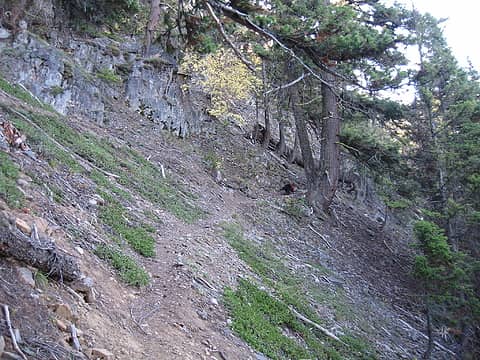
The trail starts as a old road, but soon turns into a real trail. Right at the beginning there has been a washout/landslide. The trail has been adjusted to deal with it. After that the trail is in very good shape. No blowdowns anywhere. It alternates between reasonably steep, level and everything in between. No too steep anywhere, just interesting.
A couple of times you'll hear a stream when you get to the south-most part of the switchbacks. You can just never really get to it. My dog Zoey only found two little spots where she could have a drink. But she carried her own bottles for further on the trail. Make sure you do the same, cause there is no water to be found on this trail.
The whole first part up to the ridge is on the east side and cool in the morning. When the sun gets over the ridge, I had made it to where the trees thin out. So the pant legs and long sleeve shirt came off. And the switchbacks just keep going. Finally you get to the junction with the Nelson Ridge trail. Here you can peek over the ridge and see how dry it is on the other side. Rainier sure has a big influence here.
After the junction you keep right and traverse to the south side of the ridge. When you get there you can finally see your objective. And it looks nice and impressive. On your way to it you descent quite a bit to make it to the ridge that leads to Mt. Aix. It feels nice to go down for a moment, but on the way out, you sure wish you didn't have to go up again. The trail along the ridge is easy with great views.
When you get to the last part, there are two options. You can traverse to the south-east ridge and hike up that ridge. Or you can scramble up through some lighter colored rocks. The junction is marked with a couple of cairns. I chose the direct route and it worked just fine. Zoey doesn't like scrambling all that much. But when I put her back on her leash, she's just fine. I guess she needs the perceived security. She found the trail all the way up. But right before you get to the summit you have to climb up a 5 foot rock. So I had to give her a little hand.
The sky was completely clear and I had great views of Rainier, Adams, Goat Rocks, St. Helens and even Baker. Just a little breeze to keep from being too hot in the sun. I spend some time adding to and reading from all the pieces of paper in the 'summit log'.
We went down the alternative route and that one seemed easier. Zoey got to play in the snow that was still there in the shadow of the ridge. I'm glad there wasn't any more of it. Most of these traverses would not have been save if they were snowed over.
And absolutely wonderful day on a great trail.
3 hours to the top, 2 and a half back down. 11.5 miles round-trip. 4350Ft elevation gain in, 285ft out.
 IMG_0417.JPG 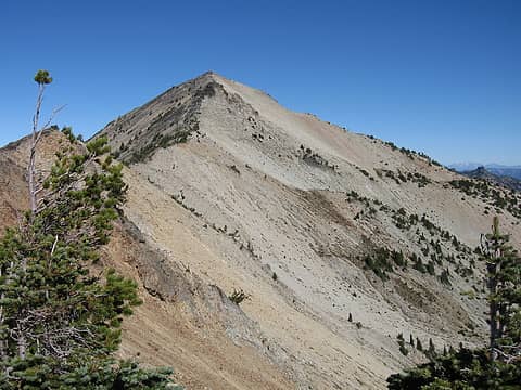 IMG_0423.JPG 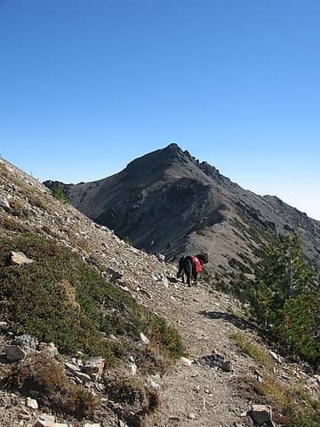 IMG_0426.JPG 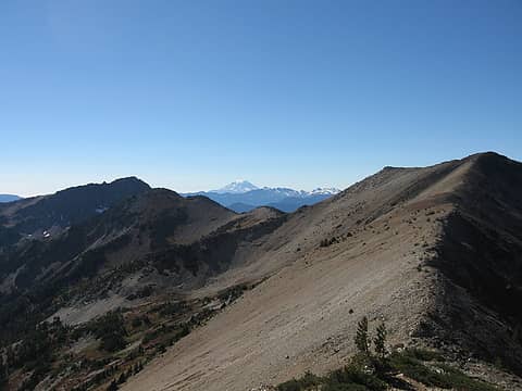 IMG_0432.JPG 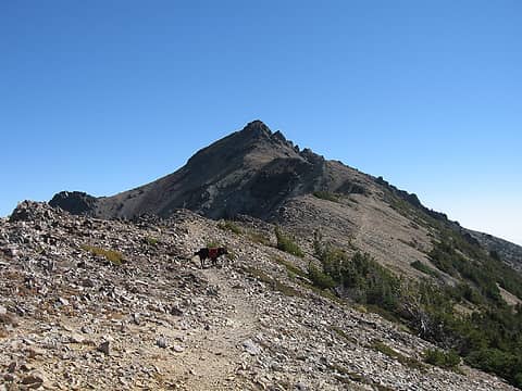 IMG_0433.JPG 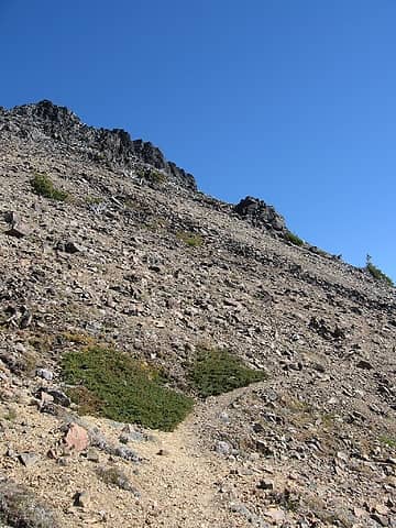 IMG_0491.JPG 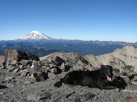 IMG_0436.JPG 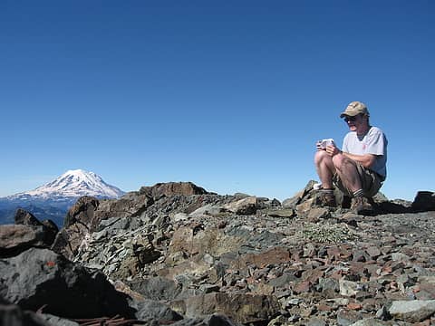 IMG_0439.JPG 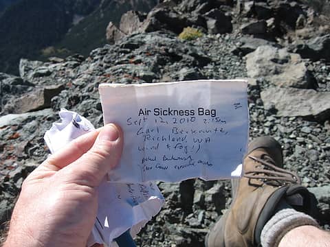 IMG_0440.JPG  IMG_0466.JPG 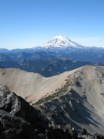 IMG_0468.JPG 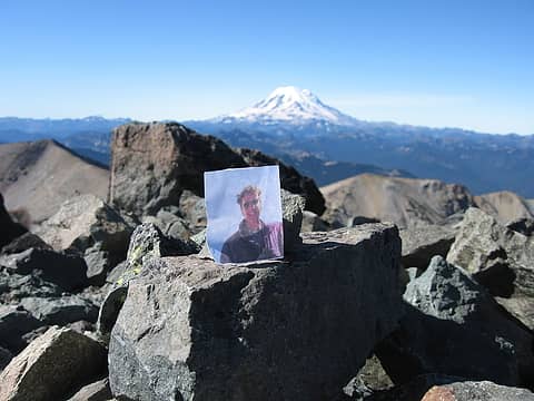 IMG_0470.JPG 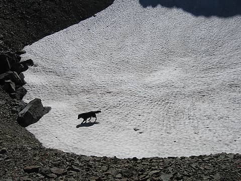 IMG_0477.JPG 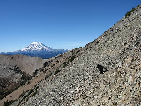 IMG_0483.JPG 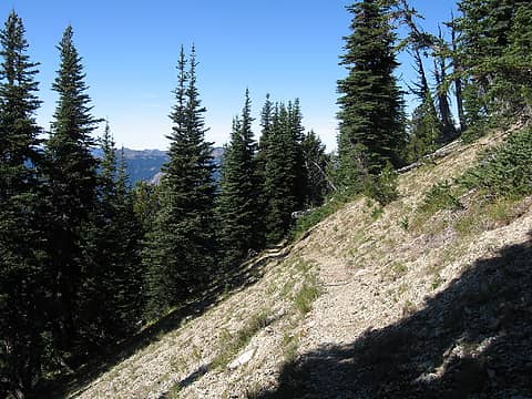 IMG_0503.JPG 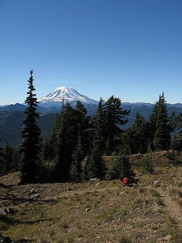 IMG_0505.JPG 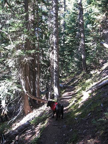 IMG_0506.JPG
|


