| Previous :: Next Topic |
| Author |
Message |
seattlehikertoo
Member


Joined: 26 Jun 2008
Posts: 582 | TRs | Pics
Location: Finding an alternative to Mailbox Pk |
Sperry-101019
Damon and I started up the Sunrise Mine trail (elev 2280) at nearly 1pm, on our way to Lake Elan and then to summit Sperry. Neither of us could think of a better way to spend the afternoon during the waning moments of fall weather in the mountains. And who could argue? The wind was absent and the temps were perfectly cool as we sauntered up through the forest for first half mile. There are a few creek crossings, two of which still require some semblance of balance, with the major one being at .56 miles (you are actually crossing south fork of the Stillaguamish River). After the crossing, when you traverse the steep meadow, the trail was rather slippery and damp from all the cool nights.
When we entered the upper Wirtz Basin (1.75mi, elev 3200), we were under crystal clear skies and a glaring sun for late October. We followed the cairns on an upward traverse across the lengthy talus field. The footing was surprisingly good through there. By the time we got to the head of the basin (2.75mi, elev 4300), we were more than toasty. By the time we arrived at Headlee Pass (3.2m, elev 4675), we were sweating.
I should note that the sign at the TH is INCORRECT. It is 3.2 miles to Headlee Pass and the elev is 4675. I've been there 4 or 5 times before and get nearly the same reading on my GPS. It is slightly under 3 miles only if you avoid the trail through the small forest in the upper basin and stay on the talus just below it, taking a straight rising traverse to the head of the basin. However, the travel is slower going this way.
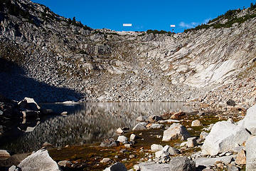
We crossed the talus field on the south flank of Sperry without incident, though I feel we should have been wearing helmets for that quarter-mile stretch. We arrived at the lake outlet (3.55mi, elev 4861), with the tranquility of the stream relaxing us so much that we decided we'd grab a lunch break at the lake (another 2/10mi) to soak in more rays and enjoy the peacefulness of an alpine afternoon.
After feasting on a sandwiches, cookies, and brownies, we departed for the "toothpick" and the "lone tree," which sit atop the saddle above the north end of the lake to the right of the low point. We ended up just going to the low point on the saddle (4.15mi, elev 5280). It was easy to pick up the boot path there and follow it right (east) toward Sperry. The boot path runs for another 1/4mi and ends at a talus field. It is at this point I think people get confused as to the easiest route to the top.
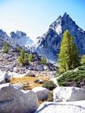
 SperryRouteSaddle-101019 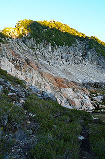 End of boot path. Head for white stripe in the center 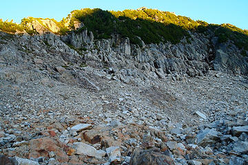 Rock cairn near end of boot path. Head for that white stripe just to left of center. 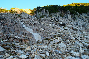 Follow the stripe. There are some cairns marking the way, but you head for the little patch of meadow in the upper center. Look for a small tree with orange flag. Do NOT go left into the meadow when you get there. 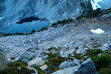 Boot path fades here, but you may be able to spot cairns. If you look right of the lake, you can see the boot path 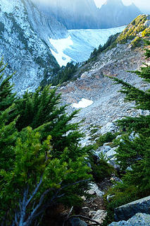 Go thru here on obvious path  Head for the rocks in upper center  Follow the boot path to right 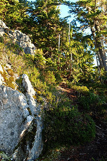 Boot path appears to dead end, but only minor dead snags and trees to climb through and obvious path continues 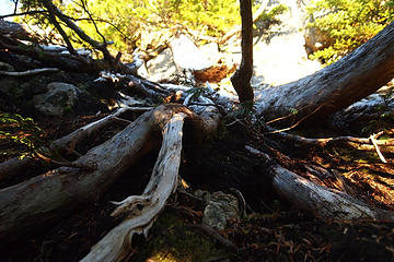 Climb over this 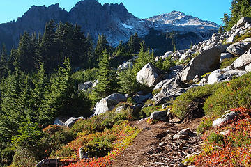 Vesper from near Lake Elan 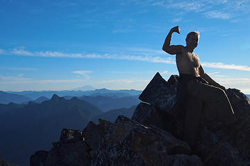 Mandatory cheesy summit shot 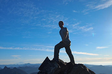 Another cheesy summit shot 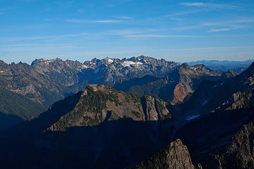 Looking ESE at Monte Cristo with my nemesis Kyes 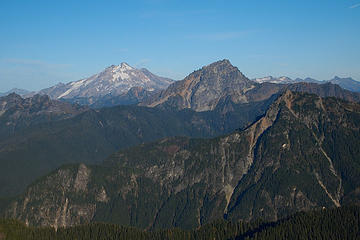 Looking E to Glacier and Sloan 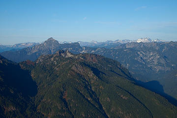 Looking NE at Pugh on left and I am guessing Dome on the right 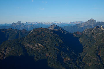 1 label Looking NNE at White Chuck left, Pugh on the right, with Forgotten center. I am guessing that's Snowking sticking above Forgottten 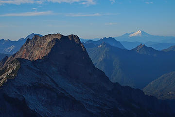 Big Four and Baker 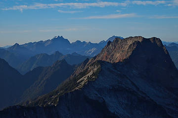 Three Fingers and Big Four 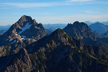 Looking mainly SSE to Del Campo and Gothic with Morningstar in the middle. Daniel and Hinman in the distance upper right. 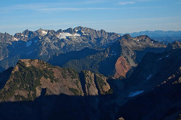 Kyes and Columbia 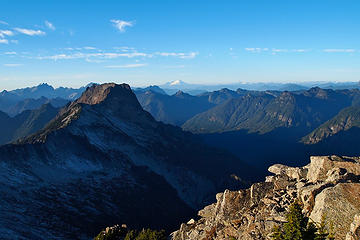 NW view. 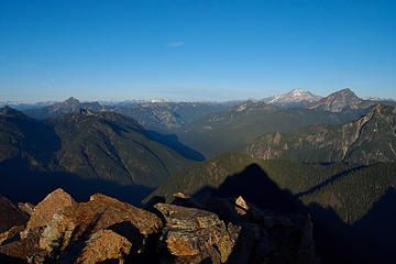 NE view 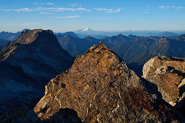 Pointing NW to Baker 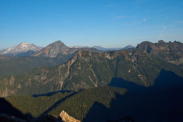 Glacier and Sloan with the moon rising in the afternoon 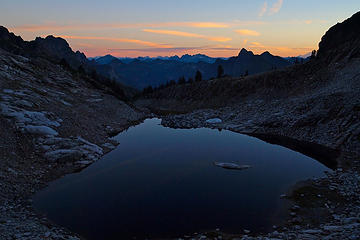 Sunset on Lake Elan. This one is worth waiting out 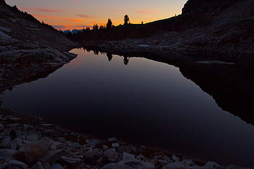 Getting darker and better. 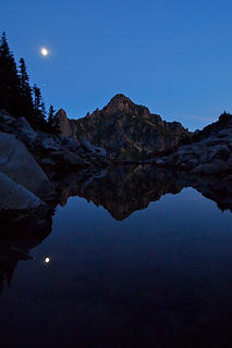 Moon over Morning Star. Must be Jupiter bright as can be below the moon. 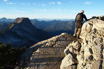 This is the best way down and up. 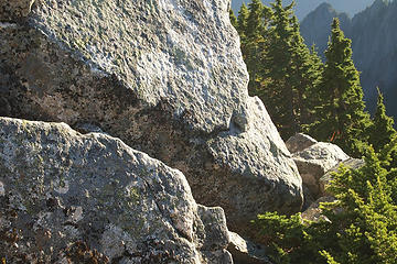 Don't follow that orange flag. It's the beginning of multiple tree belays. 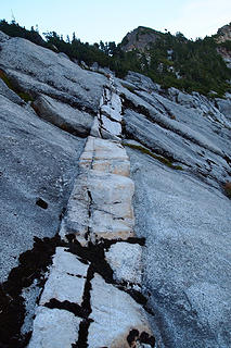 Mosaic in the granite
|
| Back to top |
  
|
|
Dayhike Mike
Bad MFKer
Joined: 02 Mar 2003
Posts: 10958 | TRs | Pics
Location: Going to Tukwila |
Great beta! I've never seen good details posted re: the top bit of scrambling. Thanks for the info and pics! 
"There is only one basic human right, the right to do as you damn well please. And with it comes the only basic human duty, the duty to take the consequences." -P.J. O'Rourke
"Ignorance is natural. Stupidity takes commitment." -Solomon Short
"There is only one basic human right, the right to do as you damn well please. And with it comes the only basic human duty, the duty to take the consequences." -P.J. O'Rourke
"Ignorance is natural. Stupidity takes commitment." -Solomon Short
|
| Back to top |
|
|
jhiker
Member
Joined: 24 Jul 2006
Posts: 286 | TRs | Pics
Location: Mill Creek |
|
jhiker
Member
|
 Sat Oct 23, 2010 4:34 pm |
|
|
Thanks for posting the beta on this one.
Your summit pictures are incredible.
|
| Back to top |
|
|
Magellan
Brutally Handsome

Joined: 26 Jul 2006
Posts: 13116 | TRs | Pics
Location: Inexorable descent |
|
Magellan
Brutally Handsome
|
Sat Oct 23, 2010 6:00 pm |
|
|
Nice to see a picture of Damon too.
|
| Back to top |
|
|
the Zachster
Member

Joined: 17 Jan 2007
Posts: 4776 | TRs | Pics
Location: dog training |
Thanks for such a detailed report! I've looked at Sperry from Vesper several times but never bothered to try it. Now I must!
"May I always be the kind of person my dog thinks I am"
"May I always be the kind of person my dog thinks I am"
|
| Back to top |
|
|
|
|
You cannot post new topics in this forum
You cannot reply to topics in this forum
You cannot edit your posts in this forum
You cannot delete your posts in this forum
You cannot vote in polls in this forum
|
Disclosure: As an Amazon Associate NWHikers.net earns from qualifying purchases when you use our link(s). |


