| Previous :: Next Topic |
| Author |
Message |
Matt
Tea, Earl Grey, Hot


Joined: 30 Jan 2007
Posts: 4307 | TRs | Pics
Location: Shoreline |
|
Matt
Tea, Earl Grey, Hot
|
 Sun Feb 06, 2011 11:54 pm |
|
|
Date: 2/5/11
Destination: Palmer Mtn 5043 (USGS Grotto), via East Ridge
Party: Martin Shetter, Dave Creeden, Dicey, Matt
I had tried this peak in 1994, when we stopped 250 feet below the summit, because steep snow on the final traverse might have been unstable. Back then, we followed a convoluted route trying to stay on logging roads. This time we used a simpler route - just go uphill and stay on the ridge crest.
For today's weather, Martin interpreted the arcane postulations of MM5 to conclude that it wouldn't rain till after 5pm. He was right.
He also suggested that the clouds would top out at about 5000 feet. He was partially right.
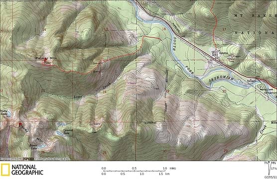 Palmer Route Map (white line is the road drive, red line is the hike) 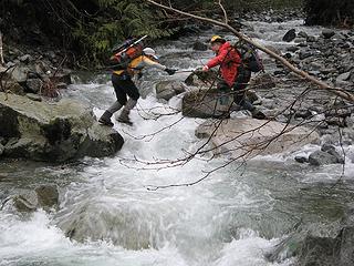 Crossing Lowe Creek 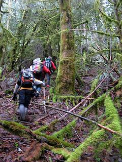 In the lower woods 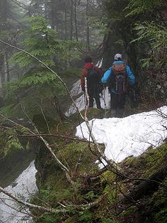 Bypassing a rock outcrop 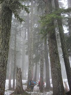 Misty winter woods hiking 1 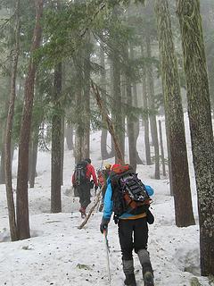 Misty winter woods hiking 2 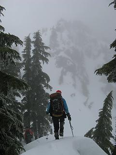 At the base of the false summit 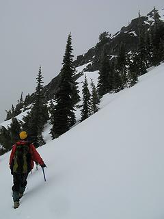 Traversing below the summit 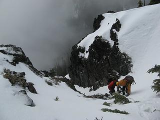 Ascending the gully 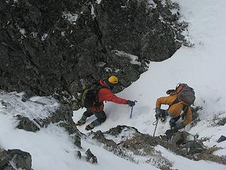 A thin spot in the gully 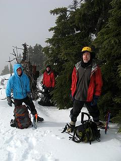 The moment of sunshine 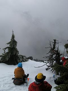 Lunch & a view of some part of Crosby 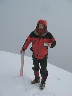 The summit post 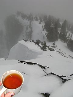 Summit tea, looking back down at the false summit 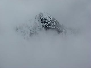 Maybe Crosby summit floating in the clouds 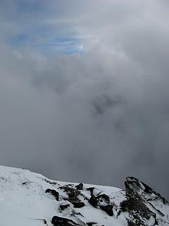 The only glimpse of blue sky 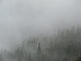 Foggy forest below 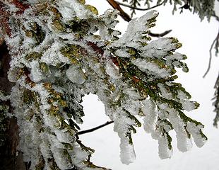 Icy cedar 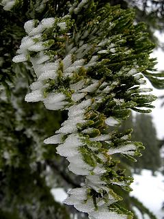 Little rime 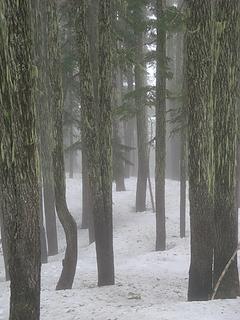 Foggy tree trunks 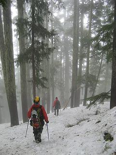 Descending foggy woods 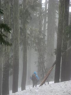 Descending foggy woods 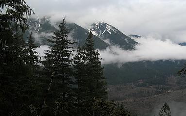 2 labels Grotto townsite & Radenska Ridge 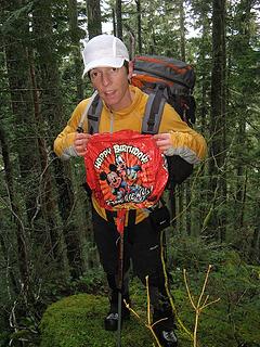 Dicey's birthday balloon 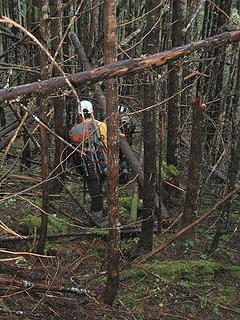 Not so fun to walk through  Mossy trunks 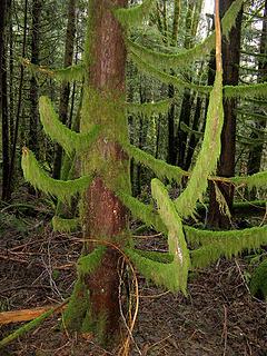 Mossy curves  Martin crossing Lowe Creek 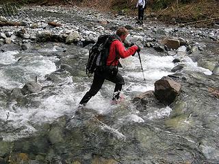 Dave crossing Lowe Creek 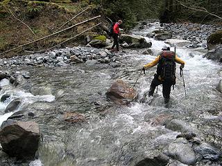 Dicey crossing Lowe Creek 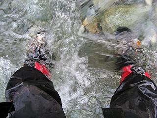 My feet in Lowe Creek
As beacons mountains burned at evening. J.R.R. Tolkien
As beacons mountains burned at evening. J.R.R. Tolkien
|
| Back to top |
  
|
|
Matt Lemke
High on the Outdoors

Joined: 15 Jul 2010
Posts: 2052 | TRs | Pics
Location: Grand Junction |
|
Matt Lemke
High on the Outdoors
|
Sun Feb 06, 2011 11:58 pm |
|
|
Looks like a great way to spend your Sunday  Nice TR
|
| Back to top |
|
|
iron
Member

Joined: 10 Aug 2008
Posts: 6392 | TRs | Pics
Location: southeast kootenays |
|
iron
Member
|
Mon Feb 07, 2011 12:25 am |
|
|
yep, should've joined. i thought it'd take longer.
how was the snow in the finally gully?
martin needs to teach us all how to use MM5 and dicey needs longer legs 
|
| Back to top |
|
|
puzzlr
Mid Fork Rocks

Joined: 13 Feb 2007
Posts: 7220 | TRs | Pics
Location: Stuck in the middle |
|
puzzlr
Mid Fork Rocks
|
Mon Feb 07, 2011 1:08 am |
|
|
Great TR. Glad things worked out after a "dicey" start. I looked at the map first and it didn't look so far, then I was surprised by the 4200' and 7+ hours. Nice work.
|
| Back to top |
|
|
Sky Hiker
Member

Joined: 03 Feb 2007
Posts: 1469 | TRs | Pics
Location: outside |
Nice report!! Been there done that except the part of falling in the drink 
|
| Back to top |
|
|
Redwic
Unlisted Free Agent

Joined: 23 Feb 2009
Posts: 3292 | TRs | Pics
Location: Going to the Prom(inence) |
|
Redwic
Unlisted Free Agent
|
Mon Feb 07, 2011 6:27 am |
|
|
Great report! I considered attempting Palmer this weekend, but then I figured the conditions would be too sketchy. Good job!
60 pounds lighter but not 60 points brighter.
60 pounds lighter but not 60 points brighter.
|
| Back to top |
|
|
Snowdog
Member

Joined: 21 Jul 2006
Posts: 1028 | TRs | Pics
Location: on (& off) the beaten path |
|
Snowdog
Member
|
Mon Feb 07, 2011 9:41 am |
|
|
| Quote: | | I really like the feel of the cloudy winter woods. with the mist glowing slightly above the snowy ground, and the moss-bearded trunks fading into soft shadows. It has sort of a gentle mystical feel to it, with all the edges softened and the light diffused by the misty air. |
Couldn't have said it better myself. 
'we don't have time for a shortcut'
'we don't have time for a shortcut'
|
| Back to top |
|
|
dicey
custom title

Joined: 11 May 2004
Posts: 2870 | TRs | Pics
Location: giving cornices a wider berth |
|
dicey
custom title
|
Mon Feb 07, 2011 9:52 am |
|
|
| iron wrote: | | how was the snow in the finally gully?
martin needs to teach us all how to use MM5 and dicey needs longer legs |
Snow in the final gully was thin and a little icy. Martin was able to kick good steps and we all wore crampons up and down (facing in) this gully.
Longer legs would really be useful for a lot of reasons!
Being wet all day wasn't that comfortable, luckily the temps were mild.
|
| Back to top |
|
|
Martin S
Member

Joined: 06 May 2007
Posts: 181 | TRs | Pics
Location: Out in the perimeter, where there are no stars |
|
Martin S
Member
|
Mon Feb 07, 2011 2:44 pm |
|
|
Palmer turned out to be a really nice trip. It was much less brushy than I had feared, and it was great to be able to drive all the way to Lowe Creek. I would recommend a high clearance vehicle for that road, though. It's got some rough spots. I would also recommend not trying to walk the old road shown on the topo since it's badly overgrown. Just stick to the crown of the ridge like Matt drew on the map above and you'll find some bits of game/climber trails to help out. They really should make all the deer wear little backpacks with ice axes sticking up so they can't make trails that duck under branches where us climbers get all hung up.
Here's a picture of the final bit of rock to the summit, taken in the spring a few years ago:
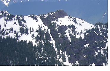 South side of Palmer summit (from Crosby)
"nothing's for certain" took the elevator down
while "anything can happen" climbed the stairs
- Ryszard Krynicki
"nothing's for certain" took the elevator down
while "anything can happen" climbed the stairs
- Ryszard Krynicki
|
| Back to top |
|
|
MtnGoat
Member

Joined: 17 Dec 2001
Posts: 11992 | TRs | Pics
Location: Lyle, WA |
|
MtnGoat
Member
|
Mon Feb 07, 2011 3:00 pm |
|
|
I've always been fascinated by that area, partly due to it's little traveled nature, partly due to the lure of the limestone deposits up there. Several sources (including Caves of WA if I remember correctly) discuss karst and sink topography in isolated patches up there, and one report discussed a fissure with open space behind it in one of the limestone outcrops. There could well be undiscovered caves up there, and it would rank as one of the very few cave bearing limestone units in WA. (Cave Ridge (Snoqualmie), Dock Butte, Metaline Falls, Cave Ridge (Okanogan), San Juans).
Diplomacy is the art of saying 'Nice doggie' until you can find a rock. - Will Rogers
Diplomacy is the art of saying 'Nice doggie' until you can find a rock. - Will Rogers
|
| Back to top |
|
|
cartman
Member
Joined: 20 Feb 2007
Posts: 2800 | TRs | Pics
Location: Fremont |
|
cartman
Member
|
Mon Feb 07, 2011 10:02 pm |
|
|
Interesting conditions. Not really remembering the route we did, but maybe Randy, don b, or Justus would. Wonder if that's the same gully we bypassed and went up to the right of, perhaps due to hard snow. We did it in Feb too.
|
| Back to top |
|
|
DIYSteve
seeking hygge

Joined: 06 Mar 2007
Posts: 12655 | TRs | Pics
Location: here now |
|
DIYSteve
seeking hygge
|
Tue Feb 08, 2011 8:35 am |
|
|
|
| Back to top |
|
|
the Zachster
Member

Joined: 17 Jan 2007
Posts: 4776 | TRs | Pics
Location: dog training |
"May I always be the kind of person my dog thinks I am"
|
| Back to top |
|
|
|
|
You cannot post new topics in this forum
You cannot reply to topics in this forum
You cannot edit your posts in this forum
You cannot delete your posts in this forum
You cannot vote in polls in this forum
|
Disclosure: As an Amazon Associate NWHikers.net earns from qualifying purchases when you use our link(s). |


 ...sorry it didn't end so well for everyone! Thanks for a great TR to a lesser known destination. And even though I prefer crisp white snow against a bright blue sky...those misty forest scenes are certainly delightful as well!