| Previous :: Next Topic |
| Author |
Message |
daffish
Member


Joined: 16 Sep 2009
Posts: 282 | TRs | Pics
Location: Dreamtime |
|
daffish
Member
|
 Wed Apr 13, 2011 11:28 am |
|
|
Reality trumps expectation
This little bump has 520 of prominence even though its elevation is only 1420. With only half a day available to me and avalanche danger quite high at the loftier elevations, I figured that this would be a good stroll in the woods for an afternoon. After closely reviewing the topo, I drove up French Creek Rd to find a good parking spot where I could head uphill. Just about when I thought I was in the general area, there was a forest road angling uphill; and the gate was open! Hmmm? This wasnt on the USGS topo I had with me.
Hiking up the easy road brought me near the ridge and where the road continued away from the peak, I entered the forest. There was dense second growth to the north but the old forest was untouched on the south and it was a pleasant ramble in the widely spaced trees. I meandered the green slope upward, wiggling around rotting logs and dodging clusters of ferns. The mosses were soft underfoot and lent myriad shades of green to the hike.
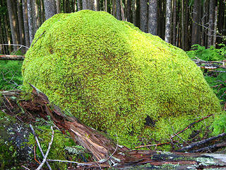 moss covered rock 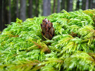 fir cone on moss 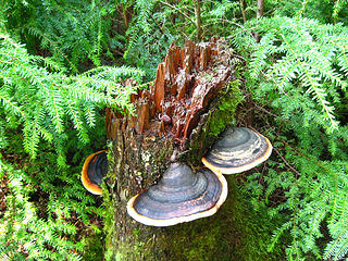 turkey tails 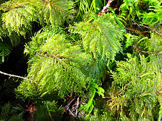 close up of moss 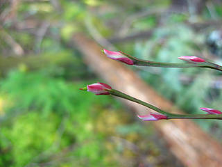 spring is here for the Huckleberries 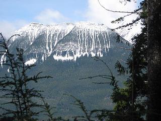 Mt Higgins across the valley 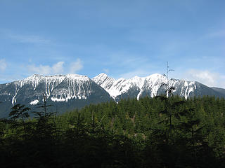 the three Higgins - West, Middle (Skadulgwas), and East 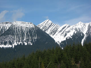 Skadulgwas Peak 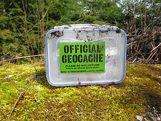 geocache on summit 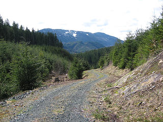 the road to the top
"Be moderate in everything, including moderation" Horace Porter
"Be moderate in everything, including moderation" Horace Porter
|
| Back to top |
  
|
|
Slugman
Its a Slugfest!

Joined: 27 Mar 2003
Posts: 16874 | TRs | Pics
|
|
Slugman
Its a Slugfest!
|
Wed Apr 13, 2011 12:51 pm |
|
|
Wait, you should get a GPS so you can skip all that "pleasant ramble in the widely spaced trees" and "mosses (that) were soft underfoot and lent myriad shades of green to the hike" and get right to "The messy fire ring with blackened pieces of wood, old beer cans and broken glass"?  
|
| Back to top |
|
|
Hulksmash
Cleaning up.

Joined: 20 Apr 2008
Posts: 7113 | TRs | Pics
Location: Arlington |
|
Hulksmash
Cleaning up.
|
Wed Apr 13, 2011 1:09 pm |
|
|
"Bears couldn't care less about us....we smell bad and don't taste too good. Bugs on the other hand see us as vending machines." - WetDog
Albuterol! it's the 11th essential
|
| Back to top |
|
|
Washakie
Member

Joined: 18 Aug 2010
Posts: 402 | TRs | Pics
Location: Ann Arbor, MI |
|
Washakie
Member
|
Wed Apr 13, 2011 5:54 pm |
|
|
"Purple Prose Attack" Alert - everyone gear up!
"What is the color when black is burned?" - Neil Young
"We're all normal when we want our freedom" - Arthur Lee
"The internet can make almost anyone seem intelligent" - Washakie
"What is the color when black is burned?" - Neil Young
"We're all normal when we want our freedom" - Arthur Lee
"The internet can make almost anyone seem intelligent" - Washakie
|
| Back to top |
|
|
dicey
custom title

Joined: 11 May 2004
Posts: 2870 | TRs | Pics
Location: giving cornices a wider berth |
|
dicey
custom title
|
Thu Apr 14, 2011 12:35 pm |
|
|
|
| Back to top |
|
|
|
|
You cannot post new topics in this forum
You cannot reply to topics in this forum
You cannot edit your posts in this forum
You cannot delete your posts in this forum
You cannot vote in polls in this forum
|
Disclosure: As an Amazon Associate NWHikers.net earns from qualifying purchases when you use our link(s). |


