| Previous :: Next Topic |
| Author |
Message |
Slugman
Its a Slugfest!


Joined: 27 Mar 2003
Posts: 16874 | TRs | Pics
|
|
Slugman
Its a Slugfest!
|
 Wed May 04, 2011 3:15 pm |
|
|
I left Seattle at 5 pm on Saturday, and drove out to the coast, towards Rialto beach, and turned onto Rayonier land, sign said "open for recreational use".  But when I got to my final road, #5600, it was not only gated but red-dotted, closed to all use. But when I got to my final road, #5600, it was not only gated but red-dotted, closed to all use.  So, there went "plan A", a trip into Norwegian Memorial the easy way, with a scouting expedition to Allen's Bay on Lake Ozette. Next up, plan B, another private logging road that leads to a shortcut trail to Mosquito beach. I couldn't find it, at least I wasn't sure if I had found it, or maybe it was one of the gated or overgrown roads I saw. So, there went "plan A", a trip into Norwegian Memorial the easy way, with a scouting expedition to Allen's Bay on Lake Ozette. Next up, plan B, another private logging road that leads to a shortcut trail to Mosquito beach. I couldn't find it, at least I wasn't sure if I had found it, or maybe it was one of the gated or overgrown roads I saw.  By this time it was 1 am, so I found a likely spot and crashed in the back of the car (free, at least).
Sunday morning it was time for emergency back-up plan C. I drove south on 101 to the Moclips Highway, then north to Taholah, only to find my Quinault reservation road closed from 10:30 am to 3 pm as part of a really big road rally that was going on. By this time it was 1 am, so I found a likely spot and crashed in the back of the car (free, at least).
Sunday morning it was time for emergency back-up plan C. I drove south on 101 to the Moclips Highway, then north to Taholah, only to find my Quinault reservation road closed from 10:30 am to 3 pm as part of a really big road rally that was going on.  So, at this point I quit, drove down to the drive-on beach at Moclips, and took a long nap in the back of the car. Then I realized the road was now open, the tide was going out, and it was still a long time until sunset, so back to Taholah I went, stopping at the police station/jail to get my day use permit. Cash only, exact change only.
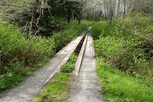
I crossed the Quinault river on the big bridge, then Duck creek on another huge bridge, then crossed Camp creek on the "pre-Columbian arch" from the movie Romancing the Stone. OK, slight exaggeration, but it was a white-knuckle bridge for sure. So, at this point I quit, drove down to the drive-on beach at Moclips, and took a long nap in the back of the car. Then I realized the road was now open, the tide was going out, and it was still a long time until sunset, so back to Taholah I went, stopping at the police station/jail to get my day use permit. Cash only, exact change only.
I crossed the Quinault river on the big bridge, then Duck creek on another huge bridge, then crossed Camp creek on the "pre-Columbian arch" from the movie Romancing the Stone. OK, slight exaggeration, but it was a white-knuckle bridge for sure.
 Pre-Columbian arch 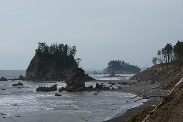 Tunnel island trip 008 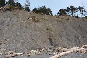 The deadly descent 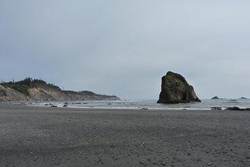 Tunnel island trip 012 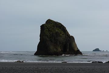 Tunnel island trip 013 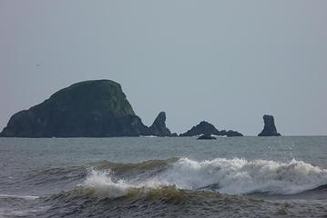 Tunnel island trip 018  Tunnel island trip 037  Tunnel island trip 039 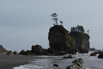 Tunnel island trip 041 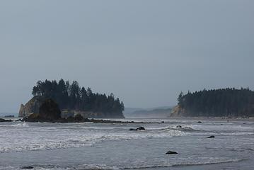 Tunnel island trip 047 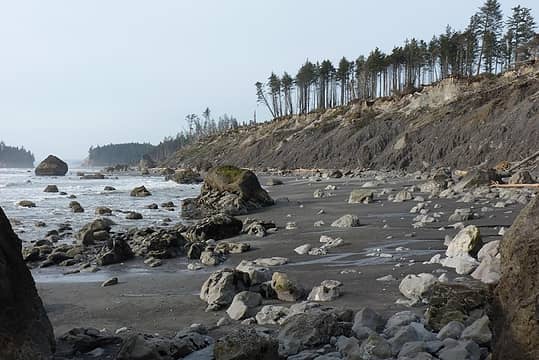 Tunnel island trip 053 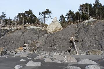 Tunnel island trip 054 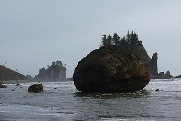 The egg 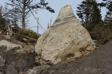 Eroded beehive of rock  Tunnel island trip 089  Tunnel island trip 096 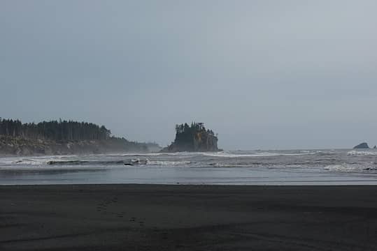 Tunnel island trip 112  The mighty Raft river 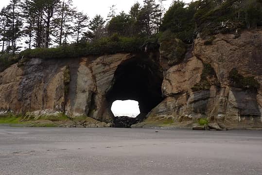 That tunnel is bigger than it looks 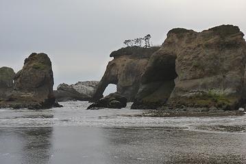 Tunnel island trip 145 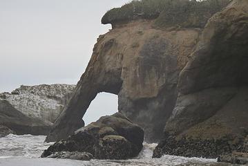 Tunnel island trip 146  Tunnel island trip 160 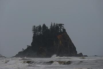 Big Hogsback  Tunnel island trip 229 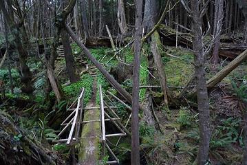 Tunnel island trip 225  Tunnel island trip 230 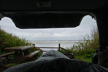 My version of the shoe shot  Tunnel island trip 250 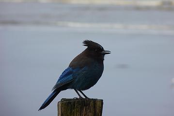 Tunnel island trip 257 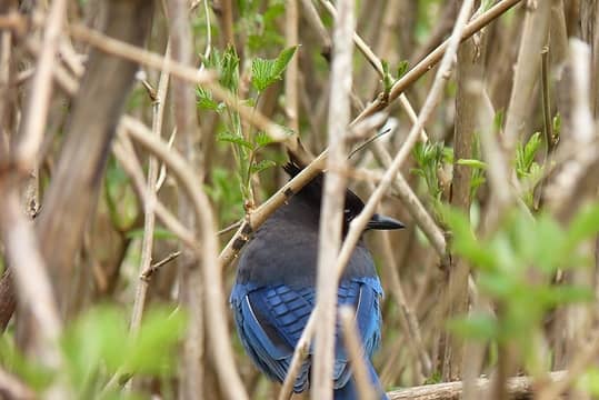 Tunnel island trip 275  Tunnel island trip 278  Tunnel island trip 281 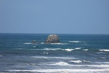 Tunnel island trip 286  The pleasures of 18X zoom  Tunnel island trip 293 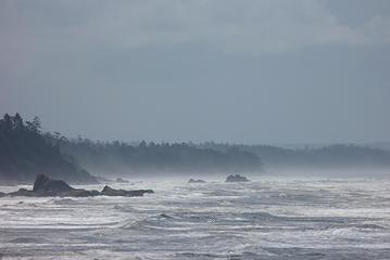 Tunnel island trip 298 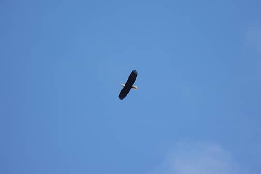 18X zoom 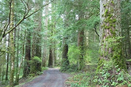 Tunnel island trip 323 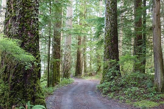 Tunnel island trip 326 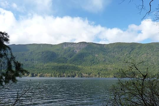 Tunnel island trip 336 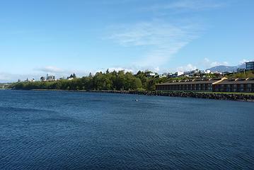 Tunnel island trip 348  Tunnel island trip 349 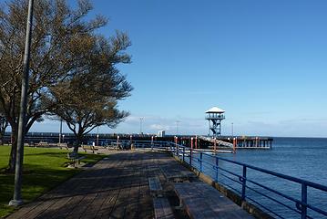 City Pier in Port Angeles 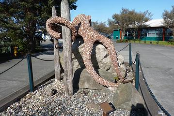 The Rocktopus 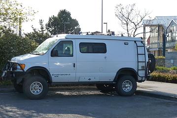 My dream van 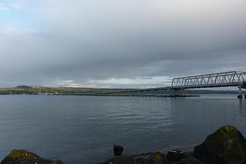 Hood Canal bridge  More "Pleasures of 18X zoom" 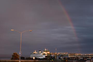 Where's my gold, ferry system? 
|
| Back to top |
  
|
|
flatsqwerl
Member

Joined: 23 Feb 2010
Posts: 1049 | TRs | Pics
Location: tacoma |
That looks like a great camping setup with that van you have ...4wd too nice!
|
| Back to top |
|
|
David¹
Token Canadian

Joined: 25 Jul 2002
Posts: 3040 | TRs | Pics
Location: The Great White North |
|
David¹
Token Canadian
|
Wed May 04, 2011 3:24 pm |
|
|
Nice!  Thanks for posting this.
|
| Back to top |
|
|
onemoremile
Member

Joined: 26 Dec 2010
Posts: 1305 | TRs | Pics
Location: Sequim |
Cool. Like the rock islands. There is a van, similar to the one in your picture, in Sequim that has a small lift kit and big tires. It also has a rack on top for all kinds of additional gear--including a small boat.
Arbolist? Look up the word. I dont know, maybe I made it up. Anyway, its an arbo-tree-ist, somebody who knows about trees. G.W. Bush
Arbolist? Look up the word. I dont know, maybe I made it up. Anyway, its an arbo-tree-ist, somebody who knows about trees. G.W. Bush
|
| Back to top |
|
|
Slugman
Its a Slugfest!

Joined: 27 Mar 2003
Posts: 16874 | TRs | Pics
|
|
Slugman
Its a Slugfest!
|
Wed May 04, 2011 3:26 pm |
|
|
I wish that was my van. It belonged to some kayakers in PA. I was in my Subaru.
I just noticed I only uploaded one picture of the magnificent Tunnel Island. More to follow.....
|
| Back to top |
|
|
Kat
Turtle Hiker
Joined: 05 Oct 2003
Posts: 2560 | TRs | Pics
|
|
Kat
Turtle Hiker
|
Wed May 04, 2011 5:28 pm |
|
|
Precarious bluff descent!
And your "shoe shot" pic - it looks like you sleep in the cargo area of your Sube, with the rear seats folded down? I didn't think there was enough room?
|
| Back to top |
|
|
Slugman
Its a Slugfest!

Joined: 27 Mar 2003
Posts: 16874 | TRs | Pics
|
|
Slugman
Its a Slugfest!
|
Wed May 04, 2011 5:58 pm |
|
|
I have a twin size futon in the back of the Subaru Legacy. The cargo area is exactly 6 feet long. The futon sticks out just a tad, keeping the rear gate from closing all the way, but that's OK as I need air anyway, and the rear hatch's downward slope sheds the rain. In a strong wind, the end of the futon on one side can get a bit, um, damp. If I want to close the hatch all the way, I can, and I just have to sleep catty-corner on the futon (I'm 6' 3"). It really is a comfortable way to sleep, almost as good as a real bed, or my camper van. Since I got the van I rarely car camp in the car anymore, but it is still useful for sleeping at trail heads the night before a hike. I use a mosquito net I got at REI to keep out the skeeters during that part of the year. Mombasa mosquito net. It's big enough to cover the whole back end of the car, or all four side windows.
In that shoe shot picture, the rear hatch is only about half way up. If it was all the way up, you wouldn't see it in that picture.
|
| Back to top |
|
|
Kat
Turtle Hiker
Joined: 05 Oct 2003
Posts: 2560 | TRs | Pics
|
|
Kat
Turtle Hiker
|
Wed May 04, 2011 6:03 pm |
|
|
Boy, that is super useful info - thanks a zillion Slugman! Yer gonna laugh - 2 weeks ago we tried to sleep in our Sube's front seats, that was sure a no-go, I figured that out in about 5 seconds  Our cargo area is pretty dirty and full of stuff tho, gotta do some rearranging and cleaning.
Sorry for the thread drift, and back to the beautiful beach trip regular programming!
Our cargo area is pretty dirty and full of stuff tho, gotta do some rearranging and cleaning.
Sorry for the thread drift, and back to the beautiful beach trip regular programming!
|
| Back to top |
|
|
puzzlr
Mid Fork Rocks

Joined: 13 Feb 2007
Posts: 7220 | TRs | Pics
Location: Stuck in the middle |
|
puzzlr
Mid Fork Rocks
|
Wed May 04, 2011 6:14 pm |
|
|
I like that giant Hershey's Kiss rock perched on the bluff (white chocolate variety). Thanks for this report -- that's an amazing looking place I've never heard of.
|
| Back to top |
|
|
Trevor
Member
Joined: 31 Jan 2004
Posts: 1562 | TRs | Pics
Location: Edmonds, WA |
|
Trevor
Member
|
Wed May 04, 2011 6:28 pm |
|
|
Thanks for the info on a rarely-photographed area!
|
| Back to top |
|
|
seawallrunner
dilettante

Joined: 27 Apr 2005
Posts: 3307 | TRs | Pics
Location: Lotusland |
wow, what a great place !!! would love to see that area with my own eyes...
and I loved your description on how to get there:
| Quote: | | Then the road got really interesting, narrow, hemmed in by brush and saplings, and pothole after pothole after pothole. Really bad, deep potholes, and no way to even try to dodge them. This goes on for miles. Finally I figure I've gone way too far, but in reality not far enough, and I see a grassy spot on the left side of the road, with a car parked there, and a small trail heading into the woods like a low tunnel. I follow that, and there is old rotting boardwalks, and some stairs still semi-existing taking me down into a creek gully, and across a huge log over the bottom of the gully, and next to a cabin on the bluff. There are some people in the cabin, and I ask if I am OK to be here, and they say "sure, no problem", so I continue on the trail. It ends on a spine of land 100 feet above the beach, with a cliff on the beach side, and a cliff down into the stream gully on the other side. huh.gif But I scouted around, and worked my way down the spine of land to about 50 feet above the beach, and I found a series of footsteps carved or beaten into the bluff's dirt and rocks, and that takes me to a grassy hummock, and then down from that is another series of micro-steps, then a little rear-end scooting, and I was down to a pile of rocks that could be descended to the beach sand. Whew! Right away I could see that this is not a place to challenge the tide, as the high water crashes right up against the bluff, for a long way in either direction. I went a short way south just to see around the nearby point, then headed north, as I was a couple of miles south of my intended destination. It all was for the best, though, as I got good looks at Hogsback and Little Hogsback, plus a good five mile (R/T) hike. |
Priceless !!
|
| Back to top |
|
|
half fast
member

Joined: 21 Mar 2010
Posts: 1392 | TRs | Pics
Location: Living the dream in my 5th Wheel |
It's all about the fun, oh and maybe the chocolate - half fast
|
| Back to top |
|
|
Sore Feet
Member

Joined: 16 Dec 2001
Posts: 6307 | TRs | Pics
Location: Out There, Somewhere |
Slug, I've wanted to get to Tunnel Island for years. The beta in this report alone is worth a beer or two.
|
| Back to top |
|
|
Slugman
Its a Slugfest!

Joined: 27 Mar 2003
Posts: 16874 | TRs | Pics
|
|
Slugman
Its a Slugfest!
|
Wed May 04, 2011 11:15 pm |
|
|
Thanks all, for the kind words. I had seen the area on the topo maps of course, but never knew how cool it was, or that it was accessible, until I read a trip report here a couple of years ago. It was by charmer, who has only posted 8 times, 2 of them trip reports. But his Elephant rock report struck a chord in me, and I had to go see for myself. I'm glad I went in where I did, and walked the beach the last two miles, as it seems that driving all the way to the Raft river leads to some pretty muddy trails to the beach, and you'd have to walk the miles anyway to see the rest of the cool stuff. The road appears to be worse now than when he drove it two years back.
So I go into the police station to buy my day-use pass for the reservation (no overnight camping). You go up to the same window that visitors to the jail use. It is glass so dark you see nothing, and a disembodied voice comes out of a speaker. I'm looking around like muppets hearing the announcer's voice in Pigs in Space, not even sure the voice is talking to me. Finally I realize they are asking for $5 and some ID. I pass it through to the invisible person, and they pass back a receipt and my ID. The receipt is generic and says nothing about what the money is for. The whole thing was weird but not creepy or unpleasant. The residents of the reservation that I met were all very friendly.
On the drive out I saw three fat chicken-sized birds, brown colored, maybe grouse? I also saw several rabbits. I could have lived for a week just off what I saw driving out. I may be "pro-bunny", but I'm also "pro-barbecue".
|
| Back to top |
|
|
Backpacker Joe
Blind Hiker

Joined: 16 Dec 2001
Posts: 23956 | TRs | Pics
Location: Cle Elum |
Hey Slugmeister, I met the owner of your dream 4x4 at the Grange in Issaquah filling up with B50 biodiesel. She told me they have a place on the coast and they go there all the time. They bought their truck used (60,000) as opposed to new (100,000) She was a nice lady.
"If destruction be our lot we must ourselves be its author and finisher. As a nation of freemen we must live through all time or die by suicide."
Abraham Lincoln
"If destruction be our lot we must ourselves be its author and finisher. As a nation of freemen we must live through all time or die by suicide."
Abraham Lincoln
|
| Back to top |
|
|
|
|
You cannot post new topics in this forum
You cannot reply to topics in this forum
You cannot edit your posts in this forum
You cannot delete your posts in this forum
You cannot vote in polls in this forum
|
Disclosure: As an Amazon Associate NWHikers.net earns from qualifying purchases when you use our link(s). |


 Nice photos... thanks for sharing...