| Previous :: Next Topic |
| Author |
Message |
seattlehikertoo
Member


Joined: 26 Jun 2008
Posts: 582 | TRs | Pics
Location: Finding an alternative to Mailbox Pk |
I made an afternoon trip to the Olympics for a hike that I have wanted to do for a long time. The weather was iffy still, but what else is new. I took the bright and early 10:30a ferry at over to Kingston, but needed to stop for supplies. After some last minute work details, slow traffic, and a couple of wrong turns, I made it to the end of FR 2860-120 (elev 3200 ft) where the trail begins by about 2p. By the time I headed down the boot path to Mueller creek, it must have been 2:15p or so, but I was too scared to look at the time. This is why you always bring your headlamp no matter what. As it turns out, I didn't need it, but being pressed for time is no fun on one of the few relatively sunny hiking days I've had during this seldom sunny spring.
The first 250 yards of the hike down the abandoned forest road are not pretty as you pass charred camp fire pits on your way down to Mueller creek (losing 100 ft or so of elev).
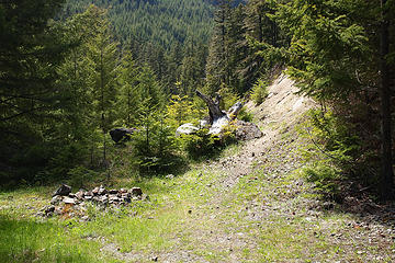 Baldy Grey Wolf via Maynard Burn: Ugly start to trail with unkept campfires 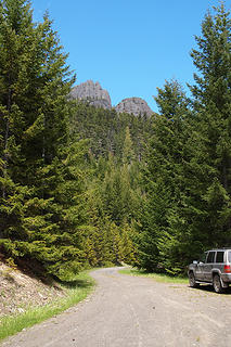 Baldy Grey Wolf via Maynard Burn:Looking back on Forest road FR 2860-120, and my lonely vehicle. 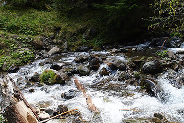 Baldy Grey Wolf via Maynard Burn: Mueller Creek crossing challenges 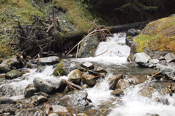 Baldy Grey Wolf via Maynard Burn: Mueller Creek 1/8 mile in 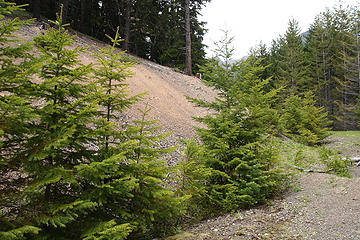 Baldy Grey Wolf via Maynard Burn: Crossing the road and going straight up c3500. 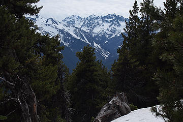 Baldy Grey Wolf via Maynard Burn: Mt Deception from Maynard Burn trail 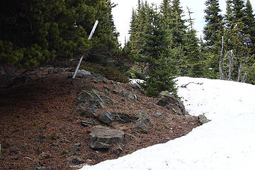 Baldy Grey Wolf via Maynard Burn: Ridge snow-free in spots c5750. NPS boundary follows ridge. 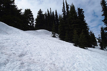 Baldy Grey Wolf via Maynard Burn: Plenty of snow at 5400 feet N and NE aspect of ridge. Summer trail may go to right of screen. I stayed on the spine (center) 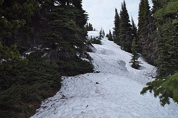 Staying on snow and near ridge fastest c5800 ft 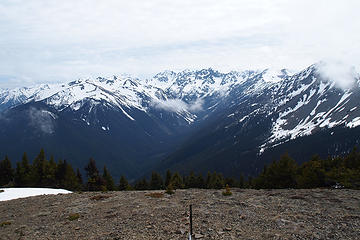 Looking S up Royal Basin from Pt6537. 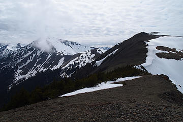 Looking SW to Grey Wolf Ridge from Pt6537. Baldy summit on the right. 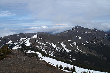 Looking ENE to Tyler Pk from Pt 6537 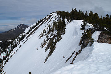 Looking back (E) to Pt 6537. Tyler Peak on left. 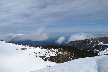 Looking N from the saddle between Pt 6537 and Baldy 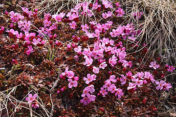 Sedum sprouting pink flowers. This is why you should try to stay on the snow as much as possible until trail melts out. 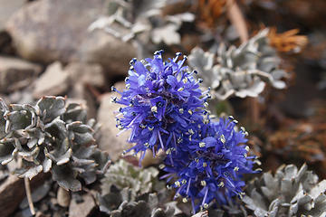 BaldyGreyWolf-110617 - 031 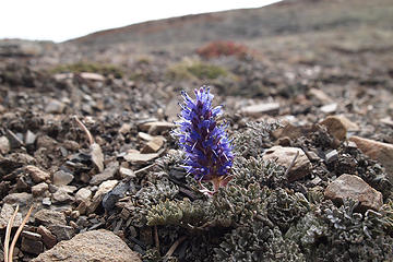 BaldyGreyWolf-110617 - 034 Looking SW to Grey Wolf Ridge from Pt6537. Baldy summit on the right. 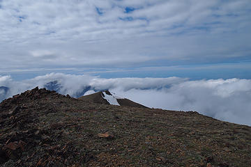 Looking NW from Baldy Summit 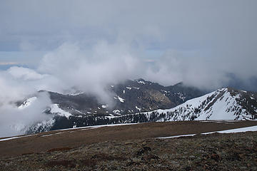 BaldyGreyWolf-110617 - 043 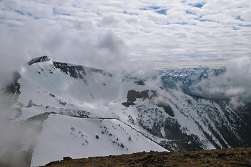 GreyWolf and Olympus from Baldy 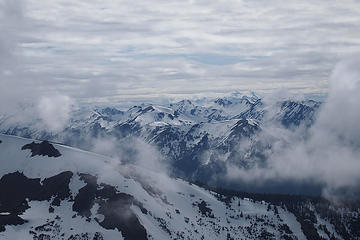 Looking SW to Olympus (right of center) from Baldy summit 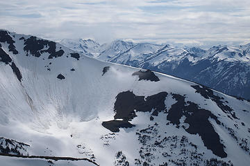 Looking SW to huge slides on Grey Wolf NE aspect with Mt Cameron rising above the corniced NW ridge. 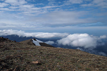 BaldyGreyWolf-110617 - 071 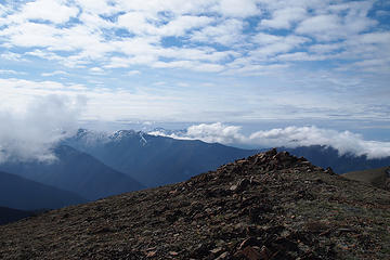 BaldyGreyWolf-110617 - 072 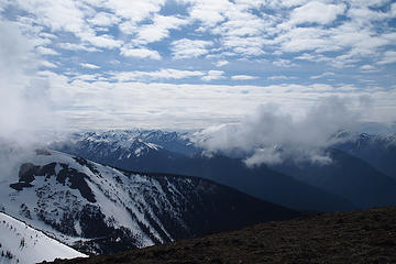 BaldyGreyWolf-110617 - 073 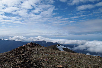 Looking NW from Baldy summit 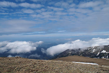 Looking N into the Strait of Juan De Fuca from Baldy summit 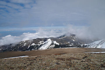 BaldyGreyWolf-110617 - 081 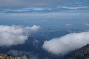 Looking N across the Strait of Juan De Fuca from Baldy summit 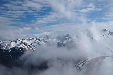 Looking S from Baldy to I'm guessing right to left:Grey Wolf, Clark,Needles,Deception,Mystery,Hal Foss,Fricaba 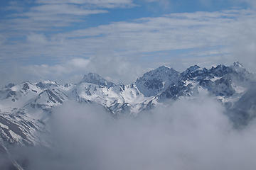 Zoom looking S from Baldy into Deception Basin guarded by Fricaba,Hal Foss,Mystery,Deception. The Needles to the right 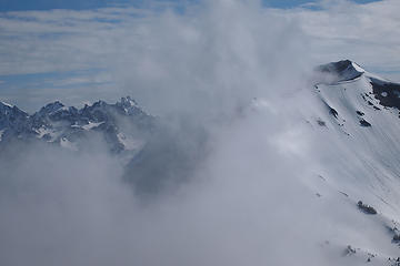 Looking S from Baldy-Zoom of The Needles 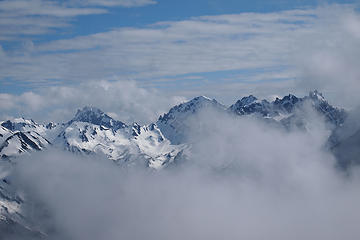 Zoom looking S from Baldy into Royal Basin guarded by Fricaba,Hal Foss,Mystery,Deception. The Needles to the right 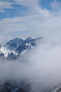 Looking S from Baldy to Deception, Clark and The Needles 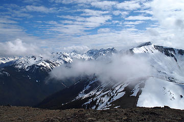 Looking S from Baldy Rt to Royal Basin peaks with Grey Wolf to the right. 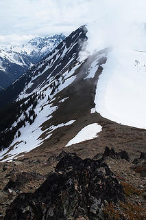 Heading down from Baldy along the route to Grey Wolf 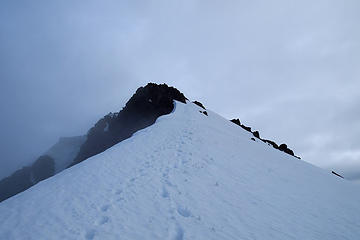 Grey Wolf. Looking back on my route 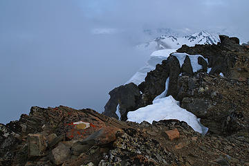 Grey Wolf summit marker. Fog rolling in. 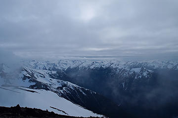 Looking SW from Grey Wolf over the Grey Wolf drainage 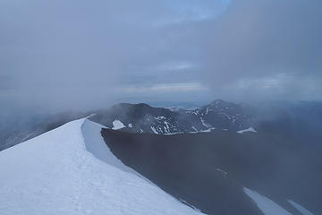 Coming down off Grey Wolf 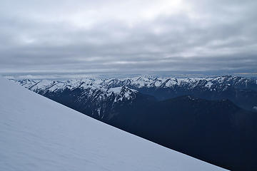 BaldyGreyWolf-110617 - 117  Looking NW from saddle below Grey Wolf at I'm guessing Hurricane Ridge (left) and Deer Park (right) 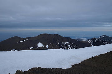 Looking N into the Strait of Juan De Fuca with 600 feet of sand and scree on Mt Baldy waiting for me (center)  Looking SE at Mt Rainier rising between Buckhorn Mt summits from the saddle NW of Greywolf summit 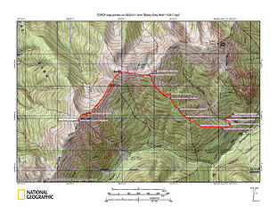 Route up to Baldy and Grey Wolf via Maynard Burn trail
|
| Back to top |
  
|
|
Phil
Member

Joined: 02 Jul 2003
Posts: 2025 | TRs | Pics
Location: Shoreline, WA |
|
Phil
Member
|
 Mon Jun 20, 2011 5:33 am |
|
|
| seattlehikertoo wrote: | | By the time I headed down the boot path to Mueller creek, it must have been 2:15p or so, but I was too scared to look at the time. |
 I like that. Truthfully I wouldnt have thought that trip could be done so fast. Great pics, and interesting report! I like that. Truthfully I wouldnt have thought that trip could be done so fast. Great pics, and interesting report!
|
| Back to top |
|
|
Ancient Ambler
Member

Joined: 15 May 2007
Posts: 1092 | TRs | Pics
Location: Bainbridge Island |
Excellent trip, report and photos. You obviously made it to the end of the -120 spur road. I'm assuming the washout is still there, about 3/10 mile in from the main road? When I looked at it a few weeks ago there was room to get by on the north side of the washout, but I didn't want to chance it caving in from vehicle weight. Maybe I was being overly cautious. Glad you got such a nice day to head up to Gray Wolf, which offers some of the best views in the Olympics.
|
| Back to top |
|
|
iron
Member

Joined: 10 Aug 2008
Posts: 6392 | TRs | Pics
Location: southeast kootenays |
|
iron
Member
|
Mon Jun 20, 2011 8:55 am |
|
|
good stuff. beautiful area! glad you got some sun and warmth. fast times as always.
|
| Back to top |
|
|
seattlehikertoo
Member
Joined: 26 Jun 2008
Posts: 582 | TRs | Pics
Location: Finding an alternative to Mailbox Pk |
Ancient-Your info a while back was very helpful, except I forgot about not getting suckered into side-hilling around Pt6527 after descending from Baldy.
FYI-the road FR 2680-120 is fine now. There are some rocks that have tumbled down onto it within 2 miles from the end, but they are easily passable. FR 2870 looks like it has been recently graded especially as it rises and drops steeply past Dungeness Forks Campground.
|
| Back to top |
|
|
wreamer
Member

Joined: 13 Apr 2008
Posts: 80 | TRs | Pics
Location: Missoula |
|
wreamer
Member
|
Mon Jun 20, 2011 4:43 pm |
|
|
Thanks for the TR. Love pic 31 of the Olympic Mountain Cutleaf Synthris, one of 11 endemic plants* on the Olympic peninsula!
*From Olympic National Park, A Natural History, Revised addition by Tim McNulty University of Washington Press, 2009
"Nothing can stop the man with the right mental attitude from achieving his goal; nothing on earth can help the man with the wrong mental attitude."
-Thomas Jefferson-
"Nothing can stop the man with the right mental attitude from achieving his goal; nothing on earth can help the man with the wrong mental attitude."
-Thomas Jefferson-
|
| Back to top |
|
|
RumiDude
Marmota olympus

Joined: 26 Jul 2009
Posts: 3589 | TRs | Pics
Location: Port Angeles |
|
RumiDude
Marmota olympus
|
Mon Jun 20, 2011 5:07 pm |
|
|
Cool pics and great TR. I want to get up there soon.
Rumi
"This is my Indian summer ... I'm far more dangerous now, because I don't care at all."
"This is my Indian summer ... I'm far more dangerous now, because I don't care at all."
|
| Back to top |
|
|
seattlehikertoo
Member
Joined: 26 Jun 2008
Posts: 582 | TRs | Pics
Location: Finding an alternative to Mailbox Pk |
Thanks for saving me the time of looking up the name of that purple flower...I am going to stitch some panos when I get a chance...
|
| Back to top |
|
|
Rainie Too!
Member

Joined: 12 Dec 2008
Posts: 377 | TRs | Pics
|
Wow! Pretty fast, with that much elevation. Nice to see some bare ground. Looks like a great workout with views. 
|
| Back to top |
|
|
|
|
You cannot post new topics in this forum
You cannot reply to topics in this forum
You cannot edit your posts in this forum
You cannot delete your posts in this forum
You cannot vote in polls in this forum
|
Disclosure: As an Amazon Associate NWHikers.net earns from qualifying purchases when you use our link(s). |


