| Previous :: Next Topic |
| Author |
Message |
D. Inscho
Not bored yet...


Joined: 28 Feb 2010
Posts: 973 | TRs | Pics
Location: Bellingham,WA |
|
D. Inscho
Not bored yet...
|
 Thu Jun 23, 2011 11:48 pm |
|
|
Stage I: Alvord Desert playa (Droppin some Alvord D.)
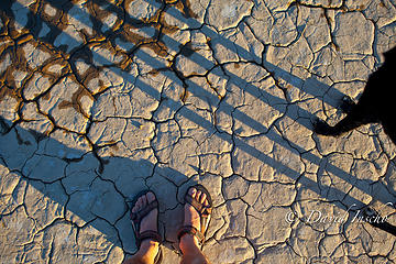 Sunset on cracked mud. 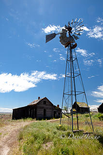 Renewable energy. Old becomes new again. 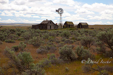 Depression era homestead. 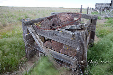 Box-o-rocks. Fencing corner. 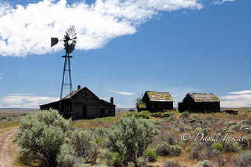 High desert homestead. 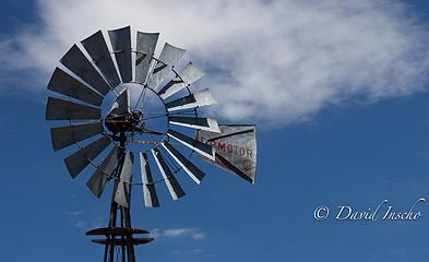 Wind power. 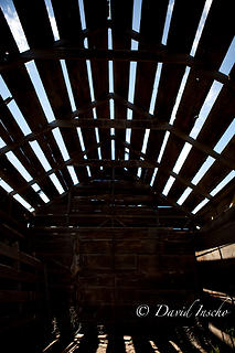 Shed 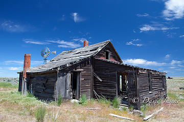 Near Grass Valley, OR High desert homestead. 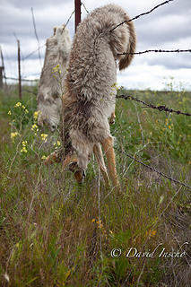 "Sportsmen" trophies 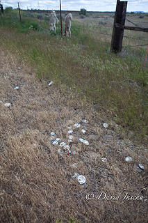 "Sportsmen's" midden. 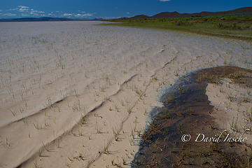 Thick water and reed grass. Looking south into Nevada. 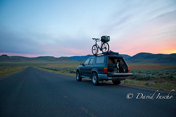 Finally! On the Fields/Folly farm Rd. at sunset. 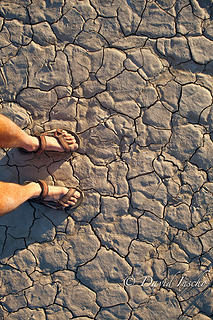 Cracked mud for miles. 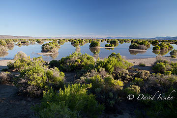 Salt tolerant Greasewood bushes. 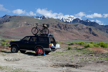 "Lakeside" camp 1st night, Steens in background 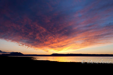 Sunrise over Alvord basin. Tailgate shot. 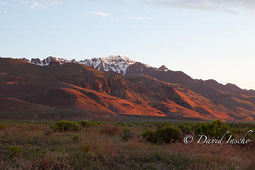 Steens Mtn. in sunrise light. Thick water and reed grass. Looking south into Nevada. 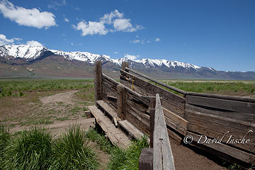 Beef country. Steens Mtn. in background. 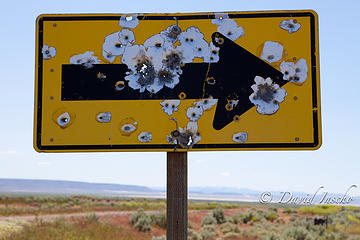 Second amendment protection from threats to freedom. Nearly every sign was shot up in eastern Oregon! (feel free to go left?) 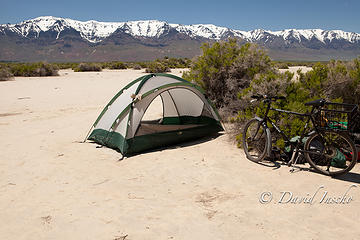 Camp at playa's edge. Steens Mtn. in background. 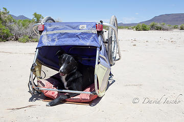 Portable shade. 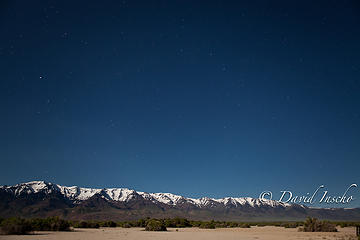 Ursa Major over Steens Mtn. Moonlit desert. 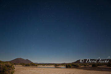 Playa's edge by moonlight. 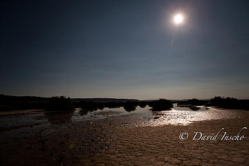 Moonshot over playa 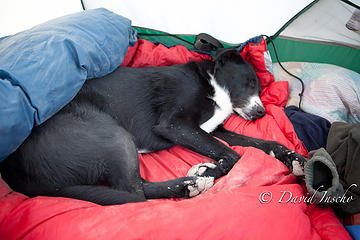 Dusty & tired 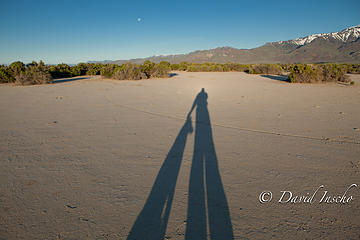 Good dog. Man, beast, and waning moon. Sunset on cracked mud. 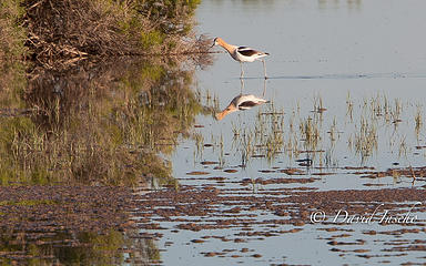 American Avocet 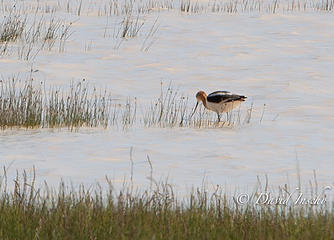 American Avocet. 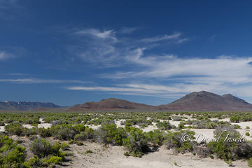 Oregon high desert 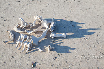 Where's the beef? 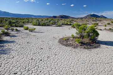 Beyond the playa, Oregon high desert tiles. 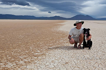 Playin' on the playa. 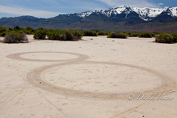 What a bike and a little free time in the desert can yield. Steens Mtn in background. 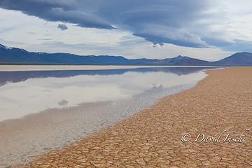 Earth & sky 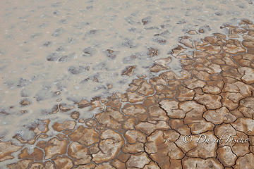 Advancing playa 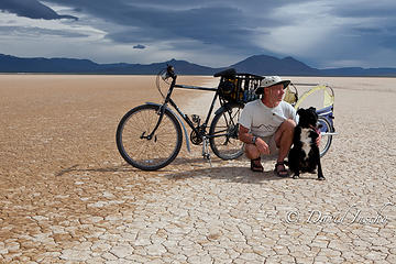 Mechanical steed and dog chariot. 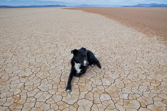 Chillin' on the playa 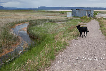 The path from the road to Alvord Hot Springs 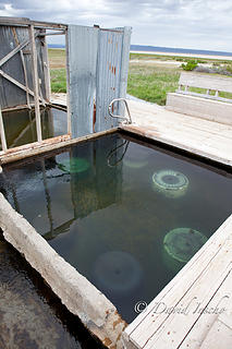 Pool and sittin' tubs 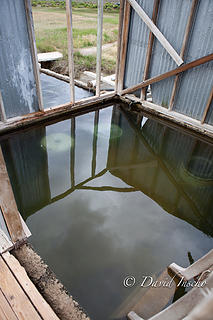 Alvord hot spring 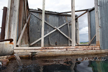 Soaker's-eye view. Lots of hot water. 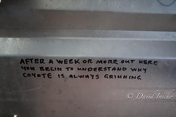 Alvord Hot Spring wisdom. 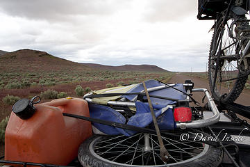 Fields/Follyfarm road with approaching storm, taken from sun roof. 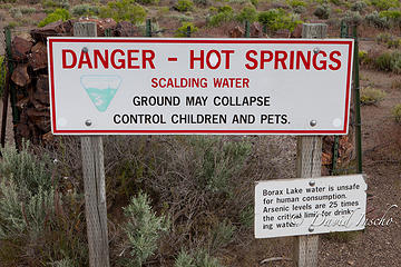 Bad place to bring a thirsty dog. 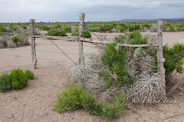 One of the gates 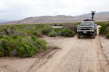 The road in. 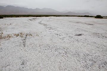 Borax mine site 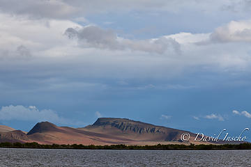 Looking south over Borax Lake  Deep and hot 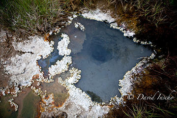 Extreme soakers only! 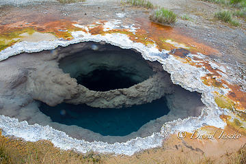 Eyeball into the earth 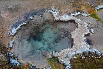 This one was boiling too 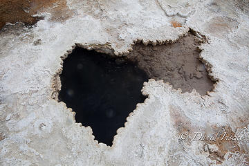 Boiling hot spring 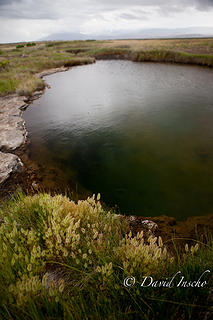 Lowest (soakable) hot spring 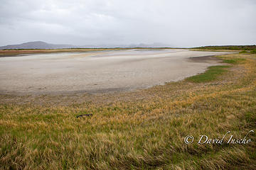 Approaching storm 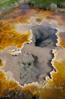 Borax hot spring, algae & mineral crust. 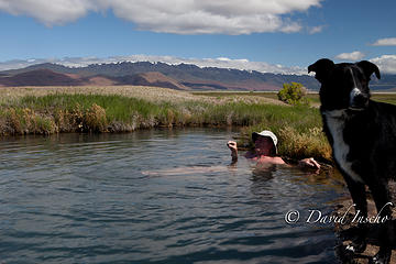 Soak it! I did! Aaahhh. 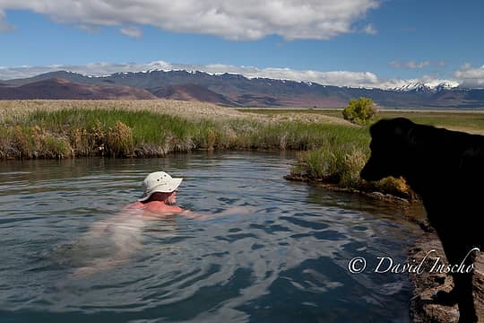 Lowest hot spring. Steens range beyond. 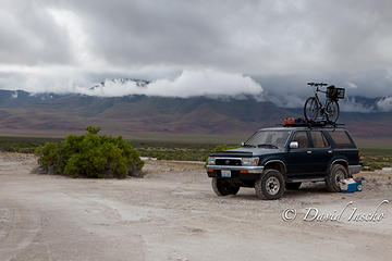 Borax Lake truck camp. 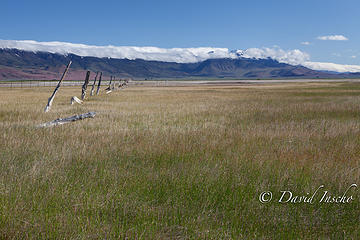 Steens range from Borax lake 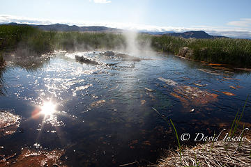 "Gusher" hot spring 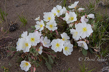 Evening Primrose - Oenothera (id courtesy of Marta) 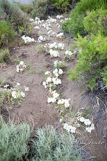 Desert flowers on dunes, Borax lake 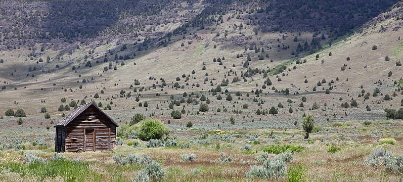 Steens country 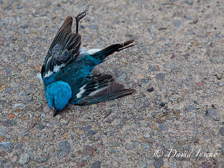 Lazuli Bunting, gone. 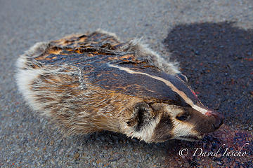 Badger: roadside taxonomy  Badger claws 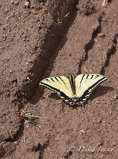 Oregon Swallowtail 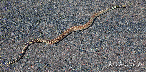 Not quite roadkill... 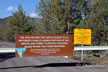 My gate 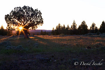 Juniper and meadow camp 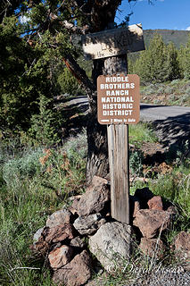 Never made it 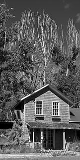 Frenchglen residence 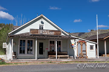 Frenchglen General 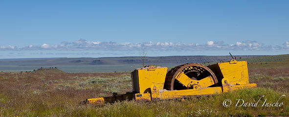 High desert monument 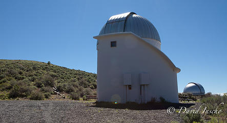 Pine Mtn. Observatory 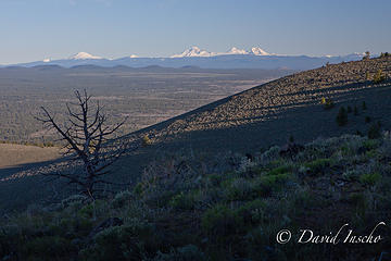 4 labels Mt. Bachelor, Broken Top/South Sister, Middle Sister, North Sister. 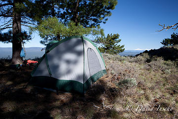 Pine Mtn. camp 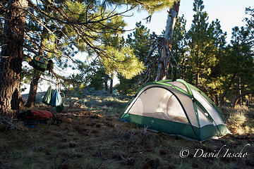 Pine Mtn. camp
http://david-inscho.smugmug.com/
The key to a successful trip is to do the planning during work hours. -- John Muir
My most memorable hikes can be classified as 'Shortcuts that Backfired'. --Ed Abbey
http://david-inscho.smugmug.com/
The key to a successful trip is to do the planning during work hours. -- John Muir
My most memorable hikes can be classified as 'Shortcuts that Backfired'. --Ed Abbey
|
| Back to top |
  
|
|
Slugman
Its a Slugfest!

Joined: 27 Mar 2003
Posts: 16874 | TRs | Pics
|
|
Slugman
Its a Slugfest!
|
Fri Jun 24, 2011 6:09 am |
|
|
Wow. Definitely a danger of "superlative abuse".  That report was truly excellent in every way. Thank you. That report was truly excellent in every way. Thank you.
|
| Back to top |
|
|
lookout bob
WTA proponent.....

Joined: 12 Apr 2005
Posts: 3045 | TRs | Pics
Location: wta work while in between lookouts |
|
lookout bob
WTA proponent.....
|
Fri Jun 24, 2011 7:17 am |
|
|
"Altitude is its own reward"
John Jerome ( from "On Mountains")
|
| Back to top |
|
|
RodF
Member

Joined: 01 Sep 2007
Posts: 2593 | TRs | Pics
Location: Sequim WA |
|
RodF
Member
|
Fri Jun 24, 2011 7:18 am |
|
|
Marvelous photos! Capture an area that always struck me as somewhat "not of this earth". The whole area has a grand scale. Looking forward to Steens!
"of all the paths you take in life, make sure a few of them are dirt" - John Muir
"the wild is not the opposite of cultivated. It is the opposite of the captivated - Vandana Shiva
"of all the paths you take in life, make sure a few of them are dirt" - John Muir
"the wild is not the opposite of cultivated. It is the opposite of the captivated - Vandana Shiva
|
| Back to top |
|
|
David¹
Token Canadian

Joined: 25 Jul 2002
Posts: 3040 | TRs | Pics
Location: The Great White North |
|
David¹
Token Canadian
|
Fri Jun 24, 2011 8:46 am |
|
|
I am mesmerized by those expansive blue skies - could there be such a place that doesn't have permanent cloud cover and rain? 
|
| Back to top |
|
|
Tag Man
side hiller

Joined: 20 May 2008
Posts: 602 | TRs | Pics
Location: Where the roots all twist... |
|
Tag Man
side hiller
|
Fri Jun 24, 2011 11:21 am |
|
|
Thanks for the report and beautiful pics. This area has been on my list for a while now. Looking forward to II and III.
|
| Back to top |
|
|
Allison
Feckless Swooner

Joined: 17 Dec 2001
Posts: 12287 | TRs | Pics
Location: putting on my Nikes before the comet comes |
|
Allison
Feckless Swooner
|
Fri Jun 24, 2011 5:37 pm |
|
|
I went last fall. Definitely worth a trip. DI didn't mention the excellent milkshakes in Fields, the excellent soaking at Alvord HS, or the rilly rilly cool geothermal stuff at Mickey HS, so I bet there's a Part 2 coming.
www.allisonoutside.com
follow me on Twitter! @AllisonLWoods
www.allisonoutside.com
follow me on Twitter! @AllisonLWoods
|
| Back to top |
|
|
Scrooge
Famous Grouse

Joined: 16 Dec 2001
Posts: 6966 | TRs | Pics
Location: wishful thinking |
|
Scrooge
Famous Grouse
|
Fri Jun 24, 2011 6:54 pm |
|
|
Sunset on cracked mud. Finally! On the Fields/Folly farm Rd. at sunset. Moonshot over playa Earth & sky  Damn! What a marvelous report. What a fun read.
Seems like that 'cracked mud' thing could grow on you. Damn! What a marvelous report. What a fun read.
Seems like that 'cracked mud' thing could grow on you.
Something lost behind the ranges. Lost and waiting for you....... Go and find it. Go!
Something lost behind the ranges. Lost and waiting for you....... Go and find it. Go!
|
| Back to top |
|
|
Ancient Ambler
Member

Joined: 15 May 2007
Posts: 1092 | TRs | Pics
Location: Bainbridge Island |
What a dream trip. Must have been awfullly sweet to leave our chrome-colored endless overcast behind and cruise the highway under those desert skies to such a remarkable place. Great photography and narrative. I'm looking forward to more.
|
| Back to top |
|
|
Rainie Too!
Member

Joined: 12 Dec 2008
Posts: 377 | TRs | Pics
|
I REALLY enjoy your photography...and living the dog's life!
|
| Back to top |
|
|
Get Out and Go
Member

Joined: 13 Nov 2004
Posts: 2128 | TRs | Pics
Location: Leavenworth |
Worth the drive?.....Judging from your TR....Absolutely!
"These are the places you will find me hiding'...These are the places I will always go."
(Down in the Valley by The Head and The Heart)
"Sometimes you're happy. Sometimes you cry.
Half of me is ocean. Half of me is sky."
(Thanks, Tom Petty)
"These are the places you will find me hiding'...These are the places I will always go."
(Down in the Valley by The Head and The Heart)
"Sometimes you're happy. Sometimes you cry.
Half of me is ocean. Half of me is sky."
(Thanks, Tom Petty)
|
| Back to top |
|
|
Allison
Feckless Swooner
Joined: 17 Dec 2001
Posts: 12287 | TRs | Pics
Location: putting on my Nikes before the comet comes |
|
Allison
Feckless Swooner
|
Fri Jun 24, 2011 9:52 pm |
|
|
It is totally worth the drive. E. Or is very special.
www.allisonoutside.com
follow me on Twitter! @AllisonLWoods
www.allisonoutside.com
follow me on Twitter! @AllisonLWoods
|
| Back to top |
|
|
Hiker Mama
Member

Joined: 25 Jun 2006
Posts: 3451 | TRs | Pics
Location: Lynnwood |
Amazing! Thank you for the great reading and eye candy!
|
| Back to top |
|
|
Altitude Junkie
Member
Joined: 25 Jul 2010
Posts: 621 | TRs | Pics
|
"Where's the beef?" cracked me up. Thanks for the fabulous vicarious adventure.
AJ
|
| Back to top |
|
|
mike
Member

Joined: 09 Jul 2004
Posts: 6398 | TRs | Pics
Location: SJIsl |
|
mike
Member
|
Sun Jun 26, 2011 9:49 am |
|
|
Better visit the area soon. Energy development is on the way big time. Mann Ranch has just leased to a a wind farm. Transmission towers to follow. Locals are divided about the development. One rancher in the Catlow Valley has refused offers...so far.
edit Link
|
| Back to top |
|
|
|
|
You cannot post new topics in this forum
You cannot reply to topics in this forum
You cannot edit your posts in this forum
You cannot delete your posts in this forum
You cannot vote in polls in this forum
|
Disclosure: As an Amazon Associate NWHikers.net earns from qualifying purchases when you use our link(s). |


