Forum Index > Trip Reports > Summit Chief & Escondito Point (USGS Big Snow) 8/20 –8/21/11
 Reply to topic
Previous :: Next Topic
Author Message
Matt
Tea, Earl Grey, Hot


Joined: 30 Jan 2007
Posts: 4307 | TRs | Pics
Location: Shoreline
Matt
Tea, Earl Grey, Hot
PostFri Aug 26, 2011 9:09 am 
Dates: August 20-21, 2011 Destination: Summit Chief via Pete Lake, PCT & Vista Lakes Party: Martin Shetter, Dave Creeden, cartman, Matt
En route to Summit Chief
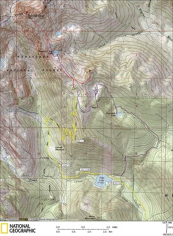
Saturday Routes to Vista Tarns We looked forward to camping at Vista Tarns, but no one looked forward to the hike up to the tarns. Although there is easy trail all the way, the accursed trail for so many miles simply fails to go up. First 4.4 miles to Pete Lake, then another 2 miles to the PCT, for a net gain of only 300 feet, then another 5 miles of long low-grade switchbacks on the PCT to gain 2500 feet to the tarns. Thus, at Pete Lake, our group divided into two alternate routes. Martin, Dave, & cartman took the Escondito Lake trail up about a thousand feet, then followed a ridge crest up to meet the PCT near Vista Tarns. I wanted to check out Escondito Lake & Escondito Tarns, so I took the trail to the lake, then followed its inlet stream up to the tarns, and then followed the PCT a mile back west to Vista Tarns. Because the trip to these lakes could be its own hike independent of scrambling Summit Chief, I posted it as a separate report.
Summit Chief Map
Summit Chief Map
Faster method for avoiding the long PCT switchbacks
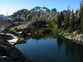
Vista Tarns Camp 5650 The Vista Tarns are somewhat mis-named, since they lie in a slight dip on the side of the ridge, providing little vista from the tarns themselves. But from the rim above the lakes, there’s a great vista of the Chikamin-Lemah-Chimney Rock crest, positioned perfectly at mid-height to reveal the 4000 feet of relief from the summits to the creek. Flat meadows and smooth polished slabs provided a fine camp, with enough bare areas to locate the tents. The rest of the group had arrived a couple hours ahead of me. They were all hiding in tents or bug nets. The mosquitoes were fierce. The late snow left marshy patches all over the meadows, producing a bumper crop of bugs more typical of July than August.
Upper Vista Tarn and a first glimpse of Summit Chief
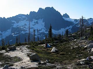
Campsite & Chimney Rock
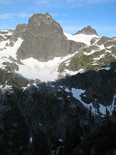
4000-foot relief from summits to valley
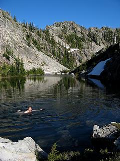
Another refreshing swim in upper Vista Tarn
Mosquitos
Mosquitos
Stats: 10 miles, 2800 net gain, 7:20 hours for me (includes time exploring tarns) About 1 mile less and 2 hours shorter for rest of group Escondito Point 6177 We made an evening side trip up to Escondito Point. Our route had four steps: 1) north up meadows to the 5700 foot col of Summit Chief’s south ridge, 2) SE up the rocky crest to the 6060-footcorner point, NE sidehilling down and up on steep dirt and rocks to bypass the next col and adjacent outcrops, 4) further NE on the easier crest to the summit. I found the side-hilling to be an unpleasant scramble. Martin commented that it was an interesting route-finding challenge. Anticipating a simpler scramble, we had brought along the stove and food, hoping to enjoy dinner and sunset on the summit. Given the awkward terrain, late time, and persistent bugs, we simply tagged the summit and departed.
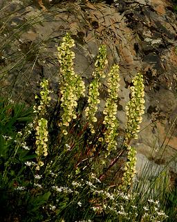
Flowers on the path up to the col
Escondito Point (route goes from col at right, over point at right, behind col in middle, and up to summit at left)
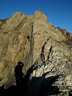
The rocky crest to the 6060 corner
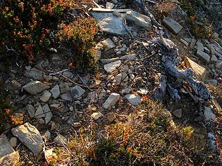
Wire marker on the summit
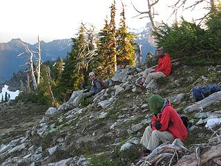
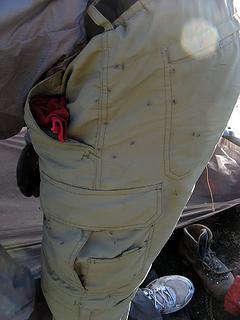
Escondito Point wardrobe:  tan pants, red jacket, bug net helmet
Escondito Point wardrobe: tan pants, red jacket, bug net helmet
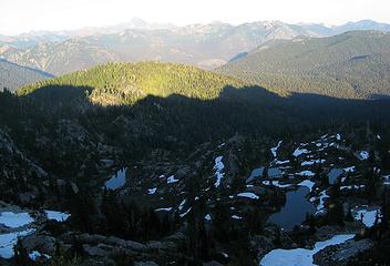
Escondito Tarns lay in shadow below us. Evening light caught Bears Breast & Daniel northeast of us.
Escondito Tarns in shadow of Escondito Point
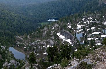
Escondito Lake, tarns & PCT
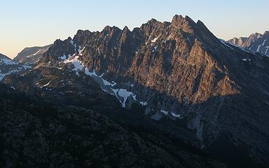
Bears Breast
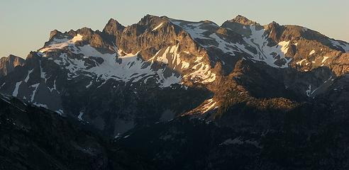
Bears Breast
Daniel
Daniel
Stats: round trip 1.5 miles, 500 net gain, 700 cumulative gain, 0:40 up, 0:10 summit, 0:30 down Night at Vista Camp When we finally did cook dinner after sunset, I especially enjoyed being able to recline against the big rocks on the slabs. After dark, when the bugs finally dispersed, there was a brief period comfortable enough to just lay back on the slab and stare up into the night sky. The stars looked so bright shining from so far away amid such immense black depths. Going out of the tent briefly later in the night, the sky was still black, but a hidden moon made the whole crest glow faintly across the valley. Sunday Summit Chief 7464 Our route to Summit Chief was the following:
  • Go to the 5700-foot col above camp.
  • Follow the crest NW nearly over Point 5965 to the next 5700-foot col (above Summit Chief Lake).
  • Traverse out into the middle of the SE bowl of Summit Chief, mainly on snow (resist the temptation to ascend until you’re in the middle of the bowl with a clear path upward).
  • Go up the middle of the snow to an upper snow basin.
  • Go rightward up to the top of the snow basin, then curve left along its top edge (partly snow and partly wide rock ramps) to reach the highest notch in Summit Chief’s south ridge.
  • Cross to the west side of the ridge, traverse north to the second shallow gully/trough, and ascend loose dirt and rock to the crest and summit.
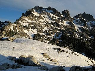
Route-finding was easy for me – just follow the tiny silhouettes of Dave & Martin kicking steps far out ahead.
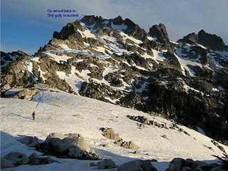
Annotated Summit Chief Route
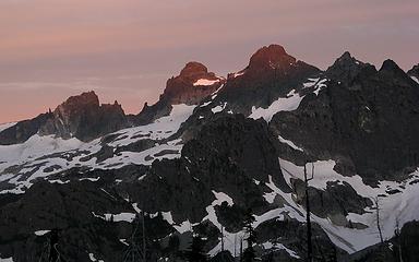
We left camp at 6:15am as sunrise touched the crests.
Sunrise touches Lemah summits
Chimney Rock sunrise
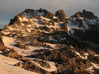
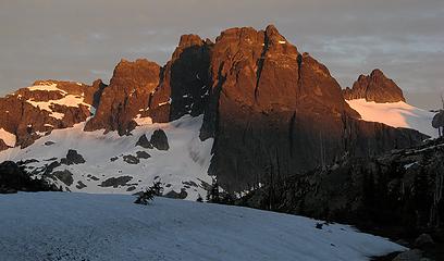
Morning light on Summit Chief, Middle Chief, & Little Big Chief
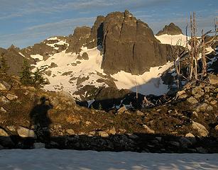
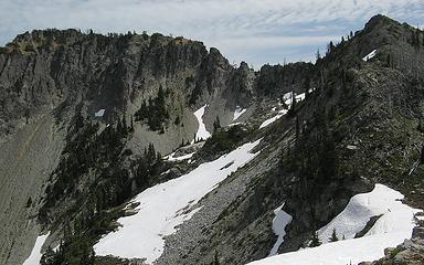
Traversing along the ridge toward the second 5700-foot col was easy on a mix of low-angle rock and snow. Westward, Chimney Rock stood in huge relief. Eastward, Summit Chief Lake appeared below the col.
Chimney Rock from Summit Chief lower south ridge
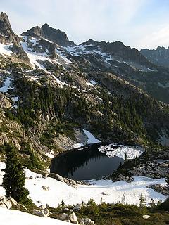
Summit Chief Lake
Summit Chief Lake
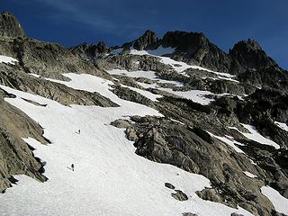
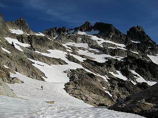
Summit Chief’s southeast bowl was a piebald patchwork of snowfields, looking like a giant jigsaw puzzle. Travel was an easy matter of connected the snow patches – out rightward to the middle, then up the snow, then back left to the highest notch. A previous party’s tracks marked the final path to the notch.
Traversing out into the basin
Still traversing out
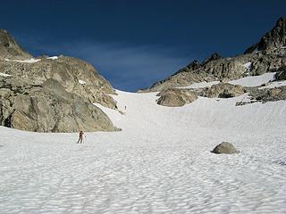
Going up from lower to upper basin
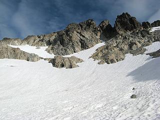
Follow the snow and rock ramp at upper left
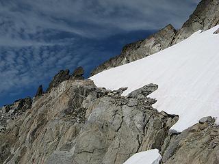
Complete the ramp to the notch
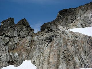
In the notch
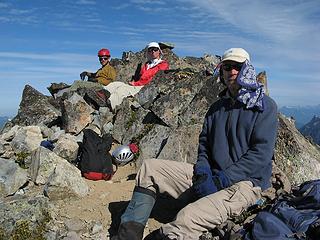
In the notch
On the opposite side of the notch, the traverse north was easy except crossing the shallow gullies. The first had hard snow that required crampons. The second had much loose dirt and rock. I was busy keeping my feet kicked in and forgot to take photos. At the top of the second gully, another hundred feet of easy scrambling put us on top. The warm weather made for a very comfortable summit stay.
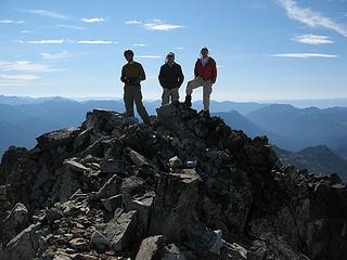
Summit Chief Summit group
Backlit summit group
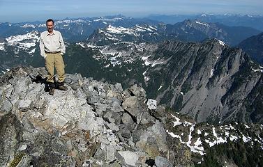
Me atop Summit Chief
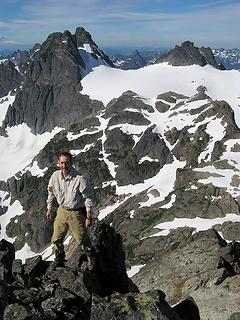
Posing in front of Chimney Rock
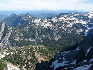
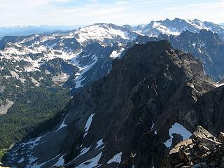
Views were wide out to the Alpine Lakes peaks.
Peaks west of Williams Lake
Peaks east of Williams Lake
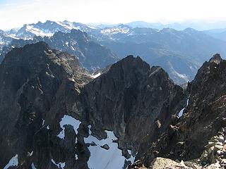
Steep crest of Summit Chief, with Bears Breast & Daniel
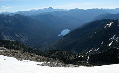
Waptus Lake & Stuart
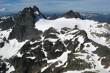
East of us, Stefan & Greg provided entertainment as their tiny silhouettes tracked back and forth across the snow seeking a route up Overcoat Peak.
Chimney Rock & Overcoat, framing Thompson
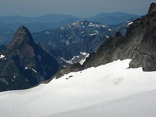
Stefan & Greg retreating from the south side of Overcoat
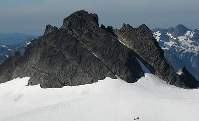
Stefan & Greg starting up the northeast snow finger of Overcoat
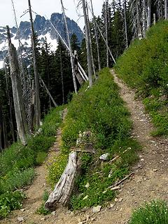
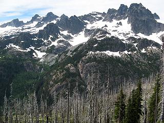
Descending required caution against rockfall at the top , but then was easy on the snowy parts, including a few glissades. On the way down, I did a side trip to Summit Chief Lake. After retracing our route down through the basin and back toward 5700-foot col above the lake, I angled down snowfields to the lake. This side trip is also in the separate report I did for lakes in the area. Stats: 5 miles round trip, 1800 net gain, 2200 cumulative gain, 3:00 up, 0:45 summit, 1:45 down (excluding side trip to lake) Vista Tarns Camp to Pete Lake Trailhead via PCT We decided to take the the PCT back to the trailhead. The 5-mile descent to Lemah Meadows had excessively long low-angled switchbacks. But it did provide fine views through the burned forest, both of the crest above and of the flowers on the hillsides.
PCT switchback
PCT switchback
Lemah & Chimney crest
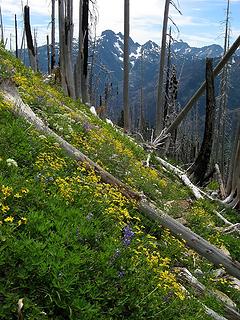
Hillside flowers
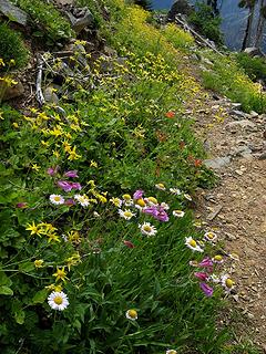
Hillside flowers
Flowers along the trail
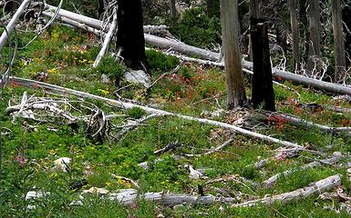
Flowers amid the burned trees
Then it was another 6.4 mostly flat miles back to the car. I was tired and slow, so the others arrived long before me. The mosquitos were especially fierce on the last few miles. When I closed my eyes to rest in the car, I could still see afterimages of them flickering across my vision, or fluttering against my skin. Stats: Descent: 11.4 miles, 5:40 hours (1 hour less for rest of group) Total trip: 27 miles, 5700 cumulative gain

“As beacons mountains burned at evening.” J.R.R. Tolkien
Back to top Reply to topic Reply with quote Send private message
Backpacker Joe
Blind Hiker


Joined: 16 Dec 2001
Posts: 23956 | TRs | Pics
Location: Cle Elum
Backpacker Joe
Blind Hiker
PostFri Aug 26, 2011 9:43 am 
Another great adventure. Climbers give the best visual and often the best written reports. Nice work you guys.

"If destruction be our lot we must ourselves be its author and finisher. As a nation of freemen we must live through all time or die by suicide." — Abraham Lincoln
Back to top Reply to topic Reply with quote Send private message
jboealps
Member
Member


Joined: 10 Aug 2006
Posts: 71 | TRs | Pics
Location: Seattle
jboealps
Member
PostFri Aug 26, 2011 1:48 pm 
Matt Great trip and report. Pretty motley crew and glad to see your keeping track of stefan and greg. Jerry

Back to top Reply to topic Reply with quote Send private message
   All times are GMT - 8 Hours
 Reply to topic
Forum Index > Trip Reports > Summit Chief & Escondito Point (USGS Big Snow) 8/20 –8/21/11
  Happy Birthday Traildad!
Jump to:   
Search this topic:

You cannot post new topics in this forum
You cannot reply to topics in this forum
You cannot edit your posts in this forum
You cannot delete your posts in this forum
You cannot vote in polls in this forum