| Previous :: Next Topic |
| Author |
Message |
Gimpilator
infinity/21M


Joined: 12 Oct 2006
Posts: 1684 | TRs | Pics
Location: Edmonds, WA |
For Labor Day weekend we decided to climb something special. Sunday would be my 30th birthday and if everything went as planned, I hoped to be standing on the summit of Dome Peak. The 50 plus miles should be enough that we could fully enjoy our time in the wilderness. The team consisted of Josh Lewis, Matt Lemke, Ryan Hoover, Jacob Smith, and myself.
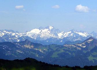 Dome SW Face Seen From Painted Mountain, 2009 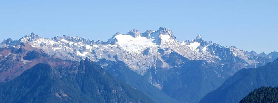 Dome SW Face Seen From Circle Peak, 2010 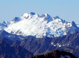 The NE Face And Chikamin Glacier Seen From Black Peak, 2011 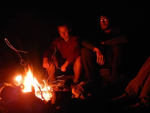 Josh And Jacob 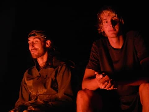 Ryan And Matt 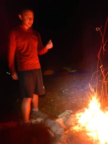 Josh 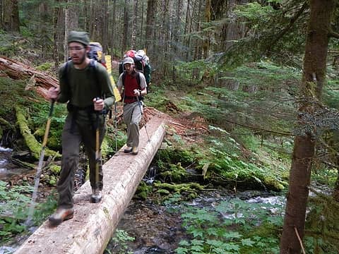 Downey Creek Trail 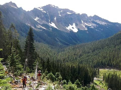 Pilot Peak Above Bachelor Creek 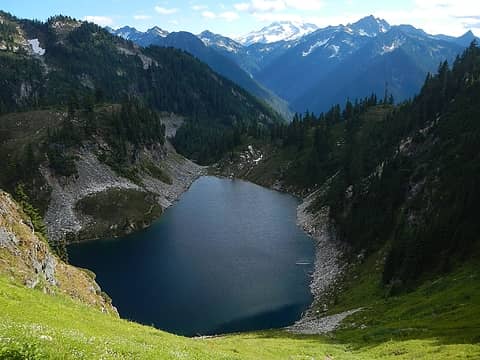 Cub Lake 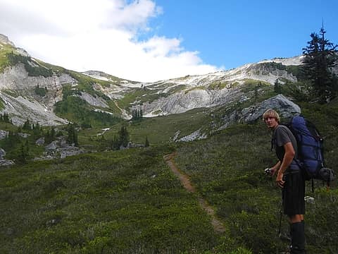 Itswoot Ridge Above 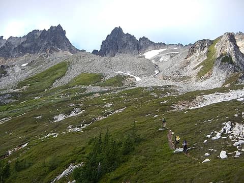 West Spire And Spire Point 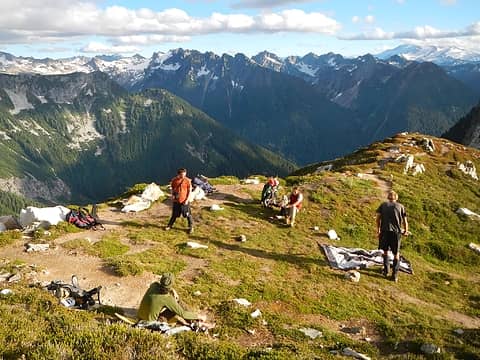 Itswoot Ridge 6400' Camp 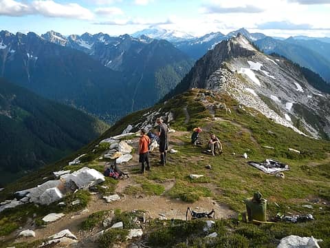 Camp 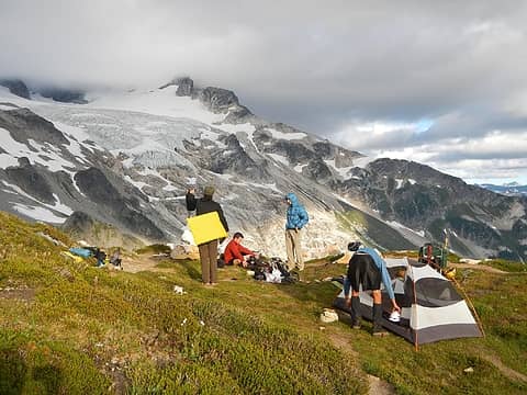 Dome Glacier 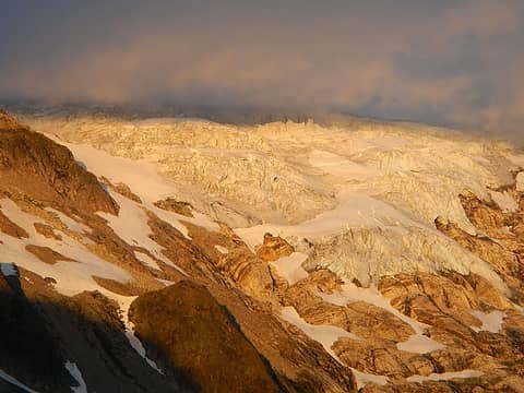 Dome Glacier 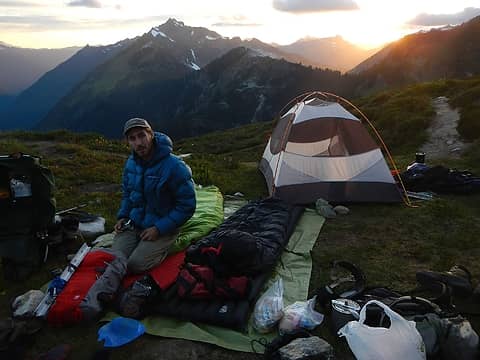 Tarp Bed 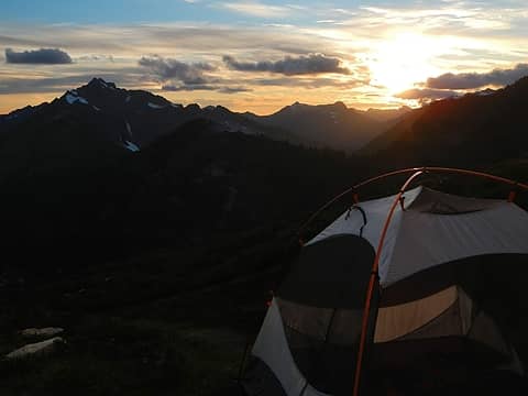 Pilot Peak Sunset 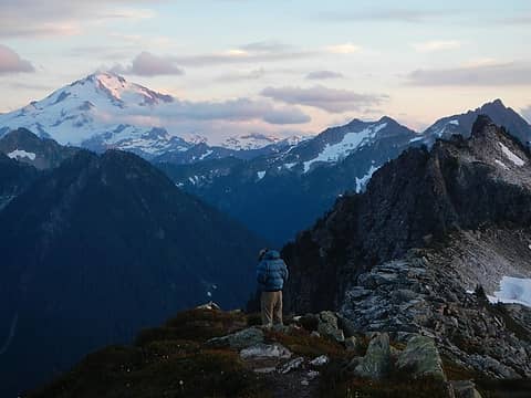 Glacier Peak 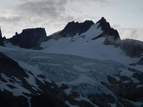 Dome Peak 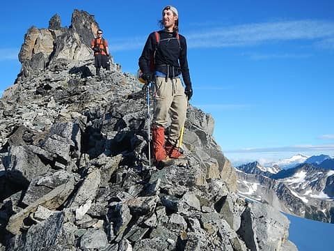 Nearing The Glacier  Sentinel And Old Guard 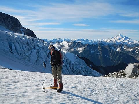 Edge Of The Glacier 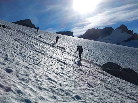 Climb On 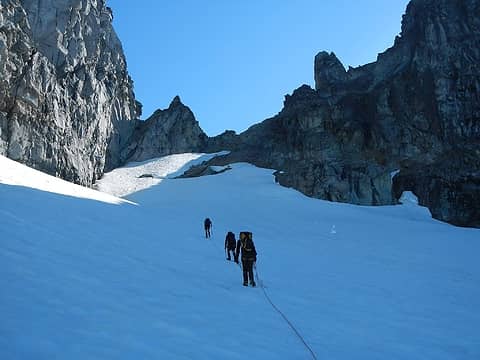 The Wrong Col 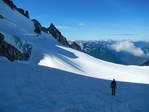 Traversing Around 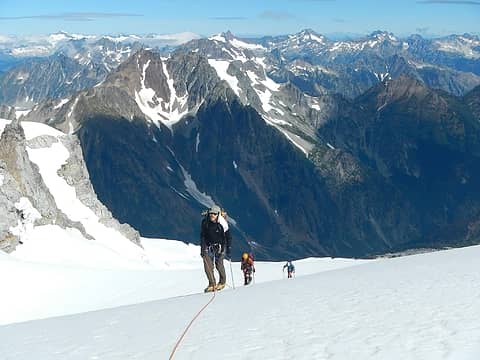 High On The Chikamin Glacier 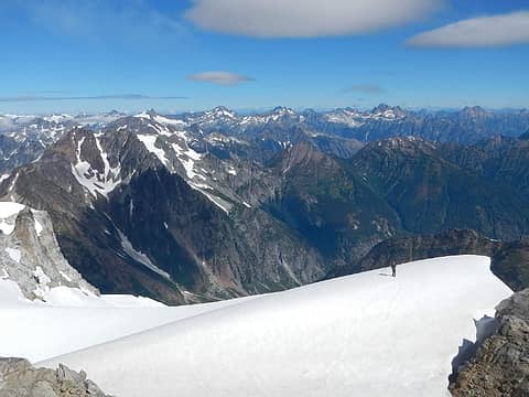 Top Of The Chikamin 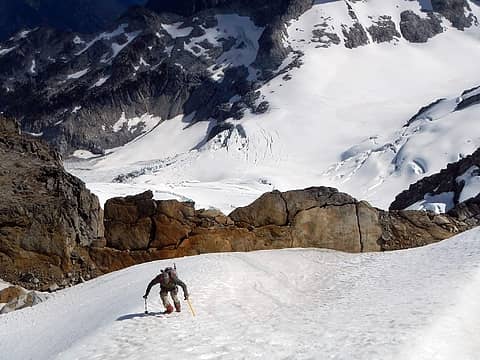 Climbing The Snow Ridge 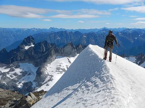 Top Of The Snow Ridge 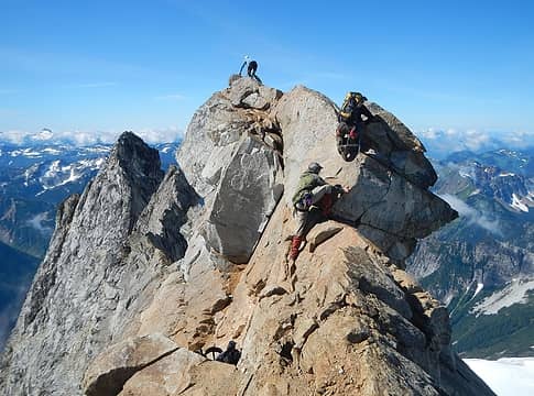 Summit Ridge 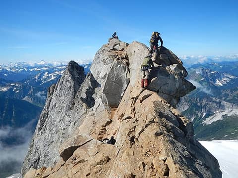 Exposed Scrambling 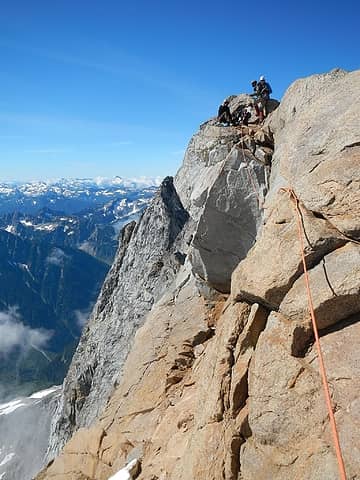 My Belay 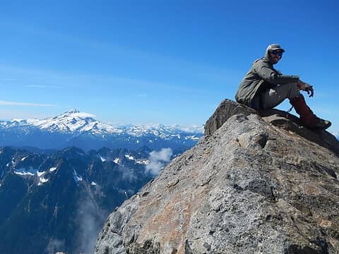 Ryan On The Summit 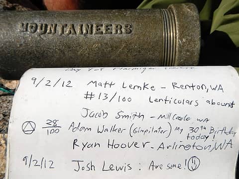 Summit Log 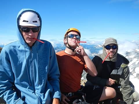 Red Vines 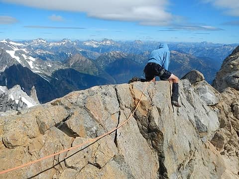 à-Cheval 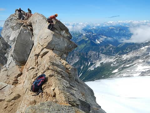 Tricky Boulder Spot 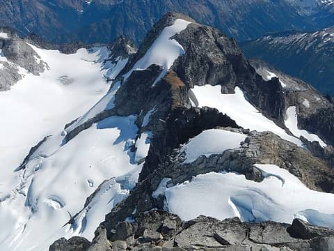 Sinister 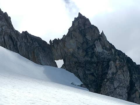 The Cannon Hole 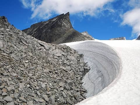 Nice Curves! 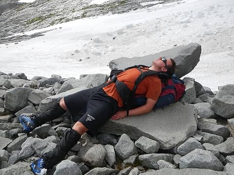 Josh Is Tired 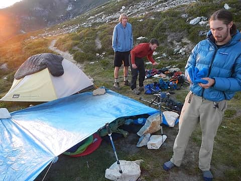 Makeshift Lean-To 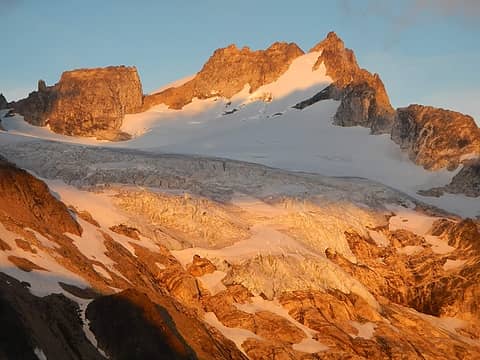 Alpenglow On Dome 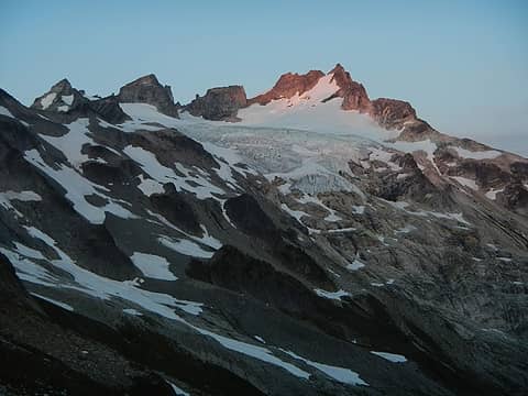 Last Light 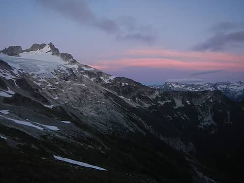 Sunset 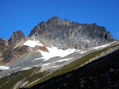 Marmot Head 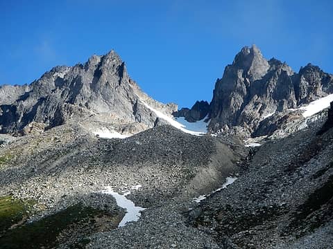 West Spire And Spire Point 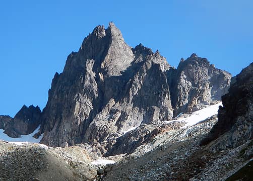 Spire Point 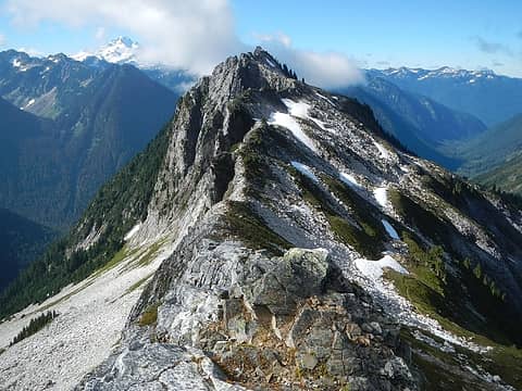 Point 6410 On Itswoot Ridge 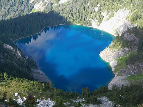 Itswoot Lake 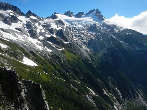 Dome Seen From Point 6410 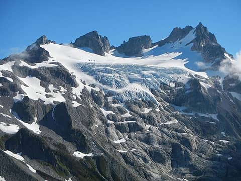 Detail View 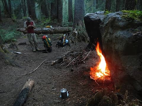 Boulder Camp In Bachelor Creek 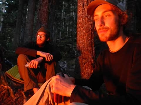 One Last Fire 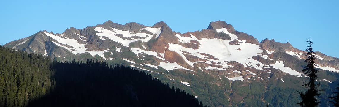 Misch And Buckindy Seen From The Upper Bachelor Creek Drainage
|
| Back to top |
  
|
|
Magellan
Brutally Handsome

Joined: 26 Jul 2006
Posts: 13116 | TRs | Pics
Location: Inexorable descent |
|
Magellan
Brutally Handsome
|
 Wed Sep 05, 2012 10:35 am |
|
|
Love it!  Sounds like an amazing trip. Sounds like an amazing trip.
|
| Back to top |
|
|
Goats Know
Gravity's Bitch

Joined: 29 Aug 2007
Posts: 194 | TRs | Pics
|
|
Goats Know
Gravity's Bitch
|
Wed Sep 05, 2012 10:45 am |
|
|
Nice job guys!
The Young Turks of NWH! I like the red vine shot.
Here on this mountaintop...Woahoho...I got some wild, wild life - Talking Heads
Here on this mountaintop...Woahoho...I got some wild, wild life - Talking Heads
|
| Back to top |
|
|
Blowdown
Sawin' Logs ...

Joined: 24 Aug 2011
Posts: 375 | TRs | Pics
Location: On the Summit |
|
Blowdown
Sawin' Logs ...
|
Wed Sep 05, 2012 10:57 am |
|
|
We did Dome many years ago when you could still drive up to the Downey Creek trailhead on the Suiattle River road. Since the road has been closed so long, I'd assumed that the Downey Creek trail would be completely overgrown and Batchelor Creek "trail" would be almost nonexistant. Great news that the routes are still viable. Great trip. Excellent photos!
|
| Back to top |
|
|
Matt Lemke
High on the Outdoors

Joined: 15 Jul 2010
Posts: 2052 | TRs | Pics
Location: Grand Junction |
|
Matt Lemke
High on the Outdoors
|
Wed Sep 05, 2012 11:09 am |
|
|
You didn't take the Detour???
We managed to get through Bachelor Creek fairly quickly and reached Downey Creek at 5:40 pm and we high-tailed it out on the trail in less than 2 hours. Just after dark, around 8:50 pm we reached the car. Thanks Adam, Ryan, Jacob and Josh for a great trip!
My photos will come soon!
|
| Back to top |
|
|
Kim Brown
Member

Joined: 13 Jul 2009
Posts: 6899 | TRs | Pics
|
| Blowdown wrote: | | We did Dome many years ago when you could still drive up to the Downey Creek trailhead on the Suiattle River road. Since the road has been closed so long, I'd assumed that the Downey Creek trail would be completely overgrown and Batchelor Creek "trail" would be almost nonexistant. Great news that the routes are still viable. Great trip. Excellent photos! |
The USFS hired a contractor who gave the entire Downey Creek trail a facelift in 2006 and 2007. The trail crew logs it out each year; they were there for a week the past June.
The latest Access & Travel Managment Plan for hte Suiattle waterhsed put the Bachelor Creek trail back on USFS inventory, though nothing's been done with it yet.
The road will open.
Someone here has a pic of Dome Peak before the Giant Rock fell off the summit. Lopper????
The pic of the dudes on bikes is great. Well, so are the mountain photos.
"..living on the east side of the Sierra world be ideal - except for harsher winters and the chance of apocalyptic fires burning the whole area."
Bosterson, NWHiker's marketing expert
"..living on the east side of the Sierra world be ideal - except for harsher winters and the chance of apocalyptic fires burning the whole area."
Bosterson, NWHiker's marketing expert
|
| Back to top |
|
|
RichP
Member

Joined: 13 Jul 2006
Posts: 5633 | TRs | Pics
Location: here |
|
RichP
Member
|
Wed Sep 05, 2012 11:52 am |
|
|
Looks like a great team .
|
| Back to top |
|
|
iron
Member

Joined: 10 Aug 2008
Posts: 6392 | TRs | Pics
Location: southeast kootenays |
|
iron
Member
|
Wed Sep 05, 2012 12:25 pm |
|
|
i saw josh at the darrington shell later that night as we were returning from another trip. he looked tired 
|
| Back to top |
|
|
Eek
still kind of a dork

Joined: 07 Mar 2011
Posts: 144 | TRs | Pics
Location: Issaquah |
|
Eek
still kind of a dork
|
Wed Sep 05, 2012 12:50 pm |
|
|
Another great trip report. I've never tried riding my bike with a full pack, but there are a few places where a bike would be nice (like my recent trip to Big Snow via Hardscrabble). How difficult is it, especially the up hill parts?
|
| Back to top |
|
|
Matt Lemke
High on the Outdoors
Joined: 15 Jul 2010
Posts: 2052 | TRs | Pics
Location: Grand Junction |
|
Matt Lemke
High on the Outdoors
|
Wed Sep 05, 2012 12:54 pm |
|
|
Riding a bike with a pack on flat terrain was actually pretty easy. The Suiattle River Road has a VERY gentle uphill grade going up and a very gentle downhill grade coming down. A soft saddle and a bike that fits you well will help immensely though.
|
| Back to top |
|
|
peltoms
Member

Joined: 13 Jul 2006
Posts: 1760 | TRs | Pics
Location: Worcester MA |
|
peltoms
Member
|
Wed Sep 05, 2012 1:40 pm |
|
|
Good shots illustrating the extent of snowcover. the nice curves are the annual layers exposed by wind erosion due to a bit of an unusual wind event this winter.
|
| Back to top |
|
|
Matt Lemke
High on the Outdoors
Joined: 15 Jul 2010
Posts: 2052 | TRs | Pics
Location: Grand Junction |
|
Matt Lemke
High on the Outdoors
|
Wed Sep 05, 2012 4:51 pm |
|
|
Here are my photos from the trip...Thanks guys for a great trip!
|
| Back to top |
|
|
puzzlr
Mid Fork Rocks

Joined: 13 Feb 2007
Posts: 7220 | TRs | Pics
Location: Stuck in the middle |
|
puzzlr
Mid Fork Rocks
|
Wed Sep 05, 2012 9:35 pm |
|
|
Great trip and done well. No drama! One of my favorite summits.
|
| Back to top |
|
|
Redwic
Unlisted Free Agent

Joined: 23 Feb 2009
Posts: 3292 | TRs | Pics
Location: Going to the Prom(inence) |
|
Redwic
Unlisted Free Agent
|
Wed Sep 05, 2012 10:00 pm |
|
|
60 pounds lighter but not 60 points brighter.
|
| Back to top |
|
|
rbuzby
Attention Surplus
Joined: 24 Feb 2009
Posts: 1008 | TRs | Pics
|
|
rbuzby
Attention Surplus
|
Thu Sep 06, 2012 1:47 pm |
|
|
Nice outing and pics! Dome is an important mountain.
The boulder placed on the summit by a "playful diety" (Beckey's description) fell off decades ago. Bob Bolton has some shots of it on summitpost.
We were using the so called "detour" back in the 90's. It's really "the route" now, not really a detour. Unless you love deep brush.
|
| Back to top |
|
|
|
|


