| Previous :: Next Topic |
| Author |
Message |
SwedishHiker
Member


Joined: 25 Apr 2010
Posts: 18 | TRs | Pics
Location: Arlington, WA |
I figure I should probably post a trip report at some point, so this is probably as good as any a place to start...  We started out as a group of five, and ended up as four. This was definitely the most demanding trip I've ever done, but I'm glad I went. It was quite the adventure and the views were certainly worth the pain and suffering.
Day 1 - Into the Diobsuds:
We started out under a mix of sun and clouds. It was still nice, though. The cooler weather made for easier travel, even though it did make for fewer photo ops.
We started out as a group of five, and ended up as four. This was definitely the most demanding trip I've ever done, but I'm glad I went. It was quite the adventure and the views were certainly worth the pain and suffering.
Day 1 - Into the Diobsuds:
We started out under a mix of sun and clouds. It was still nice, though. The cooler weather made for easier travel, even though it did make for fewer photo ops.
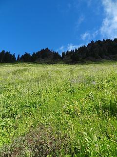
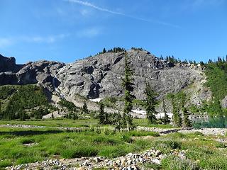
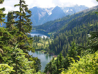
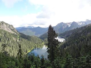 First views of the Watsons 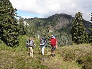 A bevy of boys 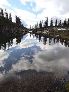 Upper Anderson 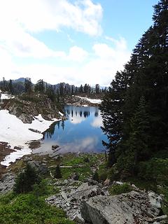 Leaving Upper Anderson 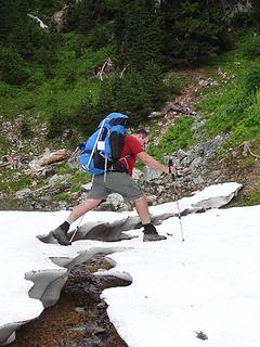 Crossing that which need not be crossed 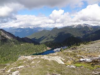 Traversing above the Watsons, first views of Blum 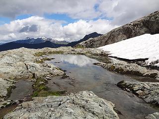 First of many tarns 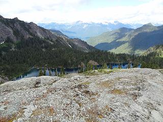 Watson Lakes below us 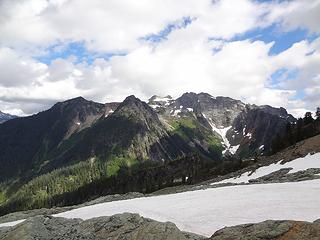 Mmmm, Bacon! 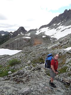 That's our pass! 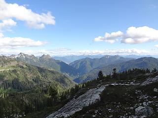 Heading down into the Diobsuds 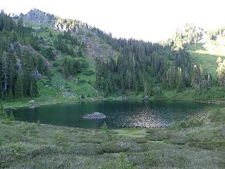 Finally home for the evening. 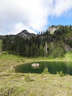 Diobsuds in the morning 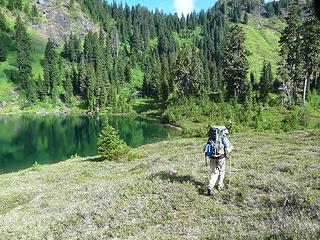 Tom says it's time to go  It took forever to reach the band of cliffs that would be our "exit" from the hellish sideslope. It took forever to reach the band of cliffs that would be our "exit" from the hellish sideslope.
 This is what hell looks like 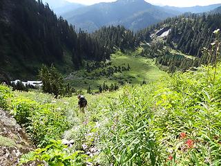 Brian and the Lower Diobsuds 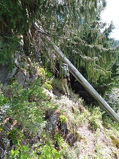 Under this log is the key to your salvation 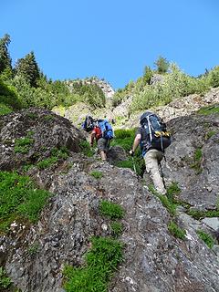 Heading up the gully 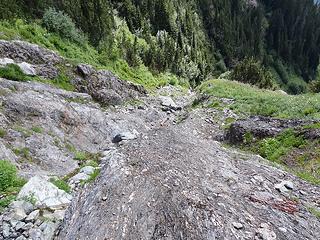 Surveying the scree below 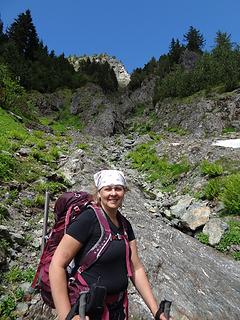 Happy to be heading up 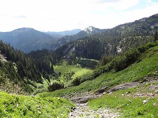 Lower Diobsuds far below 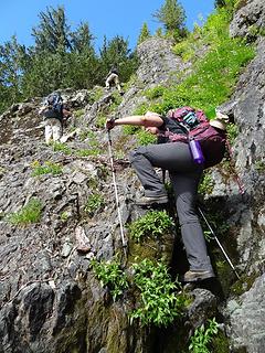 Getting steeper 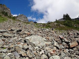 Finally in the talus above the gully 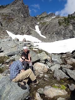 Pumping water at the tarn 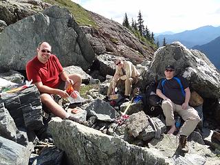 First visit to the Pizza Factory 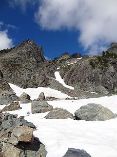 The snow finger -- our route up 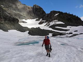 Dayhike Mike and the tarn. He seems unconcerned. 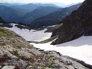 Looking back down the snow finger 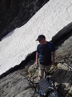 Brian is glad to be off of the steep snow 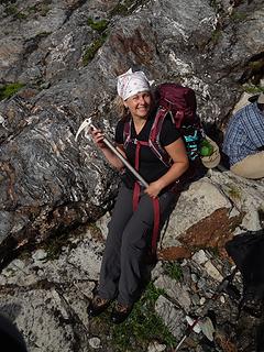 I am a stud. Look at my axe! 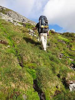 Lush shag carpeting as we head up Bacon. 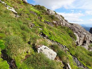 Beautiful greenery 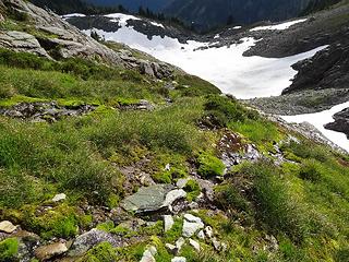 The water running off the cliff below. 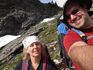 SwedishHiker and DHM 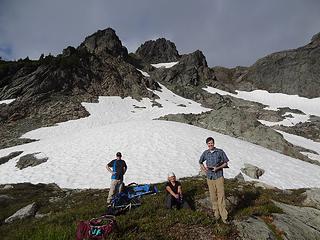 Resting at the bench. So much more to go! 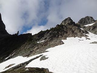 That's our notch at upper right 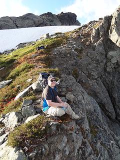 Brian, enjoying the views at the top of the notch. 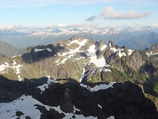 Electric Butte 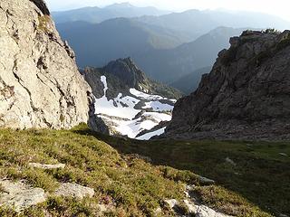 Back down the gully, from the notch at the top 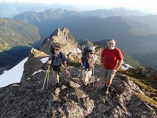 The boys, running the ridgeline. 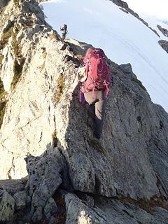 Scrambling the 4th Class step. 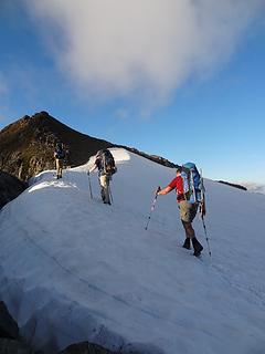 Heading up the snow arete toward the false summit 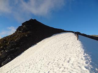 Almost off... 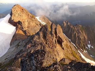 Strange rock formations on the summit 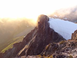 Fun with light and atmosphere 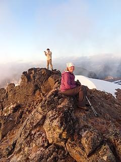 Happy to be relaxing on the summit 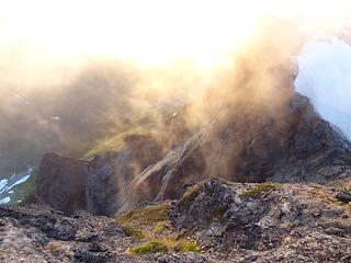 Sun and shade, slabs and snow 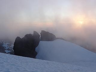 Clouds and cracks 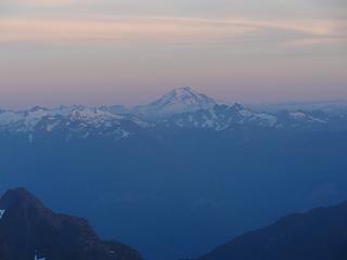 Glacier in alpenglow 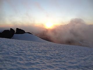 One last view as the sun goes down 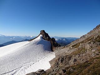 Great light in the morning 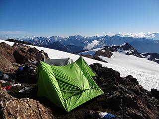 Room with a view 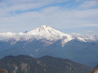 Mount Baker 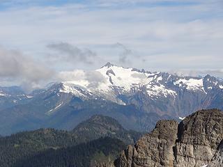 Shuksan 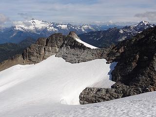 Here's the saddle we'll be passing through 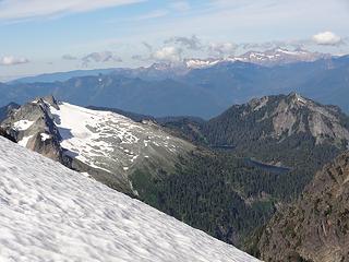 Looking back at the Watsons, Twin Sisters in the background 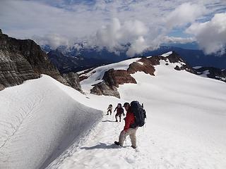 Heading down the Scary Glacier of Death 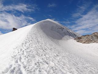 View up the ridgeline from the bottom 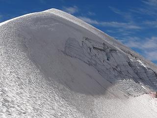 Ridgeline detail 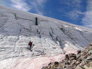 The direct route is not advised! 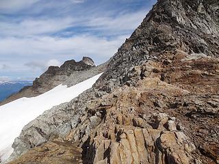 Almost to the saddle 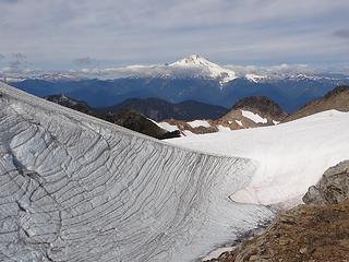 Mount Baker and our way out of the trough 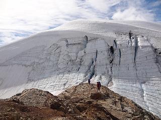 Looking back for more perspective 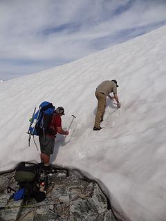 Cutting steps to get out of the trough 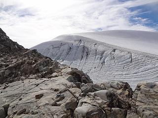 Looking back at the rock we came down 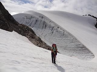 Happy to be out of the trough 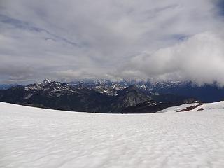 First views from the saddle 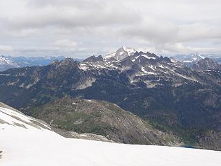 Blum and Hagan in the distance 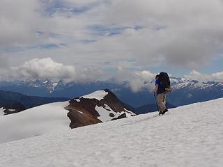 Brian heading out to get some pictures, Canadian Bacon in the background 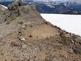 Good memories of our last visit 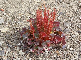 Beautiful red plants everywhere 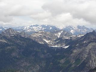 Berdeen still has a bit of snow 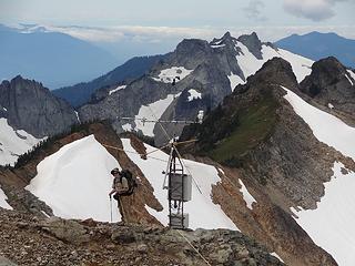 Tom surveying the Snotel thingy. How, uh, attractive..? 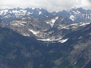 Berdeen and the Picket Range 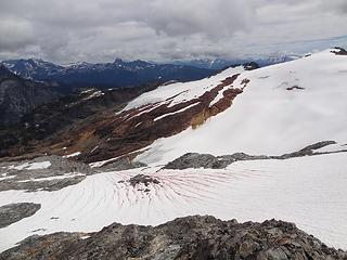 Nature has a red paintbrush 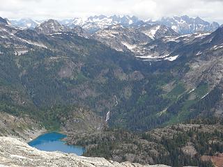 First views of Green Lake. Yay! No snow! 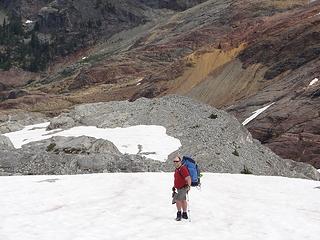 Happy to be heading down 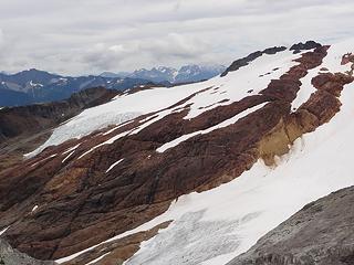 Incredible red rock on Canadian Bacon 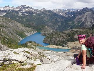 SwedishHiker, enjoying the views of Bacon Laken and Green. 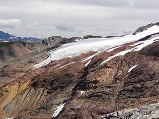 Can't get enough of those reds! 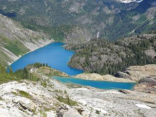 I want to go to there... 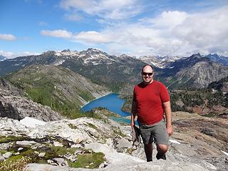 DHM is happy to be back 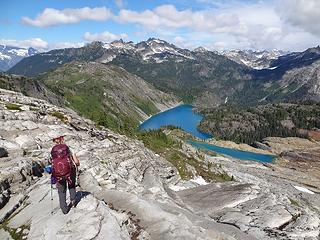 Descending on a polished slabby sidewalk 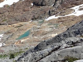 First views of the tarns below 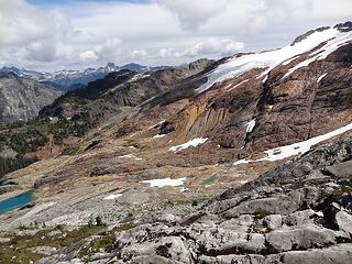 Red, White, and Blue...how patriotic! 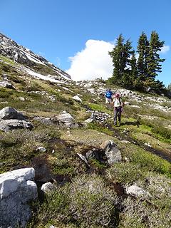 Heading down the heather benches... 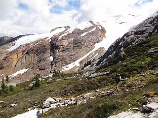 ...with Tom leading the way. 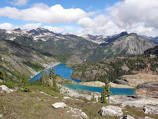 Green Bacon and Laken! 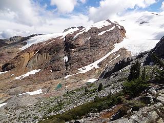 Almost down... 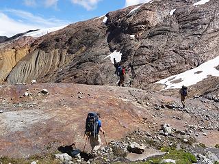 Finally walking on the red rock 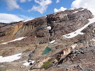 Better views of the Bacon Tarns 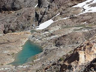 Zooming in on the upper tarns 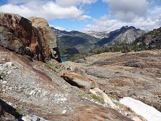 Looking down the valley 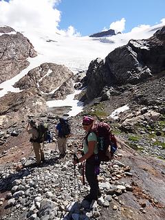 Arrival at the tarns 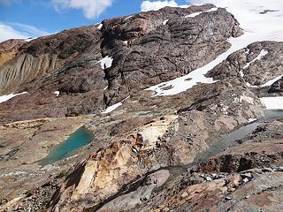 Wandering amongst the waterways 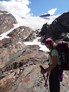 Let's head up there... 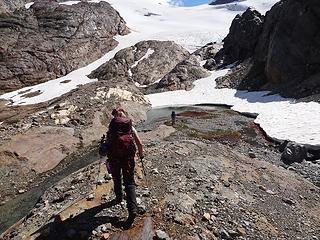 Follow me... 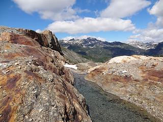 Hagan in the distance 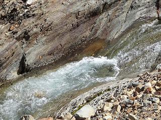 Polished flumes 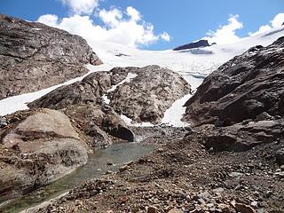 Up the left, to the toe of the glacier 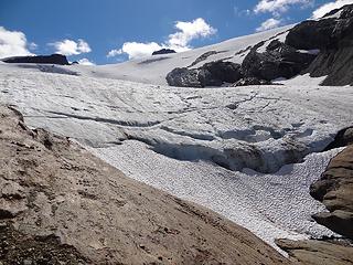 Almost there... 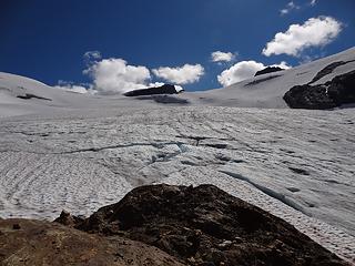 We've arrived 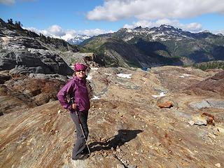 Mastering the art of friction walking 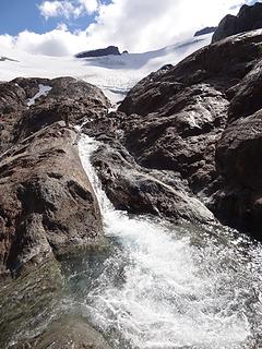 Flumes galore 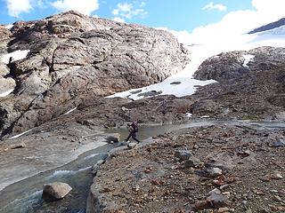 Navigating the waterways 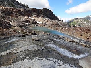 Working our way down 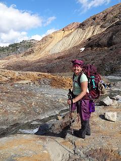 Ecstatic. Simply ecstatic. 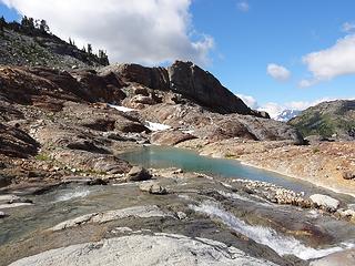 I love this one...waterfalls and airy blues 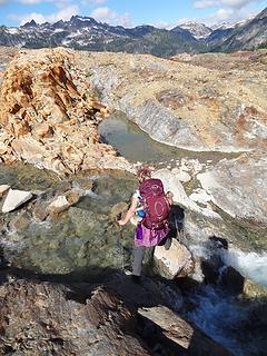 Crossing more waterfalls 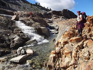 Looking back 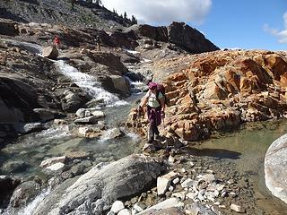 Where to wander next 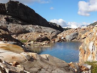 A hidden tarn, Shuksan fighting to be seen in the background 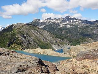 Getting closer... 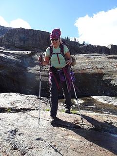 I can do this all day 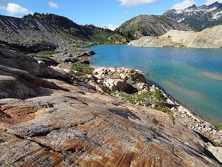 Polished reds and buffeted blues 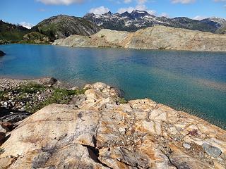 Feels great to be here... 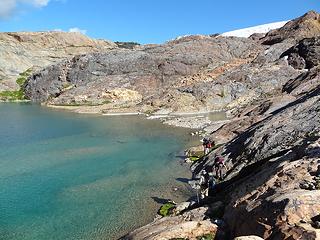 The party making their way around the shoreline 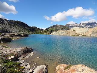 Peaceful perfection 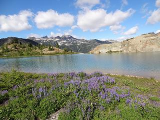 Lupine and the outflow 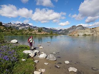 SwedishHiker in paradise 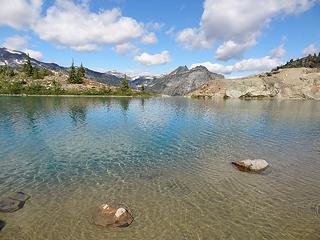 Interloper in the background 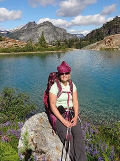 Swede in Sunlight 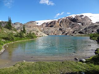 View from the far end 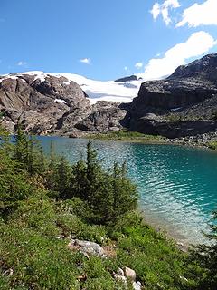 Looking back from whence we came 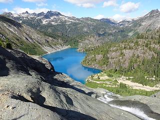 Down the waterfall toward Green Lake 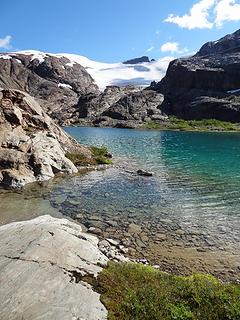 Polished rock at the outflow 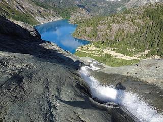 Quickest way down 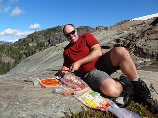 Ready for pizza? 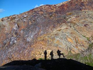 Shadowplay on ruddy rocks 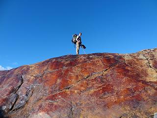 Tom atop burnished leather 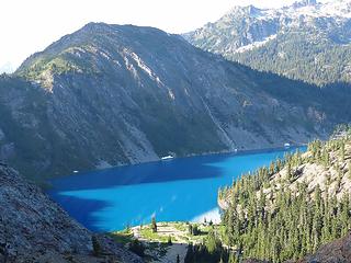 Finally descending to Green 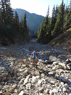 So much unstable rock 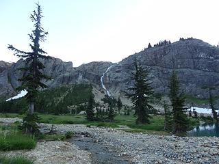 Views from the camp toward the inflow 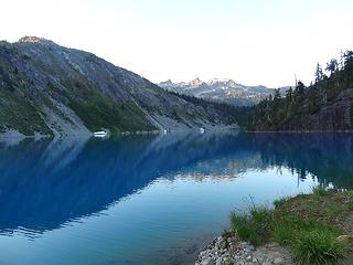 And our sea of tranquility  Before long, we were back out of the rafts at the far end. We dried our gear and had a few snacks before packing things up and heading on. Before long, we were back out of the rafts at the far end. We dried our gear and had a few snacks before packing things up and heading on.
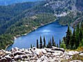
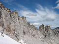
 Our campground, beside Green. 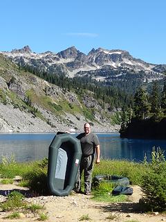 The flotilla is ready to launch, Cap'n. 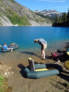 Bryan lounges while Tom preps the boat ramp 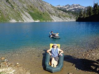 This Swede was born to float. 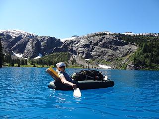 Amazing blues and views back toward Bacon. 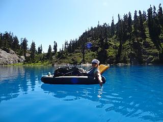 Blues and greens. 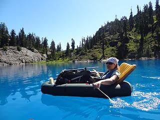 Paddling seems so effortless. 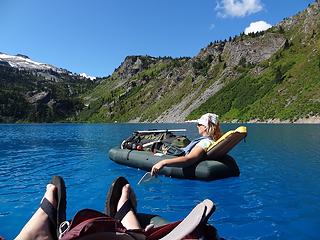 Enjoying the views and resting the feet. 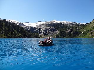 Dayhike Mike is having a good time as well. 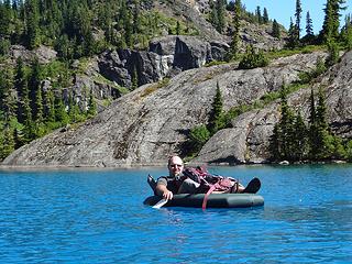 Getting close to the outflow. 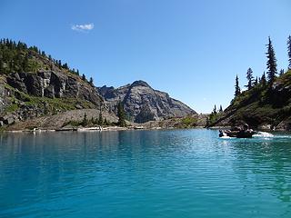 Follow me... (Interloper in the background.) 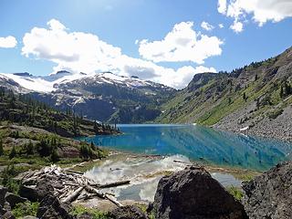 Leaving Green Lake. Up, up, up! 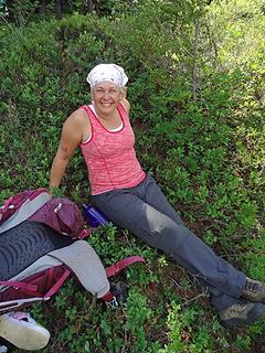 Happy to be off the steep. 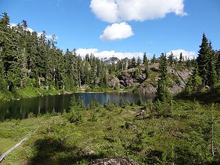 Finally at Nert. 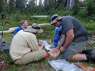 Time for pizza yet again... 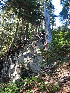 Winding our way through the cliffs on the last steep bench. 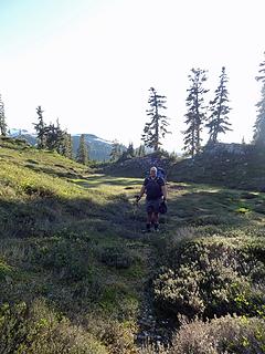 And finally in the meadows again. 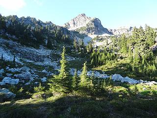 Just around the corner... 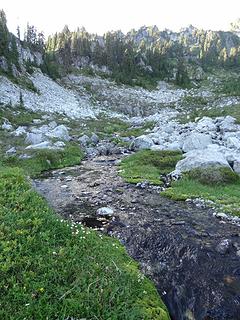 A stream from Upper Nert! 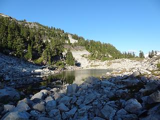 This looks comfy. Let's call this home tonight. 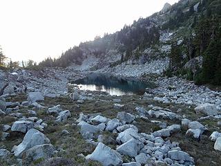 The view from our campsite. 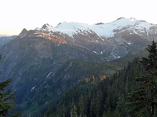 Back to Green and Bacon. 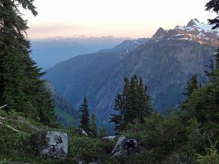 Down the valley to Glacier Peak. 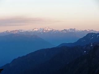 Zooming in... 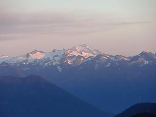 And in...  Faces in the heather. 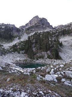 Hagan looming above. Goodnight Upper Nert... 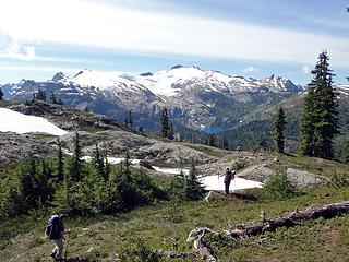 Descending the ridgeline after the traverse 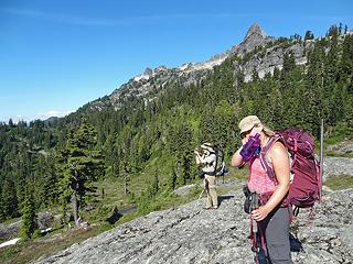 Photo time, looking back... 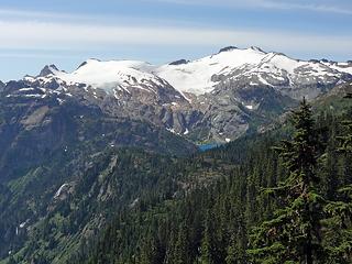 Views back to Bacon and Green 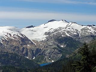 Zooming in on Bacon... 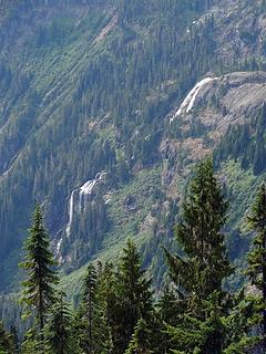 Waterfalls on the outflow from Green Lake 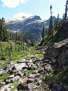 Off the ridgeline, heading toward the meadows under Berdeen. 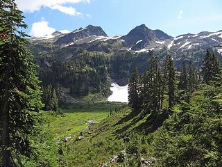 Where are the bears? 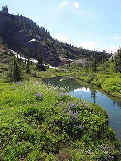 Flowers and pools 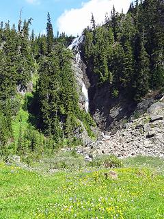 Flowers and waterfall 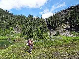 Wandering through the meadows 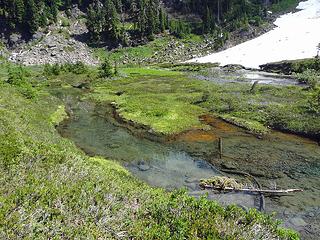 Winding past the pools 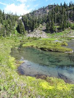 Winding past the pools 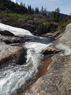 Following the stream down to Lower Berdeen 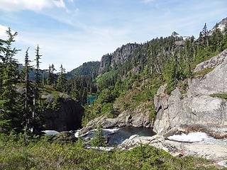 The water flows into a narrow ravine. 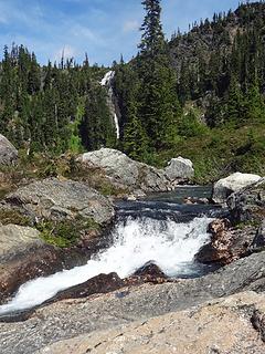 Looking back toward the meadows 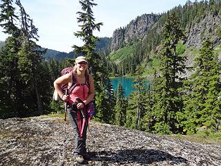 Waiting for the shutterbugs on our descent to Lower Berdeen 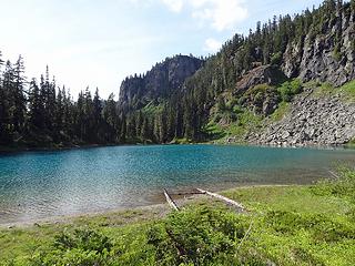 On the shores of Lower Berdeen. Time to swim! 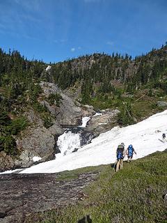 Heading up... 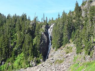 Best view we had of the upper falls 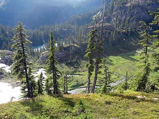 High above the meadows 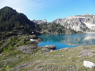 First views of Berdeen 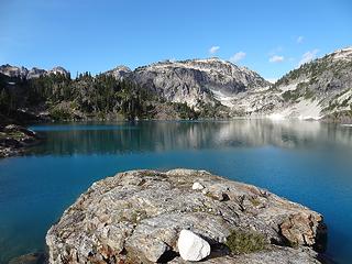 Touring the peninsula 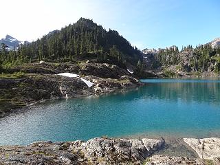 Looking toward the outflow 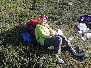 Resting in camp 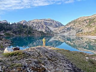 Catching low light on the lake 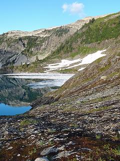 Moss and lichen on the rocks 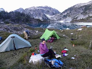 Calling home from camp 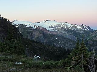 Morning colors over Bacon 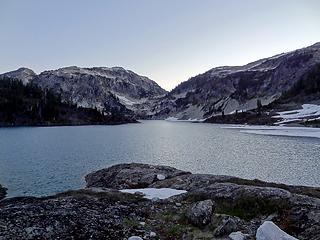 Soft light on the horizon 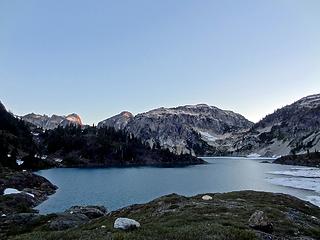 First light on Lonesome and Berdeen Peak. 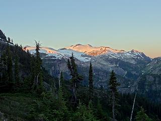 First light on Bacon 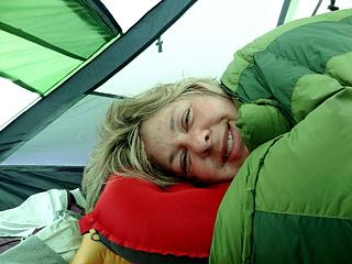 Swede is toasty in her sleeping bag. 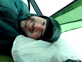 DHM's pillow is not as comfy. 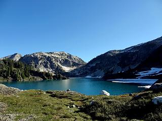 Sun is up. Time to go... 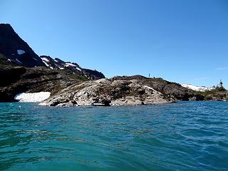 Choppy waters on the lake 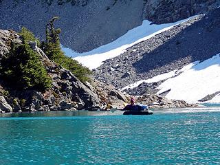 SwedishSailor fighting against the wind. 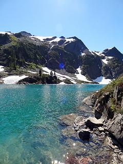 Too much work. We're pulling out here. 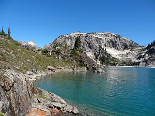 Pulling out, packing up 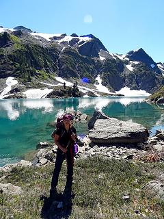 Jessica and Interloper 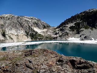 The ice across the lake, and the pass to Porkbelly Ridge 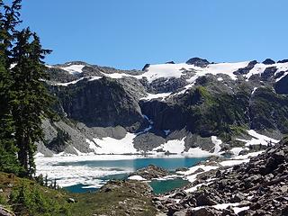 Just a beautiful day at Berdeen 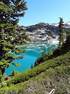 Brilliant blues of Berdeen 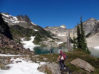 SwedishHiker and Tom rounding the lake 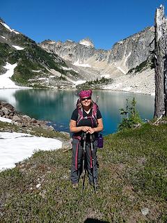 Happy to be hiking again 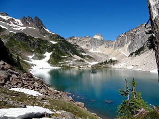 The far end of the lake 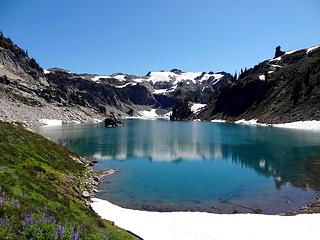 Looking back down the lake 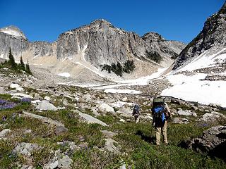 Continuing on toward Upper Berdeen 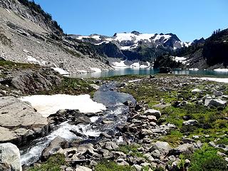 The babbling brook feeding Berdeen 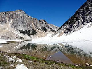 The upper lake is starting to thaw 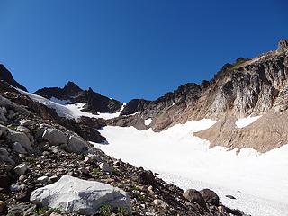 That steep snow is our route out. 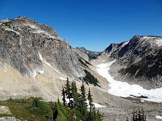 The beginning of Mystery Ridge 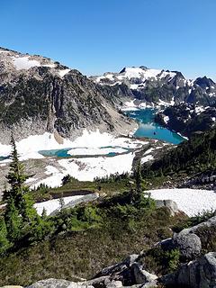 Looking back on the Berdeens 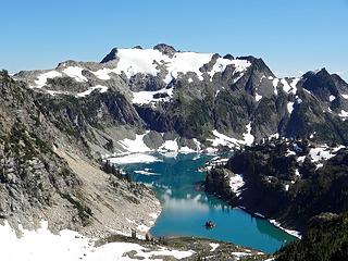 Berdeen and Interloper 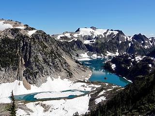 Looking back on the Berdeens 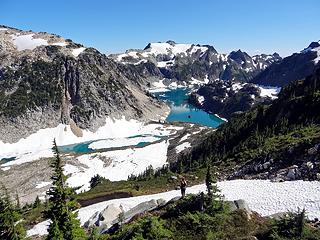 Swede soaking in the scenery 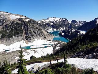 Tom and SwedishHiker enjoying views from the lower bench. 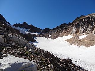 Time to go! Our route is in the shade now. 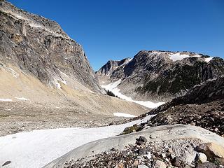 One last view back down the valley. 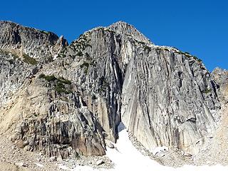 Lonesome Peak 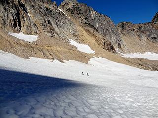 Tom and Bryan heading up the glacier. 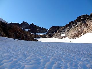 Getting closer to the route out. 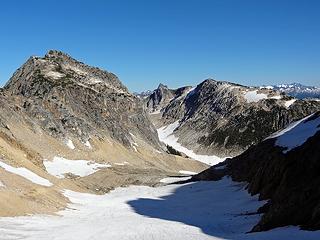 View back to Triumph peeking out above Mystery Ridge. 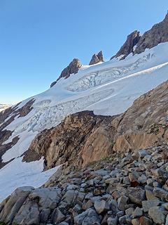 Ridgelines and glaciers off the south face of Hagan. 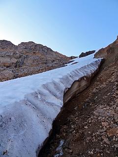 Finally, steep snow slope is our our route out. 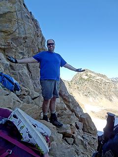 What could possible go wrong? 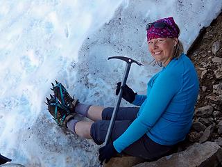 Crampons and ice axe! I'm feeling secure! Kinda... 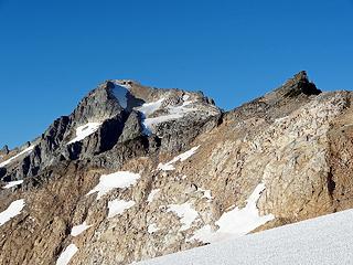 Finally on top. First views of Blum. 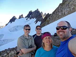 The Fab Four, happy to be past the Gully of Doom. 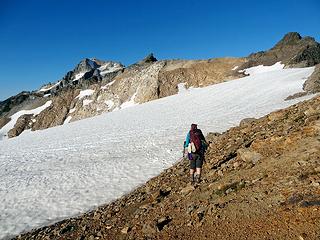 Losing light. Let's head out... 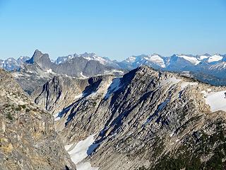 Finally full views of Triumph behind Berdeen Peak. 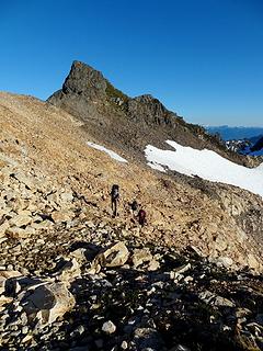 Traversing on talus. 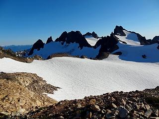 Looking back to where we came up. 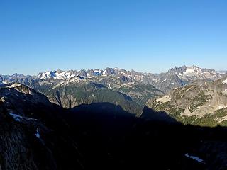 Northern and Southern Picket Range. Pioneer Ridge in foreground. 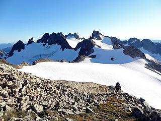 Bryan is ready to rest. 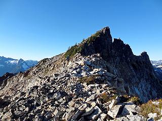 Tom continues, traversing high. 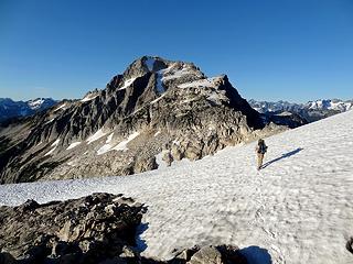 Descending on snow to Blum. 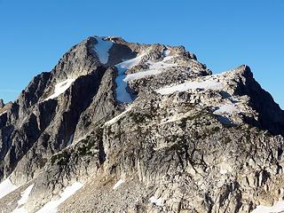 Our campsite is up there! 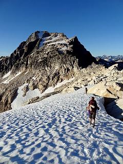 Fast travel on snowfield. 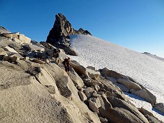 SwedishHiker and Sore Feet descending the granite. 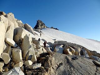 Finally on the granite slabs. 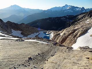 Baker, Shuksan, and Upper Blum. 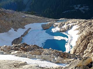 Upper Blum and the outlet tarn. 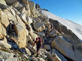 Winding their way through the rock. 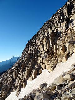 We just need to traverse across that? Painless! 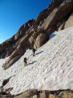 Dayhike Mike leading the charge. 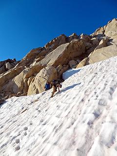 Tom reinforcing the steps while DHM looks on. 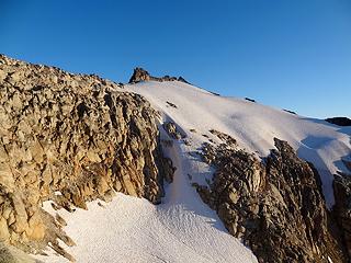 Golden light on the ridge we traversed. 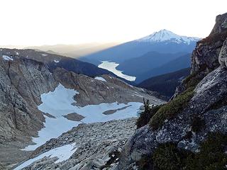 Shadows cast by Baker as our lingering light fades. 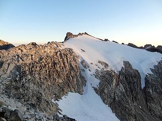 Last light on the ridgeline. 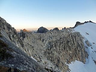 Going, going, gone... 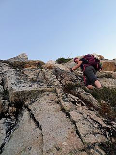 The 'trail' is *STEEP!* (looking up) 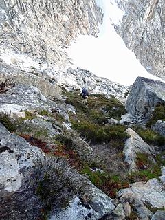 The 'trail' is *STEEP!* (looking down) 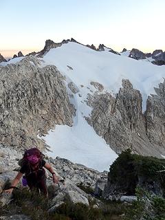 Looking down on the steep heather. Bryan's pack is visible waaay down there. 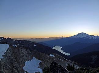 Shadows off Mount Baker. Night falling on Baker Lake. 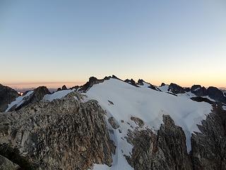 Sunset on Hagan. Glacier Peak in back left. 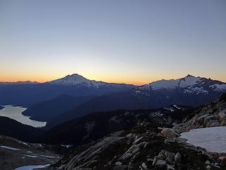 Sunset behind Baker and Shuksan. Twin Sisters at far left. 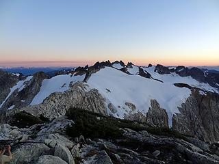 Sunset over Hagan. 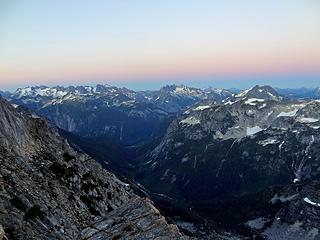 Sunset over the Picket Range. 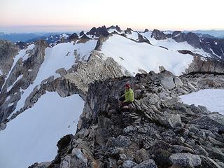 Soaking in the scenery from the top of the world. 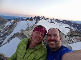 DHM and SwedishHiker. Happy to be hiking together. 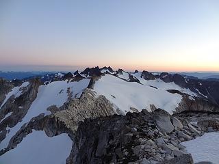 Sunset over Hagan. 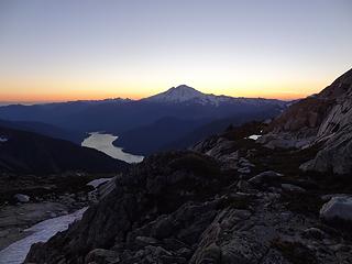 Sunset behind Mount Baker. 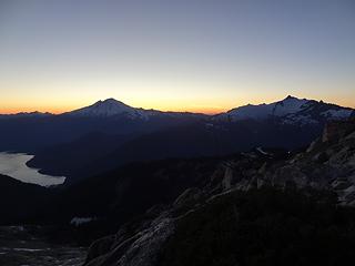 Sunset behind Baker and Shuksan. 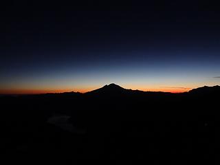 Sunset behind Mount Baker. 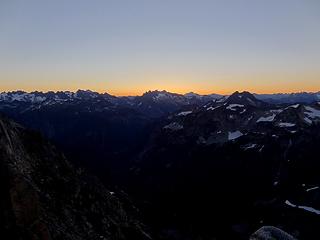 Sunrise behind the Southern Pickets. 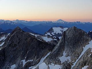 Morning colors on Glacier Peak. 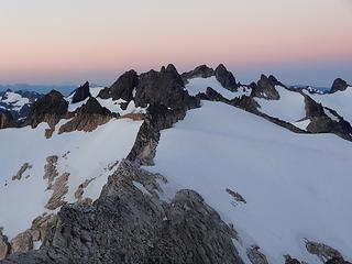 Morning color on Hagan. 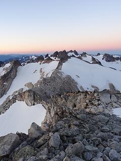 Morning color on Hagan. 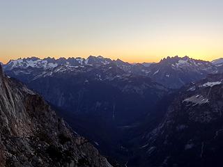 Sunrise behind the Picket Range. 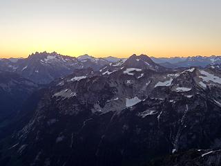 Sunrise behind the Southern Pickets and Despair. 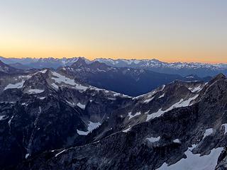 Sunrise behind Triumph. 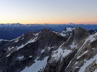 Sunrise on the horizon. Glacier Peak in the distance. 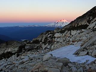 First light on Mount Baker. 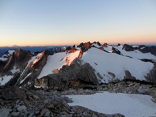 First light on Hagan. 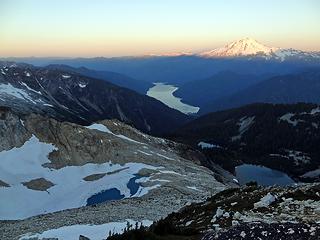 Mount Baker and the Twin Sisters in light. Baker Lake and the Blums below. 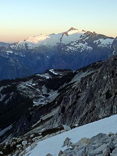 First light on Shuksan. Vista Lake on far ridgeline. 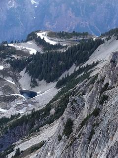 Zoom into Vista (top) and Blum tarn (below). 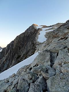 First light on the top of Mt. Blum. 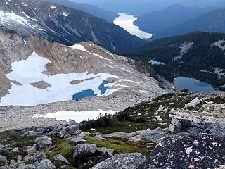 Upper Blum, Middle Blum, and Lower Blum. Baker Lake far below. 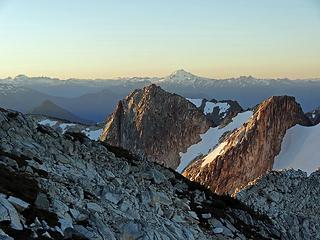 Glacier Peak lit up on the horizon. 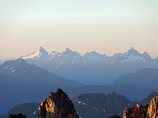 Sloan, Pugh, and White Chuck. 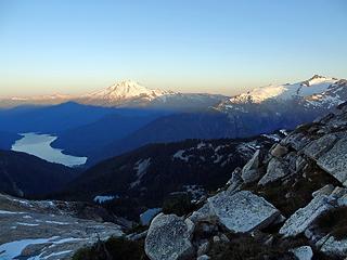 Mount Baker and Shuksan from the west edge of our shelf. 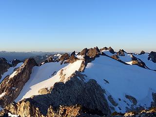 Full light on Hagan. 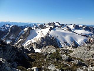 The view back toward Hagan as we headed up. Watson starting to peek out on right. 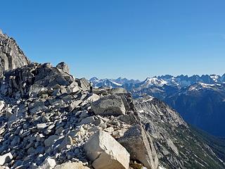 Jessica running the ridgeline. Redoubt to Spickard and Whatcom to West Fury in the background. 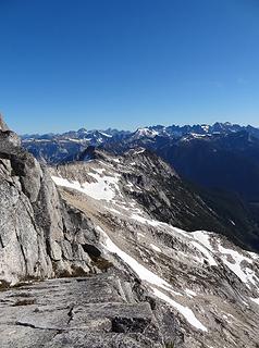 Incredible relief in the North Cascades. 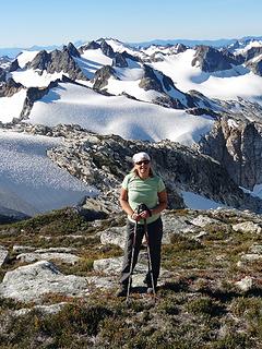 All smiles for this Swede. 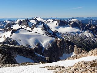 Our route beginning to appear. Bacon finally visible behind Hagan. Watson on the right. (Notice Whitehorse, Three Fingers, and Rainier on horizon!) 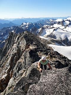 Jessica and Tom running the ridgeline to the top of Blum. 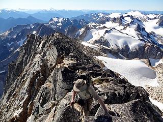 Tom scrambling the ridgeline. 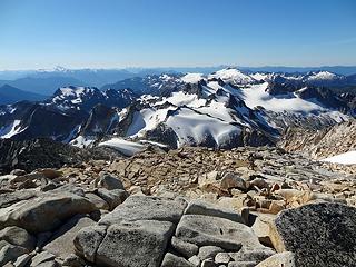 Almost there! Walking across to reach the true summit. 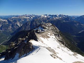 View to the north. Redoubt, Custer, Rahm, and Spickard in back left. Whatcom, Challenger Complex, Fury Complex, and Perfect Pass. 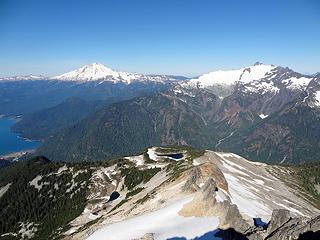 View to the west. Twin Sisters, Baker, Shuksan, and Seahpo in back. Vista and Blum tarn below. 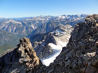 Perspective on the northern spur. 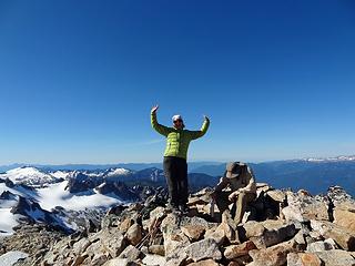 Woo woo! Jessica celebrates while Tom searches for the register. 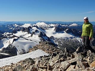 Jess and the view back to our entire route. 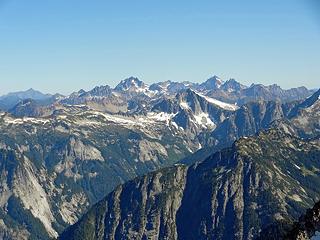 Zoom to north. Redoubt, Custer, Rahm, Spickard, and Mox Peaks in background. Whatcom squarely in the middle. Pioneer Ridge in the foreground. 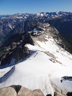 Northern ridgeline of Mount Blum. 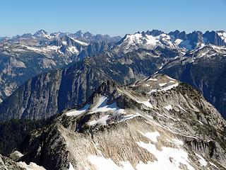 Another view to the north. 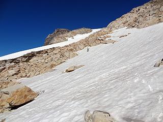 Heading back down to the camp. Snow has softened considerably. 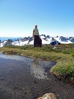 Back to camp. Packing up. 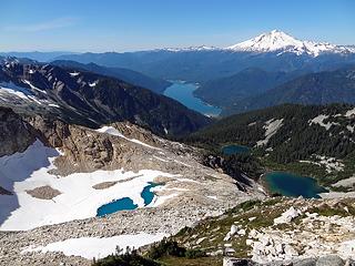 Heading down. Upper, Middle, and Lower Blum. Baker Lake far below. 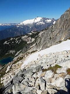 Shuksan and our route down.  The brilliant blues of Upper Blum and Hagan high behind. 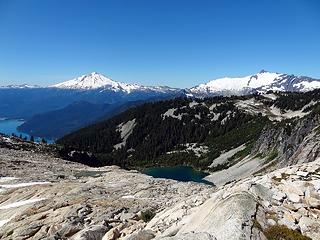 Enjoying the slabby granite as we approach Upper Blum. 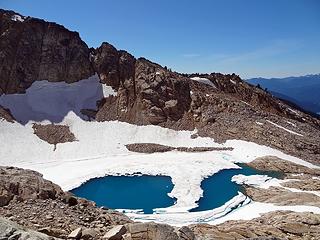 Upper Blum. 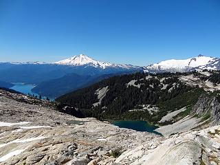 Upper Blum Tarn and Middle Blum below. 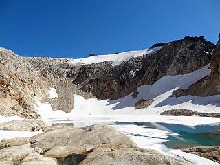 Finally at Upper Blum. 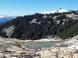 Heading down to Upper Blum Tarn. Shuksan disappearing behind Vista Ridge. 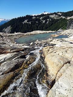 Outflow from Upper Blum to Upper Blum Tarn. 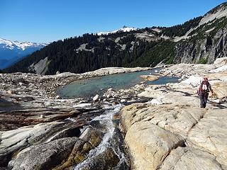 Swede is loving the slabs. 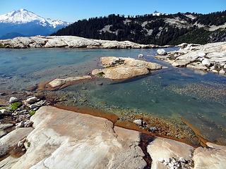 Crisp and colorful, Upper Blum Tarn. 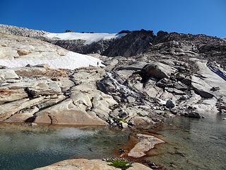 Tom walking down the outflow. 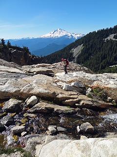 Jess, jumping over streams from the tarn. 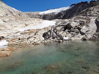 Last look up to the ridgeline. 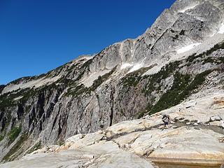 Tom and the impossible traverse to Vista. Does not go. 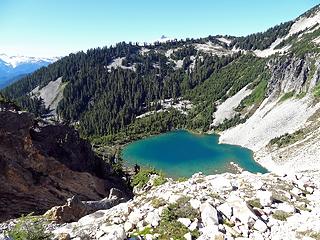 Middle Blum is brilliant below. 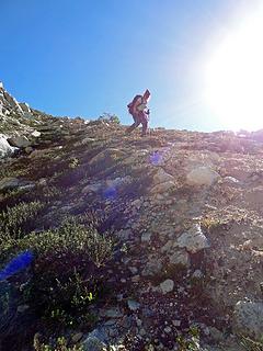 SwedishHiker swearing at the steep, slick hillside. 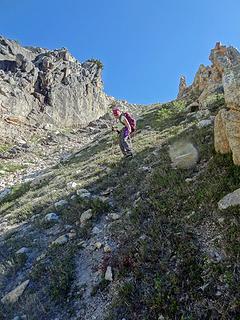 Not a fun descent on hard packed earth. 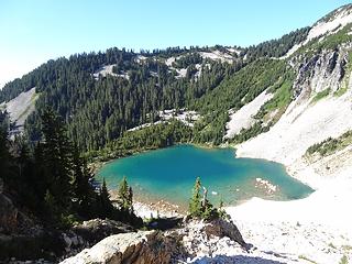 Middle Blum beckons us... 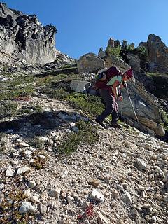 Almost off the worst of it. 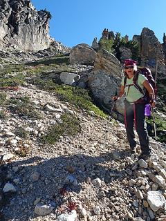 Glad to be done with that crap. 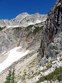 The direct route down is not advised. 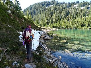 Finally on flat. Rounding Middle Blum. 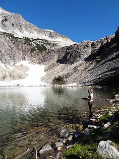 Cooling off in Middle Blum. 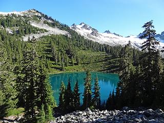 One final view of Lower Blum and Hagan before we head DOWN!
|
| Back to top |
  
|
|
Dayhike Mike
Bad MFKer
Joined: 02 Mar 2003
Posts: 10958 | TRs | Pics
Location: Going to Tukwila |
SwedishHiker did a great job of writing up a summary of the whole trip, and her pics are kinda my pics too, so I'll just add a few thoughts here.
All in all, it was a great trip. It was harder than normal due to the snow levels. Several steep sections that were reasonably safe with additional melt (on our previous trip), felt excessively exposed with the steep snow. I know we pushed Sore Feet and SwedishHiker way out of their comfort zones, but they did great, took it in stride and I think they are both happy that they came along.
Day 1 -- If we'd known how much snow was still up there, we probably would have come in low via the Watsons instead of traversing over the top. We really wouldn't have missed much and it would have been easier travel. And it's too bad BPJ had to turn around, but I think he made the right choice.
Day 2 -- The traverse across from the Diobsuds is always brutal. Stay as low as you can as long as you can. No reason to be high up on the hillside. Just seek out flat ground and come up to the log at the last moment. I liked running the ridgeline on top better than the sidehilling on snow we did last time. Very scenic.
Day 3 -- The Tarns and Bacon Laken were the highlight of the trip, again. Definitely worth it to get onto the South Rib, rather than descend down the boring expanse of glacier. Far more scenic.
Day 4 -- Originally planned on camping at Berdeen, but because of the slow start, ended up deciding to cut this day short, camp high at Upper Nert, and spend the next day exploring the area around Lower Berdeen. It ended up being a great decision.
Day 5 -- Here, we made a mistake. We got up to Berdeen so early that we really should have pushed on and camped at the far end of Berdeen, or preferably, at the camp left of the saddle near the entrance to Mystery Ridge. We had nice conditions in the evening, heavy winds in the morning. I don't believe the ice was entirely across the lake in the evening, whereas it made passage difficult the next day. And staying at the outflow of Berdeen meant that we had a very long day on Day 6. In short, it was comfy, but dumb. Lesson learned.
Day 6 -- Beautiful day, but yeah, that exit up onto Hagan was a pain. I just prefer rock to steep snow. The ramp onto Blum still goes great. Long day, and some were wishing they'd brought more water.
Day 7 -- This was a hard day. The heavy blowdown on the exit ridge slowed our descent, which ended up leaving us in the dark, and that dark prevented us from finding the nicer trail down. This was brutal.
Someone seriously needs to go up there and flag a route. Leave the flags up for a few years until a decent foot path has re-emerged. At present it's just a kinda crappy hodge podge of blowdown with the barest remnant of boot path showing itself once in a while. People are too dispersed, and it's not doing anyone any good. (I keep wondering where the good route actually heads left. It has to happen after the narrow point around 2800' where the ridgeline is reduced to a single lane of traffic for roughly 20 feet. Anyone know?)
Three other items of note: #1. When leaving Upper Blum, don't go down the gully to Middle Blum. It's far easier to traverse left and descend on gentler slopes direct to the lowest lake. #2. From Lower Blum, gently ascend on the talus as you're traversing all the way out to the end of the last talus field. Yes. Go HIGH. The higher you are when you begin traversing in the forested section, the less steep pine needles and duff you'll need to endure before reaching the gentler slopes of the ridgeline. And #3. Bring extra water for the ridgeline. It's a bad place to be running low.
"There is only one basic human right, the right to do as you damn well please. And with it comes the only basic human duty, the duty to take the consequences." -P.J. O'Rourke
"Ignorance is natural. Stupidity takes commitment." -Solomon Short
"There is only one basic human right, the right to do as you damn well please. And with it comes the only basic human duty, the duty to take the consequences." -P.J. O'Rourke
"Ignorance is natural. Stupidity takes commitment." -Solomon Short
|
| Back to top |
|
|
Tom
Admin
Joined: 15 Dec 2001
Posts: 17851 | TRs | Pics
|
|
Tom
Admin
|
 Sat Sep 08, 2012 1:50 pm |
|
|
Finally got around to uploading my vids and pics. Enjoy!
Day 1
 Watson Lakes 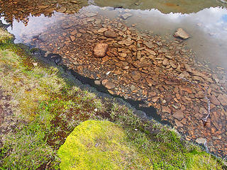 Mossy Anderson Shoreline 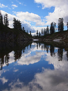 Lower Upper Anderson Lake 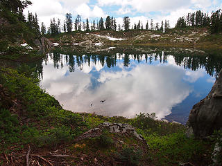 Leaving Lower Upper Anderson 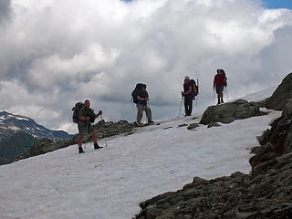 Traversing on Snow above Watson Lakes 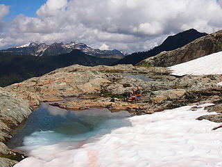 Backpacker Joe Enjoying a Break 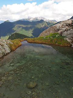 One of Many Pools Along the Traverse 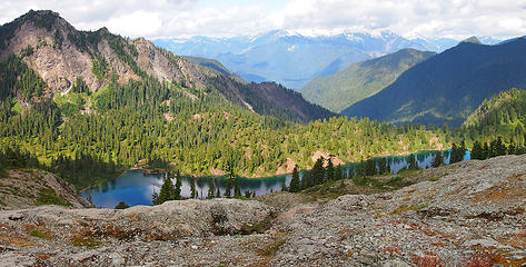 Upper Watson Pano 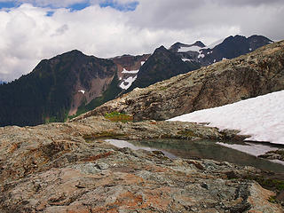 Bacon Peak from Tarns 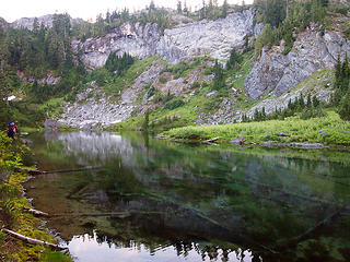 Arriving at Diobsud Lakes 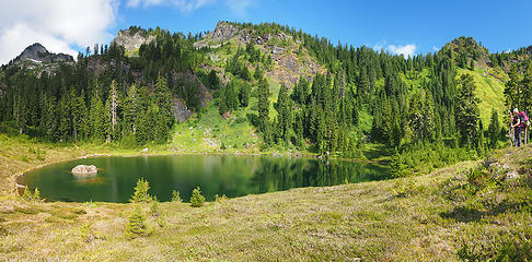 Upper Diobsud Pano 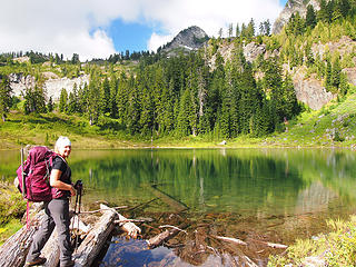 Jessica at Upper Diobsud Outlet 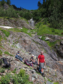 Past the Brushy Ramps, Preparing to Ascend 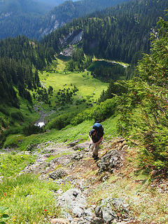 Brian and Lower Diobuds from Ascent 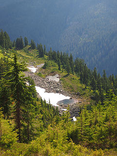 Tarns at ~4840' 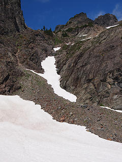 The Steep Snow Gully to Ascend 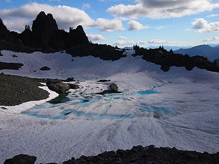 Leaving Lake 5420' 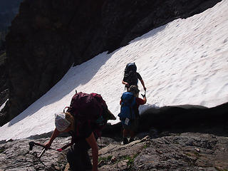 Mike Helping Brian Safely Off the Snow Gully 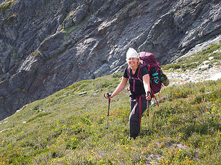 Jessica Happy to Be Past the Gully 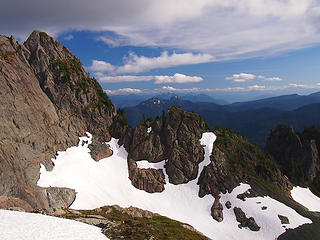 Diobsud Buttes in Distance 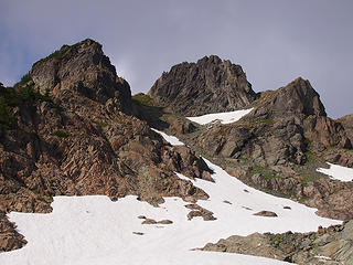 The Route Up 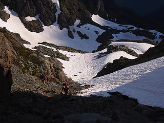 Jessica Scrambling 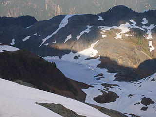 Unmapped Lake SE of Bacon Still Frozen 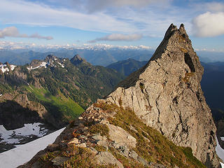 Views Opening Up 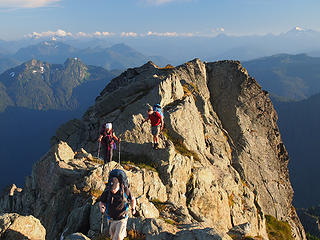 Scambling the Ridge 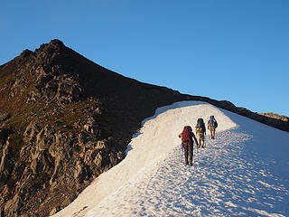 Approaching the False Summit 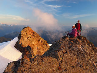 Alpenglow atop Bacon 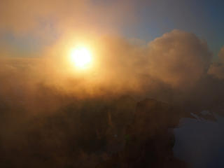 Foggy Sunset 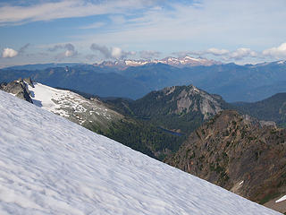 Watson Lakes from Bacon (Twin Sisters in Distance) 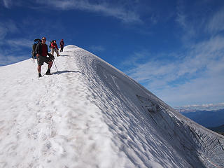 Descending the Scary Glacier of Death 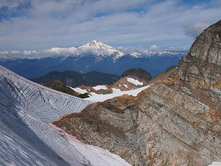 Baker in Distance 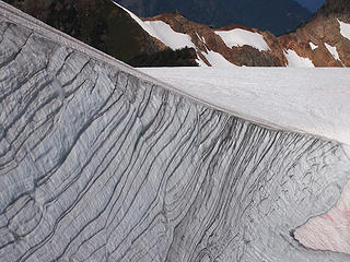 Glacial Rings 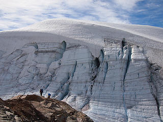 Swiss Cheese Glacier 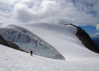 Looking Back to Bacon Peak 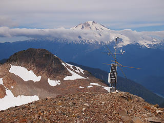 Where is Wilderness Watch When You Need them? 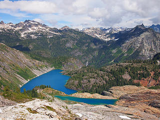 Green and Bacon Laken 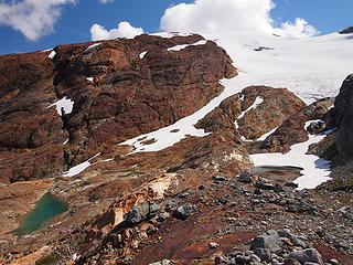 Arriving at Upper Pools 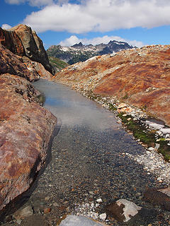 Outlet Channel 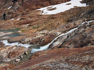 Waterfall 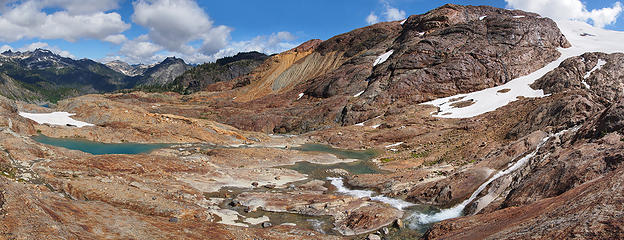 Pano of Upper Pools  Bacon Glacier  Bacon Glacier and Ledges  Waterflow 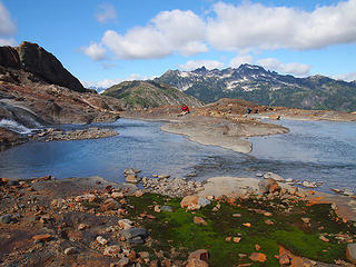 Bryan Shooting a Waterfall 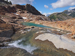 Lower Pool 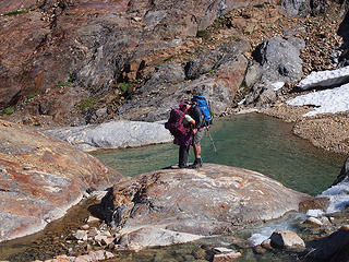 Love Bacon Laken Style 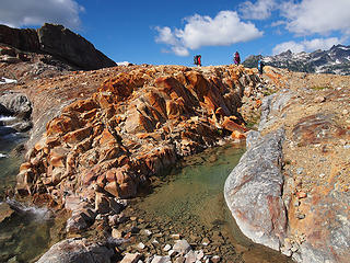 Leaving Upper Pools 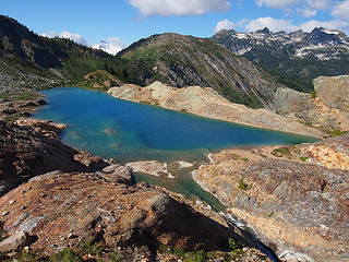 Descending to Bacon Laken 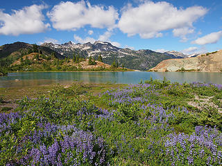 Shangrila 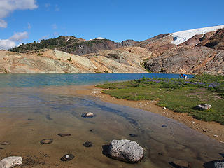 Bryan at Bacon Laken 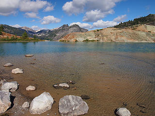 Traversing Bacon Laken 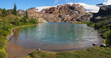 Mike Approaching Outlet 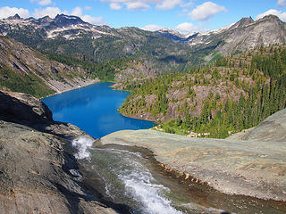 Green from Bacon Laken Outlet 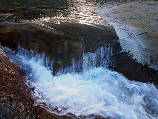 Bacon Laken Outlet 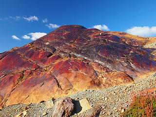 Bacon Slab 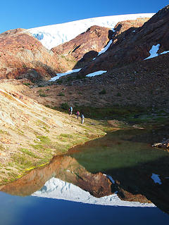 Leaving Shangrila 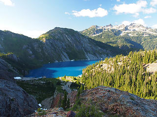 Shadows Falling on Green 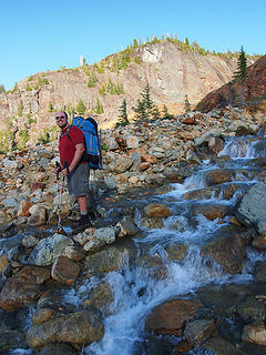 Mike Leading the Way Down to Green 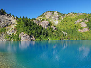 Green from Raft Launch 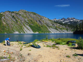 Getting Ready to Raft 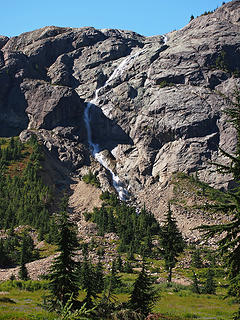 Bacon Laken Outlet Waterfall 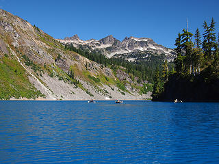 Rafting Green 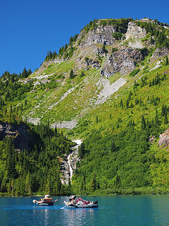 Jessica and Mike 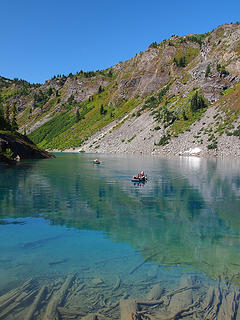 Mike Docking at Green 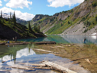 Packing Up 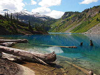 Green Lake from Outlet 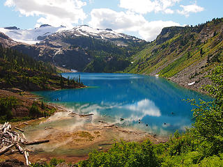 Leaving Green 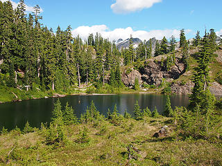 Arriving at Nert Lake 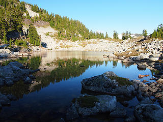 Arriving at Talus Tarn (Upper Nert) 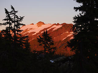 Alpenglow on Interloper Peak 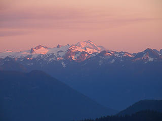 Glacier Peak from Camp 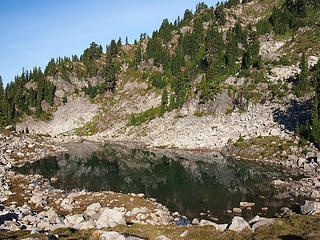 Talus Tarn 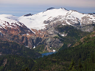 Bacon and Green 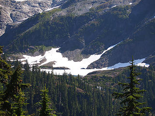 Snow on Berdeen 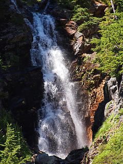 Waterfall 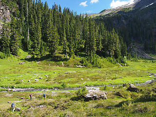 Descending to Meadows below Berdeen 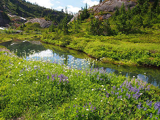 Meadow Pool and Wildflowers 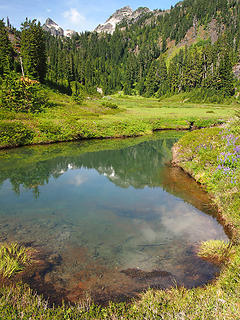 Hagan from Berdeen Meadows 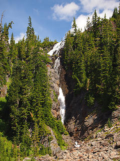 Berdeen Waterfall 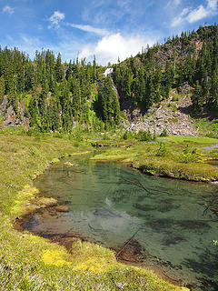 Berdeen Waterfall and Pools 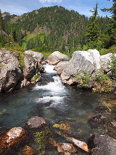 Above Falls to Lower Berdeen 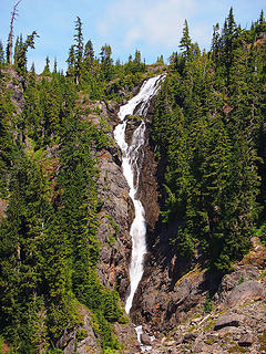 Berdeen Outlet Waterfall 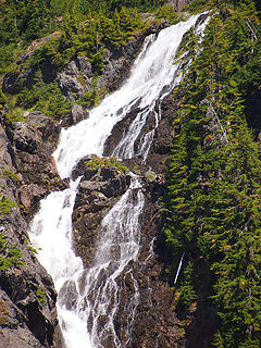 Zooming in to Upper Portion of Falls 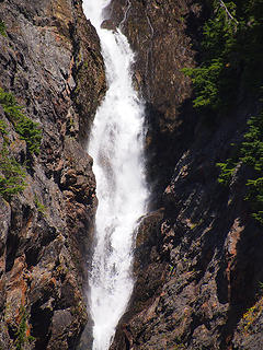 Zooming in to Lower Portion of Falls 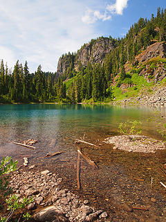 Arriving at Lower Berdeen 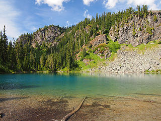 Lower Berdeen 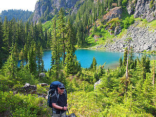 Leaving Lower Berdeen 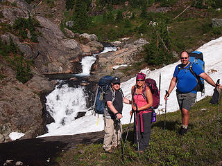 Bryan, Jessica, and Mike at Falls above Lower Berdeen 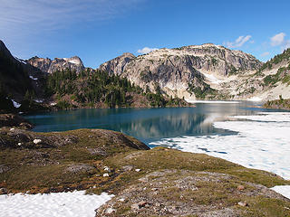 Arriving at Berdeen 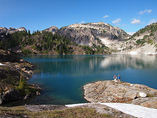 Bryan and Mike at Berdeen 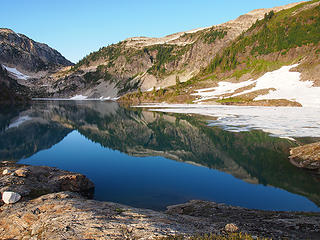 Berdeen from Camp 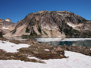 Snow Flotilla on Berdeen 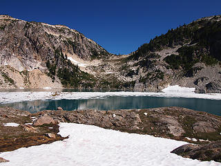 Snow Flotilla on Berdeen 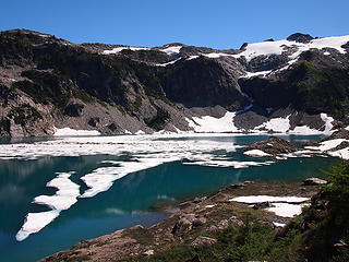 Perhaps We Could Have Rafted Thru 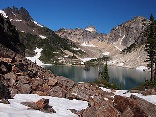 Hagan and Lonesome 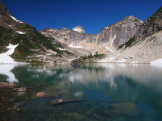 Traversing to Berdeen Inlet 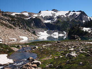 Leaving Berdeen Inlet 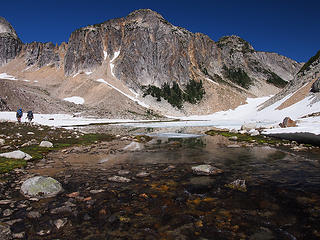 Leaving Upper Berdeen 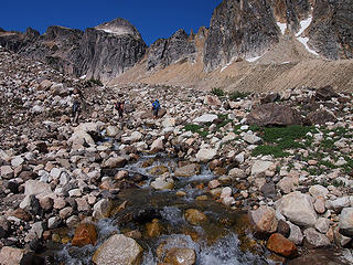 Outflow from East Hagan Glacier 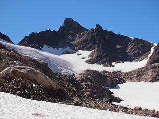 Hagan and Steep Snowfield Exit (to Right) 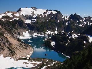 Berdeen from Viewpoint 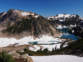 Upper Berdeen from Viewpoint 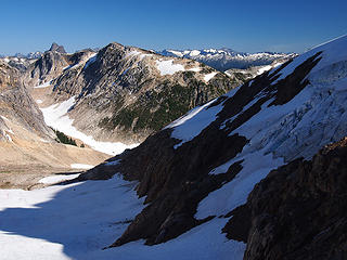 Shadows Falling on Hagan Glacier 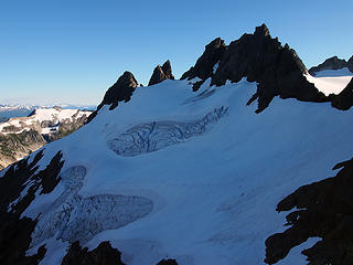 Safely Above Hagan Glacier 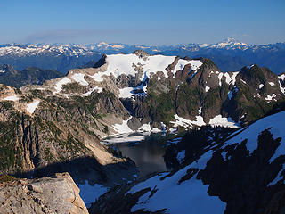 Looking Back to Berdeen 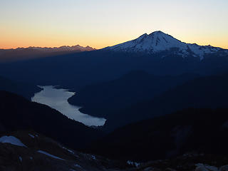 The Bakers from Blum Camp 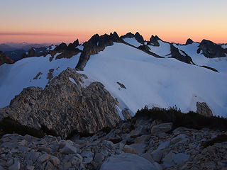 Hagan from Blum Camp 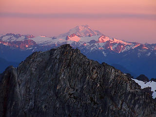 Snowking and Glacier Peak from Blum Camp 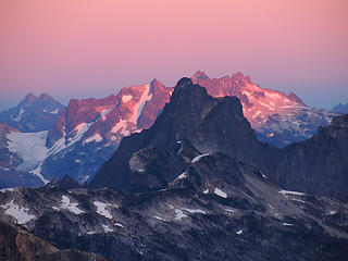 Triumph and Beyond from Blum Camp 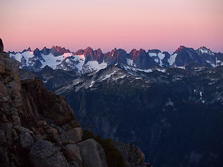 Northern Pickets from Blum Camp 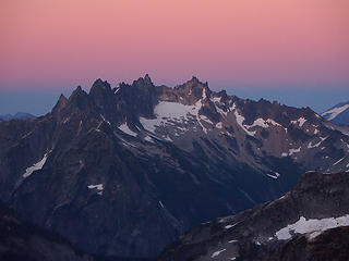 Terror from Blum Camp 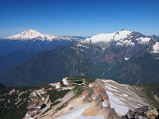 Baker, Vista, and Shuksan from Blum 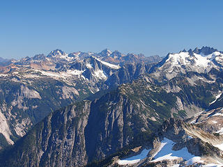 Redoubt, Mox, Spickard, etc.from Blum 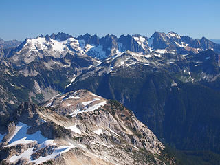 Northern Pickets from Blum 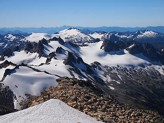 Hagan, Bacon, and Watson from Blum 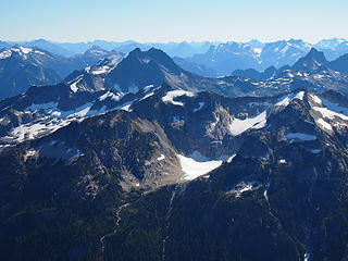 Mystery Ridge and Lonesome Lake from Blum 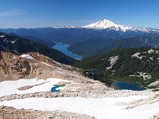 Hither We Go 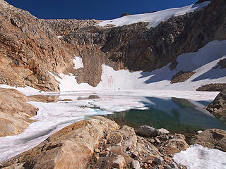 Uppermost Blum (5760) 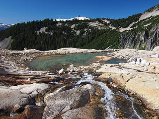 Descending to Outlet Tarn 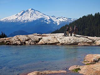 Baker and Gang at Outlet Tarn 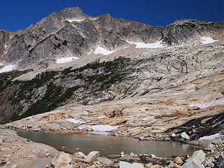 Mt Blum from Outlet Tarn 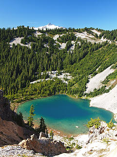 Descending to Upper Blum 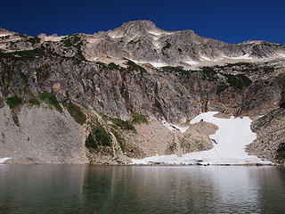 Mt. Blum from Upper Blum 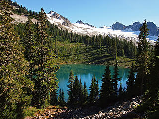 Hagan from Lower Blum  Looks Like An Easier Route Down to Lower Blum
|
| Back to top |
|
|
Sore Feet
Member

Joined: 16 Dec 2001
Posts: 6307 | TRs | Pics
Location: Out There, Somewhere |
Not going to cover much since the Swede did a pretty good job with the synopsis. This was my first time doing any sort of glacier / snow hiking and I had this image in my mind that it would be a lot more difficult than it was.
The exposure in a couple places definitely pushed me well past my comfort zone - namely the Chossy Gully of Death and one spot on the climb up to the campsite on the shoulder of Blum - but the rest of it wasn't that bad considering some of the places I've gotten myself into when hunting down waterfalls.
The big highlight of this trip for me was being able to finally lay eyes on the big waterfalls coming out of Berdeen and Green Lakes, while simultaneously the biggest disappointment was realizing I wouldn't be able to get anywhere near as close to them as I had thought I could. It certainly looks possible but navigating the terrain in that area is just so much more difficult than it appears on maps that I just didn't have the energy to expend.
Definitely going to be back, but probably via a different route and more to focus on photography around the lakes rather than doing the whole traverse again (though I wouldn't necessarily be opposed to it).
Three days on from getting home and my thighs are still killing me from the descent.
A few pictures so far, more to come later:
 Sunset on Bacon  Green  Sunrise on Hagan 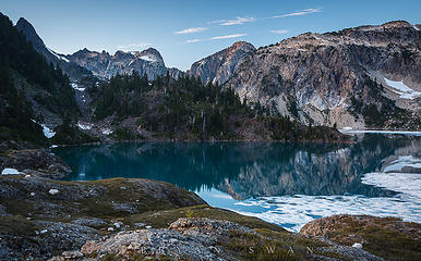 Berdeen
|
| Back to top |
|
|
forest gnome
Forest nut...
Joined: 24 Apr 2003
Posts: 3520 | TRs | Pics
Location: north cascades!! |
reserved for  caus I dint git go.... caus I dint git go....
|
| Back to top |
|
|
Chief Joseph
Member

Joined: 10 Nov 2007
Posts: 7703 | TRs | Pics
Location: Verlot-Priest Lake |
Cliff notes and pics?
Also, where is this Berdeen place of which you speak? It's not in any of the 3 100 hikes books I own.
Go placidly amid the noise and waste, and remember what comfort there may be in owning a piece thereof.
Go placidly amid the noise and waste, and remember what comfort there may be in owning a piece thereof.
|
| Back to top |
|
|
Ingunn
Hiking Viking
Joined: 01 Feb 2008
Posts: 1751 | TRs | Pics
Location: Redmond |
|
Ingunn
Hiking Viking
|
Sat Sep 08, 2012 4:05 pm |
|
|
Aah, you survived a Mike & Tom Special! You must be pretty cool (for a Swede).
|
| Back to top |
|
|
forest gnome
Forest nut...
Joined: 24 Apr 2003
Posts: 3520 | TRs | Pics
Location: north cascades!! |
oh for gods sake chief....it's the same one I keep beggin u to look up.... 
|
| Back to top |
|
|
Backpacker Joe
Blind Hiker

Joined: 16 Dec 2001
Posts: 23956 | TRs | Pics
Location: Cle Elum |
Reading this report, I think I made the right decision. Glad you guys made it and had a good time!
"If destruction be our lot we must ourselves be its author and finisher. As a nation of freemen we must live through all time or die by suicide."
Abraham Lincoln
"If destruction be our lot we must ourselves be its author and finisher. As a nation of freemen we must live through all time or die by suicide."
Abraham Lincoln
|
| Back to top |
|
|
Dayhike Mike
Bad MFKer
Joined: 02 Mar 2003
Posts: 10958 | TRs | Pics
Location: Going to Tukwila |
BPJ, yep. There were many times in the trip when we would look at each other and say "Good thing BPJ bailed. He really wouldn't like this."
Overall, we did great with everything considering the conditions. But time and time again we found ourselves commenting that "this was way easier last time".
"There is only one basic human right, the right to do as you damn well please. And with it comes the only basic human duty, the duty to take the consequences." -P.J. O'Rourke
"Ignorance is natural. Stupidity takes commitment." -Solomon Short
"There is only one basic human right, the right to do as you damn well please. And with it comes the only basic human duty, the duty to take the consequences." -P.J. O'Rourke
"Ignorance is natural. Stupidity takes commitment." -Solomon Short
|
| Back to top |
|
|
Backpacker Joe
Blind Hiker
Joined: 16 Dec 2001
Posts: 23956 | TRs | Pics
Location: Cle Elum |
Did the Rafts and cramps and Axe work out for you guys alright Michael?
"If destruction be our lot we must ourselves be its author and finisher. As a nation of freemen we must live through all time or die by suicide."
Abraham Lincoln
"If destruction be our lot we must ourselves be its author and finisher. As a nation of freemen we must live through all time or die by suicide."
Abraham Lincoln
|
| Back to top |
|
|
BarbE
Member

Joined: 28 Jul 2006
Posts: 1153 | TRs | Pics
|
|
BarbE
Member
|
Sat Sep 08, 2012 7:54 pm |
|
|
|
| Back to top |
|
|
SwedishHiker
Member
Joined: 25 Apr 2010
Posts: 18 | TRs | Pics
Location: Arlington, WA |
BPJ,
I am sorry you had to bail, I would have liked having you along and enjoyed meeting you. Much appreciation for the loan of the rafts and the rest of the gear. We'll just have to meet up for a less traumatic hike.
|
| Back to top |
|
|
Backpacker Joe
Blind Hiker
Joined: 16 Dec 2001
Posts: 23956 | TRs | Pics
Location: Cle Elum |
God dag, Hej. I'm sorry too, but after reading your report Im pretty sure I did the right thing. Glad my gear could make the trip with you guys. 
"If destruction be our lot we must ourselves be its author and finisher. As a nation of freemen we must live through all time or die by suicide."
Abraham Lincoln
"If destruction be our lot we must ourselves be its author and finisher. As a nation of freemen we must live through all time or die by suicide."
Abraham Lincoln
|
| Back to top |
|
|
forest gnome
Forest nut...
Joined: 24 Apr 2003
Posts: 3520 | TRs | Pics
Location: north cascades!! |
|
| Back to top |
|
|
|
|
You cannot post new topics in this forum
You cannot reply to topics in this forum
You cannot edit your posts in this forum
You cannot delete your posts in this forum
You cannot vote in polls in this forum
|
Disclosure: As an Amazon Associate NWHikers.net earns from qualifying purchases when you use our link(s). |


 and you're willing to do it again!