| Previous :: Next Topic |
| Author |
Message |
Martin S
Member


Joined: 06 May 2007
Posts: 181 | TRs | Pics
Location: Out in the perimeter, where there are no stars |
|
Martin S
Member
|
 Wed Oct 03, 2012 11:15 pm |
|
|
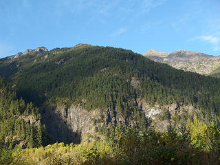
What non-volcanic peak in the Cascades has the greatest topographic prominence? The answer, I was surprised to learn, is Silvertip Mountain; not the one near Monte Cristo, but the 8517 ft one in BC, halfway between Hope and Ross Lake. Another surprising thing about Silvertip is that it has relatively good access both from the north, via the Sumallo River Road off of highway 3, and from the south, using the Silver-Skagit Road. The north side route allows you to drive to 3500 ft elevation and only 2 horizontal miles from the summit but involves some slide-alder bushwhacking and several thousand feet of steep scrambling on very unstable rock; the south side route is a straightforward ridge ascent but starts at only 2000 ft elevation and thus is a hefty 6500 ft of gain. So pick your poison.
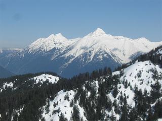 Rideout and Silvertip from the SE, May 2, 2011 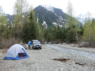 Camp by the Sumallo River, June 2011  Traversing the false summit 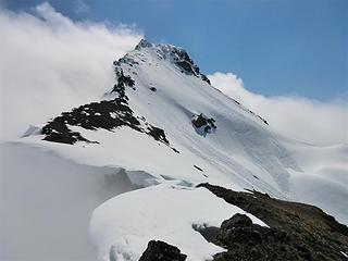 June 12, 2011. Silvertip summit 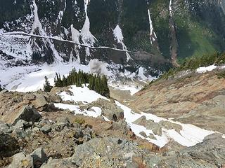 June 12, 2011 north face of Silvertip 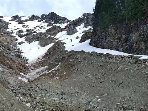 June 12, 2011 north face of Silvertip 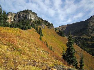 Forced off the S ridge at 6500 ft 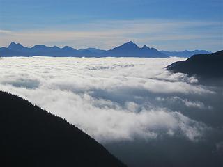 Hozomeen and clouds in the Skagit River valley 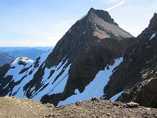 N side of Silvertip 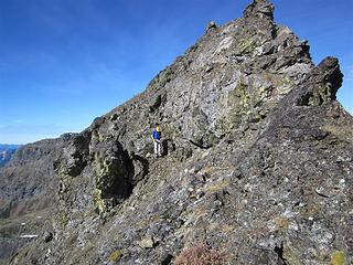 Bypassing the false summit 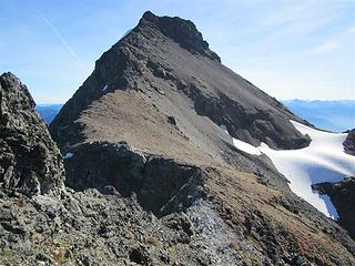 Silvertip summit from the false summit 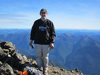 Craig displaying Everet Silvertips team gear 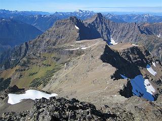 Rideout 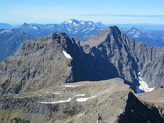 Rideout 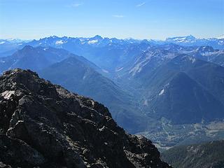 Maselpanic Creek, Custer, Rahm, Redoubt 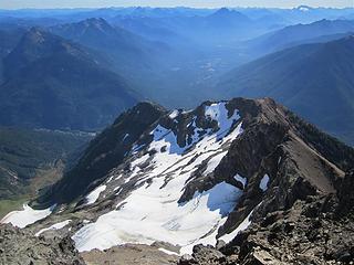 E face glacier and Ross Lake 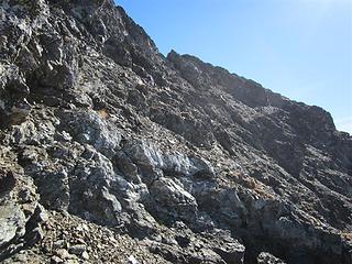 Descending near the summit 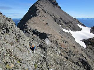 Redwic traversing the false summit 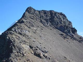 Silvertip summit 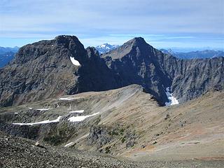 Rideout 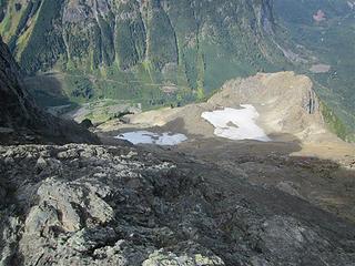 Looking down the north side 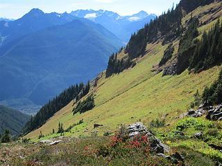 Route from S ridge into the SW basin 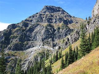 Rideout 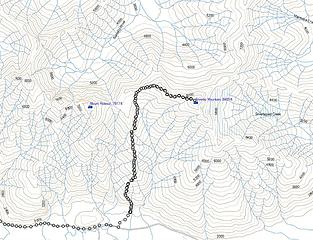 South route on Silvertip
"nothing's for certain" took the elevator down
while "anything can happen" climbed the stairs
- Ryszard Krynicki
"nothing's for certain" took the elevator down
while "anything can happen" climbed the stairs
- Ryszard Krynicki
|
| Back to top |
  
|
|
Matt
Tea, Earl Grey, Hot

Joined: 30 Jan 2007
Posts: 4307 | TRs | Pics
Location: Shoreline |
|
Matt
Tea, Earl Grey, Hot
|
Wed Oct 03, 2012 11:32 pm |
|
|
So what is Silvertip's prominence?
As beacons mountains burned at evening. J.R.R. Tolkien
As beacons mountains burned at evening. J.R.R. Tolkien
|
| Back to top |
|
|
Redwic
Unlisted Free Agent

Joined: 23 Feb 2009
Posts: 3292 | TRs | Pics
Location: Going to the Prom(inence) |
|
Redwic
Unlisted Free Agent
|
Wed Oct 03, 2012 11:52 pm |
|
|
| Matt wrote: | | So what is Silvertip's prominence? |
Silvertip Mountain has 6089' of clean prominence. Most people would probably guess that Mount Stuart is the most prominent non-volcanic peak in the Cascade Mountain range, but Mount Stuart only has 5354' of clean prominence.
Other Facts:
-> Silvertip Mountain is the 35th-most prominent peak in British Columbia.
-> Located only approximately 10 miles north of Washington, Silvertip Mountain is the closest Canadian ultra-prominence peak to the contiguous USA border.
-> To put things in perspective a little more, if the Washington border extended northward only 10-12 miles to include Silvertip Mountain, then the peak would be the sixth-most prominent peak in Washington and 25th-most prominent peak in the contiguous USA. Yowsers, there are a lot of very prominent peaks in BC!
------------
Thanks, Martin! I had a great time!
This peak was a long time coming, for both of us. I had been in correspondence about Silvertip Mountain with multiple people, both in Washington and British Columbia, for the past few years. Martin and I both helped to coordinate for last year's trip but I had other commitments when Martin, Greg, and Edward made their first attempt. Edward returned with another friend (Duane) two months later and was successful via the same (northwest) route he previously attempted. I'm glad that Martin and I did this peak together, tried a different approach (southwest ridge, which proved to be the safest route option), and that we could remove this peak from Martin's list of failed attempts.
This was my favorite summit trip of the year, for a variety of reasons.
In addition, we had found limited useful information available to the masses for this peak (probably due to the fact it is only attempted a few times per year at most), so I am very glad we can possibly help future summiters with our gathered photos and descriptions.
 SW Ridge, Silvertip Behind 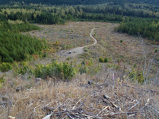 Looking Down At Parking Area 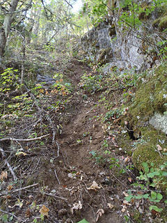 "Steep Dirt Step" 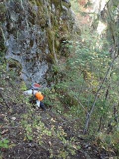 Martin Descends "Steep Dirt Step" 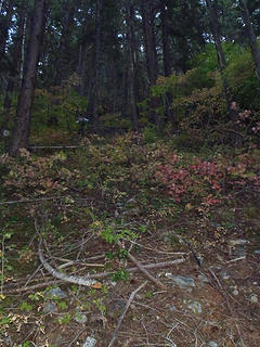 Martin In Steep Forest 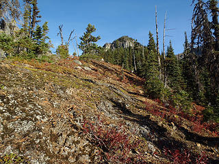 Martin On Upper SW Ridge 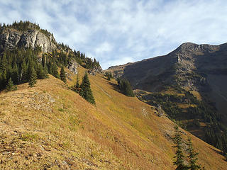 Prior To Bluff (6000') 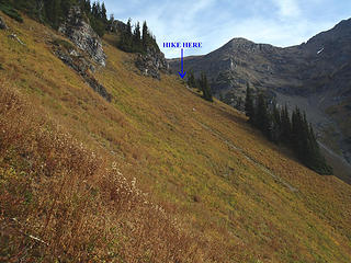 Bluff Bypass (6100') 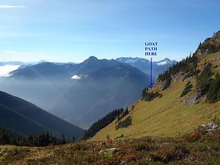 Looking Back Towards Bluff 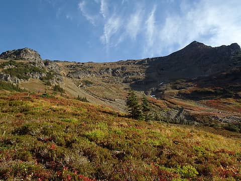 Looking Up At West Ridge 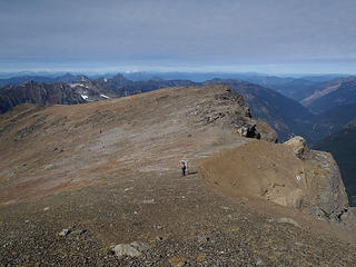 West Ridge 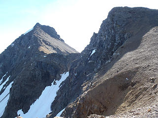 North Faces 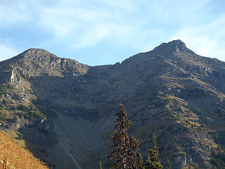 False & True Summits  Silvertip Mtn 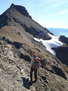 Approaching True Summit 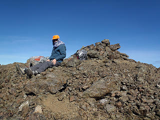 Martin On Summit 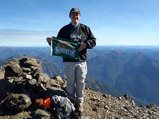 Silvertips, For The Win!!! 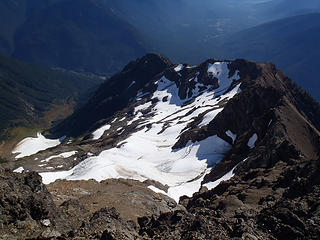 Glacier On East Slopes 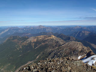 North View From Summit 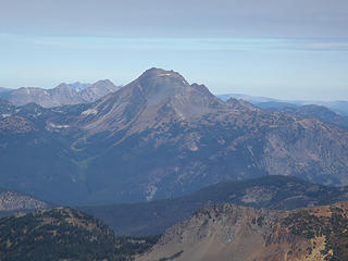 Mount Outram 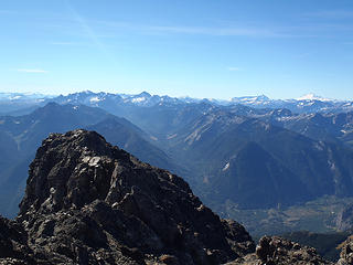 South View From Summit
60 pounds lighter but not 60 points brighter.
60 pounds lighter but not 60 points brighter.
|
| Back to top |
|
|
Stefan
Member

Joined: 17 Dec 2001
Posts: 5093 | TRs | Pics
|
|
Stefan
Member
|
Thu Oct 04, 2012 1:09 pm |
|
|
|
| Back to top |
|
|
|
|
You cannot post new topics in this forum
You cannot reply to topics in this forum
You cannot edit your posts in this forum
You cannot delete your posts in this forum
You cannot vote in polls in this forum
|
Disclosure: As an Amazon Associate NWHikers.net earns from qualifying purchases when you use our link(s). |


