| Previous :: Next Topic |
| Author |
Message |
Gimpilator
infinity/21M


Joined: 12 Oct 2006
Posts: 1684 | TRs | Pics
Location: Edmonds, WA |
Natasha and I spent some time trying to decide where we would go to do some easier hiking, after her finger was broken during our climb of the North Twin. Copious scrambling and snow climbing or glacier travel was out of the question. We thought about Borah and Diamond in Idaho but the weather was bad there, so we settled on the Pasayten Wilderness and decided to leave crampons and ice axes at home.
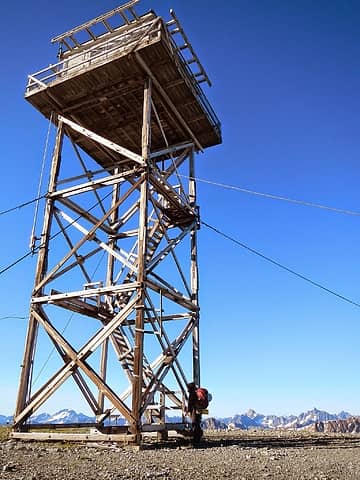 Slate lookout 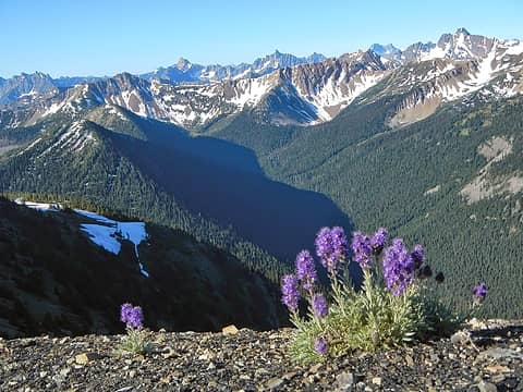 Slate views 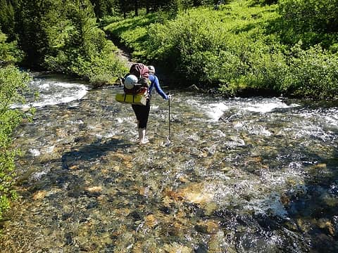 crossing the middle fork Pasayten 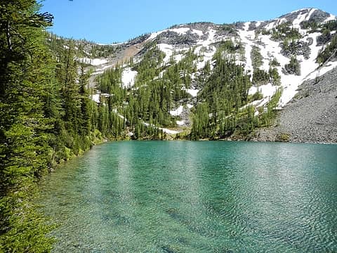 Freds Lake 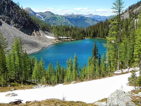 Fred's Lake 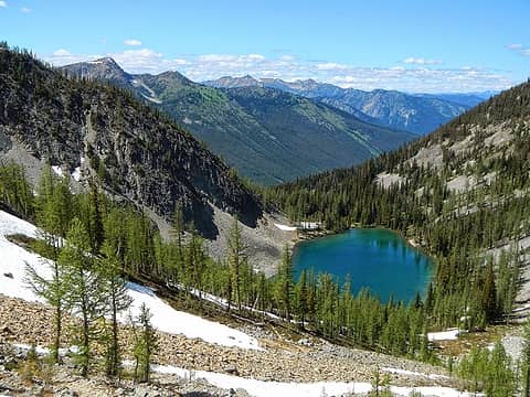 Fred' Lake 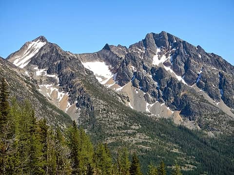 Blackcap and Monument 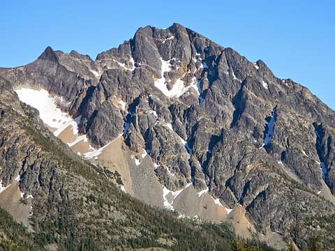 Monument 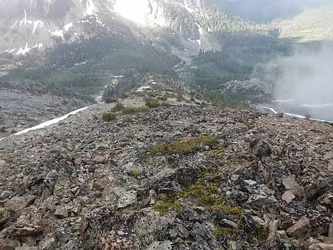 the rib I ascended on Lago 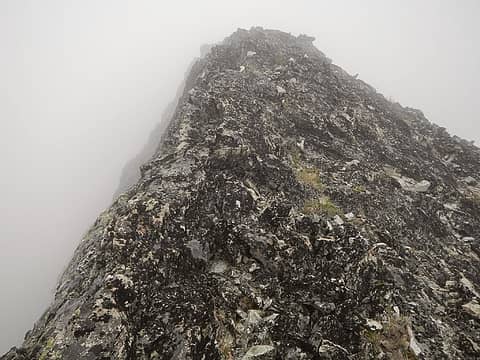 whiteout on the summit ridge 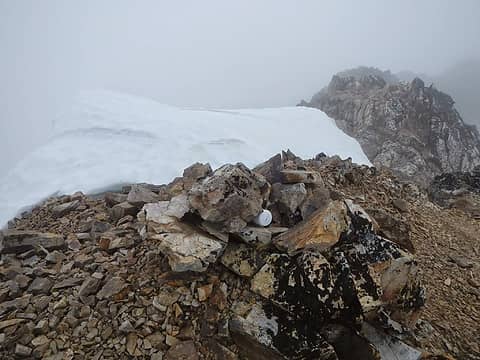 Lago summit and register 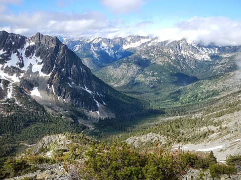 conditions improving 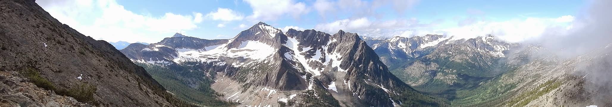 pano 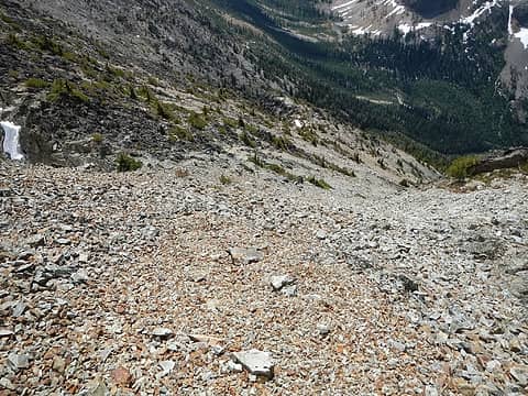 typical loose crap 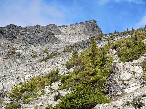 the first class 3 step on Carru 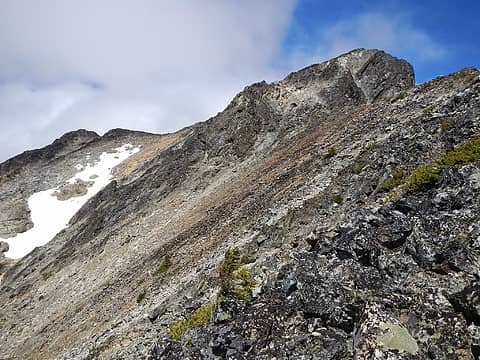 the second class 3 step on Carru 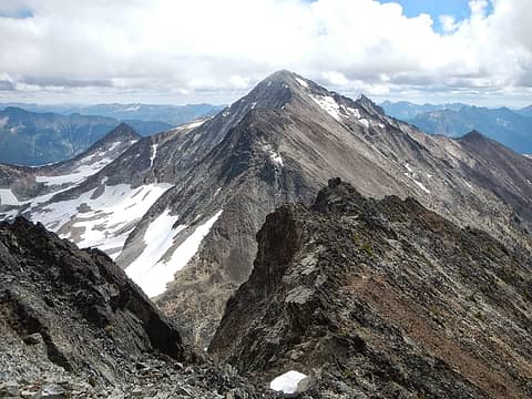 Lago from Carru 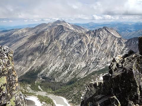 Ptarmigan and Dot from Carru  false summit 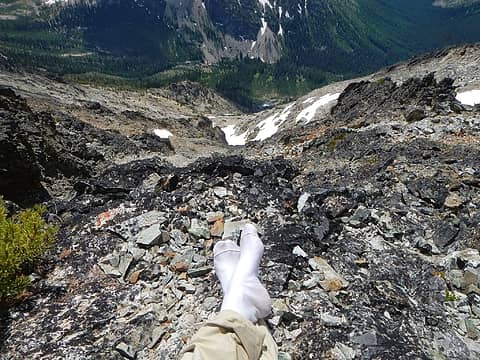 drying my socks 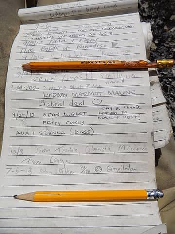 old pencil and new one 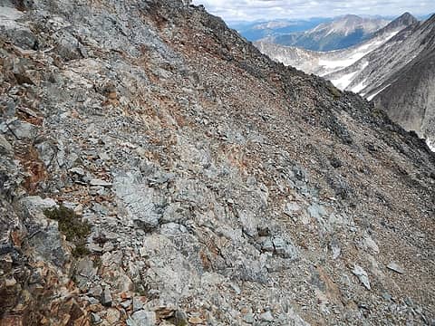 more loose crap 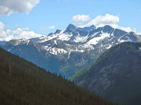 Reynolds north face 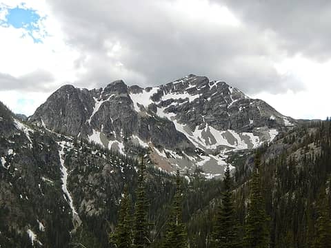 Rolo 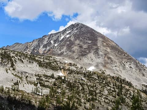 Osceola 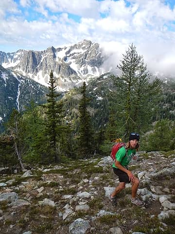 Kevin 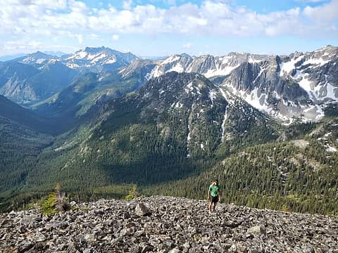 high on Osceola 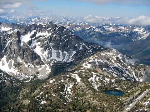 Rolo and Doris Lake 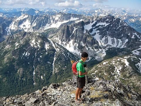 near the summit 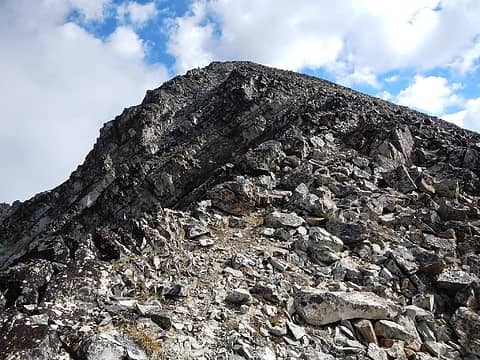 the ridge 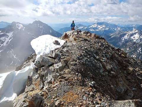 Osceola summit 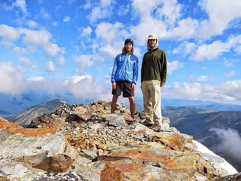 Kevin and I 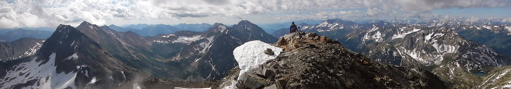 Osceola summit pano 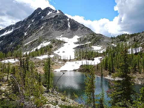 the lake that wasn't there 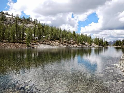 mystery lake 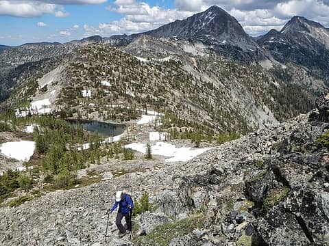 the lower north ridge of Rolo 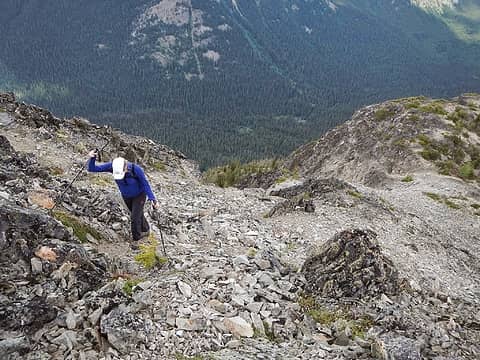 loose rock 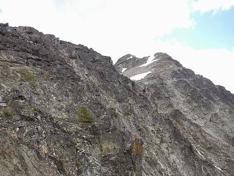 class 3 above 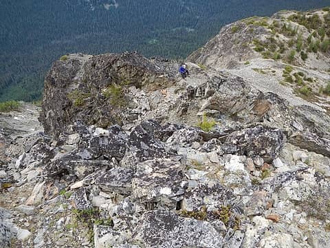 I left Natasha 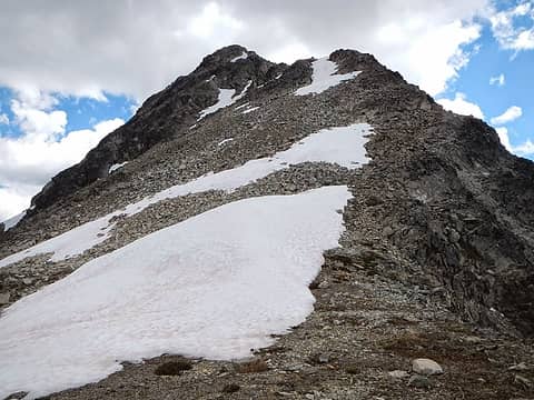 north ridge 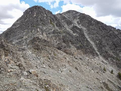 summit visible at right, loose traverse options below 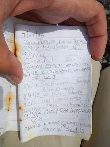 Rolo summit register 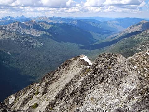 looking down the north ridge 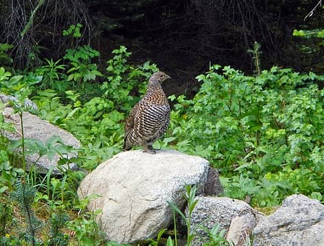 mother 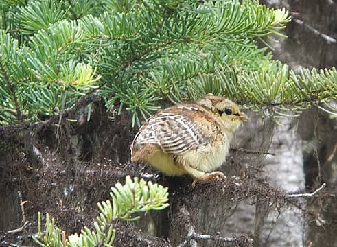 chick 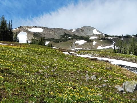 Slate Peak above 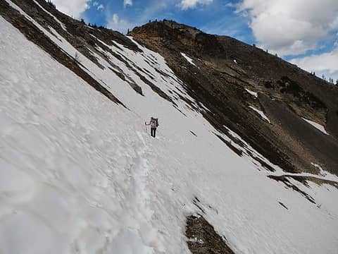 nearing slate pass 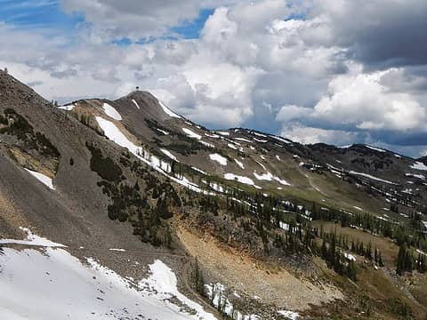 Slate and the lookout 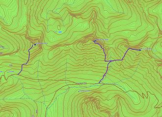 my routes
|
| Back to top |
  
|
|
RichP
Member

Joined: 13 Jul 2006
Posts: 5633 | TRs | Pics
Location: here |
|
RichP
Member
|
 Mon Jul 08, 2013 9:19 am |
|
|
Love that area. I spent 8 days up there in '08 to grab most of those peaks and was sad to leave. Rain just about every day but at the right time when we were back at camp. Still planning on a return trip for Rolo and Trailblazer, hopefully this year.
If you haven't walked up Monument Ck, you owe it to yourself as it a marvel of trail building, even in it's sad, unmaintained state. You probably will head up that way for the other T/100 peaks. Bring your loppers or a saw.
|
| Back to top |
|
|
Redwic
Unlisted Free Agent

Joined: 23 Feb 2009
Posts: 3292 | TRs | Pics
Location: Going to the Prom(inence) |
|
Redwic
Unlisted Free Agent
|
Mon Jul 08, 2013 9:36 am |
|
|
Sounds like a good way to get out.
I was wondering where you had disappeared to, when I returned from Mexico. I correctly figured it must be a multi-day trip for Top 100 peaks.
60 pounds lighter but not 60 points brighter.
60 pounds lighter but not 60 points brighter.
|
| Back to top |
|
|
Bedivere
Why Do Witches Burn?

Joined: 25 Jul 2008
Posts: 7464 | TRs | Pics
Location: The Hermitage |
|
Bedivere
Why Do Witches Burn?
|
Mon Jul 08, 2013 12:02 pm |
|
|
Neat trip, you covered a pretty good amount of ground in 3 days. I never did make it up Carru, which I'm kind of disappointed about but you would've seen my name in the Lago, Osceola, and Rolo registers.
Congrats on getting out there, too bad Natasha's finger's still bugging her but I bet she'll be back in the saddle soon.
|
| Back to top |
|
|
raising3hikers
Member

Joined: 21 Sep 2007
Posts: 2344 | TRs | Pics
Location: Edmonds, Wa |
I've also gotta go back to do Ptarmigan and Dot. Can't believe the lack of snow in the area. Nice place to go
|
| Back to top |
|
|
seabadge
Member

Joined: 19 Sep 2012
Posts: 43 | TRs | Pics
Location: Kenmore, WA |
|
seabadge
Member
|
Mon Jul 08, 2013 7:25 pm |
|
|
Thanks to your lovely summit panos, I almost feel like I was there 
|
| Back to top |
|
|
wildernessed
viewbagger

Joined: 31 Oct 2004
Posts: 9275 | TRs | Pics
Location: Wenatchee |
 Nice ! Nice !
Living in the Anthropocene
Living in the Anthropocene
|
| Back to top |
|
|
|
|
You cannot post new topics in this forum
You cannot reply to topics in this forum
You cannot edit your posts in this forum
You cannot delete your posts in this forum
You cannot vote in polls in this forum
|
Disclosure: As an Amazon Associate NWHikers.net earns from qualifying purchases when you use our link(s). |


