| Previous :: Next Topic |
| Author |
Message |
RodF
Member


Joined: 01 Sep 2007
Posts: 2593 | TRs | Pics
Location: Sequim WA |
|
RodF
Member
|
 Tue Jul 30, 2013 3:57 pm |
|
|
This trail-less-travelled provides a dayhike into a series of the most verdant subalpine meadows to be found anywhere in the Olympics, filled with wildflowers and grasses knee, waist and sometimes chest high.
Robert L. Wood's "Olympic Mountains Trail Guide" provides an accurate description. Those seeking a paved trail, and the enjoyment of chats with many visitors from around the world, may prefer the Hurricane Hill trail; Cox Valley is its antithesis.
The trailhead is on Obstruction Point Road, 0.6 miles from its gate at the Hurricane Ridge Visitors Center parking lot. Parking is available 100 yards past the trailhead for one or two cars. It has been only irregularly maintained for the first 1.7 miles, so involves some route-finding and scrambling over windfalls and through brush. The November, 2007 windstorm broke many trees along the road and upper switchbacks of this trail; these windfall were cleared, but it appears not much has been done since. Entering the first meadow at the base of the switchbacks, the trail disappears - look to the right for cut logs and a metal tag.
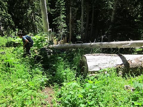 0.4 miles: in first meadow at base of switchbacks, look right for cut logs 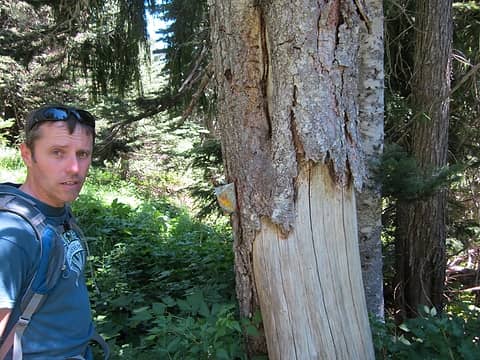 0.5 tag on standing snag 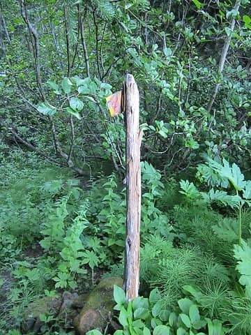 0.7 post with flag at entrance to second meadow 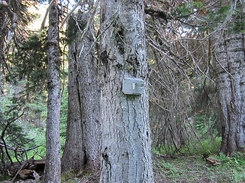 1 Mile sign 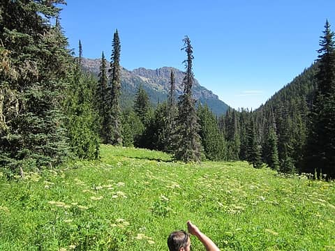 1.1 third, large meadow 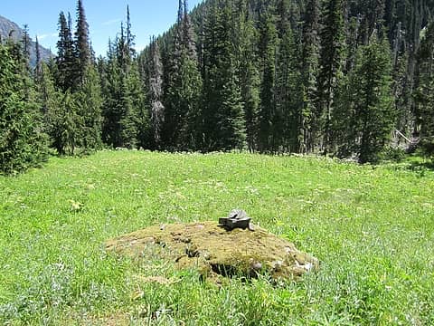 1.2 cairn 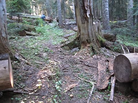 1.3 many cut logs 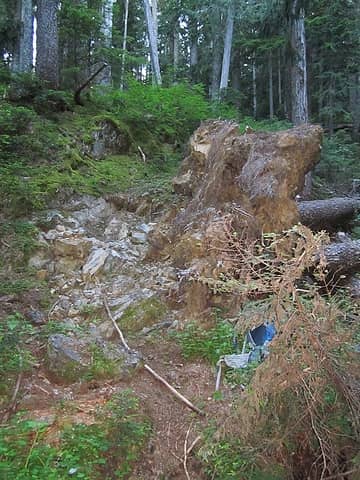 1.6 stream crossing 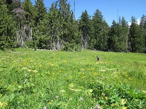 1.7 Norm searching for Cox cabin 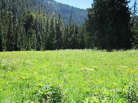 1.7 Cox meadow 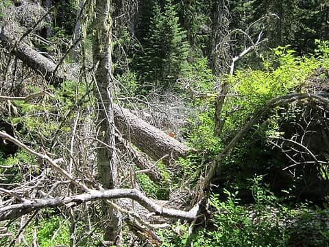 1.8 tag on fallen tree at Morse Creek crossing 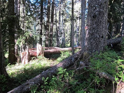 2.1 tag near bend of trail south of Morse Creek. definite tread leading NE. 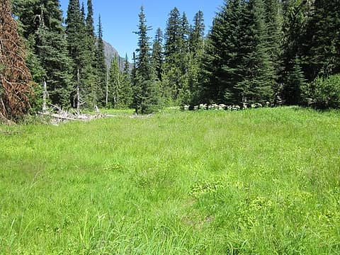 2.2 second,larger meadow south of Morse Creek 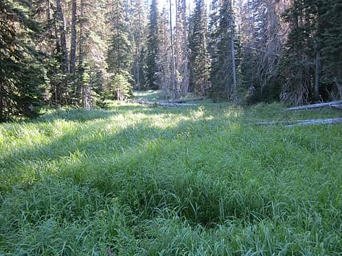 2.2 second, larger meadow south of Morse Creek 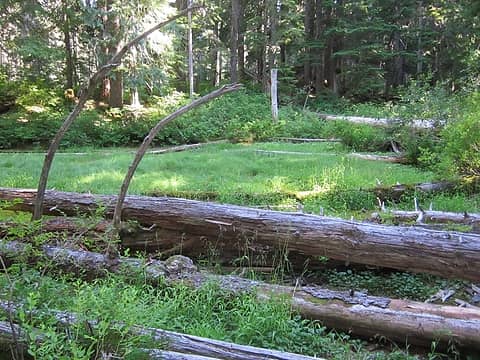 2.3 pocket meadow, south of Morse Creek, west of Wells creek 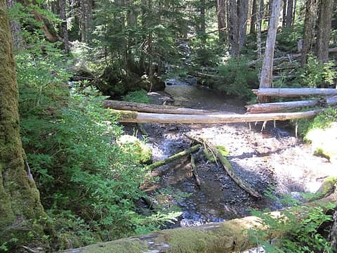 2.6 confluence Wells Creek and Morse Creek 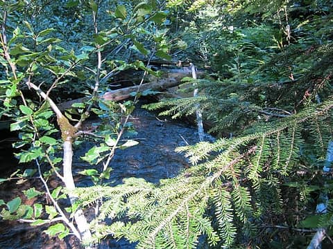 3.0 second crossing of Morse Creek, hidden beneath alder | Quote: | | South of the Ennis Creek headwaters and over the divide into the Morse Creek drainage, A. E. Cox, with the help of friends, cut a lengthy trail leading to a circular, level opening which he settled on in the mid to late 1890s. Cox arrived in the west in the early 1890s and stayed in Seattle in the height of the country's economic depression during the early 1890s. After moving to upper Morse Creek (known as Cox Valley on the most recent U.S. Geological Survey maps), Cox erected a log cabin and large shake barn and cultivated potatoes and hay. A friend named Wells filed claim on a larger open parcel nearby. Cox established his "ranch" when he was well along in years and presumably did not live on his property long. The Cox trail and ranch continued to be used as a stopping place by county game wardens, cattle drivers, sportsmen and campers in the 1910s and 1920s (Webster 1921, 57-59). The Cox trail is no longer in use today. All that remains of the Cox homestead buildings are collapsed piles of lumber and aging notch marks on trees that served to support the barn walls. None of the structures of these known early settlers in the Ennis Creek and Morse Creek Valleys are extant. |
Lands Office land claims records show that in 1894, Aurin E. Cox, Moses A. Cox, George W. Wells and Harry P. Wells each claimed lots within the city of Port Angeles.
http://www.glorecords.blm.gov/details/patent/default.aspx?accession=WASAA 087583&docClass=SER&sid=5j3lk0gn.jjw
(Note: cut and paste into browser - not clickable due to embedded space.)
The 1907 Lands Office cadastral survey shows Cox's Trail leading into upper Morse Creek, but, surprisingly, no cabin or barn was depicted. It also depicts a spur trail heading towards Well's Valley.
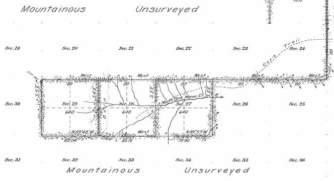 upper Cox's Trail from 1907 Lands Office cadastral survey 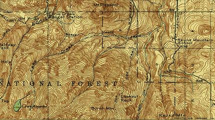 1918 USGS/USArmy Port Angeles, Old and New Cox Trails 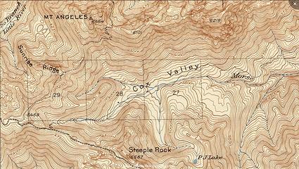 1944 USGS Mount Angeles
"of all the paths you take in life, make sure a few of them are dirt" - John Muir
"the wild is not the opposite of cultivated. It is the opposite of the captivated - Vandana Shiva
"of all the paths you take in life, make sure a few of them are dirt" - John Muir
"the wild is not the opposite of cultivated. It is the opposite of the captivated - Vandana Shiva
|
| Back to top |
  
|
|
Phil
Member

Joined: 02 Jul 2003
Posts: 2025 | TRs | Pics
Location: Shoreline, WA |
|
Phil
Member
|
Tue Jul 30, 2013 8:30 pm |
|
|
Beautiful! Never heard of that place... thanks for sharing.
|
| Back to top |
|
|
IanB
Vegetable Belayer

Joined: 21 Jul 2010
Posts: 1062 | TRs | Pics
Location: gone whuljin' |
|
IanB
Vegetable Belayer
|
Wed Jul 31, 2013 8:19 am |
|
|
Interesting detective work Rod. 
"Forget gaining a little knowledge about a lot and strive to learn a lot about a little." - Harvey Manning
"Forget gaining a little knowledge about a lot and strive to learn a lot about a little." - Harvey Manning
|
| Back to top |
|
|
cascadetraverser
Member

Joined: 16 Sep 2007
Posts: 1407 | TRs | Pics
|
Rod: I am alway impressed by your thorough and historically relevant TRs as well as your willingness to travel to unique places. Thanks alot for another great TR!
|
| Back to top |
|
|
FrogFarm
Member

Joined: 31 Aug 2010
Posts: 29 | TRs | Pics
Location: Probably eating |
|
FrogFarm
Member
|
Wed Jul 31, 2013 9:59 am |
|
|
Wow! What an amazing trip! I always learn so much about the Olympics from your trip reports. Thank you for taking the time to put together so much wonderful information!
|
| Back to top |
|
|
Magellan
Brutally Handsome

Joined: 26 Jul 2006
Posts: 13116 | TRs | Pics
Location: Inexorable descent |
|
Magellan
Brutally Handsome
|
Wed Jul 31, 2013 10:46 am |
|
|
Amazing trip back in time Thanks Rod!
|
| Back to top |
|
|
Ski
><((((°>

Joined: 28 May 2005
Posts: 12832 | TRs | Pics
Location: tacoma |
|
Ski
><((((°>
|
Wed Jul 31, 2013 12:28 pm |
|
|
| Quote: | | about 50 cattle were grazed on Hurricane Ridge under USFS grazing permits that were grandfathered into the Park |
great report. funny the kind of stuff you dig up when you look.
"I shall wear white flannel trousers, and walk upon the beach.
I have heard the mermaids singing, each to each."
"I shall wear white flannel trousers, and walk upon the beach.
I have heard the mermaids singing, each to each."
|
| Back to top |
|
|
ethorson
Member

Joined: 07 Jun 2007
Posts: 114 | TRs | Pics
Location: Port Townsend |
|
ethorson
Member
|
Sat Aug 03, 2013 8:41 pm |
|
|
Thanks for the fascinating report Rod. Do you think any of the meadows are visible from the Hurricane Ridge road?
|
| Back to top |
|
|
bobbi
stillaGUAMish

Joined: 13 Jul 2006
Posts: 8012 | TRs | Pics
Location: olympics! |
|
bobbi
stillaGUAMish
|
Sat Aug 03, 2013 9:45 pm |
|
|
I have actually been to Cox Valley many many years ago! The markers helped us then and good to know that it's still there for you!
We explored the area until I got into some nettles  Thanks for the history lesson
bobbi ૐ
"Today is your day! Your mountain is waiting. So
get on your way!" - Oh, the Places Youll Go! By Dr. Seuss
bobbi ૐ
"Today is your day! Your mountain is waiting. So
get on your way!" - Oh, the Places Youll Go! By Dr. Seuss
|
| Back to top |
|
|
RodF
Member
Joined: 01 Sep 2007
Posts: 2593 | TRs | Pics
Location: Sequim WA |
|
RodF
Member
|
Sat Jun 06, 2015 6:00 pm |
|
|
Over the past two years, friend Norm and I have cleared, brushed and re-opened the Cox Valley trail for 1.8 miles to the Cox homestead meadow. The previously difficult bushwacks through salmonberry are now gone, and it's a pleasant hike gradually descending through a series of meadows along the headwaters of Morse Creek. Visiting yesterday, I was glad to see a few bootprints, still outnumbered by the hoofprints of elk and deer and bear signs along the trail. Although only 2 miles from the crowds at the other Hurricane Ridge trailheads, it offers solitude - I've never seen another car at the trailhead, nor met another hiker there.
The wildflower meadows are poised to explode into bloom in about 2 or 3 weeks. Late June would be an ideal time to see it
The trail disappears in the verdant meadows it passes through. Look carefully for the old metal snow course / trail markers in the trees, marking where it enters and leaves each meadow.
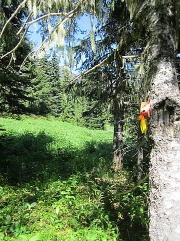 flag entering Cox meadow 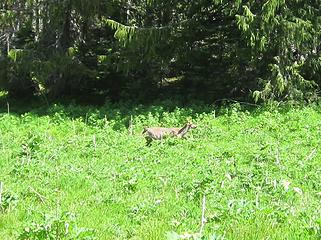 deer in meadow 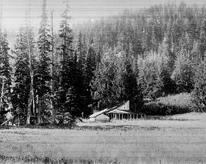 Cox Ranch 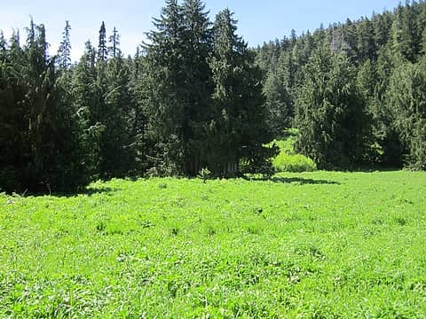 Cox grove today 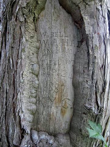 1887 arborglyph
"of all the paths you take in life, make sure a few of them are dirt" - John Muir
"the wild is not the opposite of cultivated. It is the opposite of the captivated - Vandana Shiva
"of all the paths you take in life, make sure a few of them are dirt" - John Muir
"the wild is not the opposite of cultivated. It is the opposite of the captivated - Vandana Shiva
|
| Back to top |
|
|
|
|
You cannot post new topics in this forum
You cannot reply to topics in this forum
You cannot edit your posts in this forum
You cannot delete your posts in this forum
You cannot vote in polls in this forum
|
Disclosure: As an Amazon Associate NWHikers.net earns from qualifying purchases when you use our link(s). |


