| Previous :: Next Topic |
| Author |
Message |
wildernessed
viewbagger


Joined: 31 Oct 2004
Posts: 9275 | TRs | Pics
Location: Wenatchee |
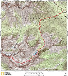
Location : W. of Twisp
Access : SR 97A > Twisp River Rd. > South Creek TH just beyond South Creek CG
Maps : GTM - Stehekin, USGS - Gilbert, TOPO
Stats : 17 mi, 5600' r/t
 Mt Gibbs - Ba 8142' 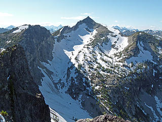 Mt. Gibbs from Rennie Peak. 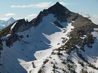 Mt. Gibbs from Rennie Peak. After seeing this angle I knew I had to get up there. 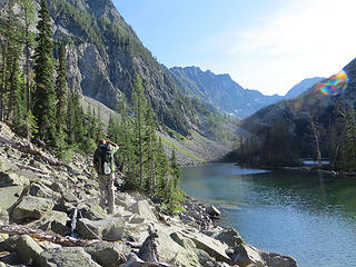 Steve processing... 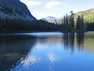 Abernathy in the background of Louis Lake. 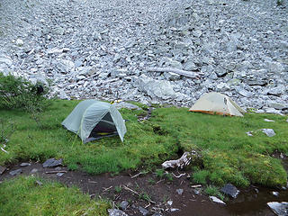 Not much tent space. Very marshy ground.  , but we had some. We scrambled the initial summit ridge of Gibbs class 1-3 to the top which is the false summit, but still above 8k' then I followed the slim West ridge, which you can straddle in places, and have to do a very exposed down climb on to the true summit. , but we had some. We scrambled the initial summit ridge of Gibbs class 1-3 to the top which is the false summit, but still above 8k' then I followed the slim West ridge, which you can straddle in places, and have to do a very exposed down climb on to the true summit.
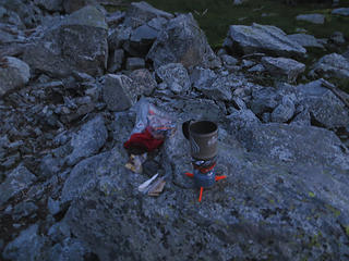 Coffee 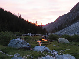 Time to be moving ! 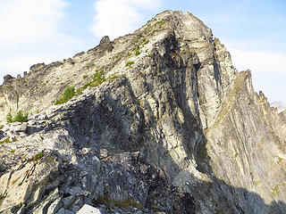 Below Mt. Gibbs 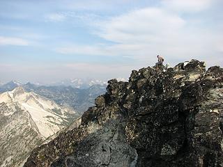 w on summit. 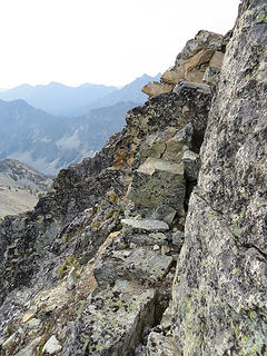 Narrow step to the right down to a very narrow ledge which avoids broken ridge with unstable blocks. After crossing ledge regain slightly higher ridge again to summit. 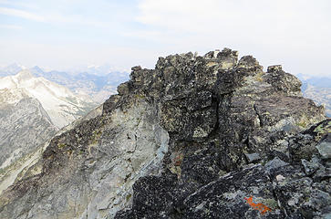 From what appears to be the summit from below a broken ridge narrow enough to straddle in places extends West to the true summit. 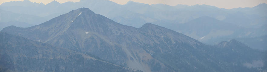 Camels Hump 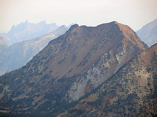 Motherlode 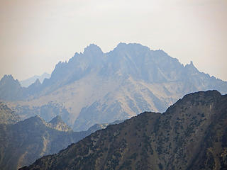 Silver Star (note smoke in air) 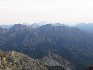 Crescent Mountain with Motherlode and South Butte. 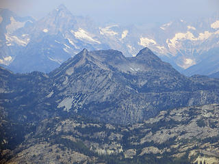 ? 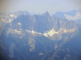 Tupshin 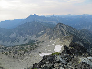 Upper Basin. 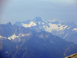 Tupshin - Bonanza 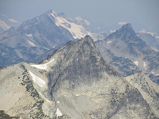 McGregor (L) - McAlester - Bowan (R) 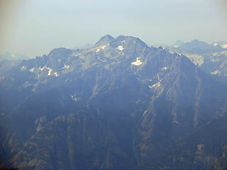 ? 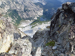 Bugger Lake nearly 3000' below. 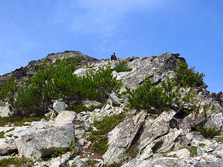 Steve on the lower summit ridge. 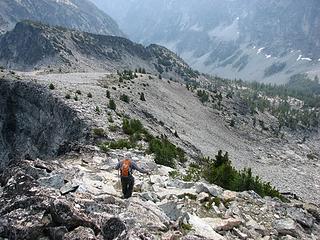 W descending. 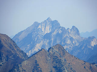 Big Kangaroo 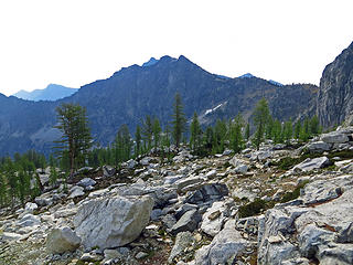 Rennie from upper basin. 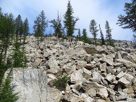 More Boulders... 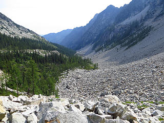 Boulder Alley 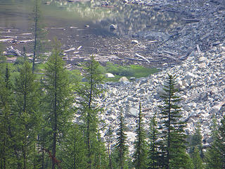 tents next to tarn. 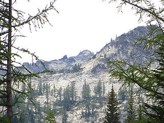 Gibbs in the distance as seen from our camp. 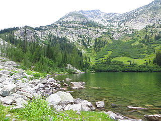 At Louis Lake looking up at Louis Peak.  I told Steve I feel like were two kids out in the woods on some adventure. I told Steve I feel like were two kids out in the woods on some adventure.
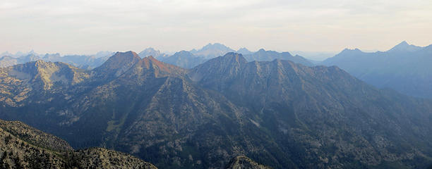 Crescent - South Butte - Motherlode 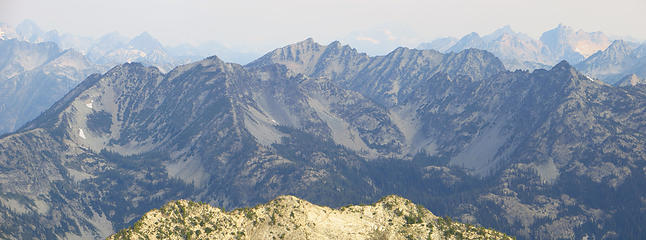 Looking West towards South Pass 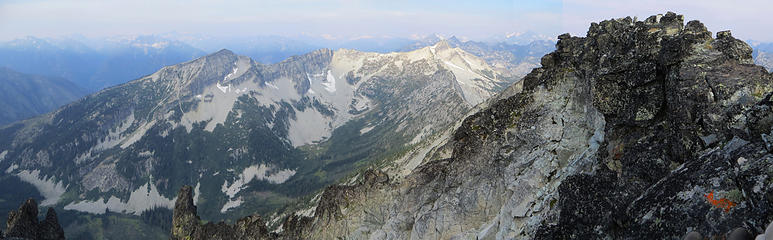 McAlister and Gibb's summit 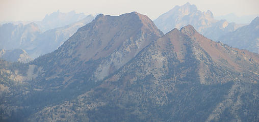 Motherlode 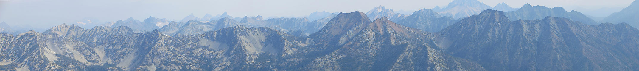 Upper Twisp River Peaks Super Pano 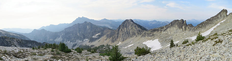 Upper Basin with Rennie in foreground and Reynolds in background.
Living in the Anthropocene
Living in the Anthropocene
|
| Back to top |
  
|
|
gb
Member

Joined: 01 Jul 2010
Posts: 6311 | TRs | Pics
|
|
gb
Member
|
 Thu Aug 15, 2013 2:37 pm |
|
|
Of your unnamed peaks,
? (note smoke in the air) = Silver Star
? unsure but glacier in back left is the hint
? = Tupshin
Upper basin
no label = Tupshin foreground left, Bananas right rear
no label = McGregor in the back and Bowan on the right
? unsure
name it = Big Kangaroo (one of the better rock climbs in the area)
|
| Back to top |
|
|
cefire
Member

Joined: 03 Feb 2010
Posts: 523 | TRs | Pics
|
|
cefire
Member
|
Thu Aug 15, 2013 2:42 pm |
|
|
Awesome pictures!
|
| Back to top |
|
|
wildernessed
viewbagger
Joined: 31 Oct 2004
Posts: 9275 | TRs | Pics
Location: Wenatchee |
gb thanks for the peak identifying. I should have had my phone with the peakfinder app or another map.
Living in the Anthropocene
Living in the Anthropocene
|
| Back to top |
|
|
b00
Member

Joined: 29 Sep 2003
Posts: 1144 | TRs | Pics
|
|
b00
Member
|
Thu Aug 15, 2013 7:05 pm |
|
|
| wildernessed wrote: | Big Kangaroo |
| gb wrote: | | name it = Big Kangaroo (one of the better rock climbs in the area) |
is that the tomahawk on the right?
|
| Back to top |
|
|
HitTheTrail
Member

Joined: 30 Oct 2007
Posts: 5460 | TRs | Pics
Location: 509 |
Do you guys seek out those obscure peaks just to make the rest of us look bad? Good effort and pay-off for a little 24 hour overnighter. Sorry the smoke ruined your views but it did make some of the photos look surreal.
|
| Back to top |
|
|
gb
Member
Joined: 01 Jul 2010
Posts: 6311 | TRs | Pics
|
|
gb
Member
|
Thu Aug 15, 2013 7:31 pm |
|
|
I'm thinking the 4th picture with the glaciated peak in the left background is likely Goode - or Memaloose ridge anyway. If so, the glacier on Goode is just beyond a rib in the picture. The peak that shows the glacier on the left of the picture is Buckner and Goode would be there at about the right distance from Buckner.
There was diffuse smoke in the air near Mt. Baker Tuesday morning, too. By afternoon the wind blew the smoke to the NE.
By the way 8142 has long been on my ski list...
|
| Back to top |
|
|
wildernessed
viewbagger
Joined: 31 Oct 2004
Posts: 9275 | TRs | Pics
Location: Wenatchee |
| HitTheTrail wrote: | | Do you guys seek out those obscure peaks just to make the rest of us look bad? Good effort and pay-off for a little 24 hour overnighter. Sorry the smoke ruined your views but it did make some of the photos look surreal. |
We do look for the path less traveled ( actual or current ) when we can but this one was right on Sawtooth Ridge so it had a special standing.
Living in the Anthropocene
Living in the Anthropocene
|
| Back to top |
|
|
HitTheTrail
Member
Joined: 30 Oct 2007
Posts: 5460 | TRs | Pics
Location: 509 |
| wildernessed wrote: | | We do look for the path less traveled ( actual or current ) when we can but this one was right on Sawtooth Ridge so it had a special standing. |
Yeah right! I just did a search on Gibbs and it looks like you, Tom_S and Steph are the only ones to do a TR on it. And they say the summit is seven feet higher than the one you and El Steveo were on. Looks like you guys did the wrong summit after all. Ha ha, gotta go back and set foot on the real one.
|
| Back to top |
|
|
Treehugger5
Member
Joined: 23 Sep 2012
Posts: 407 | TRs | Pics
Location: Spokane, WA |
Absolutely gorgeous.
Help a girl out--I can't quite make out the numbers on the larger map: Was trailhead elevation around 3300'? And gain was 5600'?
Elrond's Rocket of Rivendell~ hiker and runner extraordinaire
Elrond's Rocket of Rivendell~ hiker and runner extraordinaire
|
| Back to top |
|
|
puzzlr
Mid Fork Rocks

Joined: 13 Feb 2007
Posts: 7220 | TRs | Pics
Location: Stuck in the middle |
|
puzzlr
Mid Fork Rocks
|
Sun Aug 18, 2013 10:51 am |
|
|
I can see why you wanted to climb it -- a good looking mountain. Congrats on getting up to a rarely visited high point.
|
| Back to top |
|
|
wildernessed
viewbagger
Joined: 31 Oct 2004
Posts: 9275 | TRs | Pics
Location: Wenatchee |
I think the TH elevation is 3100. The peak is cited at different elevations on different maps. Trust me i was on the true summit. Straddling the ridge with 3k' drop on each side is something you won't forget or do for a low spot. Looking at the peak from the East your seeing the sum of it's parts. The actual peak wasn't as pleasing to the eye when you were on it.
Living in the Anthropocene
Living in the Anthropocene
|
| Back to top |
|
|
HitTheTrail
Member
Joined: 30 Oct 2007
Posts: 5460 | TRs | Pics
Location: 509 |
Ok, OK I take back everything derogatory I said. Funny how many different ways there are to bump a truly unique hike that nobody is paying attention to.
|
| Back to top |
|
|
|
|


