| Previous :: Next Topic |
| Author |
Message |
MangyMarmot
Member


Joined: 06 Apr 2012
Posts: 474 | TRs | Pics
|
I've wanted to go up Necklace Valley for a few years now. Somehow I hadn't made it out there though. Last Friday the chance came at last. I had a whole day without any other responsibilities, so I headed up to the Foss River Road. The morning was clear and beautiful in Seattle. By the time I got to Sultan, there were clouds overhead. By Skykomish, it was raining. The forecast was for improving weather throughout the day, so I put my faith in the weather man, donned the rain gear, and started up the trail.
The first part of the trail is a fairly level walk through the forest. After the bridge across the river, the trail turns South-West and get steeper. As I gained elevation, I had serious doubts about the forecast, as the rain showed no signs of stopping. I cursed the weather man, not always under my breath. By the time I reached the first lake, though, the rain had finally stopped. I sat down for a quick snack, and pulled out a dry shirt from the bowels of my pack.
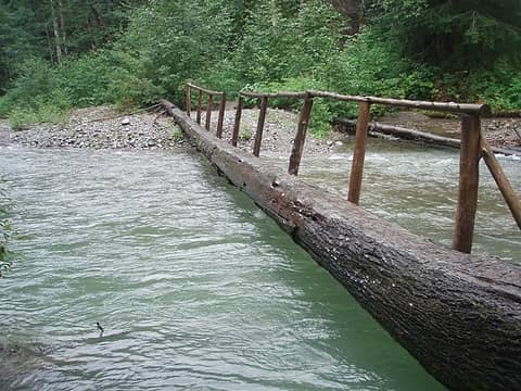 Bridge across the river 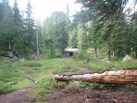 Cabin 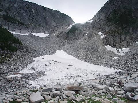 Talus slope 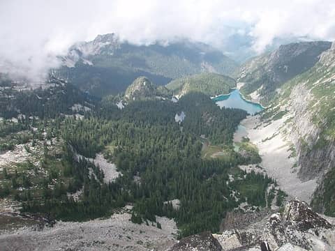 Necklace Valley 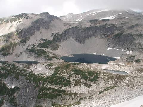 La Bohn Lakes 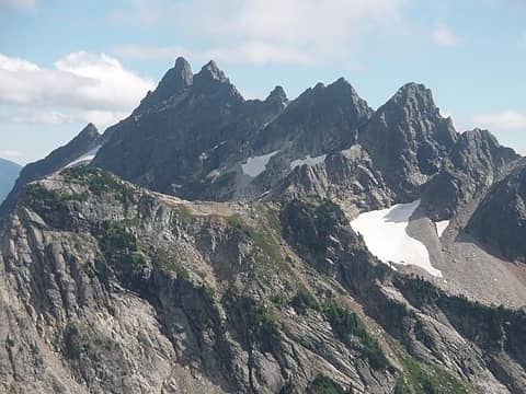 Bear's Breast Mountain 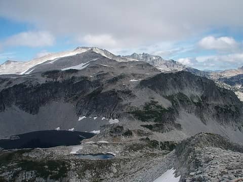 Hinman and Daniel 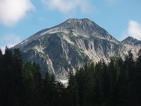 La Bohn Peak from Jade Lake
|
| Back to top |
  
|
|
Magellan
Brutally Handsome

Joined: 26 Jul 2006
Posts: 13116 | TRs | Pics
Location: Inexorable descent |
|
Magellan
Brutally Handsome
|
 Fri Sep 06, 2013 9:56 pm |
|
|
Cool. 
|
| Back to top |
|
|
RichP
Member

Joined: 13 Jul 2006
Posts: 5634 | TRs | Pics
Location: here |
|
RichP
Member
|
Fri Sep 06, 2013 9:59 pm |
|
|
Always a great area to visit.
|
| Back to top |
|
|
Slide Alder Slayer
Member

Joined: 14 Jan 2002
Posts: 1960 | TRs | Pics
|
Done in a day, impressive! Glad the weather cleared and you got great views from La Bohn Peak.
|
| Back to top |
|
|
contour5
Member

Joined: 16 Jul 2003
Posts: 2963 | TRs | Pics
|
|
contour5
Member
|
Sun Sep 08, 2013 2:02 pm |
|
|
Nice one! That is one long day hike. I've spent 2 days just coming down that trail...
|
| Back to top |
|
|
puzzlr
Mid Fork Rocks

Joined: 13 Feb 2007
Posts: 7220 | TRs | Pics
Location: Stuck in the middle |
|
puzzlr
Mid Fork Rocks
|
Sun Sep 08, 2013 3:41 pm |
|
|
Nice trip. Unusual to go up La Bohn Gap without some preconception of what it's like. Agree that La Bohn Peak has wonderful views, as your pictures show.
|
| Back to top |
|
|
Bedivere
Why Do Witches Burn?

Joined: 25 Jul 2008
Posts: 7464 | TRs | Pics
Location: The Hermitage |
|
Bedivere
Why Do Witches Burn?
|
Sun Sep 08, 2013 9:04 pm |
|
|
Way to just pick a destination and go, and to hell with a bunch of pre-trip research!
|
| Back to top |
|
|
Force9
Member

Joined: 05 Apr 2011
Posts: 15 | TRs | Pics
|
|
Force9
Member
|
Wed Jul 23, 2014 2:52 pm |
|
|
Did this same hike about two weeks before you. Just now saw your report. We climbed the boot path you missed out of the Necklace valley. Our trip was an overnight, camped next to Labone Lake. Then bagged Hinman summit the next morning. This trip really needs to be a two-day. Too much to see and to far to cover everything in one day. Great report and photos
|
| Back to top |
|
|
|
|


