| Previous :: Next Topic |
| Author |
Message |
El Dooder
Green Earth Bum


Joined: 15 Jul 2007
Posts: 240 | TRs | Pics
Location: Olympia, Washington |
|
El Dooder
Green Earth Bum
|
 Tue Sep 17, 2013 7:05 pm |
|
|
Encouraged by some recent trail reports from the area of Obstruction Point Road, I took Monday off for a tour of the Lillian Basin and surrounding environs, via the Lillian Ridge high route above Grand Valley.
The forecast called for warm, sunny weather on Saturday, then turning to rain and thunderstorms on Sunday. Hoping for the best, I secured a back country permit for Lillian Lake and reached the Obstruction Point trailhead at 9:30 AM. Bluebird skies and sweeping views made for a slow start as the shutterbug in me slowed travel.
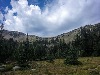
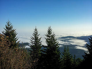 Marine Layer over the lowlands 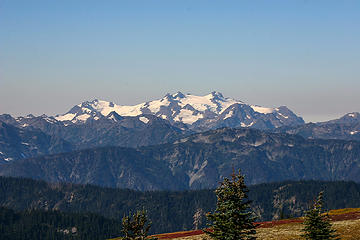 Good ole Olympus 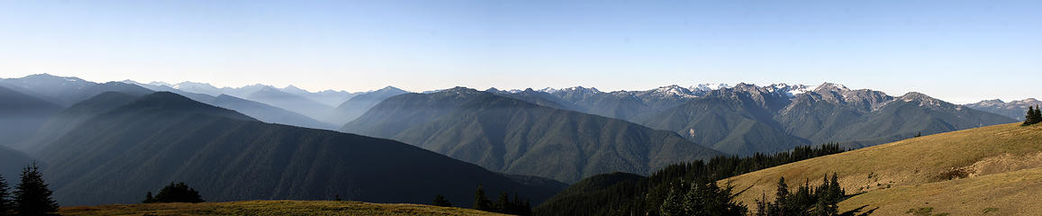 Bluebird morning at Hurricane Ridge 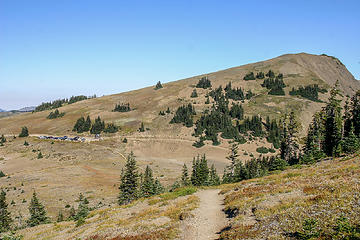 Obstruction Point and trail head 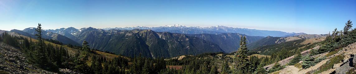 Early views opening up along Obstruction Ridge looking west 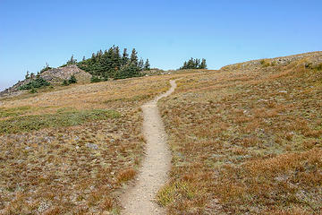 easy trail grade to begin the day 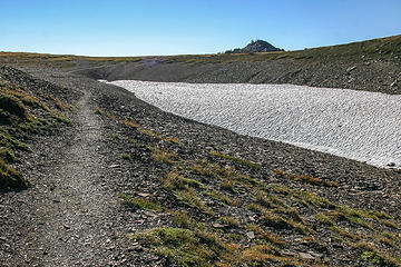 tundra environment 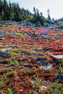 Signs of Fall 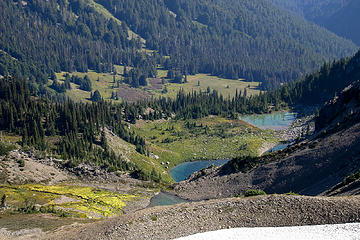 Badger Valley 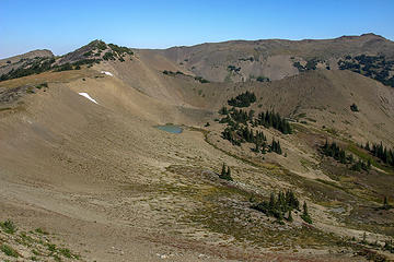 Tarns below trail on Obstruction Ridge 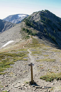 the turnoff south along Lillian Ridge 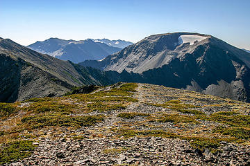 High ridge walk along Lillian 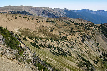 Scenery along Lillian Ridge 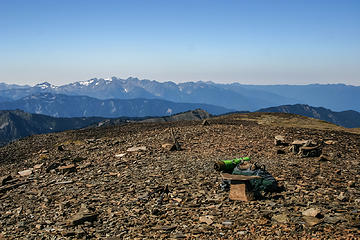 Summit of Moose Mountain - Mt. Olympus in background 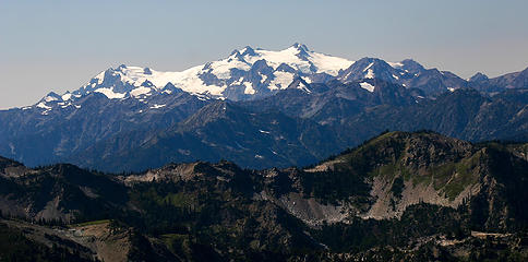 Mt. Olympus 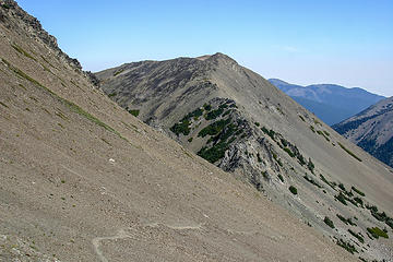 Pt. 6753 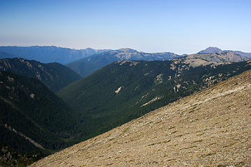 Lillian Valley 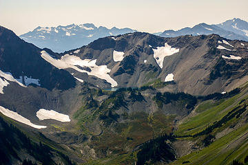 Looking west toward Lillian Lake 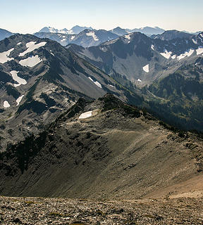 Looking south off Moose 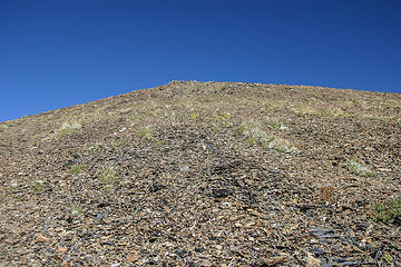 stark tundra of Moose Mountain 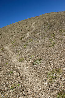 the trail coming off Moose 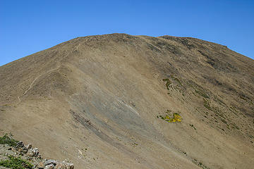 Looking north back at Moose Mountain 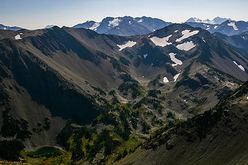 Grand Pass 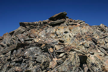 Interesting rock formations around Low Pass 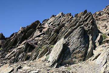 rock formations around Low Pass 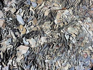 shale deposits 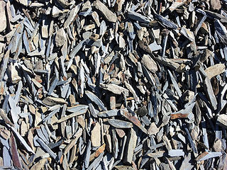 shale deposits 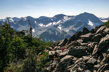 Low pass scenery 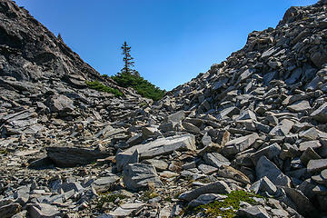 Walking through Low Pass 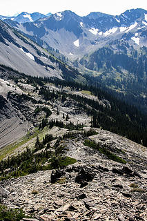 Low Pass 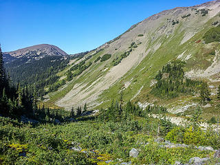 Lillian Valley 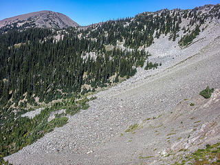 talus field below Low Pass 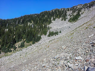 talus field I had to cross in Lillian basin traverse Looking west toward Lillian Lake Looking south off Moose 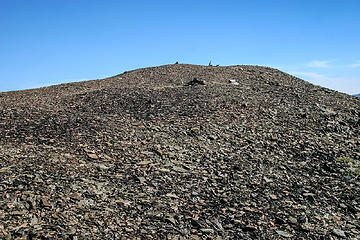 tundra summit of Moose Mountain 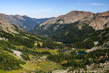 Grand Valley with hint of fall colors coming 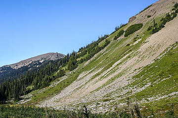 View of Low Pass from Lillian basin 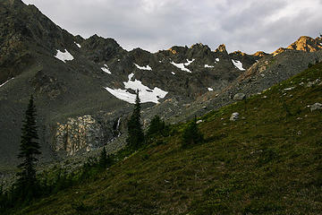 A waterfall in upper Lillian Basin 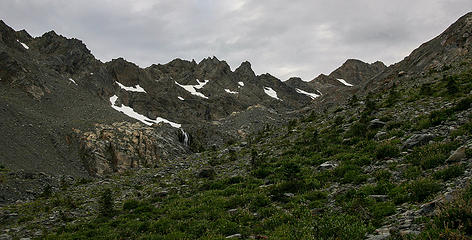 still further in the upper Lillian Basin 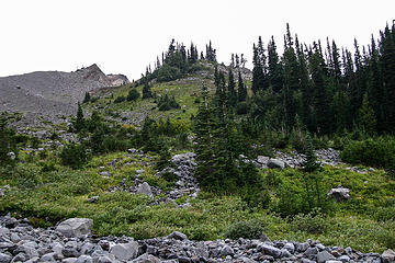 Upper Lillian Basin - I rolled my ankle in this meadow, requiring me to stop for the night just behind the clump of trees to the right 
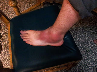 Inspecting my rolled ankle I had to endure walking out 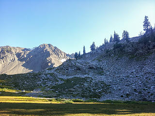 Bench in upper Lillian Basin I camped at after I rolled my ankle 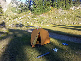 Home for the night 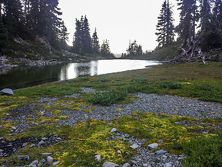 campsite surroundings 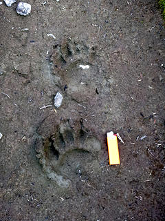 This was 5 feet from the tent 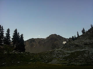 Luna makes an appearance 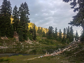 morning breaks but with clouds ... 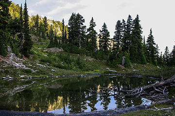 Home for the night in upper Lillian Basin 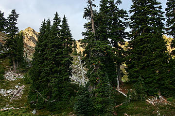 Peaks in the background bask in the morning sun 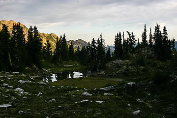 hidden tarn conveniently located only 100 feet from where I rolled my ankle - think I'll call it a day ;-) 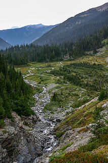 Lillian Creek outfall 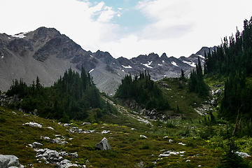 looking toward upper Lillian Basin 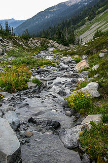 One of the many braids from the Lillian Creek headwaters  With sheer grit I made it back to Low Pass, and was welcomed with thunder, lightning, wind, and some sprinkles of rain. Feeling very exposed on the ridge, I quickly hydrated, ate a Kind bar and dropped down into upper Grand Valley.
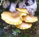
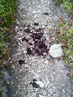 Freshies from the Ursines 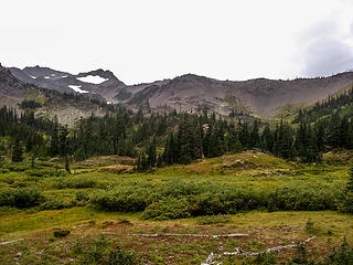 Upper Grand Valley turning colors 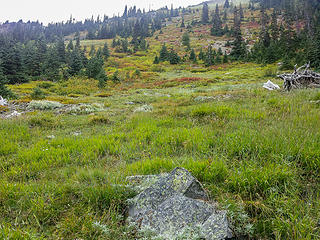 Upper Grand Valley 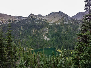 Moose Lake 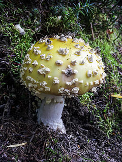 Of the Amanita variety  I am truly a glutton for punishment. I am truly a glutton for punishment. 
 Obstruction / Lillian Pass in center 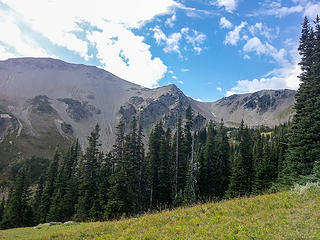 Looking up at Lillian Ridge 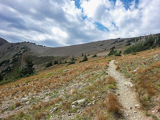 Ascending out of Grand Valley toward Obstruction / Lillian pass 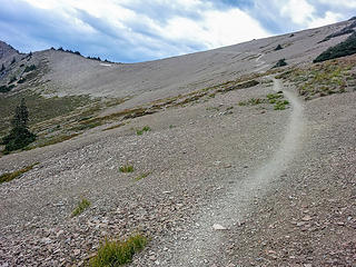 Ascending 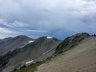 Storm clouds approaching 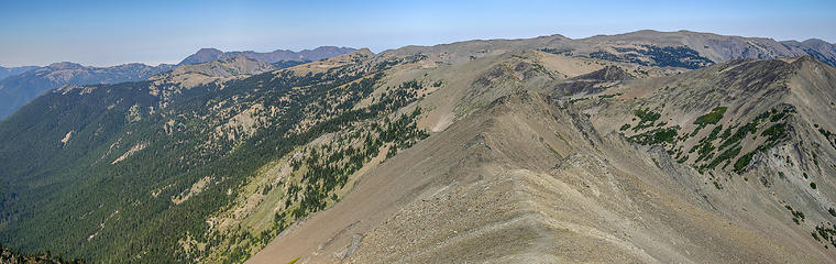 Lillian Ridge looking north toward Obstruction Point trailhead 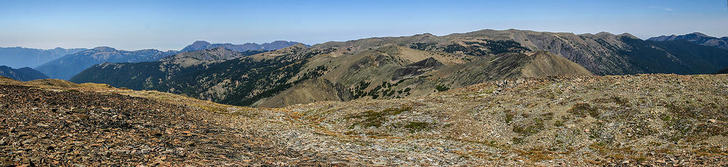 Summit of Moose Mountain 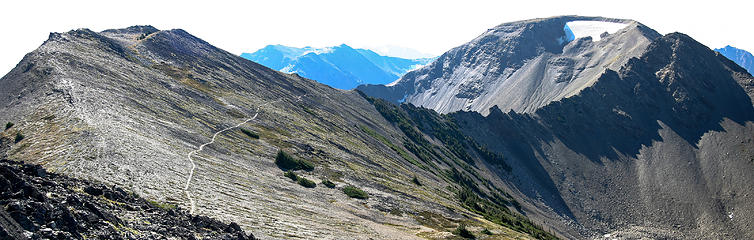 The spiny ridge between Pt. 6753 and Moose Mountain 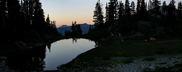 Campsite in upper Lillian basin 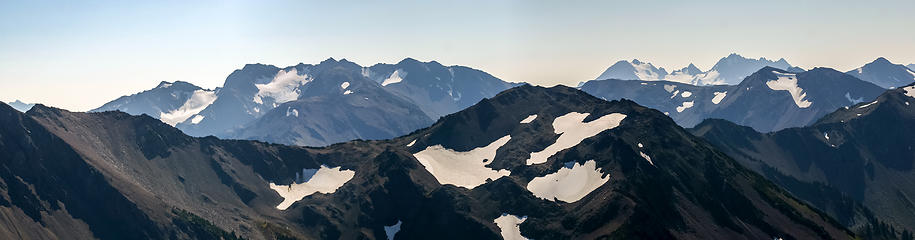 McCarthy Peak 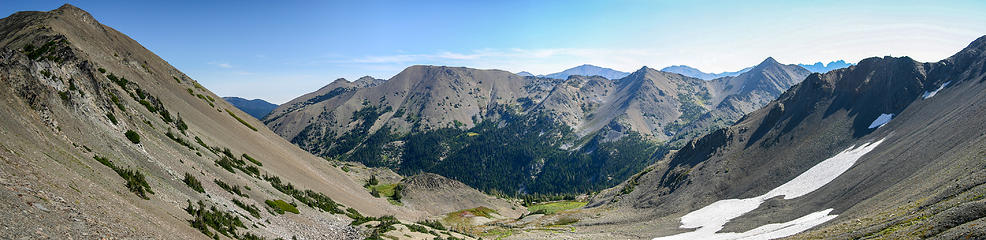 A meadow in upper Moose basin 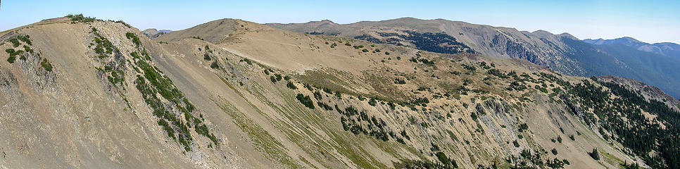 Reviewing my route looking north along Lillian Ridge 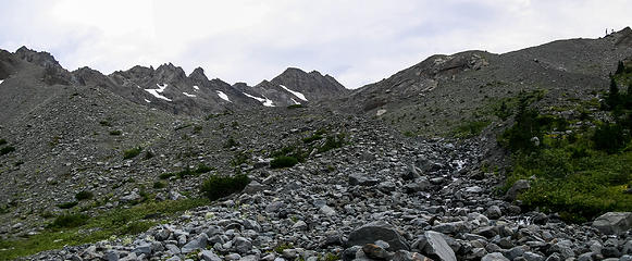 Upper reaches of Lillian Basin 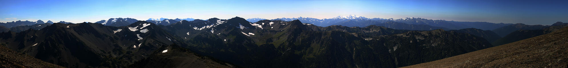 Summit of Moose Mountain
|
| Back to top |
  
|
|
williswall
poser

Joined: 30 Sep 2007
Posts: 1966 | TRs | Pics
Location: Redmond |
This was a very interesting report. I'm glad you made it out OK, nice job in coping with adversity.
|
| Back to top |
|
|
half fast
member

Joined: 21 Mar 2010
Posts: 1392 | TRs | Pics
Location: Living the dream in my 5th Wheel |
| El Dooder wrote: | Inspecting my rolled ankle I had to endure walking out |
Ouch!!!! Glad you made it out ok. Beautiful photos....  thanks !!
*Hope you are icing your ankle... thanks !!
*Hope you are icing your ankle...
It's all about the fun, oh and maybe the chocolate - half fast
It's all about the fun, oh and maybe the chocolate - half fast
|
| Back to top |
|
|
Abert
Member

Joined: 02 Sep 2010
Posts: 588 | TRs | Pics
Location: Sequim |
|
Abert
Member
|
Tue Sep 17, 2013 9:40 pm |
|
|
Great effort to get out. I'm afraid my only method of prevention is hoping something like that doesn't happen to me.
| El Dooder wrote: | | Question: Can someone explain exactly how to connect to Lake Lillian from the upper basin? I did not get a chance to explore this last section and am very curious. |
The route To Lake Lillian goes to the right of the ridge in the first picture. From the meadows in the bottom of the drainage (first picture shows the top of those meadows) I contoured around (rising and then dropping some) and then more steeply up to hit the bottom of the meadows below the lake (second picture shows the band of intervening trees) mostly looking to avoid what seemed like steeper terrain near the end of the ridge and to find the path of least vegetative resistence. In the second picture you can also see the upper part of the lake's meadows and the headwall that you ascend from them to reach the lake.
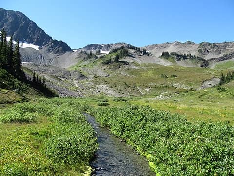 Basin below Lake Lillian 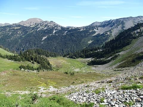 Looking down from Lake Lillian
|
| Back to top |
|
|
El Dooder
Green Earth Bum
Joined: 15 Jul 2007
Posts: 240 | TRs | Pics
Location: Olympia, Washington |
|
El Dooder
Green Earth Bum
|
Tue Sep 17, 2013 10:25 pm |
|
|
Abert, that is what I was aiming for before I turned my ankle, forcing me to camp just short of that upper route.
Thanks
|
| Back to top |
|
|
silence
Member

Joined: 25 Apr 2005
Posts: 4420 | TRs | Pics
|
|
silence
Member
|
Wed Sep 18, 2013 8:54 am |
|
|
sorry for your misfortune ... hope you are healing well .. and hope you get back there again .. the cameron ridge traverse is awesome
we found the oly mtn guide not all that helpful .. but when we did it we were going off an early version ... anyhow we ended up just following our nose and found a good way trail up to the lake from the lillian creek basin .. it was ez peezy up to the lake from where you camped
PHOTOS
FILMS
Keep a good head and always carry a light bulb. Bob Dylan
PHOTOS
FILMS
Keep a good head and always carry a light bulb. Bob Dylan
|
| Back to top |
|
|
FungiFan
Member
Joined: 09 Sep 2010
Posts: 395 | TRs | Pics
Location: East of the Olympics |
|
FungiFan
Member
|
Wed Sep 18, 2013 9:16 am |
|
|
Thanks for the TR and pictures. I'm sure we will be referring to them and the ensuing discussion when we finally commit to going to Lake Lillian. Hope your ankle heals quickly and glad you were still able to enjoy your trip!
Stupid isn't illegal...but sure comes with consequences.
Famous last words: 'Here, hold my beer and watch this.'
Stupid isn't illegal...but sure comes with consequences.
Famous last words: 'Here, hold my beer and watch this.'
|
| Back to top |
|
|
IanB
Vegetable Belayer
Joined: 21 Jul 2010
Posts: 1061 | TRs | Pics
Location: gone whuljin' |
|
IanB
Vegetable Belayer
|
Wed Sep 18, 2013 9:24 am |
|
|
So sorry about your injury.  Way to go, maintaining your composure in order to safely retreat.
Best wishes healing that ankle!
Way to go, maintaining your composure in order to safely retreat.
Best wishes healing that ankle!
"Forget gaining a little knowledge about a lot and strive to learn a lot about a little." - Harvey Manning
"Forget gaining a little knowledge about a lot and strive to learn a lot about a little." - Harvey Manning
|
| Back to top |
|
|
RichP
Member

Joined: 13 Jul 2006
Posts: 5633 | TRs | Pics
Location: here |
|
RichP
Member
|
Wed Sep 18, 2013 9:26 am |
|
|
Having just started using trail shoes full time for hikes, twisting an ankle is my biggest fear. I love the lightness but miss the support of a full on boot.
Here's hoping that you have a speedy recovery and are able to get in some fall hikes.
|
| Back to top |
|
|
contour5
Member

Joined: 16 Jul 2003
Posts: 2963 | TRs | Pics
|
|
contour5
Member
|
Wed Sep 18, 2013 9:46 am |
|
|
Very nice TR and pictures! Nicely done on the hobble out. This is the scary season for off trail injuries...
|
| Back to top |
|
|
El Dooder
Green Earth Bum
Joined: 15 Jul 2007
Posts: 240 | TRs | Pics
Location: Olympia, Washington |
|
El Dooder
Green Earth Bum
|
Wed Sep 18, 2013 10:21 am |
|
|
We've all been in this situation before.
It's the little details that can add up to a bigger injury. I was developing hotspots in my boots, so I changed to my trail runners, which I love to hike in. I shouldn't have been in them in an off-trail situation for obvious reasons. I also was moving fast trying to make the final push to the lake and stopped paying attention to each step.
|
| Back to top |
|
|
silence
Member
Joined: 25 Apr 2005
Posts: 4420 | TRs | Pics
|
|
silence
Member
|
Wed Sep 18, 2013 10:27 am |
|
|
Coming out of the Olys a few years ago I slipped on a submerged rock while crossing a creek and broke my wrist ... we still had 13 mi till the car. While unfortunate .. at least it was on our way out. But, whenever I think back I tell myself .. I made it and I paid my dues ... which makes that trip Xtra special for me ;-)
PHOTOS
FILMS
Keep a good head and always carry a light bulb. Bob Dylan
PHOTOS
FILMS
Keep a good head and always carry a light bulb. Bob Dylan
|
| Back to top |
|
|
El Dooder
Green Earth Bum
Joined: 15 Jul 2007
Posts: 240 | TRs | Pics
Location: Olympia, Washington |
|
El Dooder
Green Earth Bum
|
Wed Sep 18, 2013 10:28 am |
|
|
| silence wrote: | | we found the oly mtn guide not all that helpful .. but when we did it we were going off an early version ... anyhow we ended up just following our nose and found a good way trail up to the lake from the lillian creek basin .. it was ez peezy up to the lake from where you camped |
The OMCG was helpful to me, mostly on the descent below Low Pass to avoid the most common routefinding errors. Even following the guide I did end up controlled sliding down on short, steep patch of scree. On the way back I was able to avoid this section, but also had to deal with the ankle on steep grass, which gave me no lateral movement whatsoever.
The Cameron ridge looks great. I'll be back probably next year and would like to connect with points beyond to Cameron and Lost Passes.
|
| Back to top |
|
|
silence
Member
Joined: 25 Apr 2005
Posts: 4420 | TRs | Pics
|
|
silence
Member
|
Wed Sep 18, 2013 10:31 am |
|
|
| El Dooder wrote: | | ven following the guide I did end up controlled sliding down on short, steep patch of scree. |
we ended up here too .. what a ride! but also threw the book away trying to find the way trail ..
PHOTOS
FILMS
Keep a good head and always carry a light bulb. Bob Dylan
PHOTOS
FILMS
Keep a good head and always carry a light bulb. Bob Dylan
|
| Back to top |
|
|
|
|


