Forum Index > Trip Reports > The Pleiades (USGS Larrabee) 9/13-14/2013
 Reply to topic
Previous :: Next Topic
Author Message
Matt
Tea, Earl Grey, Hot


Joined: 30 Jan 2007
Posts: 4307 | TRs | Pics
Location: Shoreline
Matt
Tea, Earl Grey, Hot
PostSat Apr 05, 2014 2:23 pm 
Catching up on another trip report from last fall... Dates: September 13-14, 2013 Destination: The Pleiades 7334 (407P): east western summit, west eastern summit & east eastern summit Party: Dicey, Matt Introduction: The Feller & The Goat Ledge Summary: We followed Stefan Feller's route. Stefan's report was right, except for one detail – he said that Beckey was wrong. But Beckey now is right, except for one detail – he got Stefan wrong. Perhaps you'd like an explanation of that summary. Here is Stefan's route description: We went for Pleiades. Wouldn’t you know Beckey guidebook has left out a lot of details and is incorrect? Here is how you do it. Ascend a class 3 gully to the 7160+ col between the two western summits. Class 3 to get out of col to the eastern of the western summits. Go over the eastern of the western two summits (7280+). Descend an exposed and rotten class 3 gully on the eastern side of the western summit to the 6880+ col—we used a rope. Ascend up from the col to a goat ledge.... It goes for about 200-300 meters around to the base of the 7160+ col between the eastern summits.... I now doubt Beckey did this peak. I was going by Beckey’s description and it appears he says the farthest eastern pinnacle is the highest (7334). So that is what we did, and there is quite a cairn on the summit. Beckey is wrong. The highest point is actually in the clump of spires at 7320+ on the map. You can access then highest point (7320+) peak from the east, but I do not recommend it as we did. In fact I recommend you ascend a potential class 3 way up once you pass the first gully while you are on the goat ledge. I looked in Beckey's CAG3, 2nd edition, and he had an unhelpful description that mentions a lot of gullies but not how to get there. But CAG3, 3rd edition has a much more helpful route, because it's exactly Stefan's route. Except he got one detail wrong. The final line reads "Revision by Stefan Fuller." So close, but missed it by one word. Hope that Feller guy won't mind
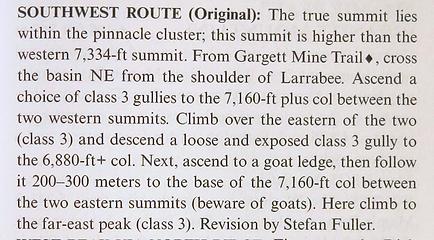
the revised entry
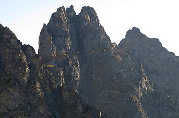
the revised entry
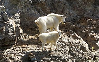
Oh, and about that goat ledge. I left out some of Stefan's raving about the ledge. Here's the full text: This goat ledge is fricken amazing. You know the goat ledge going around Dumbell to get to Greenwood? Well multiply that by around 5 to 6 times in length! Beckey’s descriptions says nothing about a goat ledge and this ledge is quite critical in making the summit. For us, it was quite literally a goat ledge. A pair of goats led us across the entire route – they went up the approach gully, across the entire ledge to the east summit, and then back up to within 100 feet of the true summit.
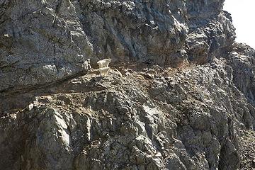
The Goat Ledge
The Goat Ledge
The Goats
The Goats
Goats on the The Goat Ledge
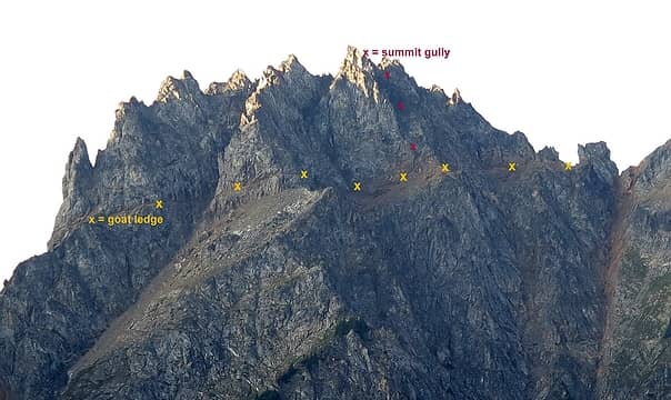
the goat ledge & summit gully
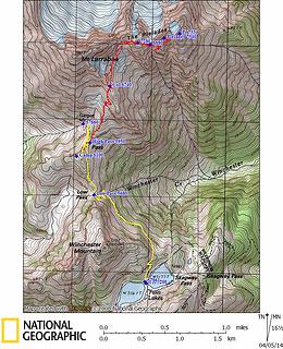
Pleiades GPS Track
Pleiades GPS Track
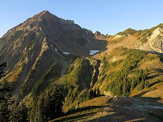
Friday We hiked from Twin Lakes to High Pass the afternoon before, so we could enjoy a high camp for the evening. Our camp was near the top of the 6131 knoll south of High Pass. There was no water at camp, but we filled a water bag from the stream just west of high pass, above the Gargett Mine.
Evening above High Pass
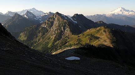
Evening light on Silesia Ridge
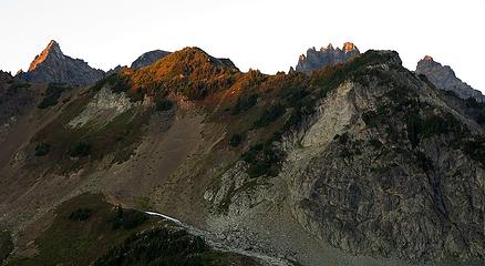
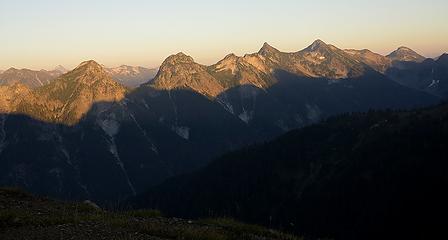
Sunset highlights the tips of The Pleiades
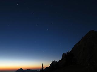
On the last warm evening of the summer, we sat outside the tent late into the evening, sipping our whiskey or tea, and watching the sky shade from deepest blue into black, with a last rim of color at the horizon and stars shining at the zenith. Later, a rising moon lit up the face of Larrabee.
Big Dipper and deep clear light of evening, 8:29pm
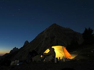
Sitting by the tent
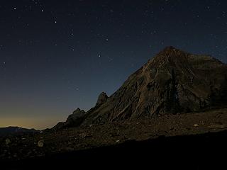
Sitting by the tent
Stars over Larrabee, 9:51pm
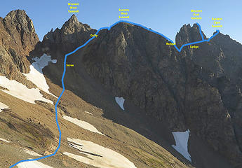
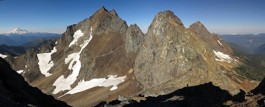
Saturday The Pleiades Route For clarification, The Pleiades has four groups of summits separated by cols, with the deepest col being a 6808-foot notch between the eastern and western halves. The marked summit is the Eastern East summit at 7334 feet. However, the highest summit is in the Western East summits, which are actually a whole cluster of adjoining spires.
Route
Route
Our route consisted of the following: Take the High Pass trail to its end on the ridge southeast of Larrabee. Cross the basin below and ascend a gully to the 7180-foot notch between the two western summits. Walk over the easy flat top of the Eastern West Summit, 7280 Descend and rappel into the 6880-notch between the two groups. Follow the goat ledge all the way around the south side of the Western East Summit. Scramble slopes up to the cairned top of the the Eastern East Summit, 7334. Return to the goat ledge and take gullies up to the Western East Summit, 7340. I approached this trip with some trepidation, knowing that this peak had killed so experienced a climber as Dallas Kloke. To the Eastern West Summit In morning light, we hiked the trail beyond High Pass to the 6740-foot col above Larrabee's southeast ridge. I'd never checked out this piece of trail before, and it's a great vantage for a fine view of the area, with an old mine at its end. Someone had a tent atop the ridge with a territorial view, definitely the best camp in the area.
Morning Light on High Pass, Winchester & Neighbors
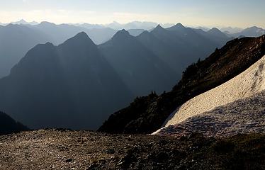
Morning Light on Silesia Ridge
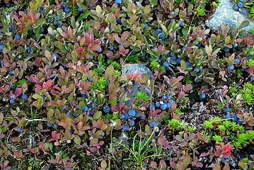
Morning Snack
Morning Snack
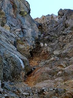
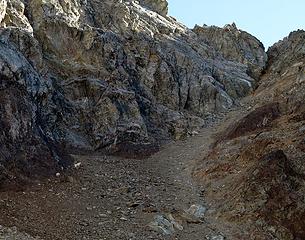
The basin on the far side of the ridge was a mess of talus and scree. It got worse closer to the peak, becoming a mix of hard-packed dirt and scree. But what's that on the far side of the basin? Yes, it’s a mother goat and kid. And they leading the way right where we want to go, up the gully to the notch between the western summits. The steep scree on rusty orange rock of this gully turned out to be just as uninviting as they looked, but we followed the goats up to the crest.
Goats on the scree below the gully
Goats going up the gully
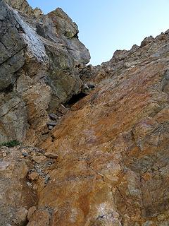
Unpleasant orange rock in the gully
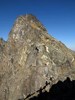
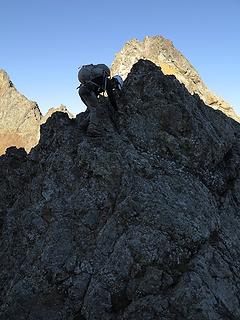
From there we had to scramble up and down some bits of narrow crest and then came out on the Eastern West summit.
Dicey at the top of the gully...
... scrambling over a bump on the crest...
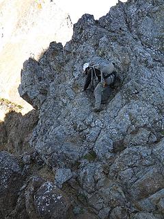
...down into a minor notch...
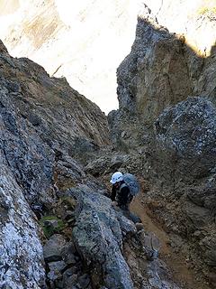
... and back out of the minor notch.
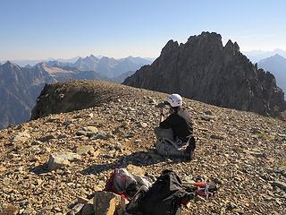
The wide flat top of the Eastern West summit was a welcome rest, especially since it turned out to be pretty much the only flat spot on this mountain.
Dicey o the Eastern West summit
View back to Larrabee, Eastern East Pleiades, & American Border
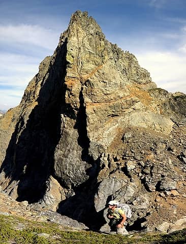
The Central Notch & The Goat Ledge To reach the central notch, we walked down slopes till we were about 80 feet above the notch, then rappelled the rest of the way. It was basically third class, but loose and exposed. (A brave climber could do it without the rappel, but Stefan rapped, and we didn't feel braver than Stefan.) the center of the notch was a narrow arete of rubble dropping off to steep gullies on both sides, which turned out to be the form of pretty much every notch on this peak. We left the rope hanging in place for our return, thus committing ourselves to hopes that we could scramble everything else.
Carla above the rappel on the west side, with the rocky scramble up to the goat ledge on the far side.  (You can see how the goat ledge is actually a fault that cuts all the way through the mountain, though it overhangs and is impassable on the north side.)
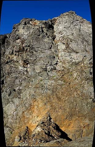
Carla above the rappel on the west side, with the rocky scramble up to the goat ledge on the far side. (You can see how the goat ledge is actually a fault that cuts all the way through the mountain, though it overhangs and is impassable on the north side.)
Looking back from the east side, with Dicey rapping into the notch (this is a larger stitched photo, so better viewed full size)
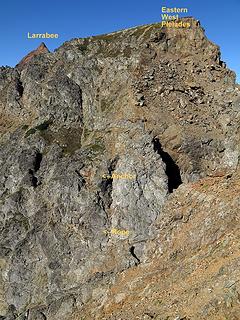
4 labels
Looking back from the east side, with Dicey rapping into the notch (this is a larger stitched photo, so better viewed full size)
Looking back from a bit further up onto the east side
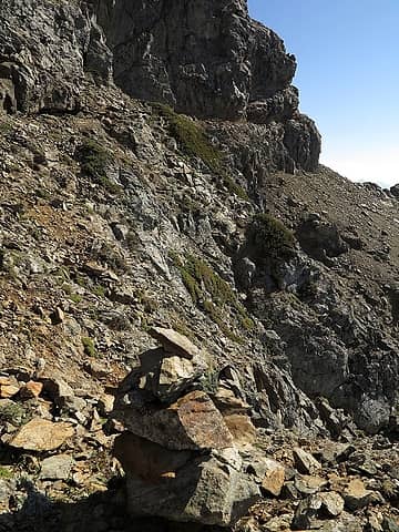
On the west side of the notch, a boulder scramble led up us up to the goat ledge. It turns out that the goat ledge is actually a fault that cuts all the way through the central group of spires. It goes entirely around the south side, and from either end you can see it continuing around the north side, but it overhangs there and is impassable. And there, on the goat ledge, were the goats. The ledge is as impressive as Stefan said. At each vertical fault in the peak, the ledge cut inward into the fault and back out, getting us past what otherwise would have been impassable cliffs.
Cairn at the beginning of the goat ledge
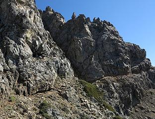
3 labels
Cairn at the beginning of the goat ledge
Goats out ahead on the ledge
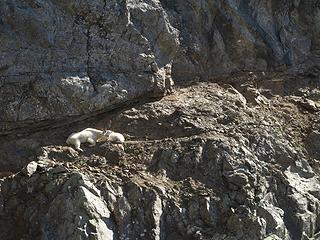
Just hanging out on their ledge
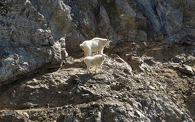
Goats leading the way
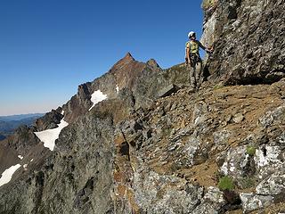
Dicey rounding a corner on the ledge
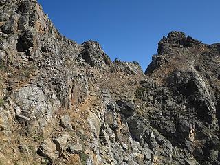
Goat ledge leading onward to final notch
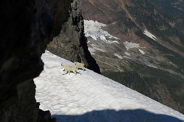
Goats continuing onto the snow
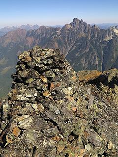
The Eastern East Summit, 7334 At the last notch, the goats turned off onto a snowfield on the north side, while we continued for a scramble up to the Eastern East summit, with its large cairn.
Summit cairn, with towers of Slesse behind
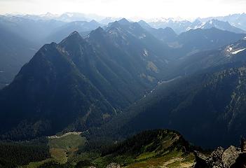
A view down the length of Silesia Ridge
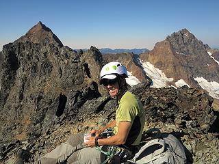
Dicey on the Eastern East summit
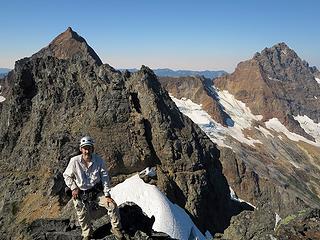
Me on Pleiades Eastern East summit
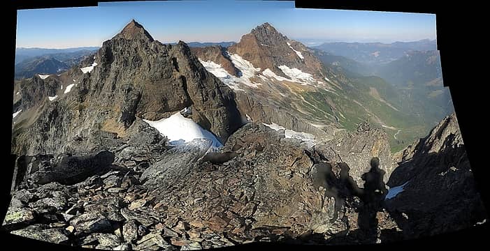
Grand View from the Eastern East summit.  Note how you can see the goat ledge continue cutting around on the north side of this end of the peak as well.  (Sorry about stitch errors in this panorama; maybe I can fix them later)
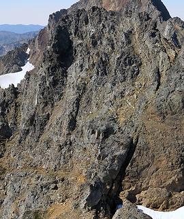
Grand View from the Eastern East summit. Note how you can see the goat ledge continue cutting around on the north side of this end of the peak as well. (Sorry about stitch errors in this panorama; maybe I can fix them later)
The Western East Summit, 7340 It was a fine view from the cairn summit, but for one flaw. The steep group of spires west of us was definitely higher, just as Stefan had said. The goats taunted us to climb it by casually reversing their course and strolling right up the side of the darn thing.
Goats heading up the Western East Summit
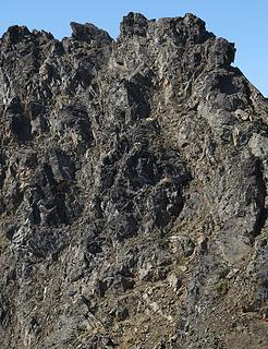
2 labels
Goats heading up the Western East Summit
Goats higher below the Western East Summit
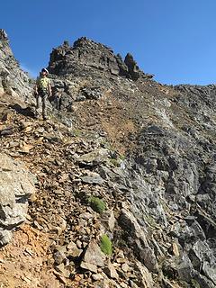
2 labels
Goats higher below the Western East Summit
The goat's route looked questionable above them, so we returned to the goat ledge and took it around the first turn of the Western East Summit, where we found a potential gully going up. It had some steeper steps, but was narrow enough to give good options for bracing against the sides. Atop that gully, we angled over and up to the right where another gully led us across the next rib. Then a left turn took us up a third gully to the crest. Since we'd left the rope behind, we had to carefully pick our course to make sure we only climbed up things that we could climb back down.
Carla on the goat path heading to Western East Summit with Eastern East Summit behind
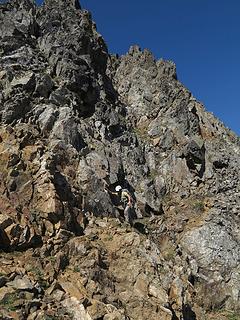
The gully we ascended is about 15 feet behind Dicey
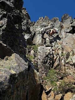
Dicey near the bottom of the first gully
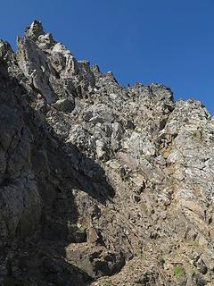
Dicey near the top of the second gully
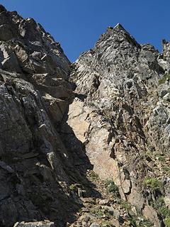
Dicey near the top of the V-shaped third gully (untrue summit on right, true summit is farther left)
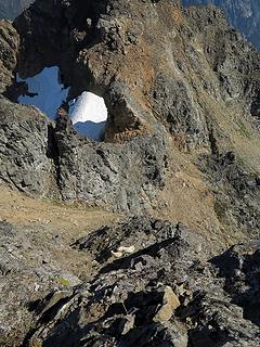
A brief scramble took us atop the spire north of the col. I looked over the edge, and there below us were the goats. Ha! We were finally above them!
Finally looking down on the goats (the notch to the eastern east summit is by the snow at upper center)
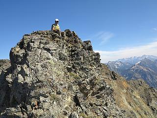
Dicey on the first spire we ascended
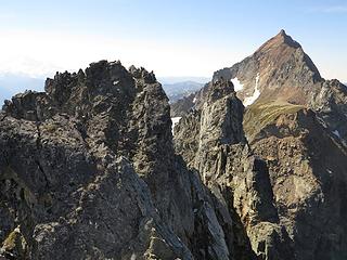
But, alas, we weren't above everything. South of us was a slightly higher spire, with a slab-sided point in between blocking the crest. So we had to work our way down to a ledge on the west side, then across and back up a final steep scramble.
Dammit, that next spire is higher, but there's a slab-sided point in between
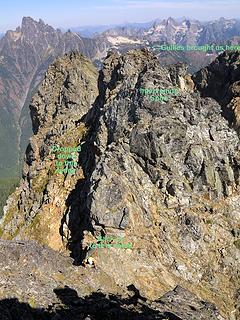
Carla coming up to the higher summit (we originally came up to the spire in the background, then had to climb down to the ramp on left to reach the notch)
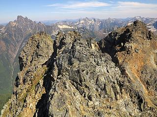
This time all of the other spires were below us. Yeah!
We're higher than any of these summits
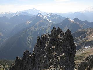
And higher than these spires
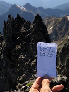
Register we made
Register we made
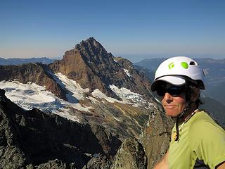
Dicey on summit (with American Border Peak)
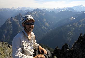
Matt on summit (with Silesia Ridge)
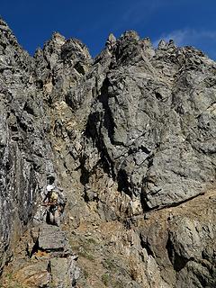
Exit Now we just had to retrace our route. Getting down he gullies was actually easier than going up, since you could mostly face out and reach down to the next steps, with counterpressure on the sides. The goat ledge was sort of fun to run along again. Where we'd left the rope, I self-belayed with a prussic while climbing back up. The bottom part was had some crumbly bits of 4th class, but some climbers would probably have been okay doing it without a rope. The only nasty part was descending into the basin at the start. The combination of gravelly rock atop hard packed dirt was just thoroughly unpleasant to work our way down. At the far side of the basin, we went higher and found a couple water-filled mine adits where the high pass trail ends. Then it was just trail back to camp, and out to Twin Lakes.
Heading back along the goat ledge (the gully we used is around the corner to the right)
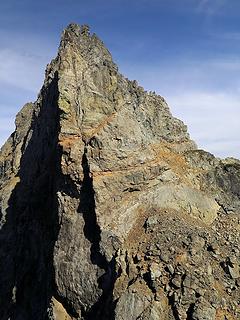
Looking back across the rappel notch to the goat ledge
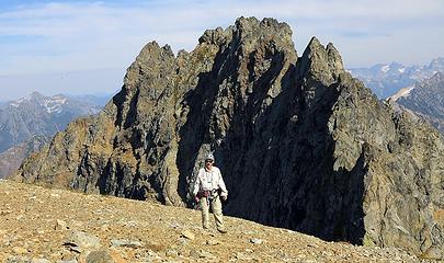
Back on the Eastern West Summit
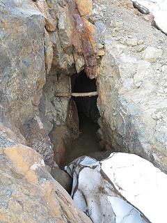
Mine adit at the end of the trail
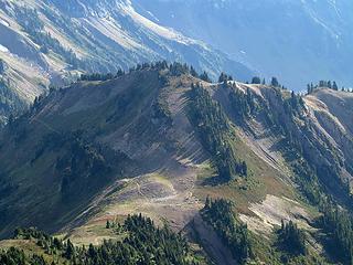
Heading back down to High Pass
This was a very satisfying trip. I enjoyed the route-finding challenge, and was glad to have a trip where we kept working at it and found a way through the various obstacles and false summits. And of course, who couldn't also enjoy the fine late summer weather, beautiful mountains, and a great companion. Stats: 11 miles, 4400 gain

“As beacons mountains burned at evening.” J.R.R. Tolkien
Back to top Reply to topic Reply with quote Send private message
Yana
Hater


Joined: 04 Jun 2004
Posts: 4212 | TRs | Pics
Location: Out Hating
Yana
Hater
PostSat Apr 05, 2014 2:33 pm 
Wow, what a piece of junk. The goats and the ledge must have been a pretty awesome experience, though!

PLAY SAFE! SKI ONLY IN CLOCKWISE DIRECTION! LET'S ALL HAVE FUN TOGETHER!
Back to top Reply to topic Reply with quote Send private message
GeoTom
Member
Member


Joined: 19 May 2005
Posts: 3215 | TRs | Pics
Location: Earth
GeoTom
Member
PostSat Apr 05, 2014 3:23 pm 
up.gif

Knows literally nothing
Back to top Reply to topic Reply with quote Send private message
dicey
custom title


Joined: 11 May 2004
Posts: 2870 | TRs | Pics
Location: giving cornices a wider berth
dicey
custom title
PostSat Apr 05, 2014 3:36 pm 
That was a fun trip! My pics here: Pleiades

I'm not always sure I like being older but being less stupid has advantages. http://www.flickr.com/photos/32121172@N00/sets/
Back to top Reply to topic Reply with quote Send private message
Gimpilator
infinity/21M


Joined: 12 Oct 2006
Posts: 1684 | TRs | Pics
Location: Edmonds, WA
Gimpilator
infinity/21M
PostSat Apr 05, 2014 3:44 pm 
Thank you! The trip reports section has been sort of slow lately. I really appreciate seeing older trips like this posted. And what a trip! Very exciting stuff. up.gif

Back to top Reply to topic Reply with quote Send private message
iron
Member
Member


Joined: 10 Aug 2008
Posts: 6392 | TRs | Pics
Location: southeast kootenays
iron
Member
PostSat Apr 05, 2014 5:30 pm 
thanks for all the details and effort it took to put the photos and story together. i second yana's statement. that looks like crap. good views though in a beautiful spot, so that equalizes things i suppose.

Back to top Reply to topic Reply with quote Send private message
PeakJunkie
Member
Member


Joined: 14 Feb 2009
Posts: 22 | TRs | Pics
PeakJunkie
Member
PostSun Apr 06, 2014 11:46 am 
Great Report!

Back to top Reply to topic Reply with quote Send private message
PeakJunkie
Member
Member


Joined: 14 Feb 2009
Posts: 22 | TRs | Pics
PeakJunkie
Member
PostSun Apr 06, 2014 11:49 am 
Nice pics Carla!

Back to top Reply to topic Reply with quote Send private message
puzzlr
Mid Fork Rocks


Joined: 13 Feb 2007
Posts: 7220 | TRs | Pics
Location: Stuck in the middle
puzzlr
Mid Fork Rocks
PostSun Apr 06, 2014 1:47 pm 
Masterful TR as usual. Thanks for all the work you put in. Makes it fun to follow along on the trip. That area looks like it would be tough to navigate in bad weather.

Back to top Reply to topic Reply with quote Send private message
Magellan
Brutally Handsome


Joined: 26 Jul 2006
Posts: 13116 | TRs | Pics
Location: Inexorable descent
Magellan
Brutally Handsome
PostSun Apr 06, 2014 9:57 pm 
Really well put together report Matt. up.gif up.gif I imagine not many people make it here.

Back to top Reply to topic Reply with quote Send private message
Malachai Constante
Member
Member


Malachai Constante
Member
PostSun Apr 06, 2014 10:10 pm 
I have always been interested in the Pleadies after first seeing them from Haugean Pass. It is nice to see them up close and personal. up.gif

Back to top Reply to topic Reply with quote Send private message
   All times are GMT - 8 Hours
 Reply to topic
Forum Index > Trip Reports > The Pleiades (USGS Larrabee) 9/13-14/2013
  Happy Birthday mtnwkr!
Jump to:   
Search this topic:

You cannot post new topics in this forum
You cannot reply to topics in this forum
You cannot edit your posts in this forum
You cannot delete your posts in this forum
You cannot vote in polls in this forum