| Previous :: Next Topic |
| Author |
Message |
wolffie
Member


Joined: 14 Jul 2008
Posts: 2693 | TRs | Pics
Location: Seattle |
|
wolffie
Member
|
 Mon Jul 07, 2014 4:18 am |
|
|
The Painted Traverse is in excellent condition now if you like snow travel.
Red > 6735 > 6716 > 6824 > Black > 6900 nubbins > Skullcap > 6910 > Portal > White > 6770
Thanks to these guys for giving me the idea:
neek 8/18/13
stefan 8/4/13
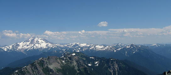 Painted Traverse from Pugh 8/3/14. Red Mt. almost touches the skyline near the right edge. Black is the little dark triangle just left of center. 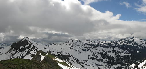 Painted Traverse looking west from Pt. 6770 7/6/14. It starts at the distant right-center peak (Red, aka Painted), goes to Black at far right, then left over 6910 and Portal (plus other nameless nubbins) to Red Pass and White Mt. at left -- everything in the photo. 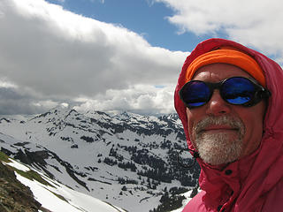 Looking back at the Painted Traverse as the sun, perversely, begins to shred the clouds at the end of the trip. 5:20 PM, 10 miles from the car, I gotta be at work tomorrow, and I don't care. 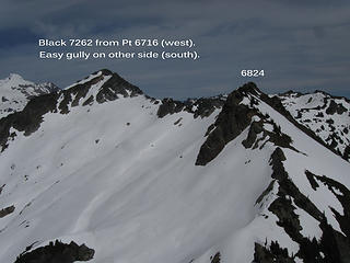 West side of Black from Pt. 6716. 7/4/14. I didn't know that an easy gully on the south of Black goes right to the top. 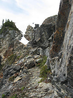 the Horrible Traverse: exposed sloping friction slab with loose rock, meager handholds, and overnight gear. Class 4. 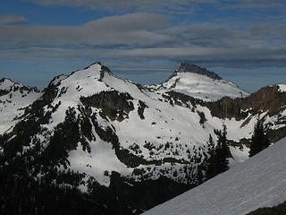 Skalabats and Sloan 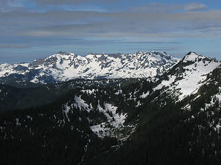 Monte Cristo at dawn from camp 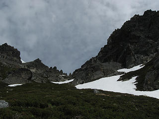 the easy south gully on Black Mt. Snow-free 7/5/14. 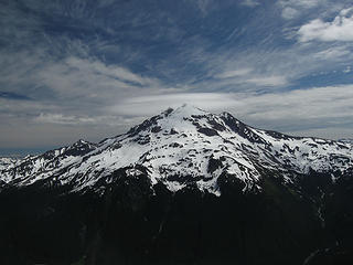 Glacier Pk W side from Black Mt 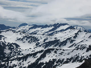 Looking SE from Black Mt. Background: left, Saul; right, Indian Head. Foreground (blends with background): right, White Mt.; follow ridge to Pt 6770 at left, where trip ends (see panos taken from there). 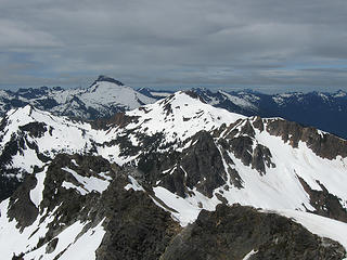 Painted Traverse looking west from Black. Skalabats at left, Red (Painted) Mt. at center, with intervening colors. 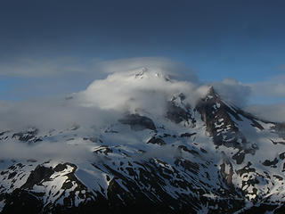 Glacier Pk from camp on Pt 6910. 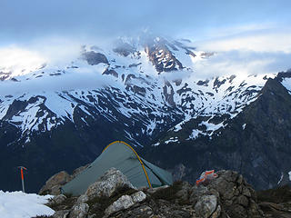 Camp 2 just below summit of Pt 6910 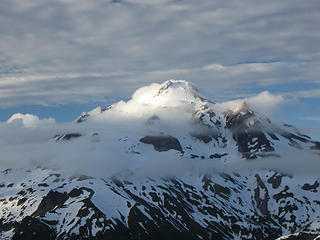 Glacier Pk sunset 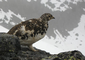 at camp 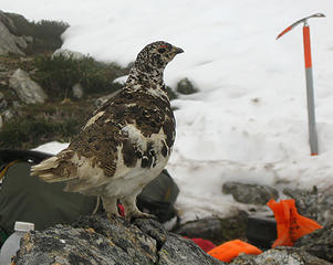 camp follower
Some people have better things to do with their lives than walking the dog. Some don't.
Some people have better things to do with their lives than walking the dog. Some don't.
|
| Back to top |
  
|
|
Michael Lewis
Taking a nap
Joined: 27 Apr 2009
Posts: 629 | TRs | Pics
Location: Lynnwood, WA (for now) |
I just drew up a google earth polygon line with this exact route in mind! So cool that you went up there! 
|
| Back to top |
|
|
Roly Poly
Member

Joined: 02 Jan 2013
Posts: 713 | TRs | Pics
|
Great trip report. I bet your photos will be fantastic once you add them. I assume that this was without a corgi.
|
| Back to top |
|
|
neek
Member

Joined: 12 Sep 2011
Posts: 2337 | TRs | Pics
Location: Seattle, WA |
|
neek
Member
|
Mon Jul 07, 2014 7:41 am |
|
|
Great route; I plan to repeat soon and maybe get up White this time. That rock ridge was scary enough carrying a micro pack. I wouldn't think of doing it with an overnight pack. Glad you found a way around.
|
| Back to top |
|
|
chiwakum
not credible

Joined: 29 Jun 2009
Posts: 980 | TRs | Pics
Location: Ballard |
|
chiwakum
not credible
|
Mon Jul 07, 2014 11:39 pm |
|
|
Great beta! Thx! Much more useful than any of my crappy TRs
|
| Back to top |
|
|
Goats Know
Gravity's Bitch

Joined: 29 Aug 2007
Posts: 194 | TRs | Pics
|
|
Goats Know
Gravity's Bitch
|
Wed Jul 09, 2014 10:42 am |
|
|
Nice trip report Wolffie!! :up
Here on this mountaintop...Woahoho...I got some wild, wild life - Talking Heads
Here on this mountaintop...Woahoho...I got some wild, wild life - Talking Heads
|
| Back to top |
|
|
yukon222
Member

Joined: 12 Mar 2007
Posts: 1893 | TRs | Pics
|
|
yukon222
Member
|
Wed Jul 09, 2014 11:12 am |
|
|
Interesting to see your report on this area from earlier in the season than when I did it in 2012 (early September). I enjoyed seeing the snow in your pics.
FYI - here is my GPS track. We did the loop counterclockwise. https://www.flickr.com/photos/8246712@N03/sets/72157631441302644
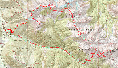 Total 25.4 miles and 12,600' gain over 2 1/2 days.
|
| Back to top |
|
|
wolffie
Member
Joined: 14 Jul 2008
Posts: 2693 | TRs | Pics
Location: Seattle |
|
wolffie
Member
|
Wed Jul 09, 2014 3:20 pm |
|
|
My Camp 1 was just east of your Camp 2 on the tiny spur S of 6824. It was easy to bail downwards on the south sides.
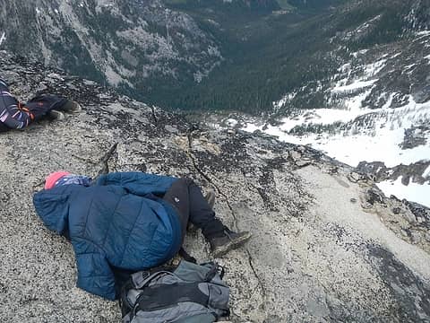
As you can see in the 3rd photo, the north side of that stretch was heavily snow-covered, and the only reasons I didn't walk the north side snow were that I was rattled and tired, it was getting late, weather looked unreliable, and mainly because I didn't know how easy the descent on the S side of Black would be. I should've just camped high up there on the ridge, but the incoming weather looked a lot worse than it turned out to be.
My Camp 2 was very close to your Camp 1, but about 100' below the summit on the east side, sheltered from the wind.
Some people have better things to do with their lives than walking the dog. Some don't.
Some people have better things to do with their lives than walking the dog. Some don't.
|
| Back to top |
|
|
contour5
Member

Joined: 16 Jul 2003
Posts: 2963 | TRs | Pics
|
|
contour5
Member
|
Wed Jul 09, 2014 7:05 pm |
|
|
Very nice TR. I'm thinking of heading up that way in the next few days... thanks for the timely beta. Also: Great pictures!
|
| Back to top |
|
|
|
|
You cannot post new topics in this forum
You cannot reply to topics in this forum
You cannot edit your posts in this forum
You cannot delete your posts in this forum
You cannot vote in polls in this forum
|
Disclosure: As an Amazon Associate NWHikers.net earns from qualifying purchases when you use our link(s). |


