| Previous :: Next Topic |
| Author |
Message |
Gimpilator
infinity/21M


Joined: 12 Oct 2006
Posts: 1684 | TRs | Pics
Location: Edmonds, WA |
Just 2 days after the Townsend trip with Heather I hit the Blanca Lake trail again, this time solo. I have attempted Merchant twice before via the south gully. The first time our large group turned around because of whiteout conditions and rotten snow in the gully. The second time was this last May. I went with just one other person and we were very near the summit when 3 avalanches came down the gully within a 20 minute span. I decided that the 3rd time I would go solo and without snow.
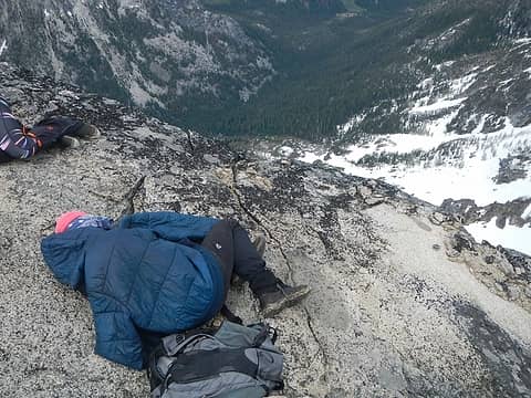
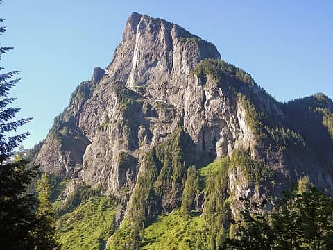 Baring looking badass 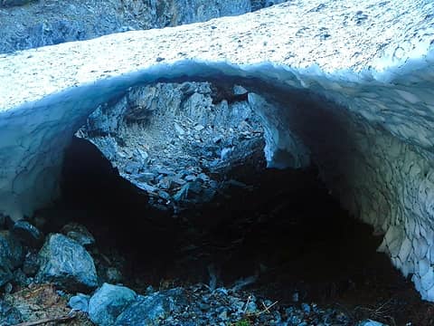 snow cave 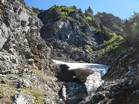 2nd snow obstacle 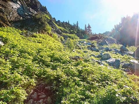 below the talus slope 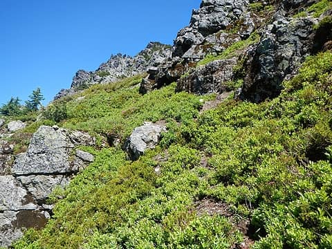 upper heather slopes 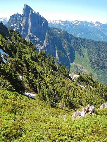 views 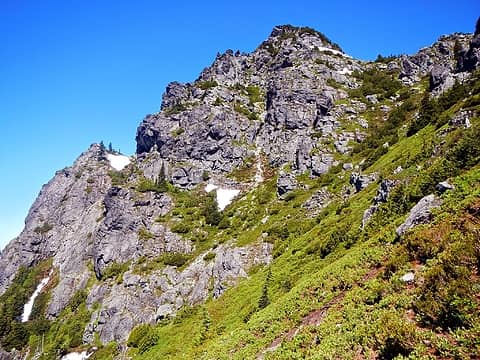 summit area visible 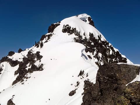 how it looked back in May (this is where we saw 3 avalanches come down) 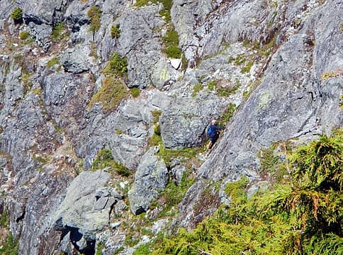 Bill, 78 year old soloist 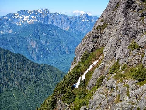 Bill (bottom right) 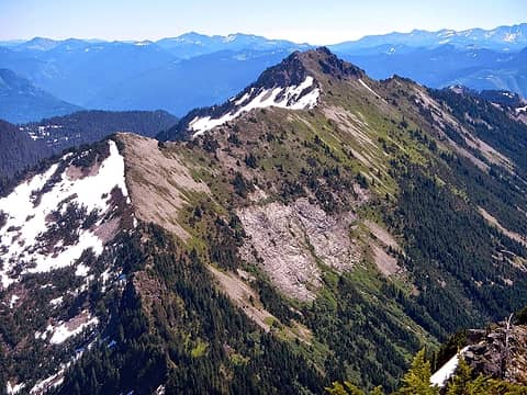 Townsend 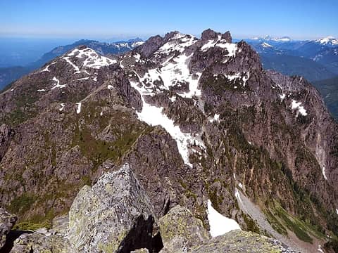 Gunn massif 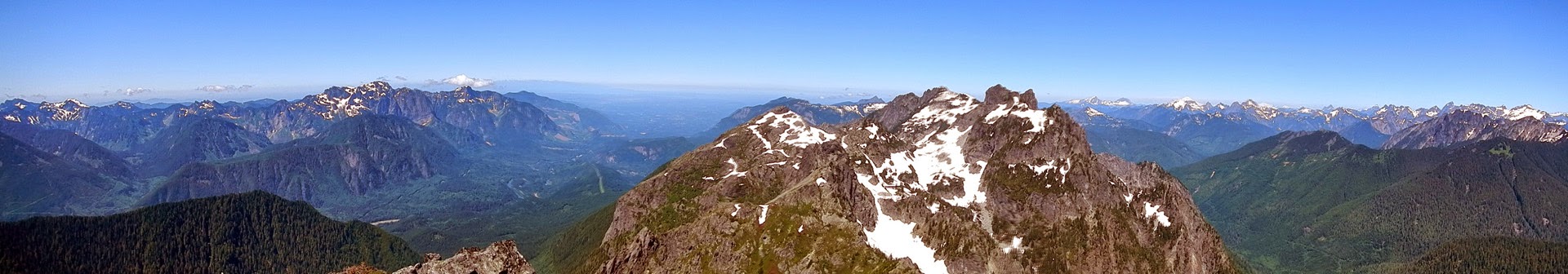 summit panorama 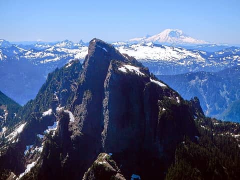 Chair, Kaleetan, Baring, Lennox and Rainier 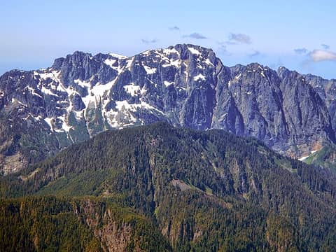 Index 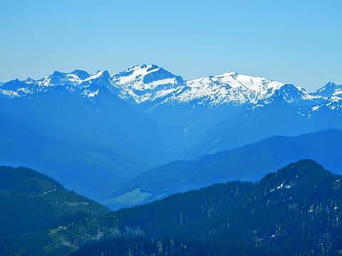 Daniel and Hinman 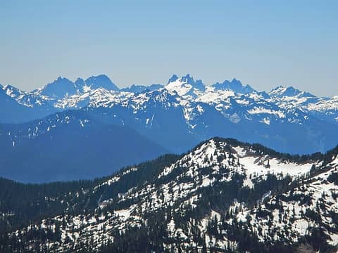 Summit Chief, Chimney Rock, Lemah 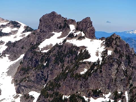 Gunn 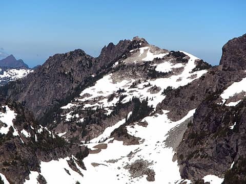 Gunnshy 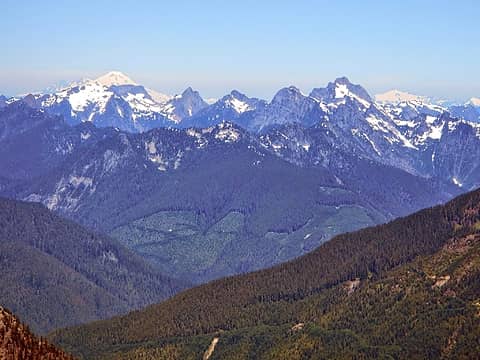 Vesper, Baker, Big Four, Sperry, Morning Star, Gothic, Del Campo 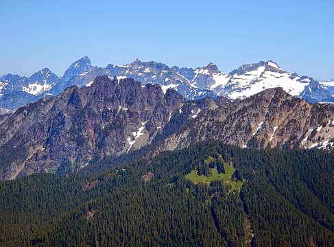 Sloan, Spire, Columbia, Monte Cristo, Kyes, Conglomerate Point 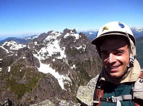 summit bliss 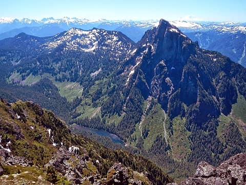 Grotto, Barclay and Baring 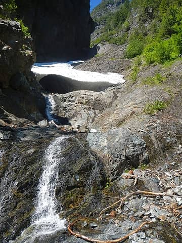 below the 2nd step
|
| Back to top |
  
|
|
puzzlr
Mid Fork Rocks

Joined: 13 Feb 2007
Posts: 7220 | TRs | Pics
Location: Stuck in the middle |
|
puzzlr
Mid Fork Rocks
|
 Thu Jul 10, 2014 11:08 pm |
|
|
Nice report. I saved it in case I ever want to try this one. Maybe I'll wait until I'm 78.
|
| Back to top |
|
|
Fletcher
Member

Joined: 29 Jul 2009
Posts: 1870 | TRs | Pics
Location: kirkland |
|
Fletcher
Member
|
Thu Jul 10, 2014 11:19 pm |
|
|
Ballsy dude! I am surprised to hear that you saw someone else up there. Even more surprised to hear that he was 78 years old, had been airlifted off Merchant once before, AND was trying it again, alone.
Cool to see the route I climbed a couple years back, melted out. Gnarly up there.
|
| Back to top |
|
|
olderthanIusedtobe
Member

Joined: 05 Sep 2011
Posts: 7709 | TRs | Pics
Location: Shoreline |
| Gimpilator wrote: | | Just 2 days after the Townsend trip with Heather I hit the Blanca Lake trail again |
Man, that's a long approach for Merchant from Blanca Lake! 
|
| Back to top |
|
|
Gil
Member

Joined: 29 Sep 2004
Posts: 4062 | TRs | Pics
|
|
Gil
Member
|
Thu Jul 10, 2014 11:57 pm |
|
|
I've thought about trying that peak, but after reading your report ... not.
But exciting TR!
Friends help the miles go easier.
Klahini
Friends help the miles go easier.
Klahini
|
| Back to top |
|
|
Michael Lewis
Taking a nap
Joined: 27 Apr 2009
Posts: 629 | TRs | Pics
Location: Lynnwood, WA (for now) |
|
| Back to top |
|
|
iron
Member

Joined: 10 Aug 2008
Posts: 6392 | TRs | Pics
Location: southeast kootenays |
|
iron
Member
|
Fri Jul 11, 2014 9:03 am |
|
|
nice. i was just thinking about this trip, but then came across route info heading to merchant from the gunn peak trail which seems like it could be a good alternative to this mess.
|
| Back to top |
|
|
Yana
Hater

Joined: 04 Jun 2004
Posts: 4212 | TRs | Pics
Location: Out Hating |
|
Yana
Hater
|
Fri Jul 11, 2014 1:47 pm |
|
|
| iron wrote: | | i was just thinking about this trip, but then came across route info heading to merchant from the gunn peak trail which seems like it could be a good alternative to this mess. |
There is also a good scramble route via Eagle Lake.
PLAY SAFE! SKI ONLY IN CLOCKWISE DIRECTION! LET'S ALL HAVE FUN TOGETHER!
PLAY SAFE! SKI ONLY IN CLOCKWISE DIRECTION! LET'S ALL HAVE FUN TOGETHER!
|
| Back to top |
|
|
Dlab
Member

Joined: 25 Jul 2012
Posts: 76 | TRs | Pics
Location: Sultan |
|
Dlab
Member
|
Mon Jul 14, 2014 8:19 am |
|
|
Got this one on saturday as well, thank god for the cooling effect of that cave. The guy who led us up does it multiple times a year?!? No thanks.
|
| Back to top |
|
|
|
|


