| Previous :: Next Topic |
| Author |
Message |
cascadetraverser
Member


Joined: 16 Sep 2007
Posts: 1407 | TRs | Pics
|
This is an area of the NCNP I had not previously been to and was looking forward to revisiting some terrain my group and I had seen 10 years prior, when we did the Redoubt traverse from the border to Whatcom Pass and North up the Chilliwack river trail.
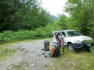
Day One: Tom and I left Seattle early and reached the portion of the Depot Creek road which was reasonably passable in our Honda CRV by about 11:00 am. It`s always interesting to set off by foot onto an unknown road with an unmarked trailhead at the start. The road turned into a trail after 30 minutes and we happily found ourselves at the border swath and the proper Depot trailhead sign on the American side. The climber`s path meanders alongside the stream with an occasional blow down but presents no problems. After 3-4 miles of fairly flat travel the trail gets steep and eventually drops you at the base of Depot creek falls, a truly awesome sight. Several ropes allow reasonable travel over the slick rocks until you reach a sheltered spot from the spray (we were both doused at this point) and then a way path leads into the alder and tracks several thousand feet up steeply until dropping one out into the amazing basin above. An intermittent path alternating with cairns led us up through wooded flats and then alongside the stream on boulders. The stream cuts into the traveling side and required us to occasionally dodge some minor alder patches. After some tiresome rock dancing, we landed at the fabulous Ouzel Lake marveling at the line of sheer cliffs and waterfalls above. We were pretty pooped with our 50+ pound packs but the sun was out and day one was done. Several goat sightings were had in the heights above.
 It's leg power from here lads! 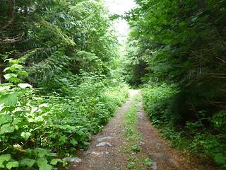 Depote Creek road/trail 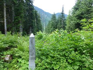 The border swath, your tax dollars at work! 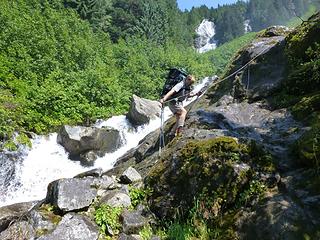 slippy slidey even with ropes 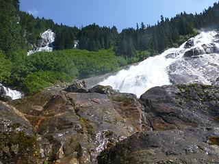 Great day for a shower 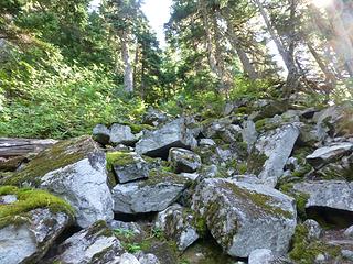 Memories of Lake Constance 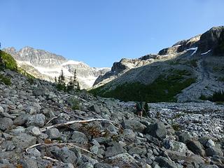 Boulder dancing 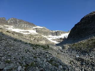 A few more boulders to negotiate 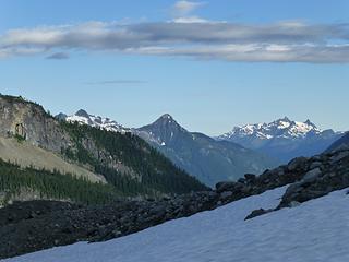 Mighty Mt Webb 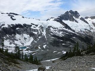 Ouzel Lake and Mt Redoubt 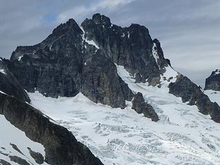 Mighty Mt Reboubt 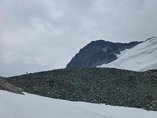 Big rock pile, little man 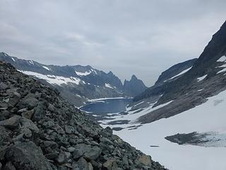 Winter is coming 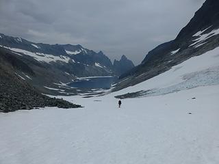 I can smell the Methow from here 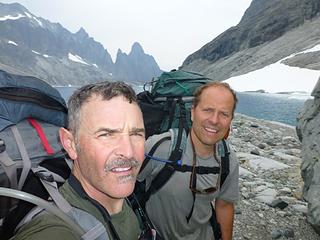 selfie with Devils Tongue  Ah summer camping 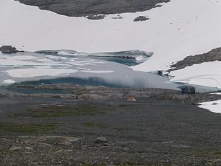 Tundra camp 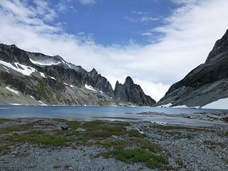 Sucker Hole! 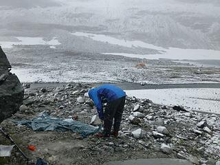 That tarp took a beattin 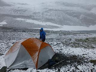 Keeping an eye out for White Walkers 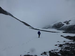 We're outta here 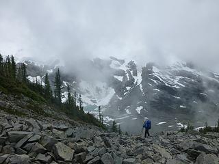 Ouzel Lake Resort 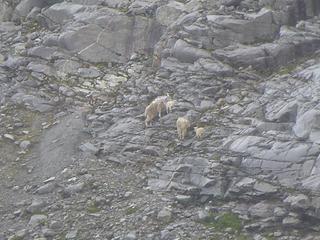 Cascadetraversers decendents  Ouzel Lake mouse refuge 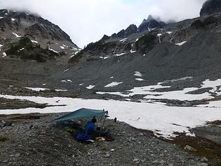 No sign of White Walkers on this side of the wall 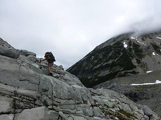 Sweet ramp system 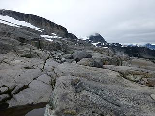 copious cairns 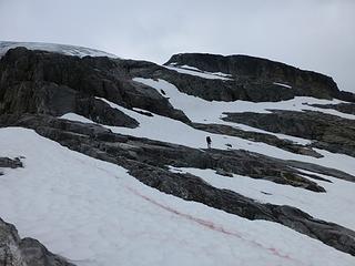 approaching Rebout Glacier 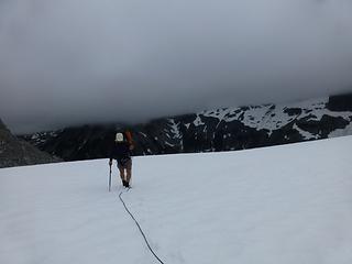 well we brought this damn rope may as well use it 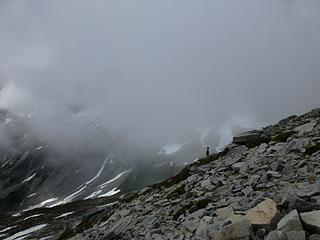 Bivy area on edge of Reboubt Glacier 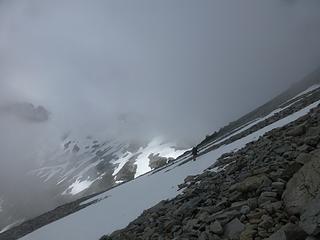 traversing to the notch 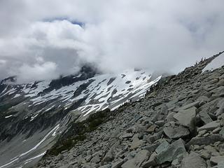 Let's do that boulder dance one more time 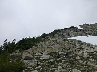 scouting the route 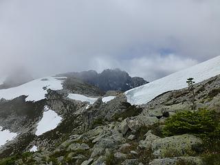 Yup, it goes 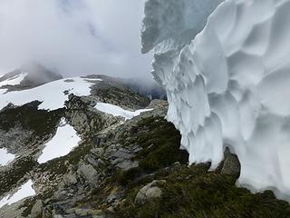 snow wall catwalk 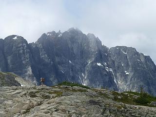 a bear of a mountain 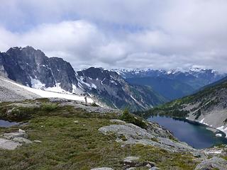 Bear lake, not this time fellas 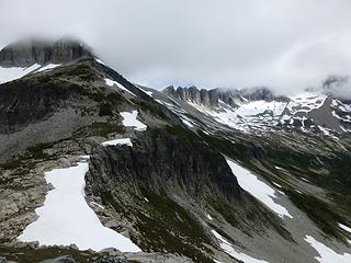 Eastern flank of Bear 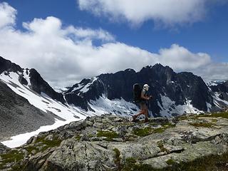 Ridge crests make for sweet walkin 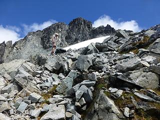 a wee accent on the way a minor pass 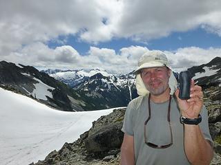 Hey Bennett you forgot your monocular 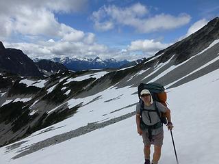 Easy travel to Cave Lake, thanks for the snow man! 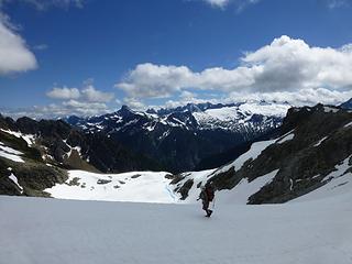 walking around Cave lake 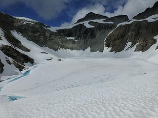 Cave Lake, no swimming tonight. 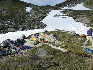 Cave Lake gear display 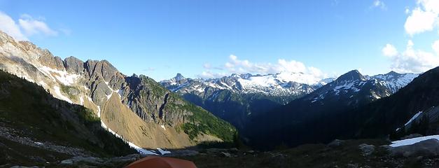 Did I mention the Alpine splendor? 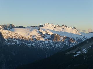 Been there, done that 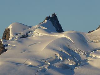 Challenger Bergshrund report 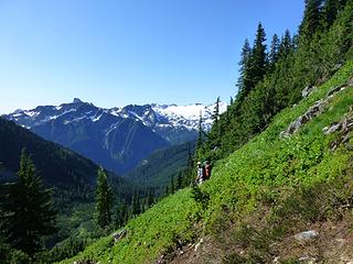 Sublime Ridge awaits! But first some slick veggies.  The first hump on Sublime 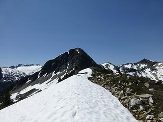 Did you put on some sunscreen? 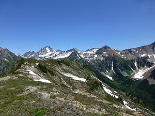 Ridge walking doesn't get any better 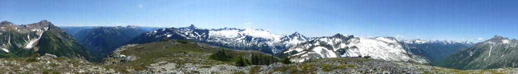 People we've got a view here! 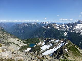 East Lakes 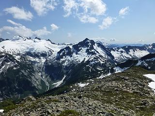 Mighty Mt Whatcom looking pretty mighty 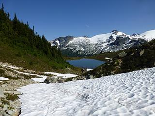 Looking for camp? this will do nicely 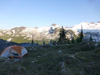 Pretty sure Thor camps here when he's in town 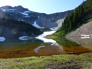 Time for a wash! Albeit a quick one 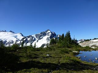 Well looky there, a trail. 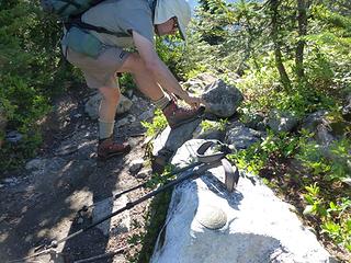 Take a left here to get to middle lakes 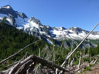 Easy Ridge from Brush Creek  9.1 miles? How hard could that be?  Only dumb city folk go north from here 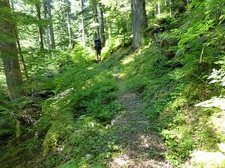 Not much trail maintenance in this area 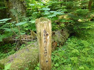 The edge of the known world 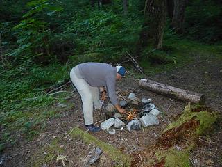 Some tiny plants gave their lives for our fire 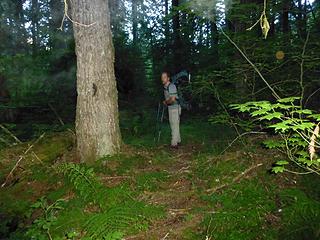 Trail yes!  Almost like I-90 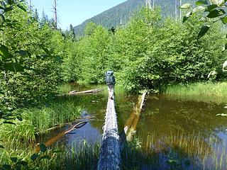 we have over water options 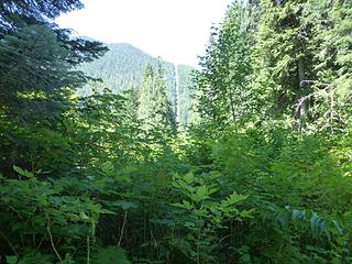 Every wonder what life in the border swath is like? 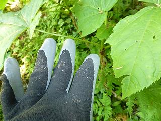 When dancing at the Devils Club please wear gloves 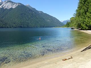 Ah the troubles of the day just melt away!  I want to be Steve Duncan when I grow up!
|
| Back to top |
  
|
|
raising3hikers
Member

Joined: 21 Sep 2007
Posts: 2344 | TRs | Pics
Location: Edmonds, Wa |
that sounds like an awesome and grueling adventure! glad you liked the cave lake side of the traverse!
|
| Back to top |
|
|
contour5
Member

Joined: 16 Jul 2003
Posts: 2963 | TRs | Pics
|
|
contour5
Member
|
 Mon Aug 04, 2014 10:36 pm |
|
|
That is some impressive terrain! Glad the weather eventually cooperated...
|
| Back to top |
|
|
FiresideChats
Member
Joined: 20 Jan 2014
Posts: 365 | TRs | Pics
Location: San Juan Islands |
Wow! An awesome adventure. Love the wild, lonely photos.
|
| Back to top |
|
|
Ancient Ambler
Member

Joined: 15 May 2007
Posts: 1092 | TRs | Pics
Location: Bainbridge Island |
Excellent adventure, cascadetraverser, with lots of quality high-traverse miles and vertical, plus a little bit of everything for weather. Looks like an emotional rollercoaster, as well, from the less-than-joyful moments captured so vividly in your photos entitled "Ah summer camping" and "That tarp took a beating" to the many more stunning, sunny alpine vistas and that iconic dip in the lake "Ah the troubles of the day just melt away", coming so appropriately after you were plunged hip-deep into the mire you'd tried so diligently to avoid. Is that a metaphor, or what? Really enjoyed following along vicariously on the map with your fine photos and many witty captions to illustrate the route.
|
| Back to top |
|
|
tommytownsend
Member

Joined: 28 Oct 2009
Posts: 44 | TRs | Pics
|
Thanks for the kind words AA. The yearly Traverse post is a collaboration between Marc and me. He does the write up (in addition to basically planning the whole trip) and I get to take photos and struggle to remember how the process of putting together a post works, I do it once a year. NWhiker sure is an interesting community and does provide frequent opportunities for vicarious journeys.
|
| Back to top |
|
|
glenoid
Member

Joined: 30 Oct 2012
Posts: 307 | TRs | Pics
|
|
glenoid
Member
|
Tue Aug 05, 2014 1:14 pm |
|
|
|
| Back to top |
|
|
iron
Member

Joined: 10 Aug 2008
Posts: 6392 | TRs | Pics
Location: southeast kootenays |
|
iron
Member
|
Tue Aug 05, 2014 9:36 pm |
|
|
awesome looking trip. bummer on the weather, but at least you got the sublime views when it mattered. bear lake looks really nice. will keep a note of that 
|
| Back to top |
|
|
cascadetraverser
Member
Joined: 16 Sep 2007
Posts: 1407 | TRs | Pics
|
Appreciate the kind comments.
AA: I am tempted to recommend this one to you given all your exploits in the Olympics, but I am not sure I would wish the last stretch on anyone! Thanks for the kind words...
Glenoid: Very funny but I am not sure even you could have ducked under that stuff!!
Iron: Bear lake is very nice indeed. Particularly if you pack certain equipment which may be a luxury on your megathon next year! Either way camping at the inlet is exquisite...
Contour 5: Sublime ridge should be on your radar after your last adventure...
R3H: Thanks for the Cave lake tip; really enjoyed that after the previous nasty brushwack on the other side; just curious, did you drop down into the kneehigh brush below the cliffs or run the ridge and bridge the cliffs?
TT: You forgot to mention the great captions you added!! GOT fan I am...
|
| Back to top |
|
|
Magellan
Brutally Handsome

Joined: 26 Jul 2006
Posts: 13116 | TRs | Pics
Location: Inexorable descent |
|
Magellan
Brutally Handsome
|
Wed Aug 06, 2014 2:46 pm |
|
|
Fantastic trip report!  Thanks for taking the time to put it together. Thanks for taking the time to put it together.
|
| Back to top |
|
|
Jetlag
Member
Joined: 17 Aug 2010
Posts: 1410 | TRs | Pics
|
|
Jetlag
Member
|
Thu Aug 07, 2014 2:09 pm |
|
|
Well written, well photographed, well attributed . . . well . . . suffered!
|
| Back to top |
|
|
raising3hikers
Member
Joined: 21 Sep 2007
Posts: 2344 | TRs | Pics
Location: Edmonds, Wa |
| cascadetraverser wrote: | | R3H: Thanks for the Cave lake tip; really enjoyed that after the previous nasty brushwack on the other side; just curious, did you drop down into the kneehigh brush below the cliffs or run the ridge and bridge the cliffs? |
i went in and enjoyed the beautiful meadows. never anything that i would call a bushwhack. i think i only went through about 5' of brush to get back to the ridge just above the saddle. very glad you liked that part of the route.
|
| Back to top |
|
|
|
|
You cannot post new topics in this forum
You cannot reply to topics in this forum
You cannot edit your posts in this forum
You cannot delete your posts in this forum
You cannot vote in polls in this forum
|
Disclosure: As an Amazon Associate NWHikers.net earns from qualifying purchases when you use our link(s). |


