| Previous :: Next Topic |
| Author |
Message |
Gimpilator
infinity/21M


Joined: 12 Oct 2006
Posts: 1684 | TRs | Pics
Location: Edmonds, WA |
Heather and I went to check out Mount Saul and see if we could figure out the route. There's not a lot of information out there and it seems like the peak is seldom done.
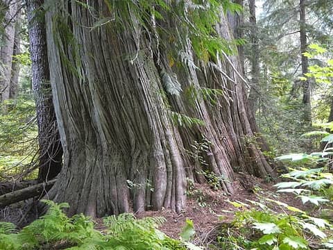 12 foot wide trunk  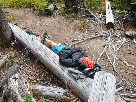 Heather waiting for my slowness  Airplane Lake trail 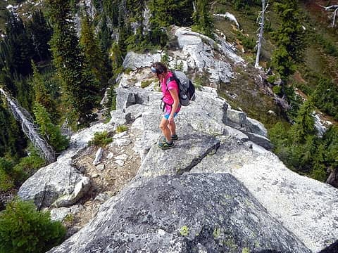 On Point 5873 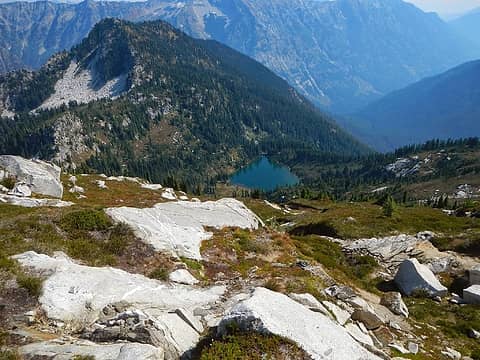 Airplane Lake below 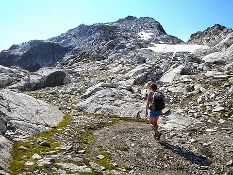 upper ridge 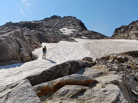 snow patch 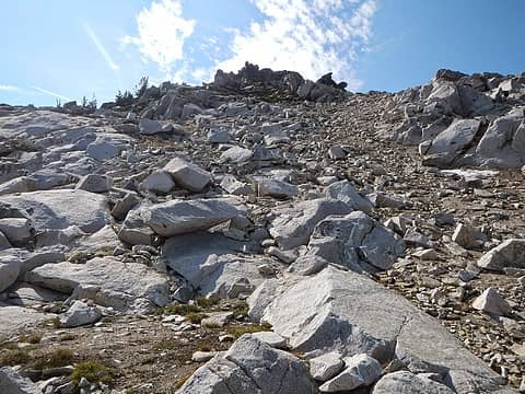 summit 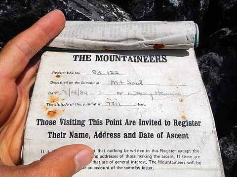 1984 register 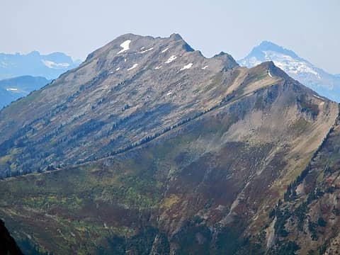 Indian Head 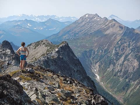 Heather near the summit 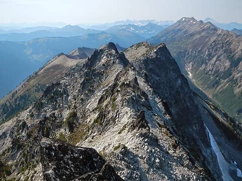 ridge to Indian Head 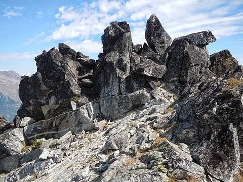 summit block west side 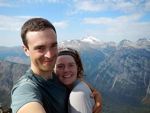 summit 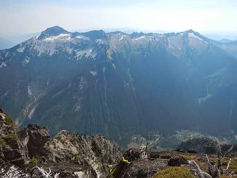 David, Jonathan, Whittier 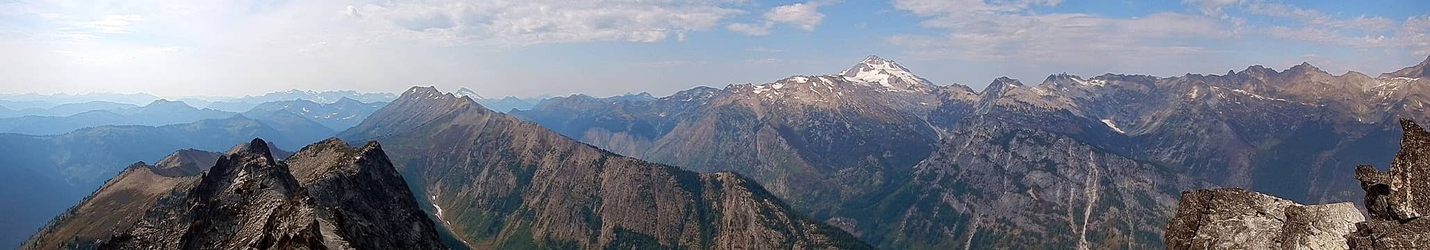 panorama 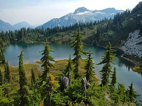 Airplane Lake 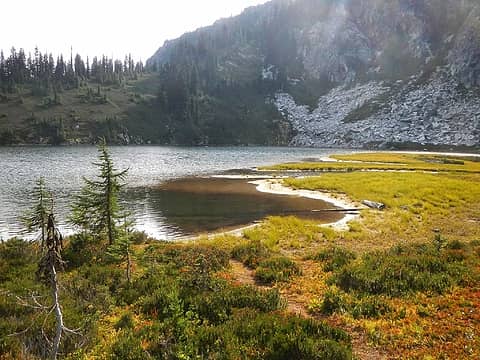 Airplane Lake 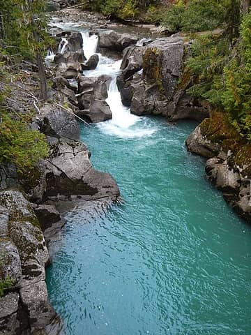 White River 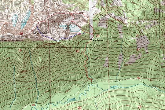 route map
|
| Back to top |
  
|
|
Backpacker Joe
Blind Hiker

Joined: 16 Dec 2001
Posts: 23956 | TRs | Pics
Location: Cle Elum |
Nice trip. Where is the trailhead and how long is the approach before you start climbing up to the lake?
"If destruction be our lot we must ourselves be its author and finisher. As a nation of freemen we must live through all time or die by suicide."
Abraham Lincoln
"If destruction be our lot we must ourselves be its author and finisher. As a nation of freemen we must live through all time or die by suicide."
Abraham Lincoln
|
| Back to top |
|
|
Gimpilator
infinity/21M
Joined: 12 Oct 2006
Posts: 1684 | TRs | Pics
Location: Edmonds, WA |
The trailhead is at the end of White River road which starts near Lake Wenatchee. If I had to guess I'd say the Airplane Lake junction is 5 or 6 miles from the parking lot, and then it's another 4000 feet to the summit. I would suggest doing it as a two day rather than in a single push.
|
| Back to top |
|
|
raising3hikers
Member

Joined: 21 Sep 2007
Posts: 2344 | TRs | Pics
Location: Edmonds, Wa |
i'm glad you noticed the big 12' wide cedar, the low elevation forest is part of the trip to the top 
|
| Back to top |
|
|
Gimpilator
infinity/21M
Joined: 12 Oct 2006
Posts: 1684 | TRs | Pics
Location: Edmonds, WA |
Yeah, I'm very fond of the White River valley. There's some big trees on the east side of the river too.
|
| Back to top |
|
|
Chico
Member

Joined: 30 Nov 2012
Posts: 2500 | TRs | Pics
Location: Lacey |
|
Chico
Member
|
 Thu Sep 18, 2014 5:21 pm |
|
|
| Gimpilator wrote: | | If I had to guess I'd say the Airplane Lake junction is 5 or 6 miles from the parking lot, |
4.7, maybe 5 miles. Drawing trail tracks on the map to get a rough estimate.
|
| Back to top |
|
|
MangyMarmot
Member

Joined: 06 Apr 2012
Posts: 474 | TRs | Pics
|
Cool trip. Nice photos. I've admired Saul from afar on a few trips.
|
| Back to top |
|
|
DIYSteve
seeking hygge

Joined: 06 Mar 2007
Posts: 12655 | TRs | Pics
Location: here now |
|
DIYSteve
seeking hygge
|
Thu Sep 18, 2014 7:54 pm |
|
|
Cool place, fun to see Heather doing scrambles. The angler's trail to the lake was well marked -- too well marked -- when we did the Saul-Indian Head traverse in 2006. BTW, my offer to provide beta re the traverse via PM remains open. It's a very cool route -- can't figure why the traverse is so seldom done. Probably too late to do it now cuz you'll need water from a snow patch in Amber Creek cirque for camp.
|
| Back to top |
|
|
Anish
Member
Joined: 07 Sep 2014
Posts: 79 | TRs | Pics
|
|
Anish
Member
|
Thu Sep 18, 2014 10:38 pm |
|
|
What a lot of work!! Thanks for coming up with the idea. I loved the challenge and the route finding.
"Our way is not soft grass. It's a mountain path with lots of rocks. But it goes upwards, forward, toward the sun." -Ruth Westheimer
"Our way is not soft grass. It's a mountain path with lots of rocks. But it goes upwards, forward, toward the sun." -Ruth Westheimer
|
| Back to top |
|
|
|
|


