| Previous :: Next Topic |
| Author |
Message |
some names
Member


Joined: 08 Jan 2012
Posts: 244 | TRs | Pics
|
We have been hiking a lot this summer . . . so much that we haven't gotten to trip reports. This was a fun one from July.
We tried Gannett Peak in 2012 and didn't quite make it . . .got close to 12,000 ft and ran out of time and air. For our 2nd attempt, we arrived in Dubois WY again, and dropped off a pile of heavy stuff with a packer. From our first attempt we learned that we are old enough that packers really make this trip work. We hike the route with light packs - they carry the heavy stuff on horses and drop it shortly before Gannett Creek, about 3 miles below our final camp. Nice! Lesson from previous visit- we allowed extra days this time for adaptation and weather windows: 2 days in, 2 days out, and 4 days at our high camp. We used the Dinwoody Creek (eastern) approach, 25 miles in and 25 miles out.
The first day we walked in 16 miles on the New Glacier Trail over Arrow Pass to near the Downs Fork River Bridge. We started at 4:30 am to get some switchback climbing done before it got hot. It was really beautiful with meadows of lupine and many other flowers. We camped near the Downs Fork bridge and continued hiking early the next morning, passing through Big Meadow and Floyd Wilson meadow to pick up our stuff near Gannett Creek. We packed our stunningly heavy packs, waded across Gannett Creek, and hiked up to the upper meadows. We camped above the trail sheltered by some krumholz at about 10,500 ft.
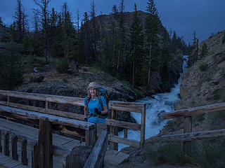 Early start- crossing Torrey Creek 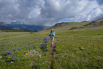 Along the trail to Arrow Pass 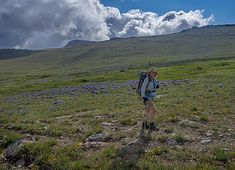 Meadows near Arrow Pass 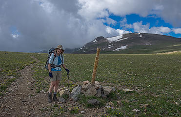 Arrow Pass 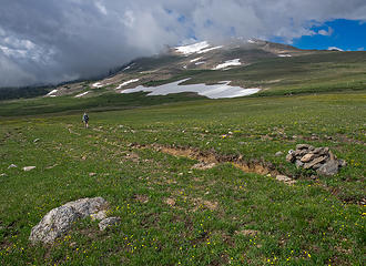 Arrow Pass 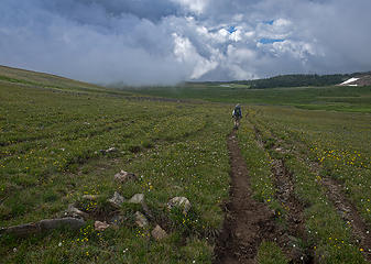 Descending Arrow Pass to Burro Flats 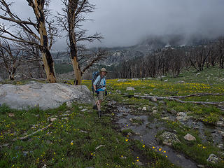 Burro Flats 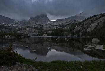 Double Lake 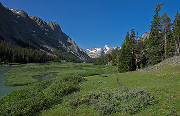 Dinwoody Creek, Floyd Wilson Meadows, first view of Gannett 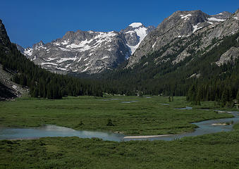 Dinwoody Creek, Floyd Wilson Meadows, and Gannett Peak slowly getting closer 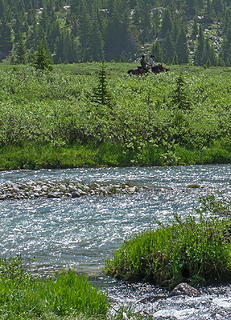 Horsepackers across the creek 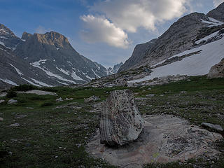 Upper Meadows camp site 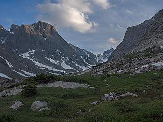 Upper Meadows dinner rocks 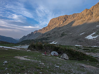 Our camp behind the sheltering krumholz 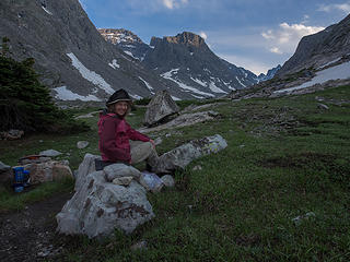 At camp with a break in the skeeters 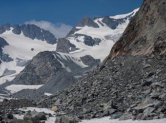 Trail end, beginning of moraine rubble. A good look at part of the route, summit hidden on right. 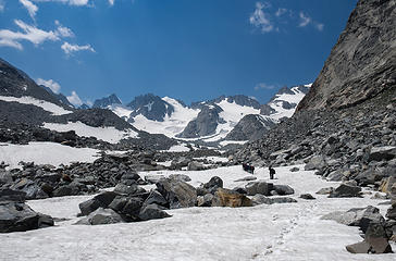 A group we met heads into the rubble 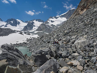 Gannett summit just visible now 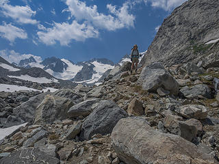 On a scouting hike 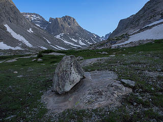 Another evening at camp 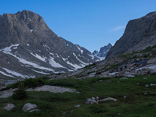 Another evening at the dinner rocks 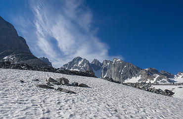 Turret, Warren, Doublet group across lower Dinwoody Glacier 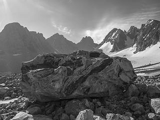 Nice rocks in Dinwoody basin 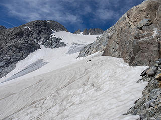 Upper Dinwoody Glacier scouting the route 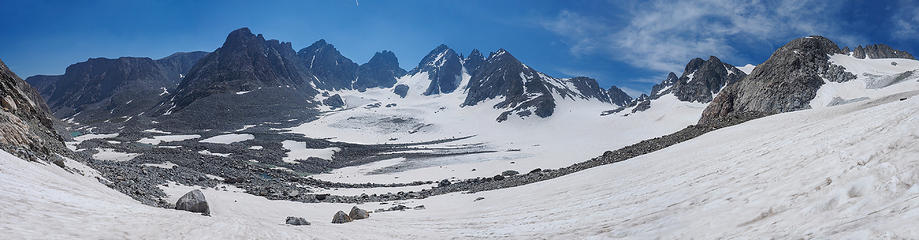 Dinwoody basin pano 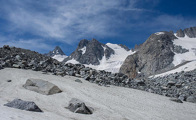 Dinwoody basin view - the Sphinx and Mt Woodrow Wilson 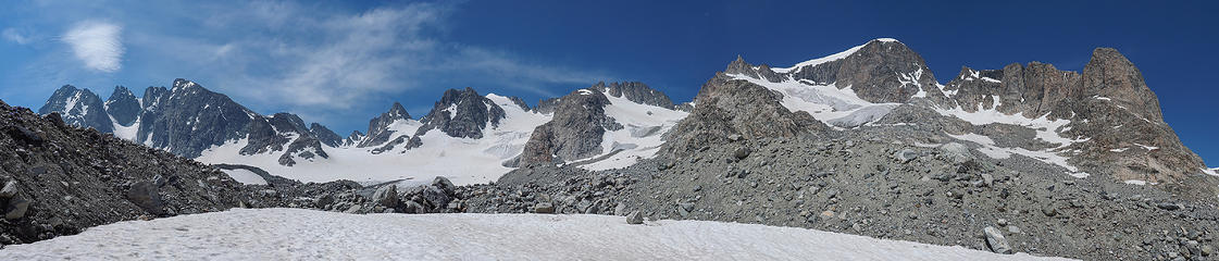 Mt Warren to Gannett Peak pano 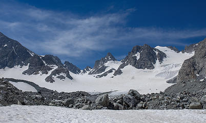 The Sphinx and Mt Woodrow Wilson 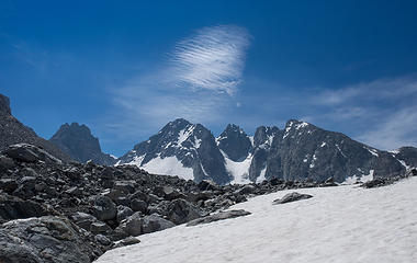 Turret, Warren, and Doublet group 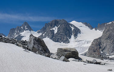 The Sphinx and Mt Woodrow Wilson 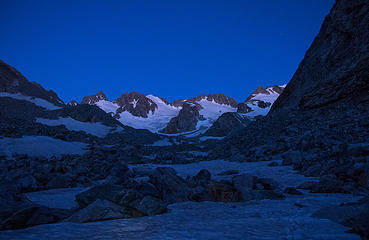 Climb day - starting into the moraine 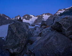 A cairn and early light in the moraine 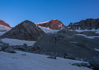 Early light on Gannett 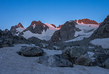 Early light on The Sphinx and Mt Woodrow Wilson 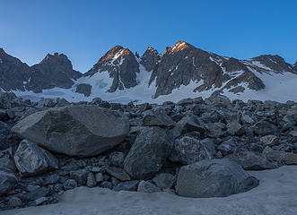 Early light on Turret, Warren, Doublet group 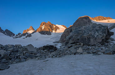 Pretty hiking 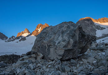 Nice big landmark rock 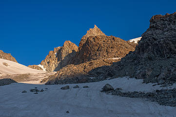 Gooseneck Pinnacle from Dinwoody Glacier 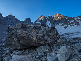 Landmark rock 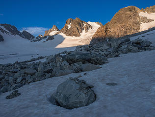 Morning sunlight feels good 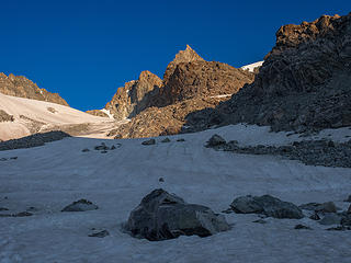 On route - Dinwoody Glacier below Gooseneck Pinnacle 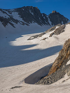 Wind drift on Dinwoody Glacier - 2 climbers coming across from Bonney Pass (Bonney Pass at upper left) 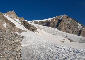 Crossing over to the Gooseneck Glacier side - guided Floridians in sight 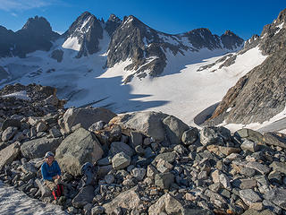 A break at 12,000' 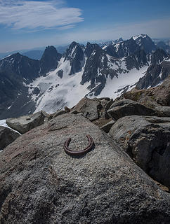 Gannett Pk summit 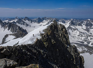 Climbers coming up to summit along final ridge 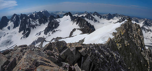 Gannett summit view to south 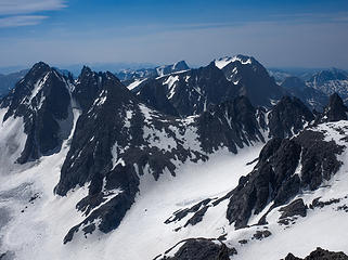 Gannett summit view 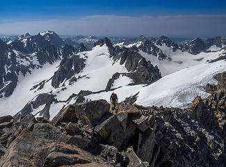 Another climber approaching summit 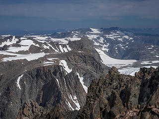 Gannett summit view to north 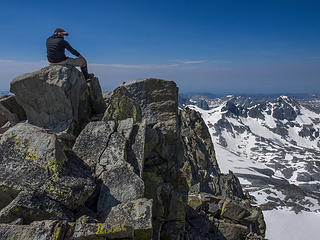 Another climber on the summit 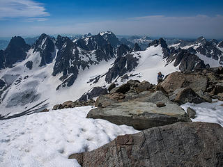 Another approaching climber 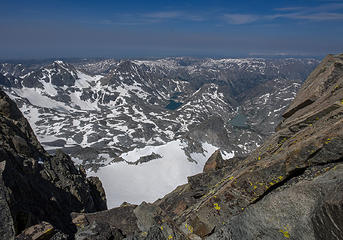 Looking west over the Continental Divide 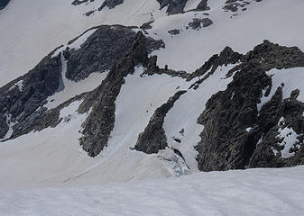 The bergshrund area from the summit - some descending climbers visible 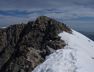 Gannett Peak summit 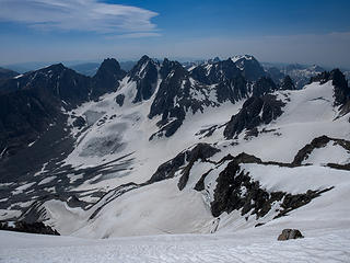 View from Gannett summit including most of the upper route 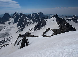 View from Gannett summit including most of the upper route 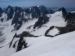 View from Gannett summit including most of the upper route 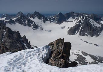 Looking SW over the Continental Divide to the Mammoth Glacier 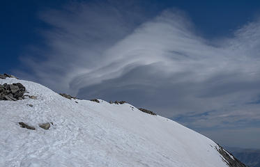 Clouds above summit hint at coming wind 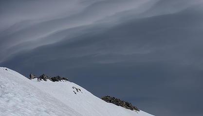 Climbers descending from the summit 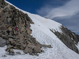 Descending the shoulder of the summit 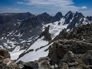 A view of Gooseneck Pinnacle 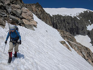 Descending mix of snow and rock around the upper summit area 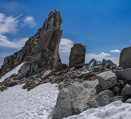 Gooseneck Pinnacle 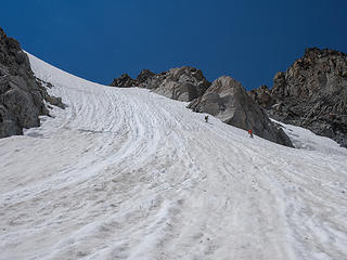 Climbers decending the bergschrund slope - they are right at the bergschrund 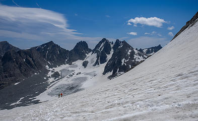 Two climbers on their way back on the Bonney Pass route - it's a long way 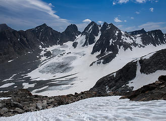 Two climbers still barely visible on the Bonney Pass route - we head down to the left to our camp - much closer 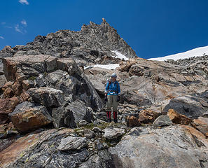 Back on rocks below the Gooseneck Pinnacle 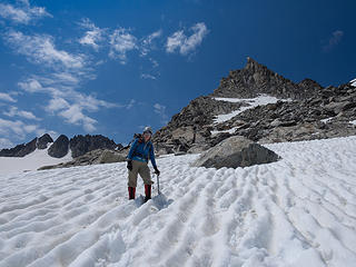 Descending the Gooseneck Glacier again 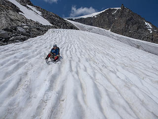 Some opportunity for some quick glissades on a warm afternoon 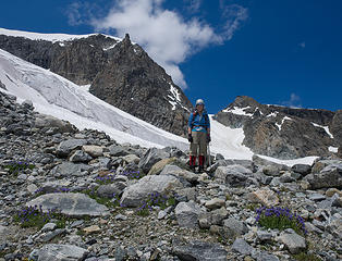 Beautiful sky pilots on the Gooseneck-Dinwoody crossover 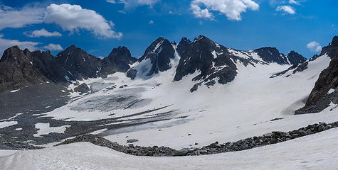 Dinwoody basin 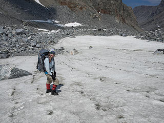 Striped rock pattern in the snow 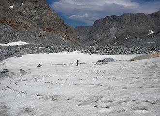 Striped rock pattern in the snow 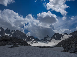 Clouds gathering on the Continental Divide 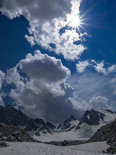 Clouds forming over Dinwoody basin 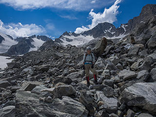 Return through the moraine 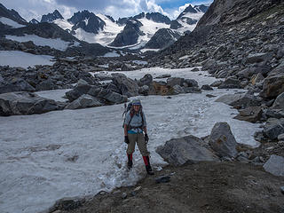 The familiar trail starts here 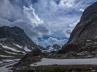 Almost back to camp 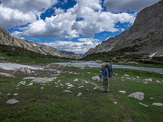 Next day hiking out of upper meadows 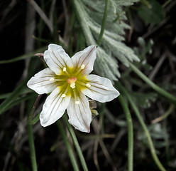 Alp lily in upper meadows 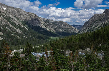 Dinwoody creek valley to Floyd Wilson meadows 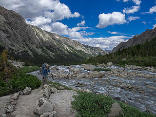 Dinwoody Creek 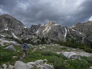 Leaving upper meadows 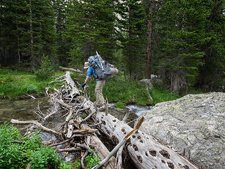 Plenty of small stream crossings 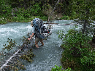 Crossing Gannett Creek 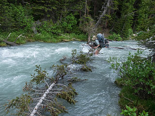 Crossing Gannett Creek 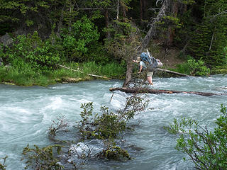 Crossing Gannett Creek 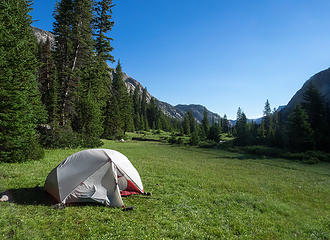 Camp at Floyd Wilson to meet the packers 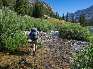 Aqua socks in action - still plenty of stream crossings along trail 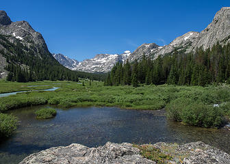 Looking back to Gannett Peak 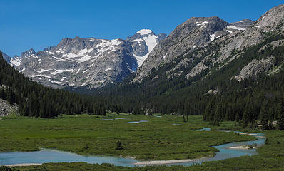 Dinwoody Creek and Gannett Peak 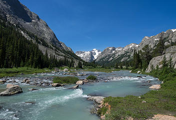 Final view of Gannett Peak 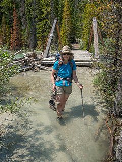 Downs Fork floating bridge - no toll 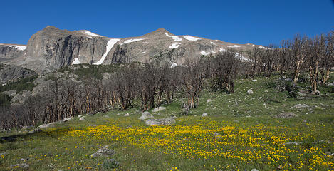 Flowers at Burro Flat 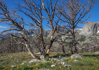 Old burn at Burro Flat 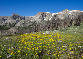 Flowers at Burro Flat 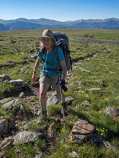 Pack train catching up 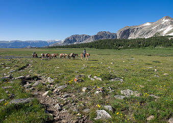 Pack train crossing Arrow Pass meadows 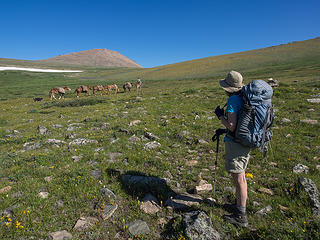 Watching the pack train go up Arrow Pass 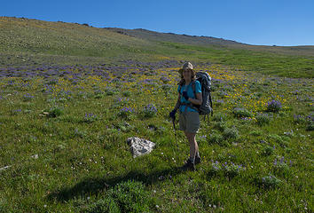 Arrow Pass meadows 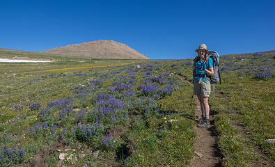 Arrow Pass meadows 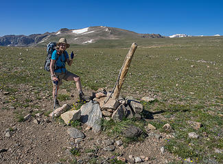 Arrow Pass 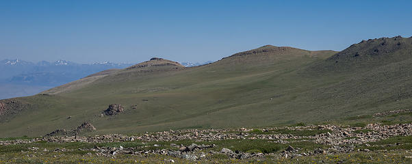 Pack train on Glacier Trail near Arrow Pass 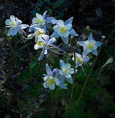 Columbines below Arrow Pass 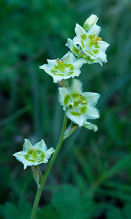 Mountain Death Camas below Arrow Pass 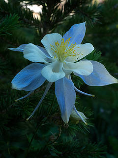 Columbine below Arrow Pass 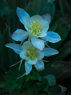 Columbines below Arrow Pass 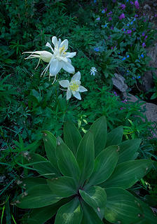 Trailside flowers below Arrow Pass 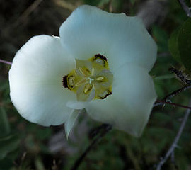 Lily along New Glacier trail 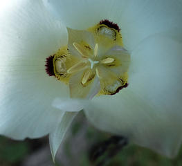 Lily along New Glacier trail 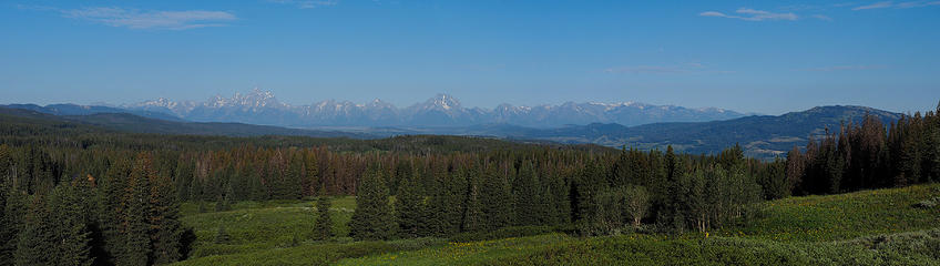 Teton Range from Togwotee Pass 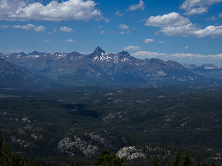 Pilot Peak and Index Peak from Clay Butte 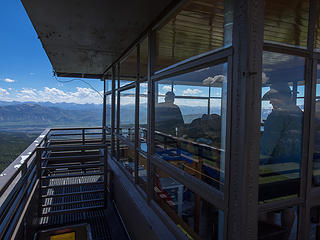 Clay Butte Lookout, MT 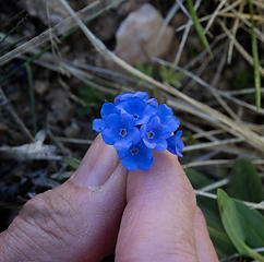 Alpine Forget-me-nots along the Beartooth Hwy 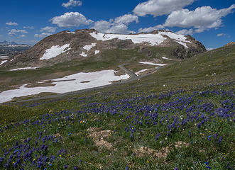 A bend in the Beartooth Hwy 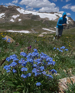 Alpine Forget-me-nots along the Beartooth Hwy
somesignaturehere and somesignaturethere
somesignaturehere and somesignaturethere
|
| Back to top |
  
|
|
RichP
Member

Joined: 13 Jul 2006
Posts: 5634 | TRs | Pics
Location: here |
|
RichP
Member
|
 Mon Sep 29, 2014 8:16 pm |
|
|
That is some wild and spectacular country. My one and only trip to the Winds is etched in my memory forever.
|
| Back to top |
|
|
olderthanIusedtobe
Member

Joined: 05 Sep 2011
Posts: 7709 | TRs | Pics
Location: Shoreline |
Looks like a great trip. Congrats on reaching the summit.
|
| Back to top |
|
|
cefire
Member

Joined: 03 Feb 2010
Posts: 523 | TRs | Pics
|
|
cefire
Member
|
Tue Sep 30, 2014 12:20 am |
|
|
Awesome, awesome pictures and report!  eek that river crossing looks intense though
|
| Back to top |
|
|
puzzlr
Mid Fork Rocks

Joined: 13 Feb 2007
Posts: 7220 | TRs | Pics
Location: Stuck in the middle |
|
puzzlr
Mid Fork Rocks
|
Tue Sep 30, 2014 9:07 am |
|
|
Congratulations on a tough peak. I've heard stories from climbing friends about this route involving accidents and injuries (in other parties, not theirs). I'm glad everything worked out safely for you.
|
| Back to top |
|
|
marydave
Musical Hikers
Joined: 11 Aug 2010
Posts: 182 | TRs | Pics
Location: Seattle |
|
marydave
Musical Hikers
|
Tue Sep 30, 2014 12:37 pm |
|
|
Great report and pictures, and congratulations on summiting. I can see an extended trip in the Wind River range in our future.
|
| Back to top |
|
|
Redwic
Unlisted Free Agent

Joined: 23 Feb 2009
Posts: 3292 | TRs | Pics
Location: Going to the Prom(inence) |
|
Redwic
Unlisted Free Agent
|
Wed Oct 01, 2014 8:44 am |
|
|
60 pounds lighter but not 60 points brighter.
|
| Back to top |
|
|
Don
Member

Joined: 25 Apr 2005
Posts: 2013 | TRs | Pics
Location: Fairwood, WA |
|
Don
Member
|
Wed Oct 01, 2014 2:03 pm |
|
|
What an excellent trip! Your pictures alone really do a super job of telling the story here.
I've always wondered about the east side approach vs. Titcomb Basin. I've viewed Gannett from Bonney Pass and thought the route looked pretty straight forward. I see you started your climb at 4:30 am. Do you recall what time you summited? I ask because your pictures from camp make the mountain look pretty far away (possibly wide angle affect).
Regardless, you passed through some beautiful country on your approach - country that looks inviting in its own right.
Congrats on an excellent adventure, and thanks for sharing! I love the Winds.
|
| Back to top |
|
|
Magellan
Brutally Handsome

Joined: 26 Jul 2006
Posts: 13116 | TRs | Pics
Location: Inexorable descent |
|
Magellan
Brutally Handsome
|
Wed Oct 01, 2014 10:54 pm |
|
|
Great information and pictures.
|
| Back to top |
|
|
some names
Member
Joined: 08 Jan 2012
Posts: 244 | TRs | Pics
|
Thank you all for the nice comments!
In case we weren't clear in our report, we had a rope, harnesses, and 2 pickets with us, but decided we didn't need to use them. We used crampons and ice axes.
We're not great at keeping time, but we remember getting to the top around noon. We got back to the start of the trail around 3:00.
somesignaturehere and somesignaturethere
somesignaturehere and somesignaturethere
|
| Back to top |
|
|
Jim Dockery
Member

Joined: 12 Sep 2007
Posts: 3092 | TRs | Pics
Location: Lake Stevens |
|
| Back to top |
|
|
|
|
You cannot post new topics in this forum
You cannot reply to topics in this forum
You cannot edit your posts in this forum
You cannot delete your posts in this forum
You cannot vote in polls in this forum
|
Disclosure: As an Amazon Associate NWHikers.net earns from qualifying purchases when you use our link(s). |


