| Previous :: Next Topic |
| Author |
Message |
Gimpilator
infinity/21M


Joined: 12 Oct 2006
Posts: 1684 | TRs | Pics
Location: Edmonds, WA |
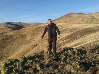
Back to Death Valley for more desert fun! We had a half day starting out so we stopped to hike up Ord Mountain in the Mojave. It's a road hike and not super-exciting. But I was excited to see that Gerry Roach and his wife Jennifer were the last people to sign in, just 4 days prior. I also noted nearby East Ord, a DPS peak I hope to do in the future.
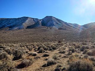
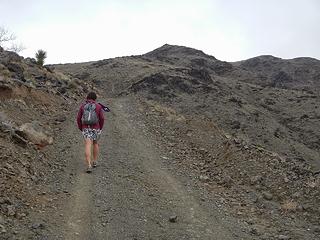 Ord road walk 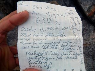 Ord register 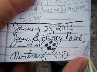 Gerry Roach entry 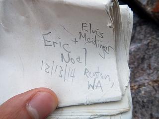 Eric Noel entry 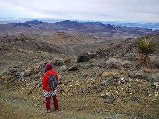 descending Ord 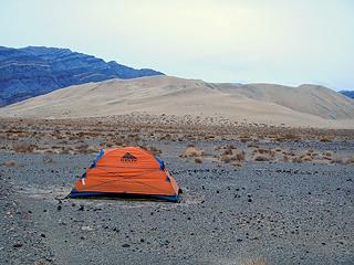 Eureka camp 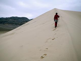 ascending Eureka Dunes 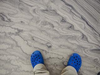 sand patterns 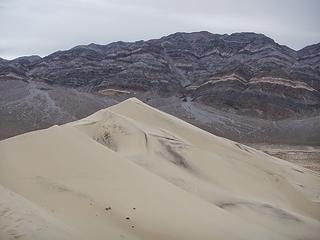 Sandy Peak behind the dunes 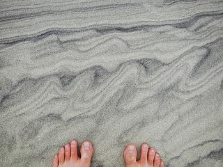 storms on Jupiter 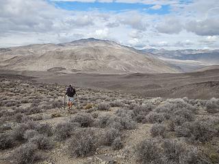 ascending Sandy 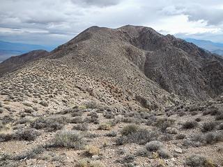 Sandy 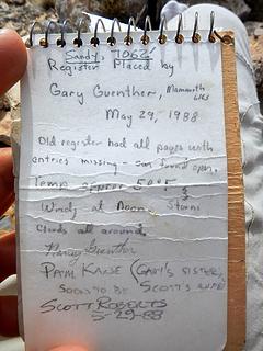 Sandy register 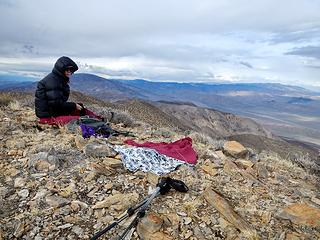 Sandy summit 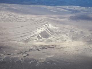 Eureka Dunes below 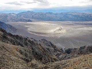 Dry Mountain and Eureka Dunes 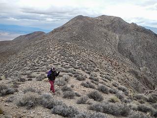 descending 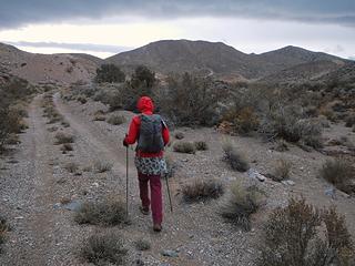 road to Last Chance 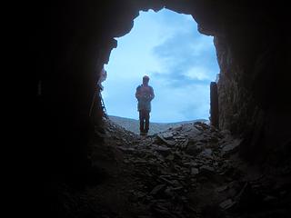 Heather waits 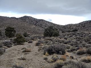 the wash 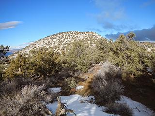 Last Chance 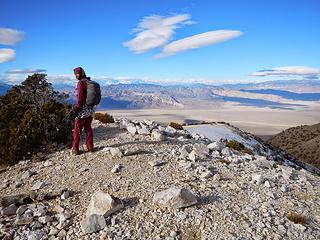 Last Chance summit 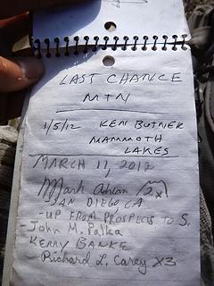 Last Chance register 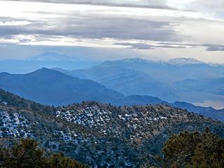 Tin and Dry to the south 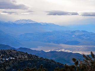 Dry 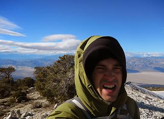 very cold wind 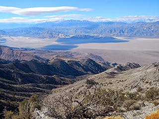 Saline Valley 
 Chocolate 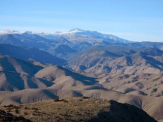 White Mountain Peak 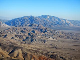 Last Chance 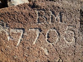 benchmark engraving 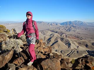 Chocolate summit 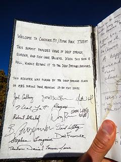 Chocolate register 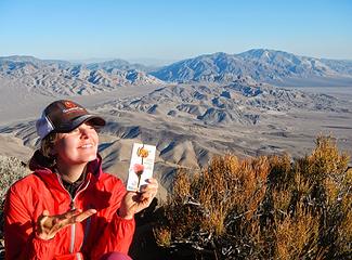 enjoying chocolate on Chocolate 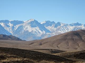 Mount Tom 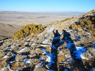 some snow on the descent 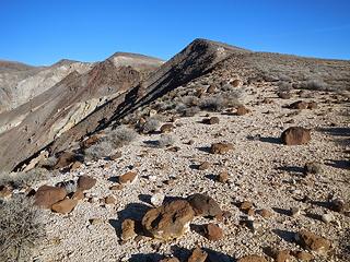 southeast ridge of Towne 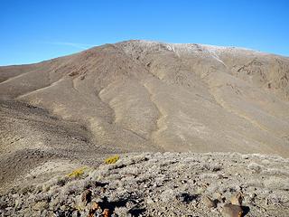 upper Towne 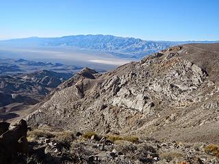 Maturango 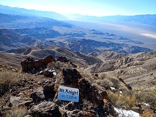 Knight? 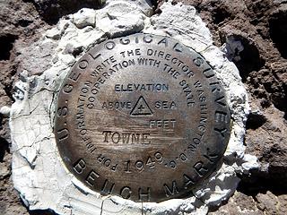 Towne benchmark 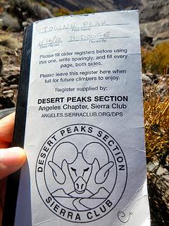 DPS Towne register 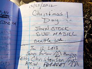 John Stolk entry 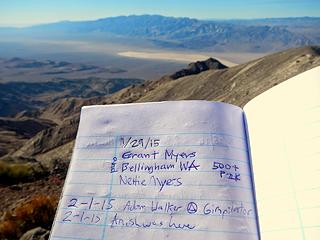 Grant Meyers entry 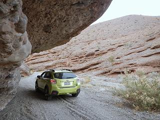 Telephone Canyon 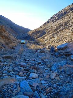 the boulder washout 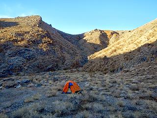 camping in Telephone canyon 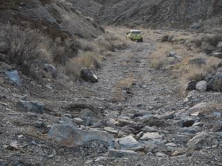 boulder washout 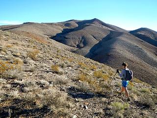 Tucki false summit 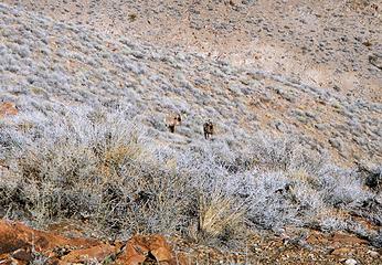 bighorn sheep 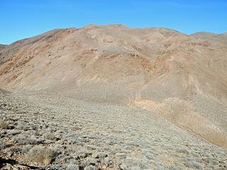 another false summit 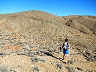 another false summit 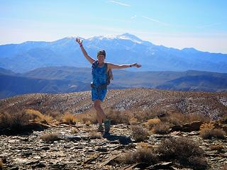 Tucki summit and Telescope behind Heather 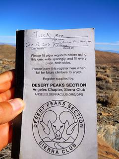 DPS Tucki register 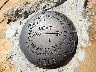 Death 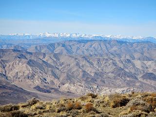 Whitney and the High Sierra 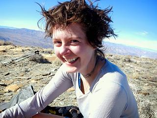 wild woman  I noticed another pile of old eroded batteries. Does anyone know what these are from? Heather and I have seen large old batteries on a number of desert summits. Or just the remaining cores. I'm guessing they have something to do with early aviation. And once again we had a very nice view of Whitney to the west. I noticed another pile of old eroded batteries. Does anyone know what these are from? Heather and I have seen large old batteries on a number of desert summits. Or just the remaining cores. I'm guessing they have something to do with early aviation. And once again we had a very nice view of Whitney to the west.
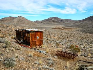 Martin Crossing cabin 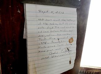 Haunta virus 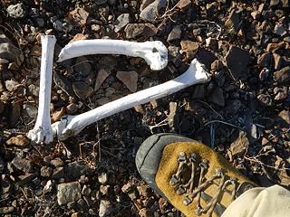 remains 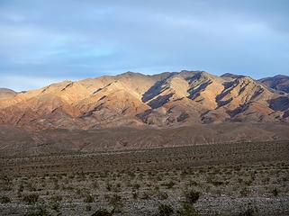 evening light on Tucki 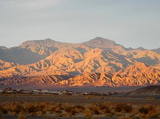 evening light on Thimble and Corkscrew 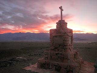 hotel construction workers memorial 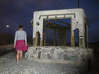 summit structure 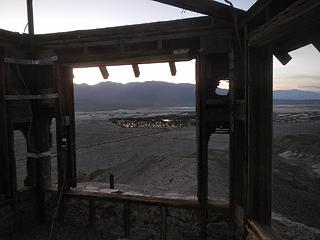 Furnace Creek lights below 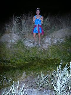 not happy to cross Furnace Creek 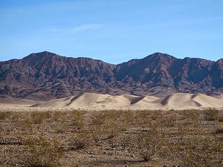 Ibex Dunes and Ibex Benchmark behind 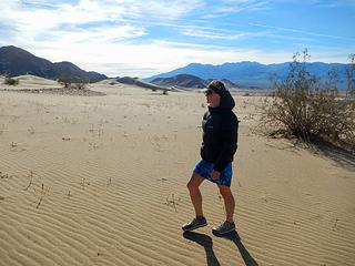 approaching Ibex Dunes
|
| Back to top |
  
|
|
Ski
><((((°>

Joined: 28 May 2005
Posts: 12823 | TRs | Pics
Location: tacoma |
|
Ski
><((((°>
|
 Tue Mar 24, 2015 7:07 pm |
|
|
excellent. love the "storms on Jupiter" shots.
so.... did you walk all the way down into that tunnel just so you could turn around and see the light at the end? 
"I shall wear white flannel trousers, and walk upon the beach.
I have heard the mermaids singing, each to each."
"I shall wear white flannel trousers, and walk upon the beach.
I have heard the mermaids singing, each to each."
|
| Back to top |
|
|
Bloated Chipmunk
Cock Rock Searcher

Joined: 29 Jan 2007
Posts: 2993 | TRs | Pics
Location: Margaritaville |
Man, sounds like you guys are knocking out all these peaks from my Desert Summits book!  We've been slowly chipping away @ some of them when we get long holiday weekends... We've been slowly chipping away @ some of them when we get long holiday weekends... 
Home is where the hiking is.
"Peaks that have come and gone four times should halt a man in his steps." -- William O. Douglas
A balanced diet is a margarita in each hand.
Home is where the hiking is.
"Peaks that have come and gone four times should halt a man in his steps." -- William O. Douglas
A balanced diet is a margarita in each hand.
|
| Back to top |
|
|
Gimpilator
infinity/21M
Joined: 12 Oct 2006
Posts: 1684 | TRs | Pics
Location: Edmonds, WA |
Yeah we recently bought that book. Initially we were just picking peaks at random down here but then someone we met while scrambling told us about it, so we decided to check it out. It doesn't have everything, but it sure covers a lot of ground.
|
| Back to top |
|
|
Brucester
Member
Joined: 02 Jun 2013
Posts: 1102 | TRs | Pics
Location: Greenwood |
Nice pix!
Love how you can look out and just see land.
|
| Back to top |
|
|
puzzlr
Mid Fork Rocks

Joined: 13 Feb 2007
Posts: 7220 | TRs | Pics
Location: Stuck in the middle |
|
puzzlr
Mid Fork Rocks
|
Fri Mar 27, 2015 9:45 pm |
|
|
The shot of Eureka Dunes is amazing.
I think if I ran across that cool sand pattern I would have been stuck there all day taking pictures. Love stuff like that.
|
| Back to top |
|
|
ofuros
Member

Joined: 04 Feb 2015
Posts: 45 | TRs | Pics
Location: Gondwana....Australia. |
|
ofuros
Member
|
Sat Mar 28, 2015 2:19 pm |
|
|
Great pics & trip report, Gimpilator.
|
| Back to top |
|
|
Jim Dockery
Member

Joined: 12 Sep 2007
Posts: 3092 | TRs | Pics
Location: Lake Stevens |
I really wanted to get out to Eureka Dunes when I was there but was put off by reports of sharp gravel giving people flats (a couple stories of multiple flats in a day leading to very expensive tow/work out there). What did you think of the approach you took? I'm hoping to get in there next time.
|
| Back to top |
|
|
Magellan
Brutally Handsome

Joined: 26 Jul 2006
Posts: 13116 | TRs | Pics
Location: Inexorable descent |
|
Magellan
Brutally Handsome
|
Sat Mar 28, 2015 10:08 pm |
|
|
Good stuff, Gimpy.
|
| Back to top |
|
|
ree
Member

Joined: 29 Jun 2004
Posts: 4399 | TRs | Pics
|
|
ree
Member
|
Sun Mar 29, 2015 1:28 pm |
|
|
|
| Back to top |
|
|
Gimpilator
infinity/21M
Joined: 12 Oct 2006
Posts: 1684 | TRs | Pics
Location: Edmonds, WA |
| Jim Dockery wrote: | | I really wanted to get out to Eureka Dunes when I was there but was put off by reports of sharp gravel giving people flats (a couple stories of multiple flats in a day leading to very expensive tow/work out there). What did you think of the approach you took? I'm hoping to get in there next time. |
This is a very valid question for anyone planning a trip. As you may have noticed, some of the park maps label certain roads as having sharp rocks and only for special tires. Furthermore the guide book we have used called Desert Summits claims that the author got multiple flat tires on certain roads in the same day. Because of this, we had some trepidation about visiting a few areas. But after our 4 trips (last report pending), I feel I have a better understanding about the road situation in Death Valley.
In many places we saw people cruising down rough washboarded roads in rental vehicles at 25+ miles per hour. We on the other hand, were without any spare tire in our vehicle and also sporting half worn-out stock issue tires. So we stayed between 5 and 10 mph the whole way on the Ureka Dunes road and 5 to 20 mph on the Ubehebe road. So to answer your question, there are a lot of rough roads in DV and many people opt to rent expensive jeeps from the Furnace Creek company. In my opinion you can go most places in a Subaru or the equivalent, so long as you are willing to drive slow. Impatience could lead to a flat.
| ree wrote: | | Isn't it interesting the wild variety of temps? You can freeze your butt off or boil like crazy. |
You said it!
| ree wrote: | | Did you drive over any deep sand by entering the park from the north? |
We did not, however I would be very curious to see how my car does in sand.
| ree wrote: | | I wanted to find some beta on the road that peels off into Oriental Wash. You can access Gold Point from DV (Eureka Dunes), and I know there is quite a bit of history in Oriental Wash. Gold Point is a fantastic ghost town (privately owned, but the owner is pretty cool about allowing sightseers.) I thought that would make an interesting loop trip through DV... |
I had not heard of Gold Point before but it looks pretty interesting. I went to the ghost town of Cerro Gordo a couple days ago and after talking to the caretaker who lives there, he allowed us to enter the old American Hotel which is incredibly well preserved. Such amazing history in these parts...
|
| Back to top |
|
|
Eric Hansen
Member

Joined: 23 Mar 2015
Posts: 866 | TRs | Pics
Location: Wisconsin |
Thanks Gimpilator. Your photos brought back a lot of great DV memories.
Monarch Falls is a 120- foot gem, an easy 3-mile off trail hike from the Beatty Cutoff.
Pyramid is on my to do list. Awesome view, supposed to be a good bivy spot on top
|
| Back to top |
|
|
ree
Member
Joined: 29 Jun 2004
Posts: 4399 | TRs | Pics
|
|
ree
Member
|
Tue Mar 31, 2015 1:40 pm |
|
|
Cerro Gordo has been on my ghost town list for ages. Got any pictures you shot of Cerro Gordo? Years ago, they allowed overnighters in the hotel there, but the owners stopped that - liability issues. I'd love to see some shots.
Go check out Gold Point, and Goldfield, if you can swing it. Goldfield has that creepy hotel in the center of it.
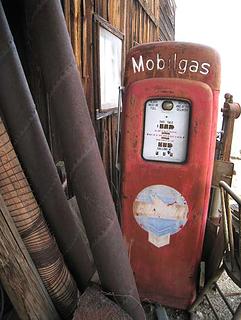 Gold Point 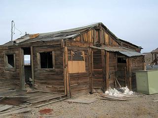 Gold Point 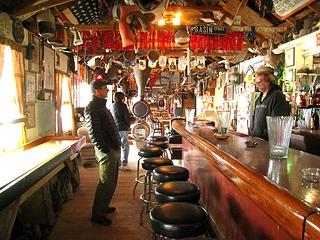 inside saloon at Gold Point 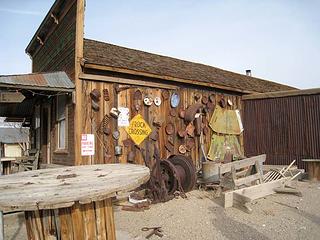 Gold Point 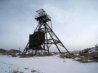 Gold Point  Gold Point
|
| Back to top |
|
|
|
|


