| Previous :: Next Topic |
| Author |
Message |
JimK
Member


Joined: 07 Feb 2002
Posts: 5607 | TRs | Pics
Location: Ballard |
|
JimK
Member
|
 Mon Aug 25, 2008 9:12 am |
|
|
Late summer is time for my annual backpacking and day hiking trip to Central Idaho. Last year Sadie's Driver accompanied me. This year Quark came along. Just more of the same. Lakes near or above 10,000', lots of granite, flowers, few people, very few bugs, warm days, cool nights. Yawn.
The Sawtooths are great and I am now equally pleased with the White Clouds.
I have way to much to do to get my Idaho reports up so I will just post parts as I get to them. First is day one of the Big Boulder Lakes trip.
Day One
Since my brother moved to Sun Valley I have made a late summer pilgrimage to visit and to hike and backpack this terrific area. This was my fourth trip. This time Kim accompanied me and we drove. I flew in on the tree earlier visits. It's a long day of driving but not so bad with two people trading off. We headed out at 6:30 am on Saturday and arrived 680 miles later and one time zone change at 6:45 pm MDT in Sun Valley. My house is at 220' above sea level and my brother's is at 5800'. The Sawtooth and White Cloud Mountains soar much higher. We spent Sunday just getting a little acclimatized.
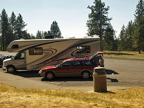 Itty Bitty Outback 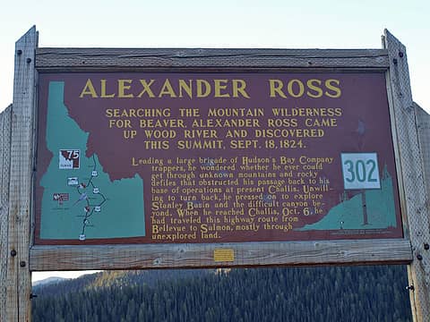 Historical Marker 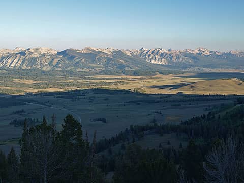 Salmon Rvr & Sawtooths 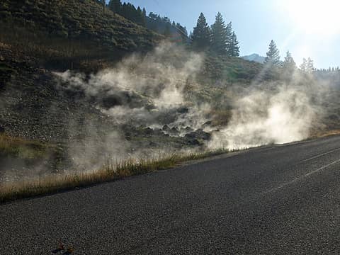 Road Side Steam  Sunbeam Hot Springs  Livingston Mill Trailhead 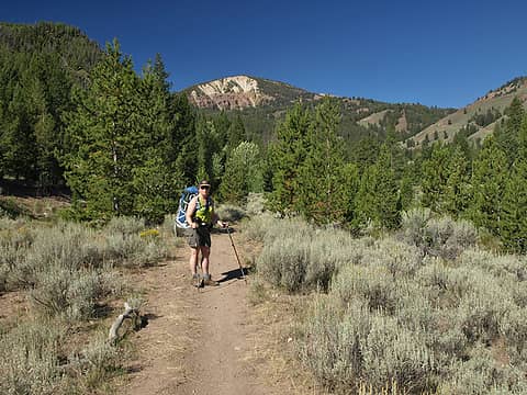 Start Of Trail 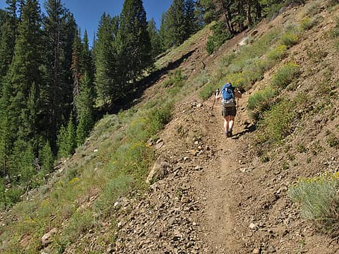 Grassy Slope 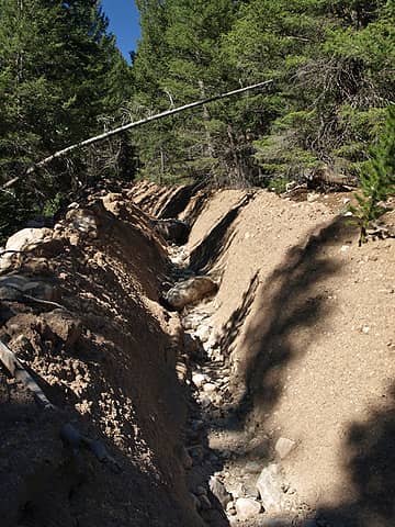 New Ravine 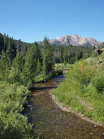 Big Boulder Creek 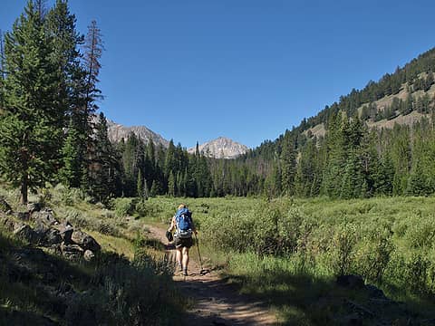 Peak Beyond Meadow 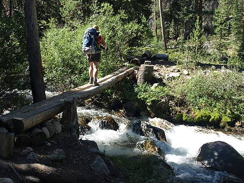 Creek Crossing 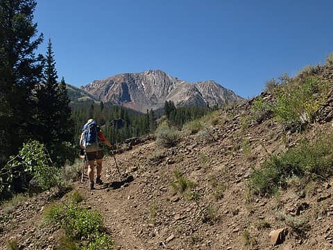 Closer To Peaks 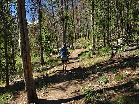 Cooling Shade 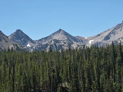 Improving Peak Views 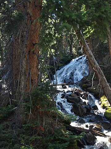 Waterfall 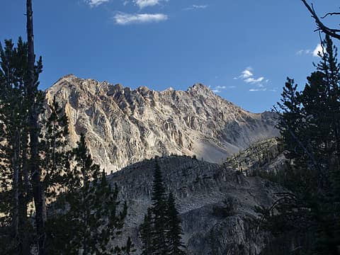 Granite Peaks 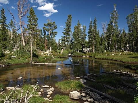 Outlet Creek Meadow 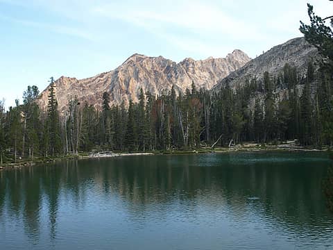 Walker Lake 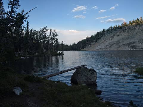 Setting Sun On Lake 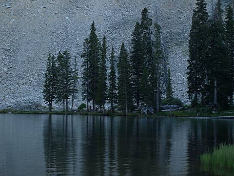 Reflection In Lake 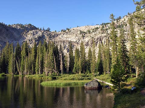 Morning Light 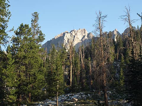 Granite Peak Above 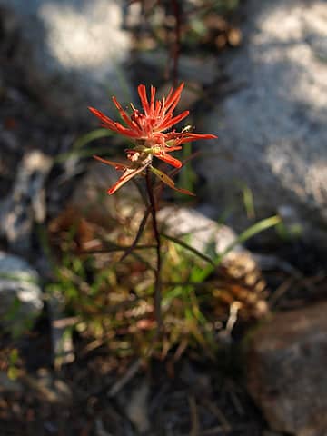 Indian Paintbrush 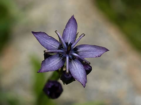 Beautiful Purple Flower 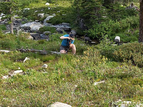 Kim At Work 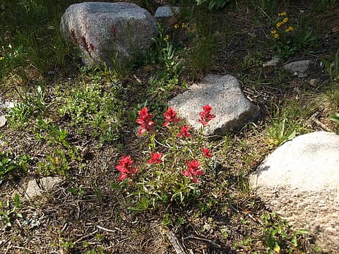 Bright Red Paintbrush  White Flowers 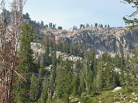 Saddle Is In Sight 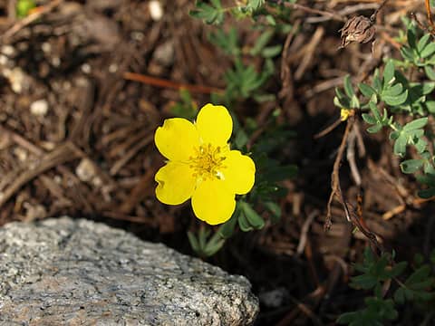 Buttercup Like Flower 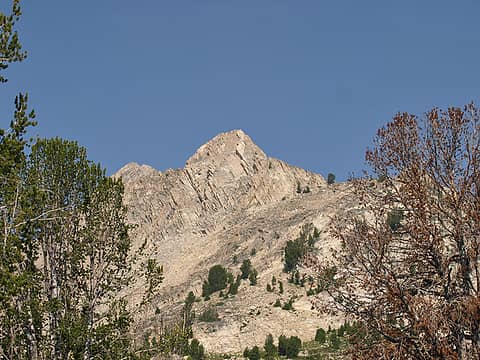 Tilted Rock Peak 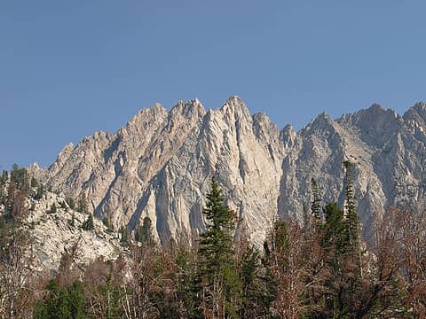 Beautiful Granite 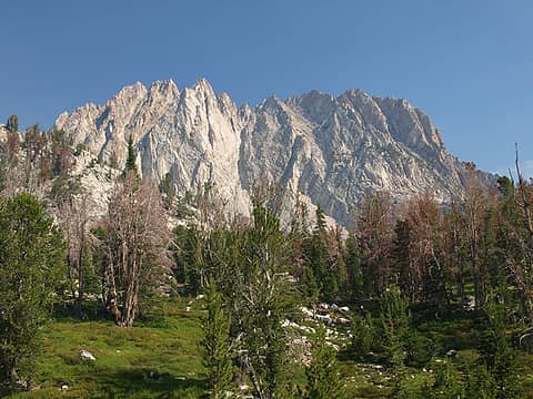 Meadow & Sharp Peak 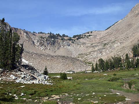 End Of Basin 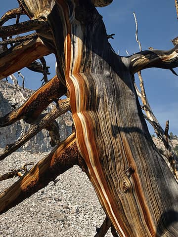 Snag Art 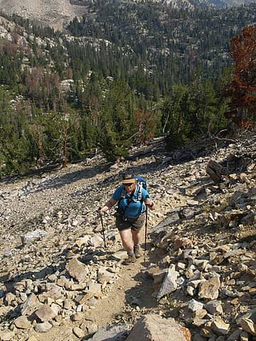 Heading To Saddle 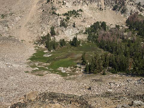 High Above Meadow 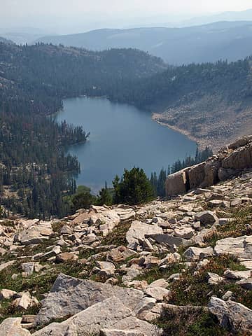 Above Walker Lake 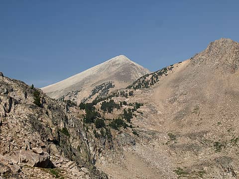 White Peak In Sight 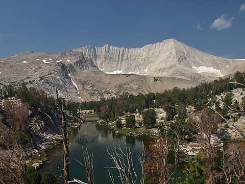 Wow! DO Lee Peak 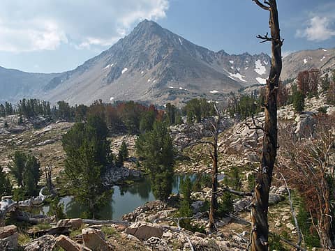 Point 11,272 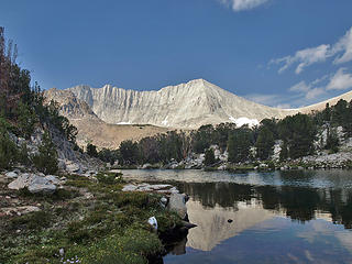 Hook Lake & DO Lee 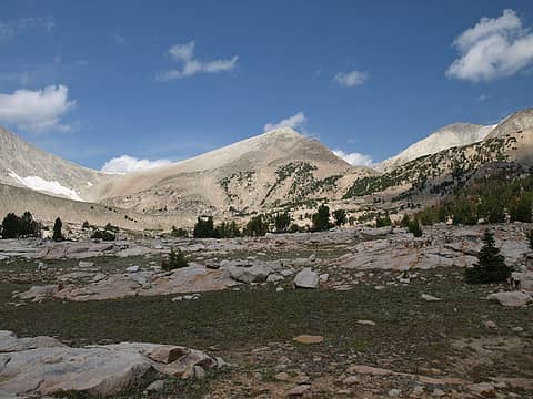 White Cloud Peak 9 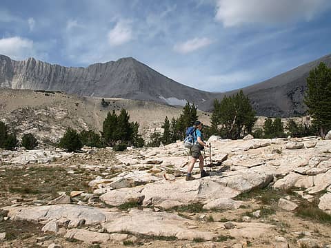 Kim On Granite Plateau 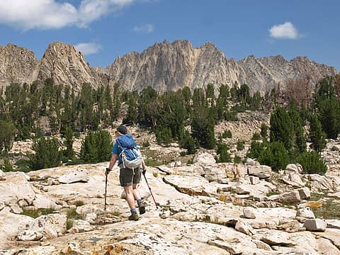 Crossing Plateau 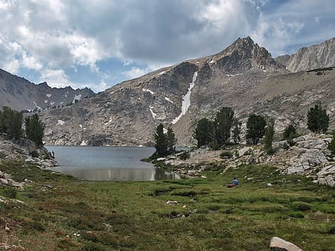 Fishing Sapphire Lake 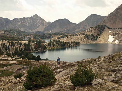 Sapphire Below 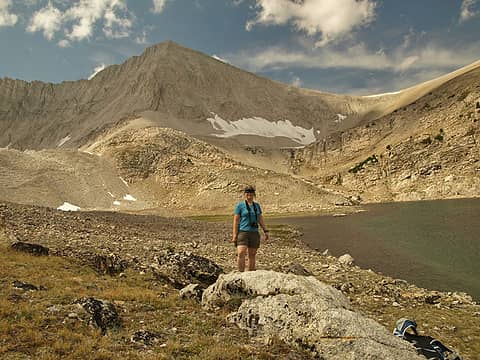 Kim At Cirque Lake 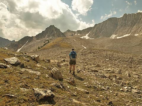 Heading To Moraine 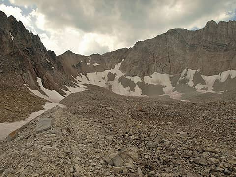 In The Moraine 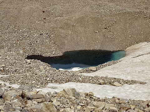 Search Finds One Kettle 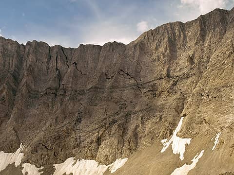 Looks Like Cracks 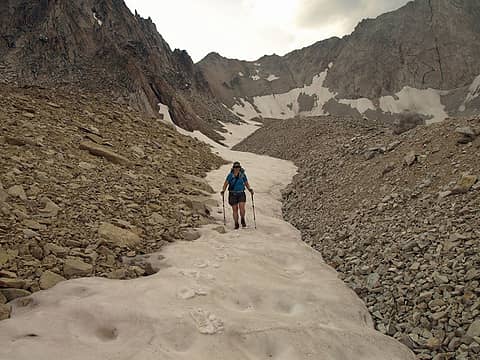 Exit Via Snow Finger 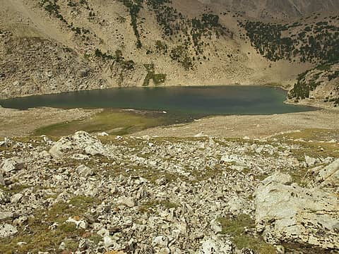 Barren Cirque Lake 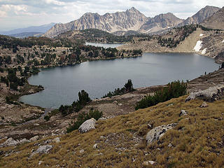 Sapphire From Cirque 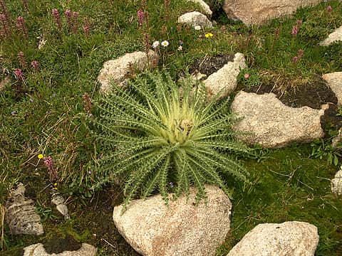 Strange Plant 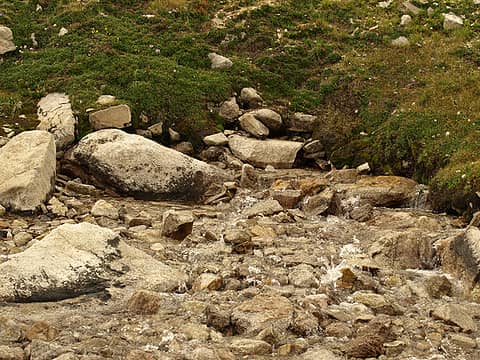 Creek Emerges  Smoke Blows In 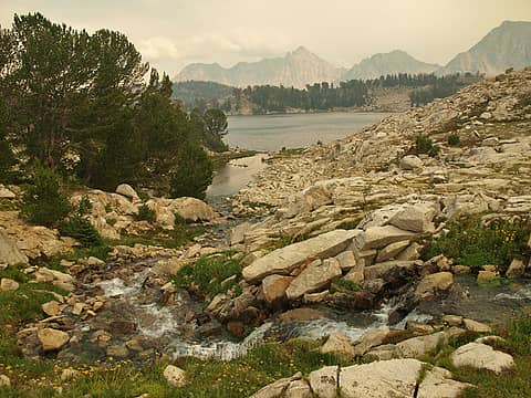 Creek Into Cove Lake 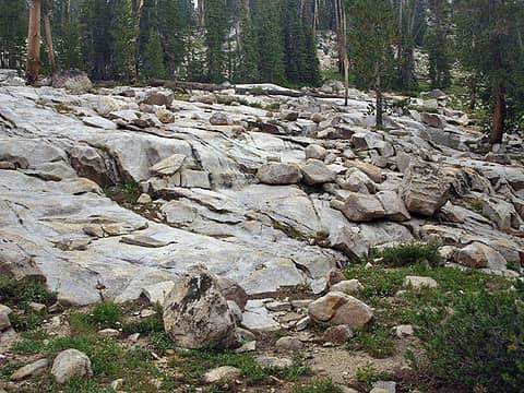 Slabs Near Camp 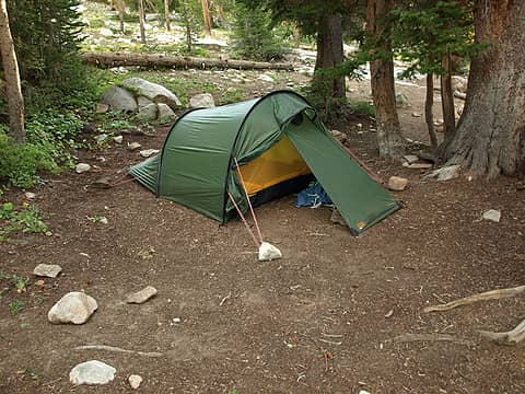 Walker Camp 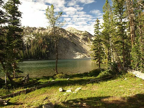 Smoke Is Gone 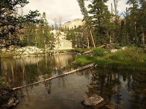 In Lake Basin 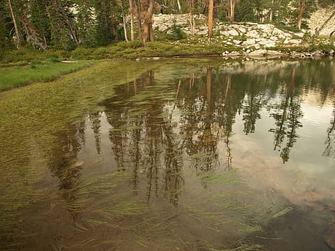 Reflection 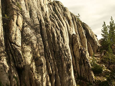 Interesting Rock 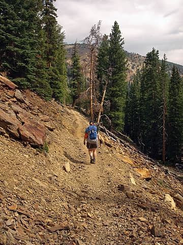 New Trail 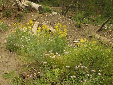 More Flowers  Livingston Mill 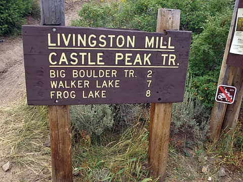 Trailhead Sign 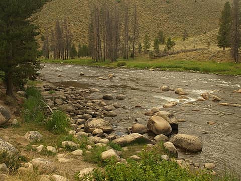 Salmon River
|
| Back to top |
  
|
|
Backpacker Joe
Blind Hiker

Joined: 16 Dec 2001
Posts: 23956 | TRs | Pics
Location: Cle Elum |
Looking forward to it James.
"If destruction be our lot we must ourselves be its author and finisher. As a nation of freemen we must live through all time or die by suicide."
Abraham Lincoln
"If destruction be our lot we must ourselves be its author and finisher. As a nation of freemen we must live through all time or die by suicide."
Abraham Lincoln
|
| Back to top |
|
|
Quark
Niece of Alvy Moore

Joined: 15 May 2003
Posts: 14152 | TRs | Pics
|
|
Quark
Niece of Alvy Moore
|
Mon Aug 25, 2008 9:56 am |
|
|
Clouds are so named because it's difficult to determine where the peaks end and the clouds begin. A very apt description for these gorgeous peaks, some blindingly white from their composition of limestone and granite.
Cool stuff always happens - we met a local royal family of Ketchum on one of the trails we hiked; the father of our new trail freind was the first backcountry ski instructor in the area in 1937. He also named some of the local peaks in the Pioneer Mtns around Ketchum. It was pretty exciting to meet this gentleman. I feel sorta bad because I thought he was a bit of a jerk at first, but as we all know, once you give a person a chance and actually speak to them rather than judging them before you know them, they're not really jerks at all. He and his kids are the nicest folks, and we're extremely thrilled to have met them and heard their family story.
Will post a link to the Ketchum backcountry ski history (Jim sent it to me) later, along with pics.
"...Other than that, the post was more or less accurate."
Bernardo, NW Hikers' Bureau Chief of Reporting
"...Other than that, the post was more or less accurate."
Bernardo, NW Hikers' Bureau Chief of Reporting
|
| Back to top |
|
|
Don
Member

Joined: 25 Apr 2005
Posts: 2013 | TRs | Pics
Location: Fairwood, WA |
|
Don
Member
|
Mon Aug 25, 2008 10:34 am |
|
|
| Backpacker Joe wrote: | | Looking forward to it James. |
 While in Eagle Cap, I talked to another couple at great length about the Sawtooths and White Cap area, and received a lot of beta from them for a future trip. Now I find all I had to do was fire Mr. K a pm? Sheesh!
|
| Back to top |
|
|
MLHSN
What goes here?????

Joined: 09 Sep 2007
Posts: 1069 | TRs | Pics
Location: Wenatchee |
|
MLHSN
What goes here?????
|
Mon Aug 25, 2008 6:23 pm |
|
|
yes, very interested to read this one..... I'm waiting... impatiently
|
| Back to top |
|
|
kaydubpdx
Member

Joined: 11 Aug 2008
Posts: 26 | TRs | Pics
Location: Portland, Oregon |
Great choice on the White Clouds. I drove out from Portland and hiked into the Upper Boulder Chain Lakes two summers ago. It was soo scenic and quiet. It made the long, long hike in and all of the vertical worth it. I actually just returned last night from the Bighorn Crags in the northern end of the Frank Church Wilderness. Stunning country! I'll post a report soon.
Keith
|
| Back to top |
|
|
Quark
Niece of Alvy Moore
Joined: 15 May 2003
Posts: 14152 | TRs | Pics
|
|
Quark
Niece of Alvy Moore
|
Mon Aug 25, 2008 9:08 pm |
|
|
At first I thought, "God what did I get myself into..." the E Fk Salmon Rv Rd winds through what looks like Central Washington - canyons, sagebrush....I thought how dumb I was to agree to do a deserty hike in August.
But no fear, it's alpine enough....odd mixture of highland sagebrush, then scrubby forest. We actually got quite cold in the upper basin of the Lakes. I smelled smoke as we got to camp the first night; and by the 2nd day in the upper basin, we knew a forest fire or two was somewhere around - the basin got so smoky we had to cut our visit there a bit short.
Gorgeous place. Good road to get to the trailhead, trail is in great condition, logs placed at all creek crossings, and excellently maintained trail (including a brand new re-route around Quicksand Meadows)
Pics of Big Boulder Lakes
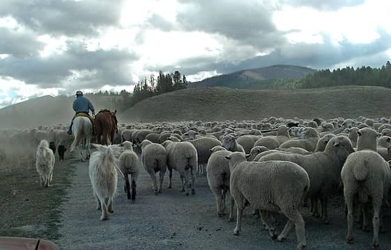 Herding sheep 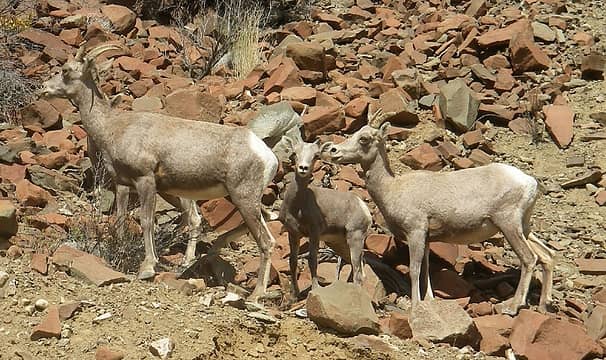 Critters along the E Fk Salmon Rv Rd 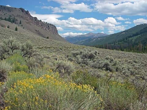 Along E Fk Salmon River road to Livingston Mill 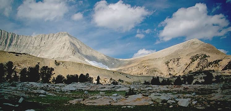 Big Boulder Lakes basin, David O Lee on the left, unk on the right 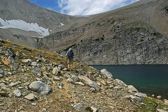 Jim at Cirque Lk 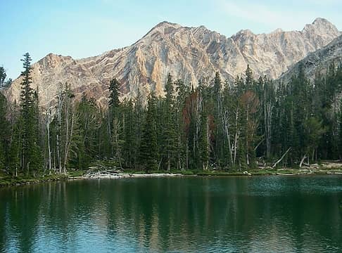 Swoopy rock mountain, Big Boulder trail 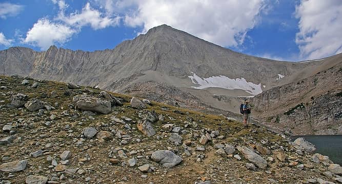 A hiker at Cirque Lake, Big Boulder Lakes, David O Lee Pk on the left  Ascending the moraine  King of the Moraine, Big Boulder Lakes, ID_David O Lee Pk  Lawrence of Albania at Big Boulder Lakes moraine  Ohnoitshimagain 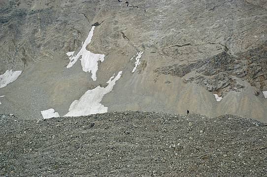 Stalking David O Lee Pk 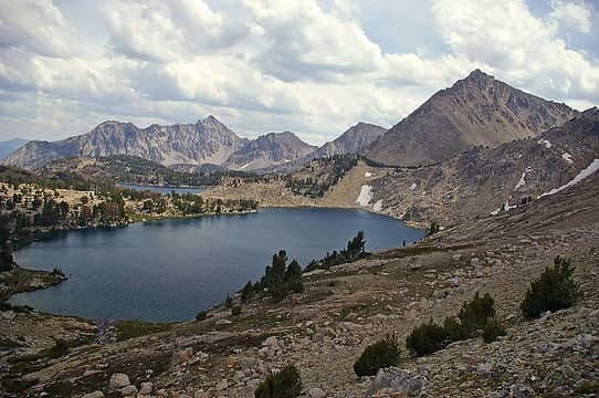 Sapphire and Cove Lakes, Big Boulder Lakes Lawrence of Albania at Big Boulder Lakes moraine A hiker at Cirque Lake, Big Boulder Lakes, David O Lee Pk on the left
"...Other than that, the post was more or less accurate."
Bernardo, NW Hikers' Bureau Chief of Reporting
"...Other than that, the post was more or less accurate."
Bernardo, NW Hikers' Bureau Chief of Reporting
|
| Back to top |
|
|
Quark
Niece of Alvy Moore
Joined: 15 May 2003
Posts: 14152 | TRs | Pics
|
|
Quark
Niece of Alvy Moore
|
Mon Aug 25, 2008 9:10 pm |
|
|
Pics of Born Lakes trail
Dayhike. We stayed at Sunny Gulch car campground after rejecting the dismal camping choices at Redfish Lake. Sunny Gulch is a wonderful camping spot, access to the Salmon River behind the campground.
After a chicken fried steak and porkchop dinner at a restaurant in Stanley, we turned in, then dayhiked to Born Lakes. This valley burned in 2005. The forest eerily charred, but certainly very beautiful in this stage of life. We enjoyed it immensely. The trail is well maintained and popular. 7ish miles RT gets you to Born Lakes. a steep descent into Ants Basin. Us Washingtonians couldn't stand the thought of a basin not riddled with strips of trails going all over the place. This basin is in excellent condition. Only one trail clearly mars it's face. There are likely more trails here and there, but hikers have kept it in good condition.
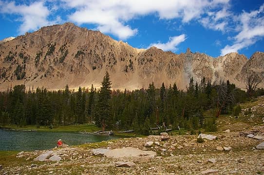 A hiker enjoys Born Lake 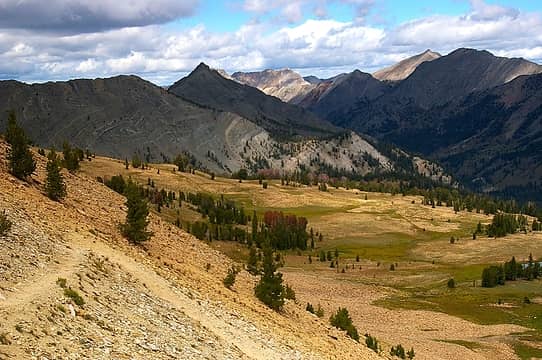 Ant Basin, shadows and light 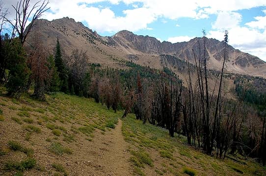 Born Lakes trail 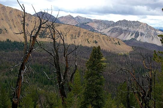 Colorful mountains, Born Lakes trail 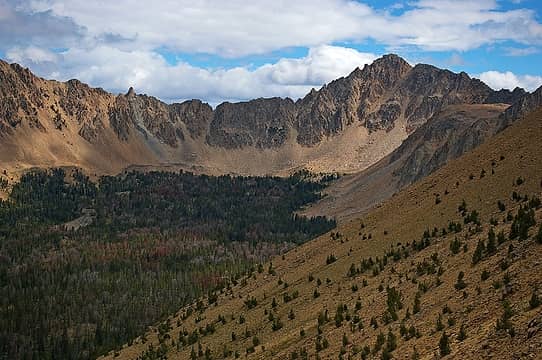 Looking toward Born Lakes from the Pass above Ant Basin  Ants Basin and David O. Lee Peak, White Clouds Range, Idaho Herding sheep
"...Other than that, the post was more or less accurate."
Bernardo, NW Hikers' Bureau Chief of Reporting
"...Other than that, the post was more or less accurate."
Bernardo, NW Hikers' Bureau Chief of Reporting
|
| Back to top |
|
|
kaydubpdx
Member
Joined: 11 Aug 2008
Posts: 26 | TRs | Pics
Location: Portland, Oregon |
Here are some shots of the Upper Boulder Chain Lakes...if you ever make it out that way again...
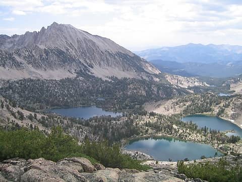 Upper Boulder Chain Lakes 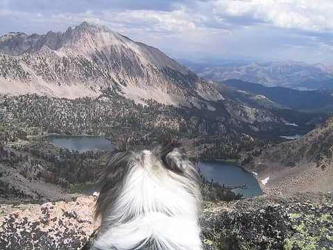 Henry taking in the view 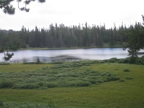 Frog Lake
|
| Back to top |
|
|
Quark
Niece of Alvy Moore
Joined: 15 May 2003
Posts: 14152 | TRs | Pics
|
|
Quark
Niece of Alvy Moore
|
Mon Aug 25, 2008 9:23 pm |
|
|
Would've been great to see all the lakes in the upper basin, but the smoke - it was so thick that at one time I coughed and choked a bit. I got claustrophobic and a little freaked (I'm a fresh air fiend, and was worried that I"d never catch my breath).
Of course this only means a return trip is in order. Such a gorgeous place.
You know if what I saw at The Kettles is petrified wood? Sure looks like it - limestone covered in dacite flow, then exposed by glacier action - could be, I suppose.....
"...Other than that, the post was more or less accurate."
Bernardo, NW Hikers' Bureau Chief of Reporting
"...Other than that, the post was more or less accurate."
Bernardo, NW Hikers' Bureau Chief of Reporting
|
| Back to top |
|
|
trailjunky
Backcountry Bumpkin'

Joined: 14 Jun 2004
Posts: 1124 | TRs | Pics
Location: timberline |
|
trailjunky
Backcountry Bumpkin'
|
Tue Aug 26, 2008 12:06 am |
|
|
Way to go guys, I've been waiting for this trip for a long time. Hey Jim, your going to have to start getting a hold of me on these Idaho trips. Nice shots as usual Quark. 
|
| Back to top |
|
|
Tazz
Member
Joined: 27 Apr 2005
Posts: 7902 | TRs | Pics
|
|
Tazz
Member
|
Tue Aug 26, 2008 7:30 am |
|
|
oh my one of my fav places. I grew up in that area. Love it! good stuff!
|
| Back to top |
|
|
Quark
Niece of Alvy Moore
Joined: 15 May 2003
Posts: 14152 | TRs | Pics
|
|
Quark
Niece of Alvy Moore
|
Tue Aug 26, 2008 9:57 am |
|
|
So Tazz, d'you know anything about petrified wood up there? Know anyone who knows? The lady at the Stanley ranger station said that though petrified wood and fossils are in other areas of ID and MT, she didn't think anything was at Big Boulder Lakes; but dang, that stuff sure looks like wood. I poked around a long time and saw rocks that looked like rocks, and petrified wood looking stuff. So it's not like everything looked like petrified wood.
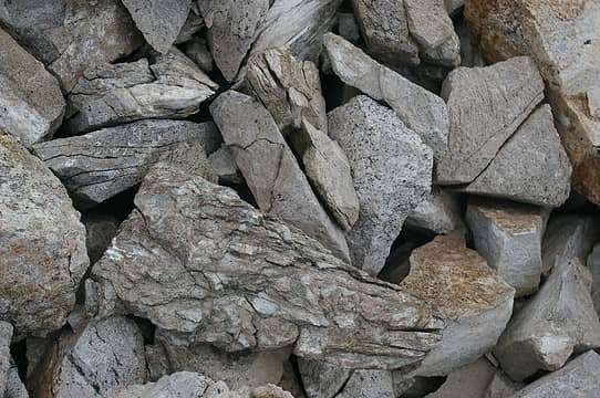 6 labels this is a pic of what I think, or hope, is petrified bark 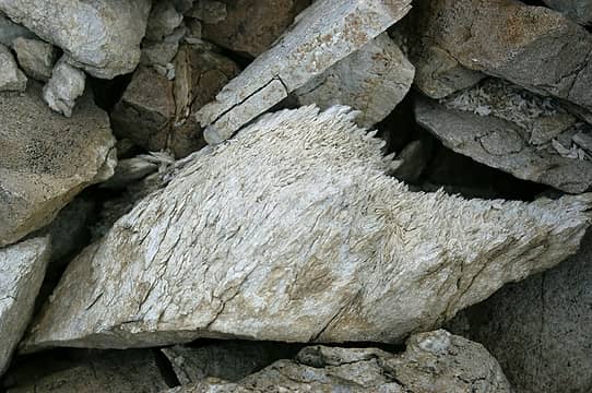 this one looks like the heart of a tree that was once soggy and punky. 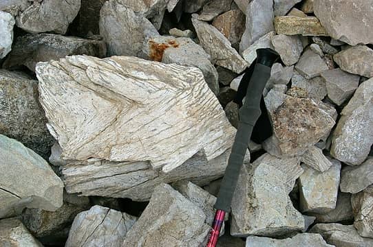 your average run-of-the-mill chuck of what looks like petrified wood
"...Other than that, the post was more or less accurate."
Bernardo, NW Hikers' Bureau Chief of Reporting
"...Other than that, the post was more or less accurate."
Bernardo, NW Hikers' Bureau Chief of Reporting
|
| Back to top |
|
|
TrailPair
Member

Joined: 17 Apr 2005
Posts: 1699 | TRs | Pics
|
Yes, Yes, I am sure that was Lawrence of Albania. I almost mistook him for Laurence of Suburbia.  Kool trip....looking forward to "the rest of the story".
This thing called work is interfering with my play
This thing called work is interfering with my play
|
| Back to top |
|
|
JimK
Member
Joined: 07 Feb 2002
Posts: 5607 | TRs | Pics
Location: Ballard |
|
JimK
Member
|
Wed Aug 27, 2008 2:27 pm |
|
|
Day Two in the upper basin has now been added to the first post in the thread.
|
| Back to top |
|
|
|
|
You cannot post new topics in this forum
You cannot reply to topics in this forum
You cannot edit your posts in this forum
You cannot delete your posts in this forum
You cannot vote in polls in this forum
|
Disclosure: As an Amazon Associate NWHikers.net earns from qualifying purchases when you use our link(s). |


