| Previous :: Next Topic |
| Author |
Message |
Allison
Feckless Swooner


Joined: 17 Dec 2001
Posts: 12287 | TRs | Pics
Location: putting on my Nikes before the comet comes |
|
Allison
Feckless Swooner
|
 Tue Sep 06, 2005 12:32 am |
|
|
This look back from the 1974 edition of 100 hikes for the Alpine Lakes Wilderness:
| Quote: | | From this point north through the superior wildlands of the Alpine Lakes Cascades the Crest Trail is in the process of being moved to a new line closer to the actual crest, but since the project will not be finished until the late 1970s, the 1974 trail is described here. The current "main" route crosses Red Mountain Pass (Hike 28), but because of the dangerous snow gully at pass, usually is impassable until August and some years never does open for safe travel. The alternate route via Snow Lake is therefore recommended. From the Snoqualmie Pass Ranger Station walk the highway west. Go under Interstate 90 to the Alpental Road, and find the Snow Lake Trail (Hike 27). drop from Snow Lake to the Middle Fork Snoqualmie river and hike upstream passing around Goldmeyer (sic) Hot Springs to the Middle Fork road.
Pass to Goldmeyer Hot Springs about 13 miles; elevation gain about 1600 feet; hiking time 2 days.
Now, much hard work, rewarded by the magnificence of alpine lakes and rugged mountains. From near Goldmeyer Hot Springs walk the Middle Fork road past logging operations and climb to Dutch Miller Gap (Hike 39) and the ridge above, and drop to Cle Elum River Road.
Distance from Goldmeyer Hot Springs to Cle Elum River Road about 30 miles; elevation gain about 4800 feet; hiking time 3 days.
End the journey in mostly alpine country decorated with several outstanding lakes. From the Cle Elum River Road pass Hyas Lake (Hike 41), climb to Deception Pass (Hike 6) cross Pieper Pass (Hike 7), and drop to Glacier Lake and Surprise Lake. Now switchback to a high pass, contour above Trapp (sic) Lake, descend to Hope Lake, pass Mig Lake, ascend to a pass above Swimming Deer Lake, proceed to a viewpoint above Lake Josephine (Hike 8) and drop to Stevens Pass.
Distance from Cle Elum River road to Stevens Pass about 26 miles; elevation gain about 6400 feet, hiking time 3 days. |
www.allisonoutside.com
follow me on Twitter! @AllisonLWoods
www.allisonoutside.com
follow me on Twitter! @AllisonLWoods
|
| Back to top |
  
|
|
Snowbrushy
Member

Joined: 23 Jul 2003
Posts: 6670 | TRs | Pics
Location: South Sound |
|
Snowbrushy
Member
|
Tue Sep 06, 2005 5:30 pm Memories
|
|
|
Mary Lou, Thank's for the memories. We did those trail's (troop 186) in 67/68 before it was changed. I was just a kid ..
Oh Pilot of the storm who leaves no trace Like thoughts inside a dream Heed the path that led me to that place Yellow desert stream.
Oh Pilot of the storm who leaves no trace Like thoughts inside a dream Heed the path that led me to that place Yellow desert stream.
|
| Back to top |
|
|
Timber Cruiser
Member
Joined: 17 Dec 2001
Posts: 220 | TRs | Pics
Location: Cosi |
I did the reverse of that route (alternate included) in 67. I don't have that version of the "Hikes" books, but in my 1971 "102 Hikes..." a couple of passages from Ira about the Commonwealth Basin trail are; " Those who have watched the accelerating degradation of Snoqualmie Pass over the past 25 years can barely stand the pain of a visit." And after describing the first mile or so that passed through clearcuts and up a logging road he writes: "Now the outrage and sorrow can be submerged in pleasure,..". In his 1968 "100 Hikes in Western Washington" he wrote: "The next 1/2 mile climbss bleak logging shambles and roads.."
Did he tone down the rhetoric in his latter books? I get a kick out of these passages now. I don't think I even noticed logging activities when I was hiking back then. Even after hiking down the Middle Fork road. I do remember hippies at Goldmeyer and garbage at Snow Lake!
"Logging encourages the maintenance of foilage by providing economic alternatives to development."
"Logging encourages the maintenance of foilage by providing economic alternatives to development."
|
| Back to top |
|
|
Sawyer
Member
|
|
Sawyer
Member
|
Tue Sep 06, 2005 10:23 pm |
|
|
There is definitely entertainment value out of old books. My copy of the original 100 Hikes in Western Washington (Louise Marshall, RIP) describes some interesting hikes that no longer work very well. Evergreen Mt, where the lookout exists, is a trip from Rapid River up some roads and much more trail than now. Enchantment Lakes was a scramble route from Snow Lakes. She complains about the slimy crossing of the dammed lake. Mt Pilchuck was climbed from the ski lodge. Kennedy Hotsprings still existed... oh yeah, that was only a few years ago. There was a shelter at Image Lake. An old trail drops down to Hwy 20 from Sauk Mtn. There is a photo of 25 Mountaineers hiking the Olympic coastline.
The definitive guide to the CCT is "High Trails, A Guide to the Cascade Crest Trail", Robert H. Wills, 1962. Some day I'm gonna hike it from Snoqualmie to Stevens Passes.
|
| Back to top |
|
|
Allison
Feckless Swooner
Joined: 17 Dec 2001
Posts: 12287 | TRs | Pics
Location: putting on my Nikes before the comet comes |
|
Allison
Feckless Swooner
|
Wed Sep 07, 2005 12:56 am |
|
|
I was up the MfK this weekend before the weather sent me home. Did a bit of hiking toward DMG and was commenting to Tom while we were hiking that the area had been logged once before. When I got home I was looking at the Goldmyer newsletter which says the upper valley had never been logged. I'm no expert, but was pretty sure the area had seen logging activity, and was glad to see that I'm not completely blind, and that the area had been logged before. The above account mentions active logging in the upper valley at the time of publication, 1971 for the first edition and 1974 for the reprint or the second edition.
I would not say that human incursions before the area was made Wilderness are significant, but they are there. I also think that some sections of the trail were once an old roadbed, and would be interested to know if that is accurate. The area was logged once, possibly not all that long ago. Does anyone know the logging history of the area now included in the ALW, and part of the Upper Middle Fork River area?
www.allisonoutside.com
follow me on Twitter! @AllisonLWoods
www.allisonoutside.com
follow me on Twitter! @AllisonLWoods
|
| Back to top |
|
|
Quark
Niece of Alvy Moore

Joined: 15 May 2003
Posts: 14152 | TRs | Pics
|
|
Quark
Niece of Alvy Moore
|
Wed Sep 07, 2005 11:08 am |
|
|
I have copies of many of WTA's old Signpost magazines. I pulled out the Fall, 1974 one last night, and it was interesting to note that the same issues we're dealing with about now were a concern then as well:
The avvy danger at Source Lake and how to make people aware in general (2 girls were buried by snow at Source Lake that year, and the magazine interviewed a FS ranger).
Dogs on leashes.
Wilderness management issues and questions.
In General:
The Mid Fk road closure was at issue. as far back as the first magazine, 1969 or so (I'll have to double-check).
Image Lake: was completely overrrun and torn up - pre-Wilderness there were no limit rules and up to 50 boyscouts at a time were camped at the shore at any given weekend.
"...Other than that, the post was more or less accurate."
Bernardo, NW Hikers' Bureau Chief of Reporting
"...Other than that, the post was more or less accurate."
Bernardo, NW Hikers' Bureau Chief of Reporting
|
| Back to top |
|
|
#19
Member
Joined: 17 Dec 2001
Posts: 2197 | TRs | Pics
|
|
#19
Member
|
Wed Sep 07, 2005 11:59 am |
|
|
| Quark wrote: | | I have copies of many of WTA's old Signpost magazines. I pulled out the Fall, 1974 |
As long as this thread and section are about history - in '74 there was no WTA. Northwest Trails Association began in the early '80s which became WTA later in the '80s.
|
| Back to top |
|
|
Quark
Niece of Alvy Moore
Joined: 15 May 2003
Posts: 14152 | TRs | Pics
|
|
Quark
Niece of Alvy Moore
|
Wed Sep 07, 2005 1:23 pm |
|
|
yeah, you're right. my mistake.
I have copies of the old Signpost magazines.
"...Other than that, the post was more or less accurate."
Bernardo, NW Hikers' Bureau Chief of Reporting
"...Other than that, the post was more or less accurate."
Bernardo, NW Hikers' Bureau Chief of Reporting
|
| Back to top |
|
|
Quark
Niece of Alvy Moore
Joined: 15 May 2003
Posts: 14152 | TRs | Pics
|
|
Quark
Niece of Alvy Moore
|
Wed Sep 07, 2005 1:25 pm |
|
|
yeah, you're right. my mistake.
I have copies of the old Signpost magazines.
"...Other than that, the post was more or less accurate."
Bernardo, NW Hikers' Bureau Chief of Reporting
"...Other than that, the post was more or less accurate."
Bernardo, NW Hikers' Bureau Chief of Reporting
|
| Back to top |
|
|
Brian Curtis
Trail Blazer/HiLaker

Joined: 16 Dec 2001
Posts: 1696 | TRs | Pics
Location: Silverdale, WA |
I can remember work being done at the end of the midFork road in 1973. We were forced to park down the road a ways and walk the rest of the way. They were working above us. I heard some guy yell "Fire in the hole!" We started running but still ended up having rocks falling around us. I don't know what they were doing. Building road, probably.
There's a log loader laying derelict in the old road that you use to get up to the Hardscrabble Lakes. That being there would indicate there was probably some logging going on and, if I remember correctly, the area that old road runs through has been logged.
that elitist from silverdale wanted to tell me that all carnes are bad--Studebaker Hoch
that elitist from silverdale wanted to tell me that all carnes are bad--Studebaker Hoch
|
| Back to top |
|
|
Allison
Feckless Swooner
Joined: 17 Dec 2001
Posts: 12287 | TRs | Pics
Location: putting on my Nikes before the comet comes |
|
Allison
Feckless Swooner
|
Wed Sep 07, 2005 2:43 pm |
|
|
| Quote: | | There's a log loader laying derelict in the old road that you use to get up to the Hardscrabble Lakes. That being there would indicate there was probably some logging going on and, if I remember correctly, the area that old road runs through has been logged. |
Duh, and part of the route to HSL is on an old logging road. 
www.allisonoutside.com
follow me on Twitter! @AllisonLWoods
www.allisonoutside.com
follow me on Twitter! @AllisonLWoods
|
| Back to top |
|
|
Tom
Admin
Joined: 15 Dec 2001
Posts: 17853 | TRs | Pics
|
|
Tom
Admin
|
Wed Sep 07, 2005 2:51 pm |
|
|
Yes, I'm pretty sure it's been logged. I recall several stumps like this one.
|
| Back to top |
|
|
Backpacker Joe
Blind Hiker

Joined: 16 Dec 2001
Posts: 23956 | TRs | Pics
Location: Cle Elum |
So where's the trip report?
Hmm.
"If destruction be our lot we must ourselves be its author and finisher. As a nation of freemen we must live through all time or die by suicide."
Abraham Lincoln
"If destruction be our lot we must ourselves be its author and finisher. As a nation of freemen we must live through all time or die by suicide."
Abraham Lincoln
|
| Back to top |
|
|
Allison
Feckless Swooner
Joined: 17 Dec 2001
Posts: 12287 | TRs | Pics
Location: putting on my Nikes before the comet comes |
|
Allison
Feckless Swooner
|
Wed Sep 07, 2005 9:01 pm |
|
|
| Backpacker Joe wrote: | | So where's the trip report?
Hmm. |
What trip report? The one where me and briejer got three flat tires on the way in and out of going to Hardscrabbles, or the one where Tom and I got tapped on the shoulder by Mother Nature (in the form of a rainstorm marching up the valley) and asked to leave the area last Sunday? 
www.allisonoutside.com
follow me on Twitter! @AllisonLWoods
www.allisonoutside.com
follow me on Twitter! @AllisonLWoods
|
| Back to top |
|
|
Randy
Cube Rat

Joined: 18 Dec 2001
Posts: 2910 | TRs | Pics
Location: Near the Siamangs |
|
Randy
Cube Rat
|
Thu Sep 08, 2005 9:59 pm |
|
|
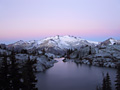
No, no. Perhaps this one from Tom's peakbagging collection.
|
| Back to top |
|
|
|
|


