| Previous :: Next Topic |
| Author |
Message |
Randy
Cube Rat


Joined: 18 Dec 2001
Posts: 2910 | TRs | Pics
Location: Near the Siamangs |
|
Randy
Cube Rat
|
 Sun Oct 22, 2006 8:45 pm |
|
|
Granite Mountain (North and South Peaks), French Ridge (East and West Peaks), and Trico Mountain:
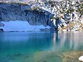
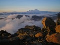
I was looking for a stellar area where I could really get out and stretch the wickets a bit. Robin Lakes seemed to meet my criteria and after some snooping around, I found that there are a lot of peaks in the general area that one can run up to make for a worthwhile day even if they are just Backcourt peaks. That said, this has to be about the nicest area in the Backcourt outside of the Enchantments. I had planned for a 4-peak day including Granite, Trico, and the east and west peaks of French Ridge. However, upon picking up Mike Collins on Saturday morning, I was quickly reminded that there was a 5th peak to be had. In addition to the main summit of Granite Mountain there is also its south peak coming in just a bit over seven grand.
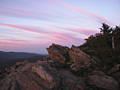
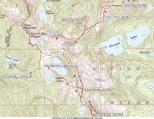 Granite, French Ridge, Trico 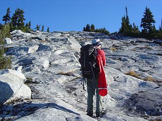 Below Robin lakes  Working Up to The Saddle...and Sun! 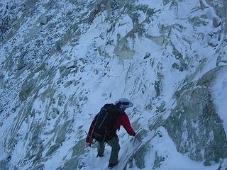 No Slipping Allowed 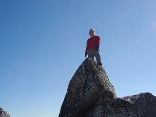 Mike on the Summit of Granite Mountain 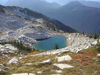 Unnamed 6600' Lake 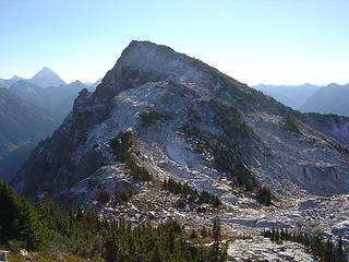 Granite Mountain, South Peak 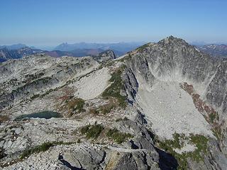 Granite Mountain from South Peak 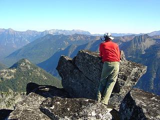 Mike on the Summit of the South Peak 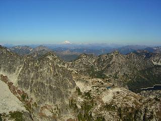 Views of French Ridge From the South Peak. West Peak of French Ridge Just Left of Center, East Peak Left of Center. 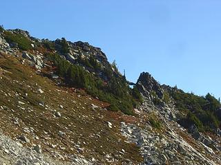 The Chockstone 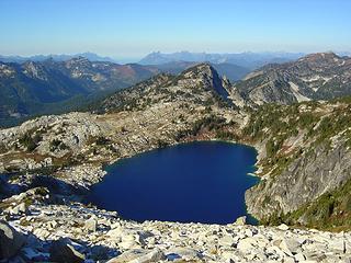 Robin Lake and Trico 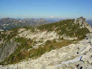 The Traverse Route 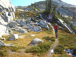 Traverse Above Robin Lakes 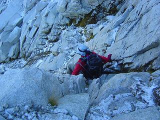 Working Towards the West Peak of French Ridge 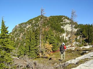 Mike and the West Peak of French Ridge 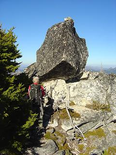 Mike and the Summit of the West Peak 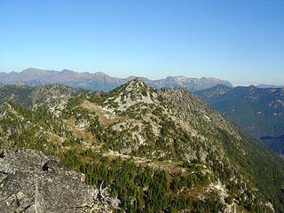 East Peak From West Peak 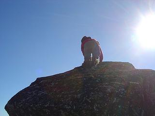 Contemplating the Descent off the West Peak 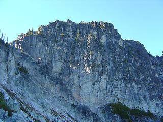 West Peak from the East 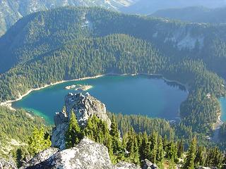 Lower Klonaqua From Summit of East Peak 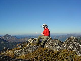 Mike on the East Peak 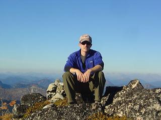 Taking a Long, 2 Minute Rest on the East Peak 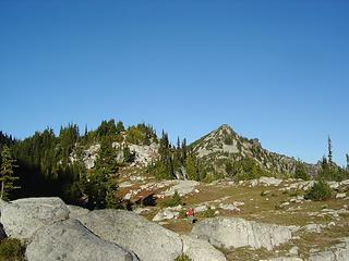 Returning From the East Peak 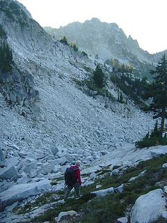 Working Towwards Trico. Trico in Center. 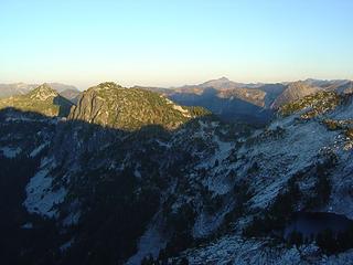 Evening Views From Trico. French Ridge High Points Left of Center. 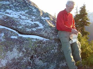 Mike Browses the Trico Register 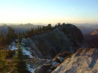 Trico Summit Ridge
|
| Back to top |
  
|
|
Type E
Member

Joined: 19 Aug 2006
Posts: 1381 | TRs | Pics
|
|
Type E
Member
|
Sun Oct 22, 2006 9:54 pm |
|
|
Most impressive day! It sure is a special area that holds many special memories.
|
| Back to top |
|
|
naturealbeing
Member

Joined: 05 Dec 2004
Posts: 1565 | TRs | Pics
Location: Great Mystery |
Hey! If you guys are expecting us to believe that you guys went out and intentionally tagged those 5 summits, your delusional. We all know you got lost and went from peak to peak looking for your way back to your truck. Just tell the truth we're all friends here. He He He!
Just KIDDING! What a great trip, TR, and pictures to boot. No doubt, one of the best trips October could have served up. You two had one stellar October day and an experience to cherish a life time.
Cheers!
Richard
|
| Back to top |
|
|
Randy
Cube Rat
Joined: 18 Dec 2001
Posts: 2910 | TRs | Pics
Location: Near the Siamangs |
|
Randy
Cube Rat
|
Mon Oct 23, 2006 12:10 pm |
|
|
NB, it was definitely an awesome day. Next time you're going to have to come with us!
|
| Back to top |
|
|
Tazz
Member

Joined: 27 Apr 2005
Posts: 7902 | TRs | Pics
|
|
Tazz
Member
|
Mon Oct 23, 2006 12:26 pm |
|
|
VERY nice!!! We did Granite in a day and that was a blast! Would like to get back up there and hit Trico and that ridge. Nice shots! 
|
| Back to top |
|
|
Tom
Admin
Joined: 15 Dec 2001
Posts: 17854 | TRs | Pics
|
|
Tom
Admin
|
Mon Oct 23, 2006 3:28 pm |
|
|
Nice, looks like quite a leg stretcher!
|
| Back to top |
|
|
Dayhike Mike
Bad MFKer
Joined: 02 Mar 2003
Posts: 10958 | TRs | Pics
Location: Going to Tukwila |
Ditto that... Sounds like a long but rewarding day!
"There is only one basic human right, the right to do as you damn well please. And with it comes the only basic human duty, the duty to take the consequences." -P.J. O'Rourke
"Ignorance is natural. Stupidity takes commitment." -Solomon Short
"There is only one basic human right, the right to do as you damn well please. And with it comes the only basic human duty, the duty to take the consequences." -P.J. O'Rourke
"Ignorance is natural. Stupidity takes commitment." -Solomon Short
|
| Back to top |
|
|
Sabahsboy
Member

Joined: 18 Jul 2006
Posts: 2484 | TRs | Pics
Location: SW Sno County |
|
Sabahsboy
Member
|
Mon Oct 23, 2006 7:06 pm Granite environs
|
|
|
Magnificent! Splendid peaks for splendid camera work by supermen!
Thank you.
|
| Back to top |
|
|
Randy
Cube Rat
Joined: 18 Dec 2001
Posts: 2910 | TRs | Pics
Location: Near the Siamangs |
|
Randy
Cube Rat
|
Mon Oct 23, 2006 8:01 pm |
|
|
| Dayhike Mike wrote: | | Ditto that... Sounds like a long but rewarding day! |
Indeed, but nothing like a good old DHM classic. We're about due for one of those aren't we?
|
| Back to top |
|
|
wildernessed
viewbagger

Joined: 31 Oct 2004
Posts: 9275 | TRs | Pics
Location: Wenatchee |
The read is exhausting enough and all of a sudden my knees hurt. 
Living in the Anthropocene
Living in the Anthropocene
|
| Back to top |
|
|
nuclear_eggset
Member

Joined: 02 Jul 2006
Posts: 2206 | TRs | Pics
Location: Eastside |
Wow! Just... Wow! That sounds like a *wonderful* trip. (I loved reading the report too.)
|
| Back to top |
|
|
Beave
Member

Joined: 21 Dec 2001
Posts: 276 | TRs | Pics
Location: Woodinville |
|
Beave
Member
|
Thu Oct 26, 2006 9:52 pm |
|
|
Great TR Randy.... I'm glad I opted out of this one; You guys would have smoked me!!  Looks like I missed some good company and a few good peaks. Catch up with you guys next time. Looks like I missed some good company and a few good peaks. Catch up with you guys next time.
|
| Back to top |
|
|
Jeff R
Closet hiker.
Joined: 10 Apr 2005
Posts: 972 | TRs | Pics
Location: Everret |
|
Jeff R
Closet hiker.
|
Fri Oct 27, 2006 2:57 pm |
|
|
Very nice! Thats a lot of distance during a short fall day.
Where is the chockstone? That was the only thing missing from the map and being able to walk on it looks fun.
|
| Back to top |
|
|
Randy
Cube Rat
Joined: 18 Dec 2001
Posts: 2910 | TRs | Pics
Location: Near the Siamangs |
|
Randy
Cube Rat
|
Fri Oct 27, 2006 3:23 pm |
|
|
Jeff, the chockstone is along the SW ridge of Granite Mountain (the north peak). It's a fun ride and worth a trip by itself...well almost.
|
| Back to top |
|
|
Jeff R
Closet hiker.

Joined: 10 Apr 2005
Posts: 972 | TRs | Pics
Location: Everret |
|
Jeff R
Closet hiker.
|
Fri Oct 27, 2006 3:44 pm |
|
|
Thanks, I will have to check it out someday. Great map and pictures!
|
| Back to top |
|
|
|
|
You cannot post new topics in this forum
You cannot reply to topics in this forum
You cannot edit your posts in this forum
You cannot delete your posts in this forum
You cannot vote in polls in this forum
|
Disclosure: As an Amazon Associate NWHikers.net earns from qualifying purchases when you use our link(s). |


