| Previous :: Next Topic |
| Author |
Message |
contour5
Member


Joined: 16 Jul 2003
Posts: 2963 | TRs | Pics
|
|
contour5
Member
|
 Tue Jul 19, 2022 9:38 pm |
|
|
Spent a few days wandering around in Stafford Creek Basin. I walked up toward Navaho and took a left; exiting the trail where it begins to ascend a gigantic mound of volcanic dust below the pass. It felt good stepping off the trail.
Followed the flowery creek up a ways, and then slid off into the pleasantly open forest.
Passed through lush pockets of meadow in the forest that were filled with flowers as I made my way up to the ridge to camp. There's still a lot of water here for mid July.
 olderthanIusedtobe, Slim, Nancyann, HitTheTrail, Bootpathguy, JimK, Get Out and Go, RichardJ, rubywrangler, jaysway, awilsondc, reststep, abkoch3, Tom, zimmertr olderthanIusedtobe, Slim, Nancyann, HitTheTrail, Bootpathguy, JimK, Get Out and Go, RichardJ, rubywrangler, jaysway, awilsondc, reststep, abkoch3, Tom, zimmertr
olderthanIusedtobe, Slim, Nancyann, HitTheTrail, Bootpathguy, JimK, Get Out and Go, RichardJ, rubywrangler, jaysway, awilsondc, reststep, abkoch3, Tom, zimmertr |
| Back to top |
  
|
|
John Morrow
Member

Joined: 03 Apr 2007
Posts: 1526 | TRs | Pics
Location: Roslyn |
Oh well, that's kind of a semi well kept secret since it is not actually on the USGS Topo map! It is also the only stand of subalpine larch in the Teanaway watershed save a few scattered individuals. The rest are on the Ingalls and Cle Elum watershed sides. I'd have to do some study but it may very well be the southernmost extent of Larix lyallii.
If anyone goes to camp up there, please don't have a campfire and camp on the bare serpentine gravels...Last time I was there I erased almost all presence of humanity that I could. "Pristine" is a relative term but it was looking pretty close, 2016?
Tell me, what is it you plan to do with your one wild and precious life?-Mary Oliver
A nation that continues year after year to spend more money on military defense than on programs of social uplift is approaching spiritual doom.
― MLK Jr.
Tell me, what is it you plan to do with your one wild and precious life?-Mary Oliver
A nation that continues year after year to spend more money on military defense than on programs of social uplift is approaching spiritual doom.
― MLK Jr.
|
| Back to top |
|
|
zimmertr
TJ Zimmerman
Joined: 24 Jun 2018
Posts: 1228 | TRs | Pics
Location: Issaquah |
|
zimmertr
TJ Zimmerman
|
Thu Jul 21, 2022 1:50 pm |
|
|
| John Morrow wrote: | | Oh well, that's kind of a semi well kept secret since it is not actually on the USGS Topo map! |
I was wondering why I couldn't find that tarn on topo after seeing the pictures. It's not the tarn that can be spotted from Earl, is it? Would someone mind sharing or PMing me the approximate location?
| John Morrow wrote: | | It is also the only stand of subalpine larch in the Teanaway watershed save a few scattered individuals. |
I assume Volcanic Neck is part of the Teanaway Watershed? There are a few Larix Lyalli off the west flank of the ridge on the Hardscrabble Creek trail. Right near a meadow with incredible and beautifully framed views of Stuart. Somewhere around here:
|
| Back to top |
|
|
Sculpin
Member

Joined: 23 Apr 2015
Posts: 1383 | TRs | Pics
|
|
Sculpin
Member
|
Thu Jul 21, 2022 1:58 pm |
|
|
Egads, I just got back from almost exactly this same hike, the only difference was we turned off the trail a bit lower. Like John, we wiped out a fire ring at the smaller tarn below the one shown in the images.
Boggy meadows all the way, with <1% of the expected biting insects.
Between every two pines is a doorway to the new world. - John Muir
Between every two pines is a doorway to the new world. - John Muir
|
| Back to top |
|
|
John Morrow
Member
Joined: 03 Apr 2007
Posts: 1526 | TRs | Pics
Location: Roslyn |
| zimmertr wrote: | | I assume Volcanic Neck is part of the Teanaway Watershed? There are a few Larix Lyalli off the west flank of the ridge on the Hardscrabble Creek trail. Right near a meadow with incredible and beautifully framed views of Stuart. Somewhere around here: |
Technically, Hardscrabble is in Chelan County in the Ingalls drainage. There are indeed nice larch stands across the north side of the Teanaway crest. It's kind of a meangingless tid bit that the larches around the upper Earl Basin are in the Teanaway drainage headwaters and in Kittitas County. I think aspect plays a significant role in where these southernmost range of larches are found. Very few on the Kittco side in the Teanaway headwaters while they are plentiful just over the crest in multiple north facing headwater basins of Ingalls drainage.
I seem to be full of mostly meaningless drivel today....as you were.
Tell me, what is it you plan to do with your one wild and precious life?-Mary Oliver
A nation that continues year after year to spend more money on military defense than on programs of social uplift is approaching spiritual doom.
― MLK Jr.
zimmertr
Tell me, what is it you plan to do with your one wild and precious life?-Mary Oliver
A nation that continues year after year to spend more money on military defense than on programs of social uplift is approaching spiritual doom.
― MLK Jr.
zimmertr
|
| Back to top |
|
|
contour5
Member
Joined: 16 Jul 2003
Posts: 2963 | TRs | Pics
|
|
contour5
Member
|
Thu Jul 21, 2022 2:45 pm |
|
|
This one?
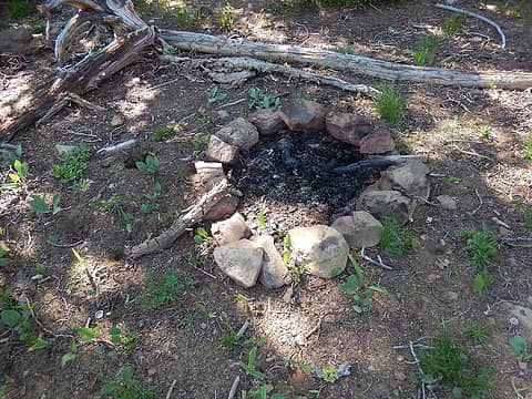 fire pit at lower tarn
|
| Back to top |
|
|
HitTheTrail
Member

Joined: 30 Oct 2007
Posts: 5460 | TRs | Pics
Location: 509 |
Nice set of photos. 
|
| Back to top |
|
|
jaysway
Member

Joined: 16 Jul 2020
Posts: 347 | TRs | Pics
|
|
jaysway
Member
|
Thu Jul 21, 2022 8:51 pm |
|
|
| zimmertr wrote: | | It's not the tarn that can be spotted from Earl, is it? |
It is. I remember noticing the larch trees in the basin from the top of Earl last summer and thinking it would make a great spot to visit during larch season. On my latest trip to the Teanaway I was surprised that I didn't see more larches south of the Teanaway crest since I had seen the ones near Earl.
A project that I would love to find more time to work on (after the hiking season) would be to build a granular distribution model of alpine larch trees in Washington. I've thought about where the westernmost larch strand could be (confirmed longitude of about -121.29165, but could there be other strands further west?), but not the southernmost! It looks like the latitude of the southernmost larch in the Earl strand is about 47.40577 and as far as I know that's the southernmost that I've heard of. There is, or perhaps was after the intense fires last summer, a lot of western larch in the Aix area. That area is the kind of place that I would think could support alpine larches, but probably doesn't.
zimmertr
zimmertr |
| Back to top |
|
|
Sculpin
Member
Joined: 23 Apr 2015
Posts: 1383 | TRs | Pics
|
|
Sculpin
Member
|
Fri Jul 22, 2022 7:22 am |
|
|
| contour5 wrote: | This one?
fire pit at lower tarn |
...no longer exists!
As John attests, the best camps are up on the rocky ribs with panoramic views, not down in the meadows by the tarns where you will find the few bugs that are there.
Jaysway wrote:
"westernmost larch strand could be (confirmed longitude of about -121.29165"
Where is that? I got to about -121.05 at Sprite Lake. 
Between every two pines is a doorway to the new world. - John Muir
Between every two pines is a doorway to the new world. - John Muir
|
| Back to top |
|
|
philfort
Member

Joined: 02 Sep 2003
Posts: 444 | TRs | Pics
Location: seattle |
|
philfort
Member
|
Fri Jul 22, 2022 9:30 am |
|
|
| jaysway wrote: | | A project that I would love to find more time to work on (after the hiking season) would be to build a granular distribution model of alpine larch trees in Washington. I've thought about where the westernmost larch strand could be (confirmed longitude of about -121.29165, but could there be other strands further west?), but not the southernmost! It looks like the latitude of the southernmost larch in the Earl strand is about 47.40577 and as far as I know that's the southernmost that I've heard of. There is, or perhaps was after the intense fires last summer, a lot of western larch in the Aix area. That area is the kind of place that I would think could support alpine larches, but probably doesn't. |
Here's the distribution shown on iNaturalist:
Of course that could include mid-identifications and planted ones.
The western most one listed there in Washington is at -121.79559 in Gifford Pinchot.
Several reports near Mt Aix.
jaysway
jaysway |
| Back to top |
|
|
olderthanIusedtobe
Member
Joined: 05 Sep 2011
Posts: 7709 | TRs | Pics
Location: Shoreline |
One late fall a few years ago I was shocked to see a clump of golden larches up above Falls Creek, near Carson, WA. Can't tell from that map posted, but that might be both the southern most and western most in WA.
|
| Back to top |
|
|
philfort
Member
Joined: 02 Sep 2003
Posts: 444 | TRs | Pics
Location: seattle |
|
philfort
Member
|
Fri Jul 22, 2022 9:52 am |
|
|
jaysway |
| Back to top |
|
|
contour5
Member
Joined: 16 Jul 2003
Posts: 2963 | TRs | Pics
|
|
contour5
Member
|
Fri Jul 22, 2022 10:05 am |
|
|
Thanks for the map!
What do you do with the black stuff cinders and ashes and soot? I sometimes see this material spread all over the ground in old campsites where fire pits have been decommissioned. Do you carry a shovel in order to bury the blackened material?
|
| Back to top |
|
|
jaysway
Member
Joined: 16 Jul 2020
Posts: 347 | TRs | Pics
|
|
jaysway
Member
|
Fri Jul 22, 2022 12:54 pm |
|
|
| Sculpin wrote: | | Where is that? I got to about -121.05 at Sprite Lake. |
Luna cirque, if you search this site you can find some excellent TRs with pictures of them. I've done a bit of searching in the past to look for pictures of that grove in the fall with golden needles and haven't found any. I would guess that few parties are climbing Luna in late September/early October, especially because early season snow in that area is going to stick around.
I'm fascinated by these strands closer to the crest that are seemingly isolated in contrast with the vast strands further to the east in the Pasayten, Chelan-Sawtooth, and Enchantments areas. Another isolated set of strands that some very close to being the westernmost are the ones in the Depot Creek area, they go to a longitude of about -121.27398 versus Luna's -121.29136. I wouldn't be surprised if there are other strands even further west that have yet to be discovered or documented though  ! If anybody knows of any strands even further west please share here (alpine, not western). ! If anybody knows of any strands even further west please share here (alpine, not western).
|
| Back to top |
|
|
jaysway
Member
Joined: 16 Jul 2020
Posts: 347 | TRs | Pics
|
|
jaysway
Member
|
Fri Jul 22, 2022 12:57 pm |
|
|
| olderthanIusedtobe wrote: | | One late fall a few years ago I was shocked to see a clump of golden larches up above Falls Creek, near Carson, WA. Can't tell from that map posted, but that might be both the southern most and western most in WA. |
While it's possible, I would be surprised if those weren't western larches. There are a bunch on the east side of Hood: https://wyeastblog.org/2018/10/22/the-larch/
|
| Back to top |
|
|
|
|


