| Previous :: Next Topic |
| Author |
Message |
Dayhike Mike
Bad MFKer

Joined: 02 Mar 2003
Posts: 10958 | TRs | Pics
Location: Going to Tukwila |
Wow. Talk about a doozy of a dayhike.
My dad and I and RialtoSol headed out Hwy 2 early Saturday morning (07/05/03). We dropped a vehicle up the east fork of the Miller River and took my car around to the west fork of the Foss River. Hit the trail around 7:15am amid overcast skies, occasional fog, and a light smattering of raindrops. I was thankful for the cooler weather, especially during the switchbacks up from Trout Lake. Met two parties on their way out on the way up from Trout.
Took the sidetrip to Malachite and unfortunately found it completely fogged in. Backtracked and continued on to Copper Lake. Decided to break for a little snack here at Copper and took in yet another fog shrouded lake. (10am)
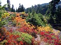
Pushed on to Little Heart Lake... The trail through the meadows has always been bad, but seemed extra muddy and heavily trampled for some reason. Thankfully, it seemed that the fog was beginning to lift at Little Heart. (11am)
Up and over the ridge to Big Heart Lake, came across three more parties leaving Big Heart "because of all of the fog". 20 minutes later we arrived at Big Heart and found that the morning mists were gone, the sun was out in full splendor, and the waters of the lake were brilliant and inviting. Filtered some water at the outlet and then pressed on. (12pm)
Headed up and around the next ridge to view down to Angeline... Had our first patches of snow across the trail here, but it's still easy to follow and most of it has melted out. Great views down to this long alpine lake...the cliffy headwall on the north shore is particularly stunning when you're balancing on the edge and peering down into it.
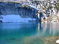
Headed up onto the ridge between Angeline and Big Heart, heading for the tarn overlooking Chetwood. Again, crossed a few patches of snow, but didn't hit heavy snowpack until we were coming back up and out of the saddle at the south end of the lakes. Our long trek up was rewarded with the incredible blues of the slowly melting tarn. Definitely a sight for sore eyes. Had a seat and discussed our next move. (2pm)
Dropped down to the shores of Chetwoot and headed west along the shoreline. Chetwoot, unlike the other lakes, was still frozen over but showing signs of melt. The route around the lake is really poorly defined, and the heavy runoff from melting snow made the steep and slippery slope that much worse. The trail re-formed as we headed back up into Chetwoot Pass (the saddle on the west end of Chetwoot). This section was very slow going. (4pm)
At Chetwoot Pass, enjoyed another tarn, and had great views of Camp Robber Valley, Gus Lake, and Cecils Lake. Dropped down the talus slope into the valley and headed back up talus to another saddle on the northwest flank of Wild Goat Peak. Had great views of Big Snow Mountain and just a glimpse of Gold Lake. (6pm)
Traversed across more talus and rounded Gold Lake. Incredible views of the lake and surrounding mountains, but the bugs were starting to get bad and so we packed up quickly and headed down. (7:30pm)
Trail was well defined to the valley floor and then it just disappeared. Beckey indicated the route was supposed to be on the west side of this first stretch of river, but we found nothing until the small pond where the route went up and over the ridgeline. (Although, I could swear I saw markings of trail on the opposite (east) bank). A long bushwhacking session got us to the junction with the route to Fools Gold Lake. (10pm)
Crossed the river and entered into familiar territory (thanks to an exploratory trip the previous weekend). Another 30 minutes and we pulled out flashlights and proceeded to bushwhack down to the first falls, just above Lake Dorothy. Lost the trail just before the decent to the valley floor and decided to call it a night. (1:15am)
Temperatures dropped to the high-30s but luckily there was no more rain. Threw on our packs at 4:45am and provoked sore, stiff, and weary bodies to rise and continue home. Got to the south end of Lake Dorothy at 5am and had great views of mists rising off the waters in the pre-dawn hours.
Left the lake at 6am and had a particularly slow decent due to sore and sensitive feet. Finally made it to the trailhead at 7am. My dad pointed out that technically it was still a dayhike since we'd been gone less than 24 hours. After a short ride in RialtoSol's truck, we were back to my car and on our way home at 7:45am. Quite an adventure!
Many thanks to RialtoSol and my dad for their patience and encouragement through the course of this trip. This hike was more than I was physically ready for and their strength and persistence definitely kept me going.
"There is only one basic human right, the right to do as you damn well please. And with it comes the only basic human duty, the duty to take the consequences." -P.J. O'Rourke
"Ignorance is natural. Stupidity takes commitment." -Solomon Short
"There is only one basic human right, the right to do as you damn well please. And with it comes the only basic human duty, the duty to take the consequences." -P.J. O'Rourke
"Ignorance is natural. Stupidity takes commitment." -Solomon Short
|
| Back to top |
  
|
|
pappt-
Guest

|
|
pappt-
Guest
|
 Sun Jul 06, 2003 9:31 pm |
|
|
Most excellent trip and report.  Exceptional. Exceptional.
|
| Back to top |

|
|
Dayhike Mike
Bad MFKer
Joined: 02 Mar 2003
Posts: 10958 | TRs | Pics
Location: Going to Tukwila |
And now, the pictures that tell the r-r-rest of the story...
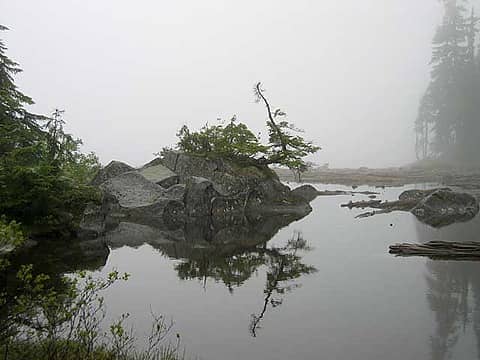 Fog on Lake Malachite. 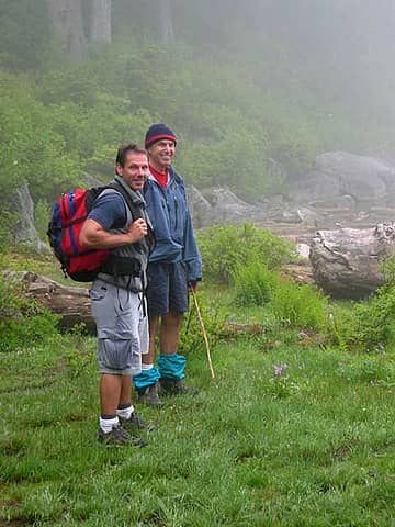 Two of our intrepid explorers. RialtoSol (left) and my fearless father (right). 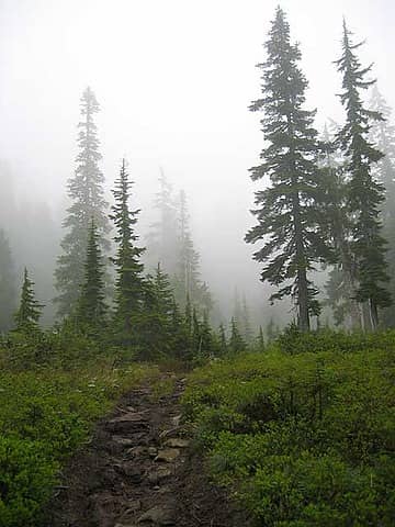 The trail from Copper Lake up to Little Heart. 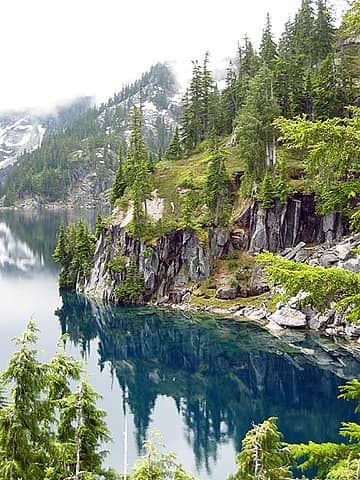 First Views of Big Heart Lake. 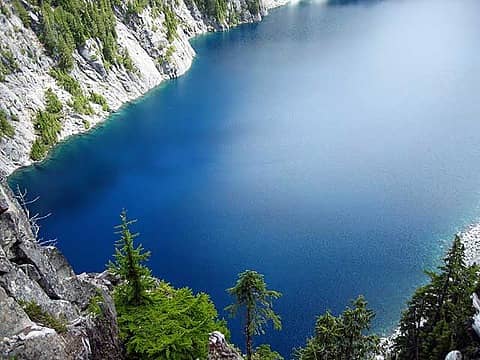 Looking down into the depths of Lake Angeline. 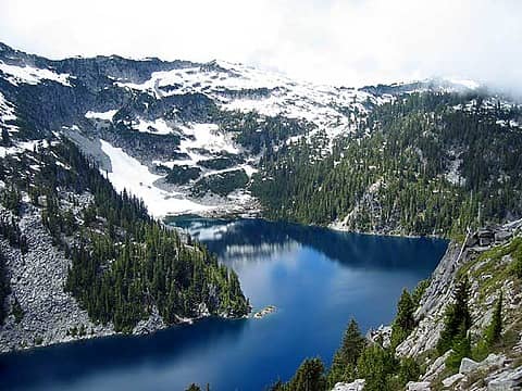 A view of Big Heart Lake and point 5929 from the ridge between Angeline and Big Heart. 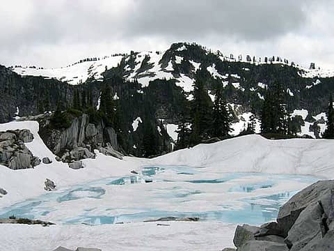 The glorious tarn above Chetwoot Lake. 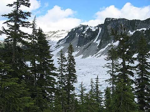 Looking back at Chetwoot Lake from Chetwoot Pass. 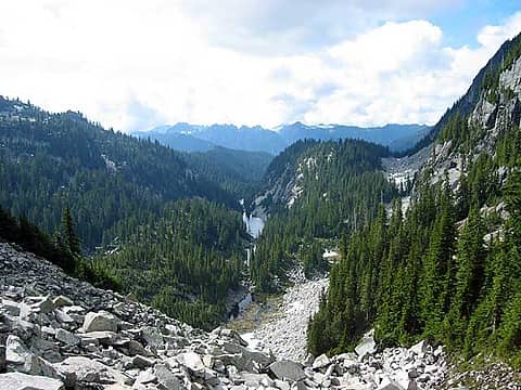 Descending into Camp Robber Valley from Chetwoot Pass. 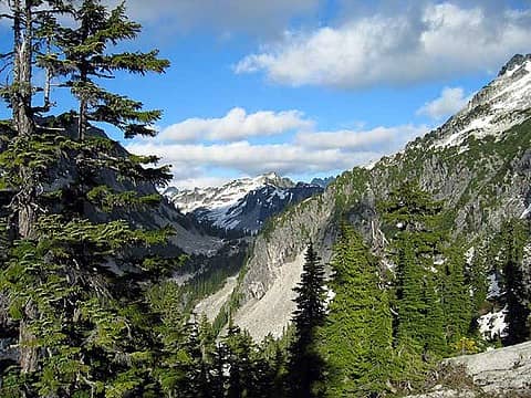 Looking back at Chetwoot Pass from the flanks of Wild Goat Peak. 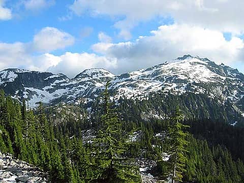 Big Snow Mountain (right) and point 6131 (left). Gold Lake is just out of view on the left.
"There is only one basic human right, the right to do as you damn well please. And with it comes the only basic human duty, the duty to take the consequences." -P.J. O'Rourke
"Ignorance is natural. Stupidity takes commitment." -Solomon Short
"There is only one basic human right, the right to do as you damn well please. And with it comes the only basic human duty, the duty to take the consequences." -P.J. O'Rourke
"Ignorance is natural. Stupidity takes commitment." -Solomon Short
|
| Back to top |
|
|
Backpacker Joe
Blind Hiker

Joined: 16 Dec 2001
Posts: 23956 | TRs | Pics
Location: Cle Elum |
Well I miust say that I am impressed! You're crazy, but I'm impressed! Dante and I have done a few of those treks! The trouble is, the Foss area to too damn beautiful to leave it so soon!
Nice shots!
TB
"If destruction be our lot we must ourselves be its author and finisher. As a nation of freemen we must live through all time or die by suicide."
Abraham Lincoln
"If destruction be our lot we must ourselves be its author and finisher. As a nation of freemen we must live through all time or die by suicide."
Abraham Lincoln
|
| Back to top |
|
|
Tom
Admin
Joined: 15 Dec 2001
Posts: 17855 | TRs | Pics
|
|
Tom
Admin
|
Mon Jul 07, 2003 10:42 am |
|
|
Great trip report and pics. I must say I'm impressed by that little camera of yours.
|
| Back to top |
|
|
Larry
Member

Joined: 22 Feb 2003
Posts: 1084 | TRs | Pics
Location: Kitsap |
|
Larry
Member
|
Mon Jul 07, 2003 10:57 am |
|
|
An enjoyable and well written report, complete with beautiful photos. What a nice adventure you had, and it was all of your own making. Your group evidently consists of upbeat and happy people, all enjoying the fruits of exploration. This is what it's all about, and epitomizes the whole point of this forum, in my opinion.
Thanks a lot, and looking forward to the next report!
|
| Back to top |
|
|
Dayhike Mike
Bad MFKer
Joined: 02 Mar 2003
Posts: 10958 | TRs | Pics
Location: Going to Tukwila |
Thanks guys...I appreciate the encouragement.
The Foss area's long been one of my favorites and I'd love to see more of it...but it looks like I'm going to have to do the responCible thing, plan for 2-3 days and pack accordingly.
I'd definitely like to spend more time around Gold Lake and on Big Snow Mountain, and still haven't had the full tour of the feckless Necklass Valley...but the year is still young and I'll be ready to go again soon enough.
"There is only one basic human right, the right to do as you damn well please. And with it comes the only basic human duty, the duty to take the consequences." -P.J. O'Rourke
"Ignorance is natural. Stupidity takes commitment." -Solomon Short
"There is only one basic human right, the right to do as you damn well please. And with it comes the only basic human duty, the duty to take the consequences." -P.J. O'Rourke
"Ignorance is natural. Stupidity takes commitment." -Solomon Short
|
| Back to top |
|
|
|
|
You cannot post new topics in this forum
You cannot reply to topics in this forum
You cannot edit your posts in this forum
You cannot delete your posts in this forum
You cannot vote in polls in this forum
|
Disclosure: As an Amazon Associate NWHikers.net earns from qualifying purchases when you use our link(s). |


