Jamin Smitchger
Member


Joined: 02 Oct 2004
Posts: 673 | TRs | Pics
Location: Pullman |
At class 5.2, Twin Peaks is the only technical summit in the Wallowas. Only one summit actually remains. The other collapsed down the side of the mountain in the early 1900s. The spire of Twin Peaks is composed of basalt, which is harder than the broken underlying rock, but like much of the rock in the Wallowas, it is crumbling. A subpeak is currently slightly undercut, and it will probably fall down the mountain in the near geologic future. The rock is solid in some places and very loose in others, which makes this peak difficult to protect and at a high risk from rockfall.
I decided to give Twin Peaks a try this past Saturday because it looked like an interesting summit. Because I was going solo, I only planned to attempt the summit if I felt comfortable doing the rock.
I reached the Hurricane Creek Trailhead at about 9am after driving 3 hours. About a quarter mile up the Hurricane Creek Trail, I took the fork to the right up toward Falls Creek. I quickly began to sweat profusely so I ended up completing the climb in my long johns. No big deal since I didnt see anyone on the trail the entire day. I reached the mine, a shallow drift at about 7600 feet, about 2.5 hours later.
From that point the trail was completely covered in snow. I began an ascending traverse through scree and stunted trees toward a rocky 40-45 degree snowfield leading up toward the summit ridge. Along the way, I saw a small ice avalanche down an ice shute, and I was surprised to see that there was still a slowly decomposing pitch of about 100 feet of WI4. I will definitely try to spearhead an expedition to this areas ice next winter.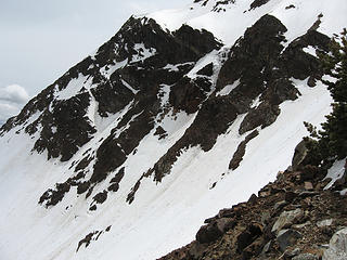 100 foot pitch of rotten WI4 in upper right center of photo 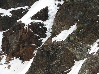 ice 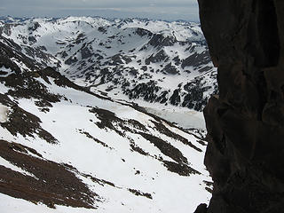 Frances Lake and the Wallowas 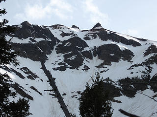 Icy northeast face of twin peaks  Ascent Route 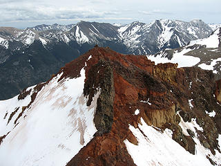 the other summit 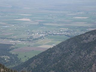 Joseph, Oregon one mile below 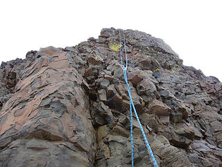 the summit Frances Lake and the Wallowas 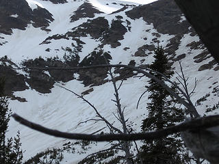 Ascent and descent route is on right.
|


