| Previous :: Next Topic |
| Author |
Message |
Bryan K
Shameless Peakbagger


Joined: 29 Sep 2005
Posts: 5129 | TRs | Pics
Location: Alaska |
|
Bryan K
Shameless Peakbagger
|
 Mon Jun 25, 2007 3:30 pm |
|
|
A suggestion from a lookout friend of mine, so what the heck, why not.
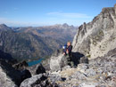
Found the trailhead with minimal difficulty.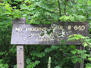 Trailhead sign, or is it a shotgun target? 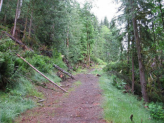 "Trail" from trail to logging road back to trail.  they were in my pack, nice and dry) they were in my pack, nice and dry)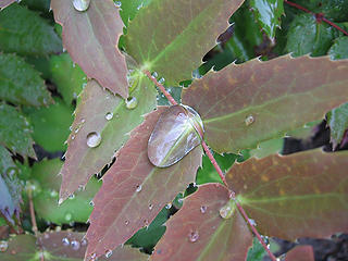 Drop of water. 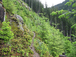 Trail through a clearcut 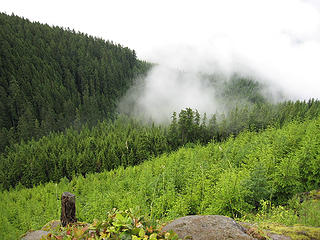 View from clearcut trail 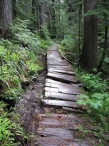 Uneven boards on boardwalk. 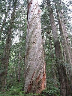 Twisty dead tree 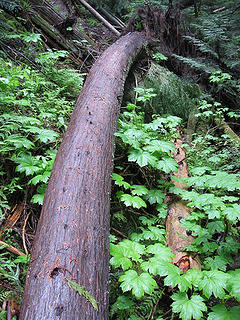 Bendy fallen tree 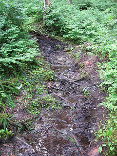 Muddy trail 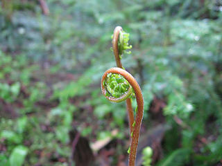 Fern 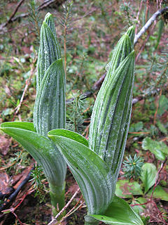 New growth sprouting up everywhere. 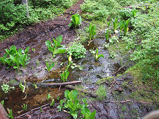 Skunk cabbage, it stunk real bad on my way back down. 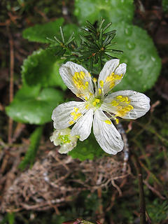 Flower 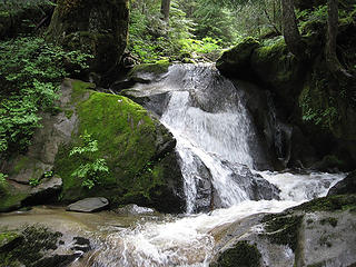 Small falls along the trail 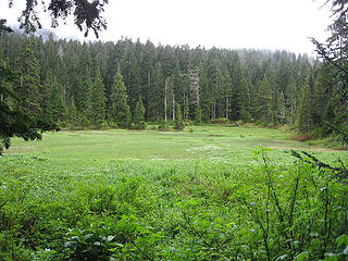 Swampy meadow near cutoff for Myrtle Lake. 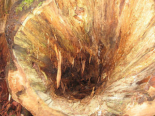 Inner workings of a tree. 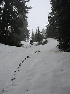 Steep section of trail covered with snow. 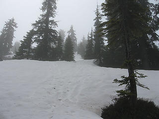 Snowy route 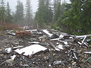 What's left of the lookout. 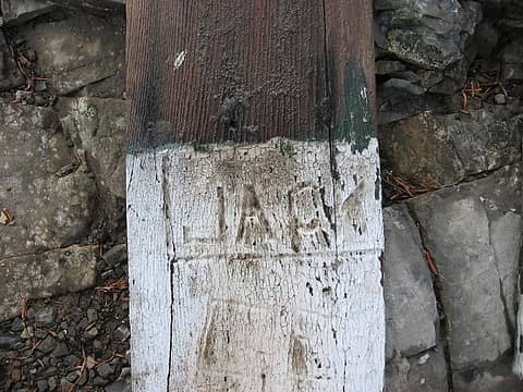 Initials inscribed into a piece of cedar siding that was on the lookout 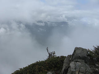 View from summit 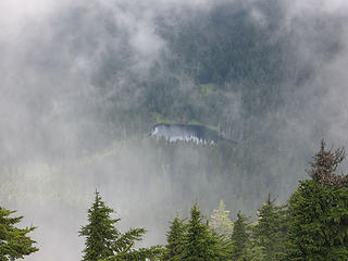 Myrtle Lake through the clouds 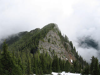 Peak above Myrtle Lake. Unsure if it has a name 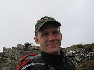 Me at the summit 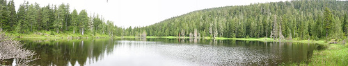 Myrtle Lake Pano  What the heck was I thinking when I was cruising down the trail, it's not like I was in a rush to get home for a wedding or something. I knew that I couldn't stop to nurse it because it would swell and lock up (past experience) after about 10 minutes I paused to get 3 Ibuprophen and kept going. I was in a pickel, I had to get down fast to avoid the inevitable knee locking, but that faster I tried to go the more it hurt. Periodically I would pause for a few seconds and when I resumed my knee kicked my butt. I made it down to my car and finally checked on my knee, no cuts but it was swelling a bit, thank god for Ibuprophen.
Despite a hurt knee and some poor judgement in traveling speed I had a great hike and found my new favorite hwy to find hikes along. Oh yeah, my feet were wet when I got to the car, what was that I said about Gore Tex?
Car to summit 2.5 hours
Summit time 40 minutes
Decent with Myrtle Lake sidetrip 2hours 20 minutes
Elevation gain- 3200' What the heck was I thinking when I was cruising down the trail, it's not like I was in a rush to get home for a wedding or something. I knew that I couldn't stop to nurse it because it would swell and lock up (past experience) after about 10 minutes I paused to get 3 Ibuprophen and kept going. I was in a pickel, I had to get down fast to avoid the inevitable knee locking, but that faster I tried to go the more it hurt. Periodically I would pause for a few seconds and when I resumed my knee kicked my butt. I made it down to my car and finally checked on my knee, no cuts but it was swelling a bit, thank god for Ibuprophen.
Despite a hurt knee and some poor judgement in traveling speed I had a great hike and found my new favorite hwy to find hikes along. Oh yeah, my feet were wet when I got to the car, what was that I said about Gore Tex?
Car to summit 2.5 hours
Summit time 40 minutes
Decent with Myrtle Lake sidetrip 2hours 20 minutes
Elevation gain- 3200'
|
| Back to top |
  
|
|
GeoTom
Member

Joined: 19 May 2005
Posts: 3215 | TRs | Pics
Location: Earth |
|
GeoTom
Member
|
Mon Jun 25, 2007 3:42 pm |
|
|
Nice job Bryan  I recall either me or my wife slipping on one of those wet boardwalk sections last year on this trail. Maybe both of us. The bootpaths were better, even if they were muddy. Hope you recover soon.
|
| Back to top |
|
|
Kat
Turtle Hiker
Joined: 05 Oct 2003
Posts: 2560 | TRs | Pics
|
|
Kat
Turtle Hiker
|
Mon Jun 25, 2007 4:39 pm |
|
|
OUCH! Take care of that knee, Bryan. Ya need it for a long time....
|
| Back to top |
|
|
Quark
Niece of Alvy Moore

Joined: 15 May 2003
Posts: 14152 | TRs | Pics
|
|
Quark
Niece of Alvy Moore
|
Mon Jun 25, 2007 7:30 pm |
|
|
re: bendy fallen tree. The top of that tree is heavier than the trunk. The topbind on that sucker's gotta be major - it'll shoot up like a rubberband soon as the weight is taken off, i.e. cut.
Don't nobody ever walk on a sloping puncheon!
If you want to go back this fall to see the view, you might be able to locate a partner. (summer = mosquitoes of biblical porportions).
"...Other than that, the post was more or less accurate."
Bernardo, NW Hikers' Bureau Chief of Reporting
"...Other than that, the post was more or less accurate."
Bernardo, NW Hikers' Bureau Chief of Reporting
|
| Back to top |
|
|
Magellan
Brutally Handsome

Joined: 26 Jul 2006
Posts: 13116 | TRs | Pics
Location: Inexorable descent |
|
Magellan
Brutally Handsome
|
Tue Jun 26, 2007 6:06 am |
|
|
Heal up quick, Bryan. You may have been distracted by boxer adjustments.
|
| Back to top |
|
|
dacker
little black dots

Joined: 27 Sep 2006
Posts: 738 | TRs | Pics
Location: the end of my rope |
|
dacker
little black dots
|
Fri Jul 06, 2007 6:33 pm July 6 Update
|
|
|
Mt. Higgins 2 1/2 weeks later
Inspired by Bryan's TR and wanting a conditioning hike other than the same tired old North Bend and Mountain Loop hills, I decided to see how much things have changed since Bryan went there on June 25.
Most of the snow in his photos is gone. There is patchy snow from 4500' to the lookout, but not enough to require an ice ax. Still plenty of mud wallows, but things are getting drier by the day.
Here are some photos with the clear views that Bryan didn't have on his hike:
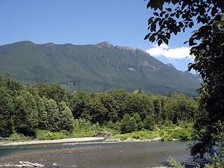 Mt. Higgins from NF Stillaguamish River 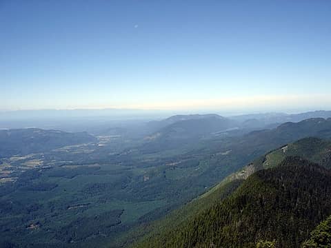 View west towards Puget Sound 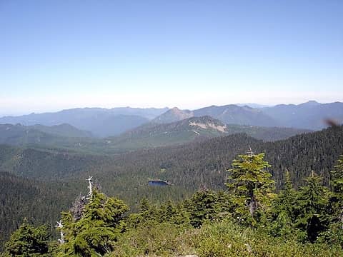 View NW showing Myrtle Lake 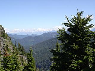 View North showing Mt. Shuksan 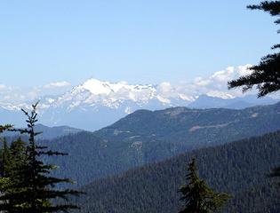 Mt. Shuksan with zoom 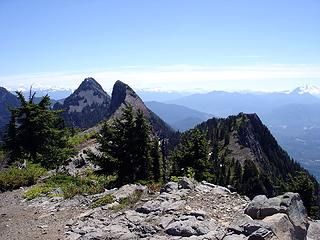 Higgins main summit (rear) and Skadulgwas Peak (center) 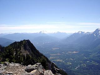 View East showing Glacier Peak and Mt. Pugh 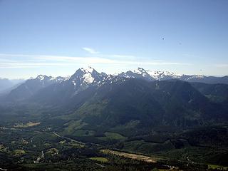 View SE showing Whitehorse and Three Fingers 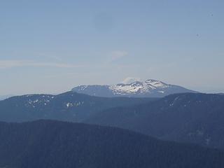 Zoom of Rainier and Pilchuck
We don't stop hiking because we grow old; we grow old because we stop hiking. --Finis Mitchell
We don't stop hiking because we grow old; we grow old because we stop hiking. --Finis Mitchell
|
| Back to top |
|
|
Layback
Cascades Expatriate

Joined: 16 Mar 2007
Posts: 5712 | TRs | Pics
Location: Back East |
|
Layback
Cascades Expatriate
|
Fri Jul 06, 2007 7:49 pm |
|
|
Nice pics Dacker.
Anyone know the scoop on the main summit and it's rating? Is it 4th class or 5th class (and if so, does it take pro)? Harvey and Manning aren't too specific about this I recall correctly.
|
| Back to top |
|
|
Matt
Tea, Earl Grey, Hot

Joined: 30 Jan 2007
Posts: 4307 | TRs | Pics
Location: Shoreline |
|
Matt
Tea, Earl Grey, Hot
|
Fri Jul 06, 2007 7:52 pm |
|
|
| Bryan wrote: | | when I resumed my knee kicked my butt. |
What kind of contortionist are you?
As beacons mountains burned at evening. J.R.R. Tolkien
As beacons mountains burned at evening. J.R.R. Tolkien
|
| Back to top |
|
|
Quark
Niece of Alvy Moore
Joined: 15 May 2003
Posts: 14152 | TRs | Pics
|
|
Quark
Niece of Alvy Moore
|
Fri Jul 06, 2007 7:57 pm |
|
|
"...Other than that, the post was more or less accurate."
Bernardo, NW Hikers' Bureau Chief of Reporting
|
| Back to top |
|
|
iggybabs
XCLBR

Joined: 03 Dec 2020
Posts: 2 | TRs | Pics
Location: Arlington |
i've been looking into alternatives to the peak to the east of the summit and it seems that there is a trail that veers off to the left of the higgins trail after the Myrtle lake. I love this underused trail and despite the 4/5 mile walk up the rd (and new rockslide), this is a great old trail..
to be continued..
|
| Back to top |
|
|
|
|
You cannot post new topics in this forum
You cannot reply to topics in this forum
You cannot edit your posts in this forum
You cannot delete your posts in this forum
You cannot vote in polls in this forum
|
Disclosure: As an Amazon Associate NWHikers.net earns from qualifying purchases when you use our link(s). |


