| Previous :: Next Topic |
| Author |
Message |
Matt
Tea, Earl Grey, Hot


Joined: 30 Jan 2007
Posts: 4307 | TRs | Pics
Location: Shoreline |
|
Matt
Tea, Earl Grey, Hot
|
 Wed Jul 11, 2007 1:27 am |
|
|
Dates: June 30 July 1, 2007
Party: Matt, Mike T, Fay P, Beth B
Destination: Hozomeen North Summit 8066 via Sunrise 2 trail and Hozomeen Ridge
If youve ever looked up the east shore of Ross Lake, you cant miss Hozomeen. Its distinctive double summit rises in prominent isolation at the north end of the lake. Ive always thought its steep dark rocky south faces looked rather lonely and inhospitable, but the north side turned out to be quite congenial for this trip.
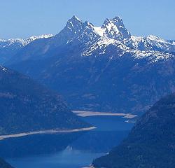 Hozomeen viewed from the south (April 2004) 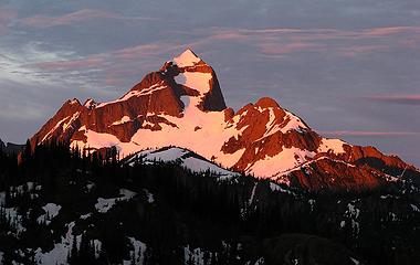 Hozomeen North summit viewed from the north at max alpenglow (7/1/07) 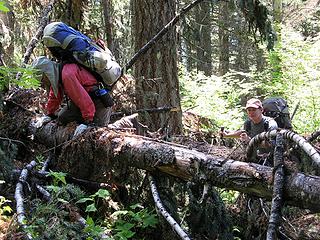 Logs blocking the trail 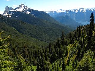 Trail opening out (but still heading away from Hozomeen) 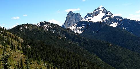 Our camp will be on the rounded lefthand bump on the ridge 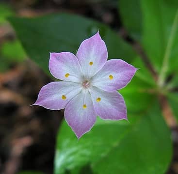 Unknown flower in the woods 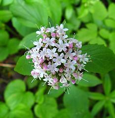 Valerian 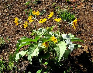 Balsamroot 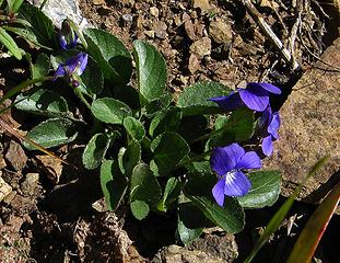 Unknown flower on drier ground 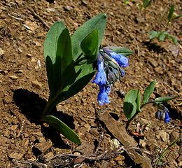 Long-flowered bluebell? 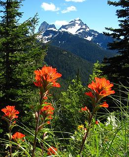 Paintbrush with view of Hozomeen 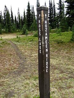 Trail junction on Hozomeen Ridge 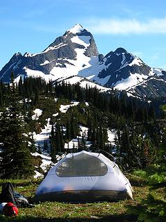 Bedroom with a View 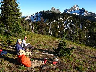 Dining Room 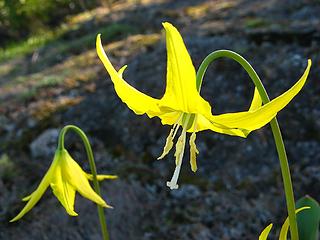 Glacier Lilies near Camp 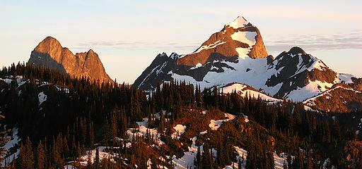 Hozomeen at Sunset 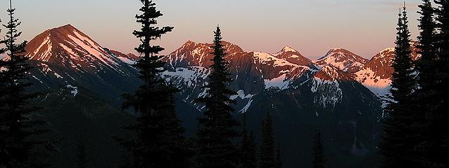 Freezeout area peaks at sunset 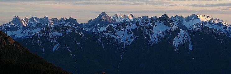 Pickets at sunset 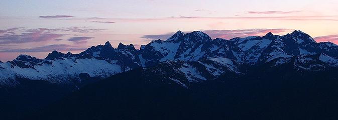 Chilliwack peaks (Mox, Spickard, Custer, Rahm) at sunset 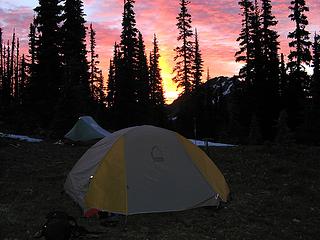 Camp at sunrise 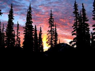 Pre-dawn sunrise clouds 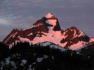 Pink Hozomeen 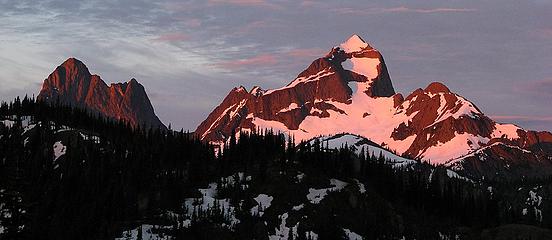 South & North Hozomeen 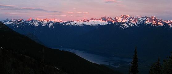 West Ross Lake Skyline 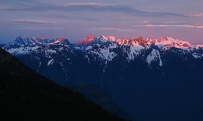 Pickets 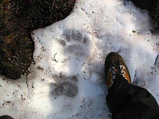 Bear track on the trail 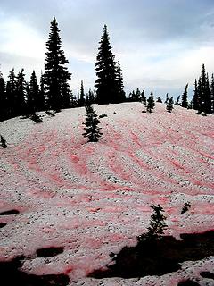 Bloodstained snow 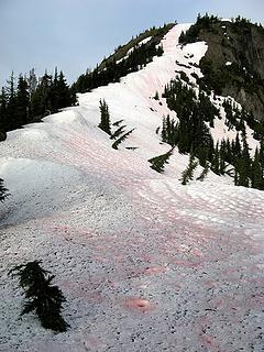 Snowfield up to Point 6500 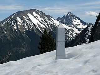 Monument 74 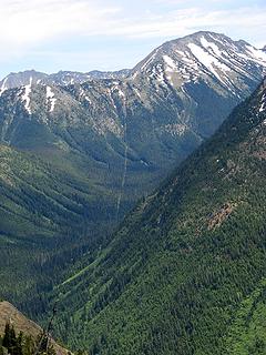 Border cut stretching east from Monument 74 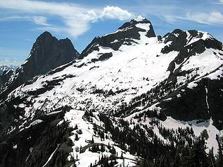 Looking down from Hill 6500 to Hill 6000 and Hozomeen 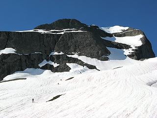 Heading up Hozomeen 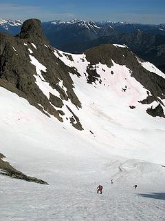 Looking down from the top of the lower snowfield 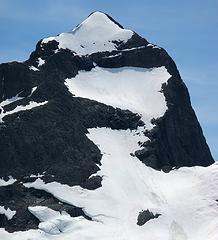 Route on upper Hozomeen, note tracks up lower snowfield and righthand part of upper snowfield 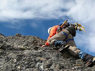 Fay on the rock crest 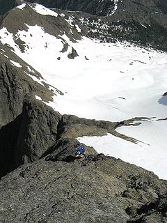 Looking down the rock to Beth 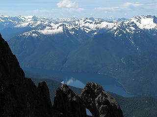 Ross Lake from partway up the rock crest 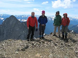 Summit Matt, Mike, Beth, Fay 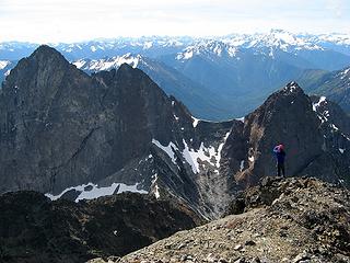 Mike viewing the route up South Hozomeen 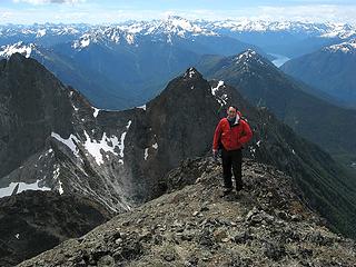 Matt on North Hozomeen, with South Hozomeen, Jack Mtn, & Ross Lake 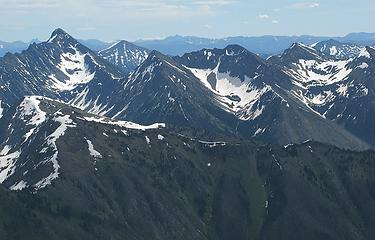 Castle, Freezout, etc 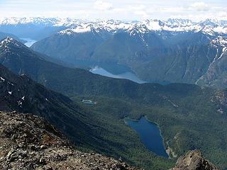 Hozomeen Lake & Ross Lake 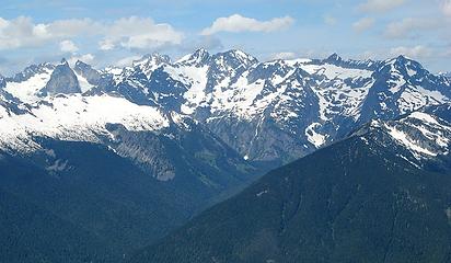 7 labels Chilliwack Group Moxes, Redoubt, Spickard, Custer, Rahm (labeled) 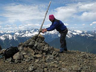 Mike improving the summit cairn 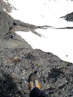 Hesitating to step down the step rock crest 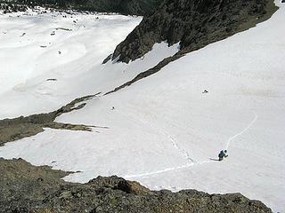 Descending the middle snowfield 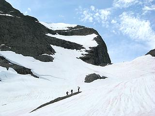 Break amid the lower snowfield 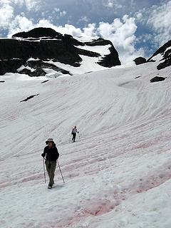 Puffy clouds above the summit 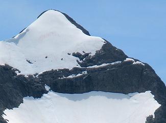 If you look close, you can see our tracks at lower right and the summit cairn at top 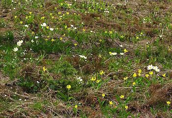 Glacier lilies and anemone along the ridge 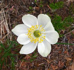 Anemone? 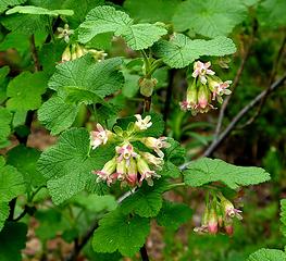 ?  Flower meadows 1 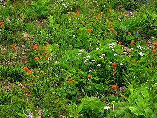 Flower meadows 2 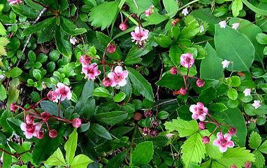 ? 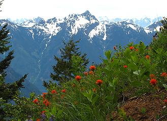 Paintbrush and "Controversy" Peak
As beacons mountains burned at evening. J.R.R. Tolkien
As beacons mountains burned at evening. J.R.R. Tolkien
|
| Back to top |
  
|
|
Trevor
Member

Joined: 31 Jan 2004
Posts: 1562 | TRs | Pics
Location: Edmonds, WA |
|
Trevor
Member
|
Wed Jul 11, 2007 1:29 am |
|
|
 I've wanted to visit this area since I've started hiking basically. I appreciate this report.
|
| Back to top |
|
|
Magellan
Brutally Handsome

Joined: 26 Jul 2006
Posts: 13116 | TRs | Pics
Location: Inexorable descent |
|
Magellan
Brutally Handsome
|
Wed Jul 11, 2007 7:03 am |
|
|
Wow! Thanks for one of the best trip reports I have ever read. I really felt like I was there, even being nervous on the rock. I can't even decide which picture is my favorite, although I am leaning towards the Pickets. Thanks for sharing this special place. 
|
| Back to top |
|
|
Mesahchie Mark
A Lerxst

Joined: 10 May 2005
Posts: 700 | TRs | Pics
Location: In Wonderland |
Just added Hozomeen to the "list". Thanks for the TR, Matt, good stuff!
|
| Back to top |
|
|
Dean
(aka CascadeHiker)

Joined: 02 Mar 2002
Posts: 1967 | TRs | Pics
Location: ex Kennewick, Wa & Lehi Utah |
|
Dean
(aka CascadeHiker)
|
Wed Jul 11, 2007 9:56 am |
|
|
I've got 50 of the Washington p2k's but not any like Hozomeen. Awesome report and pics and congrat's on getting a tough peak.  Congrat's to the rest of your group and especially Fay, she never ceases to amaze me. Congrat's to the rest of your group and especially Fay, she never ceases to amaze me. 
|
| Back to top |
|
|
cartman
Member
Joined: 20 Feb 2007
Posts: 2800 | TRs | Pics
Location: Fremont |
|
cartman
Member
|
Wed Jul 11, 2007 2:32 pm |
|
|
Great pics as always, Matt. I was surprised that you could do that much of the route on snow. Another trip for next year!
|
| Back to top |
|
|
Matt
Tea, Earl Grey, Hot
Joined: 30 Jan 2007
Posts: 4307 | TRs | Pics
Location: Shoreline |
|
Matt
Tea, Earl Grey, Hot
|
Thu Jul 12, 2007 12:51 am |
|
|
I added labels to the summit photos for the Pickets and summit pan photo.
As beacons mountains burned at evening. J.R.R. Tolkien
As beacons mountains burned at evening. J.R.R. Tolkien
|
| Back to top |
|
|
summitseeker
Member
Joined: 31 Mar 2006
Posts: 138 | TRs | Pics
Location: Seattle |
That's killer! Congrats! 
"Find out who you are and then do it on purpose."
www.summitroutes.com : Guidebook to the 100 highest peaks in Washington
"Find out who you are and then do it on purpose."
www.summitroutes.com : Guidebook to the 100 highest peaks in Washington
|
| Back to top |
|
|
Eric
Peak Geek

Joined: 21 Oct 2002
Posts: 2062 | TRs | Pics
Location: In Travel Status |
|
Eric
Peak Geek
|
Thu Jul 12, 2007 8:18 am |
|
|
Great TR and pics with the pink light on Hozomeen. From your report it sounds a lot easier than I'm sure it was. Congrats on a good summit.
|
| Back to top |
|
|
seawallrunner
dilettante

Joined: 27 Apr 2005
Posts: 3307 | TRs | Pics
Location: Lotusland |
holy absolute wow - the adventure, the photos, the trip report... .wow.
|
| Back to top |
|
|
Tom_Sjolseth
Born Yesterday

Joined: 30 May 2007
Posts: 2652 | TRs | Pics
Location: Right here. |
Sweet TR!! I hope you guys kicked some steps for us 
|
| Back to top |
|
|
Rigafari
Member

Joined: 22 Sep 2005
Posts: 98 | TRs | Pics
|
|
Rigafari
Member
|
Thu Jul 12, 2007 8:32 pm |
|
|
Nice work!!! I wonder if those cliff bands fill in during winter?????
|
| Back to top |
|
|
seawallrunner
dilettante
Joined: 27 Apr 2005
Posts: 3307 | TRs | Pics
Location: Lotusland |
Say Matt, where did you start your Skyline 2 hike? From the Silver-Skagit logging road, or from Lightning Lakes in Manning Park?
|
| Back to top |
|
|
Matt
Tea, Earl Grey, Hot
Joined: 30 Jan 2007
Posts: 4307 | TRs | Pics
Location: Shoreline |
|
Matt
Tea, Earl Grey, Hot
|
Fri Jul 13, 2007 12:59 am |
|
|
| Eric wrote: | | From your report it sounds a lot easier than I'm sure it was. |
Actually it was easier than it looks. Most of the views of the north face look very steep, because you're looking at it straight on from a distance. But when you get right up to it, it lays back a lot. On snow, we only had to face in and kick steps directly upward for about a hundred feet. The rest we could kick switchbacks. Beyond that, the rock was indeed steep for the first 50 feet, then laid back a lot. The pictures below show the difference in apearance from afar and up close.
Route looking steeper when viewed from Point 6500 Route actually much less steep when you're on it. | Rigafari wrote: | | Nice work!!! I wonder if those cliff bands fill in during winter????? |
I'm sure the route is totally snow-covered in winter.
| seawallrunner wrote: | | Say Matt, where did you start your Skyline 2 hike? From the Silver-Skagit logging road, or from Lightning Lakes in Manning Park? |
We started from Silver-Skagit, in Skagit Valley Provincial Park.
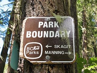 Crossing from Skagit Valley to Manning Park, about 1.5 hours out from the trailhead.
As beacons mountains burned at evening. J.R.R. Tolkien
As beacons mountains burned at evening. J.R.R. Tolkien
|
| Back to top |
|
|
ree
Member

Joined: 29 Jun 2004
Posts: 4399 | TRs | Pics
|
|
ree
Member
|
Fri Jul 13, 2007 7:13 am |
|
|
Wow, thanks for that! Great tr and awesome pics.
|
| Back to top |
|
|
|
|
You cannot post new topics in this forum
You cannot reply to topics in this forum
You cannot edit your posts in this forum
You cannot delete your posts in this forum
You cannot vote in polls in this forum
|
Disclosure: As an Amazon Associate NWHikers.net earns from qualifying purchases when you use our link(s). |


