| Previous :: Next Topic |
| Author |
Message |
yukon222
Member


Joined: 12 Mar 2007
Posts: 1893 | TRs | Pics
|
|
yukon222
Member
|
 Sun Jul 29, 2007 7:14 pm |
|
|
The weather finally cooperated and gave me a very nice weekend hiking day. Left the almost full Dingford trailhead at 7:30am Saturday. Nice cool temps with sunshine streaming down thru the forest in a few spots. Even the Devils Club was enjoying the day.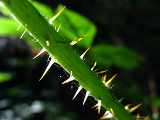 devil's club warming up for the day 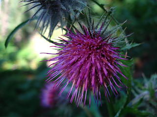 thistle 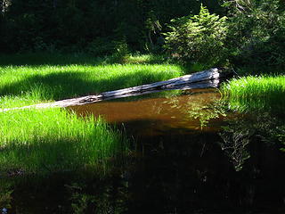 myrtle lake area 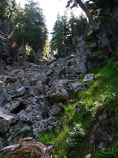 big snow outflow talus 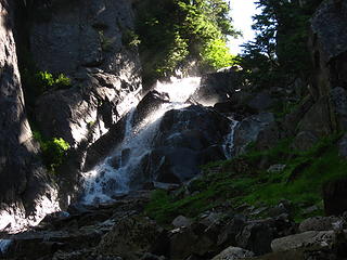 big snow outflow ascent 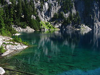 big snow lake 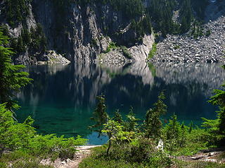 big snow lake reflection 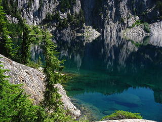 big snow lake's color 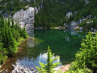 snowflake lake2 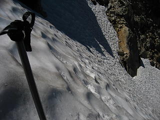 far right side traverse 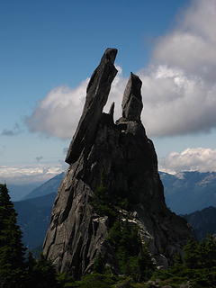 falcon & owl rock 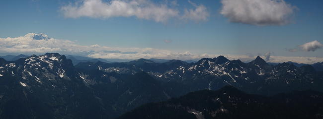 rainier & company.jpg 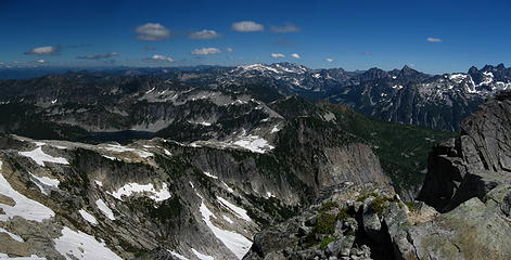 mt daniel pano.jpg 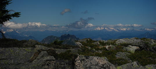 glacier from big snow.jpg 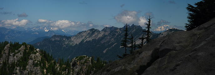 glacier first look pano.jpg 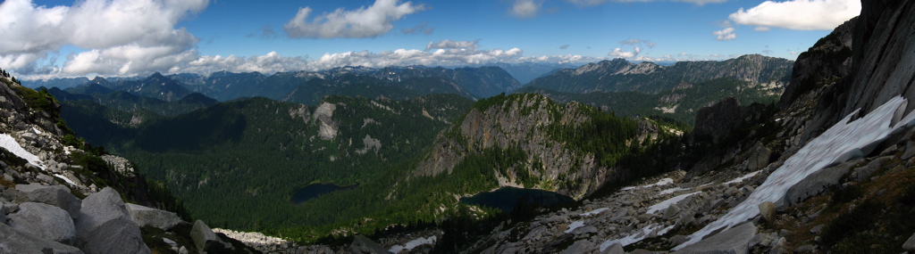 glacier big snow lake pano.jpg  big snow summit 360.jpg 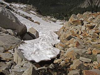 descending upper snowfield 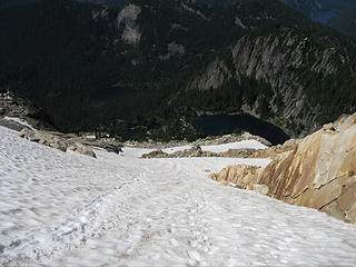 descending upper snowfield2 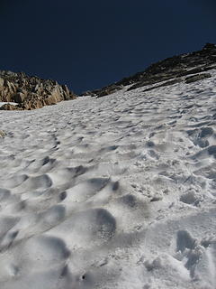 upper snowfield2 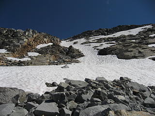 upper snowfield.jpg 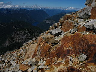 looking north 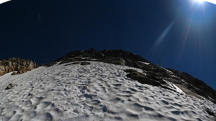 big snow snowfield pano.jpg 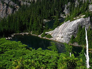 snowflake lake 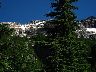 big snow upper field 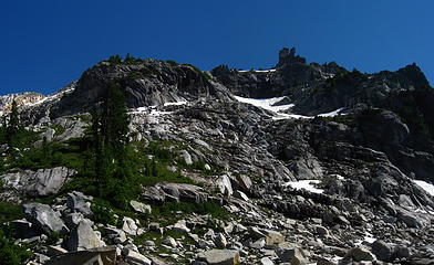 big snow upper cliffs.jpg 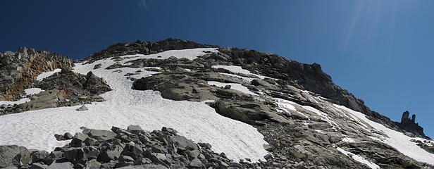 big snow upper approach.jpg 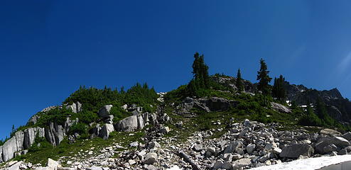 big snow middle.jpg 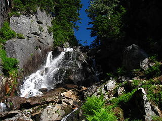 big snow outlet afternoon 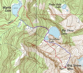 big snow route.jpg
|
| Back to top |
  
|
|
Backpacker Joe
Blind Hiker

Joined: 16 Dec 2001
Posts: 23956 | TRs | Pics
Location: Cle Elum |
Nice report and great pics Yuk. All in one day. Krazie Klimbers!
"If destruction be our lot we must ourselves be its author and finisher. As a nation of freemen we must live through all time or die by suicide."
Abraham Lincoln
"If destruction be our lot we must ourselves be its author and finisher. As a nation of freemen we must live through all time or die by suicide."
Abraham Lincoln
|
| Back to top |
|
|
1k
Member

Joined: 29 Jun 2004
Posts: 606 | TRs | Pics
Location: Ballard |
|
1k
Member
|
Sun Jul 29, 2007 8:35 pm |
|
|
Life is short, hike hard...
|
| Back to top |
|
|
Yet
Member

Joined: 23 Apr 2005
Posts: 2634 | TRs | Pics
Location: Happily Ever After |
|
Yet
Member
|
Mon Jul 30, 2007 9:28 am |
|
|
Steve, glad you got a very nice weekend hiking day. Sounds like you had quite an adventure. Your photos are incredible! Thanks for sharing them.
I like the reds in this one. 
looking north big snow snowfield pano.jpg
|
| Back to top |
|
|
Magellan
Brutally Handsome

Joined: 26 Jul 2006
Posts: 13116 | TRs | Pics
Location: Inexorable descent |
|
Magellan
Brutally Handsome
|
Mon Jul 30, 2007 9:50 am |
|
|
Big Snow really does have tremendous views. Thanks for trailblazing. I must get there soon.
|
| Back to top |
|
|
yukon222
Member
Joined: 12 Mar 2007
Posts: 1893 | TRs | Pics
|
|
yukon222
Member
|
Mon Jul 30, 2007 2:51 pm |
|
|
| Magellan wrote: | | Big Snow really does have tremendous views. Thanks for trailblazing. I must get there soon. |
If I did it again, I think I'd repeat my tracks to the Big Snow creek talus field, ie, go past the southern tip of the lake and then do an ascending traverse thru a smaller talus field before intersecting the main Big Snow talus around 4000' or so. Less brush to bash thru, plus you go thru it on a diagonal rather than straight up the slope.
In terms of getting around the middle set of cliffs above Snowflake Lake, I'd probably do the longer wrap around the lake thru the trees to get to the middle plateau and then follow the long snowfield finger up to the red rocks along the far left edge of the summit ridge. The far right stuff was more open but when the upper snowfield is gone, it will probably be a steep cliffy ascent.
The intial view of Big Snow Lake when you scramble up thru the creek outlet is amazing and definitely worth it. 
|
| Back to top |
|
|
Schmidt Altitude
Whippet Entourage

Joined: 28 Mar 2007
Posts: 803 | TRs | Pics
Location: The Quah |
Love that area Yukon - you captured it very well. We eyed the traverse from Snowflake up to Big Snow when we were there a couple years ago....definitely looked interesting. Looks like a really great summit, we especially love the unique rock formations. Glad you had a succesful day out! 
"Forest 101: These big wood stick things are called trees. The big rocks are called mountains, and the little rocks are their babies." Elliott from Open Season
"Forest 101: These big wood stick things are called trees. The big rocks are called mountains, and the little rocks are their babies." Elliott from Open Season
|
| Back to top |
|
|
yukon222
Member
Joined: 12 Mar 2007
Posts: 1893 | TRs | Pics
|
|
yukon222
Member
|
Mon Jul 30, 2007 6:17 pm |
|
|
Here's a better 360 summit pano hosted at Imageshack which allows much bigger files than Flickr.
Shot with Canon PowerShot SD700 IS at 2007-07-30
|
| Back to top |
|
|
wildernessed
viewbagger

Joined: 31 Oct 2004
Posts: 9275 | TRs | Pics
Location: Wenatchee |
Gorgeous ! 
Living in the Anthropocene
Living in the Anthropocene
|
| Back to top |
|
|
umbrella lady
umbrella lady

Joined: 10 May 2007
Posts: 66 | TRs | Pics
Location: issaquah |
Great trip report and photos and it was nice to meet you on the summit, we were really surprised to see a person up there, since there weren't other tracks that we saw except from the guy camping at Big Snow lake. Certainly agree that the hike is worth it to see the lake!
|
| Back to top |
|
|
forest gnome
Forest nut...
Joined: 24 Apr 2003
Posts: 3520 | TRs | Pics
Location: north cascades!! |
This whole area SUCKS BEANS!!! Don't go there...just stay at myrtle lake!!
those pics are all photoshopped.....actually I hope to get to snowflake soon 
|
| Back to top |
|
|
Mtn Dog
Technohiker

Joined: 01 Aug 2004
Posts: 3336 | TRs | Pics
Location: Bellevue, WA |
|
Mtn Dog
Technohiker
|
Mon Jul 30, 2007 8:45 pm |
|
|
Yukon,
Beckey's Guide talks about summiting from the lower lakes - it's great to read a TR from someone who has now done it! H. Hound showed me this view when I was up on the ridge last year.
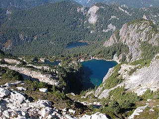 Myrtle, Big Snow, and Snowflake Lakes 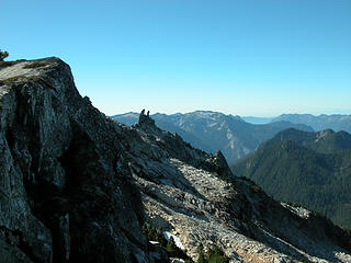 Dog's teeth looking west from the ridge
Footprints on the sands of time will never be made sitting down.
Footprints on the sands of time will never be made sitting down.
|
| Back to top |
|
|
yukon222
Member
Joined: 12 Mar 2007
Posts: 1893 | TRs | Pics
|
|
yukon222
Member
|
Mon Jul 30, 2007 10:06 pm |
|
|
Thanks, Mtn Dog. I actually thought the route from the lakes was going to be halfway established but it sure didn't appear that way to me.
The way it was going over there on the far right ridge, I thought I was going to have to go up the Teeth. (So that is what they are called, didn't know that.) Here's another rock photo, plus the face which I didn't attempt even though the final summit ridge is right there. I actually went to the far right edge of the ridge but the wind buffeting the trees as it hit the 1000' drop-off was way too "interesting". So I backed down the face 200' and went up a steep snow finger to the final ridge.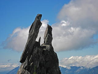 falcon & owl.jpg 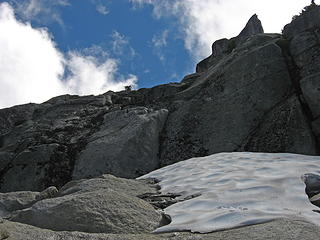 just below summit ridge
|
| Back to top |
|
|
Magellan
Brutally Handsome
Joined: 26 Jul 2006
Posts: 13116 | TRs | Pics
Location: Inexorable descent |
|
Magellan
Brutally Handsome
|
Mon Jul 30, 2007 10:07 pm |
|
|
I liked your 'Falcon and Owl' caption better.
|
| Back to top |
|
|
Matt
Tea, Earl Grey, Hot

Joined: 30 Jan 2007
Posts: 4307 | TRs | Pics
Location: Shoreline |
|
Matt
Tea, Earl Grey, Hot
|
Mon Jul 30, 2007 10:53 pm |
|
|
Falcon & owl is a great title for that photo. It really looks like those shapes.
Scary devil's club photo also.
Thanks for the info on this route.
As beacons mountains burned at evening. J.R.R. Tolkien
As beacons mountains burned at evening. J.R.R. Tolkien
|
| Back to top |
|
|
|
|


