| Previous :: Next Topic |
| Author |
Message |
jhiker
Member

Joined: 24 Jul 2006
Posts: 286 | TRs | Pics
Location: Mill Creek |
|
jhiker
Member
|
 Mon Aug 06, 2007 7:12 pm |
|
|
Thought that I'd do a new report rather than tag on the end of Whitebark's.
I've been curious about this area since I first heard about it last winter. Also realizing that I'm running out of summer so moved this up on the rotation. I'm glad I did. The only regret is that I didn't make this into an overnighter as I feel a need to further explore this whole area.
Nonetheless, Trapper Peak makes for a real nice day hike.
A few notes.
I'd heard that the road was real rough and that a high clearance vehicle was needed. Found that that wasn't really the case as the road is actually not too bad for a road to a Cascades trailhead. The only catch is that there are a couple of areas on the road that are steep and gravelly. I need the 4WD to get up them. The road is about 5 miles and begins right after MP 117 on Route 20.
The first one point something miles of the trail are completely flat. The only tricky part is where the trail crosses Thornton Creek. Look for a wood pile just to the right of where the trail crosses the creek and you should be O.K.
Right as the trail is about to leave the Thornton Creek drainage it enters thicker woods and begins to head uphill. The trail isn't too hard to walk on. Just as it starts to get serious about getting you uphill, it relaxes the grade. This is the general rule. For the most part the trail tracks through forest getting steep and then not so steep again. Eventually a meadow is reached, then a stream crossing and then the National Park Boundary marker. From this point trail gets steeper and switchbacks are encountered.
After this, a signed junction is reached. To the right is the way to Trapper Peak. Straight ahead to the lakes. A short ways past this, the Trapper route climbs the side of a ridge and continues up. Right where it gains the ridge crest look for a side path branching to the left. This is the wrong way to Trapper but leads to a real nice view of lower Thornton Lake and the peaks around it including Trapper Peak.
After looking at all this go back to the ridge crest and a little bit past this, there is a pretty steep uphill section as the path leaves this lower ridge and climbs up to the middle part of the scramble ridge. This is mostly straight up but there are good feet and hand holds to use. Once past this, it is pretty straightforward to the summit. You can do most of it without using hands at all.
The summit area is pretty expansive and there is a lot of room to spread out on. On Saturday, a large group of maybe 10 people was leaving as I was heading up.
Saturday never did clear out completely and the higher peaks remained shrouded in clouds so no good views of the Pickets. However what could be seen was sensational. Whitebark's photos taken a few days earlier show the upper lake to be fully frozen over. On Saturday, it was almost half-melted out and will probably be completely so by next weekend.
After spending some time on the summit, headed down to the lower lake. The trail is pretty steep, rocky and rooty going down. The worst part was having to back up from the lake.
Here are some photos. Some more at:
http://www.flickr.com/photos/48897736@N00/sets/72157601254357046/
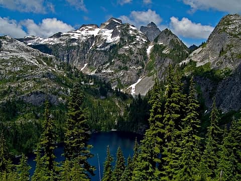 Thornton Lake from saddle 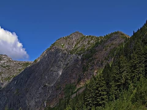 Trapper Peak from Saddle 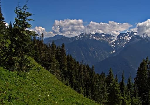 View across Skagit Valley 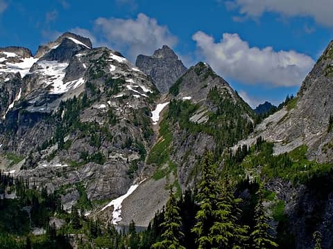 Thornton Peaks and Mt Triumph 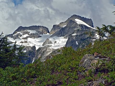 Thornton Peaks 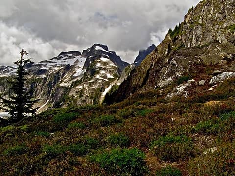 0803010 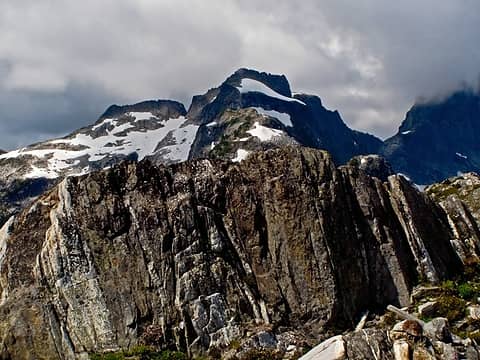 0803019 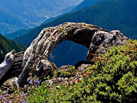 0803017 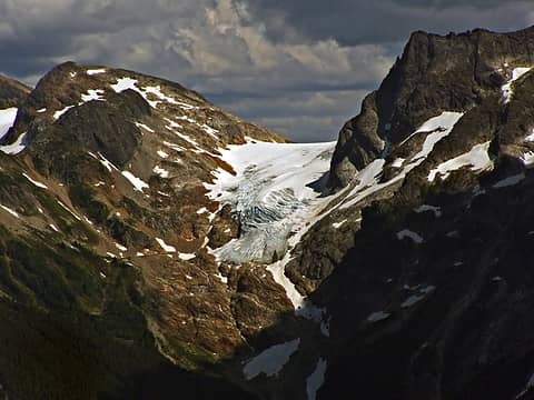 Neve Glacier 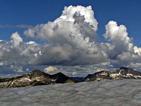 0803028 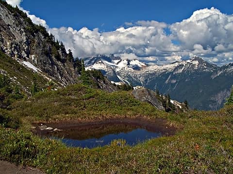 0803030 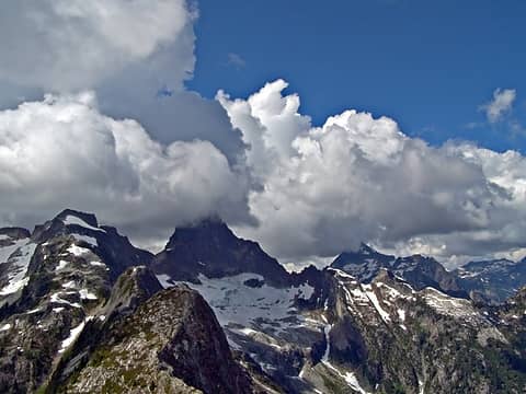 0803029 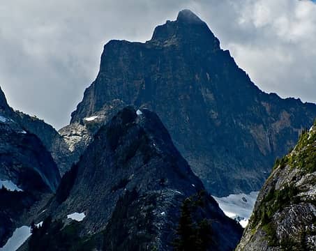 Mt Triumph 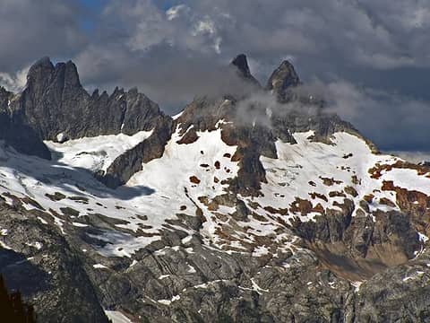 Macmillan Spires 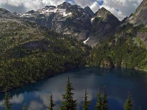 Lower Thornton Lake view 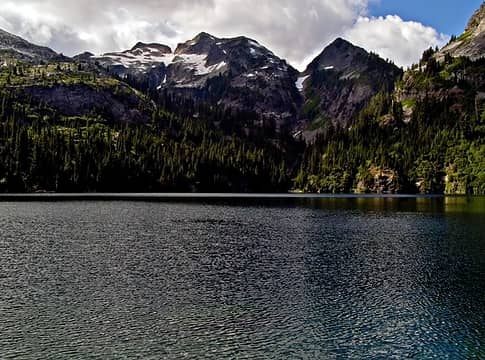 Lower Thornton Lake 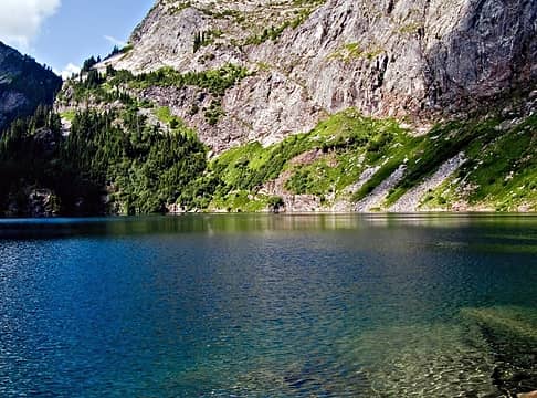 Lower Thornton Lake
|
| Back to top |
  
|
|
peppersteak'n'ale
Member

Joined: 28 Aug 2003
Posts: 1996 | TRs | Pics
|
Wow, nice pics, I think I'll add this one to the list
You mentioned the clouds obscured views of other peaks, but I've found sometimes they can enhance what you actually can see. I think you hit it right on this one 
|
| Back to top |
|
|
Mtn Dog
Technohiker

Joined: 01 Aug 2004
Posts: 3336 | TRs | Pics
Location: Bellevue, WA |
|
Mtn Dog
Technohiker
|
Mon Aug 06, 2007 8:49 pm |
|
|
Beautiful area! This hike was going to be our fallback plan if we ran into traffic or got a late start to the Canyon Creek TH last Saturday. I first saw the valley leading up to these lakes when I was mapping the right-of-way for SR 20 while working for WSDOT many years ago. Have to get there one day sooner or later. 
Footprints on the sands of time will never be made sitting down.
Footprints on the sands of time will never be made sitting down.
|
| Back to top |
|
|
|
|
You cannot post new topics in this forum
You cannot reply to topics in this forum
You cannot edit your posts in this forum
You cannot delete your posts in this forum
You cannot vote in polls in this forum
|
Disclosure: As an Amazon Associate NWHikers.net earns from qualifying purchases when you use our link(s). |


