| Previous :: Next Topic |
| Author |
Message |
gratenate
Member


Joined: 25 Aug 2007
Posts: 70 | TRs | Pics
Location: In the wake of the Mighty Mendenhall |
Malachite - Chetwoot - Emerald Lakes on the Foss River Loop
Hike Stats:
Days: sometime in late August 2005, three nights
Miles: roughly 28
Elevation Gain: ~6000 feet
Rating: Challenging
Day 1
As I sit in my cube and gaze at my computers wallpaper picture of Tank Lakes at dusk, my mind wanders back to our four-day loop hike last summer. Our plan was to tour the west and east drainages of the Foss River, just a few miles southwest of Skykomish in Washingtons Cascade mountain range. Id visited the area several times in the past, but this time we were adding a twist; we were going to link the two river drainages with approximately one and half days of off-trail hiking.
We started the hike in our usual fashion, getting out of town much later than we hoped, running into county fair traffic around Monroe, stopping just one more time at the liquor store, and, finally, stopping at the nearby Ranger Station after becoming unsure of exactly where we were supposed to leave Highway 2. Yes, we were a pack of men, without a map, loose in a mini-van (a surprisingly comfortable vehicle for this sort of trip). Eventually, we reached the trailhead at the end of USFS Road 68 and piled out of the vehicle to the hissing of crickets, or was it the nearby river? No, it was our right rear tire that had been punctured by glass in the parking area just before we halted. So, after further delay mounting the baby-spare onto the van, we finally headed out on the trail. It was past 1pm but, knowing our groups tendencies for slow starts fairly well, we had only planned on a short 3.75 miles to our first night camp on the shores of Lake Malachite. That was the good news, the bad news was that the trailhead lay at a mere 1600 above sea level whereas Lake Malachite rests at an elevation of nearly 4100. While we would only be hiking 3.75 miles with our fully loaded packs that afternoon, we would be climbing nearly 2500.
Almost immediately after setting out, we crossed the wilderness boundary. Now we were really getting someplace. A third of a mile later we came to a crossing of the West Fork of the Foss River. Last years anemic snowfall in the Cascade had reduced the river to a dry streambed with a small trickle of water moving among and under the river rocks between pools. Sure, it was August, but the low water levels couldnt be good for the fish. After crossing what was left of the river on a log bridge, the trail continued to meander peacefully through the forest for another half-mile. We were feeling good, but knew the easy part was just about over. Signaled by a small rockslide and an immense old growth douglas fir, the uphill began.
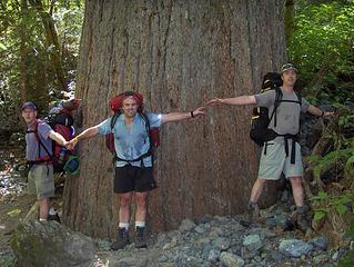 3 Amigos at Big Tree 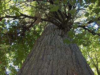 Big Tree 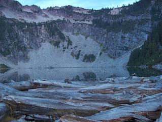 Lake Malachite 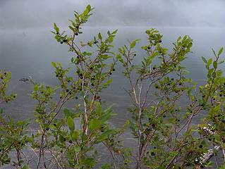 Blue Berries at MYSTy Lake Malachite 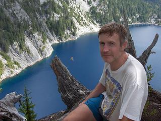 Nate over Angeline Lake 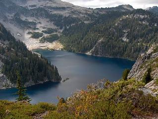 Big Heart Lake 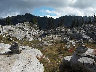 Pass to Chetwoot Lake 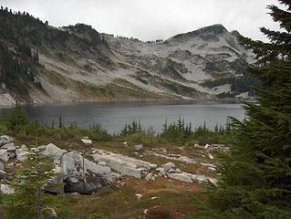 Chetwoot Lake 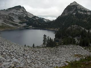 Ascending the Rockslide over Chetwoot 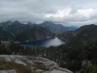 Angeline Lake 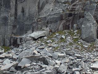 Hiking in the Danger Zone 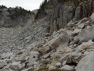 Gap to Pea Soup Pond 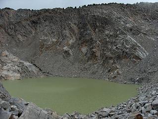 Pea Soup Pond 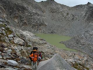 Ascending from Pea Soup Pond 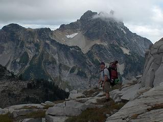 Scouting the Route 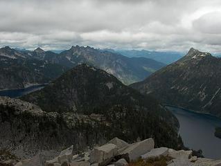 From Whenst we Came 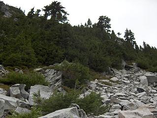 Sneaky Trail thru Scrubby Trees on Iron Cap Mtn 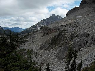 Our Path Ahead 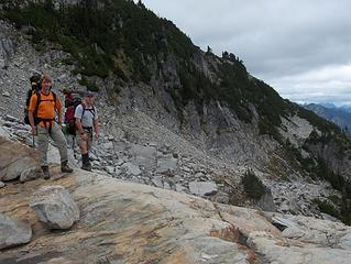 Traverse Below Iron Cap Mtn 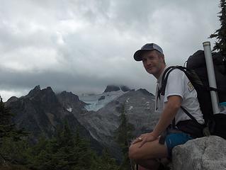 Resting with Summit Chief Mtn 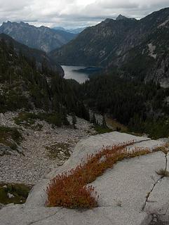 Rock Garden and Otter Lake 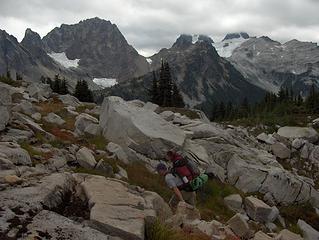 Pushing up the Saddle to Tank Lakes 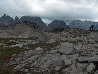 Tank Lakes Plain 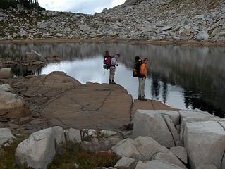 Tank Lake 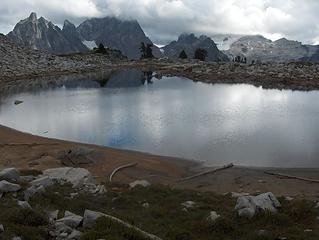 Tank Lake looking South 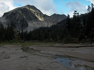 Empty Clowdy Lake 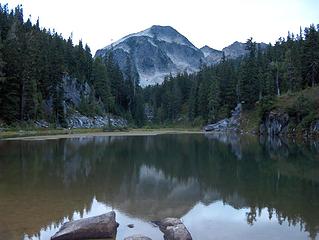 Emerald Lake
Nate
Keep it secret...keep it safe
Nate
Keep it secret...keep it safe
|
| Back to top |
  
|
|
Matt
Tea, Earl Grey, Hot

Joined: 30 Jan 2007
Posts: 4307 | TRs | Pics
Location: Shoreline |
|
Matt
Tea, Earl Grey, Hot
|
 Sun Sep 09, 2007 1:17 am |
|
|
Okay, I'm definitely going to have to do that loop sometime.
Thanks for the report.
As beacons mountains burned at evening. J.R.R. Tolkien
As beacons mountains burned at evening. J.R.R. Tolkien
|
| Back to top |
|
|
Slide Alder Slayer
Member

Joined: 14 Jan 2002
Posts: 1960 | TRs | Pics
|
|
| Back to top |
|
|
Backpacker Joe
Blind Hiker

Joined: 16 Dec 2001
Posts: 23956 | TRs | Pics
Location: Cle Elum |
Guys, your pea soup pond is Iron Cap lake... Nice report and trip. 
"If destruction be our lot we must ourselves be its author and finisher. As a nation of freemen we must live through all time or die by suicide."
Abraham Lincoln
"If destruction be our lot we must ourselves be its author and finisher. As a nation of freemen we must live through all time or die by suicide."
Abraham Lincoln
|
| Back to top |
|
|
gratenate
Member
Joined: 25 Aug 2007
Posts: 70 | TRs | Pics
Location: In the wake of the Mighty Mendenhall |
|
gratenate
Member
|
Sun Sep 09, 2007 1:59 pm Iron Cap Lake
|
|
|
Pea Soup Pond seems more appropriate but Iron Cap Lake makes sense as well
Nate
Keep it secret...keep it safe
Nate
Keep it secret...keep it safe
|
| Back to top |
|
|
Phil
Member

Joined: 02 Jul 2003
Posts: 2025 | TRs | Pics
Location: Shoreline, WA |
|
Phil
Member
|
Sun Sep 09, 2007 4:04 pm |
|
|
Very nice. I especially like the detailed route description. I read of a group once doing the loop as a dayhike and have aspired to that.
|
| Back to top |
|
|
Dayhike Mike
Bad MFKer

Joined: 02 Mar 2003
Posts: 10958 | TRs | Pics
Location: Going to Tukwila |
Beautiful area! Glad you guys had a good time on the Alpine Lakes High Traverse.
"There is only one basic human right, the right to do as you damn well please. And with it comes the only basic human duty, the duty to take the consequences." -P.J. O'Rourke
"Ignorance is natural. Stupidity takes commitment." -Solomon Short
"There is only one basic human right, the right to do as you damn well please. And with it comes the only basic human duty, the duty to take the consequences." -P.J. O'Rourke
"Ignorance is natural. Stupidity takes commitment." -Solomon Short
|
| Back to top |
|
|
|
|
You cannot post new topics in this forum
You cannot reply to topics in this forum
You cannot edit your posts in this forum
You cannot delete your posts in this forum
You cannot vote in polls in this forum
|
Disclosure: As an Amazon Associate NWHikers.net earns from qualifying purchases when you use our link(s). |


