| Previous :: Next Topic |
| Author |
Message |
Arete
Member


Joined: 29 Oct 2006
Posts: 137 | TRs | Pics
Location: Bothell, WA |
|
Arete
Member
|
 Mon Oct 15, 2007 7:14 pm |
|
|
After a great summer of adventures in the Cascades, our family decided to spend yesterdays nice fall weather over in the Olympics. It had been more than a decade since I had been up to Marmot Pass and Buckhorn Mountain. We left Edmonds on the first Sunday ferry and hit the trailhead of the Upper Big Quilcene River at 9:00. The first couple of miles are an enchanting walk through wonderful forests rich with fungi and along cascading streams. The trail begins to climb steadily after the first campsite (about 2.5 miles from the trailhead). The views begin to open up as the trail traverses rockslides around 3-3.5 miles up and finally we came to Camp Mystery in the trees (first water since the last campsite) at just over 4.5 miles. The trail quickly climbs into parkland and comes to the great views of Marmot Pass at 5.3 miles from the car. It took us three hours from the car.
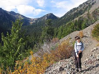 Open slopes about 3.5 miles from the trailhead 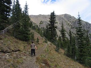 Above Camp Mystery with the west ridge of Buckhorn Mtn behind 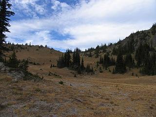 Parkland just below Marmot Pass 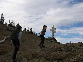 Reaching Marmot Pass 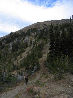 Trail at Marmot Pass. Boot path ascends slopes in center to ridgeline. 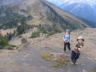 Hiking above Marmot Pass 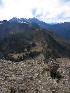 Climbing up above Marmot Pass 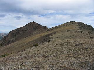 West ridge of Buckhorn Mountain 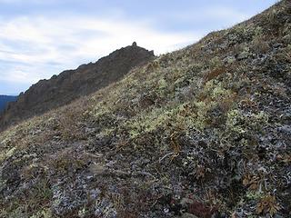 Lichen heath tundra on Buckhorn Mountain 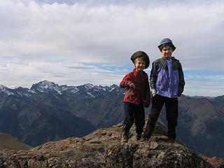 Summit of Buckhorn Mountain 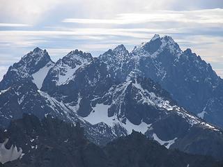 Mt Constance 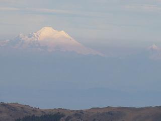 Mount Baker and Mount Shuksan
|
| Back to top |
  
|
|
Magellan
Brutally Handsome

Joined: 26 Jul 2006
Posts: 13116 | TRs | Pics
Location: Inexorable descent |
|
Magellan
Brutally Handsome
|
Mon Oct 15, 2007 10:35 pm |
|
|
Thanks for the memories. You must be really proud of your boys.
|
| Back to top |
|
|
Bryan K
Shameless Peakbagger

Joined: 29 Sep 2005
Posts: 5129 | TRs | Pics
Location: Alaska |
|
Bryan K
Shameless Peakbagger
|
Mon Oct 15, 2007 10:59 pm |
|
|
Thanks for sharing such a great hike. I was supposed to go up there with Magellan last summer but couldn't make it. Really like your pictures 
|
| Back to top |
|
|
Ancient Ambler
Member

Joined: 15 May 2007
Posts: 1092 | TRs | Pics
Location: Bainbridge Island |
What an excellent choice for a family hike on what may be one of the last good-weather days before the snow sets in up on Buckhorn. Your little troopers made good time to Marmot and did right to encourage you on up to the summit. Enjoyed your photos of early season snow in the high country. Especially enjoyed your "Mt. Constance" photo, although the actual Mt. Constance is east and outside of the view framed in your photo. Inner Constance is in the right background, the twin peaks of Warrior are in the left middle-ground, and just in the foreground from Warrior is Alphabet Ridge, with Cloudy Peak on the west end of Alphabet Ridge, and a partially snowy shoulder going down from Cloudy toward Charlia Pass at the right edge of your photo. That's quite a hike up the Upper Big Quil to the top of Buckhorn, almost 4500 foot elevation gain, so you've got some very sturdy young hikers there. Not sure my kids would have done that at the same age.
|
| Back to top |
|
|
goats gone wild
Mr. Goat

Joined: 19 Aug 2007
Posts: 2524 | TRs | Pics
Location: Vampireville |
Those look like some mighty happy campers  And quite proud to have reached the summit (as well they should).
What wonderful family memories they will have. And quite proud to have reached the summit (as well they should).
What wonderful family memories they will have.
.....leaving me wanting to return over and over in what ever capacity that may be, even if one day my knees are too old and I can only see the mountains from my porch.
Jason Hummel
.....leaving me wanting to return over and over in what ever capacity that may be, even if one day my knees are too old and I can only see the mountains from my porch.
Jason Hummel
|
| Back to top |
|
|
|
|
You cannot post new topics in this forum
You cannot reply to topics in this forum
You cannot edit your posts in this forum
You cannot delete your posts in this forum
You cannot vote in polls in this forum
|
Disclosure: As an Amazon Associate NWHikers.net earns from qualifying purchases when you use our link(s). |


