| Previous :: Next Topic |
| Author |
Message |
silly_traveler
~ roaming ~


Joined: 04 Jun 2006
Posts: 1525 | TRs | Pics
Location: Bellevue |
Peru - Part 3 of 3
8 Day Trek in the Cordillera Blanca 10/18/07 to 10/25/07 - My favorite part of our 3 part trip  We flew from Lima to Huaraz on the morning of 10/17 and had the day to get some stuff done before leaving for the 8 day trip. We flew on this tiny little 20 person plane for an hour before landing at Huaraz, elevation ~ 9000 ft.
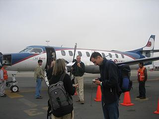 plane to Huaraz 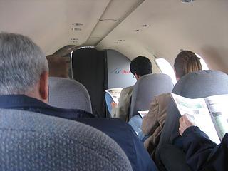 kinda cramped  We weren't sure who was picking us up at the airport (~ 20 minutes by car from Huaraz), and as it turned out, nobody! We weren't sure who was picking us up at the airport (~ 20 minutes by car from Huaraz), and as it turned out, nobody!  Scot had to get us a ride from the airline shuttle, it turned out to be free, yay! Mr. shuttle driver dropped us off at our hostel, and we were pleasantly surprised. We stayed at a place called hostel Churup and it's such a nice place! Scot had to get us a ride from the airline shuttle, it turned out to be free, yay! Mr. shuttle driver dropped us off at our hostel, and we were pleasantly surprised. We stayed at a place called hostel Churup and it's such a nice place!
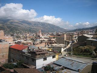 from hostel in Huaraz 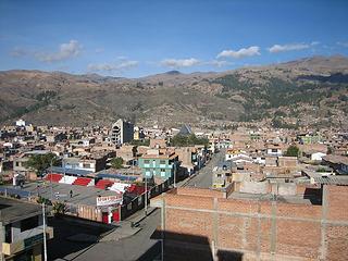 from hostel in Huaraz 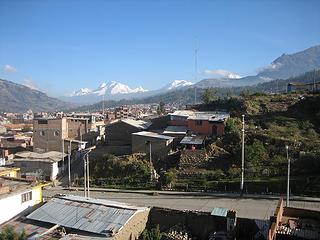 from hostel in Huaraz  .... We had some trouble exchanging our dollars! .... We had some trouble exchanging our dollars!  They have got to be crispy and good looking if you want soles out of them dollars! Anyway, we paid with cash what we could and put the rest on a credit card. Just FYI, it seems that a lot of places only take visa and not mastercard
We did what they call the Cedros - Alpamayo trek, usually this semi circuit takes 10 days, but we cut it short by stopping our trip at a town called Pomabamba. I don't have a map link but if you're really curious I can find you some. There is a good reason that most people don't stop at Pomabamba, because the only way to get from that town back to Huaraz is the bumpiest 8 hour bus ride you can ever imagine They have got to be crispy and good looking if you want soles out of them dollars! Anyway, we paid with cash what we could and put the rest on a credit card. Just FYI, it seems that a lot of places only take visa and not mastercard
We did what they call the Cedros - Alpamayo trek, usually this semi circuit takes 10 days, but we cut it short by stopping our trip at a town called Pomabamba. I don't have a map link but if you're really curious I can find you some. There is a good reason that most people don't stop at Pomabamba, because the only way to get from that town back to Huaraz is the bumpiest 8 hour bus ride you can ever imagine  Seriously! We were the only tourists on the bus.... and this bus was jammed packed Seriously! We were the only tourists on the bus.... and this bus was jammed packed  Anyway.... we met our guide (Abel) and cook (Epi) the morning of 10/18 and off we went! The car was packed with all our stuff and also our food for 8 days. We had some trouble closing the trunk
  It took ~ 3 hours (by car) to get to the trailhead and we drove through some small towns along the way. It took ~ 3 hours (by car) to get to the trailhead and we drove through some small towns along the way.
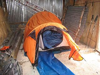
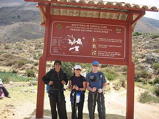 trailhead  We had some lunch that Abel packed for us in his pack and waited for Epi and the donkey driver to arrive with our stuff to set up camp. They didn't take long, showed up just as we were finishing lunch We had some lunch that Abel packed for us in his pack and waited for Epi and the donkey driver to arrive with our stuff to set up camp. They didn't take long, showed up just as we were finishing lunch 
 1st day 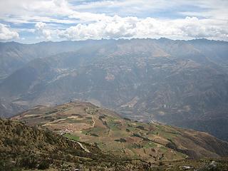 1st day 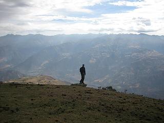 Scot on a rock 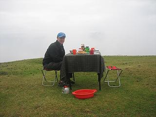 breakfast 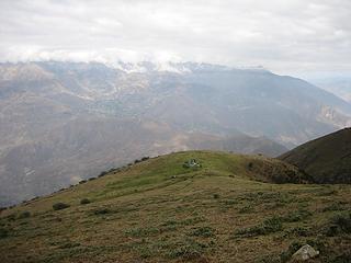 leaving 1st campsite  We hiked ~ 3 hours before reaching camp, which was fine with me, haha. The weather got crazy and started raining quit a bit, good thing we had some shelter for the night. We hiked ~ 3 hours before reaching camp, which was fine with me, haha. The weather got crazy and started raining quit a bit, good thing we had some shelter for the night.
 2nd campsite 
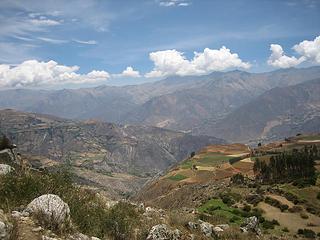
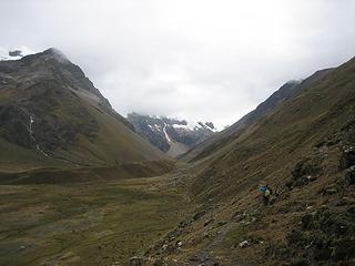
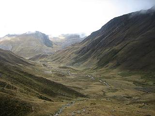
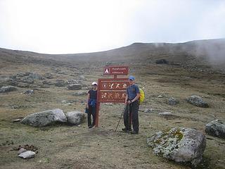 sign! 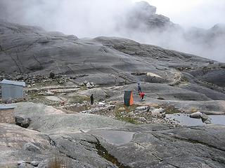 putting up the toilet tent 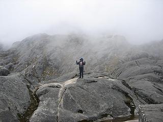 Martin the donkey driver 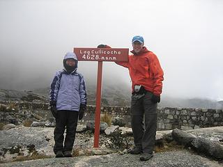 2nd campsite 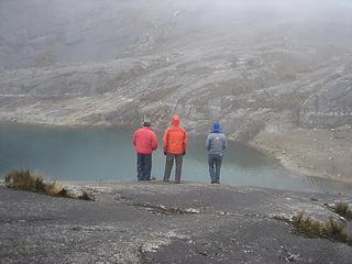 Epi, Scot, Martin.... and the lake 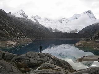 Scot enjoying the view 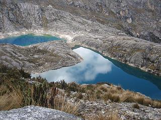 reflection 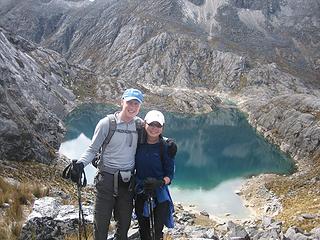 cheese! 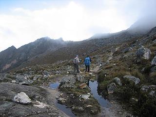 guys ahead of me on the trail 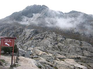 leaving 2nd campsite 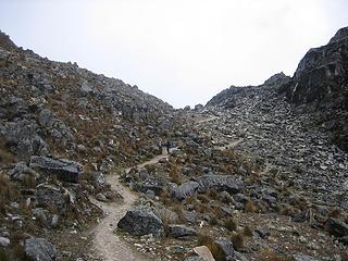 almost to the first high pass 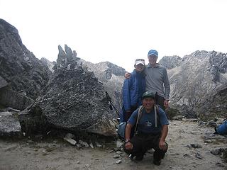 Epi and us 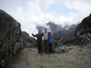 Abel and us 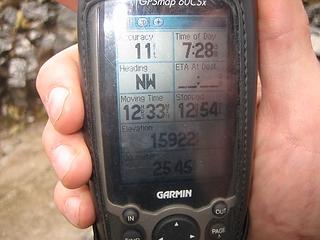 15,922 ft.! 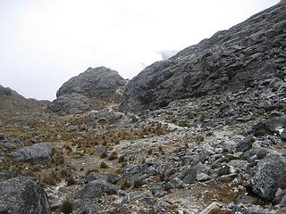 trail 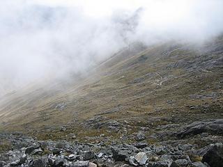 peek-a-boo view of the trail 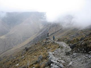 guys ahead of me on the trail  Everything seemed so much harder at that altitude, I was crawling After the 2 mountain passes, we hiked for a few more hours across this bigo valley to our 3rd campsite, Jancarurish. Everything seemed so much harder at that altitude, I was crawling After the 2 mountain passes, we hiked for a few more hours across this bigo valley to our 3rd campsite, Jancarurish.
 3rd day 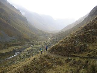 guys ahead of me on the trail 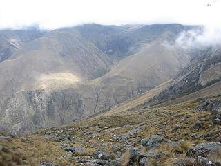 3rd day 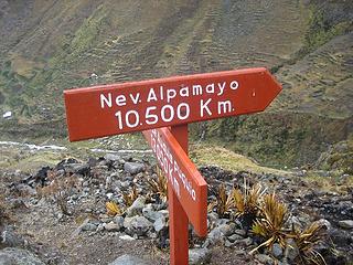 sign! 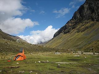 3rd campsite 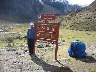 sign! 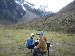 having breakfast 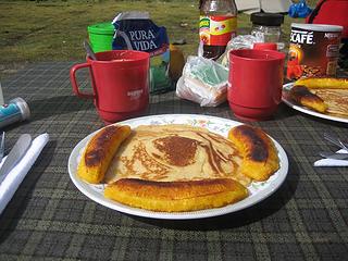 breakfast 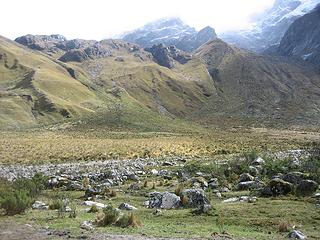 3rd/4th campsite 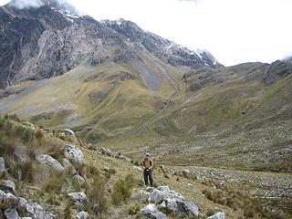 Scot on the trail 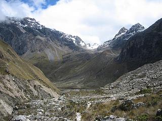 4th day 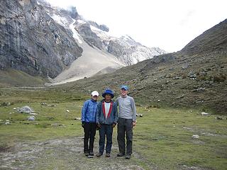 Martin and us 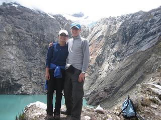 Laguna Jancarurish  Jake at Jancarurish 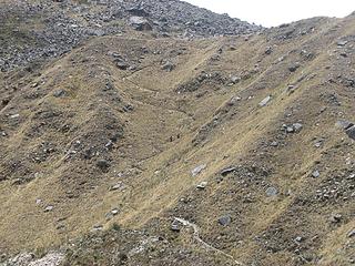 2 Canadians on the trail 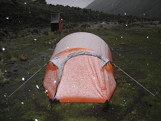 snowing?! on 4th night 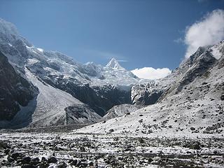 Nevado Alpamayo north side 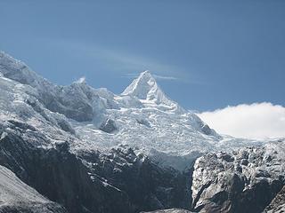 Nevado Alpayamo north side 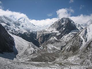 heading up the 2nd high pass on the 5th day 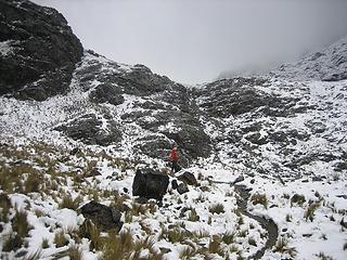 Scot on the trail  We stopped up at the pass to wait for them, not too long after, Epi showed up with 2 huge packs and a bucket of fried rice in his hand?! That's lunch, duh! At almost 16,000 ft.
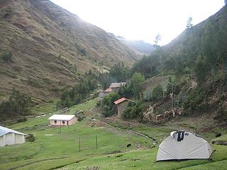
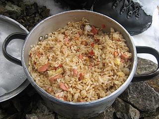 Epi's fried rice on top of pass 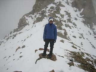 me on top of pass 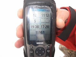 15,951 ft.! 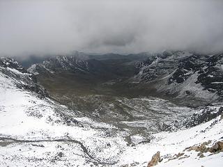 other side of the pass 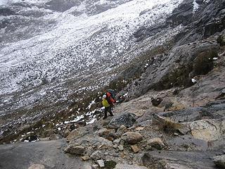 Scot heading down the other side 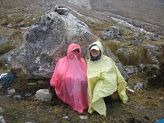 it was raining really hard.... 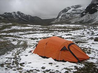 5th campsite  We didn't get going until the afternoon, as to get the eye balls some more time to rest. He did ok getting to our next camp, which took ~ 3+ hours. I think we camped on someone's property this night as there were two houses where we camped?! We didn't get going until the afternoon, as to get the eye balls some more time to rest. He did ok getting to our next camp, which took ~ 3+ hours. I think we camped on someone's property this night as there were two houses where we camped?! 
 6th day 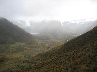 on top of small pass 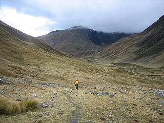 Scot on the trail 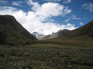 6th campsite 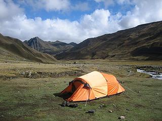 6th campsite 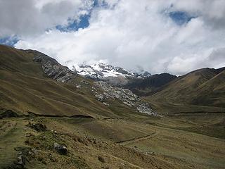 7th day  7th day 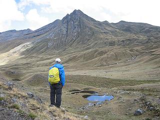 Scot enjoying the view 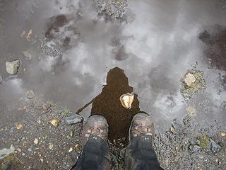 shadow and shoes 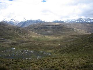 7th day 
 last campsite 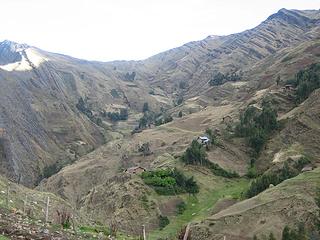 houses on a hill 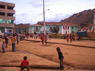 Pomabamba at sunset 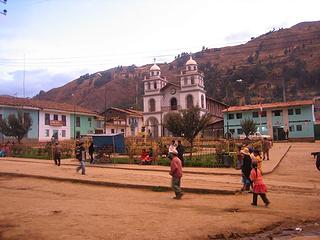 Pomabamba at sunset
♫ You have brains in your head. You have feet in your shoes. You can steer yourself any direction you choose. And you're the one who will decide where you'll go. Oh the places you'll go. - Dr. Seuss
♫ You have brains in your head. You have feet in your shoes. You can steer yourself any direction you choose. And you're the one who will decide where you'll go. Oh the places you'll go. - Dr. Seuss
|
| Back to top |
  
|
|
seawallrunner
dilettante

Joined: 27 Apr 2005
Posts: 3307 | TRs | Pics
Location: Lotusland |
wow what a trip - were the mountains above you the area where Joe Simpson experienced Touching the Void?
and what happened to Scot? why was he blinded (was it the altitude? a reaction to diamox?) and is he ok now?
|
| Back to top |
|
|
Gil
Member

Joined: 29 Sep 2004
Posts: 4062 | TRs | Pics
|
|
Gil
Member
|
 Fri Nov 02, 2007 6:50 pm |
|
|
ohmigosh! That's amazing!
Friends help the miles go easier.
Klahini
Friends help the miles go easier.
Klahini
|
| Back to top |
|
|
goats gone wild
Mr. Goat

Joined: 19 Aug 2007
Posts: 2524 | TRs | Pics
Location: Vampireville |
Amazing TR and pictures, silly_traveler
Sounds like a great adventure with some very kind guides.
? Why snowblindness. Did he forget to wear his sunglasses?
.....leaving me wanting to return over and over in what ever capacity that may be, even if one day my knees are too old and I can only see the mountains from my porch.
Jason Hummel
.....leaving me wanting to return over and over in what ever capacity that may be, even if one day my knees are too old and I can only see the mountains from my porch.
Jason Hummel
|
| Back to top |
|
|
GeoTom
Member
Joined: 19 May 2005
Posts: 3215 | TRs | Pics
Location: Earth |
|
GeoTom
Member
|
Fri Nov 02, 2007 7:01 pm |
|
|
(Except for Scot's blindness)
|
| Back to top |
|
|
ScottM
Member

Joined: 18 Apr 2007
Posts: 363 | TRs | Pics
Location: The Olympics |
|
ScottM
Member
|
Fri Nov 02, 2007 7:24 pm |
|
|
Very Nice!! I have always wanted to do some kind of trip like that in South America or maybe something in Nepal. I have always been apprehensive about it having never been outside North America. Did you go with a package through a local outfit or did you make all of the arrangements yourself.
|
| Back to top |
|
|
silly_traveler
~ roaming ~
Joined: 04 Jun 2006
Posts: 1525 | TRs | Pics
Location: Bellevue |
♫ You have brains in your head. You have feet in your shoes. You can steer yourself any direction you choose. And you're the one who will decide where you'll go. Oh the places you'll go. - Dr. Seuss
|
| Back to top |
|
|
Magellan
Brutally Handsome

Joined: 26 Jul 2006
Posts: 13116 | TRs | Pics
Location: Inexorable descent |
|
Magellan
Brutally Handsome
|
Fri Nov 02, 2007 11:11 pm |
|
|
That was a great series of TR's Silly. I'm really glad you and Scot got to do this, and have such a great time doing it. Sometimes these things don't meet expectations, but you obviously loved it. I am glad Scot is doing well now. It's a lesson for all of us.
|
| Back to top |
|
|
Backpacker Joe
Blind Hiker

Joined: 16 Dec 2001
Posts: 23956 | TRs | Pics
Location: Cle Elum |
Great way to end a three part adventure. Thanks ST.
"If destruction be our lot we must ourselves be its author and finisher. As a nation of freemen we must live through all time or die by suicide."
Abraham Lincoln
"If destruction be our lot we must ourselves be its author and finisher. As a nation of freemen we must live through all time or die by suicide."
Abraham Lincoln
|
| Back to top |
|
|
dacker
little black dots

Joined: 27 Sep 2006
Posts: 738 | TRs | Pics
Location: the end of my rope |
|
dacker
little black dots
|
Sat Nov 03, 2007 11:13 am |
|
|
| seawallrunner wrote: | | and what happened to Scot? why was he blinded (was it the altitude? a reaction to diamox?) and is he ok now? |
Snow blindness is not something to be taken lightly. He was lucky to have apparently gotten a mild case or it could have brought the trip to a screeching halt. I thought I had it once on Rainier, but strangely only in one eye. It turned out to be a corneal abrasion instead.
I wanna go! I wanna go!!
We don't stop hiking because we grow old; we grow old because we stop hiking. --Finis Mitchell
We don't stop hiking because we grow old; we grow old because we stop hiking. --Finis Mitchell
|
| Back to top |
|
|
Magellan
Brutally Handsome
Joined: 26 Jul 2006
Posts: 13116 | TRs | Pics
Location: Inexorable descent |
|
Magellan
Brutally Handsome
|
Sat Nov 03, 2007 11:17 am |
|
|
Very briefly, Sillys trip reports were the top three threads on the 24 hour page!
|
| Back to top |
|
|
Layback
Cascades Expatriate

Joined: 16 Mar 2007
Posts: 5712 | TRs | Pics
Location: Back East |
|
Layback
Cascades Expatriate
|
Sat Nov 03, 2007 11:50 am |
|
|
|
| Back to top |
|
|
peltoms
Member

Joined: 13 Jul 2006
Posts: 1760 | TRs | Pics
Location: Worcester MA |
|
peltoms
Member
|
Sat Nov 03, 2007 12:39 pm |
|
|
Great lake pictures, beautiful snowfall. You make it look very relaxing. So why did you not go up a few feet to get the magic 16,000?
|
| Back to top |
|
|
silly_traveler
~ roaming ~
Joined: 04 Jun 2006
Posts: 1525 | TRs | Pics
Location: Bellevue |
♫ You have brains in your head. You have feet in your shoes. You can steer yourself any direction you choose. And you're the one who will decide where you'll go. Oh the places you'll go. - Dr. Seuss
|
| Back to top |
|
|
mike
Member

Joined: 09 Jul 2004
Posts: 6397 | TRs | Pics
Location: SJIsl |
|
mike
Member
|
Sat Nov 03, 2007 2:35 pm |
|
|
| Quote: | | Cordillera Blanca is north of Huaraz, whereas Huayhuash is south of Huaraz |
Just to clarify, The C. Blanca runs N & S of Huaraz but the big 6km peaks are mostly north. However the Pongos which are south of the road to Chavin are an excellent area to explore and don't attract the big peak seeking crowds. The Huayhuash is visible on the horizon 40-50km (?) to the south.
|
| Back to top |
|
|
|
|


 Cordillera Blanca is north of Huaraz, whereas Huayhuash is south of Huaraz
  But it is pretty much all in the same 'general' area
  It was a great time